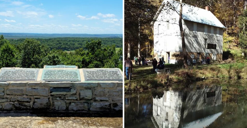
Nine towns left the map, but nobody informed their stories.
One vanished after the railroad chose another route. Another rose around coal, packed up its buildings, and disappeared with efficiency.
A former state capital lost an argument with the Mississippi River, which remains the most dramatic urban-planning dispute in Illinois history.
The clues are quieter now. A marker stands beside farmland. An old inn remembers the stagecoach era.
A bicycle trail follows tracks that once kept communities employed. Empty ground starts looking far less empty once you know what occupied it.
That is the trick with Illinois ghost towns. They do not always offer ruined streets or photogenic buildings. They make you read, imagine, and pay attention to landscapes most drivers would pass without a second glance.
Curiosity may lead the way, but comfortable shoes and respect for private property should come with it.
The residents are gone, but the towns still have corrections for the modern map.
1. Millville
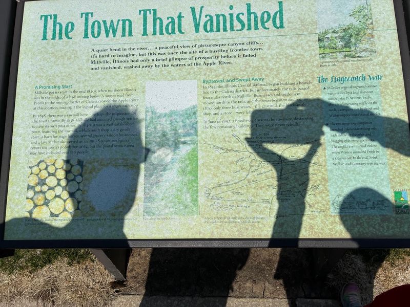
Stagecoaches once treated this river junction like a roadside celebrity. Then the railroad arrived, skipped the introduction, and sent Millville’s popularity straight downstream.
During the 1800s, stagecoaches, farmers, merchants, and other travelers passed through the area. The crossroads helped Millville grow into a rural service center where people could rest, trade, and prepare for the next stretch of road.
Then railroads began reshaping travel through Illinois, and the tracks bypassed the town.
Without regular traffic, Millville gradually lost the activity that had supported its businesses and residents. A flood in 1892 later swept away many of the structures that remained, leaving the rivers to finish what the railroad had started.
The former townsite now sits within Apple River Canyon State Park and is listed on the National Register of Historic Places.
Hiking trails pass through the canyon near the old routes, allowing visitors to explore the landscape that once made Millville useful. The river confluence still explains why anyone thought a town belonged there in the first place.
You will not find a busy crossroads anymore. The rivers remain, calmly pretending they had nothing to do with the disappearance.
2. New Philadelphia
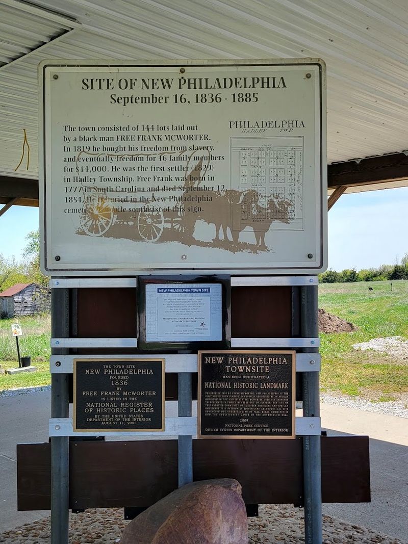
Freedom became a street plan here. In 1836, Frank McWorter turned personal independence into a town where Black and white residents built lives beside one another.
McWorter had purchased his own freedom after being enslaved. He later used his resources and land to create New Philadelphia and help secure freedom for members of his family.
Black and white residents lived in the settlement during a period when integrated communities were uncommon. The town reached its highest population around the 1860s, with homes, businesses, and farms forming a functioning rural community.
A railroad bypassed New Philadelphia in 1869. As commerce and transportation shifted toward other locations, the town began to decline.
No original buildings remain above ground, but archaeological work has helped recover evidence of daily life at the site.
New Philadelphia is now protected as a National Historic Site. Visitors can find parking, interpretive panels, an information kiosk, and open land marking the former streets and properties.
The landscape may look empty at first. Give it a minute. Few open fields carry this much determination beneath the grass.
3. Griggsville Landing
Steamboats once treated this Illinois River stop like an appointment. The railroad eventually canceled it.
Griggsville Landing began serving river traffic during the 1830s. Ferries, steamboats, workers, and travelers gave the settlement a steady flow of business.
The town grew around that traffic. A hotel, grist mill, boatyard, warehouse, and commercial lime operation once stood near the river.
Railroads eventually redirected passengers and freight toward better-connected communities. Valley City developed nearby, while the old landing gradually lost the traffic that had justified its existence.
Most of the settlement disappeared, but one substantial clue remains.
A stone lime kiln built during the mid-1800s still stands within Ray Norbut State Fish and Wildlife Area.
Its thick stone walls rise from the wooded river bluff, looking less like an industrial ruin and more like someone began constructing a small fortress and forgot to finish.
The surrounding land is managed for wildlife and outdoor recreation, so visitors should check current access notices and remain on public property.
Griggsville Landing lost its boats, buildings, and place on the transportation map. The kiln apparently refused to receive the cancellation notice.
4. Old Shawneetown
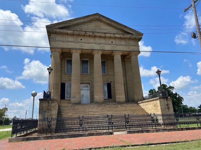
The Ohio River helped build this town, then made a convincing case for moving most of it three miles away.
Shawneetown became an important early commercial center near the Ohio River. The salt industry, river traffic, and a federal land office brought business and travelers through the community.
Its importance once appeared permanent enough to justify a grand bank.
Constructed between 1839 and 1841, the Shawneetown Bank still stands with a limestone facade, tall columns, and considerably more confidence than most surviving buildings from the period.
Then the river reclaimed control of the conversation. The major flood of 1937 devastated Shawneetown and pushed plans to relocate the community to higher ground.
A new town developed several miles inland, leaving the original river settlement with a much quieter future.
Old Shawneetown did not disappear completely. Historic homes, churches, foundations, hitching posts, and the bank still preserve pieces of the former town.
A walking tour follows Main Street and nearby landmarks. The bank is currently closed for interior tours, but its exterior remains one of the clearest reminders of the prosperity once concentrated beside the river.
Many ghost towns leave a marker in an empty field. Old Shawneetown left an enormous bank facing streets that no longer carry the business it was built to impress.
5. Vishnu Springs
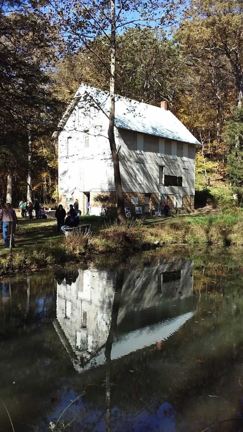
Mineral water, a woodland hotel, and ambitious resort plans sounded promising. The missing railroad connection was the small detail that ruined the brochure.
Developer Darius Hicks envisioned a destination where visitors could rest, drink from the spring, and enjoy a community built around recreation and health.
His plans included a hotel, restaurant, stores, a schoolhouse, a pond, and landscaped grounds.
The mineral water attracted interest, but reaching the site remained difficult. A convenient railroad connection never arrived, limiting the number of guests who could reasonably make the journey.
Without dependable transportation, the resort failed to grow into the full community Hicks had imagined.
One major structure survived. The former hotel still stands within the Ira & Reatha T. Post Wildlife Sanctuary, a 140-acre property owned by the Western Illinois University Foundation.
The land was donated in 2003 to protect its natural habitat and support university education and research. WIU faculty and students have used the sanctuary to study its water, wildlife, and plant life.
The property now serves conservation and academic purposes rather than routine tourism. Public access can be limited, so permission and current rules should be confirmed before attempting a visit.
That restricted setting has helped protect a rare piece of the original development.
Vishnu Springs did not become the bustling retreat its founder pictured. It did, however, leave behind a hotel in the woods, which is more than many successful resorts manage after the brochures stop printing.
The site lies near Tennessee and Colchester in McDonough County.
6. Clayville
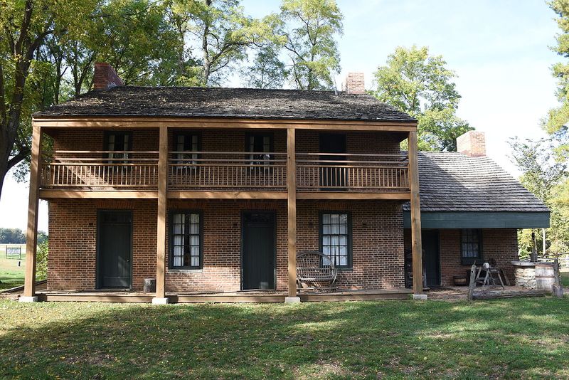
Dusty traveler seeks hot meal, fresh horse, and somewhere to complain about the road. Clayville once answered that request before rail travel made stagecoach stops obsolete.
Travelers, mail carriers, merchants, and drivers stopped there for meals, rest, and shelter. The busy route gave the surrounding hamlet a steady reason to exist.
Railroads later changed the way people crossed central Illinois. Stagecoach travel declined, roadside inns lost traffic, and Clayville gradually shrank.
The Broadwell Inn survived on its original foundation and is considered the oldest brick building in Sangamon County.
Additional historic structures from the surrounding region were later moved to the property, creating a compact collection of early Illinois buildings.
The site now offers a clearer visual connection to the past than many ghost towns, where imagination must do nearly all the construction work.
Visits are generally available by appointment from April through September, so confirming access before traveling is important.
Clayville may have lost the stagecoaches, but the inn remains ready to explain why everyone once stopped there. No muddy wheels required.
7. Old Kaskaskia Village
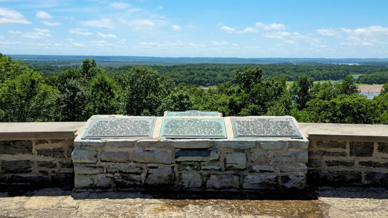
The Mississippi River did not merely flood Kaskaskia. It edited the map, moved the shoreline, and gave Illinois’ first capital an exit no politician could have arranged.
Long before statehood, the community was an important French settlement and trading center. Missionaries, settlers, merchants, and fur traders moved through the area along the river.
When Illinois entered the Union in 1818, Kaskaskia served as the first capital.
Political influence later shifted elsewhere, but the town’s most dramatic threat came from the landscape itself.
Changes in the Mississippi River channel, erosion, and repeated flooding destroyed much of the original settlement during the late 1800s.
Large portions of the former townsite are now submerged, eroded, or separated from mainland Illinois by the river’s altered course.
Fort Kaskaskia State Historic Site preserves the broader story through interpretive displays and an overlook facing Kaskaskia Island.
From that viewpoint, visitors can look toward the area where an early capital once conducted government business.
Springfield has the domes and official buildings. Old Kaskaskia has a river view and one of the most dramatic political exits in state history.
8. Forman
Forman’s vanished-town story comes with a bike trail, official signs, and considerably less explaining to suspicious property owners.
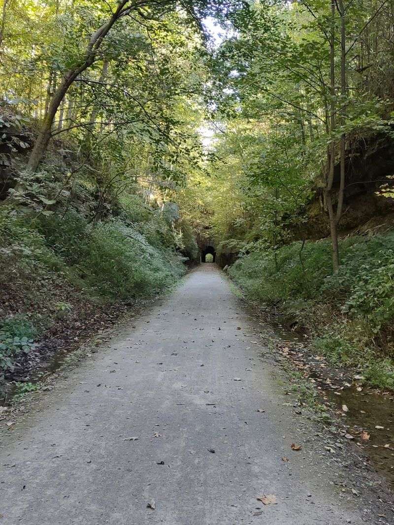
The Illinois Department of Natural Resources identifies Forman as one of the former communities along the Tunnel Hill State Trail in southern Illinois.
The trail follows an abandoned railroad corridor through Johnson County, allowing hikers and cyclists to travel the same route that once connected settlements and industrial sites.
Interpretive signs explain former towns, coal activity, railroad operations, and a sandstone quarry that supported work in the region.
The landscape now appears quiet, but the trail reveals how closely local communities depended on rail traffic and nearby industries.
Forman is less about one surviving ruin than the broader experience of moving through a corridor shaped by transportation.
That makes the journey part of the historical evidence. The grades, cuts, bridges, and straight stretches still reflect the railway that once gave the area purpose.
Use the official trail map rather than expecting a conventional street address for the former settlement.
Forman may be gone, but at least it left behind an excellent bicycle route. Few vanished towns manage such a practical second act.
The Tunnel Hill State Trail runs through Johnson County in southern Illinois.
9. Parker City
Trains gave this town a pulse. When the railroad traffic faded, the town learned that building your entire future beside the tracks comes with a rather unforgiving cancellation policy.
Like Forman, Parker City depended on railroad activity for movement, employment, and access to commerce.
When trains and related industries used the corridor, the settlement had an economic role. Goods passed through, workers found jobs, and nearby residents had a reason to build lives around the route.
As railroad use declined, that foundation weakened. Without the traffic that supported it, Parker City gradually dissolved. Buildings disappeared, residents moved elsewhere, and the name slipped away from most modern maps.
The converted rail trail now carries cyclists and hikers through the same landscape.
Signs and official maps help preserve the names of Parker City and other former settlements along the corridor, turning a recreation route into a long, linear history lesson.
Infrastructure created the town, then took its purpose away. Today, the trail gives Parker City one final connection to passing traffic.
The trains are gone. People are still traveling through, only now they have bicycles, hiking shoes, and considerably more time to read the signs.
Follow the Tunnel Hill State Trail through southern Illinois to reach the former Parker City area.