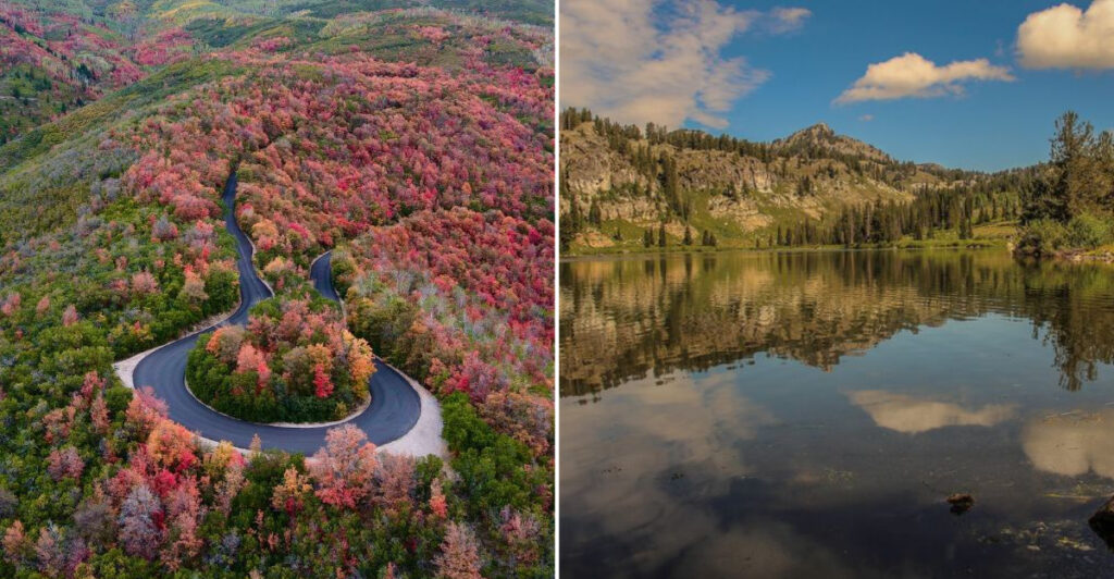
Red rock gets the postcards, but some of the most useful trip planning starts where the scenery turns green. Wooded canyons, mountain lakes, brushy trails, and shaded campgrounds offer a completely different side of Utah, and they also come with one small detail worth thinking about before heading out: ticks.
A county-level tick map can help travelers understand where extra awareness makes sense, especially when hiking, picnicking, or camping in grassy and wooded areas. It is not about making the outdoors feel intimidating.
It is about packing with a little more intention, checking clothing after a trail, and knowing what to watch for before the cooler is even unpacked. That kind of preparation takes almost no effort but can make a weekend feel much more relaxed.
For anyone exploring the greener corners of Utah, a quick look at the map belongs right beside checking the weather and filling the water bottles.
1. Box Elder Campground, Mantua
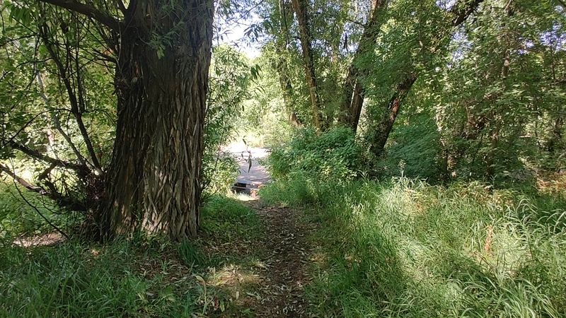
Creekside campgrounds have a way of making packing feel more serious. Suddenly, the extra socks and tick check routine do not seem like overplanning; they seem like common sense.
Box Elder Campground sits near Mantua in Box Elder County and is part of the Uinta-Wasatch-Cache National Forest. Box Elder Creek runs through the campground, and the area is known for dense bottomland hardwood forest, which gives it a very different feel from Utah’s open desert country.
That leafy cover is exactly why it belongs in a tick-aware wooded getaway list.
The campground is still listed as active by the Forest Service, so it remains a realistic option for campers looking for shade and creek scenery. Before heading out, check current forest alerts and campground details because seasonal conditions can change.
Long pants, repellent, and a careful check after walking through grass or leaf litter are not glamorous travel accessories, but they are lighter than regret.
For travelers who usually picture Utah as cliffs and sagebrush, Box Elder Campground is a reminder that the state also does quiet, green corners surprisingly well.
2. Tony Grove Lake, Logan Canyon
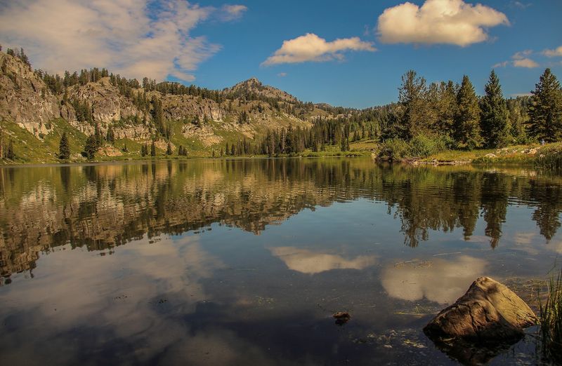
At Tony Grove Lake, the landscape seems to have read a mountain vacation brochure and taken notes. The lake sits high in the Bear River Range above Logan Canyon, surrounded by forest, meadows, and trail country.
This Cache County getaway is reached by Tony Grove Road and is managed within the Uinta-Wasatch-Cache National Forest. Visitors use the area for camping, paddling, hiking, and access to the well-known White Pine Lake Trail.
Because the setting includes high-elevation woods and meadow edges, it is smart to treat tick prevention as part of the normal gear list, along with water and layers.
Tony Grove Lake is also a good example of how varied northern Utah can be. One hour a traveler may be thinking about canyon roads, and the next the plan involves alpine water and conifers.
Mountain weather and access can be seasonal, so checking current road and recreation information matters before committing the cooler and camp chairs.
The practical move here is simple: enjoy the lake, stay on established routes where possible, and do a tick check before the ride back down Logan Canyon.
3. Mueller Park, Bountiful
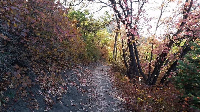
Not every wooded outing needs a packed trunk and a heroic alarm clock. Mueller Park sits above Bountiful in Davis County, close enough to feel practical but wooded enough to change the mood of a day.
The park area is known for shaded picnic spaces and access to trails in the Wasatch foothills. The popular Mueller Park Trail climbs through scrub oak, maple, and conifer areas toward higher terrain, giving hikers a leafy route without requiring a long drive from the Wasatch Front.
That mix of shade, brush, and trail edges makes tick awareness a sensible part of planning.
Families often appreciate places where a picnic and a walk can share the same outing. Couples and solo hikers may like that Mueller Park can serve as a shorter foothill visit rather than a full mountain expedition.
Still, the usual outdoor habits apply: stay on trail, avoid brushing through tall vegetation, and check ankles, socks, and waistbands afterward.
Mueller Park’s main advantage is its closeness to town. It lets Davis County show off a greener side of the foothills without asking visitors to turn the day into a logistical board meeting.
4. Mill Creek Canyon, Salt Lake City
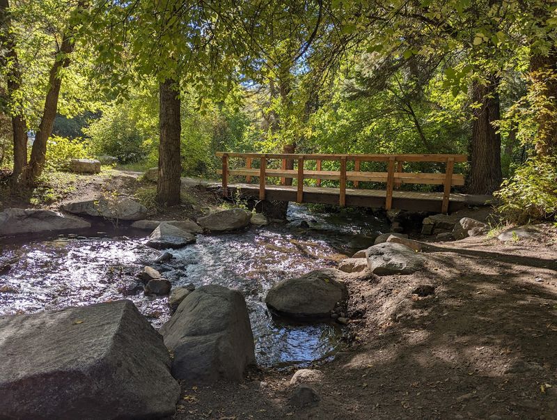
Mill Creek Canyon is the kind of place that makes Salt Lake City feel like it has a back door into the mountains. One turn east from the valley, and the plan changes from errands to trail shoes.
The canyon is managed as part of the Uinta-Wasatch-Cache National Forest, and the Forest Service lists hiking, biking, picnicking, and winter recreation among its uses. In Salt Lake County, that makes Mill Creek Canyon one of the most accessible forested choices near the Wasatch Front.
The canyon setting includes shaded drainages, brushy trail margins, and wooded picnic areas, so tick checks belong beside sunscreen on the mental checklist.
Rules in the canyon can vary by activity and season, especially for dogs and bikes, so visitors should review current Forest Service guidance before going. That matters more than guessing based on what worked on a previous trip.
Canyon roads and parking can also be affected by weather or management changes.
For travelers building a Utah outing without leaving the metro area far behind, Mill Creek Canyon offers real mountain texture. Just bring practical habits along with the picnic, because nature rarely handles reminders politely.
5. Spruces Campground, Big Cottonwood Canyon
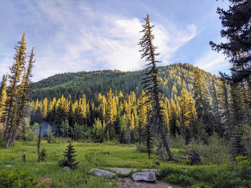
The name is not trying to be mysterious. Spruces Campground sits among spruce and aspen forest in Big Cottonwood Canyon, which makes the setting easy to understand before the tent poles even come out.
This Salt Lake County campground is part of the Uinta-Wasatch-Cache National Forest and remains an active camping area. Its location along Big Cottonwood Canyon Road puts campers in a high canyon environment with shade, mountain air, and plenty of vegetation around campsites.
In a tick map conversation, that woodland setting is the key detail.
One current planning note deserves extra attention: the natural spring water supply at Spruces Campground is unavailable, so visitors need to bring their own water. That is not the kind of thing anyone wants to learn after unloading the stove, especially if dinner depends on boiling pasta.
Check official campground updates before leaving, since canyon conditions and services can change.
For campers who want forest cover close to the Salt Lake Valley, Spruces Campground is a straightforward pick. Pack water, use repellent, keep gear out of tall vegetation, and make the post-hike tick check part of the evening routine.
6. Smith and Morehouse Reservoir, Oakley
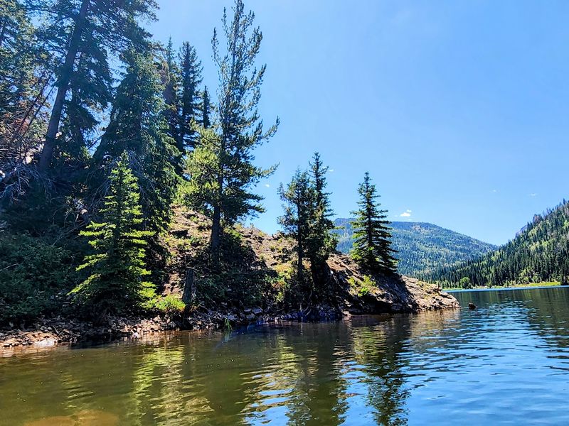
Some reservoirs feel built for speedboats and big plans. Smith and Morehouse Reservoir, near Oakley in Summit County, leans more toward canoes, camp chairs, and people who remembered to bring the bug spray.
The reservoir sits in the western Uinta Mountains and is surrounded by conifers and aspens. The recreation area and campground are currently listed for camping, canoeing, fishing, and hiking, giving visitors several ways to use the water and surrounding forest.
Because the shoreline and nearby trails include wooded and brushy areas, tick precautions make sense here too.
Smith and Morehouse Reservoir works well for travelers who want a mountain setting without aiming for the busiest marquee stop. That does not mean zero planning.
Mountain roads, water levels, campground availability, and weather can affect a trip, so current Forest Service or recreation listings should be checked before loading the car.
Bring the usual outdoor basics: water, layers, repellent, and a plan for checking clothes and skin after time near grass, shrubs, or forest edge. Summit County has plenty of polished resort energy elsewhere, but this reservoir keeps the mood focused on trees, water, and practical campcraft.
7. Wasatch Mountain State Park, Midway
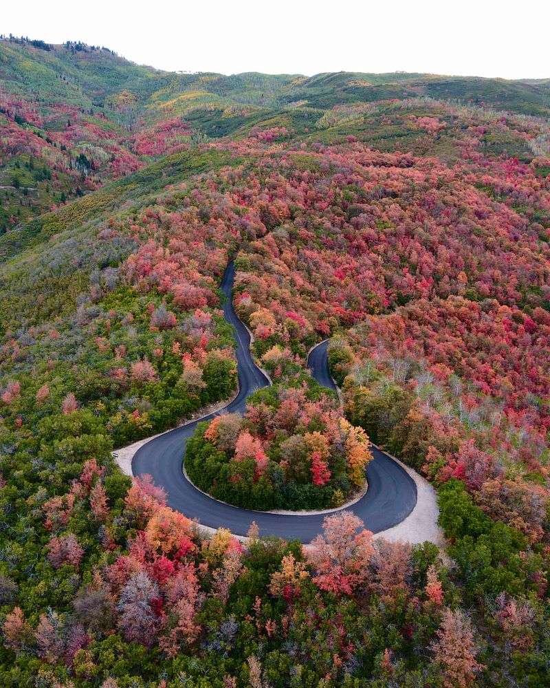
Wasatch Mountain State Park is not a postage-stamp park pretending to be rugged. It covers thousands of acres around Midway, with mountain terrain, campgrounds, and forested country above the Heber Valley.
The park is in Wasatch County and is currently open, with campgrounds operating according to Utah State Parks information updated in August 2026. That makes it one of the stronger choices for travelers who want official facilities rather than a guess-and-hope patch of woods.
The setting includes mountain vegetation and recreation areas where ticks can be part of the outdoor picture, especially along grassy or brushy edges.
Wasatch Mountain State Park also has a practical advantage: it is a state park with managed information, posted rules, and visitor updates. Checking those details before a camping weekend is not fussy.
It is how adults avoid turning a relaxing plan into a group text full of question marks.
Midway’s mountain backdrop gives the park a softer, greener side of Utah than many first-time visitors expect. Pack for changing conditions, keep to designated areas, and treat tick checks as routine park housekeeping, right between putting out the camp stove and finding the missing tent stake.
8. Cascade Springs, Wasatch County
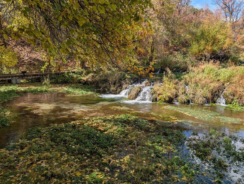
Water changes the personality of a mountain slope quickly. At Cascade Springs, it turns the area into a green, layered spring complex with boardwalks, clear pools, small waterfalls, and habitat for wildlife.
The Utah Geological Survey places Cascade Springs in Wasatch County, and the site is reached by Cascade Springs Scenic Drive. The developed boardwalk system is one of its defining features, helping visitors view the springs without trampling the fragile wet areas.
That combination of water, plants, and nearby forest also explains why tick awareness fits the visit.
Cascade Springs is especially useful for travelers who want a nature stop that does not depend on a long backcountry hike. Boardwalks make the experience more contained, though visitors should still stay on designated paths and avoid brushing through vegetation.
Roads in mountain areas may have seasonal limits or weather impacts, so current access information is worth checking before making it the centerpiece of a day.
Among Utah’s wooded getaways, Cascade Springs has a different rhythm from the campgrounds and reservoirs. The appeal is concentrated and easy to grasp: moving water, protected paths, and a reminder that even small wet places can support surprisingly busy natural systems.
9. Red Cloud Loop Scenic Backway, Ashley National Forest
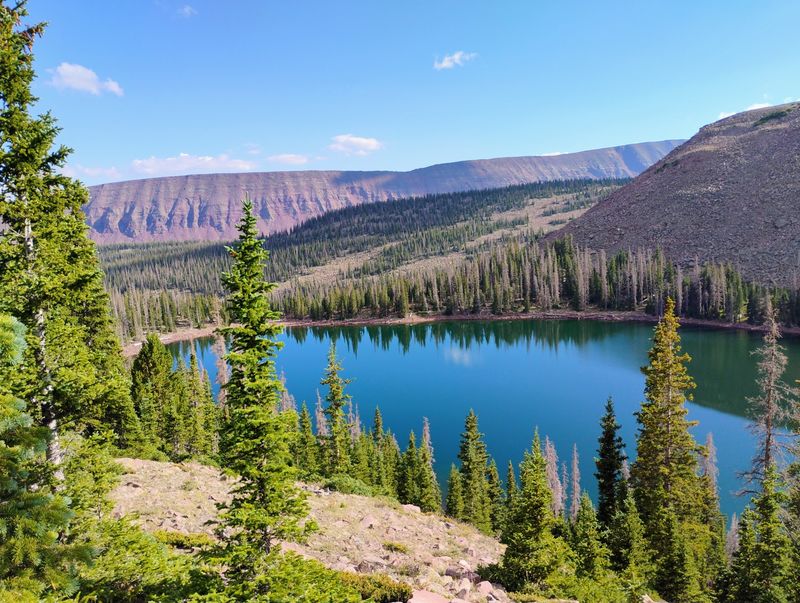
Red Cloud Loop Scenic Backway sounds like a road that should come with a paper map folded badly in the glove box. That is part of the fun, provided the planning is better than the folding.
This officially designated scenic backway runs through Ashley National Forest mountain country near Vernal in Uintah County. It is a less obvious northeastern Utah choice, especially for travelers who usually steer toward the state’s southern parks.
Forested stretches, higher terrain, and remote recreation access make the route a good fit for a tick map discussion.
Because Red Cloud Loop is a backway rather than a single picnic site, conditions matter. Drivers should check Ashley National Forest information for seasonal access, road status, fire restrictions, and any vehicle guidance before setting out.
Cell service can be limited in mountain areas, so downloaded maps and a realistic fuel plan are smarter than pretending optimism is a navigation tool.
The reward is a broader look at Uintah County than the familiar Vernal basecamp image. Red Cloud Loop Scenic Backway adds forest roads and mountain scenery to the trip, with the sensible reminder that stepping into brush for photos or breaks should be followed by a tick check.
10. Cedar Breaks National Monument, Brian Head
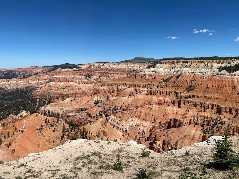
Cedar Breaks National Monument has the rare skill of making visitors look down into color and then turn around into forest. The famous amphitheater gets the photographs, but the high-elevation woods help define the place.
Located near Brian Head in Iron County, Cedar Breaks sits at elevations above 10,000 feet. As of August 27, 2026, official information listed roads, overlooks, visitor facilities, trails, and Point Supreme Campground as open.
Current fire restrictions and a water-service interruption apply, so travelers should review National Park Service updates before arriving.
The monument’s forested setting makes it different from many lower, warmer Utah viewpoints. Trees and meadow edges can create tick habitat, even at higher elevations, so staying on trails and checking clothing after walks remains a smart habit.
The altitude also means weather can shift more sharply than travelers expect from a summer road trip.
Cedar Breaks works best when visitors understand both sides of it: dramatic geology and practical mountain conditions. Bring water because of the service interruption, follow posted fire rules, and remember that a grand overlook still shares space with small outdoor realities, including ticks.
11. Woods Ranch Recreation Area, Cedar City
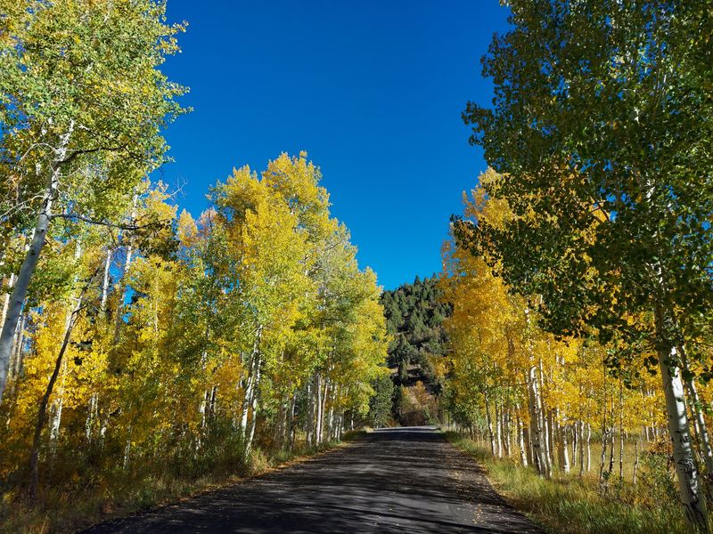
Woods Ranch Recreation Area does not need to compete with the drama of Cedar Breaks. Its strength is quieter: picnic tables, trails, and wooded mountain country east of Cedar City along Highway 14.
This Iron County recreation area gives travelers a lower-key forest stop in southern Utah’s high country. It is often used for picnicking and trail access, with trees providing the main character rather than a big visitor center or headline overlook.
That makes it a useful counterpoint to larger public lands nearby.
Because Woods Ranch Recreation Area is a wooded site with trails and vegetation around developed spaces, tick prevention belongs in the day plan. Sit at designated picnic areas, keep bags off brushy ground when possible, and check shoes, socks, and pant legs after exploring.
It is ordinary advice, yes, but ordinary advice is usually what saves a trip from becoming a cautionary tale.
Travelers using Highway 14 can treat Woods Ranch as a practical pause rather than a complicated expedition. Verify current access and any forest alerts before visiting, especially during changing weather or fire season.
Its appeal is modest in the best way: trees, tables, paths, and room to slow down for a while.
12. Kolob Canyons, New Harmony
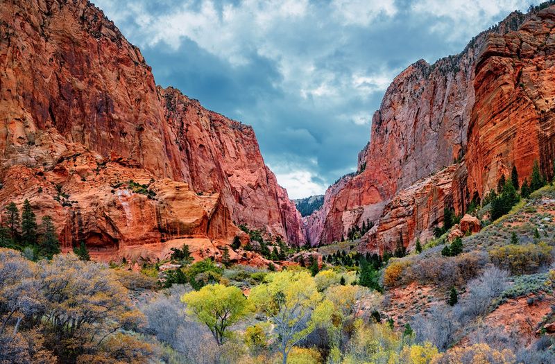
Kolob Canyons can feel like Zion National Park’s more reserved sibling. It has red rock presence, but the higher elevations bring pine and woodland scenery that contrast with hotter parts of Washington County.
The Kolob Canyons area is reached from Kolob Canyons Road near New Harmony. Zion National Park currently lists the road as open for most of the year, though temporary closures and winter conditions can affect access.
That official status matters because this is not a place to plan by vague memory or old vacation photos.
Woodland and canyon-edge terrain make Kolob Canyons a smart final stop in a Utah tick map list. Visitors may come for the cliffs, but brush, grasses, and shaded plant communities deserve the same practical respect as the views.
Stay on established trails and overlooks, use repellent when conditions call for it, and check clothing after time outside.
Kolob Canyons is especially good for travelers who want a different angle on Zion without ignoring real-world planning. Road status, weather, and park alerts should guide the trip.
The contrast is the point here: red stone above, trees around, and a county that reminds visitors how varied southern Utah can be.