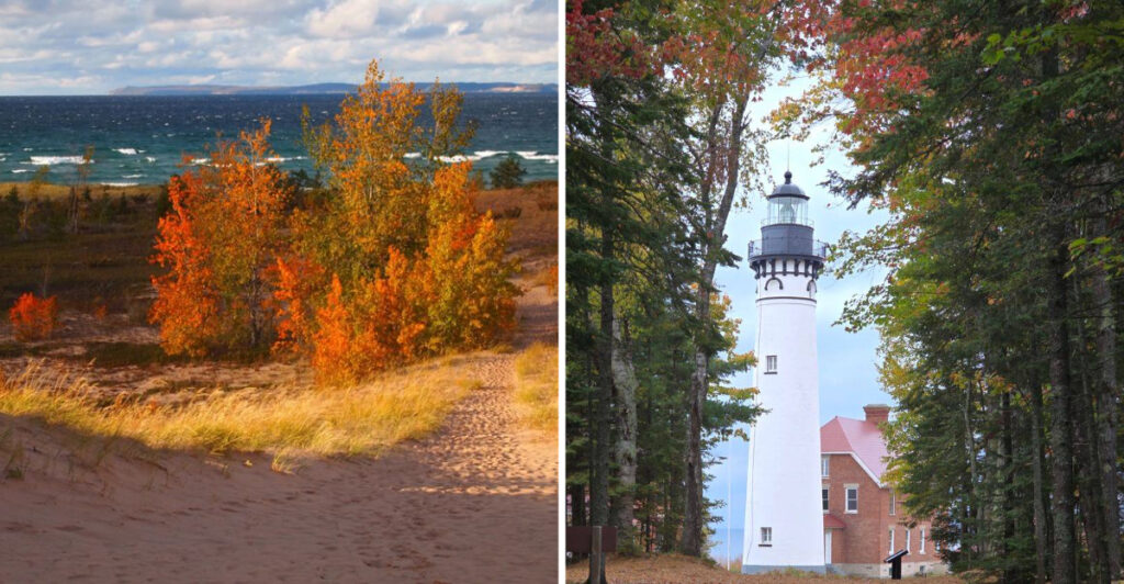
Michigan does not change color quietly. It flips the whole road-trip mood.
The first bright leaves show up in the north, then autumn starts working its way down the map. Suddenly, roads you would normally breeze through start demanding slower drives and extra pull-offs.
Some stretches feel dramatic right away. Others take their time, letting the color build mile by mile.
That keeps the route from turning into one long blur of orange and red.
I like fall trips best when the scenery keeps interrupting the plan. A good road should make you forget how many miles are left.
Just keep an eye on the color reports. Michigan autumn is beautiful, but it is not waiting around for anyone’s schedule.
1. Copper Harbor

The road starts doing the work well before you reach town. US-41 heads north through the Keweenaw Peninsula toward Copper Harbor, with an 18-mile stretch known as the Covered Drive where trees form a canopy over the highway.
Once you arrive, another road climbs above everything.
Brockway Mountain Drive runs for about nine miles between the Copper Harbor area and M-26, climbing to viewpoints roughly 720 feet above Lake Superior. From the higher stops, the Keweenaw forest spreads toward the lake in almost every direction.
That elevation makes the route especially useful when you want fall color on a much larger scale than a single roadside grove. Park at one of the overlooks and you can photograph layers of hardwood forest, inland water, and Lake Superior in the same outing.
Copper Harbor itself gives you a quieter break between drives. Small shops, trails, shoreline access, and Fort Wilkins Historic State Park sit close enough that you do not need to spend the whole day inside the car.
This far north, color usually develops earlier than it does farther south in Michigan. Instead of locking your trip to one guaranteed peak date, check the Keweenaw fall-color report before heading up.
When the timing lines up, the combination of Covered Drive and Brockway Mountain can easily turn the final approach to town into the longest short drive of your trip.
2. Marquette
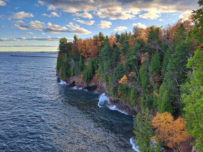
A city can earn a place on a fall-color road trip without pretending to be a tiny village.
Marquette gives you Lake Superior, wooded hills, trails, overlooks, and a downtown substantial enough to use as a base for more than one day.
The contrast is what makes it useful. You can photograph the waterfront in the morning and be surrounded by forest later without traveling far.
Sugarloaf Mountain remains one of the best-known nearby overlooks. The climb uses a trail and stair system to reach viewing platforms above the surrounding woods, with Lake Superior opening beyond them.
Mount Marquette provides another elevated perspective, while County Roads 510 and 550 add driving options when you would rather chase color from behind the wheel.
Closer to downtown, the lakefront changes the composition again. Marquette’s ore dock projects into the water, giving you an industrial landmark against the lake and wooded hills instead of another uninterrupted forest scene.
The city’s size also makes planning easier when Upper Peninsula weather changes. You can shift between outdoor stops, downtown shops, cafes, and shorter waterfront walks rather than betting the entire day on one hike.
For a photography-focused trip, that variety matters. Marquette lets autumn share the frame with Lake Superior, city architecture, forest, and a piece of Michigan’s mining and shipping history.
3. Munising
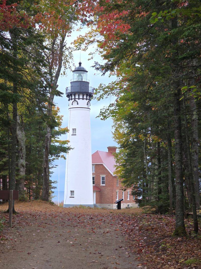
Cliffs may get the headlines around Pictured Rocks National Lakeshore, but autumn adds an entirely different layer to the shoreline.
Munising sits at the western gateway to the park, where hardwood forests turn red, orange, and yellow above Lake Superior.
Commercial boat tours can provide views of the Pictured Rocks cliffs from the water during their operating season, while park roads and trails offer inland color.
One important change affects current visits. The trail to Munising Falls remains closed because part of the paved route was washed out in 2025, so it should not be treated as an easy waterfall stop right now.
Miners Falls gives you a current alternative inside Pictured Rocks. The trail runs about six-tenths of a mile each way through forest before reaching viewing platforms above the powerful 50-foot drop.
You can also look beyond the national lakeshore. Wagner Falls Scenic Site near Munising provides another waterfall option surrounded by woods.
Autumn is particularly strong here because the water never disappears from the story. The forest color can sit above cliffs, beside falls, or against the deep blues and grays of Lake Superior depending on where you stop.
Pictured Rocks remains open year-round, although individual roads, facilities, tours, and trails can have seasonal schedules or closures.
Check current park conditions before heading out, then let Munising serve as the base for whichever combination of water, cliffs, and forest is available that day.
4. Paradise
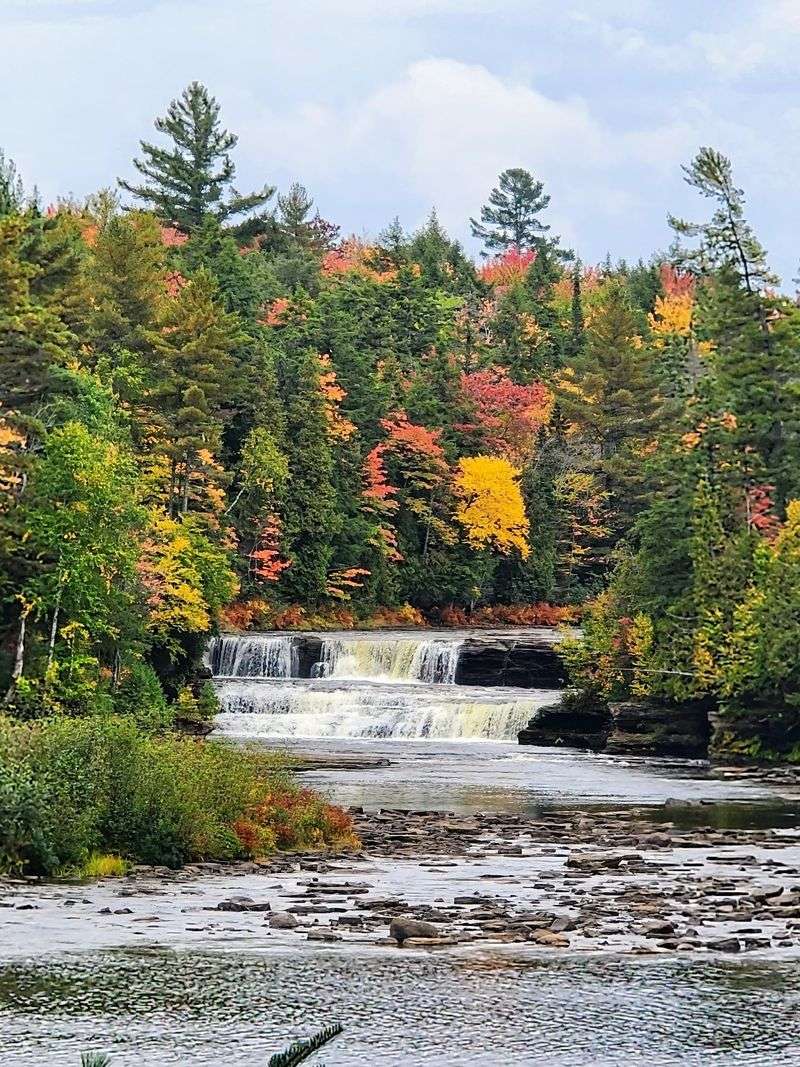
You can build an entire autumn day around the roads leading away from this tiny Upper Peninsula community.
Paradise sits between Lake Superior, Hiawatha National Forest, and Tahquamenon Falls State Park. M-123 connects the area with the falls, while the road north reaches Whitefish Point along the Lake Superior shoreline.
Tahquamenon gives the trip its biggest landmark. The Upper Falls measures about 200 feet across and drops roughly 50 feet, with the surrounding hardwood forest adding color during autumn.
The river itself brings another shade into the scene. Tannins from surrounding wetlands give the water its distinctive amber-brown tone, creating a strong contrast with the changing leaves.
Paradise enters the route naturally between the falls and Whitefish Point rather than functioning as a stand-alone sightseeing attraction.
Drive north and the forest eventually opens toward Whitefish Bay. Whitefish Point adds broad Lake Superior views, dune grass, and the historic light station, which gives your camera a completely different subject after hours of trees.
Fall color timing in the eastern Upper Peninsula can vary from year to year. The broader season commonly stretches from late September well into October, so current regional reports are much more useful than choosing a date months in advance.
This is the stop for a road trip that needs both dense forest and open shoreline without traveling to another corner of the peninsula.
5. Harbor Springs
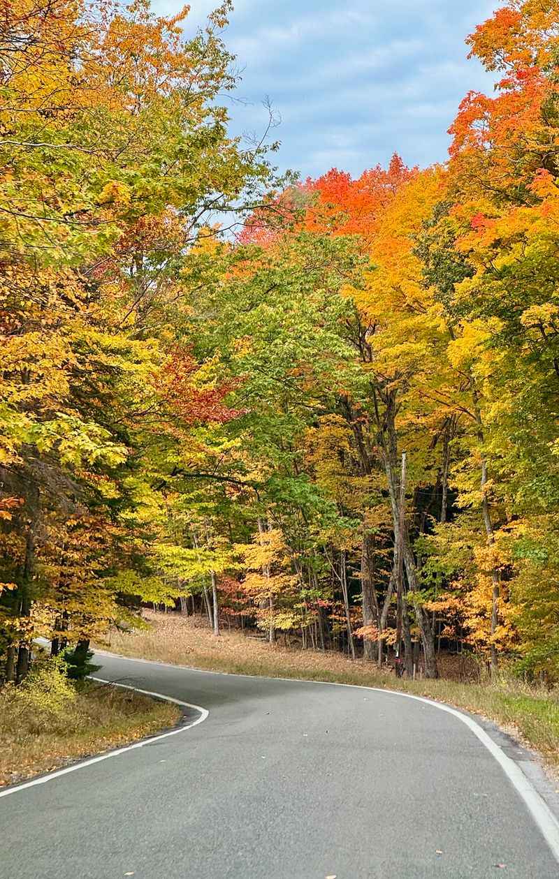
Here, one highway can become the main event.
M-119 leaves the Harbor Springs area and heads north through the Tunnel of Trees Scenic Heritage Route toward Good Hart and Cross Village. The road is narrow, winding, and famous for the tree canopy that closes around much of the route.
It is also unusual for a Michigan state highway because sections of M-119 have no center line.
Fall gives the corridor its most obvious transformation. Hardwood branches arch above the pavement while openings between the trees reveal pieces of the Lake Michigan shoreline.
Harbor Springs works naturally as the southern anchor. Before committing to the drive, you can spend time near the marina and downtown, then head north when you are ready for the wooded stretch.
The route rewards patience. Curves, limited sight lines, local traffic, cyclists, and narrow shoulders mean this is not a road for rushing or stopping wherever a photograph suddenly looks tempting.
Use designated places to pull off and let the drive unfold slowly instead.
Color around the Petoskey and Harbor Springs area typically develops later than in the far northern Upper Peninsula, but annual weather can move that timing around.
That makes Harbor Springs especially useful on a longer Michigan trip. Follow the changing color south from the U.P., and M-119 can become the next major chapter rather than a duplicate of what you already saw.
6. Petoskey
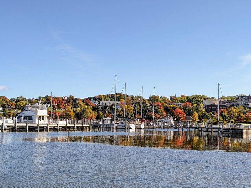
The best view in Petoskey may depend on which direction you turn.
Look downhill and Little Traverse Bay opens beyond the waterfront. Turn back toward town and the historic Gaslight District adds storefronts, lamps, and older architecture to the fall scenery.
That combination gives you a different kind of photo stop from a forest overlook.
Bayfront Park runs beside the water below downtown, and a pedestrian tunnel connects the waterfront with the city above. You can move between shoreline views and the Gaslight District without turning the stop into another driving loop.
Petoskey’s sloping terrain helps too. Streets rise away from the bay, creating elevated perspectives over the water and surrounding hills.
Autumn also works well as a bridge between Petoskey and neighboring communities. Harbor Springs and the Tunnel of Trees sit across Little Traverse Bay, while inland routes lead toward hardwood forests around northern Lower Michigan.
Petoskey stones add a completely different excuse to look down rather than outward. These fossilized coral stones are associated closely with the area, although collecting rules depend on where you search and should be checked before removing anything from a shoreline.
Color in this region often reaches its strongest stretch during October, but conditions change each season.
Instead of scheduling a single viewpoint, give yourself time to move between the bay, downtown, and the hills. Petoskey’s strongest autumn feature is how quickly the scenery changes within a small area.
7. Charlevoix
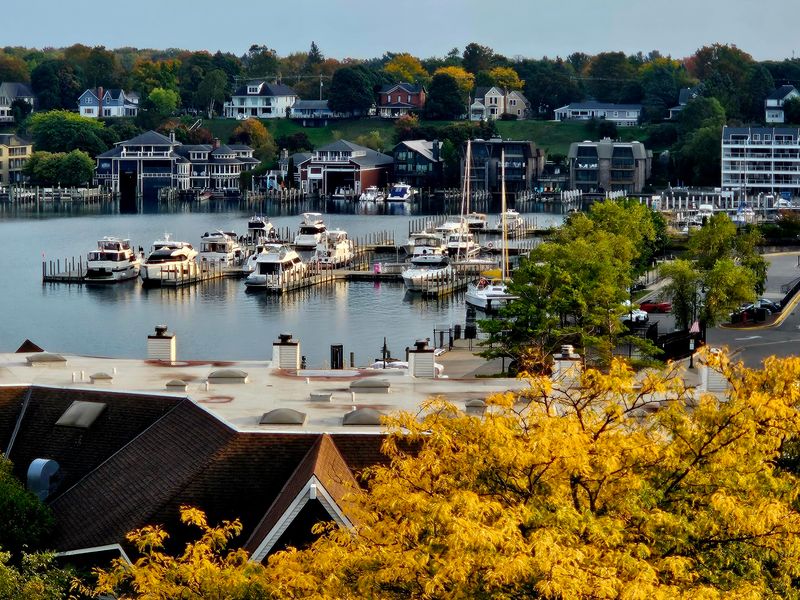
Water appears on both sides of the downtown experience here.
Charlevoix sits between Lake Michigan and Round Lake, with the Pine River Channel connecting Round Lake to the larger lake. That geography gives autumn foliage plenty of water to reflect against.
Start around East Park and Round Lake when you want the town itself in the picture. The harbor, downtown buildings, boats, and trees create a more layered scene than a simple roadside overlook.
The drawbridge across the channel adds another recognizable Charlevoix landmark, while the pier leads toward Lake Michigan and the lighthouse at the channel entrance.
Architecture provides the next change of subject. Earl Young’s stone Mushroom Houses are scattered around Charlevoix, with rounded walls, unusual rooflines, and locally sourced stone giving neighborhood walks an entirely different visual character.
The countryside outside town expands the fall-color options. Current Charlevoix routes include drives around Lake Charlevoix and scenic back roads through rolling northern Michigan terrain.
That means you do not have to choose between a town stop and a color drive. Do both.
Spend part of the morning near Round Lake, leave town for a driving loop, and come back toward the Lake Michigan pier later in the day.
Peak color can shift with weather, but October is generally the heart of the fall season in this part of northern Michigan. A current color report will tell you more than a fixed calendar date ever could.
8. Leland
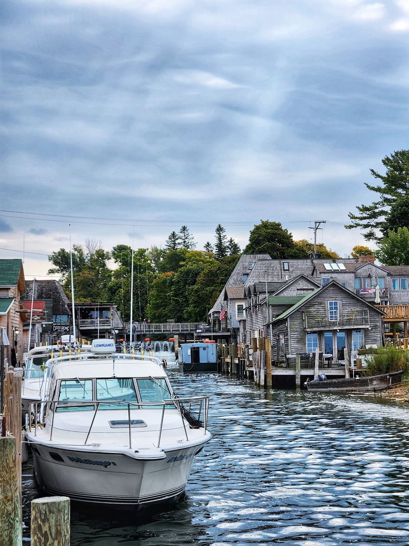
The photographs change as soon as pavement gives way to weathered docks and fishing shanties.
Fishtown sits along the Leland River near its entrance to Lake Michigan. The historic district contains old fishing buildings, smokehouses, docks, commercial fish tugs, and small shops that preserve the character of Leland’s working waterfront.
Some of those structures date to the early twentieth century, while commercial fishing remains part of the site rather than existing only as a museum display.
That makes Leland an unusually strong autumn stop because the season does not have to carry the picture by itself.
Color appears around the river and village, but old wooden structures and boats provide the foreground.
M-22 brings the broader road trip directly through Leland. Once you leave the village, the Leelanau Peninsula adds wooded roads, orchards, hills, and Lake Michigan glimpses on the way toward other communities.
Fishtown itself is open to pedestrians year-round, although individual businesses follow their own seasonal schedules.
Give yourself time to explore on foot instead of taking one photograph from the edge and returning to the car.
The river, working waterfront, and historic shanties reveal different angles as you move through the district.
Then let M-22 handle the next stage. Leland is less a single viewpoint than a place where one of northern Michigan’s signature drives briefly slows down beside the water.
9. Glen Arbor
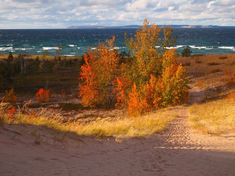
Sand changes the palette around this part of the M-22 route.
Glen Arbor sits close to Sleeping Bear Dunes National Lakeshore, where forested hills meet Glen Lake, Lake Michigan, and enormous stretches of dune.
Pierce Stocking Scenic Drive gives you one of the easiest ways to combine those elements without committing to an all-day hike. The seasonal drive winds through maple and beech forest before reaching overlooks toward Glen Lake, the dunes, and Lake Michigan.
Autumn adds color to the wooded portions while the sand and water remain almost unchanged, creating a three-part landscape that looks very different from the dense forest views farther north.
The drive is generally open to vehicles from late May through late October, but weather can affect conditions near the end of the season. Wet leaves, rain, and wind can make steep sections slippery, so current park information matters.
Glen Arbor also puts you directly on M-22, making the village easy to combine with Leland, Empire, and other Leelanau Peninsula stops.
You do not have to spend the entire day driving.
Trails, beaches, Glen Lake, the Crystal River, and village stops give you plenty of ways to leave the car between overlooks.
When fall color is strong, the best photograph may not be the closest shot of the leaves. Step back far enough to include the dunes and Lake Michigan, and the scale of Sleeping Bear becomes part of the picture.
10. Manistee
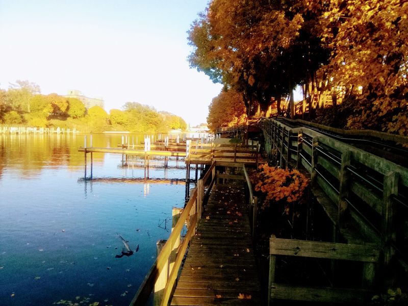
This town can be the beginning rather than the finale.
Manistee sits at the southern gateway to one of Michigan’s best-known coastal color routes. From here, M-22 heads north toward Onekama, Arcadia, Frankfort, Sleeping Bear Dunes, Leland, and the Leelanau Peninsula.
Before following it, spend some time on foot.
The Manistee Riverwalk follows the river through downtown for roughly 1.75 miles, running between Lake Michigan and Manistee Lake. The accessible walkway passes beneath bridges and provides direct connections to River Street.
That creates a useful autumn combination: historic downtown architecture on one side of the day and a long shoreline drive on the other.
Lake Michigan is close enough to add lighthouse, beach, and open-water views before you head north. If M-22 is not enough, Manistee County also maintains other fall driving routes through forest and rural countryside.
The town’s position makes route planning especially simple.
Begin with the Riverwalk, move toward the lake, then point the car north when you are ready for longer stretches of color.
Or reverse everything and use Manistee as the stopping point after driving south through the Leelanau Peninsula.
Either way, it prevents M-22 from becoming nothing more than scenery through the windshield. The road eventually leads you into a downtown where you can park, walk, and finish the trip at a completely different pace.