Your car is not invited.
Honestly, that may be the best thing about these roads.
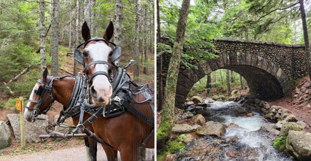
Instead of traffic and painted lanes, you get old bridges ahead and the occasional horse-drawn carriage reminding you that nobody here is in much of a hurry.
The network stretches for miles through the landscape, but I would not start by worrying about distance.
Find a loop that looks good and go.
Cyclists can ride it. Walkers can wander it. Class 1 e-bikes are allowed too.
The whole system was created more than a century ago with motor-free travel in mind, and somehow that idea feels even better now.
Just check conditions before you head out, especially during spring thaw.
Then let the road do its oldest trick: make the car jealous.
The Roads Were Designed To Stay Free Of Cars
John D. Rockefeller Jr. was an experienced horseman who wanted to travel through Mount Desert Island by horse and carriage without sharing the route with motor vehicles.
That idea shaped the carriage-road network from the beginning. Construction started in 1913 and continued through 1940, eventually creating 45 miles of rustic roads within Acadia National Park.
These were engineered roads, not casual woodland tracks. Crews built them about 16 feet wide using layers of broken stone, drainage ditches, culverts, retaining walls, and a raised crown that helped shed Maine rain.
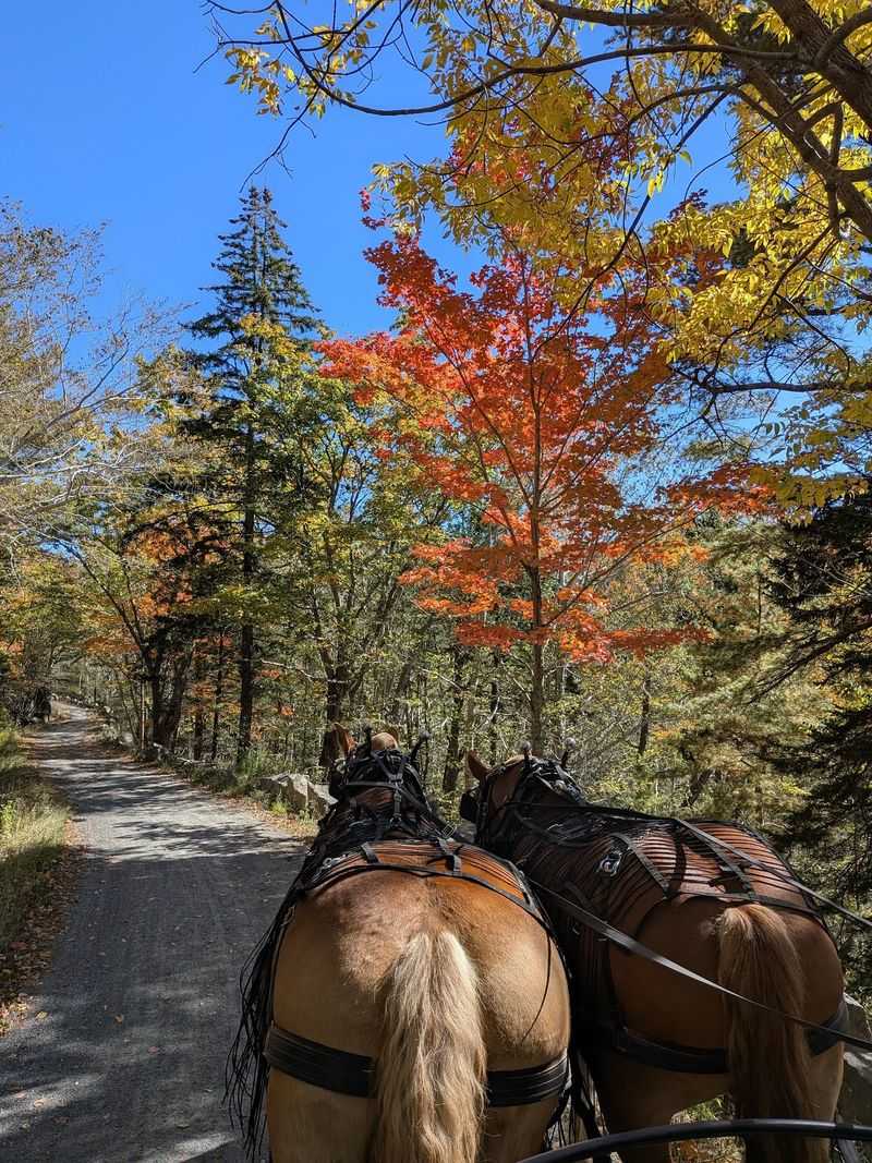
The routes were also laid out to follow the natural contours of the land. Instead of cutting straight across slopes, they curve around hillsides, preserve trees, and open toward selected views.
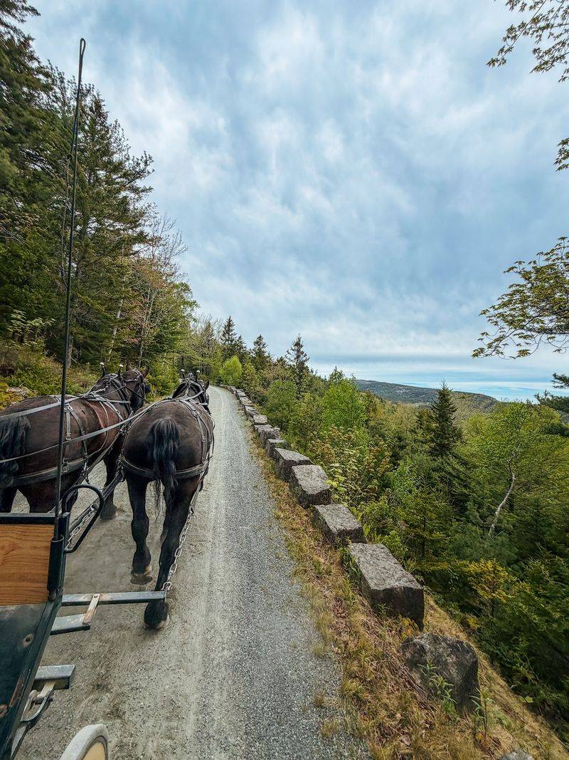
Granite coping stones line many sections as low guardrails. Their irregular shapes earned the nickname “Rockefeller’s teeth,” and once you notice them, they become easy markers along the route.
The absence of ordinary cars changes how you move through the park. Walkers can keep a steady pace without roadside traffic, while cyclists and horses share the same broad surface.
Rockefeller Oversaw Three Decades Of Construction
Rockefeller did more than finance the project. He followed road alignments on foot, watched construction, worked with engineers and bridge designers, and paid close attention to grades, curves, drainage, and stonework.
His goal was practical as well as visual. Horse-drawn carriages needed manageable slopes and turns, and the roads had to survive wet weather without washing apart.
Local granite became a major part of the system. It appears in coping stones, retaining walls, bridge facing, and other structures that connect the roads visually with the island’s rocky landscape.
Landscape architect Beatrix Farrand also consulted on roadside planting. Her work used vegetation to frame views, soften construction scars, and connect bridges and road edges with the surrounding woods.
Rockefeller and his family eventually gave the carriage roads to the park, along with substantial land that helped shape Acadia.
Curves, grades, bridges, and roadside plantings were planned around travel by horse and carriage while preserving trees and selected views.
You do not need to study the engineering before setting out. A few miles on foot or bicycle makes the design decisions easier to notice.
Forty-Five Miles Create Plenty Of Route Choices
Acadia’s carriage-road network covers 45 miles, so a visit does not have to mean tackling the whole system.
Numbered intersections correspond with carriage-road maps and help you build loops of different lengths. Eagle Lake, Witch Hole Pond, Bubble Pond, and Jordan Pond all connect with sections of the network.
The roads are mostly crushed stone rather than pavement. Their broad surfaces suit walking and cycling, but grades still vary, and a route that looks gentle on a flat map can include steady climbing.
Eagle Lake is a useful choice when you want water views and several connections. Witch Hole Pond keeps you closer to the northern side of the system, while routes farther south can link Jordan Pond, Bubble Pond, and Day Mountain.
Private carriage roads also exist outside park ownership near parts of Mount Desert Island. Bicycles are not permitted on privately owned carriage roads, so signs and current maps matter when a route approaches those sections.
Cyclists share the park roads with pedestrians and horses. Everyone yields to horses, while cyclists yield to other users and must keep speeds at or below 20 mph.
If you are unsure how much distance to choose, start with a shorter loop. Adding another section is easier than discovering halfway through a long climb that your legs had a different plan.
Stone Bridges Turn Crossings Into Landmarks
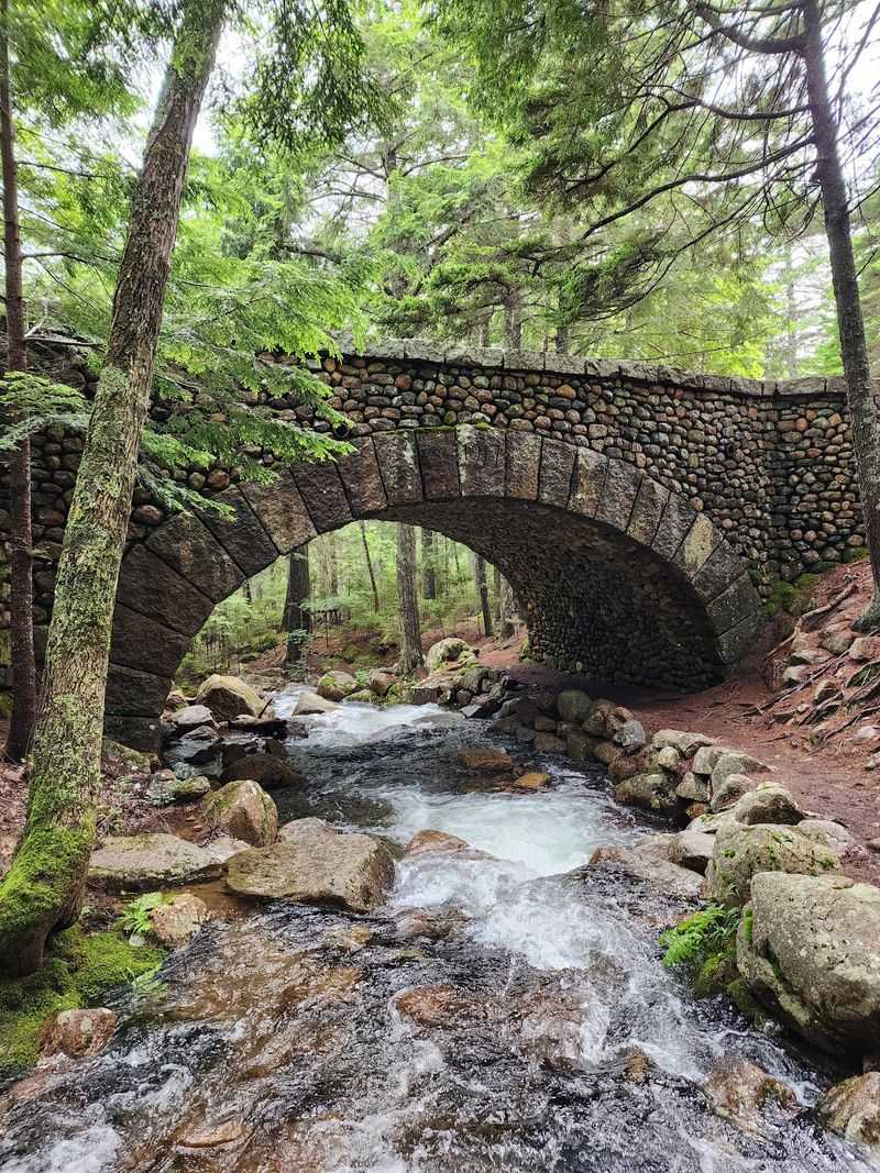
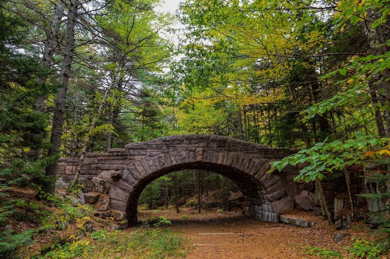
Bridges are woven into the carriage-road system rather than treated as separate attractions.
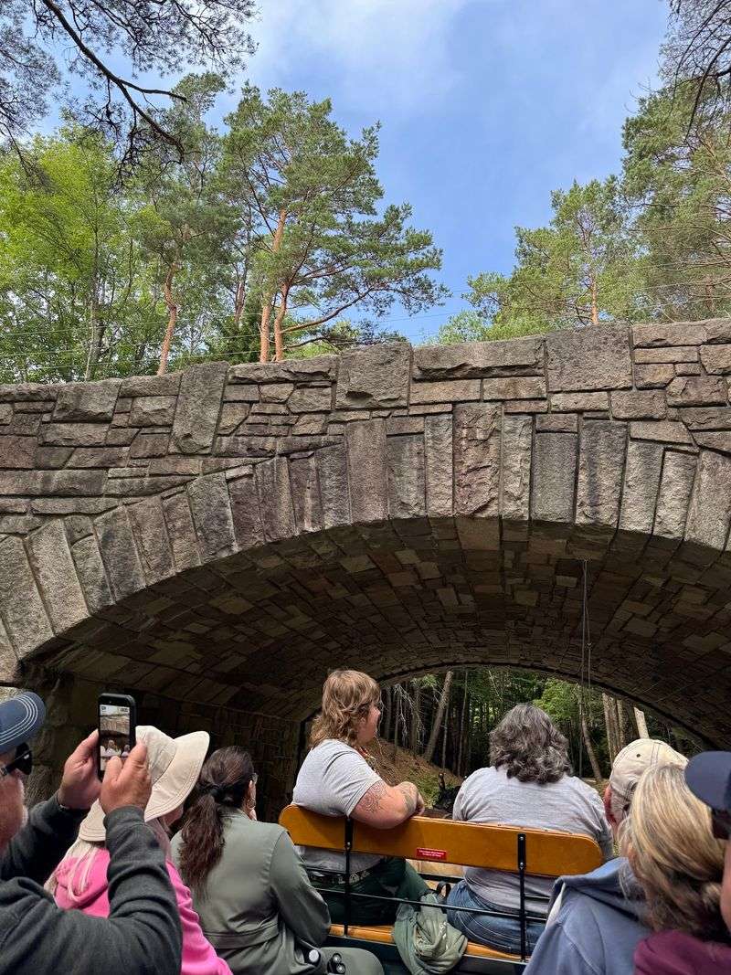
Across the broader historic network on Mount Desert Island, 17 stone-faced bridges were constructed between 1917 and 1940. Sixteen are part of Acadia’s carriage-road system, while Cobblestone Bridge sits just outside the park.
Rockefeller financed 16 of the 17 bridges. Steel-reinforced concrete provided the structural core for many of them, while local stone facing gave the arches and walls their distinctive appearance.
Each bridge responds to a different setting. Some carry a carriage road over a stream, while others separate the quiet routes from motor roads or span steep terrain.
Cobblestone Bridge, completed in 1917, is easy to recognize because of the rounded stones used in its exterior. Other structures, including Deer Brook Bridge, Waterfall Bridge, and Jordan Pond Dam Bridge, use different shapes and stone patterns.
The details are easier to appreciate on foot. Look at how the masonry changes around an arch, how coping stones continue toward a crossing, or how the road disappears beneath another route.
You can also build a route around several bridges and use the numbered intersections to connect them.
Jordan Pond Connects Water Views With The Old Roads
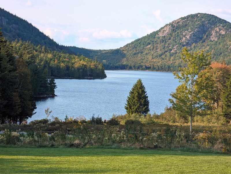
Jordan Pond gives you several ways to combine the carriage roads with one of Acadia’s best-known landscapes.
North Bubble and South Bubble rise beyond the water, while nearby carriage-road intersections connect the pond with routes toward Bubble Pond, Eagle Lake, Day Mountain, and other parts of the system.
The named Jordan Pond carriage-road loop runs 8.6 miles and crosses four historic bridges. It includes rolling sections rather than one long flat circuit, so checking the elevation profile before riding can help you judge the effort.
A separate hiking trail also circles the shoreline. It is not a carriage road, so bicycles stay off that trail, but walkers can combine a pond-side hike with time on the wider gravel routes.
Jordan Pond is a public drinking-water supply, which means swimming is prohibited. Staying on designated paths also protects vegetation around this heavily used part of the park.
Parking can fill during busy periods, especially in the afternoon. The seasonal Island Explorer provides another transportation option when service is running.
If you are arriving by bicycle, carriage-road rules still apply around the pond. Slow down near pedestrians, give horses plenty of room, and use numbered intersections rather than guessing at shortcuts.
One loop here can show how the system was built around scenery instead of speed.
Current Rules Keep The Network Motor Free
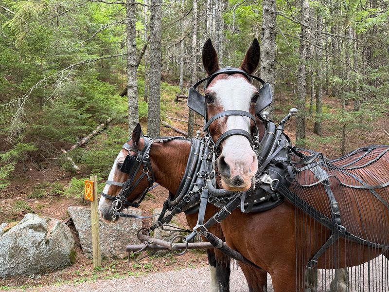
The historic roads still operate as a shared, largely motor-free system.
Pedestrians, traditional bicycles, Class 1 e-bikes, horses, and horse-drawn carriages can use park carriage roads under current rules. Class 2 and Class 3 e-bikes are not permitted, and bicycles may not exceed 20 mph.
Cyclists yield to all other users. Everyone yields to horses, which can react to sudden movement or noise, so slowing down and giving a clear warning before passing matters.
Dogs are allowed on carriage roads but must remain on a leash no longer than six feet. Pet waste needs to be carried out or disposed of properly.
Spring brings another rule that can change plans quickly. During mud season, usually around March and April, the roads may close to all traffic while the gravel surface thaws. In 2026, the park again used a temporary spring closure to protect the roadbed from damage.
Winter use depends on conditions. When there is enough snow and the roadbed is frozen, volunteers may groom sections for cross-country skiing.
The Hulls Cove Visitor Center at 25 Visitor Center Road, Bar Harbor, ME 04609, is the park’s main seasonal visitor contact point from spring into fall and can help with current conditions and route planning.
Before starting, check closures and choose the type of outing the roads can support that day.
More Than A Century Later The Quiet Idea Still Works
The carriage roads have changed users without changing their basic purpose.
Horse-drawn travel remains part of the system, but walkers and cyclists now make up much of the everyday traffic. The roads still curve through forest, around ponds, across granite bridges, and away from ordinary vehicle lanes.
Friends of Acadia and the National Park Service have played major roles in maintaining the network. A restoration partnership that began in 1994 eventually rehabilitated the full 45-mile park network, with the final Eagle Lake section completed in 2021.
That maintenance matters because broken-stone roads depend on drainage and careful surface work. Heavy rain, freeze-and-thaw cycles, and spring mud can damage them faster than a casual gravel path.
For a first visit, there is no need to chase every mile. Choose one pond, one loop, or a handful of bridges and leave room for stops along the way.
Autumn brings changing leaves, summer gives you the longest days, and winter can turn parts of the system into ski routes when snow cooperates. Spring asks for the most patience because closures protect the thawing roadbed.
The idea Rockefeller pursued more than a century ago remains easy to understand once you are moving through the woods without ordinary traffic beside you.
Quiet travel still feels like a small luxury, and here it waits for you.