If you pull over here, check where the ground went.
Seriously.
One minute you are on top of Lookout Mountain, and then the land drops away into a canyon more than 600 feet deep in places.
That is a lot of Alabama disappearing beneath your shoes.
A river runs through the bottom, waterfalls interrupt the walls, and the whole thing feels much bigger once you stop measuring it and actually look down.
You do not have to earn the view with a heroic hike either. Some overlooks are easy to reach, while other trails let you get closer to the river when you feel like doing more.
Rain can make the footing trickier, so good shoes are a smart move.
But mostly?
Take your time at the rim.
Because this is the kind of place that makes you lean forward, then immediately reconsider how far forward was necessary.
The Canyon Drops More Than 600 Feet In Places
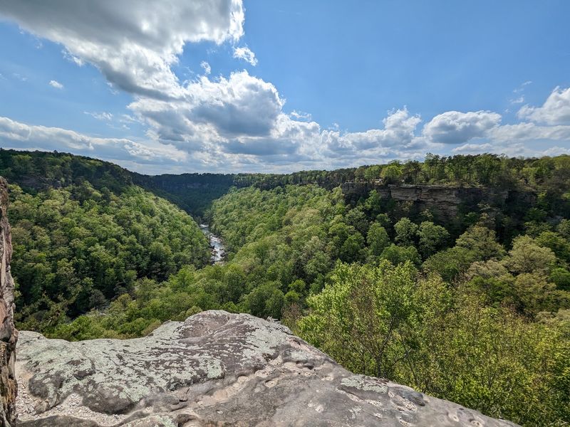
In some sections, the canyon floor lies more than 600 feet below the rim.
From the overlooks, the river can look narrow and distant below the forested slopes. The gorge does not maintain the same depth from one end to the other, so each stop gives you a different look at the canyon walls, river bends, and exposed rock.
Forested slopes soften the outline of the cliffs during warmer months. In winter, bare branches can reveal more of the underlying rock and steep terrain.
Bring binoculars if you want to pick out details along the river or opposite wall without moving close to an edge.
Some viewpoints have developed observation areas, while other parts of the preserve include steep, uneven terrain with exposed drop-offs. Stay behind barriers where they are present and give unprotected edges plenty of room.
Rain can make sandstone, roots, and loose soil slick. Keep children close near overlooks and avoid stepping onto wet ledges or unstable ground.
Morning and late-day light can make the depth easier to read because shadows fall across the walls and ravines. If you are visiting during warmer weather, those times of day can also make short walks more comfortable.
The Gorge Ranks Among The Deepest East Of The Mississippi
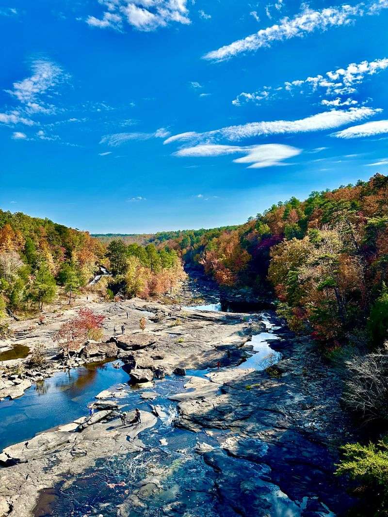
Little River Canyon is one of the deepest canyon systems east of the Mississippi River and the deepest canyon in Alabama.
The preserve sits on Lookout Mountain near Fort Payne, with the gorge cutting through a landscape of sandstone cliffs, wooded slopes, waterfalls, and river corridors.
You do not need a long hike to see the scale of the canyon.
Roadside overlooks along the rim give you several chances to stop, step out, and look down into the gorge. Other areas require short walks or steeper trails, depending on how close you want to get to the river.
Fort Payne and other Lookout Mountain destinations are nearby.
If you are building a day around the preserve, decide first whether you want an overlook-focused drive or a trail-based visit. That choice affects how much time you need and what footwear to bring.
The preserve is free to enter, and most outdoor areas are open daily from sunrise to sunset.
Keep the canyon’s scale in mind when planning. A route that looks short on a map can still involve steep grades, rocky footing, or repeated climbs between river level and the rim.
Little River Carved Its Way Through Lookout Mountain
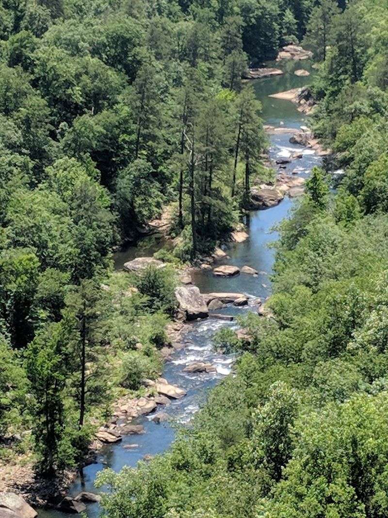
Little River follows an unusual course across the top of Lookout Mountain before cutting down through the canyon.
Over long periods of erosion, the river wore through layers of sandstone and other sedimentary rock, deepening the gorge and exposing the geology visible along the walls today.
The preserve includes rock from the Pottsville Formation, with sandstone, conglomerate, shale, coal, and mudstone found across the landscape.
Water levels change with rainfall and season.
After wet weather, the river can move faster and cover rocks that are exposed during drier periods. Clear-looking water can still contain strong currents, drop-offs, and underwater hazards.
Swimming and wading are allowed in some areas, but there are no lifeguards.
Stay away from strong current, avoid slippery ledges, and do not enter the water when conditions look high or fast. Near Little River Falls, visitors must remain at least 50 feet from the edge of the falls.
Water moving over the ledge can create hazardous currents and underwater forces below.
If you spend time beside the river, watch conditions before stepping onto rocks. A dry surface can become slick after a brief shower, and water levels can change more quickly than they appear from the bank.
Waterfalls Add Another Layer To The Canyon Landscape
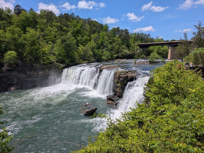
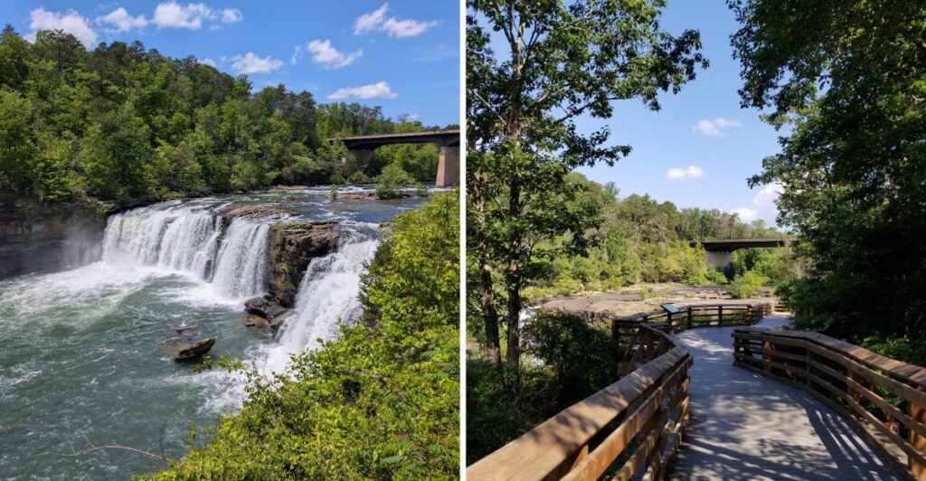
Little River Falls is one of the preserve’s major landmarks and drops about 45 feet across a broad rock ledge.
A paved parking area sits near the Highway 35 bridge, and an accessible boardwalk provides a straightforward route to a viewing area.
The boardwalk is about 100 feet long and 6 feet wide and leads to an accessible viewing area near Little River Falls.
Keep at least 50 feet from the edge of the falls and remain behind barriers.
For a steeper option, Little Falls Trail is a 0.75-mile out-and-back route that descends toward the river. The route includes 137 stone steps, so save some energy for the climb back.
Wear shoes with good grip, especially after rain.
Water flow varies throughout the year. Wetter periods usually bring stronger flow, while drier stretches can expose more rock around the falls and river channel.
The Jacksonville State University Little River Canyon Center is at 4322 Little River Canyon Trail NE, Fort Payne, AL 35967.
That address is useful as a visitor starting point, but the falls themselves are reached from the separate parking area near the Highway 35 bridge.
If you want both stops, check your route before arriving so you do not confuse the visitor center with the falls parking area.
Little River Canyon Rim Parkway Links Eight Overlooks
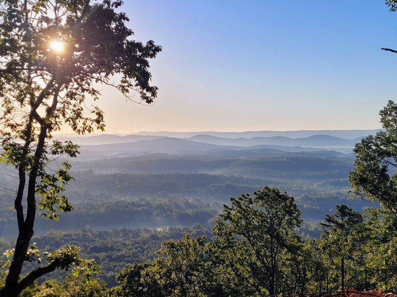
Little River Canyon Rim Parkway follows the canyon for about 11 miles and connects eight overlooks.
The drive connects eight overlooks along different sections of the gorge.
Some overlooks are close to the road, while others involve a short walk across uneven ground.
Expect sharp curves, blind turns, steep grades, and sections without shoulders. Loose gravel can also appear near pull-offs, so keep your speed low and give yourself time between stops.
RVs and trailers are not recommended on the parkway because of the road’s tight turns and steep sections.
Each overlook frames a different part of the canyon.
At one stop, the river may sit deep below the rim. At another, the view may focus more on cliffs, wooded slopes, or bends in the gorge.
Fall brings changing leaf color across the slopes, while winter can reveal more of the rock structure after foliage drops.
Give yourself enough time to stop safely rather than trying to rush the full route.
Weather, maintenance, or road work can affect access, so check current conditions before starting the drive.
A slower pace also gives you more time to notice how much the canyon changes from one overlook to the next.
Sandstone Cliffs Shape Much Of The Preserve
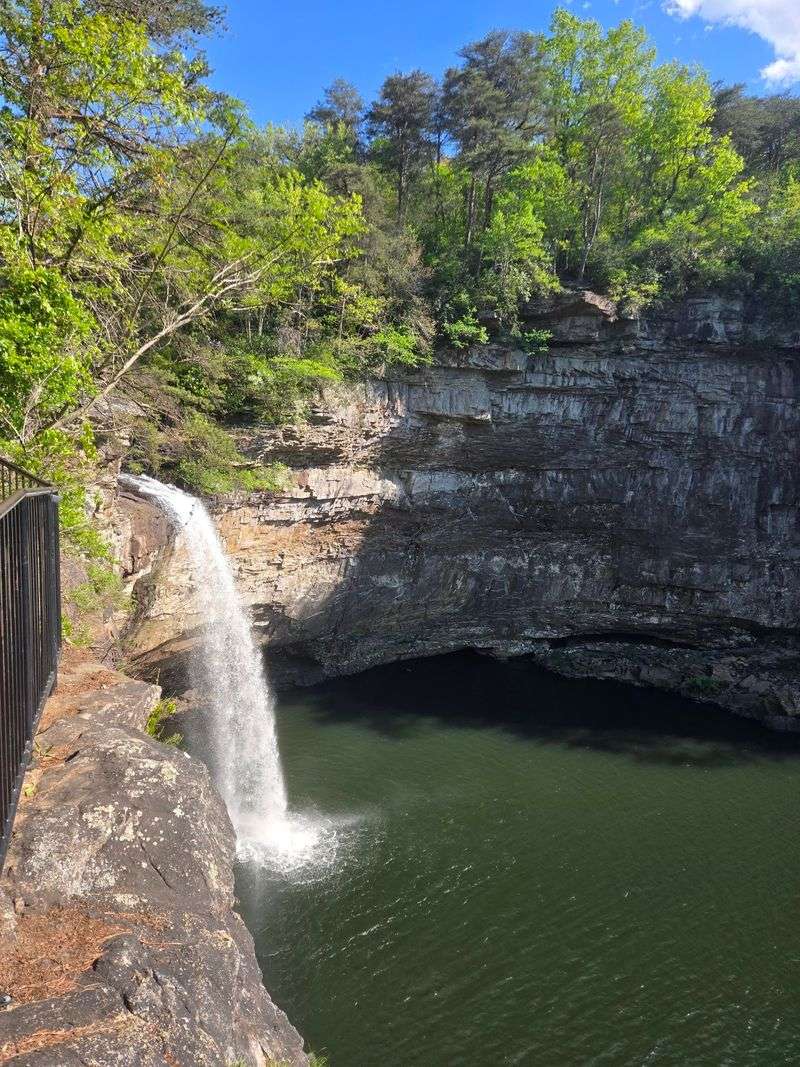
Sandstone gives much of Little River Canyon its rugged structure.
The preserve contains layers of Pennsylvanian sedimentary rock, including quartz-rich sandstone and conglomerate along with shale, coal, and mudstone.
Erosion has exposed those layers in cliffs, ledges, overhangs, and broken rock across the gorge.
Water, temperature changes, plant roots, and gravity continue to weather the exposed stone.
Trees and smaller plants grow along cracks and ledges where enough soil and moisture collect.
Stay on established routes near cliff edges.
Wet sandstone can be slick, and loose material can shift underfoot. Avoid climbing onto unstable ledges just to improve a view or photo angle.
Rock climbing is allowed in parts of the preserve, but climbing routes are separate from ordinary overlooks and hiking areas. If you are not equipped for technical climbing, stick to the designated trails and observation points.
Across-canyon views reveal broad rock layers and cliff faces, especially where vegetation is thinner.
From the opposite rim, broad layers and cliff faces become more visible, especially in areas where vegetation is thinner.
Winter can be useful for that kind of view because leafless trees expose more of the rock walls.
Trails Let Visitors Experience The Canyon From Several Levels
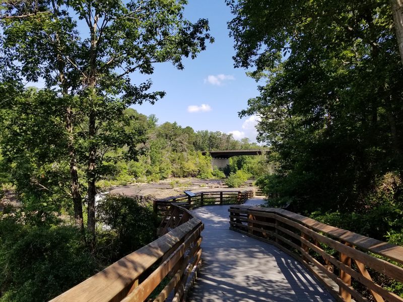
Trail difficulty varies widely across Little River Canyon National Preserve.
The Path to Learning Trail is about 0.5 miles and rated easy, while Little Falls Trail is 0.75 miles and moderate.
Other routes are much steeper.
Lower Two-Mile Trail is only about 0.10 miles, but it is considered arduous because of the descent. Eberhart Trail is about 0.75 miles and also involves steep terrain. Canyon Mouth Trail is about 1 mile and offers an easier option near the lower end of the preserve.
Longer-distance hikers can also use sections of the 16-mile DeSoto Scout Trail, which ranges from moderate to arduous.
Choose your route by terrain rather than distance alone.
A short canyon trail can require more effort than a longer path on flatter ground.
Bring water, wear sturdy shoes, and allow extra time for uphill returns. Trekking poles can help on steeper routes with loose rock, roots, or wet surfaces.
Trail conditions can change after storms or maintenance work, so check current access before heading down.
Most outdoor areas in the preserve are open from sunrise to sunset.
Start with the rim if you want broad views, then choose a lower trail if you want to experience the river and canyon walls from below.