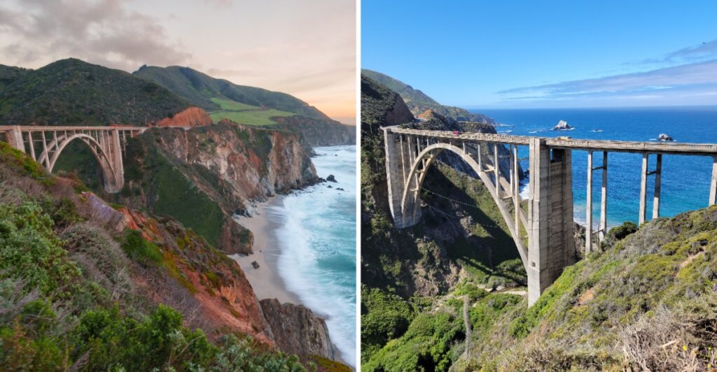
This is where the passenger gets the better deal.
The driver has Highway 1 to think about. You get the bridge.
And what a distraction it is.
A huge concrete arch stretches across the canyon, with the Pacific sitting just beyond it. California has been sending traffic over this dramatic piece of coast since the 1930s, and somehow it still looks made for a postcard.
Just do not treat the roadside like your personal photo studio.
Parking near the bridge is restricted, so the best views may have to wait for a legal stop farther along.
Honestly, that makes the passenger seat even more valuable.
You can watch the bridge appear, catch the ocean behind it, and let the driver keep both eyes where they belong.
Who knew calling dibs on the front seat could come with this much scenery?
A Big Sur Icon Standing Proud Since 1932
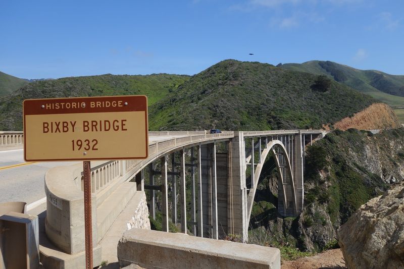
Long before dashboard navigation and phone cameras, crews were working on a crossing that would connect sections of a rugged coastline.
Bixby Creek Bridge was completed in 1932, helping transform travel along a stretch of California where steep hills and narrow roads made journeys difficult.
The bridge rises from the slopes on either side of Bixby Creek. A broad concrete arch supports the roadway, while slimmer vertical supports link that arch to the deck above. Its broad curve and evenly spaced supports stand out against the surrounding hills.
Highway 1 became an important coastal route as additional sections opened in the years following the bridge’s completion. Today, the crossing is still part of an active two-lane road, so a drive over it is an ordinary part of traveling between coastal communities.
If you’re approaching from Carmel, watch the landscape change as the road winds south. Wooded stretches give way to open slopes, coastal cliffs, and bends that reveal the ocean. Passengers can look for the bridge ahead while the driver follows the curves.
A Graceful Concrete Arch Spanning 714 Feet Of Canyon
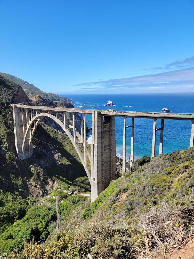
The bridge measures 714 feet from end to end. Its main arch spans approximately 320 feet, giving the structure its recognizable open curve above the creek canyon.
It is an open-spandrel concrete arch bridge. That means the space between the curved arch and the road deck is not a solid wall. Instead, upright supports connect the two, leaving openings that make the structure look lighter when viewed from a distance.
Those openings are especially noticeable against the dark slopes of the canyon. The arch traces one smooth line while the supports rise at intervals toward the road. From a suitably distant view, the entire design becomes easier to read than it is from inside a moving car.
Light and weather change its appearance. Under gray skies, the concrete can seem closer in color to the coastal rock. In brighter conditions, the pale structure stands out against the hills.
Fog may hide portions of the arch altogether.
Want a photograph showing its full length? Plan that image from a legally accessible viewpoint away from the restricted parking zone, rather than assuming the roadside beside the bridge is available.
A wide-angle lens can help with a broad landscape, but no photograph is worth a dangerous stop.
Soaring 260 Feet Above The Rugged Creek Gorge
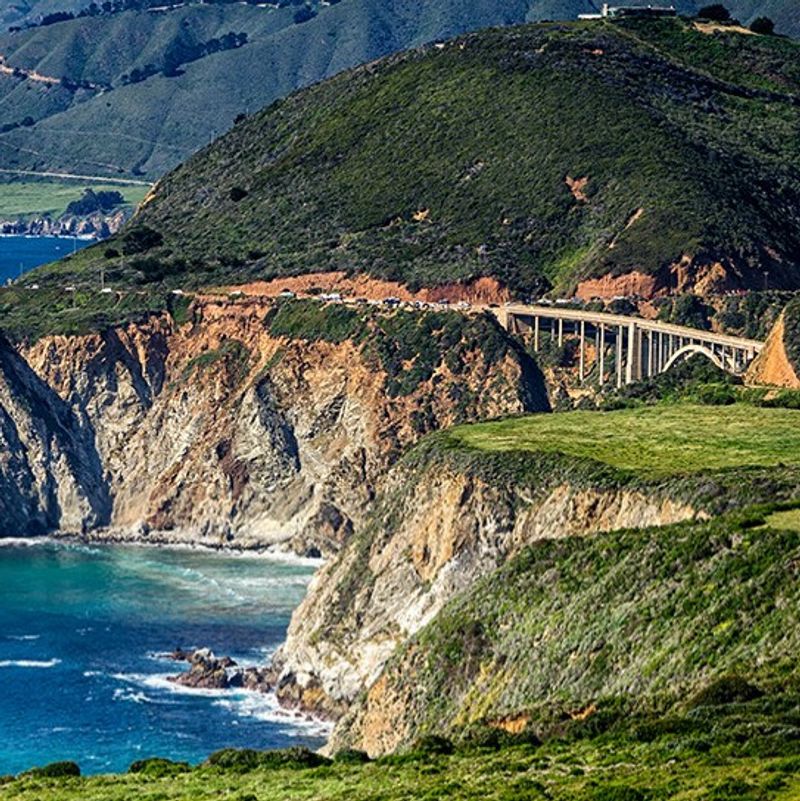
Bixby Creek Bridge carries the highway approximately 260 feet above the canyon below. Bixby Creek runs through that steep landscape toward the ocean, with the road passing high over the channel rather than following it down to the water.
From a passenger’s perspective, the bridge appears between hills that fall sharply toward the coast. Beyond the canyon, the ocean gives the scene a second sense of scale.
Waves meet the shoreline far below the roadway, and the surrounding slopes rise behind the concrete arch.
Conditions can change quickly on this part of the coast. Fog sometimes obscures the upper hills or moves across the bridge, while clearer days reveal more of the creek gorge and surrounding cliffs. Wind is another consideration, particularly outside the shelter of a vehicle.
Admire the height from safe public areas rather than walking toward steep roadside drop-offs. Unstable edges and narrow shoulders aren’t suitable viewing platforms.
Where a designated viewpoint is available elsewhere on the coast, remain behind barriers and follow any posted access limits.
The roadway stays high while the land drops away beneath it, leaving the arch to bridge the gap.
Highway 1 Carries You Right Across The Historic Span
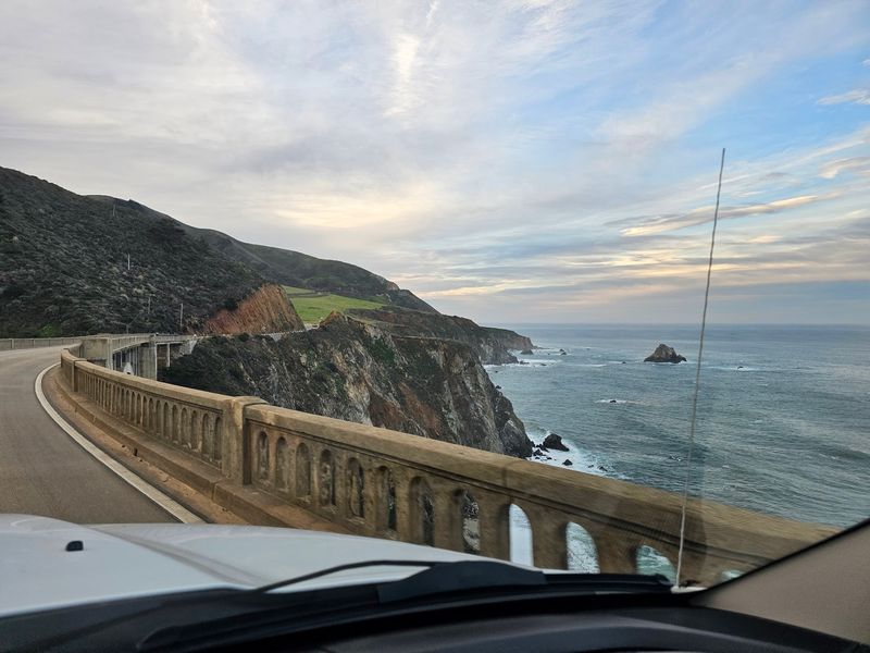
Bixby Creek Bridge is part of Highway 1, the coastal route linking communities and scenic stretches of Monterey County.
The drive toward it includes winding sections with changing visibility, so the best sightseeing arrangement is simple: let the driver drive and the passengers watch the coast.
Crossing the bridge takes only a short time. There is no separate attraction lane and no place to pause on the span. Keep moving with traffic, observe the posted speed limit, and avoid slowing suddenly for a photograph.
Parking restrictions now cover both sides of Highway 1 around the bridge.
A vehicle stopped on the shoulder can interfere with traffic on a road that already has curves, limited space, and visitors unfamiliar with the route.
Don’t make a U-turn or pull into a blocked turnout in an attempt to reach a familiar camera angle.
Weather, repair work, landslides, and other conditions can affect access along Highway 1. Check Caltrans QuickMap for current closures or traffic controls before driving, especially if you’re planning to continue far beyond the bridge.
Traveling with someone who wants photographs? Choose a permitted stopping place elsewhere on the coast before setting out. Enjoy the bridge as you cross, and save the camera for a permitted stop farther along the coast.
Ocean Cliffs And Mountains Frame Every Photo
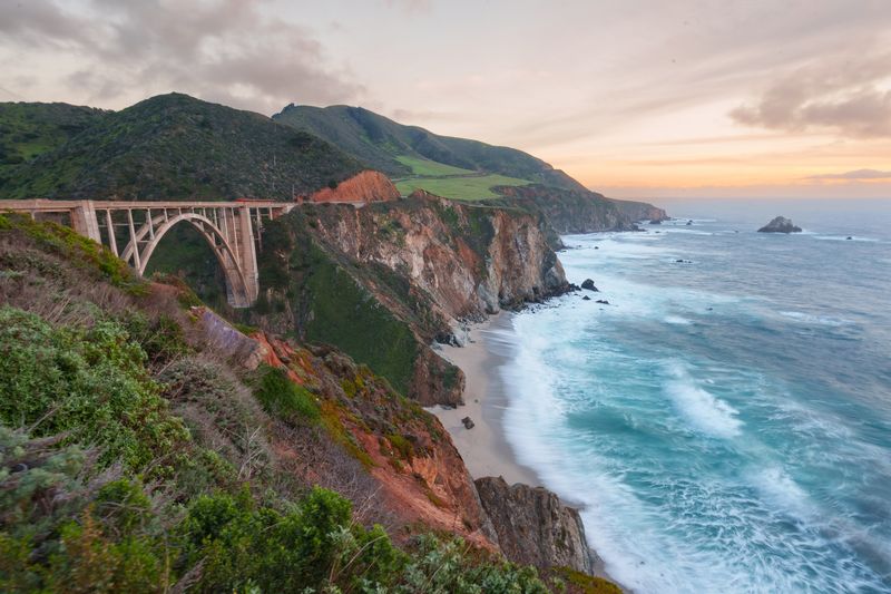
The bridge is easy to recognize in coastal images because of the landscape surrounding it. Hills rise behind the pale arch, the creek cuts through a narrow canyon, and the Pacific fills the wider view beyond the shoreline.
From different directions, the composition changes. One view emphasizes the smooth curve and vertical supports, while another places more of the cliffs and open water around the structure.
The changing weather gives the coast different colors. Green hills can look bright after winter rain and become more golden in drier months. Low clouds soften distant ridgelines, while clear weather reveals the contours of the shore.
A passenger can take in these changes without turning the roadway into a photo stop. If you’re making a longer Highway 1 trip, include other designated coastal viewpoints on your itinerary, where you can park legally and spend time composing pictures.
Avoid crossing the highway or stepping into traffic to recreate images you’ve seen online. Older travel photographs may show access points that are no longer open to visitors. Posted signs and barriers take precedence over a map pin or social media suggestion.
Built Through The Great Depression On A Tight Budget
Construction began during the early years of the Great Depression, when building a major bridge across this remote canyon required careful planning and large amounts of material.
The bridge was completed in 1932, before the entire coastal highway connection was finished.
The work involved creating a temporary wooden framework, known as falsework, to support the concrete while the arch took shape. Building that framework over steep terrain was a major part of the undertaking.
Once the concrete could carry its own weight, the temporary support could be removed.
Crews used tens of thousands of sacks of cement, along with timber and other supplies brought to a site that was difficult to reach. Material was moved across the gorge using suspended equipment, allowing construction to proceed above the creek.
Concrete was chosen for the arch rather than a steel alternative, taking construction and maintenance considerations into account. The finished bridge combined a strong structural form with a curve that follows the surrounding landscape.
Look at its open spaces and supports when you next see a photograph of the whole bridge. The arch carries the load, while the columns connect it to the roadway high above. Those working parts create the familiar outline.
Plan Your Coastal Viewpoints Beyond The Bridge
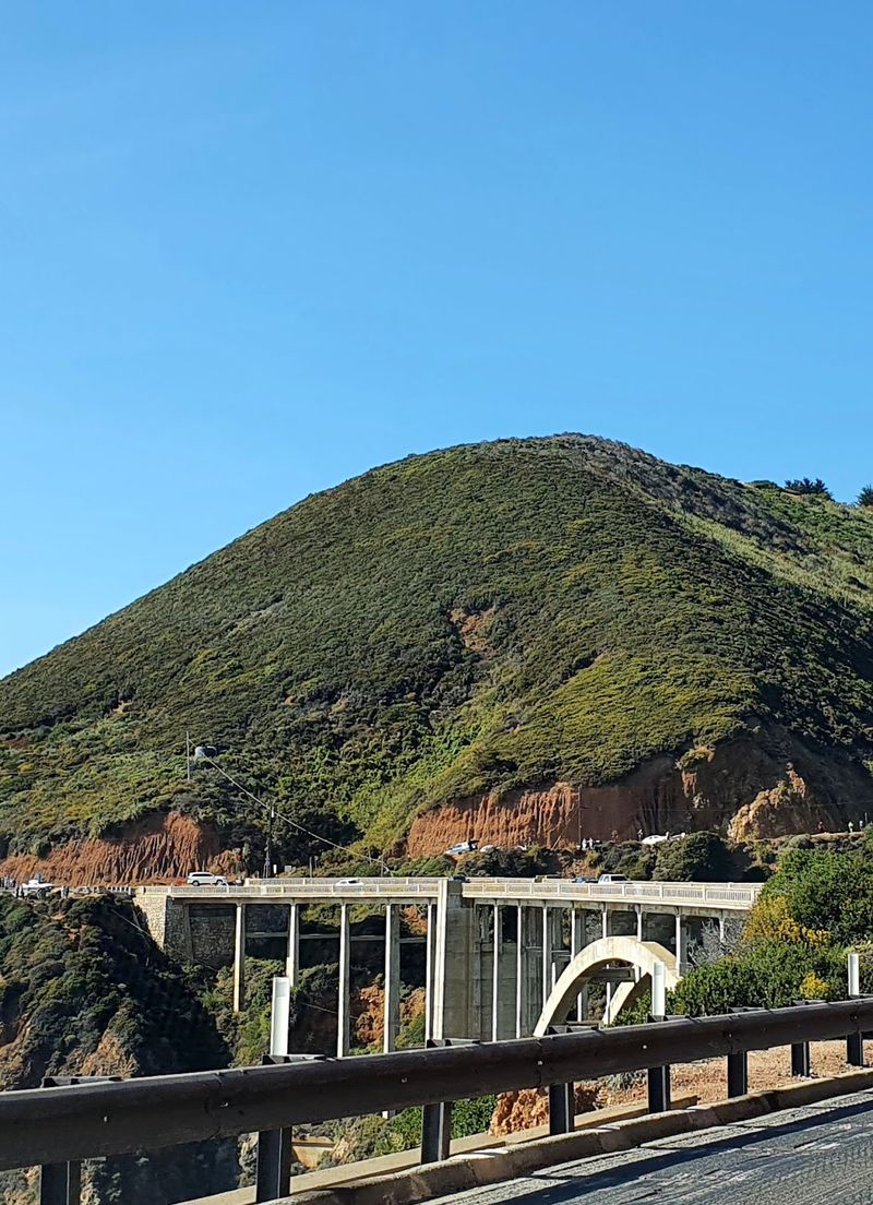
A coastal drive often includes opportunities to stop and take in the ocean, but Bixby Bridge itself requires a different plan. Parking is prohibited on both sides of Highway 1 in the designated zone around the crossing, and signs mark the restriction.
Don’t assume a wide-looking shoulder is an authorized turnout. Even a brief stop for a photograph can obstruct other drivers or leave passengers too close to moving traffic. The bridge is best experienced as part of the drive, not as a place to park and wander.
For a longer break, continue to an officially permitted parking area elsewhere on Highway 1. Choose a place where parking is allowed, follow any posted time or access limits, and keep clear of private driveways and protected areas.
Bixby Creek Bridge crosses Bixby Creek on Highway 1 in Monterey County, roughly 15 miles south of Carmel-by-the-Sea. That location makes it a useful landmark for planning your drive, even though it doesn’t have a conventional street address or visitor parking lot.
Then give the road your full attention. The bridge, the canyon, and the Pacific are part of one striking stretch of coastline, and there’s no need to stop in a prohibited area to enjoy traveling through it.