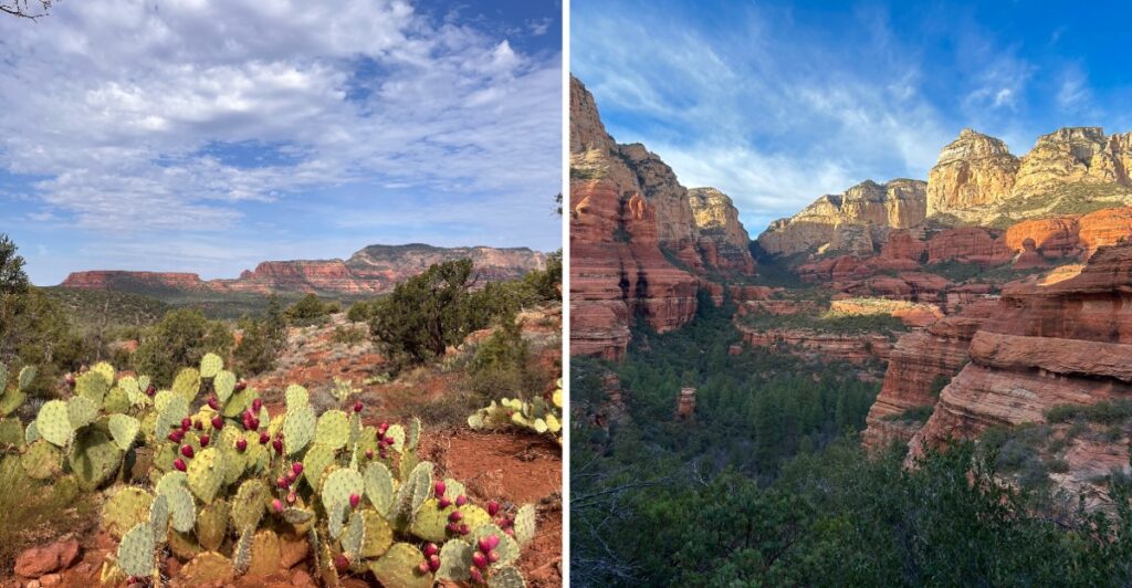
Good luck keeping your eyes on the odometer.
The road bends, another wall of red rock shows up, and whatever distance you planned to cover starts feeling much less important.
That is the nice thing about exploring this part of Arizona by car. You do not need a serious hike to get close to the scenery.
Some roads stay smooth and easy. Others trade pavement for rougher ground and ask a little more from the vehicle.
Either way, the view keeps changing.
A canyon cools things down. A creek gives you an excuse to stop. Then the road opens up again, and those red cliffs take over the windshield.
I would leave the day deliberately loose.
Not because you need more stops.
Because the road is probably going to invent a few for you.
1. Red Rock Scenic Byway
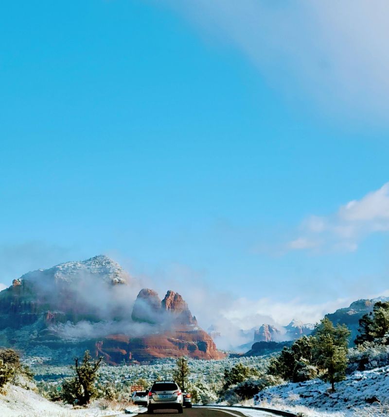
Bell Rock makes a memorable first impression, rising beside the highway like an enormous sandstone landmark. Courthouse Butte provides a second focal point, its broad walls catching the light as the road curves through open high-desert terrain.
These landmarks help define the Red Rock Scenic Byway, a designated 7.5-mile portion of State Route 179.
The route carries an All-American Road designation, recognizing scenery that makes the drive an attraction in its own right.
Junipers, prickly pear cactus, and reddish soil fill the foreground while cliffs stretch across the horizon.
For a closer look, stop at Bell Rock Vista or the Courthouse Vista area. The Bell Rock Pathway lets you explore the setting on foot without taking on a strenuous mountain trail.
Different branches and distances give you flexibility: a short stroll works just as well as a longer wander.
Some trailhead parking areas require a Red Rock Pass or an accepted federal recreation pass. Check the signs at the exact lot you use rather than assuming one parking rule covers every stop.
The byway is paved and practical for an ordinary car, though its roundabouts deserve attention, especially when cyclists and pedestrians are nearby.
Start south of Sedona and head north to watch the rock formations change position around each bend.
Morning light brings warm orange tones; late afternoon outlines the sandstone layers with deeper shadows.
Address: State Route 179, Village of Oak Creek–Sedona, AZ 86351.
2. Oak Creek Canyon Scenic Drive
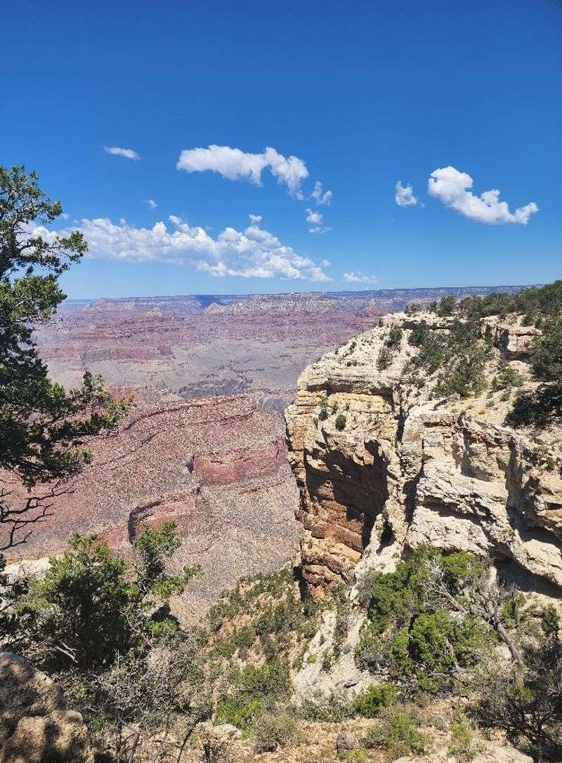
The first surprise is how quickly the desert starts feeling greener. As you head north from Sedona, the road follows Oak Creek into a canyon where sycamores and cottonwoods gather near the water and tall rock walls frame the view.
State Route 89A follows the canyon toward the high country south of Flagstaff. Over approximately 16 scenic miles toward Oak Creek Vista, the landscape gradually shifts from red sandstone surroundings to a mix of creekside trees and ponderosa pine forest.
You can stay in the car and enjoy the changes, but the stops add another dimension.
Slide Rock State Park preserves a historic apple orchard and a natural sandstone water chute. Creek recreation depends on conditions, and wet rock can be slippery, so choose activities with care. Not in the mood for a swim?
The orchard setting and canyon scenery offer plenty to see from dry ground.
Farther north, the highway climbs a series of tight switchbacks. Oak Creek Vista offers a broad look down into the canyon.
Native American artisans sometimes sell handmade work at the overlook.
Autumn is especially colorful, when yellow and gold foliage brightens the creek corridor beneath reddish canyon walls.
This is a paved mountain route, but storms, winter weather, and occasional maintenance can affect travel. Allow more time than the mileage suggests. A few pauses beside the canyon or at an overlook can turn a short drive into a full afternoon.
Address: State Route 89A, Sedona, AZ 86336.
3. Upper Red Rock Loop Road
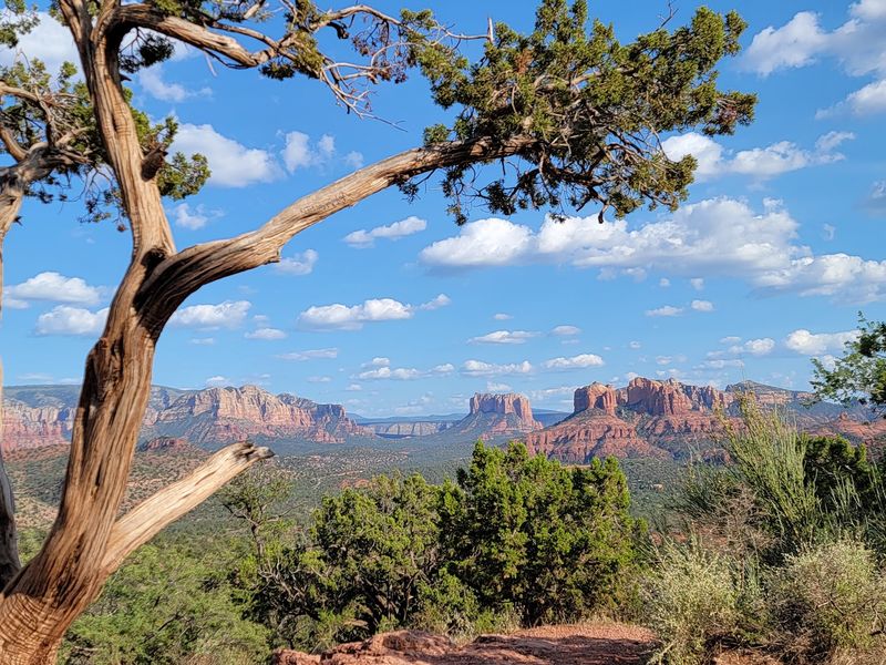
Cathedral Rock looks different when it rises beyond gentle hills rather than dominating the view immediately ahead. Its jagged spires appear over juniper trees, desert grasses, and quiet countryside as the road bends south of West Sedona.
The paved approach is part of Upper Red Rock Loop Road, reached from State Route 89A.
Compared with the city’s main highway corridors, this setting offers a more rural perspective: scattered homes, open slopes, and rock formations that seem to change shape as your angle shifts.
One appealing side trip leads to Crescent Moon Picnic Site. Turn toward Chavez Ranch Road, then follow the access road to the recreation area at Oak Creek. There, Cathedral Rock stands beyond the water and creekside vegetation.
Designated walking areas make it possible to spend a little time out of the car without planning a demanding hike.
The broader Red Rock Loop country has a long connection to screen Westerns. Filmmakers used the surrounding sandstone landscapes during the twentieth century, and the layered cliffs still give the countryside a distinctive visual character.
Your biggest decision may be whether to stop for creekside scenery or continue along the loop for more changing views. Both approaches work. Respect private property, use established pullouts, and avoid assuming every wide shoulder is a public parking area.
Later in the day, side lighting draws attention to the cliffs’ textures. This is a route that rewards looking at one familiar landmark from several unfamiliar angles.
Address: Upper Red Rock Loop Road at State Route 89A, Sedona, AZ 86336.
4. Lower Red Rock Loop Road
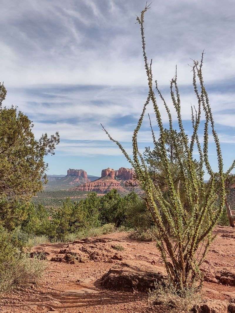
Open slopes, patches of greenery, and distant formations give this stretch of countryside a gentler feel than Sedona’s cliff-lined highway approaches. Here the pleasure comes from the landscape as a whole rather than one dramatic roadside landmark.
A drive along Lower Red Rock Loop Road connects with the larger Red Rock Loop circuit southwest of town.
The route passes rural properties and rolling terrain, with access to Red Rock State Park, a nature preserve and environmental education destination beside Oak Creek.
Inside the park, trails pass through habitats shaped by the creek and surrounding dry hills. Cottonwoods and other streamside plants provide shade and contrast with the reddish rock above them.
Guided nature walks introduce visitors to the area’s geology, plant life, and wildlife when scheduled.
It’s important to choose the right stop for your plans. Red Rock State Park is separate from Crescent Moon Picnic Site, and swimming or wading is not allowed inside the state park.
Come for the trails, birdwatching opportunities, and quieter moments beside the creek corridor instead.
The complete Red Rock Loop includes a gravel portion between paved stretches. Most visitors in standard cars should stick to maintained roads and consider recent weather before driving the unpaved section.
Go with a short walk if you have time, or enjoy the rural views from the car before returning to State Route 89A. Neither option requires a packed schedule. The changing mix of hills, riparian greenery, and distant sandstone gives this drive its character.
Address: Lower Red Rock Loop Road, Sedona, AZ 86336.
5. Schnebly Hill Road
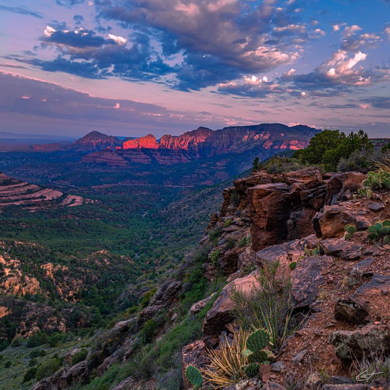
This is the entry where smooth pavement gives way to genuine backcountry driving. After the paved approach ends near Huckaby Trailhead, the terrain becomes rocky and uneven, with ruts, ledges, and rough climbs that deserve your full attention.
Schnebly Hill Road, also known as Forest Road 153, follows a historic connection between Sedona and higher ground to the east. Travelers once used this corridor on journeys toward the Flagstaff area.
These days, the difficult surface is part of what makes the route feel so different from Sedona’s paved scenic roads.
The scenic payoff is considerable. Sandstone walls and rugged formations appear along the climb, while openings in the terrain reveal wide views across Sedona. At Schnebly Hill Vista, distant ridges and red rock formations spread out beneath the higher viewpoint.
Merry-Go-Round Rock is another recognizable feature, with broad sandstone layers giving it a distinctive stacked shape. Pause only where stopping is permitted and safe; narrow rocky sections are not places for roadside photography.
A suitable high-clearance four-wheel-drive vehicle is the sensible choice for the challenging ascent. This is not a route for an ordinary passenger car. Guided off-road trips offer an alternative if you’d rather concentrate on the scenery than on navigating obstacles.
Seasonal closures and weather can change what portions are accessible. Check current National Forest road information before setting out, carry water, and leave extra time. A short line on a map does not mean a quick drive when the route is this rugged.
Address: Schnebly Hill Road (Forest Road 153), Sedona, AZ 86336.
6. Dry Creek Road
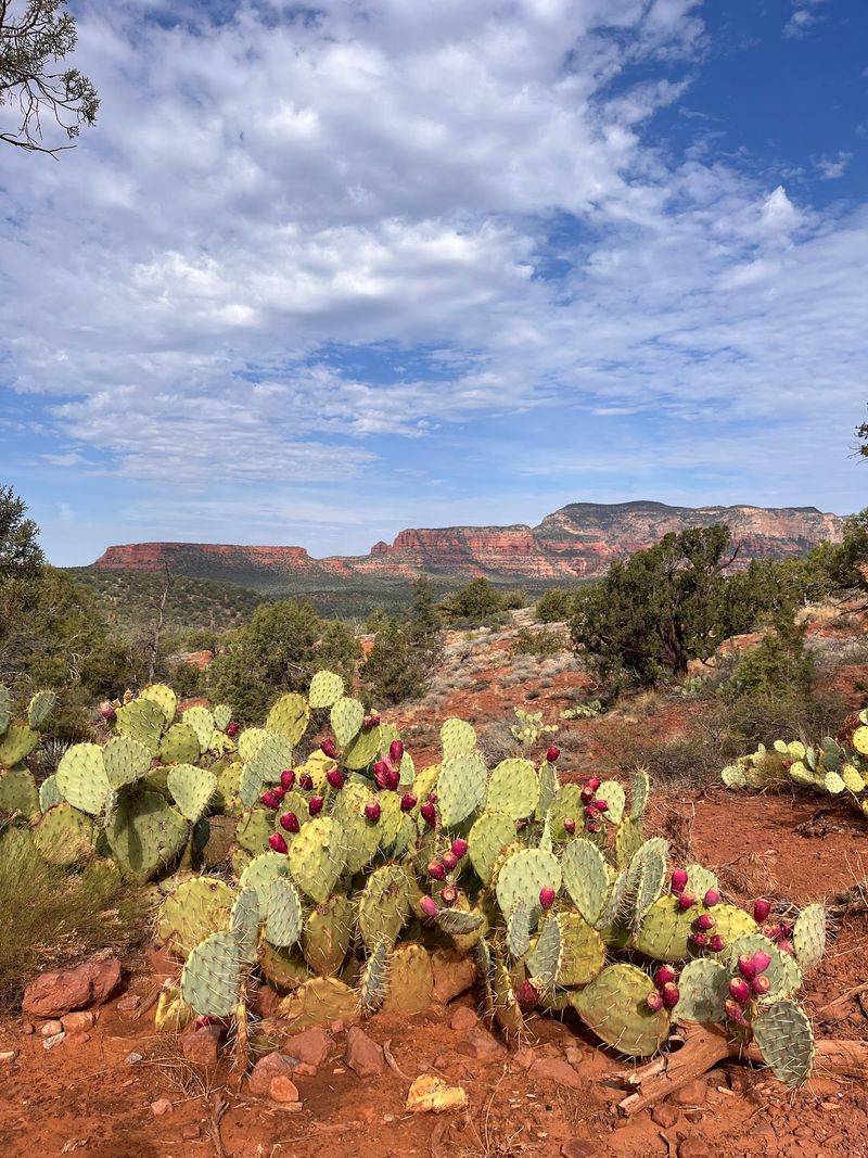
Capitol Butte, also called Thunder Mountain, provides a dramatic backdrop as you leave West Sedona. Its broad sandstone profile rises above rooftops and junipers before the scenery opens toward the rock formations northwest of town.
The road begins at State Route 89A and heads toward several popular trail access points. The paved stretch of Dry Creek Road makes a comfortable scenic outing even if you have no plans to hike.
Desert vegetation, layered cliffs, and shifting views of Capitol Butte provide plenty to see from the car.
Dry Creek Vista is a gateway for hikers heading toward Devil’s Bridge, a natural sandstone arch reached on foot. Nearby Mescal Trailhead offers other routes into the red rock landscape.
Trail distances vary, so a quick roadside drive and an actual hike should be treated as two different plans.
Sedona Shuttle service serves the Dry Creek Vista and Mescal Trailhead areas on designated operating days. If a hike is on your agenda, check the shuttle schedule and parking arrangements first.
The distinction between pavement and backcountry roads matters here. Rougher forest-road branches beyond the maintained road can require more capable vehicles, particularly after wet weather.
Don’t assume the entire route network has the easy surface you encounter near town.
For a relaxed drive, take in the view of Thunder Mountain, find an appropriate stopping area, and leave the farther forest roads to another outing.
Morning or late-afternoon light makes the rock textures especially noticeable, though the landscape is worth seeing at any time of day.
Address: Dry Creek Road at State Route 89A, Sedona, AZ 86336.
7. Boynton Pass Road
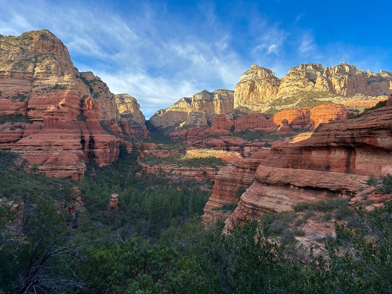
Some of Sedona’s most interesting contrasts appear where open desert meets the entrance to a narrow sandstone canyon. Juniper-covered slopes lead toward towering reddish walls, and a relatively short drive brings these features into view.
The westbound approach follows Boynton Pass Road from the Dry Creek area. Its paved sections provide accessible scenery, while farther stretches transition to dirt and require more caution. The road network also leads toward several hiking destinations.
Boynton Canyon Trail begins nearby, opening into a landscape of imposing canyon walls. The entire hike is a substantial outing, but a shorter walk can still reveal the terrain’s changing textures.
Pick a distance that suits your energy and the day’s conditions rather than treating the full trail as a required stop.
Another option in the wider area is Palatki Heritage Site, which protects ancient cliff dwellings and rock art associated with Indigenous people of the Verde Valley.
Visiting requires an advance reservation, and the approach includes unpaved forest roads. Plan that trip separately rather than assuming it’s an effortless roadside detour.
Clouds moving across the canyon can shift the sandstone from bright orange to deeper rusty tones. There is plenty of visual interest even when you stay close to the paved approach.
For a simple afternoon, enjoy the canyon views and return toward Sedona before the rougher portions. More remote exploration belongs on a day when you have the right vehicle, clear road information, and time to spare.
Address: Boynton Pass Road (Forest Road 152C), Sedona, AZ 86336.
8. Airport Mesa Scenic Drive
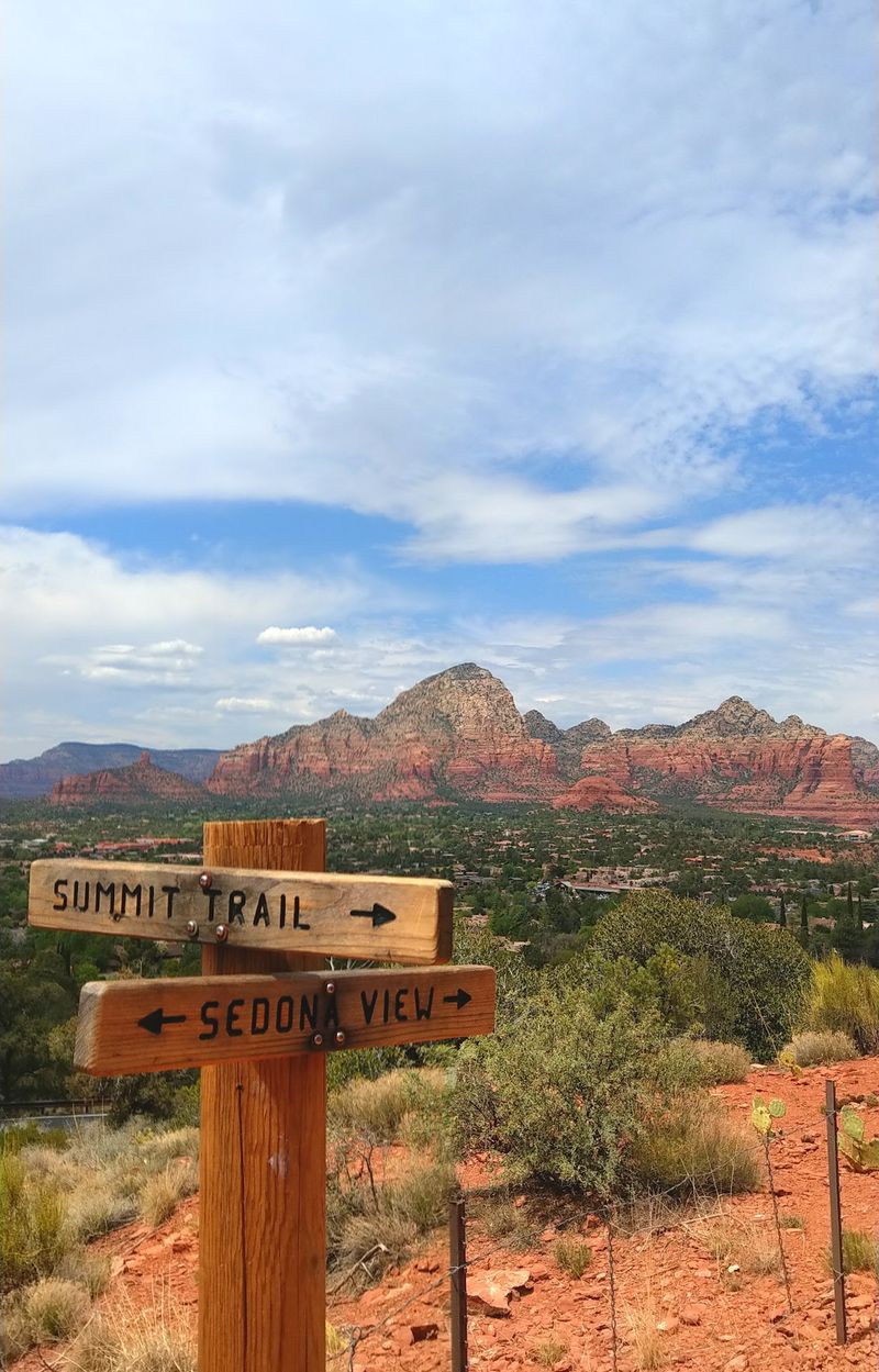
A short uphill drive can change your entire view of Sedona. From the mesa, neighborhoods spread beneath the surrounding sandstone ridges, and familiar formations suddenly become parts of a larger panorama.
Airport Road climbs from State Route 89A toward the functioning Sedona Airport. Near the top, the Airport Scenic Overlook provides a designated spot for taking in the valley and distant rocks.
It’s an easy option when you have limited time but still want a sweeping landscape view.
Regular passenger vehicles pay a parking fee at the upper overlook.
This short climb is often described as the Airport Mesa Scenic Drive. A separate viewpoint lower on Airport Road is associated with Sedona’s vortex traditions. Some travelers visit for quiet reflection, while others simply enjoy the scenery.
Either way, don’t confuse the lower trail area with the upper overlook.
Sunset adds warm colors to the sandstone, and arriving while there’s still daylight gives you time to settle in. Use a designated space rather than attempting to stop on the roadside.
There is an important pedestrian rule here: walking along Airport Road is prohibited. For a connection between the overlook and the lower viewpoint area, use the signed Sedona View Trail instead of the roadway.
Address: Airport Road, Sedona, AZ 86336.
9. Page Springs Loop Drive
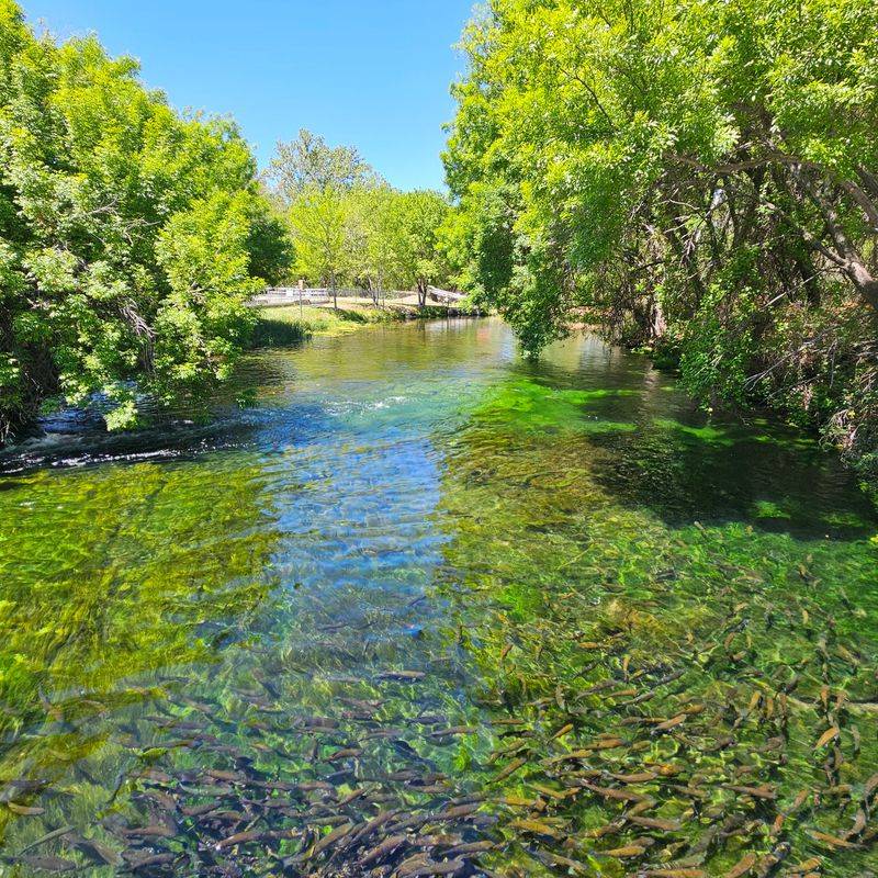
The Verde Valley introduces a greener side of Red Rock Country. Cottonwoods grow along the creek, agricultural properties appear between hills, and the scenery feels softer than the towering sandstone corridors close to Sedona.
You can make a countryside circuit using Page Springs Road, Cornville Road, Beaverhead Flat Road, State Route 179, and State Route 89A.
This is a suggested loop, not a separately designated scenic byway, and its appeal comes from the changing terrain rather than a single landmark.
Page Springs Fish Hatchery makes an interesting stop. Operated by the Arizona Game and Fish Department, the facility raises trout for stocking waters around the state.
Visitors can explore a designated self-guided path, visitor facilities, and creekside habitat during published opening hours.
The riparian environment supports birdlife, including great blue herons, black-crowned night-herons, and belted kingfishers.
Bring binoculars if you enjoy wildlife watching. The springs that supply the hatchery also help explain the green corridor cutting through otherwise dry surroundings.
Page Springs Loop Drive offers a pleasant change of pace after the dramatic viewpoints around Sedona.
Continue toward Cornville and notice how open agricultural terrain gives way to low hills and scattered homes. In autumn, cottonwood leaves bring golden color to the creek corridor.
The suggested circuit follows paved roads. Plan a pause at the hatchery if its visitor areas are open, then continue toward Beaverhead Flat Road for a broader high-desert view. The combination makes a varied outing without requiring any rough off-road driving.
Address: Page Springs Road at State Route 89A, Cornville area, AZ 86325.
10. Beaverhead Flat Road
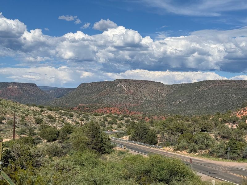
Wide views are the attraction here. Grasslands stretch toward low hills, scattered junipers dot the landscape, and Sedona’s sandstone formations rise along the distant northern skyline. Seeing the rocks from farther away makes their shapes feel part of a much larger setting.
Beaverhead Flat Road links State Route 179 south of the Village of Oak Creek with Cornville Road. This maintained paved route crosses relatively open terrain and provides a straightforward alternative to the region’s rougher forest tracks.
Rather than winding beneath individual cliffs, you’ll have opportunities to appreciate whole groups of formations at once. In clear weather, the distance creates layers of color: pale grassland in the foreground, darker hills beyond, and red sandstone farther north.
Early morning and late afternoon bring changing shadows across the low terrain. Photography is tempting, but use suitable stopping places instead of parking on narrow or uneven shoulders.
Keep an eye out for wildlife near the road, particularly when visibility is reduced.
For a fuller outing, connect this route with Page Springs Road and the Cornville area. The green creek corridor, rural properties, and open high-desert views make a useful combination in one leisurely drive.
No elaborate sightseeing itinerary is needed on Beaverhead Flat Road. Much of the enjoyment comes from the changing skyline as you travel.
After the close-up cliffs of Sedona and the tree-lined surroundings of Oak Creek, the wider view offers a fitting final perspective on Red Rock Country.
Address: Beaverhead Flat Road at State Route 179, Village of Oak Creek, AZ 86351.