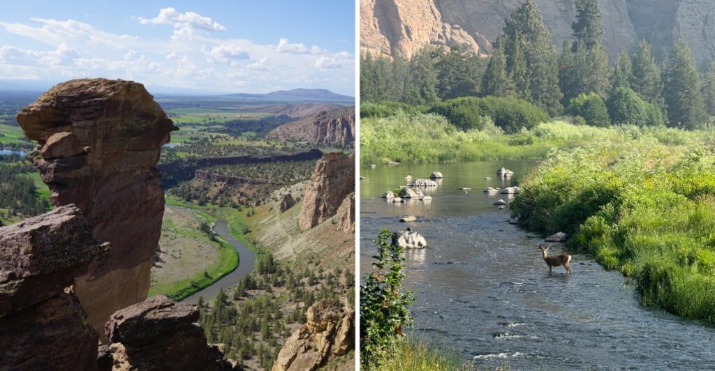
This view cannot seem to pick a personality.
The cliffs are all sharp edges and drama. Then the river slides through below like it has nowhere urgent to be. Somehow, the two work perfectly together.
In Oregon’s high desert, volcanic rock rises above a green ribbon of water.
You can keep things easy near the river or take on something steeper when your legs are feeling ambitious.
I would probably spend the first few minutes doing neither.
Just standing there works too.
Because when the desert looks this rugged and the river looks that calm, rushing into the next thing feels almost unnecessary.
Volcanic Spires That Tower Over The High Desert
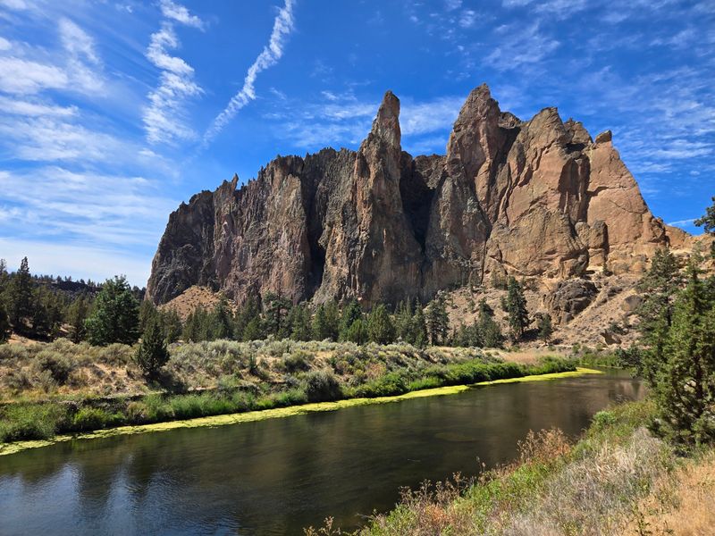
The first view from the rim has a way of interrupting conversation. Orange, tan, and reddish stone rises beyond the sagebrush, while narrow towers and broad cliff faces catch the shifting light. Take a few minutes here before choosing a trail.
Much of the scenery comes from ancient volcanic deposits. Hot ash and rock fragments accumulated and hardened into tuff, which was subsequently shaped by erosion. Other volcanic rock appears in the surrounding terrain.
You can see the effects in the steep faces, narrow pillars, and uneven layers that stand out against the flatter high desert.
The color changes are worth watching. Morning light catches the cliff edges while parts of the canyon remain shaded. Later, warm light can pick out the textured walls on the other side.
This is exposed country, though. Bring drinking water, sun protection, and footwear suitable for dusty paths. Summer heat can make a short outing surprisingly demanding, and winter can bring slick spots.
Parking in the day-use area requires a permit.
A stop at the rim before descending also helps you gauge the difference in elevation. If the river looks far below, remember you will need to climb that distance on the way back. Even a straightforward trail choice benefits from that quick reality check.
The Crooked River Lives Up To Its Name
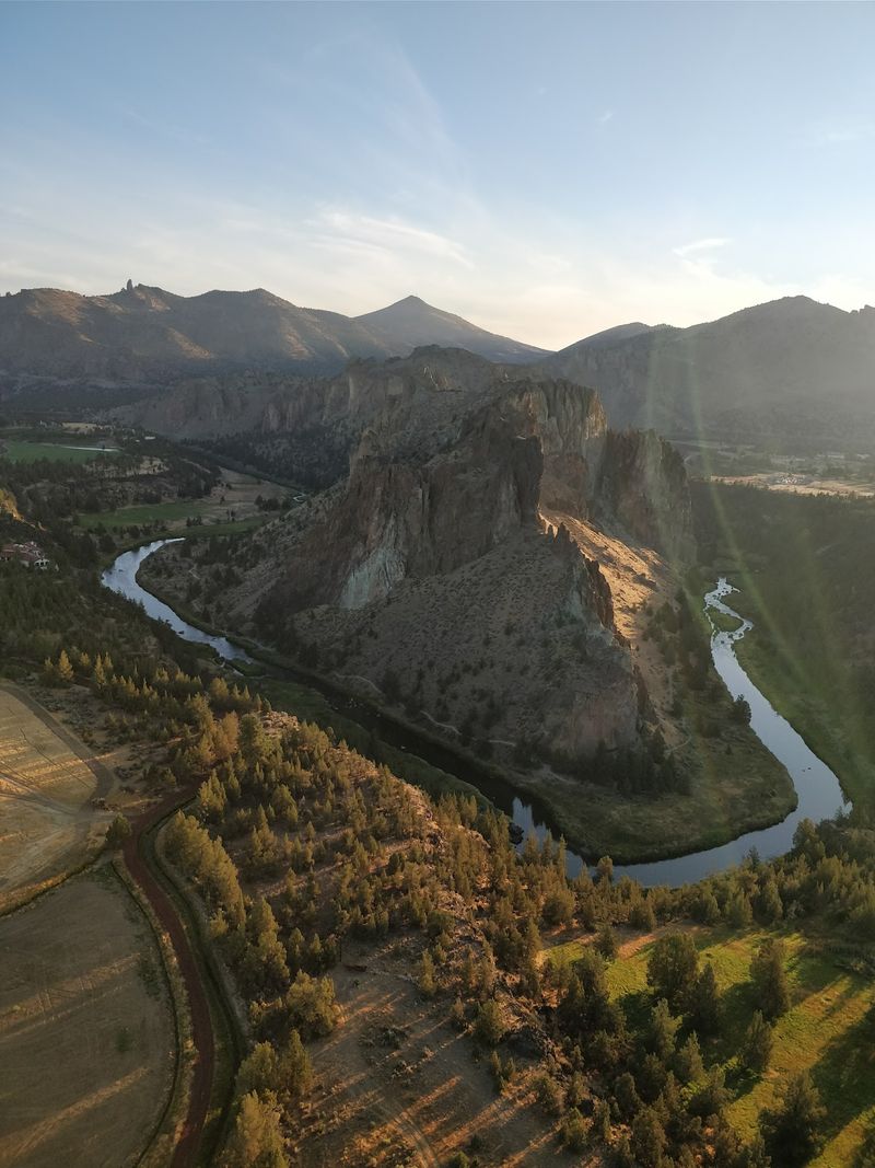
Follow the river with your eyes from the rim and you’ll see why it earns top billing in so many photographs. The Crooked River curves around the base of the rock walls, making a ribbon of green through otherwise dry terrain.
Walking down to the water changes the experience. The cliffs look taller, vegetation gathers along the banks, and the sound of flowing water replaces the open plateau’s wind. Watch for birds moving between the shrubs or resting along quieter stretches.
The riverside paths are often a gentler choice once you’re down in the canyon, but getting there involves a significant descent and an uphill return.
Don’t mistake the relative flatness near the river for an effortless round trip. The climb back to the main parking area deserves time and enough drinking water.
Water levels and trail surfaces change with weather. After rain, muddy sections may slow you down, while strong sunshine makes unshaded stretches feel longer.
Leave the riverbank plants undisturbed, stay on established trails, and give yourself a moment to sit where stopping is safe.
Monkey Face Steals The Show
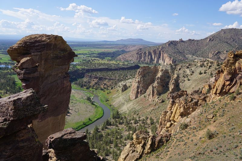
At the western end of the park’s signature skyline, a rock tower appears to have a face. Look carefully and the outline of Monkey Face comes together: a rounded upper section, a projecting profile, and an opening that suggests a mouth.
This unusual formation is also an established climbing destination. Routes on its steep faces demand specialist equipment and skill, and climbers may be visible as small figures against the stone.
If you stop to watch, choose a place outside climbing areas where falling gear or loose rock might pose a risk.
Misery Ridge offers views of Monkey Face, including a closer look on routes that continue over the ridge.
You don’t have to undertake the full hike simply to understand the formation’s appeal. From an appropriate overlook, binoculars can help distinguish the outline and the details in its surface.
One angle may resemble a narrow tower; another makes the same stone look like a broad wall. Try taking one photograph, walking a little farther, and photographing it again.
Please leave the rock itself to people using designated climbing access.
Misery Ridge Rewards Every Huffing Step
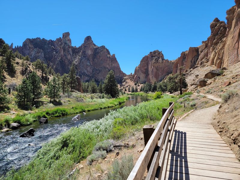
Misery Ridge doesn’t disguise its challenge. The route climbs sharply from the river, gaining elevation through steep switchbacks and steps. Give the trail more time than its distance alone might suggest.
The views expand as you climb. Look back toward the river and the plateau where you started, then turn toward the tall rock walls rising alongside the route. Higher up, new angles reveal the canyon’s bends and the formations beyond.
Many walkers connect Misery Ridge with a descent on the far side and a return along the river. The Misery Ridge Loop covers about four miles, but check your chosen connections before setting out. Parts of the descent can be steep, gravelly, or uneven.
Shoes with reliable grip are far more useful than trying to hurry.
Carry water, take rests, and turn around if the heat or your energy level becomes a concern. Rattlesnakes are possible in warm weather, so watch where you step or place your hands. Dogs must be leashed in the park, including on the trails.
If the path is crowded, step aside only where the established tread allows it. Passing on the outside edge can damage plants and put both hikers in an awkward position. Patience is especially useful on narrow switchbacks.
A Climbing Legend With Thousands Of Routes
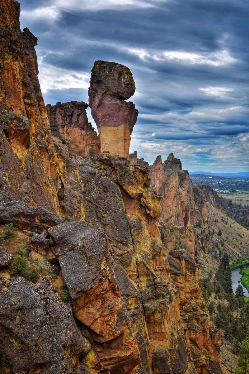
Climbing is woven into Smith Rock’s identity, even for people who arrive with no intention of leaving the ground. Look across the cliffs, and you may spot ropes hanging against the tuff or climbers searching for the next handhold.
The park is closely associated with the rise of American sport climbing, and the variety of routes has helped it earn an international reputation.
There are several thousand climbing routes here, including more than a thousand bolted routes. Some are intended for highly experienced climbers, and the rock, exposure, and weather call for careful judgment.
Beginners interested in trying the sport should seek qualified instruction rather than improvising with borrowed equipment.
For everyone else, watching from designated trails provides an introduction without stepping into the climbing zone. Keep well clear of ropes, cliff bases, and places where dropped equipment or falling stones could reach you.
Seasonal protections matter. Certain climbing areas can close or have restricted access from around mid-January through August to safeguard nesting golden eagles and falcons.
Signs at the park identify affected locations, so check them before heading toward a particular wall.
Eagles, Otters, And Other Canyon Neighbors
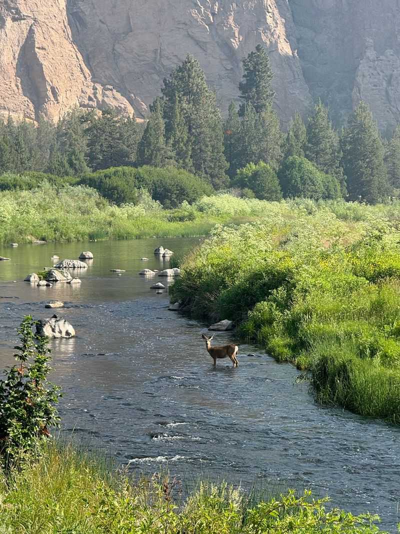
The cliffs belong to more than climbers. Golden eagles and prairie falcons use the high rock faces, and the open sky gives patient watchers a chance to observe birds soaring or crossing between ledges. Bring binoculars rather than trying to approach nesting areas.
Disturbance can be harmful even when an animal appears calm.
Closer to the ground, mule deer move through the brush, and smaller mammals take advantage of the spaces between rocks and shrubs. Along the Crooked River, river otters and beavers may occasionally be seen.
None of these sightings is guaranteed, which makes watching quietly more worthwhile than setting out with a checklist.
Choose a safe pullout or established resting spot, keep conversations low, and scan the riverbanks without pushing through the vegetation. Early or late daylight may help you notice movement, although animals can appear at any time.
Warm days bring another resident to mind: rattlesnakes. Give any snake a wide berth, avoid reaching into places you cannot see, and keep pets close on leashes. Never feed wildlife or leave snacks unattended.
If the canyon seems quiet, listen instead. Birds calling from the cliffs and water moving around the river’s bends tell their own story.
Riverside Paths And Rim Views For Every Pace
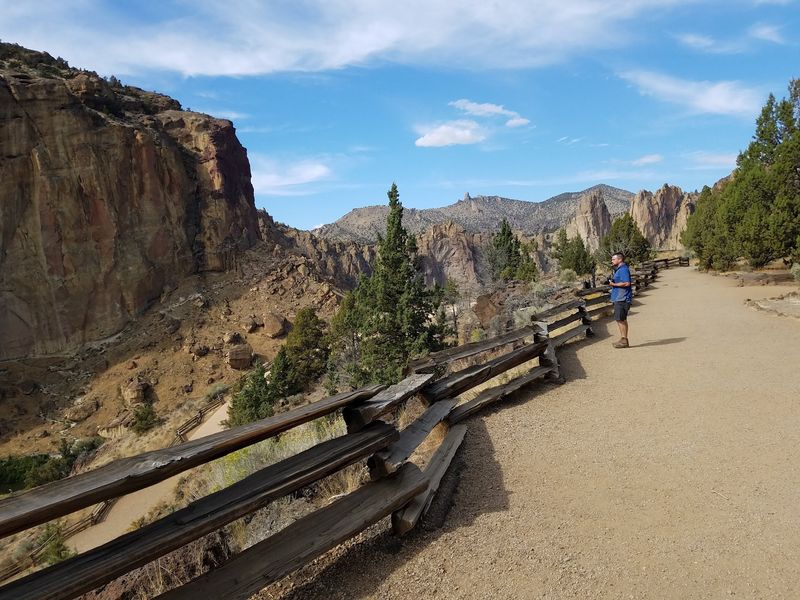
You can enjoy Smith Rock without committing to Misery Ridge. The Rim Rock Trail keeps you above the canyon, with overlooks that show the river winding beneath the main formations.
It’s a practical option for a shorter visit, especially when you want to see the cliffs before deciding how far to walk.
Surface conditions and accessible routes can vary, so don’t assume every overlook suits every mobility need.
For a longer outing, the River Trail follows the water below the cliffs. Check the trail map at the park before combining paths; neighboring routes can differ sharply in grade and footing.
The park’s day-use area opens shortly before sunrise and closes shortly after sunset. A walk-in bivouac area for tents operates seasonally, generally from spring through late fall as conditions allow.
Camping is first-come, first-served; RV camping and sleeping in vehicles are not permitted.
If you’re visiting after the autumn season, check for work affecting parking and sections of rim trails. Construction may change which convenient routes are open, even when the park itself remains accessible.
For navigation, use 9241 NE Crooked River Drive, Terrebonne, OR 97760. Fill your water bottle, look over the map, and choose the view that matches your day. A short rim stroll and a long canyon hike share the same spectacular backdrop, and neither needs to be rushed.
Keep a light jacket handy in cooler months. The exposed rim can feel windy even when the valley below is calm, and your choice of route may change once you see the conditions firsthand.