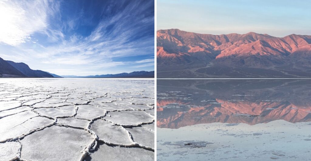
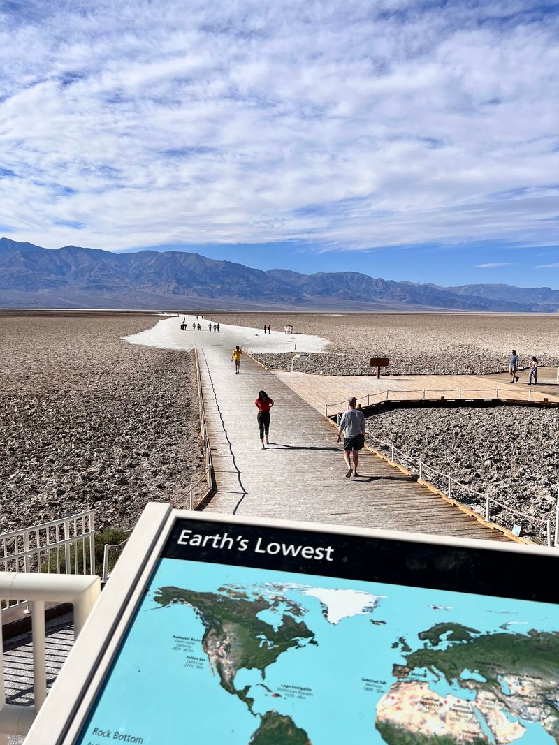
A sign bolted high on a cliff marks sea level, and it hangs about 282 feet above your head.
The parking lot sits that far below sea level, and you won’t need a snorkel or a submarine down here.
The name supposedly comes from a mule that flat-out refused to drink from a small salty pool in this spot.
That’s my kind of stubborn, and the surveyor ended up labeling the whole place “bad water” because of that mule.
Beyond that little pool, a bright white salt crust stretches out across nearly 200 square miles of eastern California.
Summer heat can top 120 degrees, so I’m calling dibs on a cooler winter visit instead of a summer one.
Look Up, Way Up, To Find Where Sea Level Lives
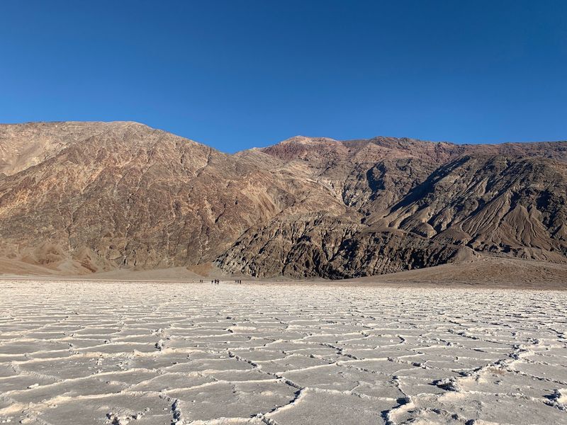
Most places put their landmarks on the ground. Badwater Basin, inside Death Valley National Park, hangs its most famous marker high on a cliff.
That sign shows where sea level sits, roughly 282 feet above the parking lot. Craning your neck to find it is half the fun.
So why does this matter? Badwater Basin is the lowest point in North America, and the sign turns that fact into something you can see.
Numbers on a map can feel flat and forgettable. A sign floating far above you sticks in your brain for good.
Bring your camera for this one, because it’s a classic photo stop. Frame the cliff, the sign, and a friend pointing upward like they just spotted a rare bird.
Here’s a fun twist about the true low point. It actually lies several miles west, out on the flats.
Its exact location can shift with rainfall and evaporation over time. The lowest spot in North America literally wanders a bit.
Still, the area near the boardwalk gives you the full bragging rights. You can tell everyone you stood below sea level in California without getting wet.
Well, mostly without getting wet. We’ll get to that.
Salt Hexagons Cover The Ground Like Nature’s Tile Floor
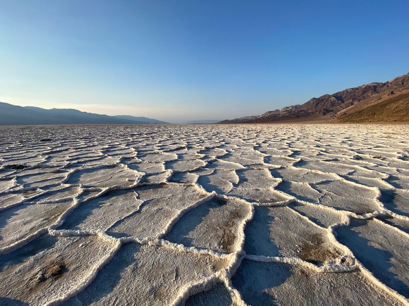
Nearly 200 square miles of salt spread across the valley floor. That’s bigger than many cities, and it’s mostly table salt.
Sodium chloride makes up most of the crust. Calcite, gypsum, and borax join the mix too.
Now for the cool part. Groundwater rises through the salt deposits and evaporates, while growing salt crystals gradually reshape the crust.
As new salt crystals grow, they expand and push the crust into ridges and geometric patterns.
This ongoing crystal growth helps form the distinctive hexagonal ridges across the salt flats. From a distance, the ground looks like a giant honeycomb or a fancy bathroom floor.
The best patterns usually show up farther from the parking area. Close to the boardwalk, lots of footsteps flatten the surface.
A walk of about a mile often pays off with cleaner shapes. The view of the whole basin and its mountains gets bigger too.
Wear sturdy shoes, since the crust can be rough and crunchy. Sunglasses help a lot because the white salt reflects bright light.
One more tip, and it’s a silly one. Please don’t taste the ground, even though it’s technically salt.
Plenty of other people walk out here, so stay on the established path near the start. Let the patterns farther out stay crisp for everyone.
Easy Strolling Starts Right From The Parking Lot
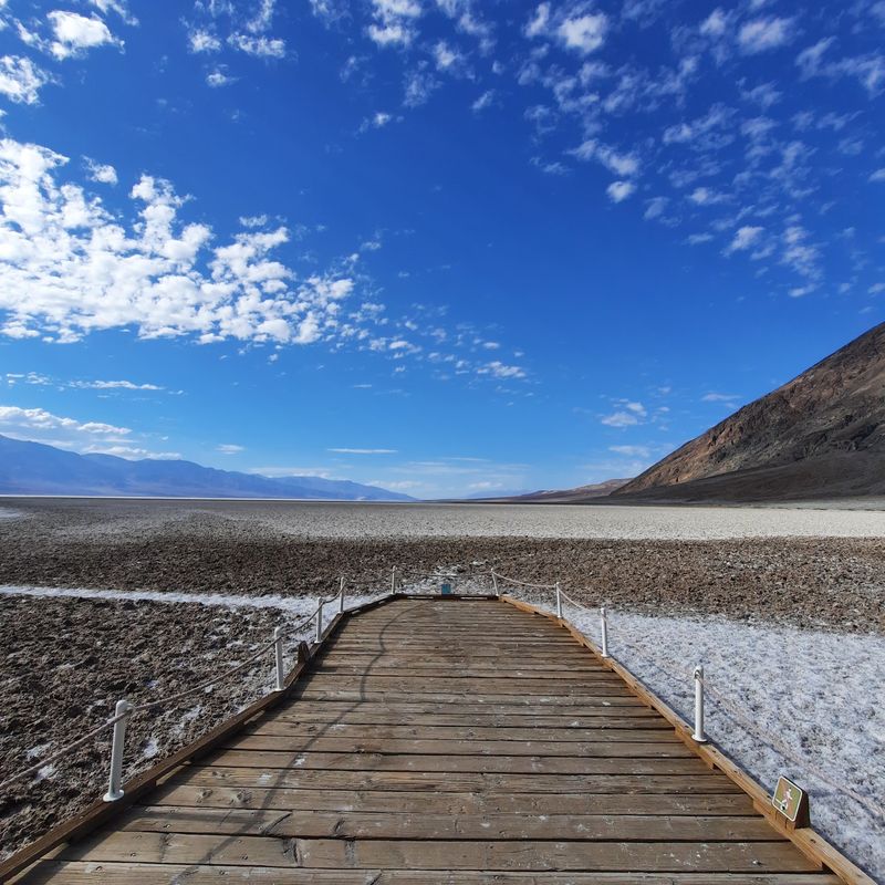
Good news for anyone who dislikes steep trails. The terrain at Badwater Basin is about as flat as Earth gets.
A short boardwalk leads from the parking area toward the salty pool and the nearby flats. The area near the boardwalk is wheelchair accessible.
After the boardwalk ends, the salt flats open wide. You can keep walking as far as your energy and the weather allow.
That freedom makes this stop work for different kinds of trips. Some people snap a few photos and move on in minutes.
Others wander for an hour, taking in the silence and the mountains. Both plans are totally fine.
The basics are covered here too. You’ll find parking for cars and spaces for buses and RVs, plus vault toilets.
Parking can fill up, so use only the designated lot. A visit to the restrooms at the Furnace Creek Visitor Center first is a smart move.
Remember your park entrance pass as well. You can buy one inside the park before heading south.
Pack water every single time, even for a short stroll. The desert air dries you out faster than you’d expect.
Cooler Months Turn A Scorcher Into A Pleasant Walk
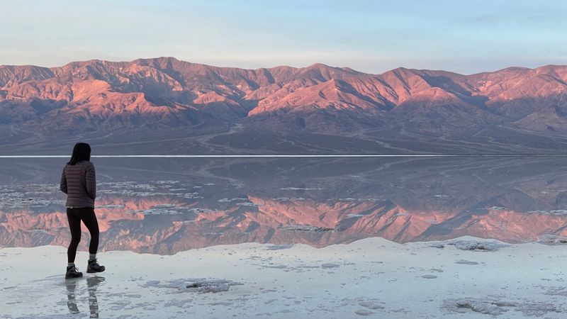
Summer here can climb past 120 degrees. That’s not a typo, and it’s not a fun afternoon either.
Heat like that makes outdoor activity risky. Walking across a shadeless white salt flat at midday becomes a serious health concern.
That’s why late fall through early spring wins. Roughly November to April gives you the most comfortable window.
Winter walks on the flats feel far more relaxed. An hour out there can actually be enjoyable instead of exhausting.
Even in spring, don’t get too comfortable. Temperatures can reach the 80s by early April.
Early mornings are especially nice. Mountains to the east can keep the area shaded for a while after sunrise.
Wind is common in this part of the valley. A light jacket helps on cooler days, even when the sun feels strong.
Any season, carry plenty of water, a hat, and sunscreen. Check the forecast before you go, since conditions can change quickly.
Think of the cooler months as the park’s welcome mat. You’ll see more, walk farther, and spend less time hiding in your car’s air conditioning.
An Ancient Lake Sometimes Makes A Comeback
Long ago, a large body of water called Lake Manly filled this valley. It slowly dried up after the last Ice Age.
The salt you walk on today is what that lake left behind. Every crunchy step is basically ancient lake leftovers.
Rain is rare in this region. The area averages only about 1.9 inches per year.
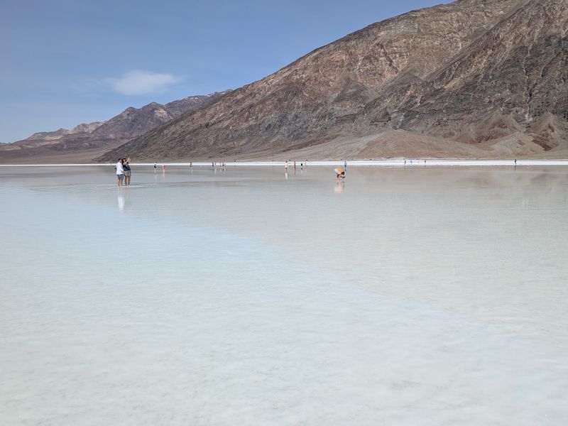
Big storms still happen sometimes, though. When they do, a shallow temporary lake can spread across the valley floor.
Record rainfall in fall 2025 did exactly that. The basin held water into early 2026, and some visitors waded right in.
On calm mornings, the water can mirror the mountains. It’s the kind of view that makes your phone’s camera roll overflow.
Don’t count on it lasting long, however. The yearly evaporation rate here is around 150 inches, so water disappears fast.
If you do catch the lake, wet salt and mud get messy. A towel and extra socks are smart additions to your bag.
Dry or flooded, the basin is worth seeing. The flooded version is just a bonus you can’t schedule.
Your Camera Will Probably Need A Bigger Memory Card
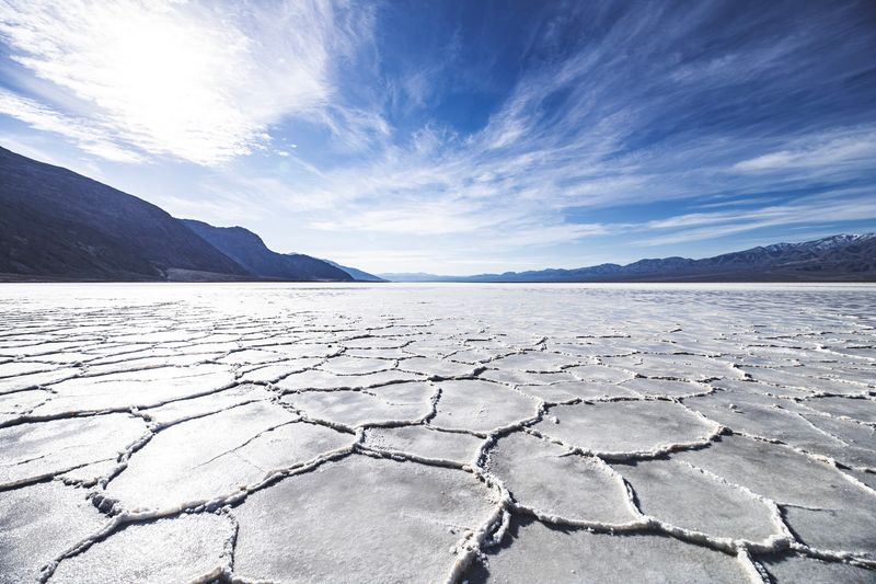
White ground, dark mountains, and wide-open sky make a striking combination. Photographers love Badwater Basin for good reason.
Sunrise is a favorite time to shoot. Soft light hits the flats and the surrounding peaks, and the air tends to be cooler.
Sunset brings warm colors too. Long shadows stretch across the salt ridges and add depth to your shots.
Midday light gets harsh and bright, especially off the salt. Polarized sunglasses help your eyes, and a lens hood can help your camera.
Try getting low to the ground for hexagon shots. The patterns lead your eye toward the mountains like natural lines on a page.
Fun perspective photos work well here too. The flat, empty space makes people look tiny against the landscape.
The sea level sign deserves a shot as well. It’s proof you were somewhere truly unusual.
Walking farther out usually gives cleaner foregrounds. Fewer footprints means more of that untouched, almost otherworldly look.
Bring a spare battery, since cold mornings can drain power faster. Missing the perfect light because of a dead battery would sting a little.
Stars Steal The Show Once The Sun Clocks Out
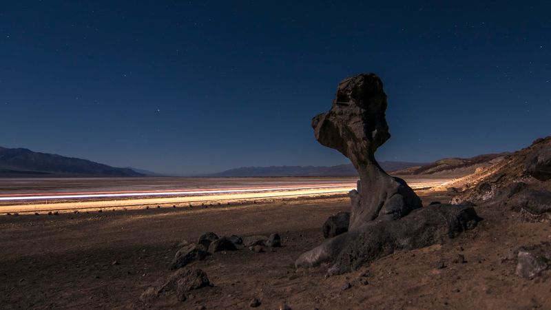
Darkness at Badwater Basin is the good kind. Death Valley National Park is a certified dark sky park with very little light pollution.
The basin is open 24 hours. That means you can come back after dinner and watch the sky fill up.
Planning around a new moon gives you the darkest skies. More stars, a brighter Milky Way, and fewer distractions.
A red flashlight is a clever tool for this trip. Red light helps you see your footing without ruining your night vision.
The white salt makes the experience feel even stranger. Starlight over that pale ground creates a quiet, moon-like scene.
Nights get chilly in the cooler months. Pack warm layers, a hat, and gloves, because desert temperatures drop fast after sunset.
Stay close to the boardwalk area in the dark. The flats look simple, but distances are tricky to judge at night.
Let someone know your plans and keep water handy. Cell service can be unreliable in the park.
Honestly, the night shift here might beat the day shift. Same salt, completely different personality.
Why 2026 Is A Smart Year To Make The Trip
Timing matters in the desert, and 2026 has been a lively year. Record rain in fall 2025 sparked a big wildflower superbloom in Death Valley.
Lower-elevation blooms peaked in March 2026. Higher-elevation flowers kept going through June.
Scotty’s Castle remained closed for restoration in 2026, although limited guided tours of its historic grounds were offered.
That makes a bigger park trip extra tempting.
Getting to the basin is simple. Head about 30 minutes south from the Furnace Creek Visitor Center on Badwater Road.
The address is Death Valley National Park, Badwater Rd, California 92328. You’ll find it near the California-Nevada border in the eastern part of the state.
Flood damage has affected some park roads recently. The stretch south of Badwater Basin may have loose gravel, soft shoulders, and unpaved spots.
Check road conditions with the park before you leave. Some closures elsewhere, like Titus Canyon Road, will last into 2027.
Park water and wastewater upgrades are also underway in other areas. They aren’t expected to close Badwater Basin itself.
So the cool months left in 2026 make a great target. Bring water, bring a sense of wonder, and maybe skip arguing with any mules.