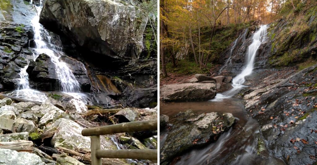
One Blue Ridge waterfall drops a total of 1,200 feet through five major cascades and a string of smaller ones. That number stopped me mid-scroll, and consider me thoroughly tempted to see the whole staircase of water in person.
The rest of this Virginia lineup holds its own, too, with one falls sliding 70 feet over greenstone. Another tumbles 93 feet in a quiet corner of a national park, framed by thick green forest.
A few of these spots even come with swimming holes at the bottom, a refreshing reward on hot summer days.
I love a place that refuses to play it safe, and these trails bring plenty of rocks and climbs.
Each one sits a short drive from scenic roads, but the views make you work a little bit first.
Fair warning: the trail is the toll, and the waterfall is your receipt.
1. Crabtree Falls
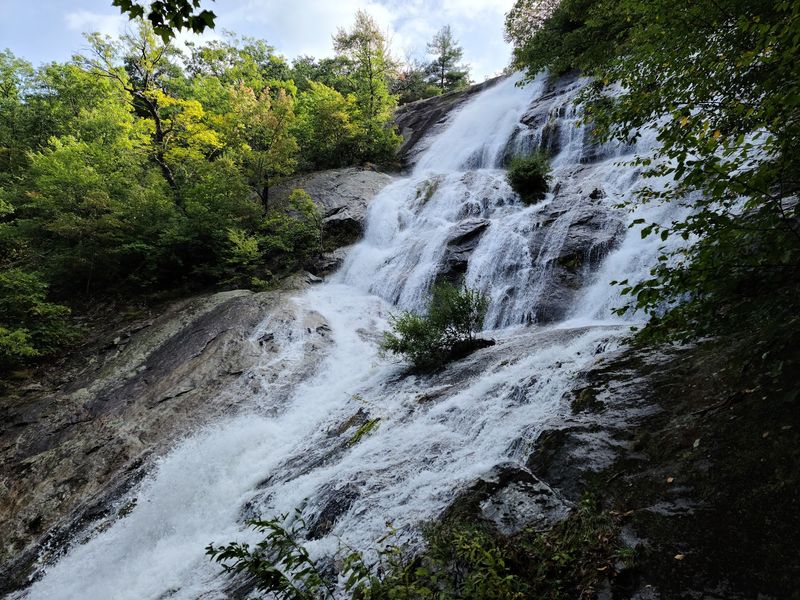
Five major cascades and a bunch of smaller ones add up to a total drop of 1,200 feet here. That’s not a waterfall so much as a vertical water parade.
The trail climbs about 1.7 miles to the top, and it’s rated moderate. Your legs will notice, but your eyes will be too busy to complain much.
Here’s the fun part about this hike. You get views of the falling water along much of the way, not only at the end.
That means you can turn around whenever you like and still feel rewarded. Even a half-mile stroll gives you plenty of splashy scenery to enjoy.
The lowest section of the trail is paved, which is a thoughtful touch. Visitors with limited mobility can still get close to the action.
If you push all the way up, a scenic view waits at the top. Think of it as a bonus prize for the folks who kept going.
The falls sit in the George Washington National Forest, just off the Blue Ridge Parkway corridor. It’s an easy add-on if you’re already cruising the mountains.
Bring sturdy shoes and plenty of water for the climb. Rocks near moving water get slick, so stay on the marked path and leave the daredevil stunts to the waterfall itself.
Plan on taking your time, too. With this much scenery stacked up, rushing would feel a little like skipping chapters in a great book.
Address: Virginia 22976.
2. Dark Hollow Falls
Going down is a breeze, but coming back up feels like your legs filed a complaint. That’s the honest deal at this Shenandoah favorite.
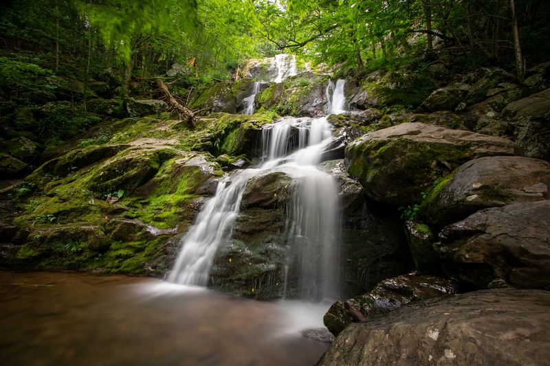
The falls drop about 70 feet in tiers over ancient greenstone rock. It’s the closest waterfall to Skyline Drive, which helps explain why it’s one of the park’s most popular trails.
The round trip is just 1.4 miles, but don’t let the short distance fool your calves. The path is steep and rocky, with about 440 feet of elevation gain on the return.
Plan on roughly an hour and 15 minutes for the full hike. Slow and steady wins here, especially on the uphill stretch.
Once you reach the bottom, you’ll find more than one set of cascades to enjoy. It’s a lovely place to sit for a minute and simply listen to the water.
A few practical notes will save you some trouble. Pets aren’t allowed on this trail, though service animals are welcome.
There are no restrooms at the trailhead, so stop at nearby Big Meadows first. You’ll also need to pay the Shenandoah National Park entrance fee.
Spring and the days after a good rain bring the strongest flow. Feeling ambitious? You can link this trail with the Rose River Loop for a bigger waterfall day.
The trailhead sits at milepost 50.7 on Skyline Drive. Grab a snack, tie your laces tight, and save some energy for that climb back.
Address: Virginia 22743.
3. Lower Whiteoak Falls
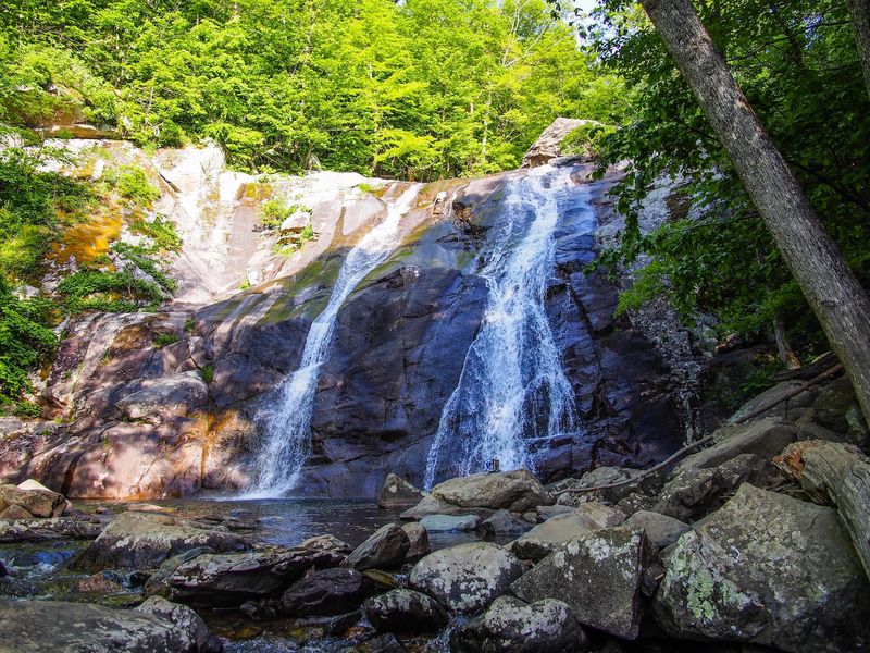
Waterfalls and swimming holes on the same trail? Whiteoak Canyon clearly understands what hikers want.
The Whiteoak Canyon Trail network winds past a series of falls in Shenandoah National Park. Lower Whiteoak Falls is one of the stops that makes the walk worthwhile.
The hike here is often described as nice and easy. That’s welcome news if your legs are still recovering from a steeper trail earlier in the week.
Expect to walk about an hour and 20 minutes to reach the first fall on this route. Pack a snack, because the scenery gives you plenty of reasons to stop.
The trail passes several pools along the way. On a hot Virginia afternoon, those spots can look very tempting.
Use good judgment around the water, though. Wet rocks get slippery, and moving water deserves respect even when it looks calm.
This area sits in the Blue Ridge range near Syria, a small community on the park’s eastern side. The setting feels tucked away from the busy pace of daily life, which is part of the charm.
Since this is inside a national park, you’ll need to pay the park entrance fee. It’s smart to check road and trail conditions before you head out.
Bring a camera and a little patience. Light shifts through the canyon trees throughout the day, so each pause along the creek can look a bit different.
Address: Virginia 22743.
4. Apple Orchard Falls
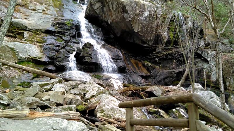
Apple trees aren’t the reason for the name, so don’t pack a basket. The title likely comes from gnarled, weather-beaten oaks on Apple Orchard Mountain that resemble an old orchard.
The real star is the waterfall, which drops around 200 feet, though some sources say 150. Either way, it ranks among the tallest falls in the Roanoke and Bedford area.
Most hikers start at Sunset Fields Overlook, milepost 78.4 on the Blue Ridge Parkway. From there, it’s roughly a 2.9-mile round trip.
That route is challenging, with a steep descent to the falls and a demanding uphill return. You descend first, which means the hard part waits patiently for your return.
Prefer something shorter? An easier 1.5-mile round trip starts from the end of Forest Road 59.
The trail is a National Recreation Trail, and it shows. You’ll cross wooden bridges and climb a stone staircase along the way.
At the base, a wooden viewing platform and boardwalk give you a front-row seat. It’s a great spot to catch your breath and snap photos.
Leashed dogs are welcome, and there’s no fee. There’s also no drinking water, so carry plenty or bring a way to purify stream water.
Parkway sections sometimes close in bad weather, so check conditions before driving up. Then grab your trekking poles and give those knees a pep talk.
Address: Virginia 24066.
5. Rose River Falls
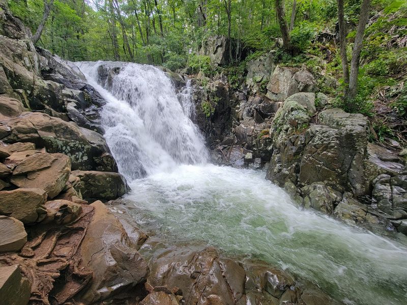
After a good rain, this waterfall can split into as many as four separate falls. It’s like the river decided one wasn’t enough.
The main drop measures about 67 feet in several tiers. Clear pools sit nearby, and the trail follows both the Rose River and Hogcamp Branch.
Most people hike the loop, which runs about 4 miles. It’s rated moderate, with steep climbs and rocky or muddy patches.
Elevation gain lands somewhere around 866 to 910 feet. Give yourself three to five hours so you can linger by the water.
Along the way, you’ll spot lots of smaller cascades. Part of the loop passes through federally designated wilderness, so it feels pleasantly wild.
History fans should watch for the Cave Cemetery along the route. Families who lived in this area in the 1930s and 1940s are buried there, and some graves date to the Civil War.
Leashed pets can join you on this one. That’s a nice change from nearby Dark Hollow Falls, where pets aren’t allowed.
Speaking of which, you can combine the two trails for a double waterfall day. It’s a solid plan if your legs are feeling brave.
The trailhead sits at Fishers Gap on Skyline Drive. Restrooms and a store wait at Big Meadows Wayside, and the park entrance fee is now cashless.
Address: Rose River Ln, Syria, VA 22743.
6. Doyles River Falls
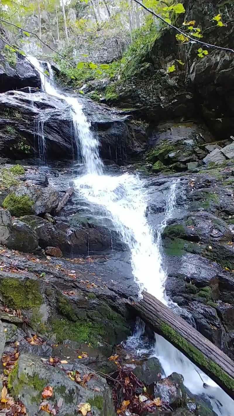
Two waterfalls on one trail sound like a sweet bargain. Doyles River delivers exactly that, plus a third waterfall if you continue toward Jones Run.
Upper Doyles River Falls drops 28 feet, while Lower Doyles River Falls drops 63 feet. An upper cascade adds even more splash to the route.
Here’s the catch you should know before starting. Heading to the falls is mostly downhill, so the trip back is the tougher half.
Many hikers turn this into a loop with Jones Run, covering roughly 6.5 to 7 miles. Expect about 1,200 to 1,400 feet of elevation gain and several hours on your feet.
The trail follows stream corridors through forested hollows. You’ll pass pools, big trees, mature hardwoods, and some impressive rock formations.
Part of the loop often uses the Appalachian Trail. That’s a fun bragging point for your next family dinner.
Common starting spots include Browns Gap Parking Area at milepost 83 on Skyline Drive. Jones Run Parking Area at milepost 84.1 works too.
Leashed dogs are allowed here. There’s no drinking water on the circuit, so pack more than you think you’ll need.
Cell service can be spotty, so download a map ahead of time. Visit after heavy rain for the best flow, because dry spells can shrink these falls to a trickle.
Address: Virginia 22932.
7. Overall Run Falls
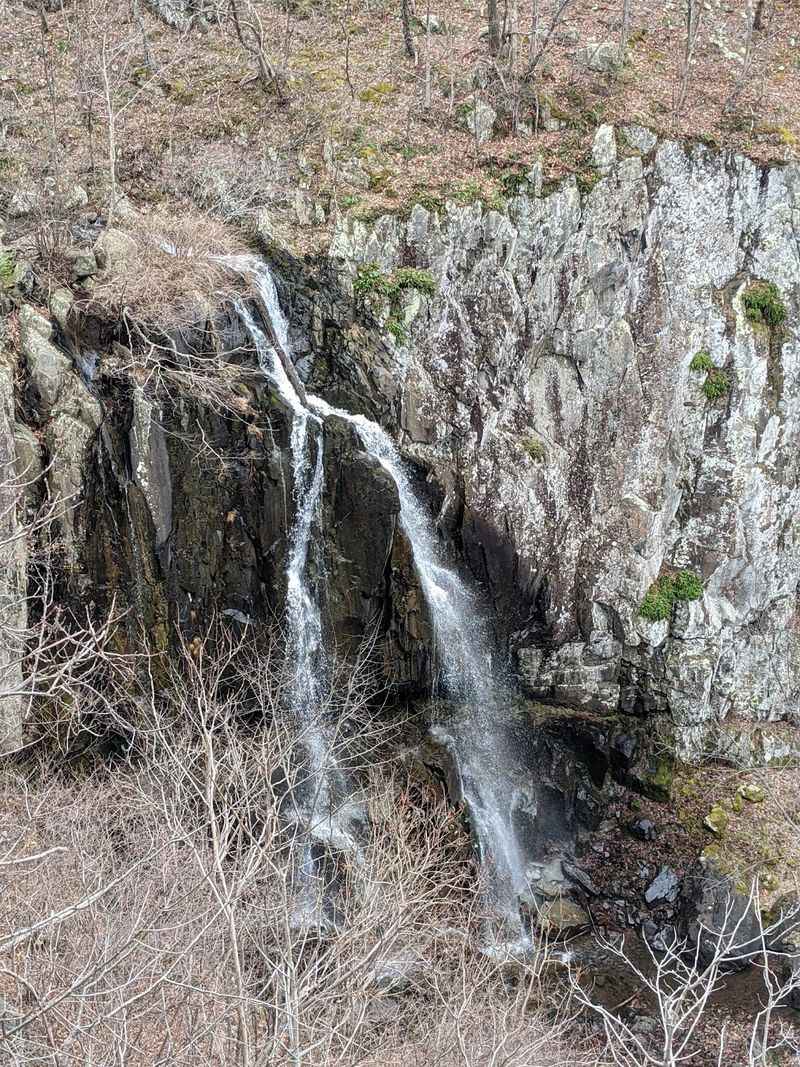
At 93 feet, Overall Run Falls is the tallest waterfall in Shenandoah National Park. That’s a big drop for a stream with such a modest name.
You’ll find it in the park’s northern district. Scenic trails wind through lush woods before the falls come into view.
The 5.1-mile round-trip hike is rated moderately strenuous and typically takes about four hours to complete. Some folks call it tough, but the view tends to win the argument.
Good news for anyone who worries about getting lost. The trail is well-marked and well-maintained.
A smaller waterfall along the route offers a spot to cool off. On a muggy summer day, your feet will thank you for the break.
Wide views add to the payoff here. Bring a camera, because the scenery stretches well beyond the water itself.
Since this is a national park trail, you’ll need to pay the entrance fee. Arriving early can help you enjoy the trail at a calmer pace.
Wear shoes with solid grip for the rocky sections. Pack water, snacks, and a light layer, since mountain weather can shift quickly.
Flow tends to look best in spring or after a decent rain. Visit then, and this tall beauty puts on its fullest show for the effort you made.
Address: Virginia 22610.
8. South River Falls
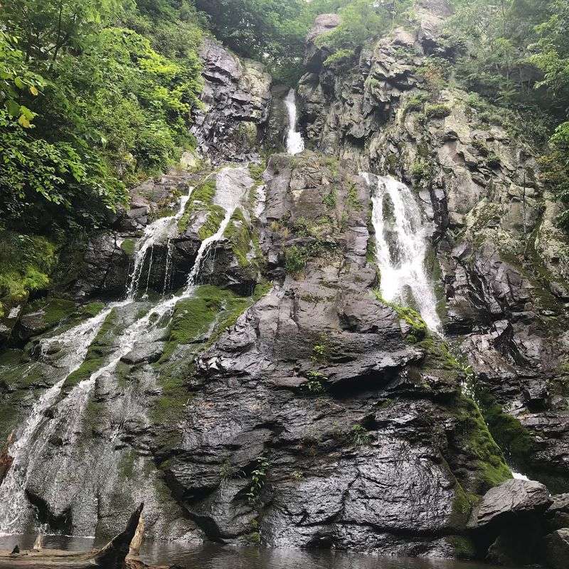
Some waterfalls show off right next to the road. South River Falls prefers to hide in a deep gorge and make you come find it.
The trail sits along the Blue Ridge ridge line in Shenandoah National Park. Its route measures about 3.3 miles and carries a moderate rating.
That distance makes it a nice middle option. It’s longer than a quick stroll but much shorter than an all-day trek.
The gorge setting is a big part of the appeal. Rock walls and forest frame the falling water, giving the scene a tucked-away feel.
Fall is an especially pretty time to visit. The trees around the gorge can turn this hike into a colorful outing.
Remember that what goes down must come back up. Pace yourself on the return so you finish with energy left over.
You’ll need to pay the park entrance fee to reach this trail from Skyline Drive. Check road status before you go, especially during winter months.
Bring layers, since gorges can feel cooler than the open ridge. A pair of trekking poles may also help on uneven ground.
Picnic plans pair nicely with this hike. Grab lunch before or after, then sit back and admire the photos you snapped of that lovely gorge.
Address: Virginia 22973.
9. Jones Run Falls
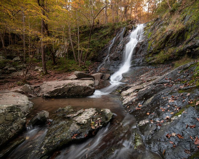
Not every waterfall needs to be a showstopper. Jones Run Falls trades big drama for calm, and plenty of hikers find that peaceful vibe refreshing.
The falls drops about 42 feet along a shaded mountain stream. It sits in the southern district of Shenandoah National Park, off Skyline Drive.
Most hikers start from the Jones Run Parking Area at milepost 84.1. The trail heads downhill from the ridge toward the water.
Here’s a fun bit of history for your walk. The Jones Run Trail passes through young forest that used to be pasture land.
You can keep the trip short and simply hike to the falls and back. Or you can link up with Doyles River for a longer loop with more waterfalls.
That bigger loop covers roughly 6.5 to 7 miles. It’s best saved for a day when you’ve got time and plenty of snacks.
Leashed pets are allowed on these trails. There’s no drinking water, though, so fill your bottles before leaving home.
The park charges an entrance fee, even if you’re only visiting the falls. Payment is cashless, so have a card ready.
Go after heavy rain to see the strongest flow. Dry weather can shrink it down a lot, but the quiet stream setting still makes a pleasant escape.
Address: Virginia 22932.
10. Fallingwater Creek
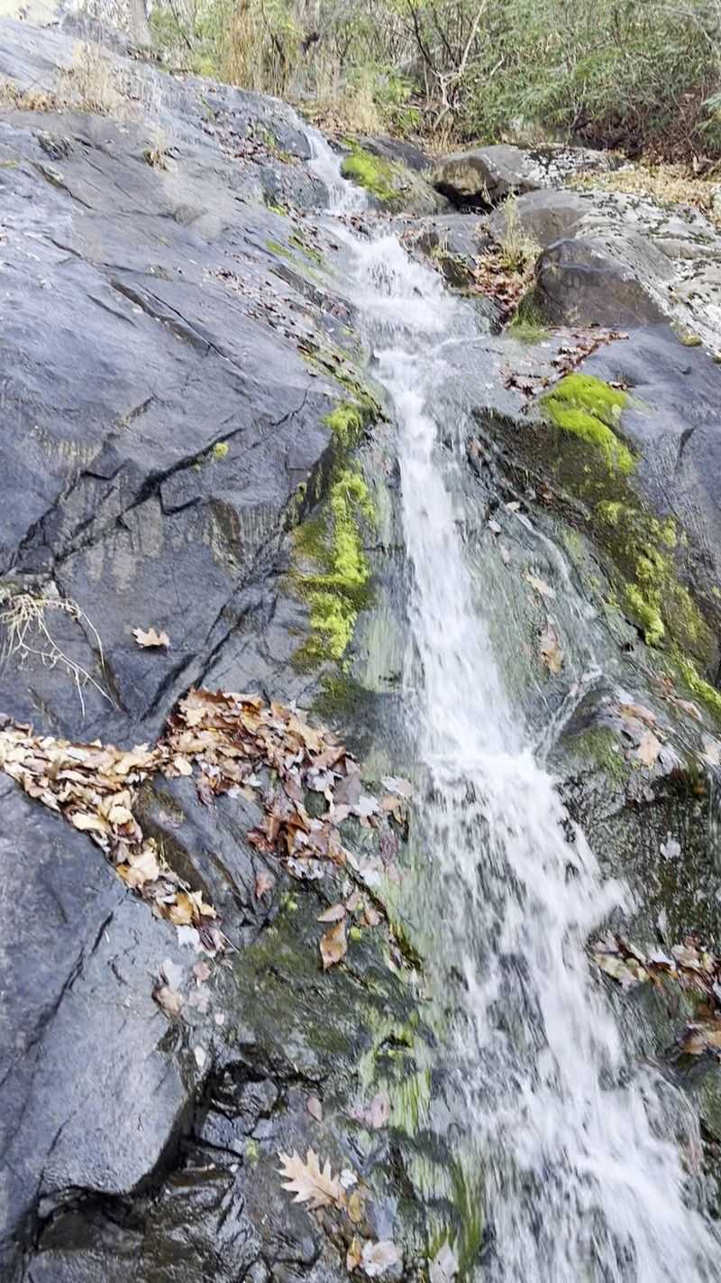
Most waterfalls give you one viewpoint and call it a day. Fallingwater Cascades lets you walk right alongside the action for a good stretch.
The creek tumbles down in a long series of cascades near Peaks of Otter. The trail is a 1.6-mile loop, rated easy to moderate.
Expect around 400 to 450 feet of elevation change. Stairs, switchbacks, and footbridges help you through the steeper parts.
Like Apple Orchard Falls, this route is a National Recreation Trail. It’s part of the Peaks of Otter Recreational Area in Bedford County.
Rhododendron and mountain laurel line the woods along the creek. In late spring and early summer, those blooms add bright color to the trip.
The trailhead sits at milepost 83.1 on the Blue Ridge Parkway. It’s just a short distance from the Flat Top Mountain Trailhead and a few miles north of Peaks of Otter Lodge.
Craving a bigger challenge? You can pair this loop with the Flat Top Mountain Trail for a hike of about 10.4 miles.
Leashed dogs are allowed, so your furry buddy can tag along. Water levels look best in spring and after rainfall.
Seasonal Parkway closures can affect access, so check ahead. Then wrap up your Virginia waterfall tour here, where the creek keeps the show going nearly the whole way.
Address: Virginia 24066.