Most hikers do not give Louisiana enough credit for its trails, partly because the state’s reputation for flat swamp land makes people assume there is nothing worth climbing.
The reality is more varied than the stereotype suggests: ridge-line paths through the Tunica Hills rise and dip like something out of Arkansas, boardwalks cut straight through cypress swamp where alligators sun themselves a few feet off the trail, and longleaf pine forests open onto overlooks that stretch to the horizon.
Some of the routes below cover serious mileage for backpackers; others are gentle loops that a family with small children could finish before lunch. A handful are paved or crushed-stone multi-use paths that welcome cyclists alongside runners.
What they share is a willingness to show off a side of the state that most travelers never see, the side where the bayou quiets down, the canopy opens up, and the trail itself becomes the destination.
Louisiana trails range from swamp boardwalks to pine-forest ridges, and these thirteen are worth lacing up for any season.
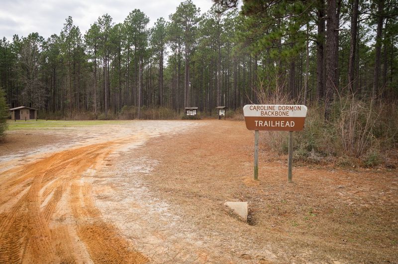
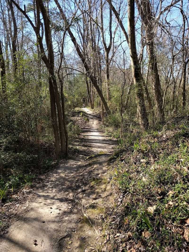
13. Backbone Trail
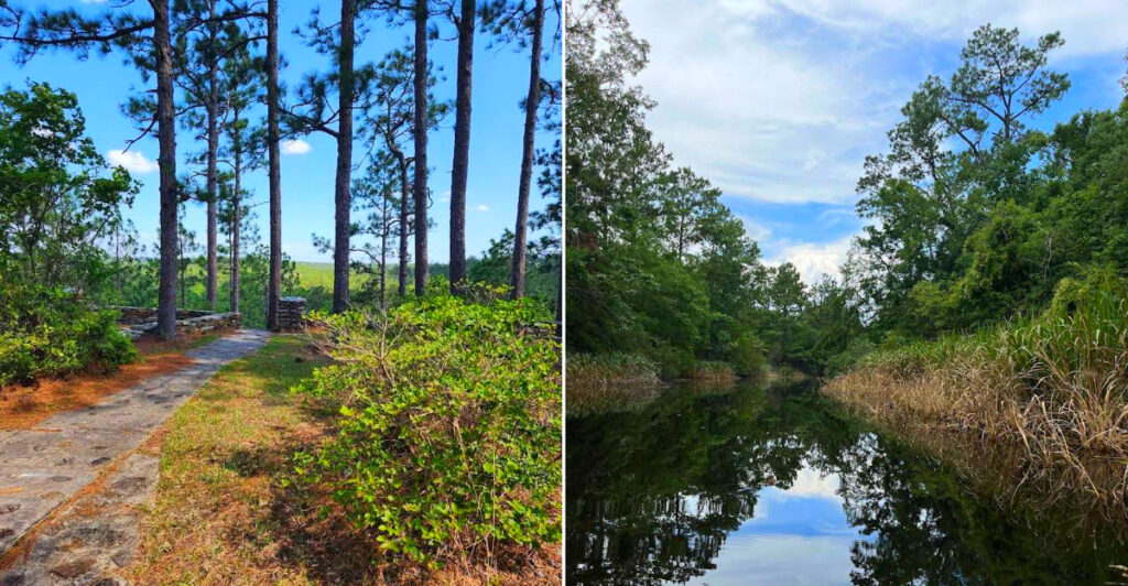
A piney ridge walk through Kisatchie Hills Wilderness gives the Backbone Trail its rare Louisiana drama.
The signed Backbone Trailhead shares access with the Caroline Dormon Trailhead off Longleaf Scenic Byway, also known as Forest Highway 59, near Provencal, LA 71468; the Kisatchie Ranger District office is listed at 229 Dogwood Park Road, Provencal, LA 71468.
The route moves through sandy soil, pine forest, hardwood pockets, and higher ground that gives the hike a surprisingly rugged feel. It is not mountainous in the western sense, but for Louisiana, the repeated rises, overlooks, and dry ridge sections feel genuinely distinctive.
Trail users should expect a more backcountry-style experience than a city park loop. Bring water, bug spray, offline navigation, and shoes that handle sand, roots, and occasional rougher stretches.
What makes this hike memorable is its quiet confidence. It does not need a dramatic waterfall or boardwalk to impress; it simply lets you feel how different central Louisiana can become when the trail climbs into the hills.
12. Caroline Dormon Trail
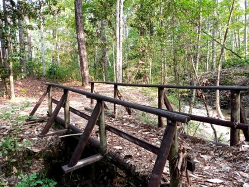
Named for one of Louisiana’s most important conservation voices, the Caroline Dormon Trail carries a wilder, more purposeful character through Kisatchie National Forest.
The trailhead sits off Longleaf Scenic Byway, Forest Highway 59, near Provencal, LA 71468, with the Kisatchie Ranger District office listed at 229 Dogwood Park Road, Provencal, LA 71468.
The route is not a loop, which immediately makes planning more important. Hikers, mountain bikers, and horseback riders use the trail, and the surface can shift from pine flats to rooty, uneven, more technical sections.
That mixed-use character gives the trail a lived-in forest rhythm.
You feel the region’s recreation culture as much as its ecology, especially where longleaf pine, hardwood pockets, and sandy rises alternate across the route.
This is best for people who enjoy a little logistics with their scenery. Plan mileage carefully, check current forest conditions, and carry more water than you think you need if heat is in the forecast.
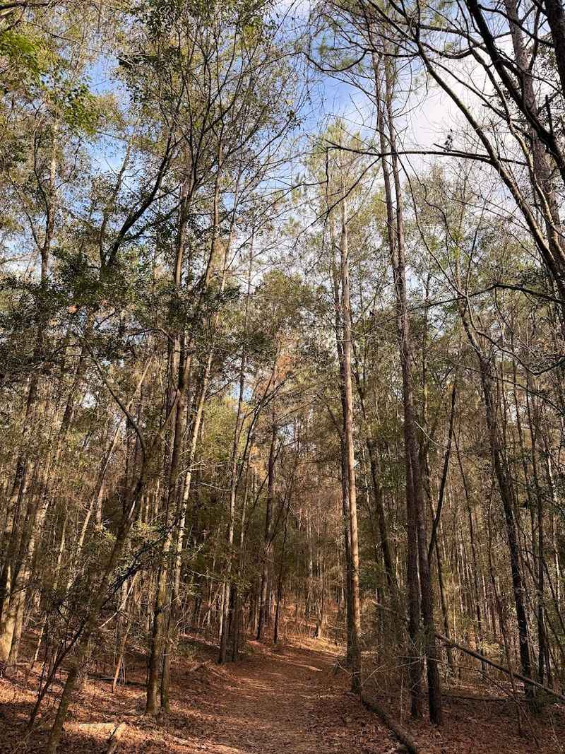
11. Wild Azalea Trail
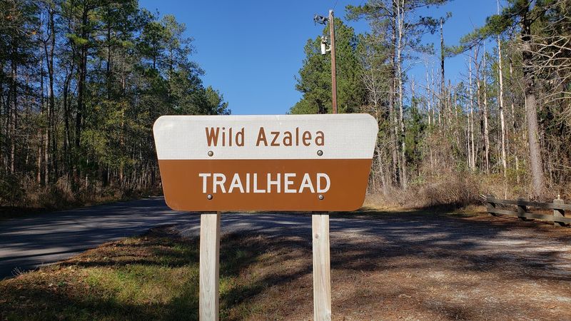
Spring gives the Wild Azalea Trail its famous color, but the route earns its place in every season. The trail runs through the Evangeline Unit of Kisatchie National Forest, with key access at Valentine Lake Recreation Area near Gardner, LA, and the eastern trailhead near Castor Plunge Road/FS 287 by Woodworth, LA 71485.
The full route is Louisiana’s long-distance showpiece, often described as the state’s longest hiking trail. It passes through pine woods, sandy ridges, creek bottoms, and flowering understory that feels especially alive when the azaleas are blooming.
Because this is a point-to-point trail, casual visitors should choose a section rather than pretending the whole route is a quick outing. Shuttle planning, water, timing, and weather all matter if you are taking on serious mileage.
Day hikers can still enjoy the spirit of the trail without committing to the full distance. Pick a manageable segment, go slowly, and let the plant life and shifting terrain prove that Louisiana hiking has more range than people expect.
10. Longleaf Vista Interpretive Trail

A compact loop with a surprisingly big view makes the Longleaf Vista Interpretive Trail one of the easiest introductions to Kisatchie’s hill country.
The trail begins at Longleaf Vista Recreation Area off Forest Highway 59, near Provencal, LA 71468; the Kisatchie Ranger District office is listed at 229 Dogwood Park Road, Provencal, LA 71468.
The trail is short, but it moves through several forest settings, including open pine, hardwood bottoms, creek areas, and higher ground. Interpretive signs add context without slowing the walk too much.
This is a good first stop for visitors who want scenery and education in one efficient outing. Families, casual hikers, birders, and road-trippers on the Longleaf Scenic Byway can all make sense of it.
Check current forest alerts before driving out, especially after storms, prescribed burns, or wildfire activity. When conditions are clear, the loop offers a quick but meaningful look at one of Louisiana’s most unusual landscapes.
9. Mount Driskill Trail
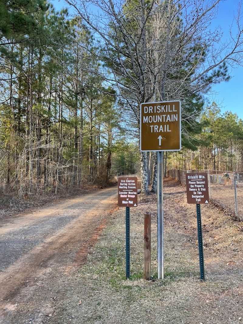
Louisiana’s highest natural point is modest by mountain-state standards, but the Mount Driskill Trail still feels like a small achievement. The usual access begins near Mount Zion Presbyterian Church at 1279 Mount Zion Road, Simsboro, LA 71275, where hikers follow the marked route toward Driskill Mountain.
The summit rises to 535 feet, which is exactly why the hike is charming rather than intimidating. The trail moves through a mix of pine and hardwood, with signs helping visitors stay on the correct route to the actual high point.
This is a good choice for families, peak-baggers, and anyone who likes a clear destination without needing a full wilderness day. The climb is steady in places, but the round-trip distance stays manageable for most hikers.
Bring water, wear comfortable shoes, and respect the private-land context around the access route. The reward is partly the view, partly the marker, and partly the odd pleasure of standing on top of Louisiana.
8. Lake Chicot Loop Trail

Water stays close for much of the experience on the Lake Chicot Loop Trail, a long hiking route inside Chicot State Park. The park is located at 3469 Chicot Park Road, Ville Platte, LA 70586, and the trail system circles one of the state’s most atmospheric cypress-edged lakes.
The full loop is a serious undertaking, stretching roughly 20 miles around Lake Chicot. Hikers who do not want the whole distance can still enjoy shorter sections with shoreline views, forested stretches, boardwalk areas, and quiet pockets of swampy beauty.
Morning is especially good here, when fog lifts from the lake and birds begin moving along the water’s edge. The landscape has a slow, reflective quality that rewards patience more than speed.
Pack insect spray, water, and a realistic sense of distance. This is one of Louisiana’s best places to feel the meeting point between state-park comfort and backcountry edge.
7. Tunica Hills C Trail
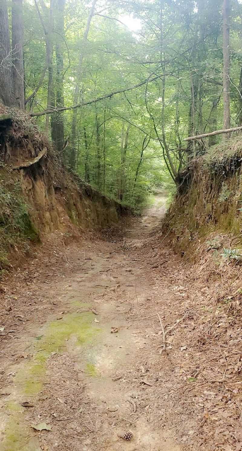
A rugged bluffland hike northwest of St. Francisville makes the Tunica Hills C Trail feel almost imported from somewhere hillier. The trail is part of Tunica Hills Wildlife Management Area, reached from the South Tract off Old Tunica Road near St. Francisville, LA 70775.
The appeal here is terrain. Ravines, steep climbs, hardwood forest, sandy creek bottoms, and bluffland plant communities create a kind of Louisiana hiking that feels dramatically different from the flat swamp stereotype.
Conditions can change quickly after rain because clay and loess soils get slick. Good footwear matters, and slower pacing makes the trail more enjoyable than trying to rush through every descent and climb.
Because this is a wildlife management area, hikers should check seasonal closures, hunting dates, and access rules before going. When the timing is right, the trail offers one of the state’s strongest doses of real hiking texture.
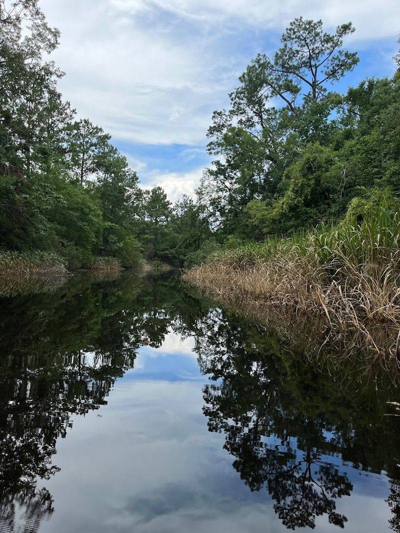
6. Barataria Preserve Trails
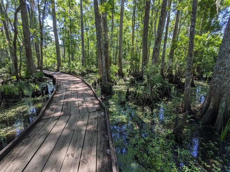
Close to New Orleans, the Barataria Preserve Trails deliver an easy and memorable way into Louisiana wetland ecology. The Barataria Preserve visitor center is listed at 6588 Barataria Boulevard, Marrero, LA 70072, while the Wetland Trace Boardwalk is located at 4917 City Park Drive, Jean Lafitte, LA 70067.
The trail system moves through swamp, marsh, bayou edges, hardwood forest, and elevated boardwalk sections. Alligators, turtles, wading birds, frogs, and dense wetland vegetation make the preserve feel far more remote than its drive time suggests.
What works so well here is the infrastructure. Boardwalks and signed paths make the landscape accessible without making it feel artificial, and ranger information helps visitors understand what they are seeing.
Go early for cooler air and better wildlife movement. Bring water, use insect protection, and let the preserve slow your pace until the swamp’s sounds become part of the walk.
5. Tammany Trace
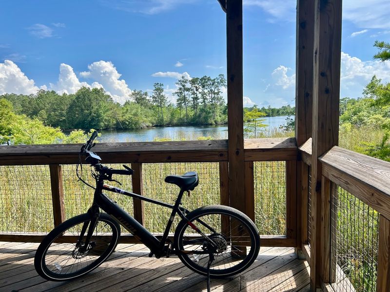
A converted rail corridor gives Tammany Trace its easy grade and social personality. The trail stretches through St. Tammany Parish, connecting Covington, Abita Springs, Mandeville, Lacombe, and Slidell, with trail headquarters commonly listed at 21490 Koop Drive, Mandeville, LA 70471.
The surface is smooth and friendly for cycling, walking, running, and skating. Unlike more rugged forest routes, this one feels communal, with small-town stops, parks, rest areas, and local businesses folded into the experience.
That accessibility is the whole point. You can turn the trail into a serious ride or simply choose a short section between towns and let the old railroad corridor carry you through Northshore scenery.
Weekday mornings are best if you want quiet. Weekends bring families, cyclists, and a livelier atmosphere, which suits the trail’s community-driven character.
4. Comite Park Loop
Near Baton Rouge, the Comite River Conservation Area gives local hikers and mountain bikers a compact but surprisingly active trail experience.
The main access is at 8900 Hooper Road, Baton Rouge, LA 70818. The trail system runs along the Comite River and Cypress Bayou, with wooded terrain, short hills, roots, turns, and enough uneven ground to keep the route interesting.
It is especially known as a mountain-bike destination, but walkers can still appreciate the shaded natural setting. This is not a long-distance wilderness escape. Its strength is convenience: a quick nature fix near town with more texture than a flat neighborhood path.
Wear shoes with grip, watch for bikes, and bring bug spray in warmer months. The loop works well when you want outdoor movement without turning the day into a full road trip.
3. Bogue Chitto Gorge Run Trail
Southern Louisiana gets unusually dramatic at Bogue Chitto State Park, where the Gorge Run Trail shows off hills, creek bottoms, and eroded sandstone features. The park is located at 17049 State Park Boulevard, Franklinton, LA 70438.
The trail loops through pine-covered slopes and lower cypress-tupelo areas, giving hikers a stronger sense of elevation change than many expect this close to the Gulf Coast. Nearby Fricke’s Cave adds a geological highlight with fragile sandstone formations shaped by erosion.
This is one of those routes where the side details matter. Small streams, exposed textures, shaded slopes, and boardwalk-style access points make the landscape feel animated rather than repetitive.
Check trail conditions before going, especially after heavy rain. Good shoes, water, and extra time for slow descents make the experience much more pleasant.
2. Cane Bayou Trail
Inside Fontainebleau State Park, the Cane Bayou Trail offers a gentler Northshore route through woods and marsh-edge scenery. The park address is 62883 Highway 1089, Mandeville, LA 70448, and the trail leads toward views connected to Cane Bayou and the Lake Pontchartrain landscape.
The route is easygoing compared with Louisiana’s hillier forest trails. That makes it a strong choice for birders, photographers, families, and anyone who wants wetland atmosphere without a difficult hike.
You move through a mix of pine, marsh, reeds, and bayou-adjacent habitat, with wildlife and shifting light doing much of the work. The quiet payoff comes from slowing down enough to notice movement in the grass, water, and tree line.
Expect insects in warm months and possible wet spots after rain. When conditions are good, this is a calm, accessible trail with a strong sense of coastal Louisiana place.
1. Fontainebleau State Park Trail
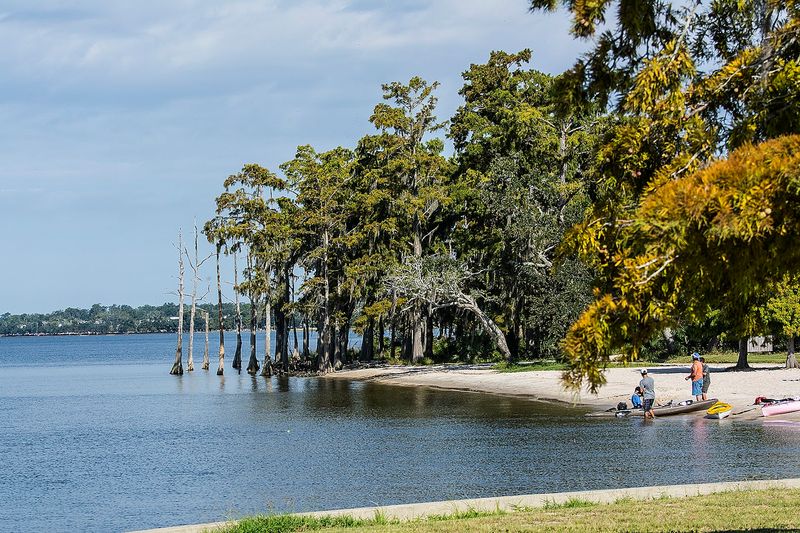
Lake Pontchartrain gives Fontainebleau State Park Trail its open, breezy edge. The park is located at 62883 Highway 1089, Mandeville, LA 70448, and its trail options combine shoreline views, wooded paths, marsh overlooks, and traces of the old sugar mill landscape.
The park is popular because it works for several kinds of visitors at once. Families can keep things easy near the lake, birders can focus on habitat variety, and walkers can mix shorter nature trails with longer routes toward Bayou Cane.
What makes the setting especially useful is the contrast between open water and shade. One stretch can feel like a lakeside stroll, while another pulls you into live oak, pine, and marsh-edge quiet.
Late afternoon is a strong time to go, especially when the light softens over Lake Pontchartrain. Bring sun protection, water, and insect spray, then let the park give you a little of everything without making the outing complicated.