Black sand. Pacific waves loud enough to feel in your chest.
Mountains that drop straight into the surf with almost no flat land between the summit and the shoreline. Highway engineers looked at this California coast and walked away.
It has never recovered from that, in the best possible way. The long road to get here demands your full attention.
The beach demands the rest of it. Roosevelt elk move through the bluffs.
Bald eagles circle without any interest in being impressive. Sneaker waves make swimming seriously dangerous, which keeps the ocean honest.
California protects this place under federal designation, and the remoteness does the rest. It is not on the way to anywhere else.
That is the entire point.
The Road That Civilization Never Finished Building
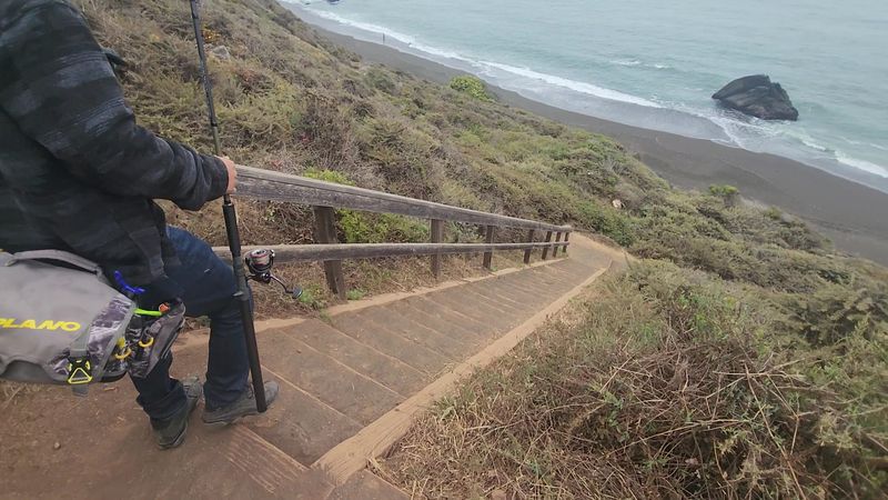
Getting here is half the story. The road into Shelter Cove is narrow, full of curves, and demands full attention behind the wheel.
It moves slowly through steep terrain that once convinced highway engineers to simply walk away.
California State Route 1 never made it to this part of the coast. The King Range mountains were deemed too steep, too unstable, and too expensive to build through.
That decision, made decades ago, is the reason this coastline still looks the way it does today.
Visitors coming from Highway 101 should budget extra time for the drive. It is not a road for distracted driving or impatience.
But the moment the ocean comes into view through the tree line, the slow pace suddenly feels completely worth it. The isolation begins before the beach does, and that is exactly the point.
Some places earn their remoteness, and this one has earned it thoroughly.
Why The Sand Here Looks Like Nothing Else In The Country
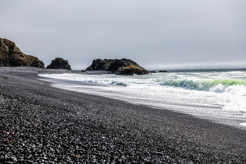
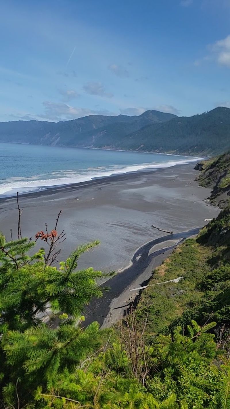
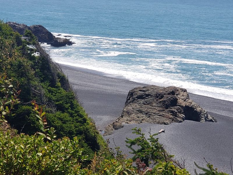
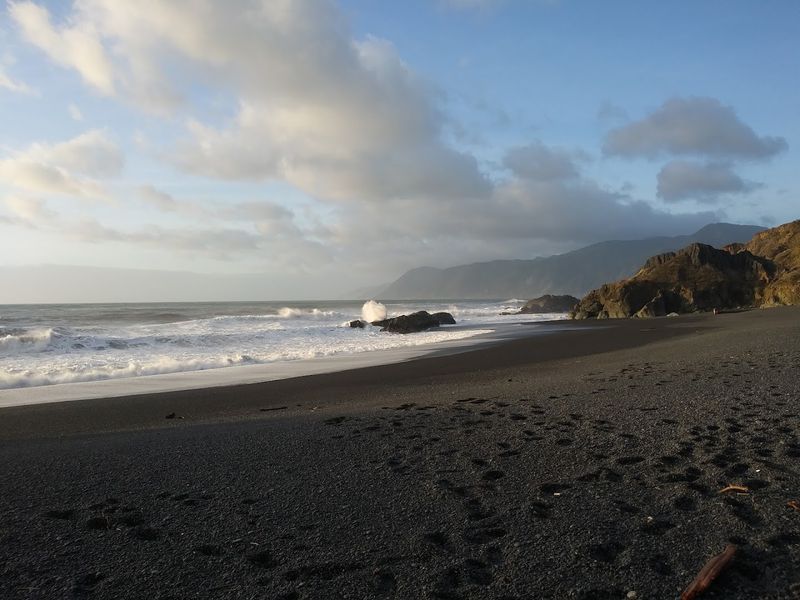
Black sand beaches exist in a handful of places around the world, but California is not where most people expect to find one. Yet here it is, stretching for miles along the Lost Coast, dark and striking against the white foam of the Pacific.
The color comes from eroded greywacke sandstone and compressed shale, shaped by tectonic activity where continental and oceanic plates meet offshore. The result is a beach that looks almost otherworldly, covered in small black pebbles and dark granules that shift and tumble with every retreating wave.
That tumbling sound is something visitors consistently mention. When the water pulls back across the rocks, it creates a low, rolling percussion unlike anything a typical sandy beach produces.
It is oddly calming for a place that looks so dramatic. The textures underfoot are also different, uneven and shifting, which makes walking along the shoreline a genuine physical experience rather than a casual stroll.
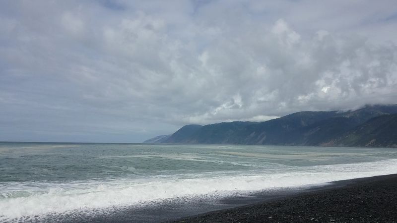
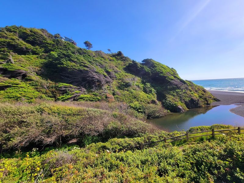
Mountains That Drop Straight Into The Ocean
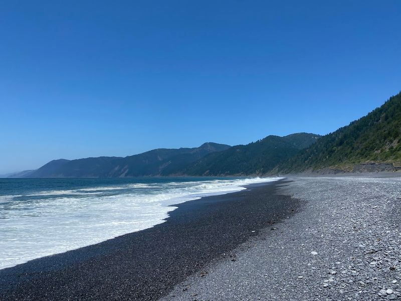
The King Range does not gradually slope toward the water. It falls.
Peaks reaching over 4,000 feet rise just a few miles inland, creating one of the most dramatic land-to-sea transitions anywhere along the West Coast.
Standing on the beach and looking back at those ridgelines puts the scale of this place into immediate perspective. The mountains feel close because they are close.
There is almost no flat land between the summit and the surf, which is precisely what made road construction here fiscally impossible for California planners.
This mountains-to-ocean interface creates microclimates, wildlife corridors, and ecological diversity that few coastal areas can match. Fog rolls in quickly.
Light changes fast. The landscape shifts moods throughout the day in ways that keep the scenery from ever feeling static.
Morning light on those ridgelines is particularly worth waking up early for, especially when low clouds hang between the peaks and the shoreline below.
Wildlife That Has Not Learned To Fear Visitors
Roosevelt elk wander the coastal bluffs. Sea lions bob in the surf.
Bald eagles circle overhead without much concern for the humans below. The Lost Coast supports a level of wildlife activity that feels almost prehistoric in its density and calm.
The area provides critical habitat for species listed under the Endangered Species Act, including the Northern spotted owl, Marbled murrelet, Coho salmon, and Steelhead trout. Black bears and mountain lions also move through the backcountry, though sightings near the beach trailhead are uncommon.
Migrating whales pass offshore during certain seasons, and seabirds work the cliffs and tidepools with focused efficiency. Visitors are reminded to keep distance from sea lions and other wildlife encountered along the trail.
These animals are not tame, and they are not performing. They are simply living in a place where human pressure has remained low enough to let them do exactly that, which is rarer than it sounds along the California coast.
The Lost Coast Trail And What It Actually Takes To Walk It
The Lost Coast Trail runs roughly 25 miles from Mattole Beach to Black Sands Beach Trailhead, and it is not a casual weekend walk. The terrain shifts constantly between soft sand, loose rock cobbles, and bluff-top paths.
Boots and gaiters are strongly recommended.
Tide charts are not optional here. Certain sections of the trail become completely impassable at high tide, and hikers who ignore that reality create serious problems for themselves.
Permits are required for camping, and the daily number available is limited, which keeps the trail from becoming overrun even during peak season.
Most people complete the route over three to four days, moving south to north or north to south depending on logistics. Shuttle services operate between trailheads, making one-way trips the most popular approach.
The campsites range from beach-level spots to bluff positions and creek-side clearings among trees. Every camp feels earned, and that earned feeling is a significant part of what makes this trail memorable in California backpacking circles.
The Water Looks Inviting And Absolutely Is Not
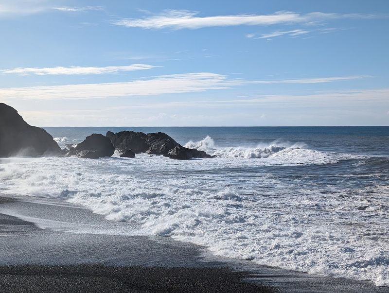
Warning signs at Black Sands Beach are not decoration. Sneaker waves hit without warning, and the beach drops off steeply into powerful undertows.
Swimming here is genuinely dangerous, and the ocean makes no exceptions for confidence or experience.
The phrase sneaker wave describes a wave that arrives significantly larger and faster than the surrounding surf, with no obvious build-up to signal its approach. These waves have reached people standing well back from the waterline.
The advice from every source, including posted signs and experienced locals, is consistent: admire the water from a safe distance.
That distance still offers an extraordinary view. The waves at Black Sands Beach are large, dramatic, and relentless.
Watching them crash against the dark shoreline and send white spray up against the cliff faces is genuinely spectacular. The ocean here does not need swimmers to be impressive.
It commands attention entirely on its own terms, and visitors who respect that boundary tend to leave with a deep appreciation rather than a close call.
Protected Land That Almost Became Something Very Different
The King Range National Conservation Area was established in 1970, covering around 68,000 acres of this rugged Northern California coastline. Without that designation, the story of the Lost Coast might have gone in a very different direction.
Conservation efforts in the 1960s blocked large-scale resort development that had been proposed for the area. The combination of difficult terrain and growing environmental awareness worked together to keep bulldozers out.
Sinkyone Wilderness State Park adds additional protection to the southern portion of the coast, creating a patchwork of preserved land that buffers the shoreline from encroachment.
But protection on paper does not mean the threats have disappeared. Industrial timber harvesting historically pushed into redwood forests here.
Illegal cultivation operations have caused damage in backcountry areas. Climate change affects fish habitats and coastal erosion patterns.
Active landslides regularly close trail sections, particularly after heavy rain. The land holds on, but it does so against ongoing pressure, which is why the word preserved feels more accurate than safe when describing what this coastline represents.
Sunsets That Make The Long Drive Feel Like An Obvious Trade
Sunsets at Black Sands Beach land differently than sunsets at crowded coastal spots. There are no restaurants, no boardwalks, and no competing light sources.
Just the sun dropping behind the Pacific horizon while dark sand absorbs the last of the warm light.
The combination of the black shoreline, the cliff silhouettes, and the open ocean creates a color palette that photographers chase for good reason. Oranges and pinks hit the water differently against a dark foreground.
The effect is stark and beautiful in equal measure, and it changes quickly, so arriving early pays off.
Sunrise is equally worth the effort for those camping nearby. The eastern ridgelines of the King Range catch the first light before it reaches the beach, creating a layered effect of illuminated peaks above a still-shadowed shoreline.
Both ends of the day offer something that the middle hours simply cannot match. For a place this remote, the light alone justifies the visit, regardless of what else the day holds.
Unique Redwoods And The Forests Behind The Beach
Most people associate redwoods with tall, straight columns of ancient timber. The Lost Coast has those, but it also has something stranger.
Candelabra redwoods grow here, twisted and multi-trunked, shaped by the relentless coastal winds into forms that look more like sculpture than forest.
These trees grow where the terrain and weather create conditions that push the typical redwood growth pattern sideways, literally. The result is a grove that feels unlike any other redwood experience in California.
They are smaller, more contorted, and somehow more expressive than their towering inland cousins.
The forests behind the beach also support recovering old-growth areas where conservation efforts have worked to limit extraction and allow natural regeneration. Hiking up from the beach into the tree line shifts the sensory experience completely.
The sound of the ocean fades, the air cools and dampens, and the light filters through canopy in long, soft columns. It is a reminder that the Lost Coast is not just a beach.
It is an entire ecosystem stacked vertically from the surf to the ridgeline.
What To Know Before Heading Out To The Trailhead
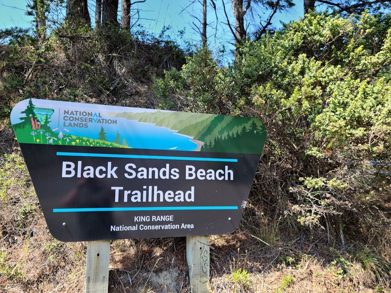
The trailhead at 903 Beach Rd, Whitethorn, CA 95589 has a parking area with restroom facilities, which is more infrastructure than most of this coastline offers. No parking fee is collected, and the lot holds a modest number of vehicles.
Arriving early on weekends during peak season is a practical move.
Camping requires permits, and those permits are limited in number per day. Anyone planning an overnight trip on the Lost Coast Trail should secure permits well in advance and study tide charts before setting foot on the beach.
Some trail sections become impassable at high tide, and that is not a situation to discover without a plan.
Poison oak grows near some overlook areas, so staying on marked paths matters. Dogs have been spotted enjoying the beach, though visitors should verify current regulations before bringing pets.
Water is available at the parking area. Cell service is minimal or absent once away from town.
Packing for genuine self-sufficiency, not just for a day hike, is the mindset this place requires and rewards.