Standing on a ridge that curves gently toward the sky, it takes a moment to register what you are actually looking at.
These earthen mounds were shaped by human hands over three millennia ago, long before written language reached this corner of the world. The scale is staggering, spanning hundreds of acres with concentric ridges that rise from the ground like the rings of a massive earthen fingerprint.
Trade goods from sources eight hundred miles away have been found here, evidence of a network that extended far beyond what most people imagine possible for its time.
A museum on site displays artifacts that tell the story of a community both sophisticated and deeply connected to the land around it.
Walking the trails between the mounds, the silence makes the weight of that history feel tangible. Louisiana holds one of the most remarkable archaeological sites in North America, and most people have never heard of it.
First Impressions On Arrival
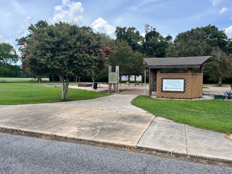
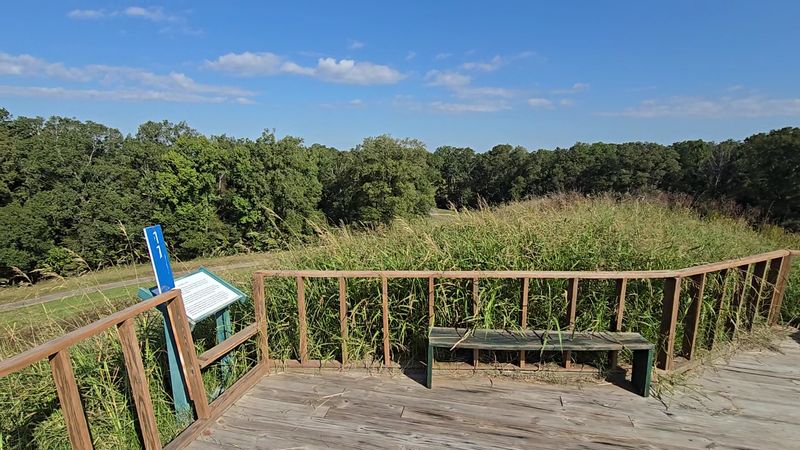
The first thing that hits you at Poverty Point is the scale even before you see Mound A. The visitor center is small and well designed, with exhibits that frame what you’re about to walk into.
Staff at the desk hand out maps and practical advice, which is more valuable than a cursory brochure because the site is sprawling and the features are subtle from ground level.
Paths and short drives lead you past ridges and low mounds; some look like gentle hillocks until you read the placard. That sense of discovery, the ordinary landscape hiding extraordinary handiwork, stays with you the whole visit.
Exit 153 Is Where The Clock Starts Running Backward
Poverty Point World Heritage Site sits at 6859 Louisiana Highway 577 in Pioneer, Louisiana. From Interstate 20, take Exit 153 at Delhi and head north on Louisiana Highway 17.
Stay on Highway 17 for roughly 11 miles until you reach Epps, then turn right onto Louisiana Highway 134. Continue east for about six miles through the quiet countryside.
Turn left onto Louisiana Highway 577 and drive approximately one more mile. The entrance will appear on the right, with signs guiding you into the visitor parking area.
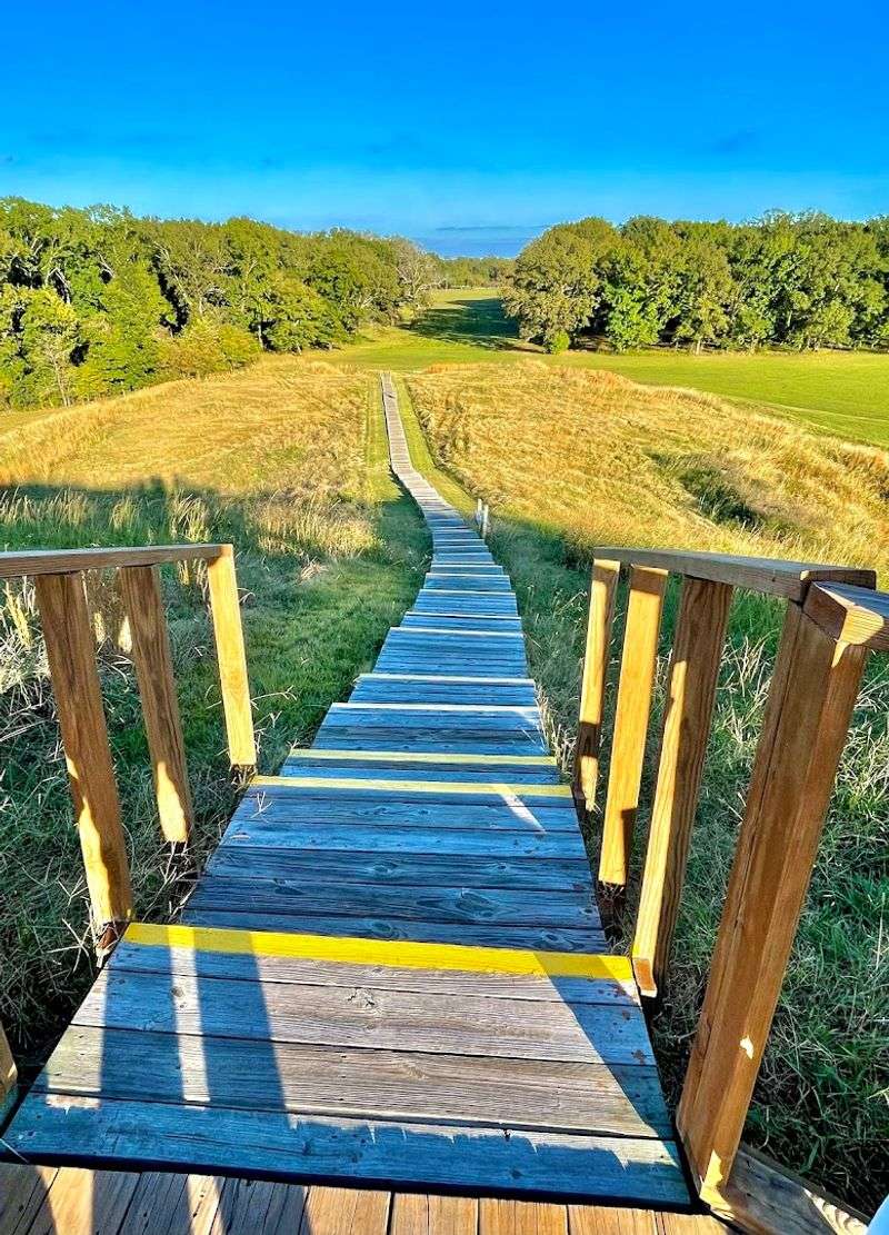
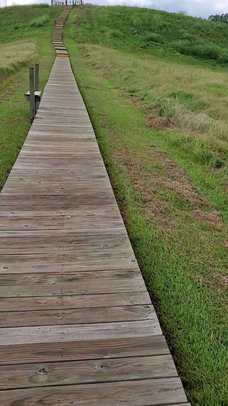
Mound A Up Close
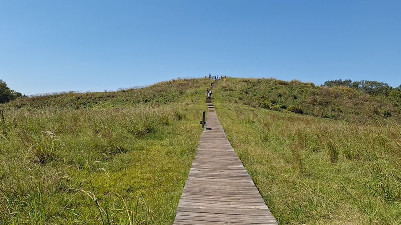
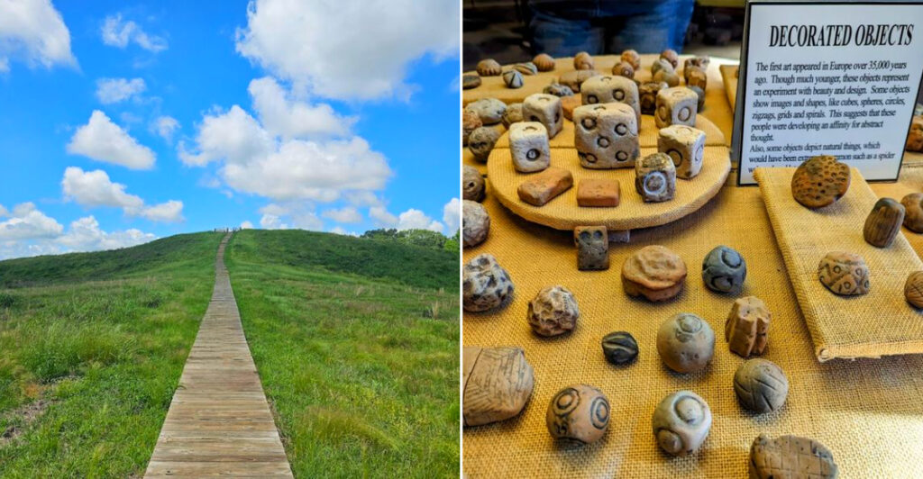
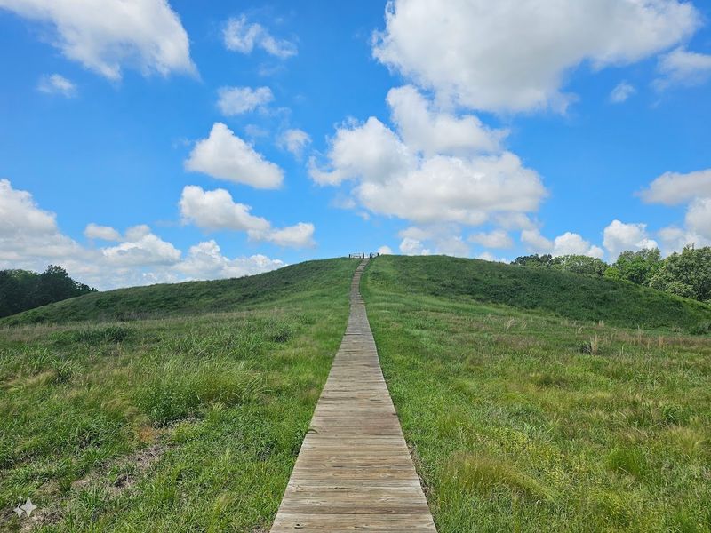
Mound A dominates the site in a way that no photograph fully captures; it is both massive and oddly serene. Climbing the platform gives a sense of how much manual labor went into shifting hundreds of thousands of tons of soil, an engineering triumph for a pre-agricultural society.
From the top, the concentric ridges and central plaza read differently, revealing intentional geometry across the landscape.
Interpretive signs explain estimates of soil moved and construction phases. The visual and numerical facts together make the human effort tangible, and standing there encourages a kind of humble awe at coordinated work undertaken thousands of years ago.
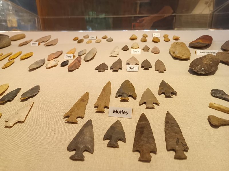
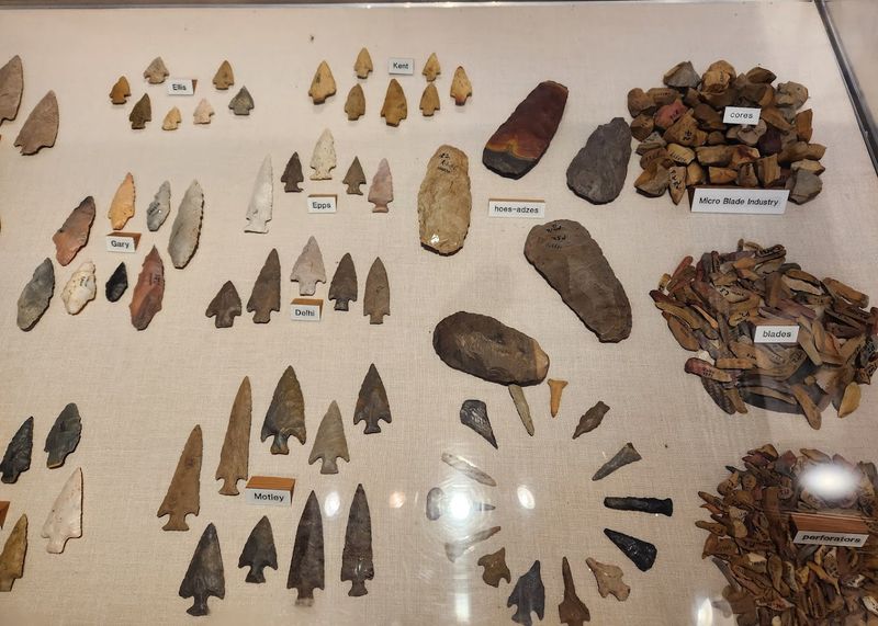
Artifacts And The Little Museum
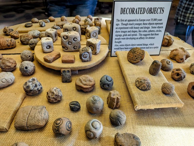
The small museum is modest but dense with finds that tell a wide trade story: stone from distant regions, fired clay cooking balls, projectile points, and ornamentation.
The exhibits are curated to show how materials moved across great distances, indicating a network of exchange that connected Poverty Point with places hundreds of miles away.
That reach reframes the site from a local settlement to a regional hub.
A short film and labeled displays are worth the modest entry fee; they condense complex archaeology into clear narratives. Plan to spend at least half an hour here before wandering the earthworks, they orient you to the scale and sophistication of the people who built the site.
Guided Tours And Ranger Interactions

Ranger-led tours and tram options turn a casual visit into a layered experience, especially when archaeologists or interpreters share recent findings. Guides know to point out subtle features most visitors miss and to translate technical archaeology into vivid stories about daily life and trade.
Their enthusiasm is genuine, and asking questions yields concrete, up-to-date information about ongoing research and preservation efforts.
If a guided tour is available during your visit, take it. Even short ranger talks change how the landscape reads and help you spot patterns in the ridges and mounds that you would otherwise stroll past without registering.
Guides can explain how seasonal conditions, preservation decisions, and new evidence influence interpretation. That context turns apparently empty stretches of earth into readable records, making the scale of ancient planning easier to understand and the site’s complexity harder to overlook.
Walking The 2.6 Mile Trail
The 2.6-mile trail winds through diverse stretches: open ridges, shady groves, and marshy low spots that remind you this is a living landscape. Trail markers are well placed and paired with a pamphlet or map from the museum, which turns a walk into a chronological and spatial narrative.
Bring good shoes, some sections get muddy after rain and a couple of gentle hills test your calves.
Pacing yourself and taking pauses on benches lets the site reveal small details like soil color changes and artifact scatter patterns flagged by signs. The loop gives a satisfying sense of completion and perspective on the whole complex.
Seasonal Character And Best Times To Visit

Spring and fall are the friendliest seasons here: temperatures are comfortable and humidity is lower, which makes walking the ridges pleasant. Summer intensifies the heat and insects, so early mornings or late afternoons work better then, bearing in mind that the site closes at 5 pm.
Winter visits are quiet and crisp, and the visibility across the ridges can be unexpectedly clear on cold days.
Check operating hours before you go because the site closes on certain holidays. Packing sunscreen, insect repellent, and water will keep your visit focused on the place rather than your comfort levels.
A light jacket helps during cooler mornings, while breathable clothing makes warmer afternoons easier to manage. After rain, expect softer ground and occasional muddy patches along natural paths.
Weather can shift quickly, so check the forecast before leaving whenever possible.
Accessibility And Practical Logistics
Poverty Point offers an accessible visitor center and a wheelchair-accessible tram, which makes the main interpretive components available to many visitors. There are paved paths close to the museum and restrooms, but much of the historic footprint remains uneven and natural.
If mobility is a concern, plan on the tram or stick to the paved areas near the center for the clearest views and exhibits.
Admission fees are modest and the site’s hours are consistent. Arrive early on busy days to secure parking, and note that dogs on leash are welcome on the grounds, which can be handy for people traveling with pets.
Calling ahead can also help confirm tram schedules, temporary closures, and any accessibility accommodations available that day. Bring water for longer outdoor stops, and allow extra time between exhibits so the visit remains comfortable rather than rushed or physically demanding.
Understanding The Builders And Their Economy
The people who built Poverty Point were sophisticated hunter-gatherers who organized labor, crafted specialized objects, and maintained long-distance exchange networks.
Artifacts show that stone and raw materials came from hundreds of miles away, which suggests trade routes and social ties extending to the Ozarks and Appalachian foothills.
They gathered fish, nuts, and wild plants, and that mixed subsistence supported dense settlement and monumental construction.
Interpreting the site through that lens challenges assumptions about the link between agriculture and monumental architecture. The ingenuity of these communities is clear in both artifacts and earthworks.
Preservation Efforts And Ongoing Archaeology
Active archaeology and preservation are part of the site’s modern life; you may see work in progress or read about recent digs in the museum. Excavations follow careful protocols and public outreach helps explain methods and discoveries.
Conservation includes managing vegetation, controlling erosion, and balancing visitor access with protecting fragile contexts beneath the surface.
Community partnerships and designation as a UNESCO World Heritage Site bolster funding and attention, but preservation is ongoing. Watching archaeologists at work adds immediacy to the place and shows you that knowledge here grows incrementally, not all at once.
Even small findings can reshape interpretations, so researchers document each layer before removing it. Visitors who pause to study these updates gain a clearer sense of archaeology as patient, collaborative work rather than a hunt for spectacular objects alone today.
Practical Visitor Tips And Etiquette
Practicalities matter: arrive with water, sun protection, sturdy shoes, and a printed map if you prefer paper. Follow signage and stay on designated paths to protect unexcavated areas and fragile contexts.
The museum offers pamphlets and ranger-led options that help you prioritize what to see if you have limited time, and the tram provides a good overview for shorter visits.
Respect local culture and the fact this is a sacred archaeological landscape; take photos but avoid touching exposed soils or artifacts. Small actions help preserve the site for future visitors and ongoing research.
Give yourself time between stops, especially in hot weather, since shade can be limited and the open landscape can feel more demanding than expected. If conditions turn uncomfortable, return to the visitor center, refill water, and adjust your route accordingly.