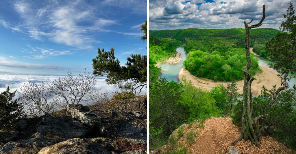
One Arkansas hike begins with a boat ride. The trail sits on an island in a lake, and the path to the top uses steep wooden stairs.
That means your workout starts before your boots even get muddy.
The surprises keep stacking up. One roadside overlook lets you spot Missouri about 40 miles north on a clear day.
Another bluff hovers more than 550 feet above a winding river, and bald eagles drift past in winter.
Then there’s a mountaintop where you can learn Trail of Tears history while the sun climbs over a river valley.
My legs filed a complaint just reading about these climbs, and my eyes overruled them instantly.
Lace up, pack plenty of water, and pick your summit. The views are waiting, and they don’t take days off.
1. Yellow Rock Overlook
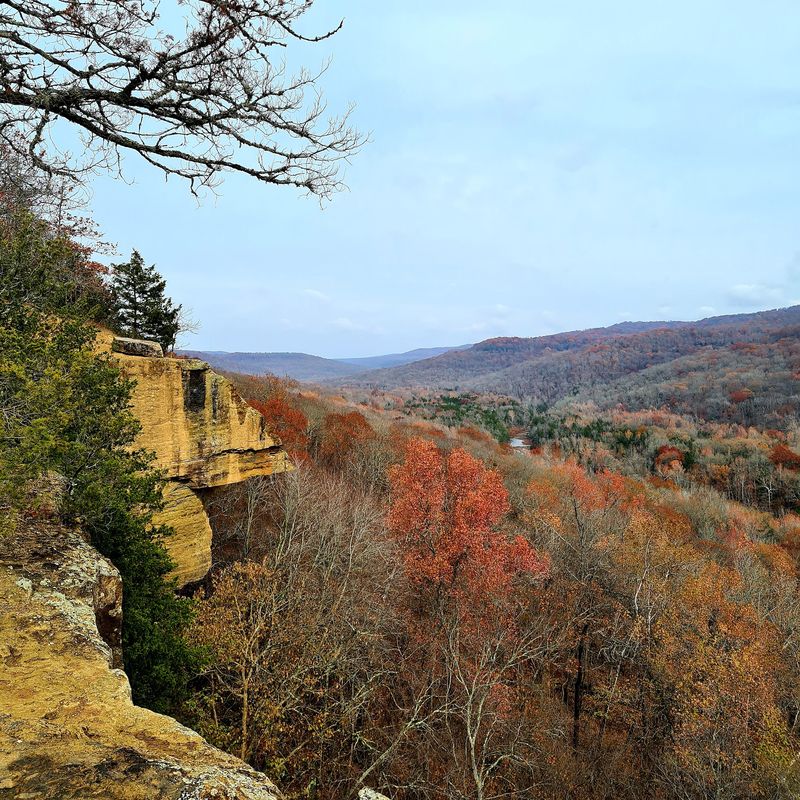
Yellow is a bold color choice for a rock, and this overlook wears it with confidence.
The trail is a moderately challenging hike, with the full 3-mile route taking about two hours to complete.
You’ll find it near West Fork, a small Ozark community with a rural woodland setting. The overlook sits in the Devil’s Den area, a longtime favorite for Arkansas families.
Yellow Rock Trail is a moderately challenging hike with rocky terrain and uphill sections, so beginners should be prepared for a longer climb.
Experienced hikers still get enough of a climb to feel like they earned the view.
Kids who usually groan about hiking might surprise you here. A trail with striking rock formations and scenic views feels more like an adventure than a chore.
Keep your eyes open on the way up, too. The trail passes striking rock formations on its way to the overlook, so the scenery starts long before the big panorama.
Once you reach the top, the overlook spreads out with plenty of room to walk around. That matters when you want a photo without a stranger’s elbow sneaking into the frame.
Timing can make a difference here. Saturday afternoons and evenings tend to draw the biggest groups, while weekday evenings are usually calmer.
Comfortable trail shoes help on the uneven rock. A water bottle never hurts either, even on a shorter uphill walk.
Bring a snack and give yourself extra time at the top. The view is wide enough that a quick glance won’t cover it.
Address: West Fork, AR 72774.
2. Sugar Loaf Mountain Nature Trail
Few hikes in Arkansas require a boat ride before you can even reach the trailhead.
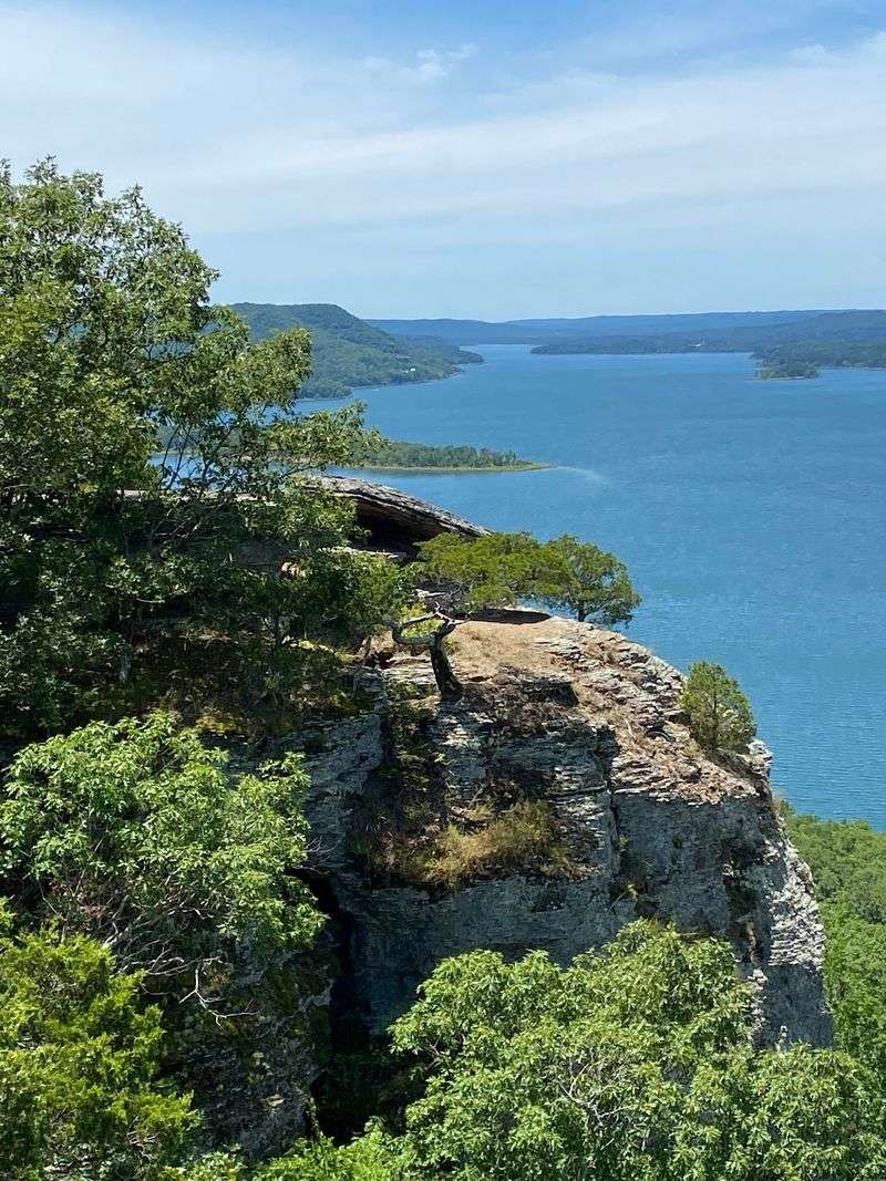
This one sits on an island in Greers Ferry Lake, so the boat ride is part of the fun.
Higden is a tiny lakeside village, and the trail matches that quiet, out-of-the-way feeling. Once you step off the water, the mountain does the talking.
Two trails give you options. One circles the base of the mountain, while the other takes you up and across the top.
Pick the summit route if your legs are feeling brave. The climb includes steep wooden stairs that will make your thighs reconsider their life choices.
Good news, though. The trail is well marked, so you can focus on breathing instead of guessing which way to turn.
Summer brings serious humidity to the island. Start early, carry more water than you think you need, and take breaks on the stairs without shame.
Saturday mornings and afternoons are the busiest stretch. Weekday mornings tend to be quieter if you want the stairs mostly to yourself.
The reward at the top is a spectacular sweep of lake and hills. Steep, sweaty, and absolutely worth it pretty much sums up the experience.
Pack a light bag so the stairs feel easier. A small towel for your face might become your favorite gear of the day.
Address: 818 Woodgrace Rd, Higden, AR 72067.
3. Pinnacle Mountain West Summit Trail
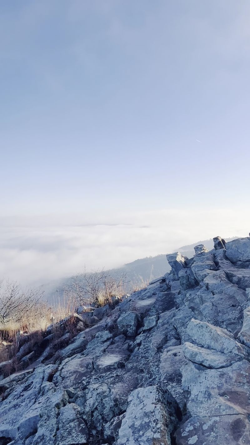
Hands, feet, and maybe a little pride all get involved on this climb. The West Summit Trail on Pinnacle Mountain is famous for its rocky scrambles.
The mountain rises about 1,011 feet with a cone shape you can spot from far away. It’s a landmark of central Arkansas, and climbing it feels like a local rite of passage.
Some sections get steep and bouldery. Hikers who aren’t used to climbing over rocks should take it slow and choose their footing carefully.
Up top, the payoff is huge. You can gaze over Lake Maumelle, the Arkansas River Valley, and the Ouachita Mountains in one turn of your head.
Prefer a different flavor of climb? The park also has an East Summit Trail, plus a Base Trail that connects the routes.
Pinnacle Mountain State Park is a day-use park with no camping. It opens at 6:30 in the morning and closes one hour after sunset.
Weekend afternoons draw the biggest crowds on the trail. An early start helps you beat both the people and the afternoon heat.
After the hike, swing by the newer visitor center for exhibits and restrooms. A Loblolly Creamery Outpost there makes a sweet reward for tired legs.
Bring kids who like climbing on things. They’ll treat the boulders like a giant playground while you focus on catching your breath.
Address: RGQ4+PP, Roland, AR 72135.
4. Arkansas Grand Canyon
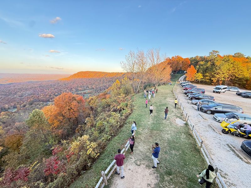
Missouri is visible from here, and you didn’t even have to leave Arkansas to see it. On a clear day, the view stretches about 40 miles north across the state line.
The Arkansas Grand Canyon is a deep, lush valley in the Boston Mountains of the Ozarks. It’s known as the deepest canyon in the Ozarks, which is quite a title to hold.
Getting here is refreshingly simple. The main stop sits along Highway 7 at Scenic Point, south of Jasper, so your car does most of the climbing.
Still want to earn it? Climb the stairs and head up the lookout tower for an even higher view.
From the top, the scene spreads about 50 miles from west to east. Rolling hills and thick forest fold together like a giant green blanket.
Seasons change the look dramatically. Fall color is a big draw, but spring greens put on a strong show too.
Practical perks make this a great road trip stop. You’ll find a gift shop, restrooms, and roadside parking.
A sign at the overlook shares elevation details about the area. Read it before you snap photos, and the view suddenly makes more sense.
Plan a little extra time for the drive itself. Highway 7 winds through the mountains, so slow down and enjoy the curves.
Address: AR 7, Jasper, AR 72641
5. Buffalo Point Overlook
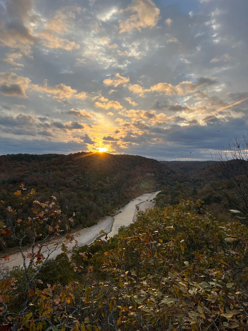
Early birds get the best seat at this one. The short walk to Buffalo Point Overlook makes it an easy spot to watch the sunrise paint the river.
The view centers on the Buffalo National River and its wide river valley. Congress protected the Buffalo in 1972, and the scenery shows why that mattered.
Don’t worry about needing mountain goat skills here. The walk is relatively short, but parts of the trail are narrow, rocky, and uneven.
Bring a flashlight if you plan to arrive before dawn. Watching the valley go from gray to gold is a quiet kind of magic.
The National Park Service manages the trails in this area. That means good chances to keep exploring once you’ve soaked in the overlook.
The surrounding landscape stretches out in layers of ridges and trees. It makes a fine backdrop for photos, even if your camera is just a phone.
Yellville is the nearest town, a small rural Ozark community. It’s a peaceful home base for a river weekend.
Got a friend who hates long hikes? This overlook is your secret weapon for winning them over to the outdoors.
Pack a light jacket for early mornings by the river. Valley air can feel chilly before the sun climbs high.
Stay a while after sunrise, too. The colors change quickly, and the second act is often just as pretty.
Address: Yellville, AR 72687.
6. Red Bluff Overlook
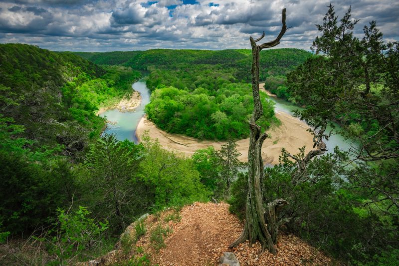
Here’s a twist on the usual climb. At Red Bluff Overlook, you head down first and save the uphill workout for the walk back.
The overlook sits just a few miles outside St. Joe, a tiny Searcy County village. Rugged limestone bluffs define the area, and this one ranks among the tallest on the Buffalo River.
Parking is simple, with a small free lot near the trail. From there, a short path leads you down toward the bluff.
Short doesn’t mean easy, though. The trail is steep and can get slippery, so steady footing matters.
If you feel unsure on rough ground, consider skipping this one. The good view requires that tricky descent, and there’s no shortcut around it.
For confident hikers, the reward is a breathtaking look at the Buffalo River. Once you’re there, it’s a relaxing spot to sit and take in the scenery.
Wear shoes with real grip rather than smooth soles. Dry weather also makes the path far friendlier than after a rain.
Keep kids close and stay well back from the edge. Bluffs this high deserve respect, no matter how calm the river looks.
The hike back up will remind your legs who’s boss. Take it slow, and pause to look behind you once or twice.
Address: St Joe, AR 72675.
7. Sugarloaf Mountain Trails
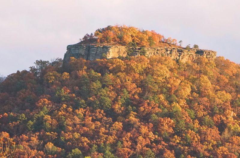
A college campus is the last place you’d expect a mountain adventure to start. These trails sit right behind ASU Heber Springs, which makes them handy for a quick escape.
Heber Springs is a small resort town in the foothills of the Ozarks. Sugarloaf Mountain gives the town a rocky landmark to show off.
The summit trail climbs at a steep incline, but the path stays clean and clear. You’ll feel the burn early, so pace yourself.
Now for the plot twist. Reaching the very top means climbing rock for about 60 feet through natural rock gullies.
Hikers without rock climbing experience may want to stop short of that final push. Going with a friend is a smart move if you plan to try it.
Even below the peak, the scenery rewards your effort. Rugged rock formations keep the climb interesting from start to finish.
The trails are open daily from 7 in the morning until 8 at night. That gives you a long window for a morning hike or an evening outing.
A gender-neutral restroom sits on site, a nice bonus before you start climbing. Saturday afternoons get busiest, while weekday mornings are usually quieter.
The Sugarloaf Heritage Council helps care for the area. Respect the trail so it stays this pleasant for the next hikers.
Address: Trailhead Rd, Heber Springs, AR 72543.
8. Kings River Overlook
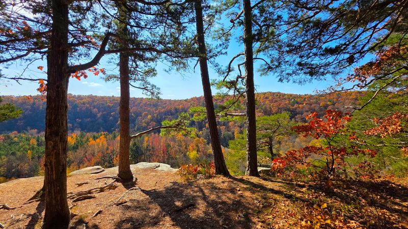
Bald eagles have excellent taste in real estate, and they like this spot in winter. Kings River Overlook perches more than 550 feet above a dramatic bend in the river.
The walk is a moderate, approximately one-mile round-trip hike along a bluff overlooking the Kings River.
It’s mostly gentle, with a brief steep stretch near the end.
The drive is the tougher part. A winding dirt road leads to the trailhead, and it can challenge small cars after a rain.
Most two-wheel drive vehicles can handle it in decent weather. Take it slow, and the quiet waiting at the end makes the bumps worth it.
At the overlook, the Kings River curls through layers of Ozark hills. It’s pure valley drama without a ticket or a crowd of tour buses.
Birdwatchers should bring binoculars. Besides eagles, you might spot red-shouldered hawks and turkey vultures riding the air.
Golden hour and fall are prime times for a visit. Autumn color turns the hillsides into a giant patchwork quilt.
The overlook has a sheer drop-off, so keep children close. Camping and campfires aren’t allowed on the trail or at the overlook.
Want more to explore? Eagles Nest Falls is nearby, making it easy to turn one stop into a full afternoon.
Address: Huntsville, AR 72740.
9. Sunrise Point
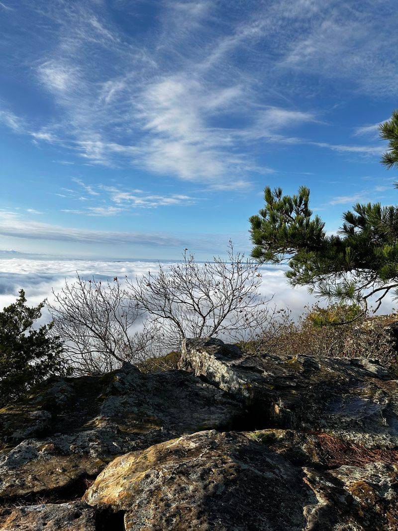
The name doesn’t leave much mystery, and that’s a good thing. Sunrise Point at Mount Nebo State Park faces the eastern sky and wraps its view around to the south.
Below you, the Arkansas River Valley spreads out in wide, glorious layers. Mount Nebo rises about 1,350 feet above the surrounding Arkansas River Valley.
Getting up the mountain is half the adventure. Highway 155 winds steeply to the top, and trailers or RVs over 24 feet should skip it.
History runs deep here, too. Mount Nebo is a certified Trail of Tears National Historic Trail site, connected to the removal of five tribes along the river route.
The Civilian Conservation Corps built many park structures in the 1930s using native materials. Those rustic touches give the mountaintop a sturdy, old-school charm.
Hikers can tackle the 4-mile Bench Trail, which circles the mountaintop. The park offers more than 32 miles of hiking and mountain biking trails.
Like the view so much you don’t want to leave? Here you will find 15 cabins and 34 campsites, including 24 Class B sites and 10 hike-in tent sites.
Mountain breezes often keep the summit cooler than the valley below. That makes summer visits a little more comfortable for sweaty hikers.
Save some energy for Sunset Point later in the day. Catching both ends of the day here is a very Arkansas way to spend a weekend.
Address: Sunrise Cir, Dardanelle, AR 72834.