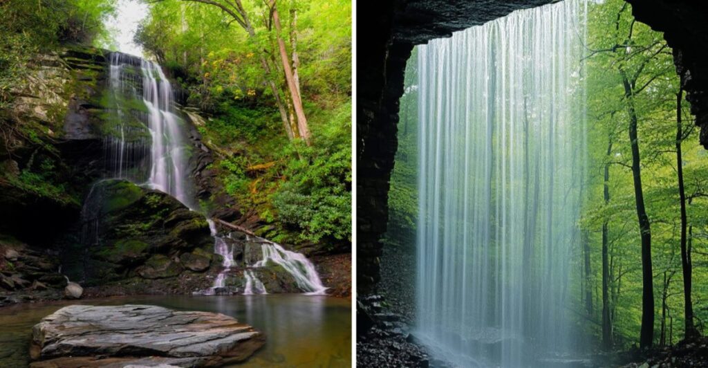
Hear that?
That is probably your cue to keep walking.
In North Carolina, some waterfalls make you work for the reveal. You follow the sound through the trees, round one more bend, and there it is.
Others are much less demanding.
A short walk can be enough.
That means the day does not need a heroic hiking plan. Pick something easy when your legs want a break. Go farther when they do not.
Just remember that wet trails can change the rules quickly.
Good shoes help.
So does knowing when to turn around.
And once you hear rushing water somewhere ahead, are you really going to stop now?
1. Looking Glass Falls
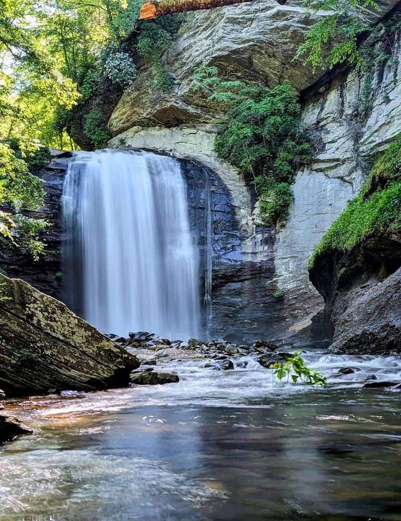
You don’t need a morning-long hike to appreciate a mountain waterfall. Along U.S. 276 in Pisgah National Forest, water drops roughly 60 feet beside the highway, with a roadside view that makes this an easy stop between Brevard and the Blue Ridge Parkway.
Looking Glass Falls has a broad, familiar shape: water sweeps over a rock ledge and falls into a pool framed by boulders and green forest.
The name comes from nearby Looking Glass Rock, whose exposed face can reflect the light, especially when icy conditions give it a glassy appearance.
Start at the roadside viewing area and take in the full waterfall before deciding whether you want to use the steps for another perspective.
Unlike a woodland trail with miles between the parking area and its destination, this stop lets you spend your time looking instead of walking.
It also works when one person in the group isn’t up for a long hike.
The setting changes noticeably with the seasons. In spring, fresh foliage softens the forest around the falls. Autumn frames the drop with orange and gold leaves, while winter sometimes reveals more of the surrounding rock and trees.
Parking is limited to designated spots along the highway, so don’t stop in a travel lane or block access.
Enjoy the water from established viewing locations rather than treating the pool or slick rocks as a swimming invitation. A camera and a few unhurried minutes are really all you need.
Location: Looking Glass Falls Scenic Area, US Highway 276, Pisgah National Forest, near Brevard, NC 28712.
2. Dry Falls
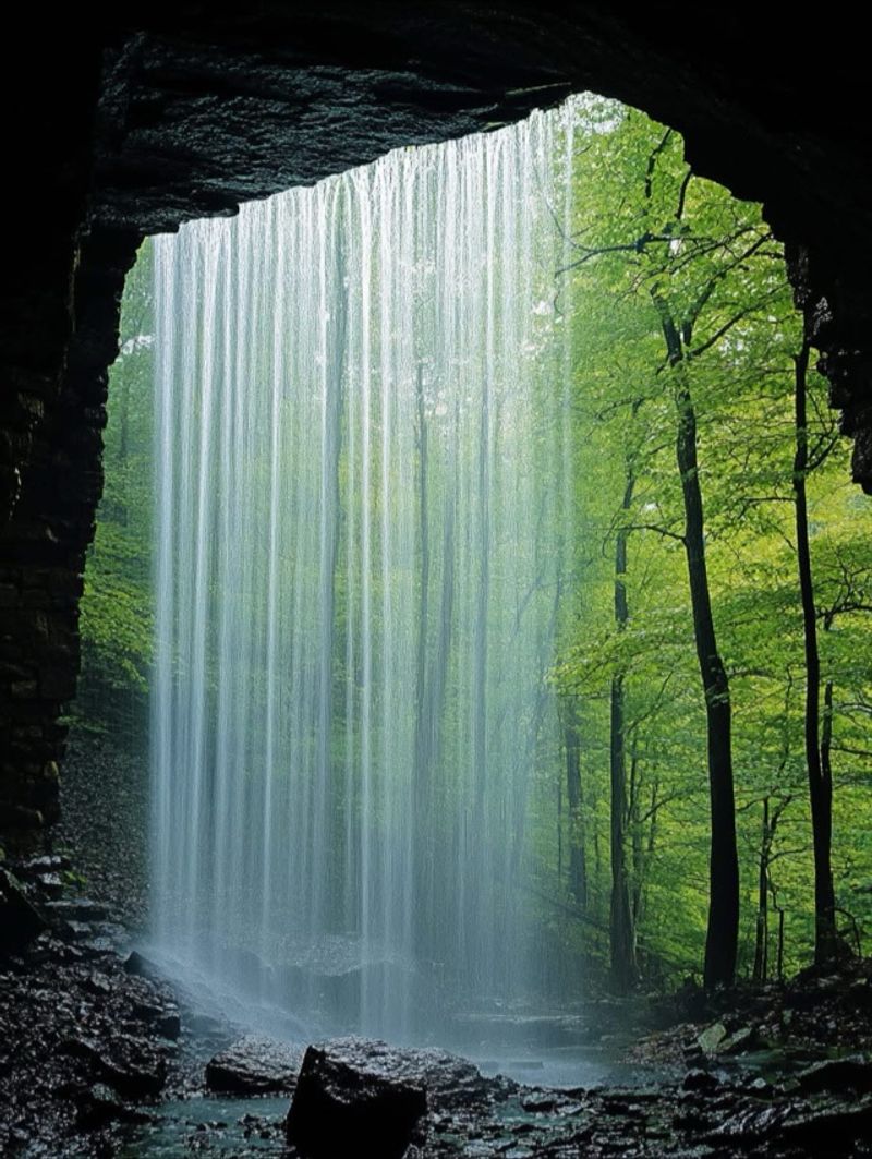
At this Highlands-area waterfall, the most memorable viewpoint is not in front of the water. A trail curls behind the falling curtain, letting you watch the Cullasaja River descend from the shelter of a rocky overhang.
Dry Falls is a roughly 65-foot cascade along U.S. Highway 64 west of Highlands. Its name describes the experience on calmer days, when the overhang can keep visitors relatively dry.
During higher flows, mist reaches much farther into the walkway, so count on at least a little spray rather than perfectly dry clothing.
A viewing platform near the parking area provides one angle without requiring the descent. To go behind the cascade, follow the developed path and stairs downhill. Although the walk is short, it isn’t an entirely level stroll; damp surfaces and steps call for shoes with traction.
The best part comes when the perspective reverses. From behind the waterfall, moving water fills the opening while the trees and gorge appear through the spray. Take a moment here rather than hurrying straight through.
The sound and changing light are part of the attraction.
Pair this stop with a scenic drive through the Cullasaja Gorge, or work it into a Highlands outing with time for another nearby overlook.
The roadside facilities make the visit more manageable than a remote backcountry waterfall, but parking can still be busy during popular travel periods.
Keep to the maintained path and follow posted signs; the rocks around the drop aren’t a shortcut to a better photograph.
Location: Dry Falls Recreation Area, US Highway 64, approximately 3 miles west of Highlands, NC 28741.
3. Upper Whitewater Falls
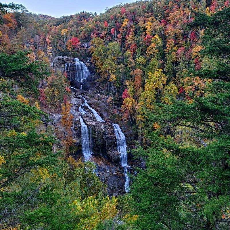
A waterfall that descends hundreds of feet deserves room to be seen. Upper Whitewater Falls delivers that scale from forested overlooks, where ribbons of white water run down a steep mountainside near the South Carolina border.
The upper falls are commonly measured at about 411 feet, making them one of the region’s most striking high cascades. They lie in Nantahala National Forest, and the established viewing areas give visitors a way to appreciate the scene without scrambling into the gorge.
From the parking area, a paved walkway leads to the upper overlook. It’s a practical choice for a shorter visit and offers a broad look at the waterfall surrounded by wooded slopes.
To see it from a different angle, continue to the lower overlook by descending 154 wooden steps.
Those steps are a useful decision point. If you prefer a gentler outing, linger on the upper platform and enjoy the panorama. If you’re ready for more climbing on the return, the lower viewpoint brings another perspective on the cascading water and rock formations.
The changing light can make the falls look different from one visit to the next. Bare branches in winter open longer sightlines, while summer surrounds the white water with thick green foliage. A little cloud cover can be pleasant for photography, too.
There is a recreation-area fee, so plan for that before arriving. Stay on marked walkways and overlook platforms; steep terrain beyond them is not part of the sightseeing route.
Location: Whitewater Falls Recreation Area, Whitewater Falls Road off NC Highway 281, near Sapphire, NC 28774.
4. Soco Falls
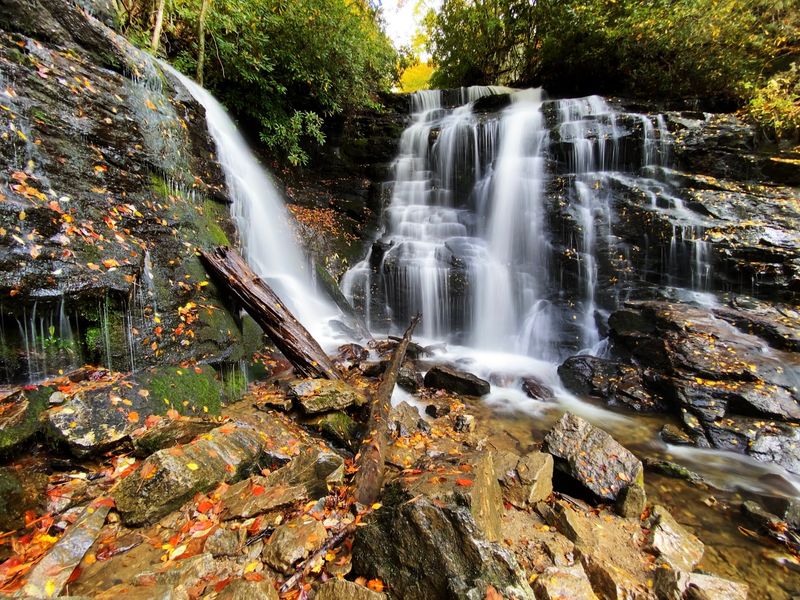
Two streams descend side by side into a wooded hollow, creating the unusual double-waterfall view at Soco Falls. It’s the sort of stop that rewards a short detour without demanding a full hiking day.
The falls sit between Cherokee and Maggie Valley, beside U.S. Highway 19. The setting connects naturally with a mountain drive, particularly if you’re already traveling between the Qualla Boundary and the Blue Ridge Parkway.
The landscape is closely associated with Cherokee country, and visitors should treat the area and surrounding land with care.
Soco Falls has undergone improvements to its access and parking facilities. Use the designated parking area and follow the established trail to the viewing platform rather than looking for an informal route down the hillside.
The walk is short, but wet ground and uneven footing still make sturdy shoes worthwhile.
At the viewing point, look first at how the two separate ribbons of water meet below the ledges. The scene is especially appealing when the surrounding forest is fully green, though autumn foliage can give the falls a colorful frame.
This makes an easy addition to a day with several scenic stops. You might visit the overlook, continue toward Cherokee, and save a longer trail for another part of your trip. With parking capacity limited, keeping the stop relatively brief also helps other travelers use the site.
The steep slope beneath the established lookout isn’t a safer or necessarily better viewing spot. Let the double cascade be the attraction, and leave the scrambling out of the itinerary.
Location: Soco Falls, US Highway 19 between Cherokee and Maggie Valley, NC 28751.
5. Linville Falls
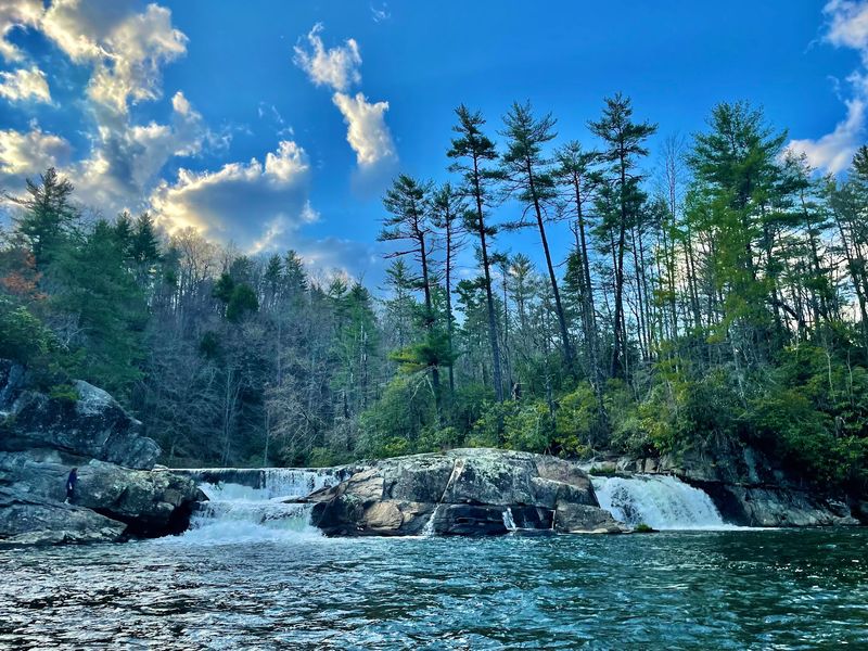
The Linville River doesn’t simply spill over one ledge and disappear. It moves through an upper cascade, narrows into a rocky channel, and then drops into the deep landscape of Linville Gorge. Multiple overlooks let you follow that changing scene.
On the Blue Ridge Parkway, Linville Falls offers one of the region’s classic waterfall-and-gorge combinations. The Erwin’s View route is traditionally a 1.6-mile round trip, with viewpoints that show different parts of the river, cascades, and distant gorge.
The first viewpoint focuses on the upper falls, while farther stops broaden the scene. The final overlook looks toward the gorge and gives the outing a sense of scale that a close-up waterfall photograph cannot capture.
Expect some climbing and uneven terrain, rather than assuming the whole route is a flat stroll.
There is an important practical detail for planning. Hurricane Helene affected this area, and some trails remain closed. The upper-falls trail is accessible, but the route toward the gorge remains restricted.
The visitor center, campground, and picnic area are closed, and nearby Parkway road access can change during reconstruction. Check the current trail map and posted signs before setting out, and choose only open overlooks.
For a slower visit, take breaks as the viewpoints unfold. The gorge itself offers just as much to notice as the water: layered rock, forested walls, and changing shadows throughout the day.
Swimming and rock climbing around the river are prohibited. This is a place to observe the force of the water from designated trails rather than seeking access to the pool beneath the drop.
Location: Linville Falls Trail Access, Blue Ridge Parkway Milepost 316.4, near Linville Falls, NC 28647.
6. Catawba Falls
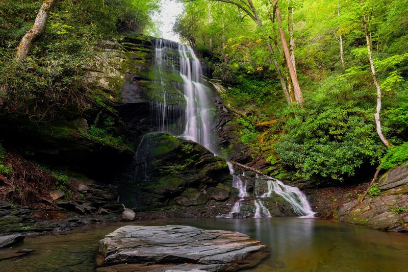
A walk beside the headwaters of the Catawba River builds toward a wide set of cascades spilling over layered rock. The waterfall’s appeal isn’t a single straight plunge; it’s the way water finds several routes down the stone face.
Catawba Falls lies near Old Fort in Pisgah National Forest, an easy destination to consider when traveling east of Asheville.
The trail system has been improved to offer a broader hiking experience, including routes with overlooks and significant stair climbing for visitors choosing the longer option.
For a manageable outing, follow the river corridor toward the lower waterfall views, enjoying the sound of water alongside the trail.
The full loop is a more demanding undertaking than a simple waterfall stroll, with sustained elevation change and many steps.
Choose your route based on the group’s energy and the posted trail information.
A mix of forest shade, rock, and cascading water makes the approach part of the experience. On warm days, tree cover is welcome; in autumn, fallen leaves and changing color can make the path equally memorable. Keep shoes with reliable grip, especially after rainfall.
Some features have remained closed during recovery work, including the upper viewing platform and Wildflower Trail. Respect closures even if a route appears inviting beyond a barrier. Trail conditions can shift, so it makes sense to confirm access before driving out.
This is one waterfall where bringing water and allowing extra walking time improves the day. Rather than rushing to a single photograph, enjoy the smaller scenes along the river on your way to the falls.
Location: Catawba Falls Trailhead, 3074 Catawba River Rd, Old Fort, NC 28762.
7. Triple Falls
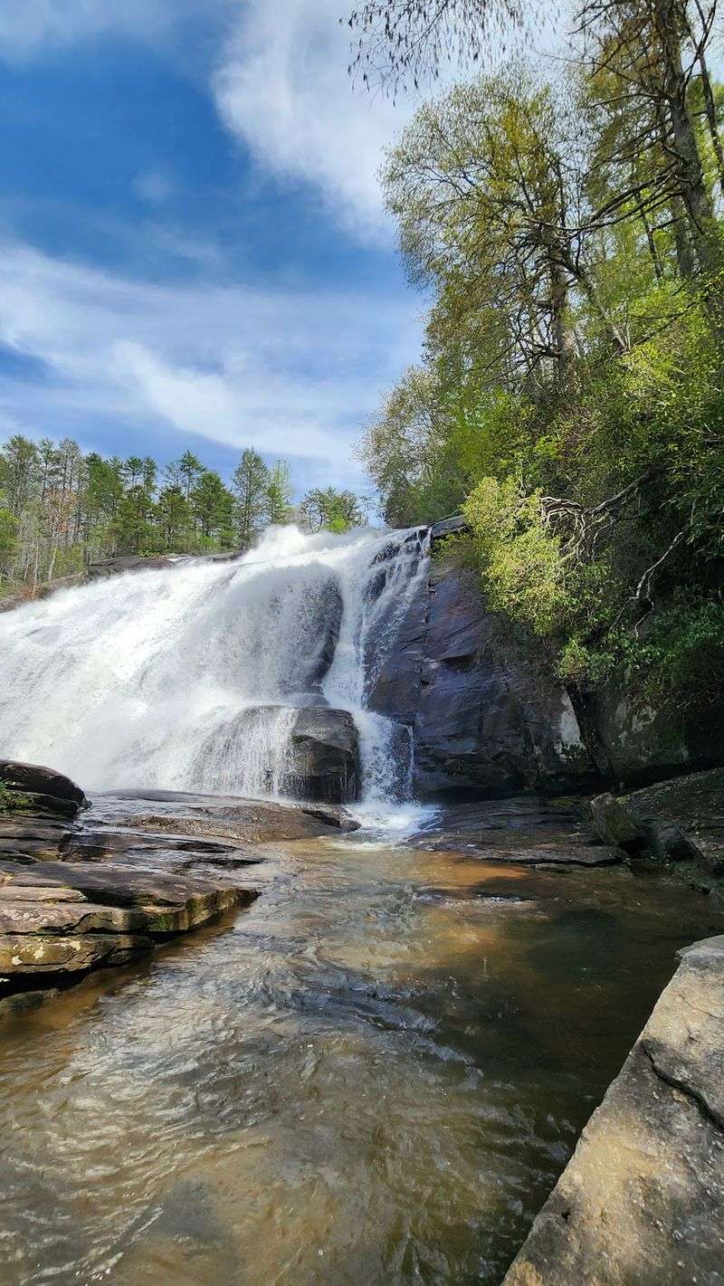
Triple Falls: Three Steps Along the Little River
One waterfall, three broad tiers: Triple Falls makes its shape immediately clear. The Little River tumbles down a staircase of rock in DuPont State Recreational Forest, giving the scene a dramatic profile from the maintained overlook.
The falls also have a screen connection, appearing in The Hunger Games. Even without recognizing the setting, it’s easy to see why filmmakers were drawn to the distinct tiers and surrounding forest.
You can approach from the Hooker Falls access area or the High Falls access area. The trail from the Hooker Falls side includes a steep section, so what seems like a short hike on a map can still raise your pulse. Wear comfortable hiking shoes and give yourself time for the climb.
At the overlook, stop where the three drops come into view together. The tiers make for a natural composition, and the movement of the water across the rocks is interesting enough without trying to move closer.
The stairway that once led to a nearer view was damaged during Hurricane Helene and remains closed. Stay with the open trail, shelter, and overlook, and do not cross barriers to reach the river or rocks. The established viewpoint is the intended destination.
If you have more time, continue your day at High Falls, another waterfall in the same forest. Or keep things easy with a picnic at a designated area and a shorter loop back to the car. Bring your own snacks, drinking water, and a bag for litter; the forest has limited services.
Location: DuPont State Recreational Forest, Hooker Falls Access Area, Staton Road, near Cedar Mountain, NC 28718.
8. Hooker Falls
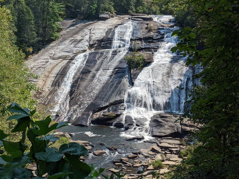
Height isn’t everything. At roughly 12 feet, Hooker Falls is much shorter than many mountain cascades, yet its broad curtain of water makes an appealing destination after only a brief walk beside the Little River.
The falls lie in DuPont State Recreational Forest, where an established access area provides parking and a short path to the river.
This is one of the forest’s more approachable waterfall outings, especially if someone in your group prefers a modest walk over a steep mountain trail.
Look at how the current spreads across the ledge rather than dropping through a narrow chute. The wide pool below gives the location a very different character from the dramatic gorge views at Linville or the high cliff at Whitewater Falls.
The site has a piece of local history, too. Edmund Hooker operated a mill below the falls in the late nineteenth century, and the cascade was once called Mill Shoals Falls. The old name fits the broad, low shape you see today.
Hooker Falls has a pool below the cascade, but moving water is unpredictable. Never swim or wade upstream of the falls, climb on wet ledges, or assume the pool is clear of hidden obstacles. Enjoying the view from the shore is a perfectly good choice.
The parking area includes restrooms, and the trail provides a convenient starting point for nearby Triple Falls if you decide to extend the outing. Keep an eye on the time and trail map before adding the steeper walk.
Location: Hooker Falls Access Area, Staton Road, DuPont State Recreational Forest, near Cedar Mountain, NC 28718.
9. Rainbow Falls
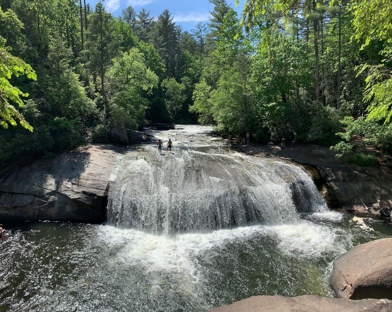
Sunlight and waterfall spray can produce a rainbow, and this powerful cascade has earned its name from that colorful possibility. Even when the colors don’t appear, the sheer drop and rush of the Horsepasture River make the trip worthwhile.
Rainbow Falls plunges about 150 feet in Pisgah National Forest. Its most commonly used trail begins at nearby Gorges State Park’s Grassy Ridge access, where a well-marked route leads toward the river and the waterfall. The falls themselves lie beyond the state-park boundary.
Plan for approximately three miles round trip, with significant downhill walking on the way in and uphill effort on your return.
The trail is classified as strenuous, so it’s better suited to walkers prepared for uneven ground and elevation change than to anyone expecting a quick roadside stop.
The landscape changes as you follow the route: woodland, river sound, and finally the broad cliff where the water drops. Give yourself enough time to pause at safe viewpoints and take in the scene. In bright conditions, the drifting mist may catch a little color.
Turtleback Falls lies farther upstream, but don’t treat its rounded rock as an invitation to slide. Fast current and slick stone make moving outside established routes hazardous. Stay on the marked trail and well away from the edges of the river and cascade.
The Gorges visitor center offers an opportunity to look at park information before your hike. Carry water, check the weather, and aim to finish comfortably before the park’s evening gate hours.
Location: Gorges State Park, Grassy Ridge Access, 976 Grassy Ridge Rd, Sapphire, NC 28774.
10. Lower Cascades Falls
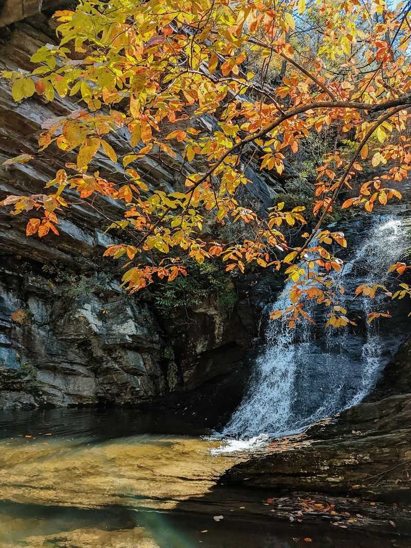
You don’t have to drive all the way to the high western mountains for a waterfall framed by dramatic rock. In Hanging Rock State Park, a short woodland trail drops into a stone-lined hollow where Lower Cascades tumbles into a round pool.
The waterfall is about 35 feet high, but the setting gives it a larger presence. Tall rock walls wrap around the basin, creating an enclosed view unlike the open mountainside panoramas farther west.
Lower Cascades has its own parking area, separate from the main Hanging Rock visitor center.
From there, the marked trail is approximately 0.4 mile one way.
The distance is modest, but the final descent includes steep wooden and stone stairs, and those same steps await on the return climb.
Start slowly and take time to look around as you reach the bottom. Depending on the light, the rock walls can appear warm and textured or cool and shaded. The falling water becomes the center of a natural amphitheater, with foliage filling in the upper edges.
Because the trail includes stairs and uneven surfaces, this isn’t a completely effortless walk or a stroller route.
Good footwear matters more than the mileage might suggest. Enjoy the pool and rocks from designated places rather than entering closed or unsafe areas around the falls.
For a longer day, the rest of Hanging Rock State Park offers trails, forest views, and other scenery. But this separate access makes Lower Cascades a satisfying destination even when you have time for just one short hike.
Location: Lower Cascades Trailhead, 2143 Hall Rd, Westfield, NC 27053.