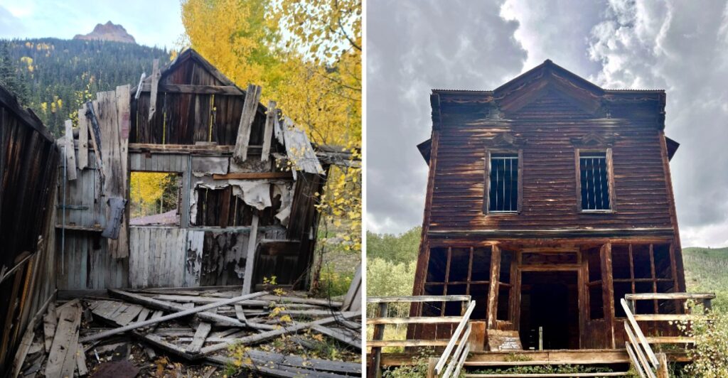
A town does not disappear all at once.
First the work dries up. Then the shops close. Eventually, the street gets quiet enough for the mountains to take over the conversation.
That is what makes old mining towns so interesting.
In Colorado, some lasted only a few years. Others grew big enough for schools, newspapers, and busy main streets before the boom moved on.
Now you get the leftovers.
A cabin beside an empty road. A storefront with no customers. Maybe a row of buildings that still makes it easy to imagine the place on its busiest day.
Getting there can be part of the story too. Some stops are simple. Others sit much farther into the mountains.
Either way, the strange part is not that these towns were abandoned.
It is how much they still manage to say.
1. St. Elmo
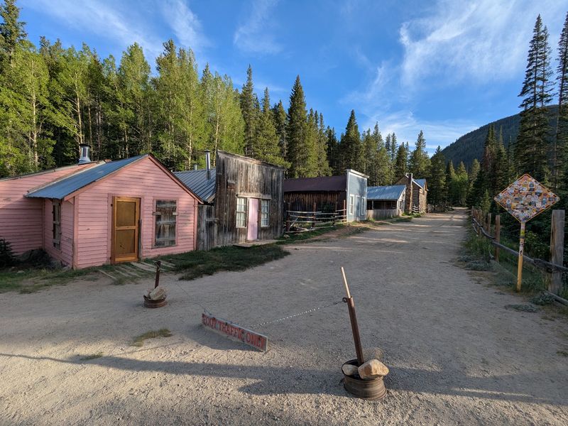
A row of weathered wooden storefronts makes the main street feel like a scene from another century. Store signs, old porches, and a mountain backdrop give this former mining center a remarkably intact appearance, even though daily life is much quieter than it once was.
St. Elmo developed during the mining boom of the 1880s. Gold and silver prospects drew workers and merchants into Chalk Creek Canyon, and the community gained hotels, shops, and railroad connections.
Nearby mines, including the Mary Murphy, helped sustain the local economy before changing transportation and mining conditions gradually reduced activity.
This is a good place to begin a Colorado ghost-town trip because you can appreciate many buildings from the public road. Walk slowly along the historic street and notice how tightly the former businesses stand together.
Their false fronts once gave modest wooden structures the appearance of substantial commercial buildings.
The general store operates seasonally, providing a rare hint of activity among the older structures.
Some properties remain privately owned, so treat a picturesque porch or open-looking doorway as something to admire rather than an invitation to enter. Keep children close around old foundations and avoid any abandoned mining workings nearby.
The mountain journey is part of the attraction. County Road 162 follows Chalk Creek through a valley of forested slopes, with summer generally offering the easiest access. Road and weather conditions can change outside the warmer months.
If your day allows, combine the stop with scenic overlooks in the canyon rather than trying to inspect every structure up close.
Address: County Road 162, St. Elmo, near Nathrop, CO 81236.
2. Ashcroft
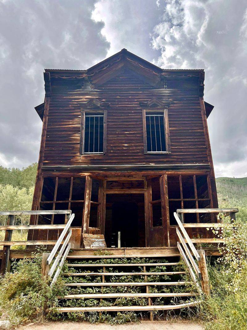
A broad alpine meadow dotted with log buildings gives this former silver town a different personality from a crowded wooden main street. Mountains rise behind the cabins, while interpretive paths reveal where a once-active community worked and lived.
Silver discoveries in Castle Creek Valley encouraged the growth of Ashcroft in 1880. The camp developed shops and civic buildings, but its prosperity was brief.
Shallow ore deposits and the stronger appeal of nearby Aspen drew residents away; some even moved their cabins to more promising locations.
Today, restored and relocated historic structures help visitors picture that early period. Aspen Historical Society maintains the site, with signs along the route and staff available during seasonal docent hours.
The self-guided walk is appealing if you like to set your own pace and pause for mountain views between buildings.
One easy approach is to start at the welcome cabin, look across the meadow, and follow the main thoroughfare.
Parts of the route are rudimentary boardwalk, but rocky, uneven ground means you should not assume the entire site is smooth. A light jacket is useful even on a bright summer day.
Admission is generally handled through a modest fee or honor system, and seasonal tours can add context. Pets are not permitted in the ghost town.
This is also ancestral Ute country, a history that extends well before the arrival of prospectors and deserves a place in how you understand the valley.
The paved Castle Creek Road makes Ashcroft an accessible historical stop when conditions permit. Come for the cabins, but leave time for the open valley and its changing mountain light.
Address: 11000 Castle Creek Road, Aspen, CO 81611.
3. Animas Forks
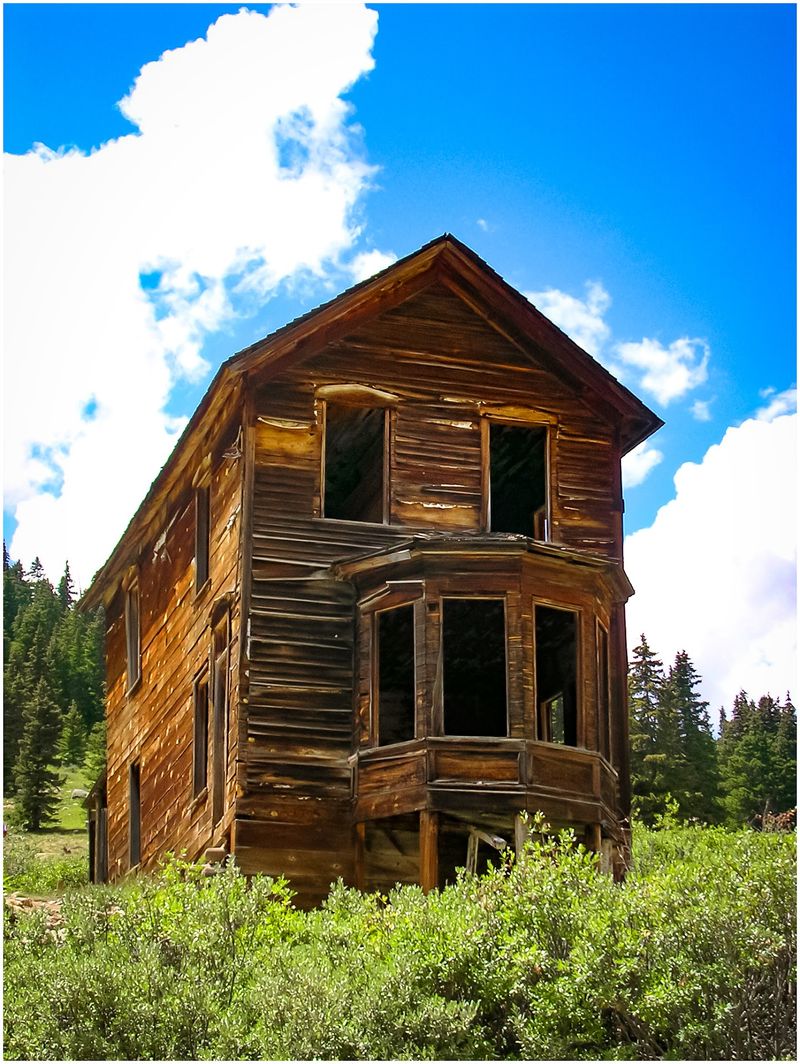
At roughly 11,200 feet, a cluster of cabins seems almost impossibly high above the everyday world. Mountain ridges surround the townsite, and the thin air makes a short walk feel different from a stroll at lower elevations.
The first cabin appeared here in 1873. Animas Forks expanded into a mining settlement with a hotel, store, post office, and even a newspaper. Around 450 people lived here by 1883.
Snow and isolation shaped daily life; an 1884 storm reportedly left more than twenty feet of snow, forcing residents to dig between buildings.
The remaining structures show the varied ambitions of the settlement. Look for the distinctive two-story house with a bay window, simpler log cabins, and traces of the surrounding mining industry.
Interpretive displays help connect the visible buildings with a town that eventually faded after mine operations declined.
The approach deserves careful planning. The Bureau of Land Management describes the summer road from Silverton as potentially passable by two-wheel-drive vehicles, but it remains unimproved and conditions vary.
Beyond Animas Forks, routes toward Engineer Pass can require high-clearance four-wheel drive and substantial mountain-driving experience.
Choose your turnaround point before setting out. A guided off-road trip can be a more comfortable option when you would rather enjoy the San Juan scenery than negotiate rocky stretches yourself.
Stay on public roads and marked paths, and never enter old mine openings or unstable buildings.
Summer is the practical season for most visits. Bring water, rain layers, and sun protection; weather at this elevation can change sharply during an afternoon.
Address: Animas Forks Historic Site, County Road 2, near Silverton, CO 81433.
4. Independence
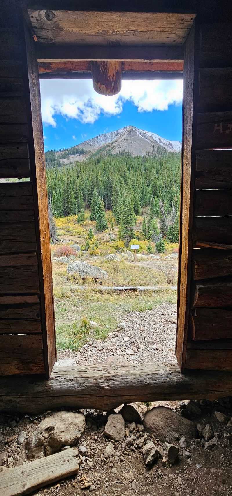
A few log structures scattered across a high slope are all you need to imagine how challenging life could be here. The setting is just below Independence Pass, where the growing season is short and mountain weather has always called the shots.
Gold was discovered around July 4, 1879, inspiring the settlement’s patriotic name. Within a few years, Independence had mines, a mill, businesses, and hundreds of residents. The deposits proved limited, and Aspen’s expanding silver economy drew workers away.
By the end of the century, only a small community remained.
One story from the winter of 1899 captures the isolation. With severe snow blocking supplies, residents made skis from long boards and traveled toward Aspen.
It is an unforgettable detail to consider while walking beside the remaining cabins on a summer afternoon.
Aspen Historical Society stewards this archaeological preserve within the White River National Forest. Interpretive signs guide a self-directed visit, and the paths cross uneven mountain terrain.
A suggested donation supports care of the site; pets are not permitted, and visitors should not expect restrooms here.
You can pair the stop with a drive over the pass when Highway 82 is open, but seasonal closure is a real limitation rather than a minor inconvenience. Unlike Ashcroft, the townsite is not available for ordinary road access throughout winter.
Pause to look across the valley before turning back. The surviving buildings are modest, yet their location says plenty about the determination required to establish a town so close to the Continental Divide.
Address: Highway 82, 16 miles east of Aspen, near Independence Pass, CO 81611.
5. Vicksburg
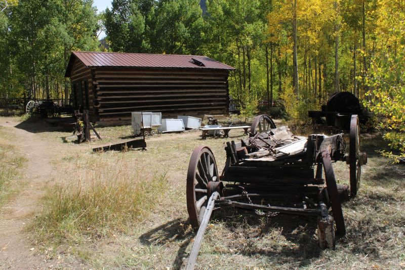
The straight row of trees is what first makes this settlement stand out. They mark a historic village lane through Clear Creek Canyon, where surviving log cabins provide glimpses of everyday life during the silver rush.
Prospectors entered the canyon during the nineteenth century, and Vicksburg developed rapidly after the discoveries of the late 1870s. Shops, hotels, a schoolhouse, and workshops served miners who needed far more than pickaxes.
The town eventually declined, but some cabins remained in use and preservation efforts protected the historic landscape.
Rather than searching for a dramatic abandoned mill, start with the little details: hand-built log walls, the spacing between cabins, and the trees that make the old street unusually recognizable.
These are traces of a place where people cooked meals, raised families, and conducted business despite the remote setting.
Vicksburg is reached from U.S. Highway 24 by following County Road 390 past Clear Creek Reservoir. The road is generally approachable by ordinary vehicles in suitable conditions, although gravel, weather, and seasonal maintenance still matter.
Drive cautiously and use established parking areas.
The community includes protected historic structures and private holdings. Respect signs and boundaries rather than treating the whole townsite as an open-air building tour. A quiet walk on permitted routes provides plenty to see without crossing anyone’s property.
If you have more time, continue farther into the canyon toward Winfield. The two settlements make a natural pairing, with mountain scenery unfolding between them and different building styles to notice along the way.
Address: County Road 390, near Granite, CO 81211.
6. Winfield
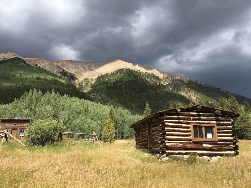
At the upper end of the drive into Clear Creek Canyon, a restored schoolhouse provides a focal point for an old mining settlement. Forested slopes and mountain peaks surround it, making the place feel far from the busy highways below.
Winfield developed as prospectors explored the valley during the late nineteenth century. Mining attracted merchants and families, and the settlement acquired businesses and community buildings.
As the local economy weakened, many residents moved elsewhere, leaving a scattering of cabins and reminders of the old town.
The schoolhouse is one of the most memorable surviving structures. Its simple shape makes it easy to picture lessons taking place while miners worked in the surrounding mountains.
Other historic buildings and remnants tell a less polished story, showing how weather and time have affected the settlement differently.
A visit here works especially well after Vicksburg. County Road 390 leads to both sites, though surfaces become rougher farther into the canyon.
Conditions beyond the ordinary two-wheel-drive road vary, so avoid committing to a rocky side route without the proper vehicle or reliable local information.
Walk around the permitted historic area and allow the scenery to share the attention. Clear Creek runs nearby, and hiking routes in the wider valley head into more demanding alpine terrain.
Those longer trails are separate adventures and should not be confused with a brief townsite visit.
Bring food and water rather than expecting services at the end of the road. Follow preservation signs, leave artifacts untouched, and admire the cabins from safe ground rather than testing fragile floors or stairways.
Address: County Road 390, Winfield, near Granite, CO 81211.
7. Tomboy
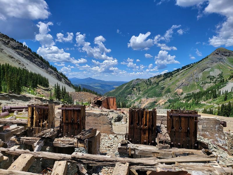
High above Telluride, old mining structures dot a rugged slope beside one of the region’s best-known four-wheel-drive routes.
It is a striking setting for a former community that once supported hundreds of people at an elevation where even summer weather can feel unpredictable.
Tomboy grew around gold mining and developed more than basic cabins. The high-altitude settlement had a school, store, YMCA, and recreation facilities, including tennis courts.
The mine closed in the late 1920s, and the town gradually emptied, leaving structural remains and traces of heavy industrial work.
The route from Telluride follows Tomboy Road toward Imogene Pass, with rocky surfaces, tight turns, and steep, exposed sections. Lower Tomboy Road can close for repairs or changing mountain conditions, preventing vehicles from reaching the townsite.
Check San Miguel County’s current pass conditions before making plans; when the road is open, independent drivers need a capable high-clearance four-wheel-drive vehicle and genuine off-road experience.
A guided jeep excursion is another option when operators can access the route.
When you reach the historic area, make viewing from the public road your plan. Some ruins are on private property and are not an invitation to explore inside. Old beams, mine workings, and loose material can be unstable.
The weathered outline of a building against the mountains is impressive without stepping over a boundary.
Access is seasonal and never guaranteed. Roadwork, storms, and washouts can stop a trip well before the ruins, so honor barricades rather than attempting a workaround. Restrictions also apply to unlicensed off-highway vehicles on the lower section near Telluride.
The road, the high basin, and the surviving industrial silhouettes give you a sense of the effort needed to sustain a mining community so far above town.
Address: Tomboy Road (Imogene Pass Road), near Telluride, CO 81435.
8. Ironton
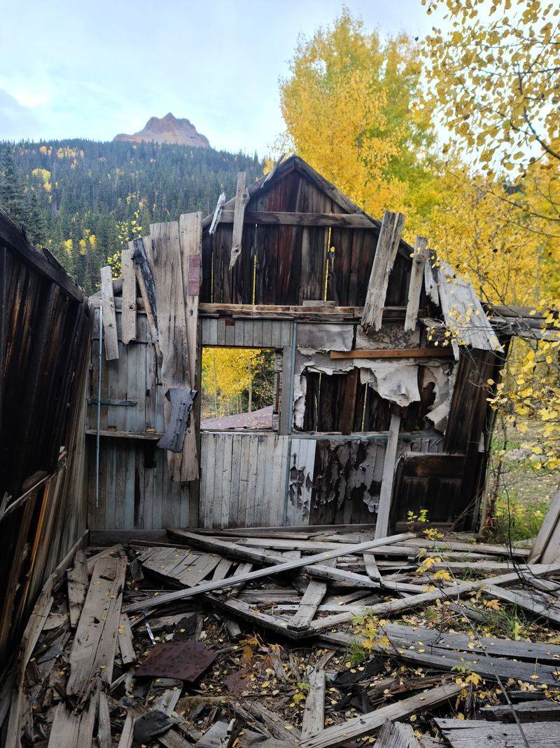
The surrounding mountains give this former settlement its palette: rust-red slopes, dark evergreens, and pale wooden buildings that appear among the trees. Along the Red Mountain corridor, Ironton makes an inviting historical pause on a famously scenic drive.
The settlement emerged during the early 1880s as nearby silver mines developed. Unlike some camps built directly around a single mine, it helped support travel, supplies, and the broader mining district.
Rail connections and mountain roads once brought people and materials through an area that now feels much quieter.
The mining downturn of the 1890s weakened the community, though occupancy did not vanish overnight.
Several old buildings and traces of former activity remain visible amid the forest. Their condition varies, and the landscape continues to change with snow, wind, and time.
For a relaxed visit, explore the publicly accessible area from safe paths and admire structures without entering them.
An aged roof or tilted wall may look picturesque, but that does not make it sound enough for visitors. Leave any fragments of equipment or household items exactly where you find them.
Ironton lies near U.S. Highway 550 on the route between Ouray and Silverton. The approach is far easier than the rough off-road climb to Tomboy, although mountain highway conditions can still be serious during snow or storms.
A little extra time opens up scenic pullouts along the Red Mountain corridor, where the colors of mineral-rich slopes contrast with the high peaks. Keep the visit flexible; the historical remains deserve a measured walk, not a rushed scramble among the structures.
Address: U.S. Highway 550, Red Mountain Pass area, near Ouray, CO 81432.