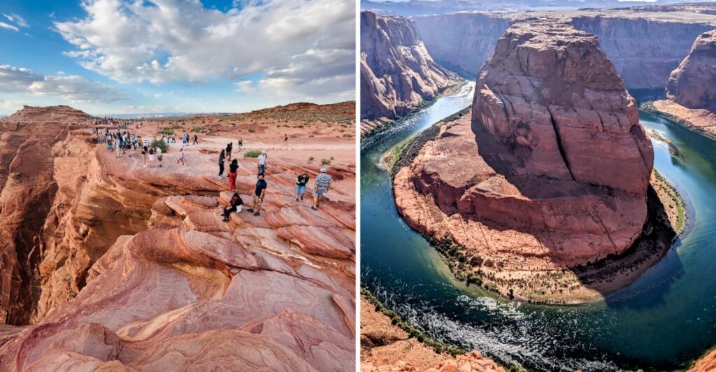
This is the kind of view that makes everyone at the railing go quiet for a second.
Then the cameras come out.
Far below, the river bends around a massive wall of sandstone so neatly it almost looks designed that way.
It is not.
That curve has been carving through this corner of Arizona for a very long time, and the scale does not really hit until you are standing above it.
The walk in is manageable, but the desert does not care how short the trail looks on paper.
Bring water. Watch the heat. Save a little energy for the way back.
Then take your time at the overlook.
Because once you see that bend from above, how are you supposed to settle for just one photo?
Why Horseshoe Bend Is One Of Arizona’s Most Photographed Natural Landmarks
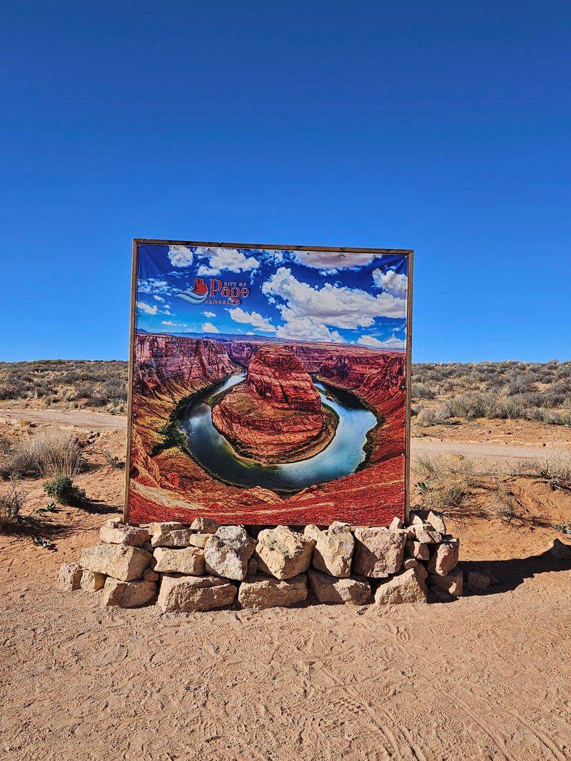
Calendars, postcards, and phone screens have carried this particular river curve well beyond northern Arizona.
At the overlook, the appeal starts with color. Water appears green or blue against bands of red and orange sandstone, with shadows darkening the canyon walls as the light moves.
Shape matters too. The Colorado River wraps around a massive rock formation in a sweeping horseshoe, so the bend fits naturally into a wide landscape photograph. The canyon walls provide a frame without any need to move along the rim in search of a more dramatic edge.
You don’t need fancy gear to enjoy it. A phone camera can capture the river and much of the rock, although a wider lens helps include more of the surrounding cliffs. Try holding the camera level and leaving a little space above the far rim.
The protected viewing platform is a sensible place to start. Look over the full curve before deciding whether to take a photo. Trace the river as it disappears around both sides of the central formation before starting the walk back.
How The Colorado River Carved Such A Graceful Canyon Curve
Water doesn’t look strong when you sip it from a bottle. Give it a very long time and a raised sandstone plateau, though, and the story changes completely.
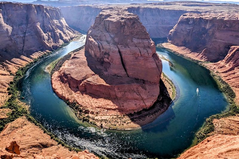
Horseshoe Bend is an entrenched meander. The Colorado River once followed a winding course across a landscape that was not cut nearly as deeply as the canyon you see today.
As the Colorado Plateau rose, the river continued along its existing curves while cutting downward through rock.
The result is a giant sandstone formation sitting in the middle of a river bend. The river makes a turn of roughly 270 degrees around it, giving the overlook its distinctive horseshoe shape.
Look closely at the canyon walls and you’ll notice layers stacked like pages in a book. They form bands across the steep rock faces and reveal changes in the ancient environments that produced the region’s sandstone.
The Dizzying 1,000 Foot Drop That Steals Your Breath
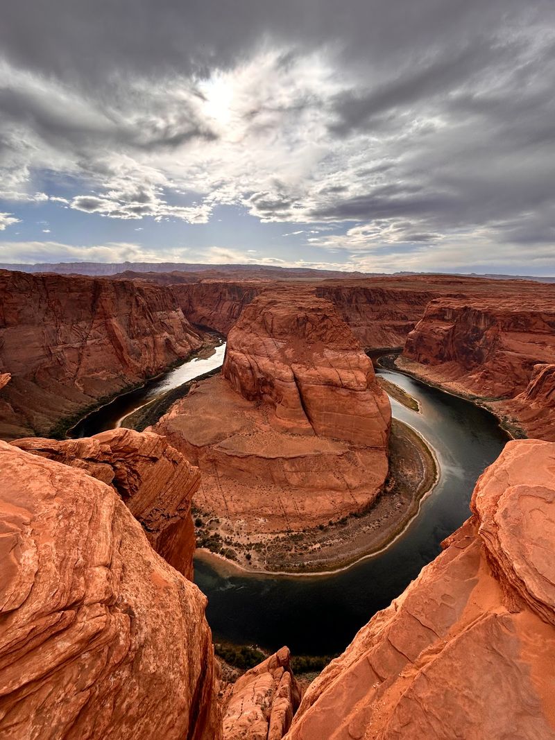
Your knees might wobble a little at first. The overlook sits roughly 1,000 feet above the Colorado River, and the difference in height is immediately apparent when you look down into the canyon.
Boats on the river, when present, look tiny from the rim. Patches of vegetation along the water appear as narrow green strips against the sandstone. The canyon is wide enough that the opposite walls seem close in a photograph but stand across a substantial gap.
A safety railing lines the main viewing platform, offering a protected place to take in the scene.
Much of the surrounding rim remains open and natural, however. There is no continuous fence along the cliffs, and a better camera angle is never a reason to approach the edge.
Keep children close and pets on a short leash. Stay behind the railing where it is provided and give yourself room to stand securely, especially when other people are taking pictures nearby.
Wind can pick up along exposed rock. Secure hats and loose belongings before reaching the viewpoint, and avoid leaning out to retrieve anything. Spend a few quiet minutes simply looking across the canyon before beginning the walk back.
Strolling The Desert Trail Toward The Famous Viewpoint
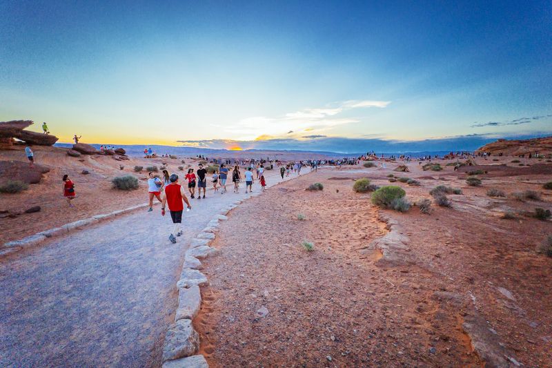
Good news for anyone who dreads long hikes: reaching the overlook takes a 1.5-mile round-trip walk from the parking area. The route follows a hardened, accessible trail rather than a rough scramble over slickrock.
The path is broad and lined in places with native stone. It is designed for wheelchair and stroller access, although the open desert setting and changes in grade still call for preparation. Travelers with mobility concerns can allow extra time and take breaks as needed.
Two shaded rest structures with benches stand along the route. There is no shade shelter at the overlook itself, so these stops are especially useful on sunny days.
The walk toward the canyon includes a downhill section. Coming back involves climbing toward the parking lot, often in direct sun. Pace yourself on the return and use the rest structures if you need a breather.
Nobody hands out medals for rushing.
Comfortable, sturdy shoes work better than thin sandals on a desert outing. Carry drinking water from the car because none is provided along the trail, and visit the restrooms at the parking area before setting off.
The trail is open for daylight visits, from sunrise to sunset. Check the sunset time for your travel date before leaving the parking area. Allow enough time to reach the viewpoint, enjoy it, and return before closing.
A relaxed visit can easily take more than an hour once photo stops and rest breaks are included.
Golden Light At Sunrise And Sunset Across The Canyon
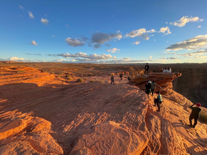
Picture soft orange light spilling across red cliffs while shadows stretch over the river. The canyon changes throughout the day as sunshine reaches different walls and leaves others in shade.
Sunrise and sunset are natural choices for landscape photographs, but each comes with a practical decision. An early visit places the walk in cooler morning conditions during warmer months. A late visit brings changing evening light, yet leaves less daylight for the return trail.
Midday brings brighter illumination and potentially sharper contrast between sunlit sandstone and shadowed canyon walls. On a clear day, adjust your camera exposure so the bright rock does not wash out the darker river below.
A wide-angle lens helps fit the curve into a single frame. Keep a lens cloth handy for desert dust during the walk and while taking pictures. Phone users can try a panorama, taking care to keep the horizon level.
Even without the entire bend in the photo, a close composition of layered rock and water can show a different side of the canyon.
If you choose a sunset visit, work backward from the daylight closing time. Keep enough time for the uphill walk rather than counting on using the trail after dark. The safer photograph is the one you can take without hurrying at the rim.
Parking Fees, Desert Heat, And Smart Packing Tips
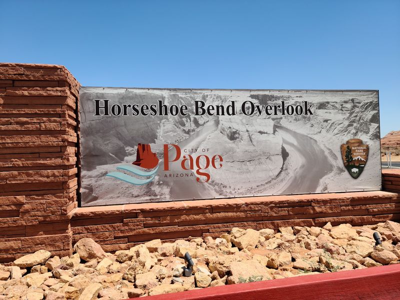
Surprise fees can sour a trip fast, so here’s the practical part. The City of Page manages the parking area and charges a separate fee for leaving a vehicle at the Horseshoe Bend trailhead.
National Park Service and America the Beautiful passes do not cover that city parking charge. Check the parking arrangements before setting out, especially during holiday periods when high demand may affect access to the lot.
Restrooms are available near the parking area, but not out on the trail. Take care of those essentials before walking toward the rim. The path has a couple of rest shelters, yet most of the route remains exposed to direct sunlight.
Summer heat is a serious consideration. Carry plenty of water, wear a hat and sunscreen, and plan the walk for cooler daylight hours when possible. Slowing your pace is a better choice than pushing through dizziness or overheating.
Traveling with a dog? Pets are permitted on a leash, but desert ground can become much hotter than the surrounding air. Bring water for your companion and consider protective booties when the surface is warm.
Never leave an animal unattended in a parked vehicle.
Pack out what you bring in, keep to the maintained trail, and carry only what you can comfortably manage on the climb back. A small daypack keeps water and supplies together.
Finding The Bend Near Page And Mapping Out Your Day
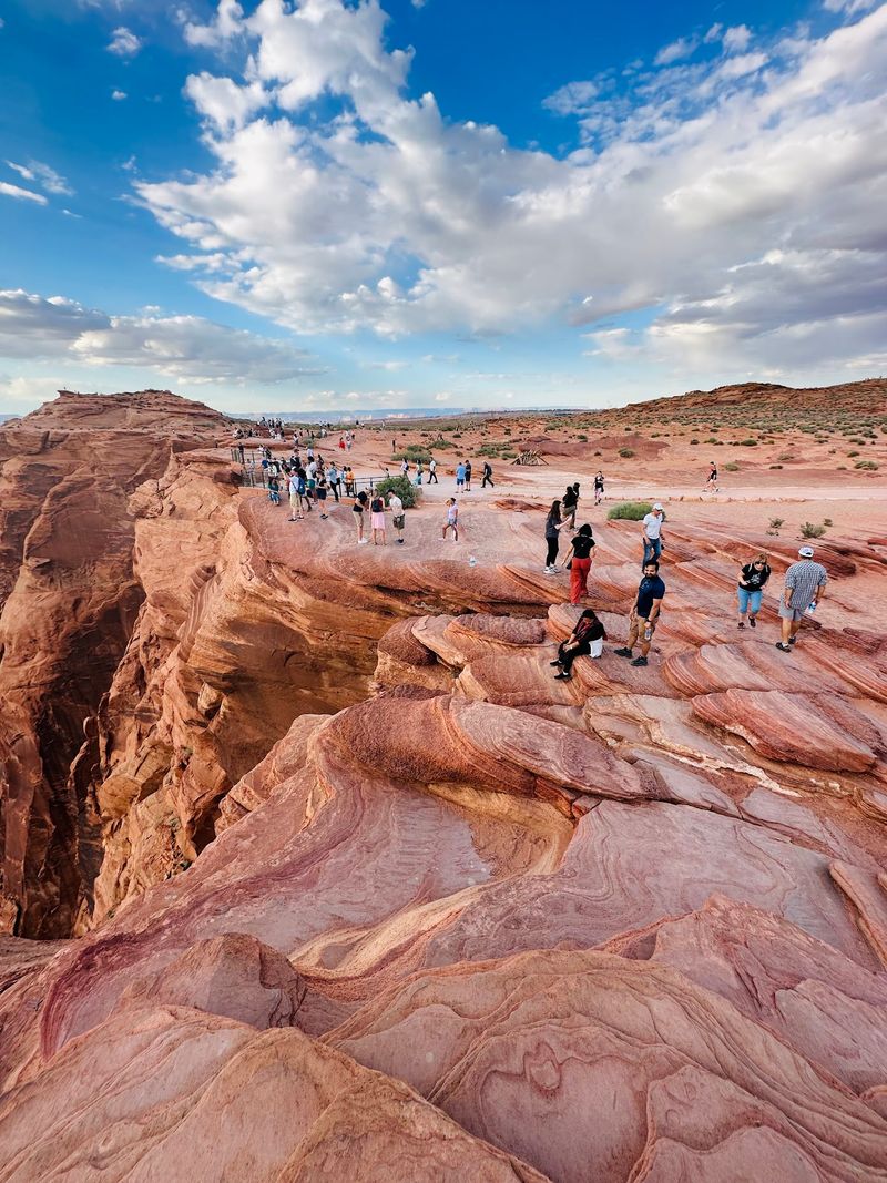
Getting here is easier than many first-timers expect. The overlook sits near Page, not deep within Grand Canyon National Park. It is part of Glen Canyon National Recreation Area, while the trailhead parking lot is managed by the city.
The route begins just off U.S. Highway 89, roughly five miles south of the Carl Hayden Visitor Center. Watch for the marked highway turnoff rather than searching for a conventional street-front entrance.
Give yourself a generous window rather than aiming to arrive just before sunset. The trail has open stretches, a moderate return climb, and few places to escape the sun. An early start is particularly useful during hot weather.
There is no need to rush straight to the railing on arrival. Find a comfortable place on the viewing platform, scan the sandstone layers, and follow the Colorado River around its broad curve. Keep your camera handy, but leave plenty of time for the walk back.
For navigation, use the marked Horseshoe Bend trailhead on U.S. Highway 89, between mile markers 544 and 545, near Page, Arizona. Once parked, follow the maintained path to the overlook and plan to return during daylight hours.