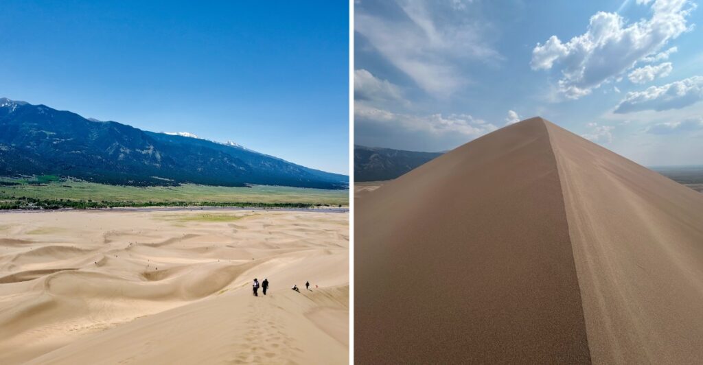
This landscape looks like two postcards got mixed together.
Huge sand dunes rise from a wide valley, then snow-dusted mountains show up behind them like nobody told the scenery to choose a theme.
The main dunefield spreads across about thirty square miles and holds the tallest dunes in North America.
And yes, you can climb them.
You can also sandboard or sled down selected slopes. When conditions line up, moving water appears along the edge of all that sand and makes the whole scene even stranger.
Then Colorado finally enters the picture, with the Sangre de Cristo Mountains towering behind everything.
Just do not trust the view from the parking lot too much.
From there, the dunes look almost manageable.
Start walking and see how long that confidence lasts.
North America’s Tallest Dunes Rise Here

The 30-square-mile dunefield is the centerpiece of Great Sand Dunes National Park and Preserve, and it holds the tallest dunes in North America.
Hidden Dune currently measures about 742 feet from base to summit, while Star Dune rises about 741 feet. They sit in different parts of the sand and require much more effort than a short walk from the parking lot.
The surrounding elevation adds another challenge. The dunes begin around 8,000 feet above sea level, so visitors arriving from lower elevations may notice the thinner air before reaching any of the higher ridges.
There are no marked trails across the main dunefield. Instead, you choose a route by reading the ridgelines and keeping obvious landmarks such as the mountains, entrance road, and visitor center in view.
Without marked routes across the main dunefield, hikers can follow ridges and saddles that suit their distance and energy level. One person may stay on the firmer crest of a ridge while another angles toward a lower saddle to avoid climbing straight up loose sand.
In summer, timing matters. Sand surfaces can reach about 150 degrees Fahrenheit during hot afternoons, and thunderstorms may build over the mountains. Early morning or evening usually gives you cooler sand and more comfortable climbing.
Hidden Dune And Star Dune Rise More Than Seven Hundred Feet
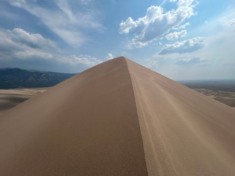
Hidden Dune sits near the center of the dunefield and is not visible from most of the main visitor area.
Its name is unusually accurate. Even from sections of the first high ridge, a false summit can block the actual top from view. Reaching it from the main Dunes Parking Lot requires roughly a seven-mile round trip and about six hours for many hikers.
Star Dune rises to about the same height and sits toward the southwest part of the dunefield. From the Dunes Parking Lot, one direct approach follows the Medano Creek bed before turning toward the pyramid-shaped dune.
Neither hike should be treated like a quick climb from the car. There is no formal trail to either summit, and progress across soft sand is slower than the same mileage on firm ground.
High Dune on First Ridge gives visitors another option. It is closer to the main parking area and provides a high viewpoint without committing to one of the tallest dunes.
Whichever ridge you choose, sturdy footwear helps. Sand works into open shoes quickly, and summer heat makes thin sandals a poor choice.
Carry more water than you think you will need, take breaks before your legs demand them, and remember that the return trip still includes plenty of uneven sand.
Mountains And Dunes Share The Same Horizon
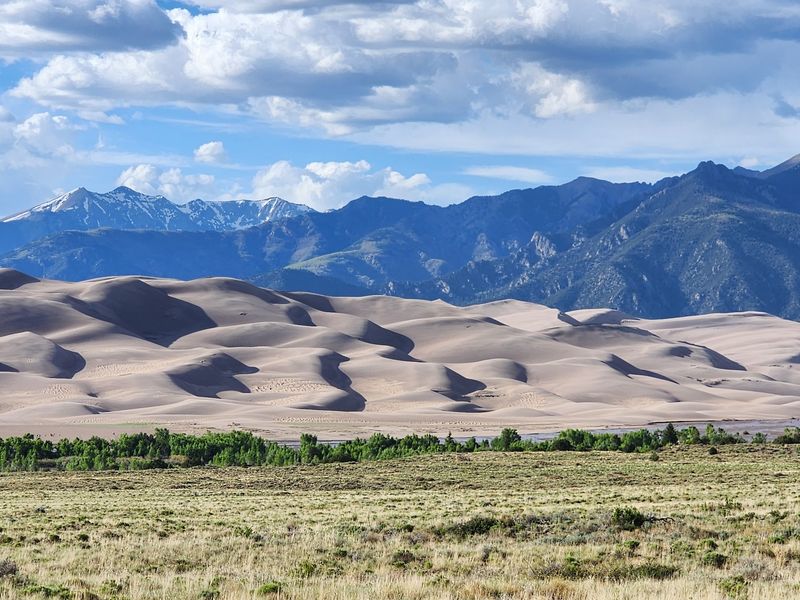
The Sangre de Cristo Mountains rise immediately east of the dunefield, creating one of the park’s defining contrasts.
These mountains form part of the southern Rocky Mountains, with high peaks reaching around 14,000 feet. Snow can linger on the upper slopes while the sand below is already warming in spring and early summer.
From the dunes, the view shifts quickly between open sand, forested foothills, and jagged mountain ridges. Climb higher and more of the San Luis Valley opens in the opposite direction.
The mountains also shape the weather. Afternoon thunderstorms are common in summer, and the exposed dunes provide no shelter from lightning.
If dark clouds begin building or thunder starts, head back toward lower ground rather than trying to squeeze in one more ridge.
Wind can change the experience just as quickly. Spring is especially windy, although strong gusts can arrive with storm systems in any season. Long pants and eye protection can make blowing sand much easier to handle.
A light layer also earns its place in the day pack. Even when the sand is warm, higher-elevation air and passing clouds can cool things quickly.
The combination may look calm from a distance, but the conditions are always part of the landscape.
Wind, Water And Mountains Keep The Sand Moving
The dunefield developed through a long interaction between sediment, wind, water, and the shape of the San Luis Valley.
Much of the sand originated from volcanic material eroded from the San Juan Mountains, with additional sediment coming from the Sangre de Cristo range. Streams carried those materials into the valley over long periods.
When lakes and wetlands shrank during drier periods, exposed sand became available for the wind to move.
Southwesterly winds pushed sand toward a low curve in the Sangre de Cristo Mountains. Northeasterly storm winds then pushed some of it back in the opposite direction.
iThose opposing wind patterns helped build and stabilize the tall dunes instead of allowing all the sand to continue moving across the valley.
Water still plays a role. Medano Creek and Sand Creek carry sand around the edges of the dunefield and help recycle it back into the larger system.
You can see evidence of movement almost everywhere. Wind forms fresh ripples, reshapes small ridges, and sends grains streaming over crests during stronger gusts.
The dunes may look fixed from the highway, but the surface is constantly changing. Your footprints can disappear, ridgelines can soften, and the same slope can look different after a windy afternoon.
Medano Creek Changes With The Snowmelt
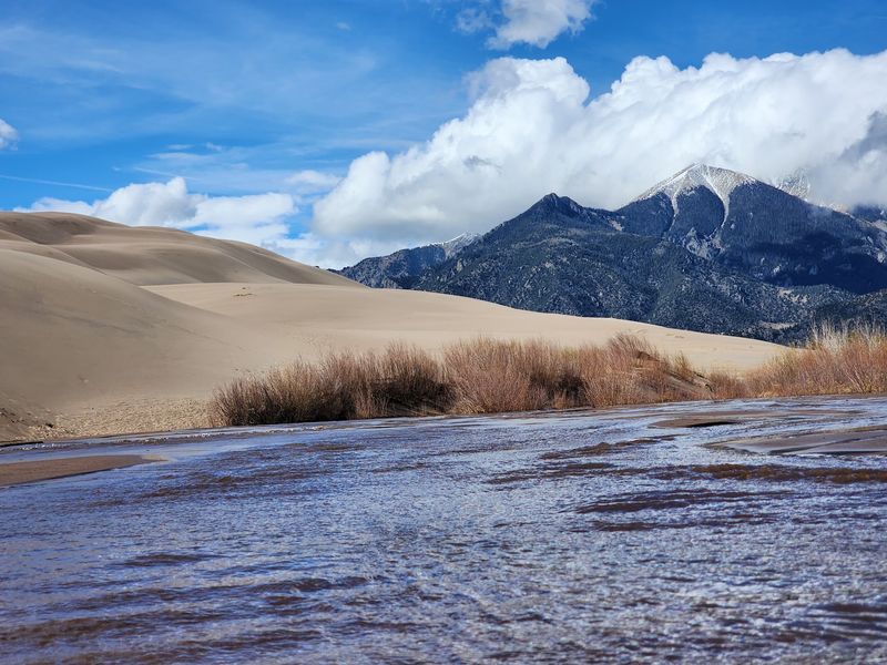
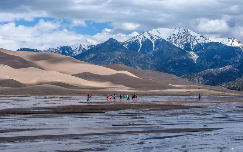
Medano Creek is seasonal, and its appearance depends heavily on the year’s mountain snowpack.
In an average year, water begins reaching the main Dunes Parking Area sometime in April. Flow usually peaks in late May and then drops through June, often disappearing from the main visitor area by late June.
Dry years can look very different. The creek may never reach the main parking area at all. Wet years can keep water flowing much longer.
Late May and early June are usually the best time to see surge flow, a rare phenomenon in which rhythmic waves move down the sandy creek bed. Small underwater sand ridges form, hold back water, and then collapse, sending repeated surges downstream.
When flow is strong enough, the creek becomes a popular place for shallow water play at the base of the dunes.
That popularity has practical consequences. Late May and early June weekends can bring heavy traffic, full parking areas, and busy stretches of creek.
If Medano Creek is a major reason for your trip, check current conditions close to your visit rather than relying on a general seasonal expectation.
A towel and change of socks are useful extras. So is flexibility, because snowmelt decides the schedule here.
Sandboarding And Hiking Need The Right Timing
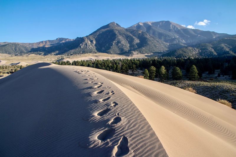
The main dunefield has no designated hiking trails, so visitors are free to choose their own routes across the sand.
Walking along ridge crests often provides firmer footing than climbing directly up a steep face. Even so, soft sand makes every uphill section slower than it appears from below.
Sandboarding and sand sledding are allowed, but equipment matters. Boards and sleds designed specifically for sand perform much better than ordinary snow sleds, cardboard, or plastic saucers.
Summer afternoons deserve extra caution because the sand surface can reach about 150 degrees Fahrenheit. Closed shoes protect your feet, while early morning and evening usually offer cooler conditions.
Storms are another reason to watch the clock. Lightning can strike the open dunefield, so leave exposed ridges when storms approach.
The visitor center at 11999 State Highway 150, Mosca, CO 81146, is a practical stop for current conditions, trip planning, exhibits, and water during open hours.
Before heading onto the sand, settle the small decisions first: how far you want to climb, whether you are carrying enough water, and what time you need to turn around.
The dunes do not have trail signs telling you when you have gone far enough.
The Protected Landscape Extends Far Beyond Sand
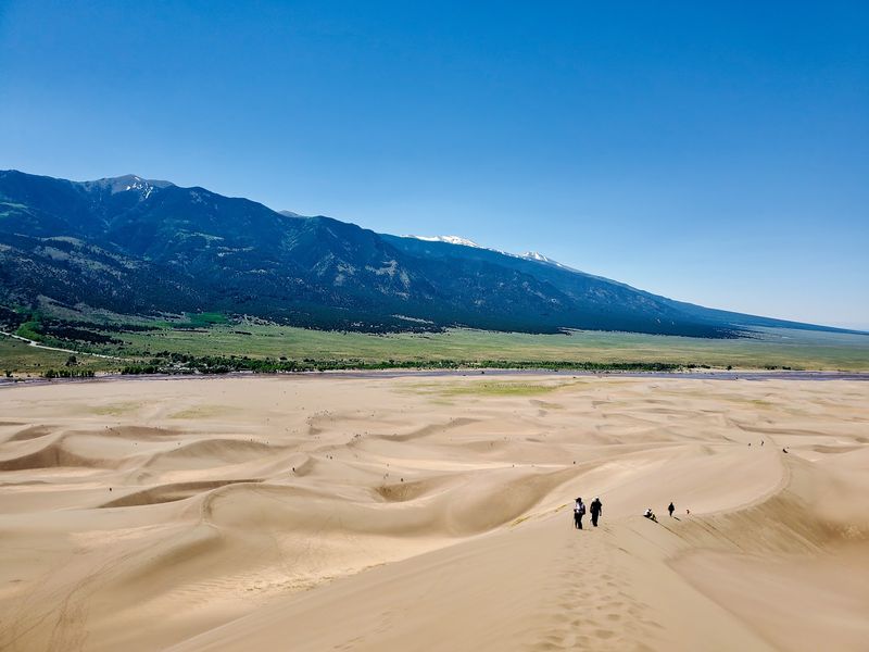
Great Sand Dunes protects much more than the famous dunefield.
Grasslands and wetlands spread across lower parts of the San Luis Valley, while forests rise into the Sangre de Cristo Mountains. Higher elevations include subalpine country, alpine tundra, lakes, streams, and rocky peaks.
That broader landscape is closely connected to the dunes. Mountain watersheds feed the creeks that move sand around the system, while wetlands and groundwater also help stabilize parts of the deposit.
The area first received federal protection when President Herbert Hoover proclaimed Great Sand Dunes National Monument in 1932.
Congress passed legislation creating Great Sand Dunes National Park and Preserve in 2000, but the national park designation depended on additional land acquisition.
In September 2004, after those requirements were met, the former monument was formally redesignated as Great Sand Dunes National Park and Preserve.
That expansion brought more of the surrounding watershed and mountain terrain under National Park Service protection.
If you have a full day, the sand does not have to be the only stop. Forest trails, mountain routes, creek areas, and night-sky viewing can all change the pace.
The surrounding mountains, wetlands, creeks, and watersheds remain closely connected to the dune system.