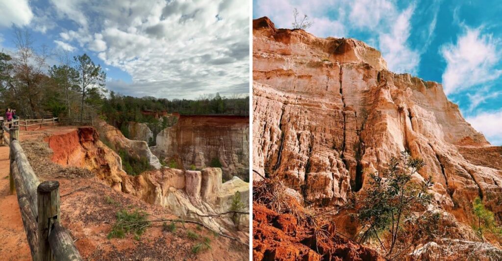
You know what Georgia is hiding behind those quiet country roads?
A canyon.
And the first look is enough to make you wonder how this ended up here.
The landscape drops away fast, revealing colors you probably were not expecting in this part of the state.
From the rim, the scale starts to sink in. Down below, the whole place feels different again.
Yes, there may be mud. Consider that part of the deal.
I’d want to see it from both levels, mostly because this is one of those places that keeps changing as you move through it.
Who expects to find this hiding in southwest Georgia?
Why Folks Call It Georgia’s Little Grand Canyon
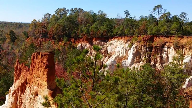
In Stewart County, the landscape changes abruptly from woodland to steep, brightly colored gullies.
Providence Canyon State Park sits near Lumpkin, where the exposed earth stands out against the surrounding pines and hardwoods.
The nickname Georgia’s Little Grand Canyon fits the view, even though this landscape has a very different origin from its famous western namesake.
The deepest gullies reach about 150 feet. From the rim, you can follow the contours of the walls and see how narrow channels widen into open spaces below.
Look across the canyon before looking straight down; the contrast between the trees and the exposed soil is easiest to appreciate from a little distance.
There are several ways to enjoy the setting. If you want a straightforward first look, begin near the visitor center and follow the designated overlooks. If you have time and suitable footwear, save the canyon floor for a longer outing.
Both routes give you a different angle on the same striking formations.
The park has picnic facilities, restrooms, and a visitor center, so you can organize your day before heading onto the trails.
Check the current parking fee and opening times ahead of your visit. Summer afternoons can be hot, and a morning start leaves room for a slower walk and a break afterward.
A Canyon Born From Careless Plowing In The 1800s
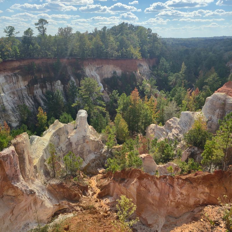
The canyon’s history begins with farmland rather than a powerful river cutting through rock over millions of years. During the early 1800s, trees were cleared and land was cultivated using farming methods that left the soil exposed to rain.
Water gradually washed the loose earth away, creating ditches that grew deeper and wider.
By the middle of that century, some channels had already reached several feet deep. Over time, running water exposed different layers of sediment and shaped the gullies visible today.
The process has continued along the walls, which remain fragile even where the surfaces appear firm.
Look closely at a canyon wall from a permitted viewpoint and you can see distinct layers rather than one uniform color.
The upper formation and the softer sands beneath it respond differently to erosion.
Lower, more resistant material slows the downward cutting in some places, while the sides continue to change.
The area became a state park in 1971. Today, a walk here puts the consequences of changing the land directly in front of you. It is an unusual place to see both human history and natural processes without needing an indoor exhibit to connect them.
Rain may make the channels more active, but save the hike for suitable weather. Wet canyon floors can be slippery or extremely soft, and staying on marked routes is essential throughout the park.
Pink, Orange, And Purple Walls That Look Painted
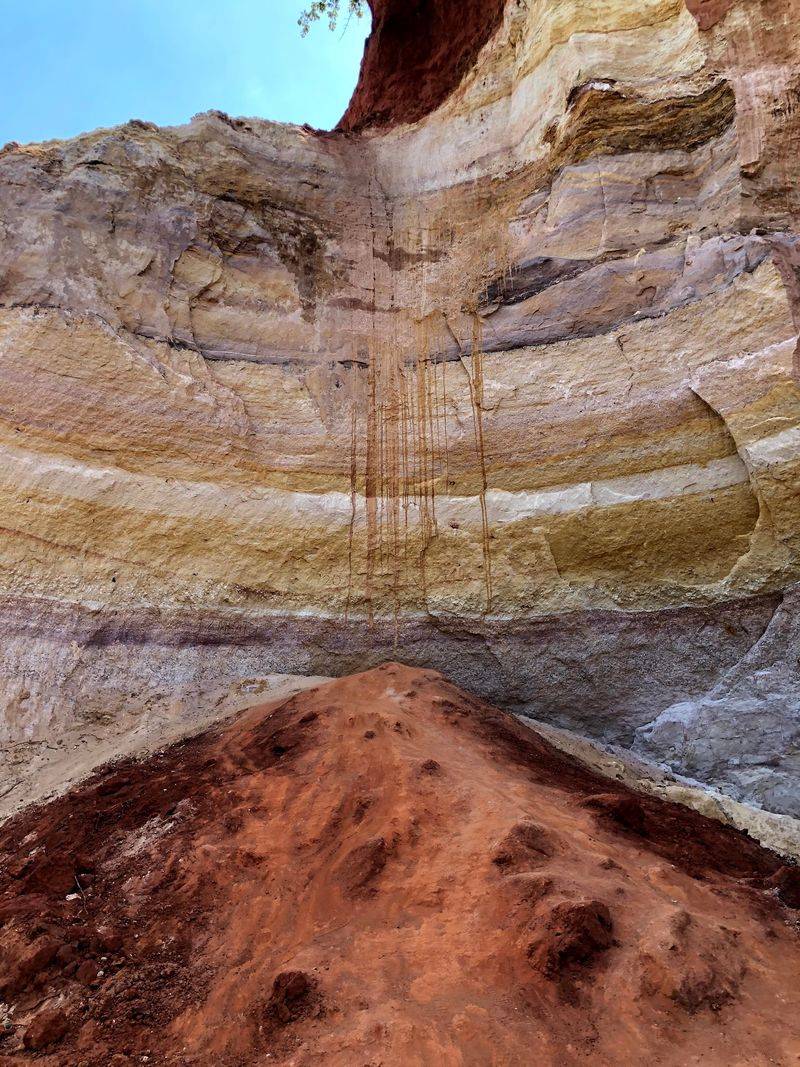
The most immediate attraction is color. Bands of salmon, pale pink, orange, red, white, and purple run through the exposed soil. The exposed soil displays around 43 different shades, although you do not need to count them to enjoy the variations.
The different layers formed from sediments laid down long before the present-day gullies appeared. As erosion opened the ground, it revealed the lighter and darker material beneath the surface.
In some places the colors appear in broad sections; elsewhere, thin streaks trace the bends of the wall.
Try looking at the same formation from two angles. A shaded stretch may appear muted while a sunlit face brings out warm oranges and pinks. On a bright day, frame some greenery beside the exposed soil for a clear sense of how sharply the scenery changes within the park.
The walls are delicate, not climbing surfaces. Stay on designated trails, keep behind rim fences, and do not scratch or carve the formations. Even a short detour up a slope can disturb soil that is already vulnerable to water and foot traffic.
Sixteen Canyons Waiting To Be Explored
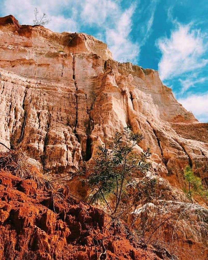
Providence Canyon contains 16 canyons, but a day hike does not lead into all of them. Nine can be explored by following the main Canyon Loop route and taking the marked side approaches.
The remaining formations are part of the wider landscape, including areas that are visible but not open for direct exploration.
Start with the numbered canyons connected to the white-blazed route. To reach canyons 1 through 5, head down to the first creek bed before turning into the canyon approaches. Canyons 6 through 9 branch from a second creek bed farther along the loop.
Canyons 4 and 5 are particularly useful choices if you want to concentrate on the park’s colorful formations. Rather than rushing from one number to the next, leave time to walk into an open area, look at the walls, and retrace your steps to the main route.
The creek beds are part of the hike, and wet ground should be expected. Choose waterproof footwear or sturdy shoes that can handle mud. Stay near the middle of the designated creek-bed routes, away from softer ground along the sides.
A simple plan works well: choose a handful of numbered stops, follow the markers, and turn back when your time or energy runs low. Reaching every branch is less important than getting back up the hill comfortably.
Hiking The Canyon Loop Trail From Rim To Floor
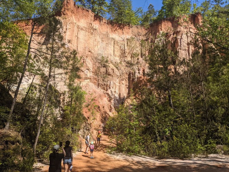
The Canyon Loop Trail is about 2.5 miles and marked with white blazes. The loop is an easy-to-moderate hike that takes about two hours, plus extra time if you explore the side canyons. The route starts and ends at the visitor center.
The first part takes you downhill toward the creek beds. The return involves climbing out of the canyon, so keep some energy for the final stretch.
If you are hiking with younger children or anyone who prefers shorter walks, decide how far to go before committing to several canyon branches.
Carry drinking water, wear shoes with good grip, and keep a trail map close. A hat and sunscreen are useful when you leave the shade, especially in warmer months.
After rain, the creek beds may hold standing water and sticky mud, so shorter steps and a relaxed pace help.
Experienced hikers can consider the separate seven-mile Backcountry Trail, marked with red blazes. It passes through forested terrain and includes steep, rugged sections. This extremely difficult route takes at least six hours, making it a different outing from a casual canyon walk.
Check trail closing times before starting, since they change seasonally. Choose the white route for a general visit, and save the longer red route for a day when you are prepared for its distance and terrain.
Rare Plumleaf Azaleas Bring Summer Color
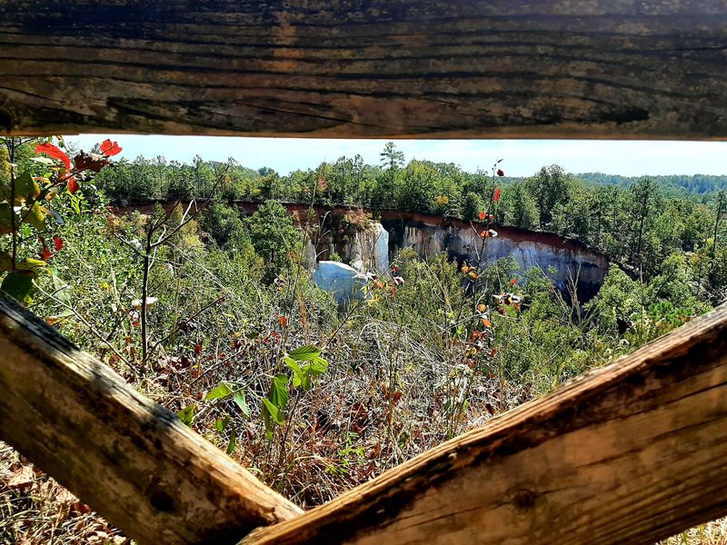
The canyon walls are not the only colorful sight. Providence Canyon is home to the rare plumleaf azalea, a native shrub with orange-red flowers that appear later than the blooms of many other azaleas.
July and August are the usual months to look for them in this part of Georgia.
Plumleaf azaleas grow near the waterways and in moist areas of the canyon landscape. Their flowers provide a smaller, brighter detail against the soil and surrounding greenery.
If you are visiting specifically to see them, allow for variation in the blooming season from year to year.
The park is an important habitat for this uncommon plant. Enjoy the flowers from established paths, and leave the branches, blossoms, and surrounding vegetation undisturbed. Picking plants or taking natural material from the park is not permitted.
Summer flower viewing calls for a little more preparation. The weather can be hot and humid, and the same damp places that support plants may make parts of the hike muddy. Carry enough water, check the forecast, and consider starting earlier in the day.
Rim Overlooks For Big Views Without The Mud
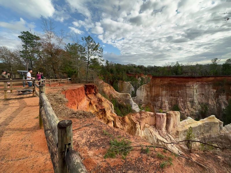
You do not have to reach the canyon floor to see the colorful formations. Rim-side overlooks provide views across the gullies, with the layered walls and forest canopy appearing together.
The picnic area is a good place to begin if you prefer scenery without a full downhill hike.
For a shorter visit, start at the visitor center and choose a nearby viewpoint before deciding whether to continue. A partially accessible overlook route extends about 100 yards, though the wider trail network includes uneven ground and slopes.
Check current accessibility details if a level approach is important for your group.
Leaves can affect the view. In seasons with dense foliage, trees may cover parts of the canyon from certain angles. When branches are bare, additional shapes and layers may be easier to see.
Weather and sunlight also change how the exposed soil looks through the day.
Bring a picnic if you want to build in a quiet stop, and keep your belongings clear of the trail. Dogs are welcome on park trails when held on a leash no longer than six feet. Keep everyone behind protective fences and away from the rim edge, where the ground can be unstable.
Before leaving, check that you have water, your map, and enough daylight for the walk back. For navigation, use 8930 Canyon Road, Lumpkin, GA 31815. Whether you choose the overlooks or the muddy canyon route, leave the fragile walls just as you found them.