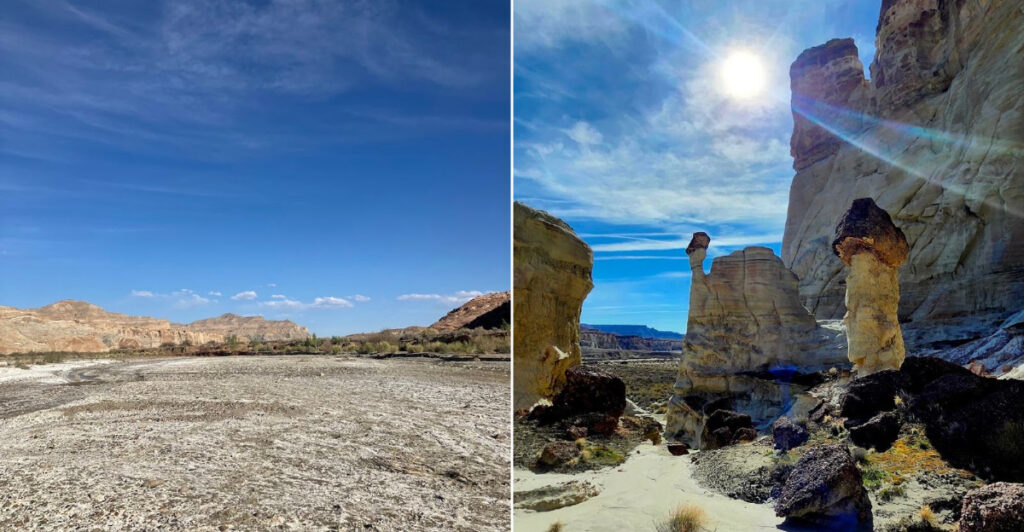
Nine miles of sand is a steep entry fee, but the landscape waiting for you at the end looks almost unreal. In southern Utah, pale stone towers rise from the desert like sculptures designed for another planet, their ghostly shapes making every hard-earned step feel justified.
The route is not casual. There is little shade, the sandy wash slows your pace, and reliable trail markers are scarce, so preparation matters as much as stamina.
Bring more water than you think you need, save an offline map, and start early enough to avoid the fiercest heat. Then let the scenery take over.
These formations do not simply stand there; they transform the horizon into something strange, dramatic, and unforgettable. Utah’s desert rarely rewards shortcuts, and this hike is no exception.
Commit to the distance, respect the conditions, and you will finish with the satisfying feeling that you truly earned the view.
What the Wahweap Hoodoos Actually Are
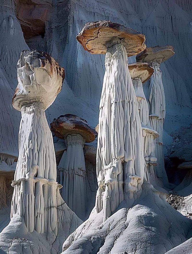
Picture a forest, but instead of trees, every vertical element is made of ancient pale rock carved by millions of years of wind and water erosion. That is roughly the visual greeting waiting at the end of this hike.
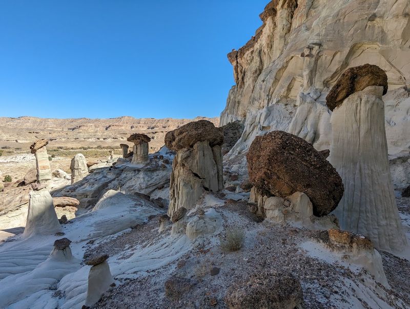
The Wahweap Hoodoos are a collection of towering white and cream-colored spire formations clustered together in a remote canyon wash near Big Water, Utah.
These formations sit within the Grand Staircase-Escalante National Monument region, managed by the Bureau of Land Management. The hoodoos range dramatically in height, some short and stubby, others tall and commanding, arranged in natural groupings that visitors describe as ghost-like and otherworldly.
The white coloring comes from the specific mineral composition of the rock, giving them a pale, almost luminous quality that photographs strikingly against the surrounding red-rock desert landscape. Geologically, they formed as softer surrounding material eroded away, leaving the more resistant caprock-topped columns behind.
Why It Matters: Understanding what you are hiking toward helps set realistic expectations. These are not roadside formations.
They reward patience, planning, and a willingness to cover real desert ground before revealing themselves.
The Trail Situation: Flat, Sandy, and Largely Unmarked
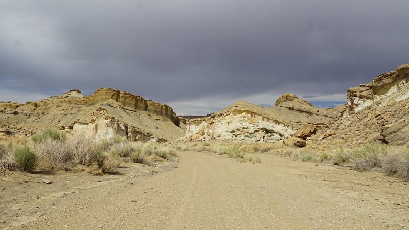
Here is the thing about the Wahweap Hoodoos trail: calling it a trail is being generous. What you are actually doing is navigating a broad, flat wash for approximately 4.3 to 5 miles one way, following Wahweap Creek through a meandering canyon with occasional side canyons branching off like interesting distractions you should mostly ignore.
There are virtually no trail markers along the route. Multiple visitors have noted that the only reliable fence marker sits at coordinates 37.115494, -111.688935, where the path passes through a fence line.
The BLM office in Kanab or Kanab-area visitor centers carry printed maps that prove genuinely useful here, and downloading an offline map before leaving cell service is not optional, it is essential.
The wash itself is sandy and relatively flat, with roughly 300 feet of total elevation gain across the entire round trip. That makes this physically accessible to most reasonably fit adults and older teens, though the sheer mileage demands stamina.
Pro Tip: The apparent path near the trailhead is actually an OHV entrance. Stay on the east side of the river early on and use a compass bearing of approximately 350 degrees to find the correct route through the fence.
When To Go and Why Timing Is Everything Here
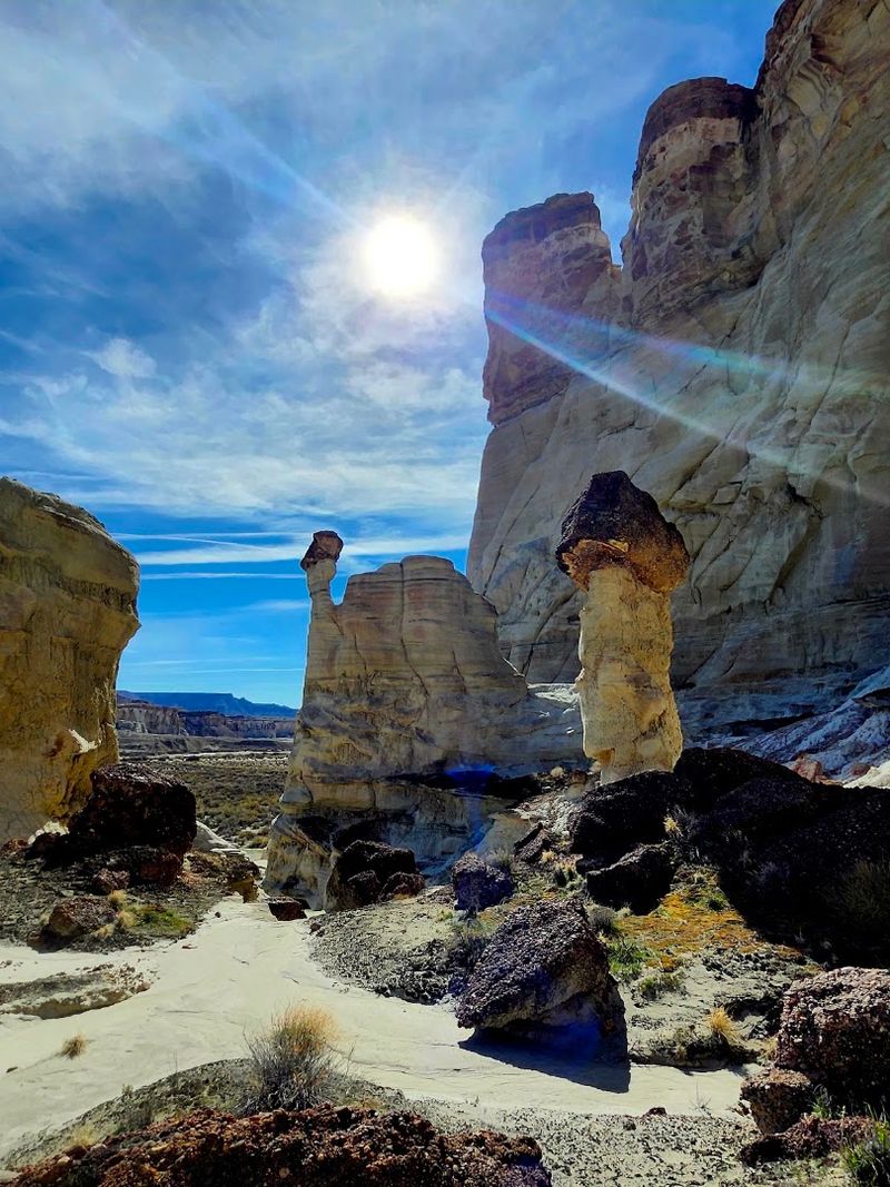
Spring and fall are not just preferred seasons for this hike, they are the only seasons most experienced visitors would seriously recommend. The wash offers zero shade for the entire route.
Zero. Not a single obliging tree or rock overhang positioned conveniently above your head when the midday sun decides to make things personal.
March is frequently cited as a sweet spot, with temperatures in the 50s and 60s making the nine miles genuinely manageable. One visitor completed the full hike starting at 8 a.m. in early March, including a lunch break and some creek cooling time, finishing around 2:30 p.m.
That timeline is a reasonable planning reference for moderately paced hikers.
Summer is a hard pass. The exposed sandy terrain absorbs and radiates heat in ways that transform a fun adventure into a genuine endurance test.
Thunderstorms also pose a real risk in a wash environment, so checking weather forecasts before heading out is non-negotiable.
Best For: Hikers planning a March through May visit or a September through November window will find the most comfortable and photogenic conditions. Early morning starts are strongly advised regardless of season to maximize daylight and avoid afternoon heat buildup.
Navigating the Trailhead and Getting There Without Getting Lost
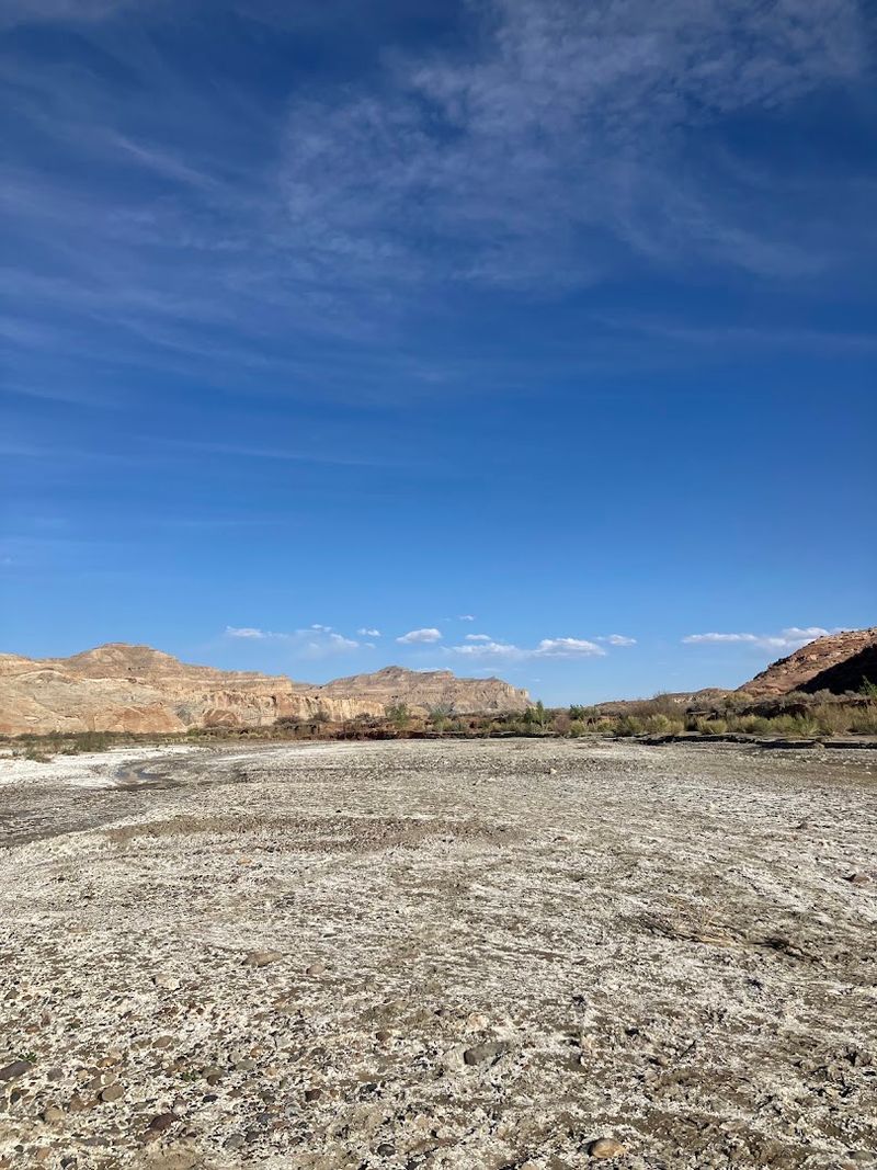
Finding the Wahweap Hoodoos trailhead is its own small adventure, and not always the fun kind. Multiple visitors have flagged that the Google Maps pin does not reliably deposit you at the correct starting point.
The trailhead sits off Nipple Creek Road near Big Water, Utah 84741, and approaching it with a standard passenger vehicle is feasible to a point.
There are two parking areas. One sits at the main trailhead.
A second sits before the Wahweap Creek crossing at approximately 37.10615, -111.68715. RV travelers should note that parking in the large area just past the Hatchery near the horse fence ramp works well, but continuing further risks reaching a creek crossing without a clear turnaround option.
Four-wheel-drive vehicles can access a second parking lot closer to the hoodoos, which shortens the hiking distance meaningfully. The BLM office carries printed maps with solid guidance, and stopping there before heading out is time genuinely well spent.
Insider Tip: Do not rely solely on a single map app for navigation to this trailhead. Cross-reference with BLM-provided maps and download offline navigation before leaving Big Water, where cell service remains available.
What the Hike Feels Like From Start to Finish
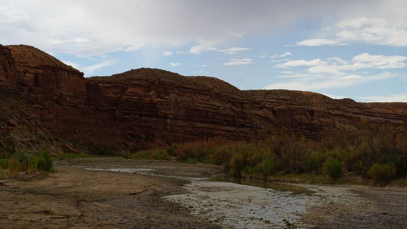
The opening miles of this hike have a particular quality that some visitors love and others find quietly testing. You are walking through a broad, open wash with canyon walls rising on either side, side canyons occasionally peeling off left and right, and the hoodoos nowhere in sight yet.
The landscape is peaceful, genuinely quiet, and about as far from a crowded national park experience as you can get in Utah.
Solitude is a real feature here. Multiple visitors have noted hiking the entire route without encountering another person until near the creek crossing before the four-wheel-drive parking area.
If you want a trail where you can think clearly, hear nothing but wind, and feel like you have the Southwest entirely to yourself, this delivers that experience reliably.
As the hoodoos come into view from a distance, they emerge gradually rather than all at once, which somehow makes the arrival more satisfying. They cluster together in groups, visible from some distance before you actually reach them, giving you a slow-building reveal that rewards the miles behind you.
Quick Verdict: The hike is long and exposed but genuinely flat and manageable. The payoff at the end earns every step, particularly for hikers who appreciate dramatic, remote geological formations over manicured trail experiences.
Safety, Water, and Wildlife Awareness on the Trail
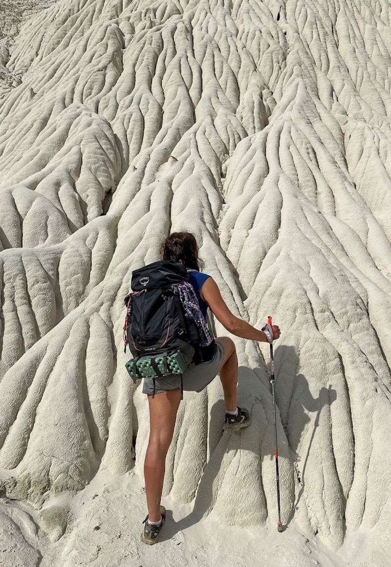
Water is not a suggestion on this hike. It is the single most important item in your pack, full stop.
The trail offers no shade, no water sources you should rely on, and no bailout points once you are deep into the wash. Visitors who have done this route in March with mild temperatures still emphasize carrying generous water supplies for a nine-mile round trip in a sun-exposed environment.
Wildlife awareness adds another layer to trip planning. The BLM has noted that mountain lions occasionally follow the creek corridor in this area.
Bear spray is a reasonable precaution that some visitors carry, though actual wildlife encounters appear rare based on visitor accounts. Coyote and dog tracks are more commonly spotted than anything else.
Thunderstorm risk in a wash is worth taking seriously. Flash floods can move through canyon washes with very little warning, and the terrain offers limited high ground for retreat.
Checking the National Weather Service forecast for the Kanab, Utah area before heading out is a simple step that significantly reduces risk.
Common Mistakes to Avoid: Underestimating water needs, starting too late in the day, skipping the offline map download, and assuming the hike is short because the elevation gain is minimal are the four most avoidable errors on this route.
Making the Most of Your Visit to Big Water and the Surrounding Area
Big Water, Utah sits just a short drive from the trailhead and functions as the logical base of operations for this hike. It is a genuinely small town, the kind where the gas station conversation is brief but real and the horizon seems to stretch about three states in every direction.
Fuel up, grab any last-minute supplies, and make sure your water situation is fully sorted before heading toward Nipple Creek Road.
The area sits within reach of the broader Grand Staircase-Escalante National Monument, and the BLM field office can provide printed maps and current trail conditions that no app quite replaces. Stopping there before your hike is a move that takes fifteen minutes and frequently saves several hours of confusion on the trail.
The hike itself is open 24 hours, though starting in full darkness without serious lighting equipment would be ambitious in the wrong direction. Early morning starts allow hikers to complete the route comfortably before afternoon temperatures or weather systems develop.
Planning Advice: Treat this as a full day outing rather than a quick morning stop. Pack a real lunch, carry more water than you think you need, wear sun protection from head to toe, and leave town early enough to be on trail by 7 or 8 a.m. for the best overall experience.