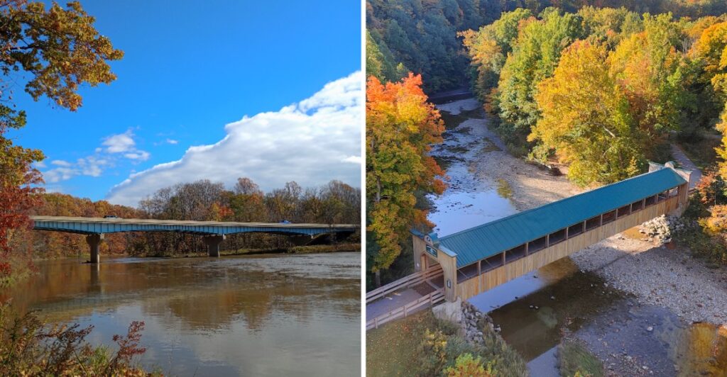
Think you can drive past a covered bridge in October without slowing down? Good luck with that.
These covered bridges are connected by official scenic routes, and they do not all look alike. Some are old and compact. Others stretch dramatically across the landscape.
Then October gets involved.
The woods around northeast Ohio start changing color, giving the river valleys and country roads a completely different look.
The second weekend of the month brings the annual covered bridge festival too, adding another reason to linger.
You can tackle one loop or turn the whole thing into a weekend.
Just forget the idea of making great time.
With nineteen bridges ahead, your brake pedal already knows better.
Nineteen Bridges Turn One County Into A Road Trip
Ashtabula County’s covered-bridge network gives you 19 distinct stops and five different bridge styles to notice along the way. Howe truss, Pratt truss, Town lattice truss, Burr Arch, and Inverted Haupt truss designs all appear in the county.
You do not need to know bridge engineering to see the differences.
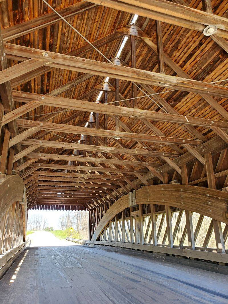
Some interiors are filled with repeating diagonal timbers. Others use heavier arches or different bracing patterns that change the look of the tunnel around the road. Once you have crossed a few, the details become easier to spot.
Seventeen of the county’s covered bridges remain open to vehicle traffic, while the rest are pedestrian structures.
That makes the route feel active rather than museum-like. Many of the bridges still do the job they were built to do, carrying cars across rivers and creeks while keeping their historic forms.
The official tour is divided into North and Eastern and South and Western routes, which helps break the county into manageable sections.
Start with one loop rather than turning the day into a bridge-counting contest. A slower pace leaves room to stop, compare construction details, and notice how each setting changes from one crossing to the next.
October Gives The Route A Different Look
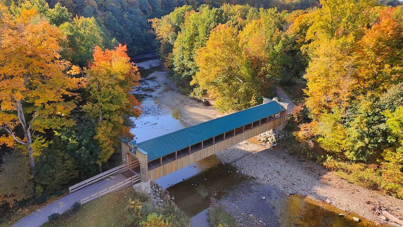
Northeast Ohio usually moves into its strongest fall color during October, although the exact timing changes with weather from year to year.
That uncertainty is part of the fun.
One weekend may bring brighter color along river valleys, while another may catch more leaves turning around farm roads and wooded hillsides. Instead of planning around one supposedly perfect date, treat the whole month as a shifting window.
October also brings the Ashtabula County Covered Bridge Festival. In 2026, the event is scheduled for October 10 and 11, continuing the county’s tradition of celebrating its bridges on the second weekend of the month.
If the festival is part of the plan, build some extra flexibility into the day. Events, vendors, and bridge-related activities can change the rhythm of a normal driving tour.
For a quieter outing, another October day may suit you better.
A light jacket belongs in the car either way. Mornings near the water can feel cool, and temperatures may change as the day moves on.
Bring a warm drink, keep the route loose, and let the color decide which bridge gets the longest stop.
Smolen-Gulf Brings The Biggest Scale
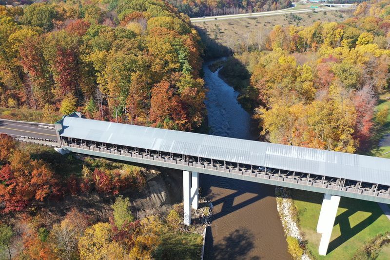
Smolen-Gulf Covered Bridge changes the scale of the trip in a hurry.
The bridge stretches 613 feet across the Ashtabula River and rises 93 feet above it. It is promoted locally as the longest covered bridge in the United States, which gives this stop a very different presence from the shorter historic bridges elsewhere on the tour.
You can drive across it, but this is one place where getting out of the car adds useful perspective.
From below, the height becomes much easier to understand. The bridge sits high over the river valley, and the structure looks very different from ground level than it does through the windshield.
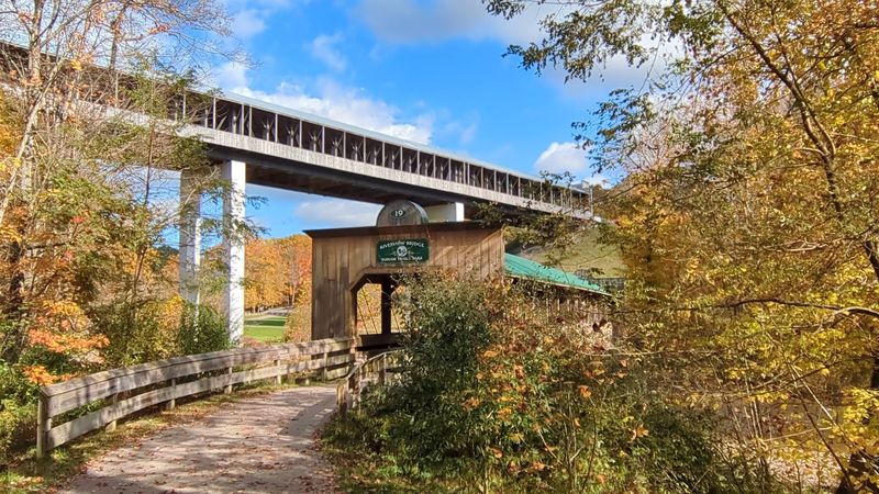
A second covered bridge adds another reason to linger. Riverview Covered Bridge, a 150-foot pedestrian bridge completed in 2016, sits below Smolen-Gulf in Indian Trails Park.
That gives one stop two bridge experiences without repeating the same thing. One is a massive vehicle crossing high above the river. The other is smaller, lower, and built for pedestrians.
If time is limited, this is the kind of stop that deserves more than a quick pass. Park, walk, look up, and let the difference in scale do the work.
Harpersfield Mixes History With River Scenery
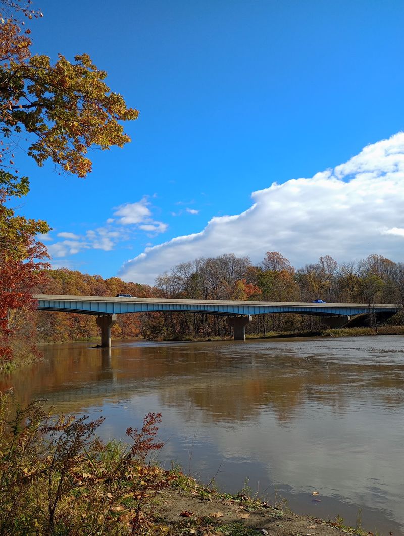
Harpersfield Covered Bridge brings the trip closer to the Grand River.
Built in 1868, the bridge has been part of the county’s landscape for more than a century and a half. After a major renovation, it reopened to vehicle traffic in 2024, keeping it connected to everyday travel rather than turning it into a static landmark.
The surrounding Harpersfield Metropark adds more than a bridge crossing.
The park includes streamside forest, scenic bluffs, picnic areas, river access, and a small waterfall. That combination makes it a useful stop when everyone in the car is ready to move around for a while.
Take a short walk, look at the bridge from the river side, or use the picnic area as a natural break between driving sections.
Wet conditions deserve a little extra attention. Riverbanks and trails can become slippery after rain, so sturdy shoes are a better choice than treating the stop like a quick roadside photo opportunity.
This is also where the bridge tour starts to feel less like a checklist. History, water, woods, and the road all meet in one place, giving the day room to slow down before the next crossing.
The Oldest And Shortest Make A Good Pair
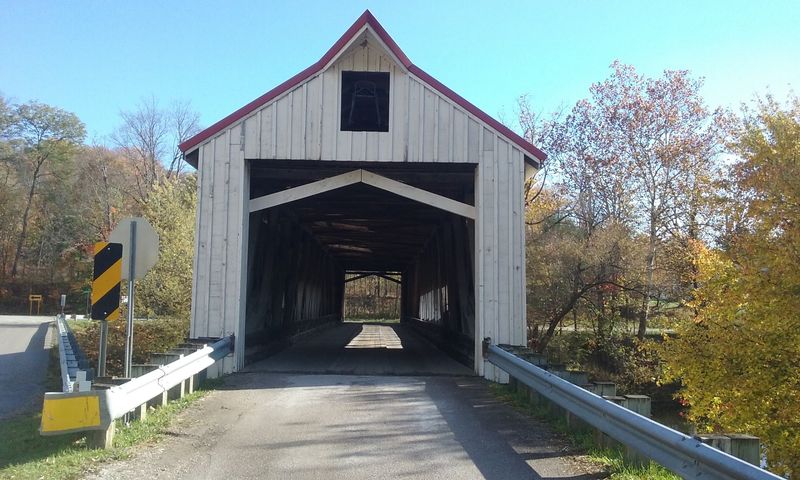
Two bridges show just how wide the county’s covered-bridge story really is.
Mechanicsville Road Covered Bridge dates to 1867 and is believed to be the oldest covered bridge in Ashtabula County. It is a 156-foot Howe truss bridge with an arch and remains open to traffic.
That makes the crossing feel practical as well as historic. Cars still pass through a structure built more than 150 years ago, so the bridge is not simply standing beside the road as a reminder of another era.
Then the scale changes completely.
West Liberty Street Covered Bridge measures only 18 feet long and is promoted as the shortest covered bridge in the United States. Vehicles can pass through it, which makes its tiny size even more amusing after seeing larger crossings elsewhere on the route.
Putting these two on the same trip creates an easy comparison.
One represents the early years of covered-bridge construction in the county. The other shows that Ashtabula County continued building covered bridges into the modern era.
Slow down at both and look at the framing inside. The biggest differences are easier to notice when you stop treating every covered bridge as the same wooden tunnel.
The Route Moves Through Rural Northeast Ohio
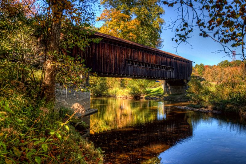
The bridges are only part of what gives this drive its character.
Between crossings, the route moves through rural roads, farm country, wooded valleys, and stretches shaped by the Grand River, Ashtabula River, Conneaut Creek, and smaller waterways.
That changes the pace naturally.
One section may run through open farmland before dropping toward a creek. Another may bring trees close to the road just before a bridge appears around a bend.
Not every stretch is paved. Official route materials note that some portions use gravel roads and advise drivers who prefer pavement to turn around safely and adjust the route.
That makes the printed or downloaded route map especially useful.
Gravel sections call for a little more patience, particularly after rain or in a low-clearance vehicle. There is no prize for rushing between bridges, and slowing down gives you more time to notice the countryside anyway.
The route is easiest when treated as a collection of short scenic decisions rather than one rigid itinerary.
Take the paved option if that suits the car. Use a gravel segment when conditions are comfortable. Stop when a bridge or river view gives you a reason.
Plan The Drive Around Two Loops
The official driving map divides the tour into North and Eastern and South and Western loops, which makes planning much easier than trying to connect 19 bridges from memory.
One loop can fill a relaxed day, especially if you plan to stop at parks, walk around larger bridges, or spend extra time at Smolen-Gulf and Harpersfield.
The Ashtabula County Covered Bridge Festival office is at 25 W Jefferson Street, Jefferson, OH 44047, a useful reference point when building the route around official bridge information.
Keep water and snacks in the car, check the weather before leaving, and pay attention to road conditions if rain has moved through the area.
October color can shift quickly, so it helps to leave space in the schedule rather than locking every stop to a precise time.
The same goes for the bridges.
Maybe the 613-foot span becomes the highlight. Maybe the 18-foot bridge gets the biggest laugh. Maybe an older crossing beside the river keeps you parked longer than expected.
That is the appeal of this Ohio road trip.
The route gives you enough structure to know where you are going, but enough variety to make each stop feel different from the last.