
Some waterfalls make you work for the introduction.
This one barely gives you time to tie your shoes.
A short walk brings you face-to-face with water dropping hundreds of feet down dark basalt, with mist already doing its best to ruin your hair.
Oregon clearly decided the first impression should be dramatic.
You can stop at the main viewpoint and take it all in, or keep climbing when curiosity wins. Higher up, the falls feel closer, and the gorge starts showing off a little more.
There is even a historic stone lodge nearby if you need food, warmth, or an excuse to stay longer.
Bring comfortable shoes and something that can handle the spray.
And really, if the first view is this good, are you stopping there?
A Roadside Waterfall In The Columbia River Gorge
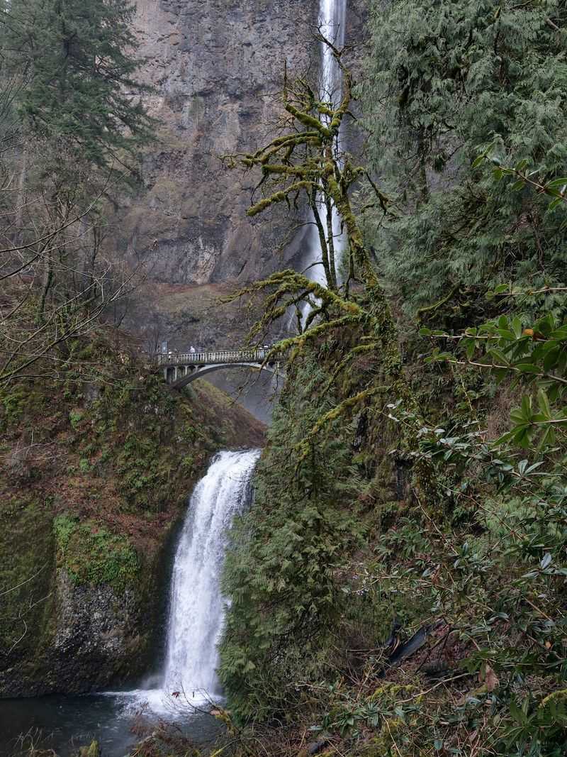
Have you ever spotted a waterfall through a car window and wanted a better look? Multnomah Falls rises above the forested roadside in the Columbia River Gorge National Scenic Area, where Interstate 84 follows the Columbia River east of Portland.
The waterfall is visible from portions of the road, although driving past provides only a brief view. The main viewing plaza offers a much better opportunity to see both tiers and the bridge between them.
Drivers using Interstate 84 can reach the large parking area at Exit 31. A pedestrian route passes beneath the interstate and connects the lot to the waterfall area.
The Historic Columbia River Highway also reaches the falls, with a smaller paid parking area near the lodge. Spaces along this route are limited, so parking may be difficult during busy periods.
During the 2026 summer season, timed-use permits were required for private vehicles entering the Interstate 84 parking area between 9 a.m. and 6 p.m. from May 22 through September 7. That requirement did not apply to arrivals using the historic highway.
The summer permit period has ended, but parking availability and road conditions still deserve attention.
For a relaxed introduction, head toward the viewing plaza before deciding whether to explore the higher trail.
The Impressive Drop From Cliff To Creek
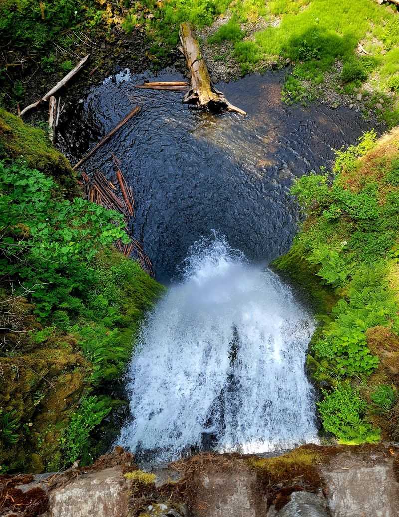
Six hundred and twenty feet is a considerable distance for water to travel. At Multnomah Falls, the combined height of the two cascades makes it Oregon’s tallest waterfall.
From the main viewing area, the upper cascade dominates the scene. Water drops down a nearly vertical cliff before reaching a pool above the shorter lower cascade.
The narrow stream appears bright against dark volcanic rock, with green moss and vegetation growing around the wet cliff faces.
Look up toward the top of the waterfall, then follow the water down to the bridge and the lower pool. Seeing the entire drop in stages makes the scale easier to appreciate.
On days when the creek carries more water, the falling stream appears fuller and the sound becomes stronger. Wind can also move the spray toward the viewing area.
Want a photograph that includes both cascades? Try a wider frame from the plaza before walking closer. A vertical composition can capture the height, while a tighter image brings out the contrast between water and stone.
You can enjoy the complete waterfall view from the lower plaza without climbing toward the bridge or upper overlook.
Two Cascades Against Ancient Basalt Cliffs
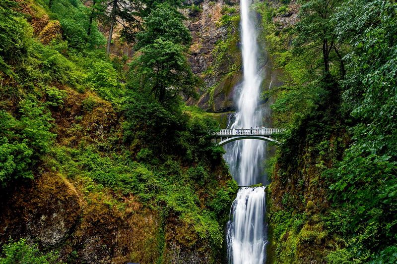
Multnomah Falls descends in two distinct stages, separated by a pool and a rocky ledge. The upper section accounts for most of the waterfall’s height, while the shorter lower cascade continues beneath Benson Bridge.
The cliffs are formed from layers of basalt, the volcanic rock that dominates much of the Columbia River Gorge.
Ancient lava flows created the foundation of these steep walls. Over time, water and erosion helped shape the cliffs, exposing bands of dark stone around the waterfall.
Look carefully at the rock surrounding the upper drop. Different layers create horizontal lines and changes in texture across the cliff face.
The water looks especially bright against these darker surfaces, while moss and ferns add green patches to the rocky setting.
Each cascade offers a different view. The upper falls forms a long, narrow column, while the lower section drops beneath the bridge into the basin below.
The amount of mist changes with wind direction and water flow. On cooler days, a waterproof layer can make standing near the falls considerably more comfortable.
If you are deciding where to take photographs, begin with the full view from below. The bridge offers another perspective once you are ready for the uphill walk.
Walking Up To The Historic Benson Bridge
Benson Bridge is one of the most recognizable features at Multnomah Falls. Built in 1914, the concrete footbridge crosses the waterfall between its upper and lower cascades.
Its graceful arch frames the lower drop, while the enormous upper waterfall rises behind it.
The bridge was funded by businessman Simon Benson, who played an important role in preserving the surrounding scenic area.
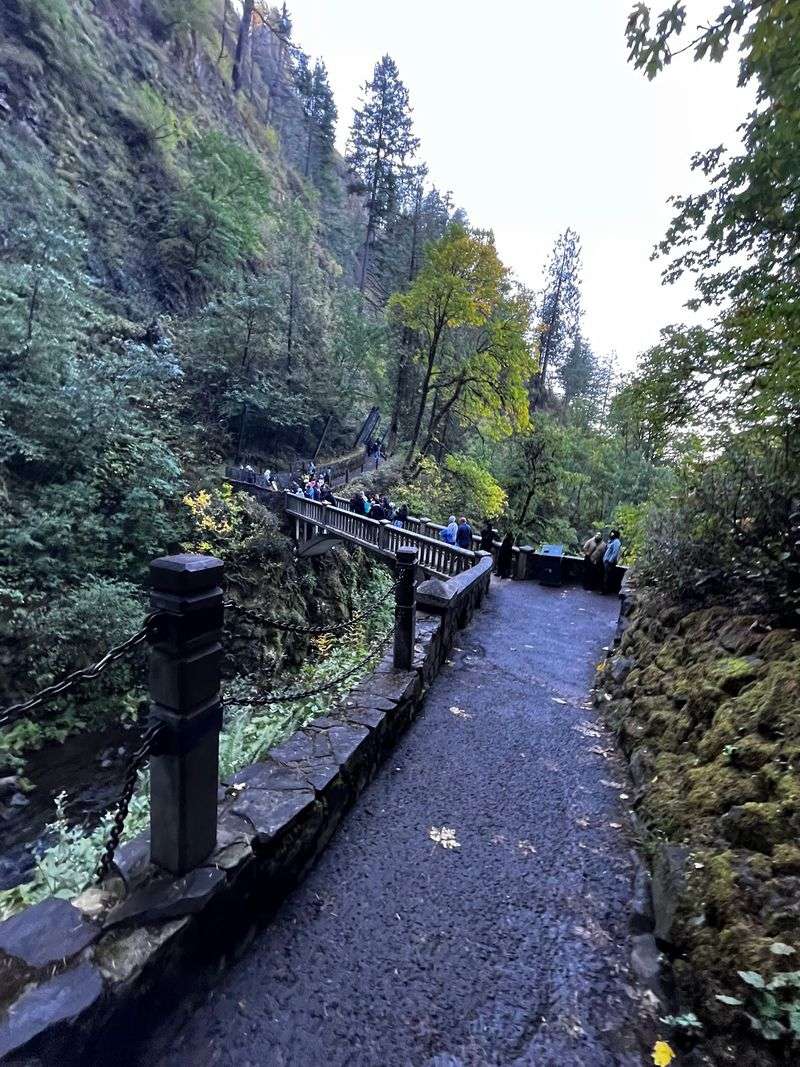
A paved uphill path connects the main viewing plaza with the bridge. The distance is relatively short, but the trail gains elevation and may feel steeper than expected.
Take your time along the climb, particularly when the pavement is wet. Spray from the waterfall can make surfaces slippery, and colder weather may bring ice.
From the bridge, you can look toward the upper cascade and down at the water continuing through the lower section.
The crossing is narrower than the plaza below, so give other visitors room to pass. Pause only where you can do so without blocking the walkway.
The bridge also offers an opportunity to notice the rock walls and vegetation around the falls from a different height.
If the uphill path is beyond your comfort level, the main plaza still provides a complete view of the bridge and both cascades.
Rain, Snowmelt, And Changing Seasonal Scenery
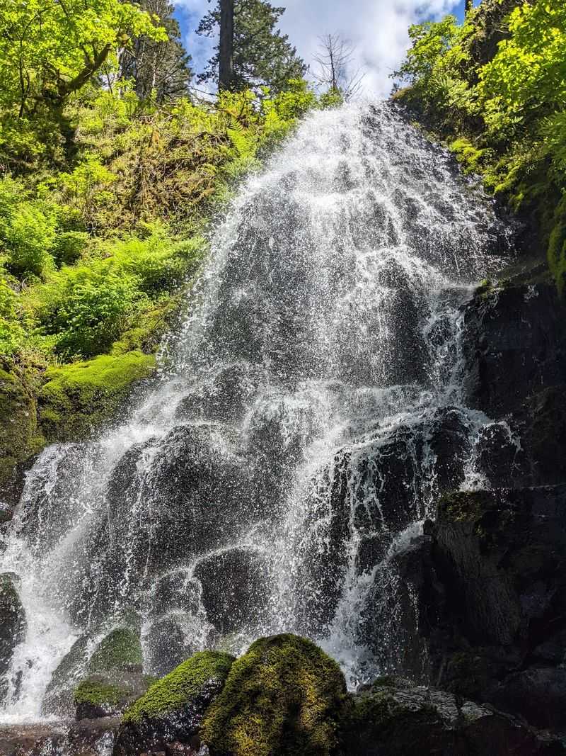
Multnomah Falls flows throughout the year, although the amount of water varies with the seasons.
Multnomah Creek receives water from rainfall, melting snow, and underground springs connected to the slopes above the gorge. Those springs help sustain the waterfall through drier periods.
Winter and spring generally bring stronger flow, when rainfall and snowmelt increase the volume of water moving through the creek.
During colder weather, ice can form along the cliffs and vegetation surrounding the waterfall. Trails may become slippery or temporarily inaccessible when conditions are hazardous.
Spring brings fresh growth to the surrounding forest, with moss-covered surfaces and ferns brightening the rocky landscape.
Summer often provides warmer walking weather, although the waterfall may carry less water than during wetter months. The viewing area can remain cool because of shade and drifting mist.
Autumn introduces changing leaves among the evergreens. Yellow and orange foliage may appear along nearby roads and forest paths, creating a different backdrop for the white cascades.
Which season sounds most appealing? Choose spring for stronger water flow, summer for generally milder hiking conditions, or autumn for seasonal color.
Whatever the month, check weather conditions before setting out and bring shoes with reliable grip.
A Historic Stone Lodge Beneath The Falls
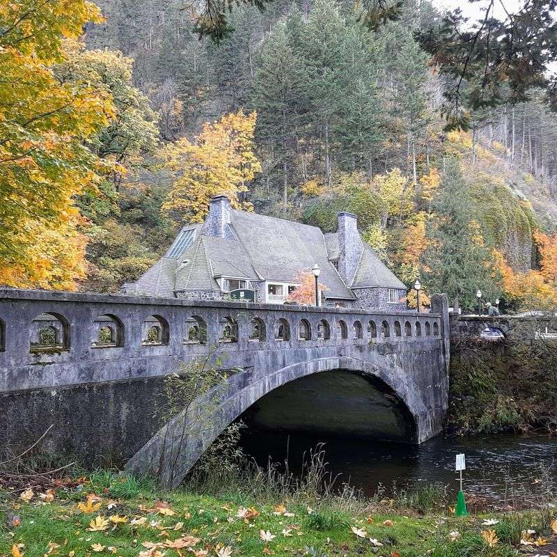
Just below the waterfall stands Multnomah Falls Lodge, a stone-and-timber building completed in 1925.
Its steep rooflines, heavy stone walls, and wood details reflect the rustic architectural style associated with early scenic-road travel in the Pacific Northwest.
The lodge was built to serve travelers exploring the Columbia River Highway. Today, it remains an important part of the waterfall area.
Inside, visitors can find a restaurant, gift shop, refreshments, and an interpretive center focused on the surrounding landscape.
The restaurant serves breakfast and other meals, making it possible to pair a waterfall visit with a stop indoors. Restaurant reservations are encouraged but are not required.
Lodge renovations may affect access to certain facilities. The restaurant elevator is operating intermittently, and restroom renovations are scheduled to continue through November 2026. Portable toilets are available outside.
For navigation, head to Multnomah Falls Lodge at 53000 E Historic Columbia River Highway, Bridal Veil, OR 97010.
The historic highway provides another way to approach the area, with forested curves and views of the gorge along the route.
If you have extra time after visiting the falls, explore the lodge’s public spaces or stop for something warm before continuing your journey.
Short Viewpoint Walks And The Climb To The Top
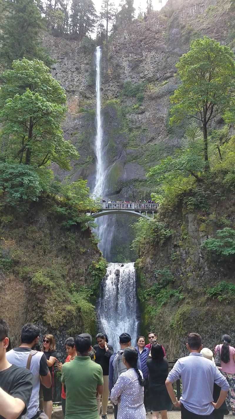
Not every visit needs to become a long hike. Multnomah Falls offers several ways to experience the scenery, from the main viewing plaza to more demanding uphill trails.
The shortest option is the approach to the base, where the viewing area provides a clear look at the waterfall and Benson Bridge.
Continue uphill if you want to reach the bridge. The paved path climbs above the plaza and offers changing views of the lower cascade.
For a bigger challenge, the trail continues toward the upper falls overlook. The route is approximately 1.2 miles each way from the base and includes numerous switchbacks.
Expect a sustained climb with significant elevation gain. Comfortable walking shoes, drinking water, and enough time for the return are important.
The overlook near the top provides a perspective looking outward across the gorge and toward the point where the creek begins its dramatic descent.
Longer trails continue into the surrounding forest, connecting with routes along Multnomah Creek and nearby waterfalls.
Trail conditions can change following storms, maintenance, or falling debris. Check current closures before committing to a longer walk.
Choose the main plaza for an easy stop, Benson Bridge for a moderate climb, or the upper overlook when you have time and energy for a more demanding walk.
Whichever route you take, leave a moment for the sound of the water before returning to the road.