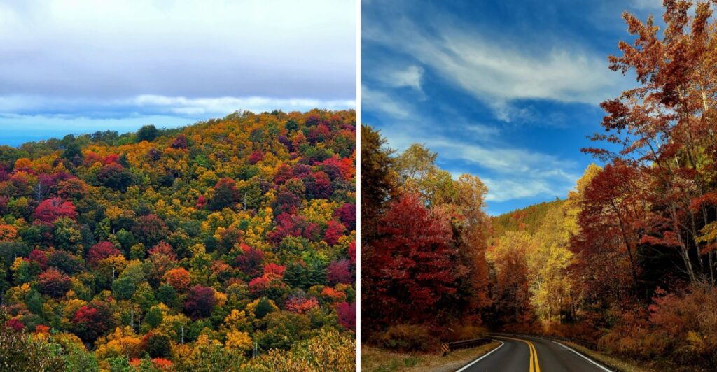
October starts changing color before this East Tennessee road has finished climbing.
Near the river, green can still hang on. Higher up, the ridges may already be deep into red, orange, and gold.
That difference makes the drive more interesting than chasing one perfect peak weekend.
The road rises from low valley country into much higher mountain terrain, so the scenery can shift noticeably as you go.
You can follow the river, head for the overlooks, or stop when one stretch of color looks too good to pass.
By the time you reach the higher elevations, the whole trip may feel like you crossed several versions of fall in one afternoon.
So which one would you rather catch first, the early color up high or the later show down by the river?
The Town Begins Where The Mountains Start To Climb
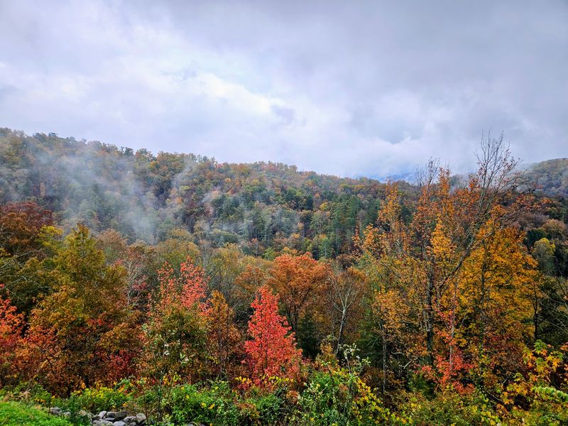
Tellico Plains is small enough that the mountains never seem far from the conversation. The town sits in Monroe County at the gateway to the Cherohala Skyway National Scenic Byway and the southern section of Cherokee National Forest.
That location makes it useful as a starting point rather than simply a place you pass through. Before the road begins climbing, you can sort out directions, check conditions, grab what you need, and decide whether the day belongs to overlooks, trails, or the river.
The Skyway is the obvious fall draw, but it is not the only one. Tellico River country spreads east and south of town, while forest roads and recreation sites open other routes through the mountains.
October also rewards an early start. Morning gives you more daylight for pull-offs and walks, and mountain temperatures can be noticeably cooler than conditions back in town.
A jacket that looked unnecessary at breakfast can become a very good idea a few thousand feet higher.
Keep the first hour loose. One road decision can easily turn into three more before lunch.Tellico Plains is small enough that the mountains never seem far from the conversation.
The town sits in Monroe County at the gateway to the Cherohala Skyway National Scenic Byway and the southern section of Cherokee National Forest.
That location makes it useful as a starting point rather than simply a place you pass through. Before the road begins climbing, you can sort out directions, check conditions, grab what you need, and decide whether the day belongs to overlooks, trails, or the river.
The Skyway is the obvious fall draw, but it is not the only one. Tellico River country spreads east and south of town, while forest roads and recreation sites open other routes through the mountains.
October also rewards an early start. Morning gives you more daylight for pull-offs and walks, and mountain temperatures can be noticeably cooler than conditions back in town.
A jacket that looked unnecessary at breakfast can become a very good idea a few thousand feet higher.
Keep the first hour loose. One road decision can easily turn into three more before lunch.
The Cherohala Skyway Turns The Drive Into The Main Event
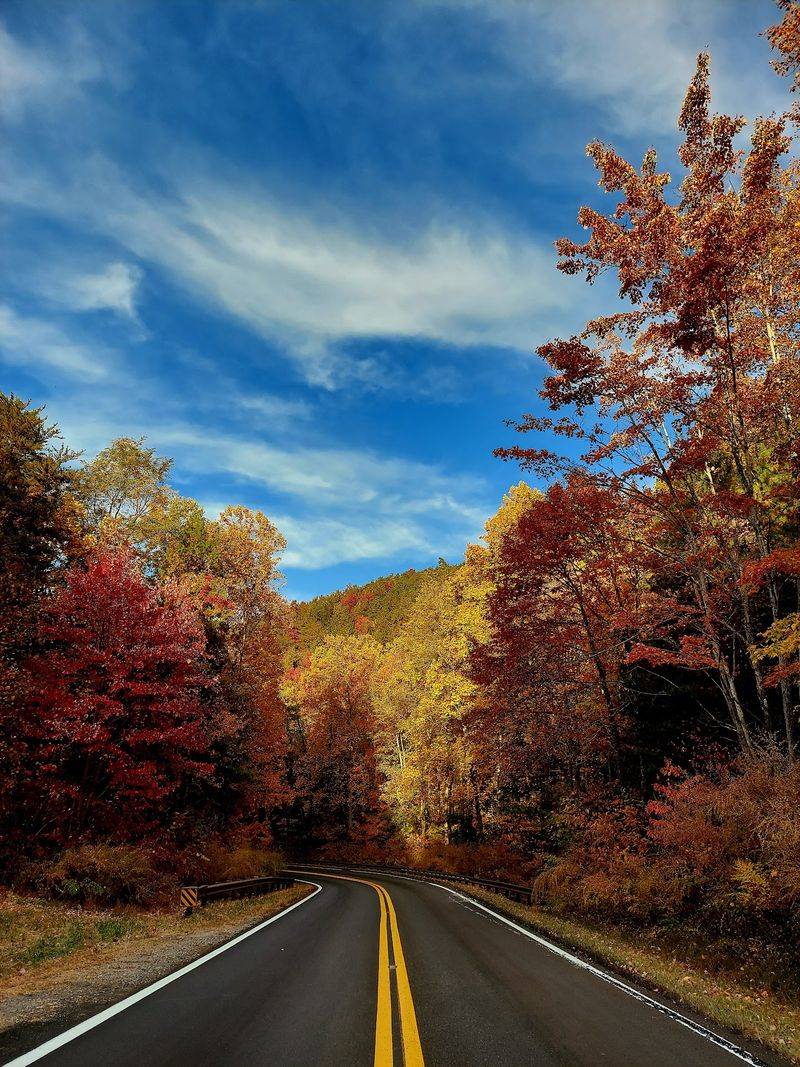
The Cherohala Skyway runs for 43 miles between Tellico Plains and Robbinsville, North Carolina, crossing Cherokee National Forest in Tennessee and Nantahala National Forest in North Carolina.
The road climbs from about 900 feet near the Tellico River to over 5,400 feet near the Tennessee-North Carolina state line, trading river valleys and lower forest for long mountain views.
That rise is what gives the drive so much variety in October. One stretch can still carry plenty of green while another is already deep into fall.
You do not need a long attraction list once you are on the Skyway. Drive for a while, pull into an overlook, walk to the edge, then continue until the next view changes the plan again.
The curves also make speed a poor goal. Give the road time, especially if leaves are wet or mountain weather changes. Taking care of fuel and basic supplies in Tellico Plains before the climb keeps the day simpler.
If you are driving the full byway, build in more time than the mileage suggests. Forty-three mountain miles are very different from forty-three interstate miles.
The better question is how many times the ridges will convince you to stop.
October Color Changes With The Elevation
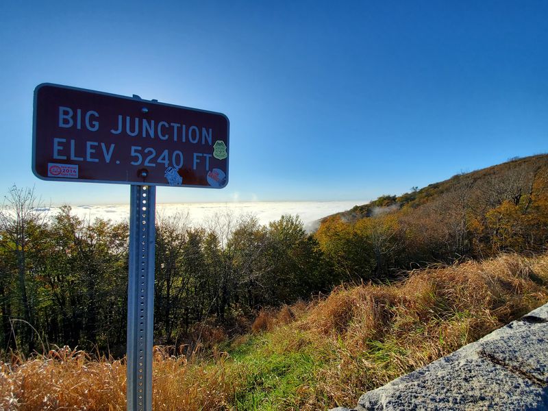
Fall color on the Skyway does not follow one neat calendar date, and that is useful.
Higher elevations generally change earlier, while mid and lower elevations often reach their strongest color later in October and into November. Weather can shift the timing from year to year, so an exact peak weekend is never something to treat as guaranteed.
That elevation spread gives you options. If the lower slopes still look early, keep climbing. If the highest ridges have already moved past their brightest stage, the valleys closer to Tellico Plains may still be holding color.
October is a strong month for the Cherohala Skyway, with mid and lower elevations often peaking later in the month. Flexibility matters more than a rigid schedule.
Cloud cover changes the look of the mountains too. Bright sun sharpens individual colors, while a softer sky can bring out layers in the distant ridges.
Check current conditions before heading up, then pay attention to what is actually outside the windshield. Fall rarely follows a script perfectly.
You get a longer color window than you might expect from one mountain road. You just have to be willing to follow it uphill or back down.
Overlooks And Short Hikes Break Up The Drive
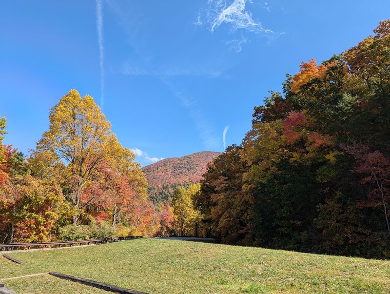
A scenic drive gets better when you stop treating the car as the best seat.
The Cherohala Skyway has multiple overlooks and pull-offs where you can step out and take in the ridges without committing to a long hike. Lake View Overlook is a named stop on the Tennessee side, while Unicoi Crest sits just across the state line in North Carolina.
Each stop changes the angle. Some viewpoints open toward layered mountains, while others look across forested slopes that can show several stages of autumn at once.
If a quick photo stop is not enough, Falls Branch Falls adds a real walk to the day. Falls Branch Trail is 1.3 miles each way and leads to a 70-foot waterfall inside the Citico Creek Wilderness.
The final portion becomes narrow, steep, and rocky, and wilderness trail markings are limited.
That makes footwear more important than enthusiasm. Save the hike for enough daylight and conditions that let you take your time.
You can also keep the day easier by choosing only overlooks. You do not need to turn every scenic drive into a workout.
Pick one place to linger instead of collecting every pull-off. Ten quiet minutes at the right overlook can beat six hurried stops.
The Tellico River Adds Waterfalls To The Fall Scenery
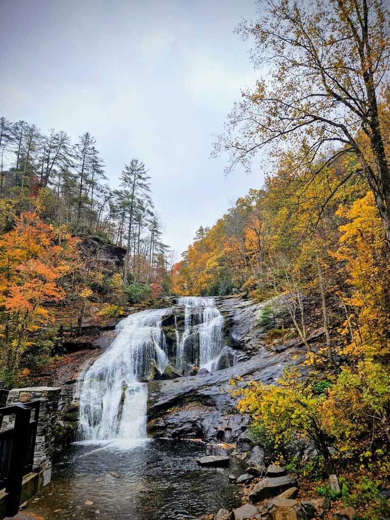
The mountains get most of the attention in October, but the Tellico River gives you a reason to come back down from the ridges.
The river corridor offers fishing, picnic areas, and waterfall scenery near Tellico Plains. It also creates a useful second route when you have already spent several hours looking across distant peaks and want something closer to the road.
Bald River Falls is an easy-to-reach landmark in this direction. The 90-foot waterfall is reached from Tellico River Road, where parking is limited and weekends and holidays can be busy.
That is a good reason to shift the waterfall portion of the day earlier or save it for a weekday when possible. A full parking area is not a reason to squeeze into an unsafe spot.
The river road also changes the scale of the scenery. On the Skyway, the view can stretch across ridge after ridge. Beside the Tellico River, the focus moves to water, rock, forest, and whatever color is hanging directly above the bank.
Pack lunch and a riverside stop can become the quietest part of the itinerary.
Wet leaves, damp rock, and steep edges deserve slower feet even when the camera is already out.
The Visitor Center Makes A Smart First Stop
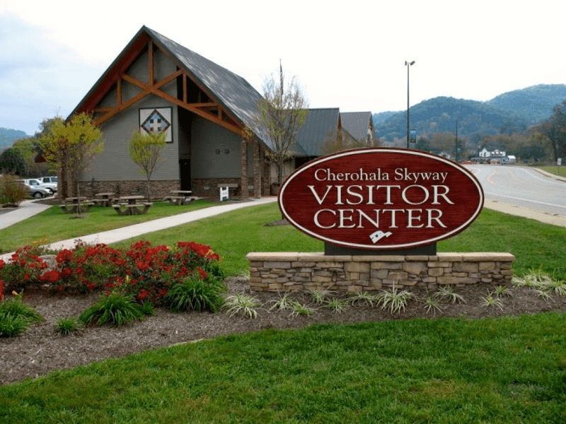
Before climbing onto the Skyway, the Cherohala Skyway Visitor Center gives you a practical place to sort out the day.
The center provides free maps, local information, current Skyway driving conditions, picnic tables, restrooms, and a gift shop. It is open daily from 9 a.m. to 5 p.m.
You will find it at 225 Cherohala Skyway, Tellico Plains, TN 37385. Putting this stop before the mountain drive gives you a chance to check conditions before committing to higher elevations.
Next door, the Charles Hall Museum and Heritage Center adds a completely different reason to pause. Its two buildings preserve local, Appalachian, Native American, and regional history, with more than 10,000 artifacts and thousands of photographs and documents.
Admission is free, and from March through December it is open daily from 10 a.m. to 5 p.m.
That combination can rescue a morning when the weather looks questionable. Spend time indoors, watch the clouds, then decide whether the mountain road still makes sense.
On a clear day, keep the stop short and save the museums for the return.
A good fall day around Tellico Plains does not have to follow the same order every time.
Cherokee National Forest Keeps The Day Open Ended
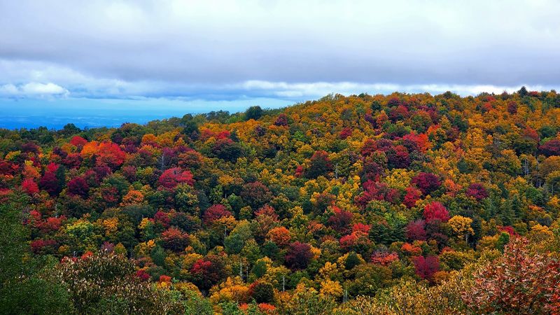
The Skyway may be the headline drive, but Cherokee National Forest is what keeps the trip from ending at the last overlook.
The forest around Tellico Plains includes streams, trails, picnic areas, campgrounds, waterfalls, and large stretches of mountain terrain. That gives you room to adjust after the main drive. A short walk can replace a longer hike.
A picnic can take the place of another hour behind the wheel. The river can win if the ridges disappear into clouds.
The Cherohala Skyway continues into Nantahala National Forest in North Carolina, so the full drive naturally crosses from one national forest into another. You can make Robbinsville the turnaround point or choose a few Tennessee-side stops and head back toward town.
October daylight is worth watching. Every overlook, trail, and river stop adds minutes faster than expected, and mountain roads are more relaxing when you are not racing sunset.
Start with one priority instead of seven. Maybe it is fall color from the highest stretch. Maybe it is Falls Branch Falls.
Maybe the Tellico River gets the afternoon.
Tellico Plains gives you all of those choices without demanding that you squeeze them into one day.
For a fall trip, the town makes a useful base. The road climbs, the color shifts with elevation, and the next good stop is rarely far away.