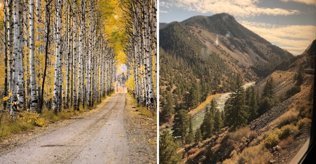
If somebody in the car keeps yelling “pull over,” blame the aspens.
They are very persuasive in fall.
Bright yellow trees take over whole stretches of mountain, and the road keeps putting another view around the next bend just when you thought everyone was finally staying in the car.
Wyoming makes a straight-through drive feel almost unrealistic here.
The route climbs through the Sierra Madre Mountains, slipping between forest and wide-open overlooks as the elevation changes.
Late September often brings the strongest color, though the weather gets to play with the calendar.
So give yourself permission to stop more than planned.
Take the photo. Stretch your legs. Get back in.
Then see how many miles you make before somebody says, “Wait, stop again.”
Aspen Alley Becomes A Tunnel Of Gold Every Fall
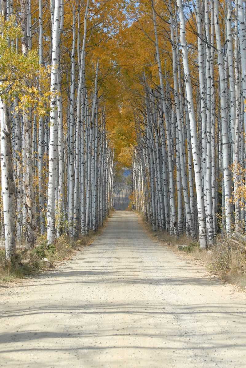
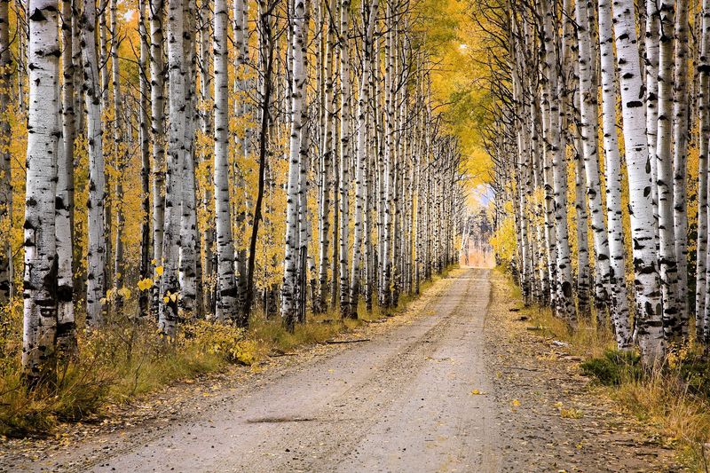
Picture yourself rolling slowly down a dirt road while golden leaves flutter overhead. That stretch is Aspen Alley, a fall stop along the Battle Pass route.
To reach it, turn north from the main byway onto Forest Road 801. The road passes through mature stands of quaking aspens that form a leafy corridor through the Sierra Madre Mountains.
In autumn, the canopy and roadside trees take on the yellow and gold color that marks the autumn season here.
The foliage here generally peaks in late September, but conditions change from year to year. A cold snap, wind, or an early storm can shorten the color window, so the calendar is only a guide.
Why do the leaves seem to tremble? Quaking aspens have flattened leaf stalks that allow the leaves to move easily in light wind. Stop where it is safe, step away from the car, and listen for the soft rustle overhead.
The road is unpaved, so slow down and allow more time than the mileage might suggest. A jacket also earns its place in the car, since mountain temperatures can feel much cooler than those back in town.
A Winding Climb Through The Sierra Madre Mountains
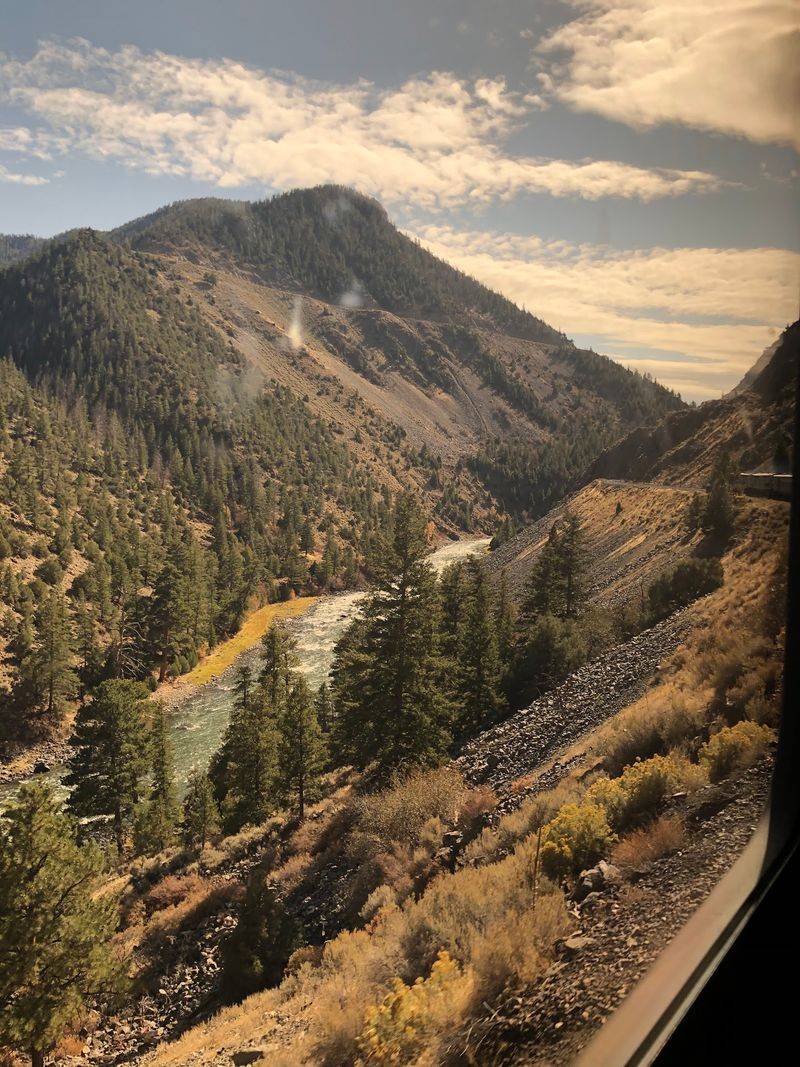
Fifty-seven miles of pavement can feel short when the scenery keeps changing. Battle Pass Scenic Byway follows Wyoming Highway 70 through Medicine Bow National Forest and over the Sierra Madre Mountains.
Dark evergreens mix with stands of aspen as the highway gains elevation. Lower views gradually give way to steeper slopes, higher ridges, and the open country around the Continental Divide.
There is no need to treat this as a point-to-point sprint. Use designated pullouts when you want to stop, and leave enough time for the side trips and viewpoints that break up the drive.
Mountain planning is simple but important. Fill the tank before heading out, carry water and snacks, and check current road and weather conditions before climbing toward the pass. Fall weather can change quickly at higher elevations.
If the day is clear, keep moving toward the higher country. If wind or clouds build, shorten the stops and save the dirt-road detours for another time. The route is scenic from the car, and a flexible schedule leaves room to step out when conditions cooperate.
The main byway stays on paved Wyoming Highway 70, while the Aspen Alley side trip turns onto unpaved Forest Road 801, so the road surface changes only when you leave the highway.
Battle Mountain Shows Off Streaks Of Orange And Gold
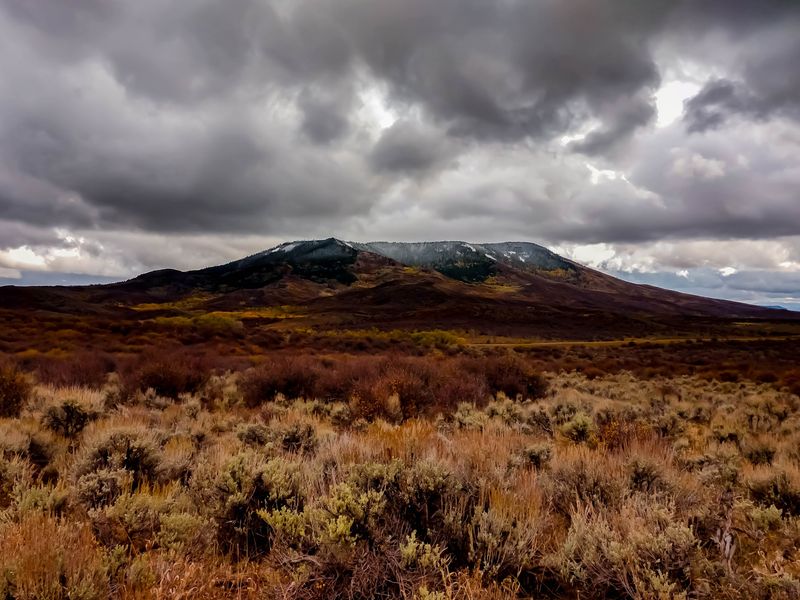
Photographers, get your wide-angle lens ready. Battle Mountain adds a broader kind of fall color to the route, with seasonal vegetation spreading across the slopes rather than surrounding the road.
In autumn, serviceberry and scrub oak contribute streaks of gold and orange below the mountain. The contrast becomes especially noticeable against darker forest and exposed high-country terrain.
Wide scenic shots work well here because the color reads across the whole slope. Instead of focusing on a single tree, frame the mountain with a little sky and enough foreground to show the scale.
Cloud cover can change the look of the ridge from minute to minute. One section may brighten while another falls into shadow, so there is little reason to rush a photo stop.
Fall foliage is temporary, and strong wind can thin the leaves quickly. Late September is usually the key period for this route, but exact color depends on the season.
Put the camera down for a minute and take in the whole mountainside. Aspen Alley gives you a close-up view of the trees, while Battle Mountain opens the scene into a much wider sweep of autumn color.
Thin Air And Big Views Near 9,900 Feet
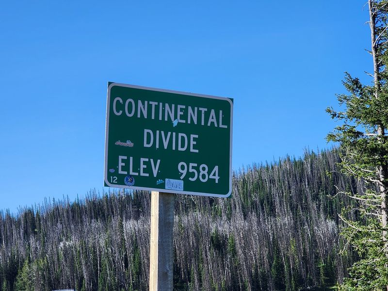
The Continental Divide near Battle Pass Summit sits at just over 9,900 feet above sea level, making elevation an important part of this stop.
From the pull-off, views stretch across high ridges in both directions. The temperature can also feel noticeably cooler than it did at lower elevations, even when the morning started mild.
Layers make this stop easier to enjoy. A warm hat or light outer layer can help when wind moves across the pass, and a few minutes of easy walking may feel better than hurrying uphill.
Thin air affects people differently. Move at a comfortable pace and take a break if you feel unusually winded.
For trip planning, use Battle Mountain Road, Encampment, WY 82325 as the Encampment-side reference point for the byway. The highway itself continues across the Sierra Madre range rather than functioning like a single-site attraction with one entrance.
Let the weather set the pace here. Clear conditions can open long views across the ridges, while stronger wind or incoming weather may make a shorter stop the practical choice.
Where Battle Pass Meets The Continental Divide
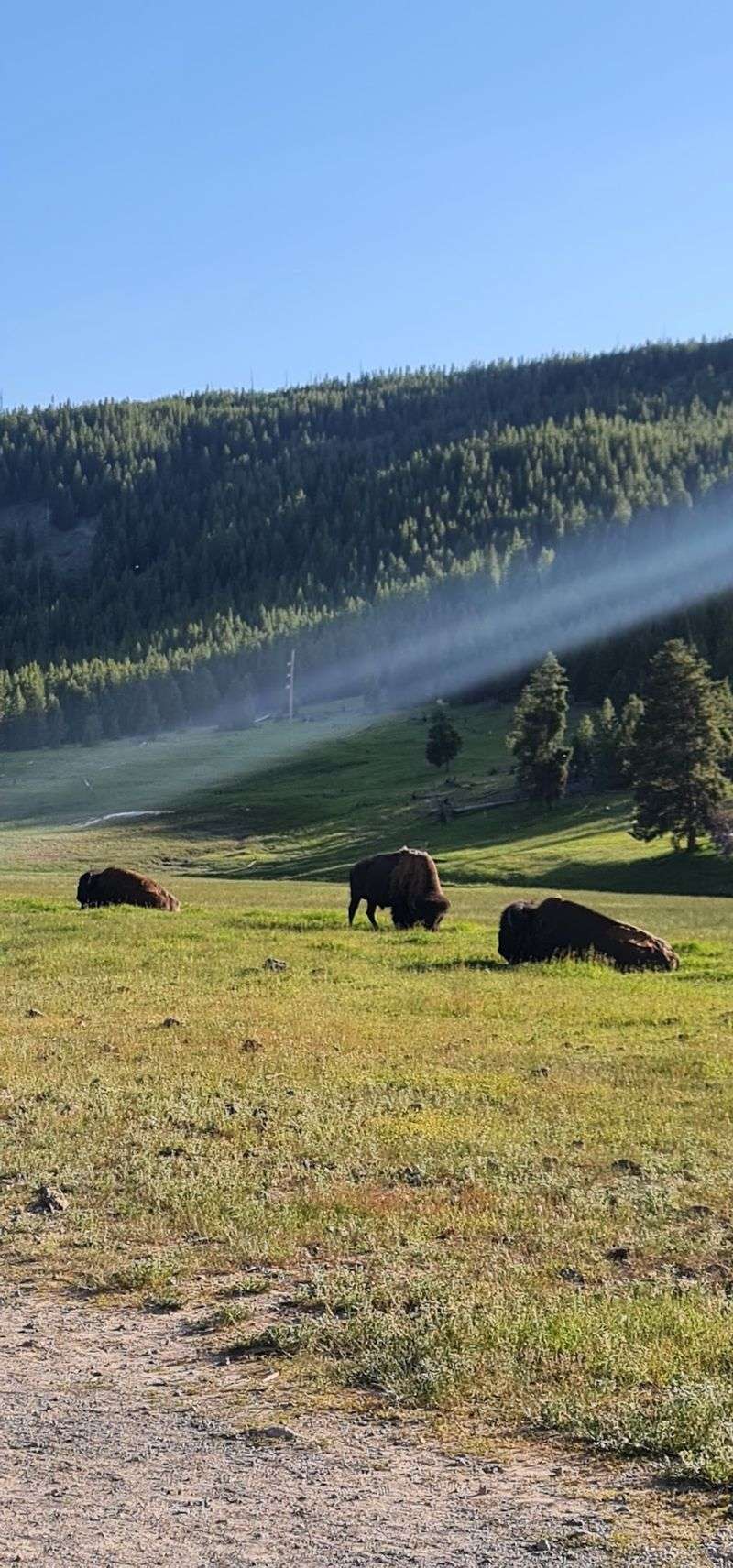
At Battle Pass, Wyoming Highway 70 crosses the Continental Divide. Rain or snowmelt on opposite sides of the divide enters different drainage systems, a geographic detail that is easy to picture when you are standing in the high country.
The Continental Divide National Scenic Trail also reaches Battle Pass. Red Mountain Trailhead provides access to the trail from Highway 70 and into the Sierra Madre Range.
Want to stretch your legs? A short walk from the trailhead can add some time outside the car without turning the stop into an all-day hike. Choose a distance that matches the weather, daylight, and the rest of your drive.
Sturdy shoes are useful on mountain trails, especially after rain or early snow. Conditions can be rocky, muddy, or uneven, and higher elevations can cool quickly.
The trail crosses a landscape of forested mountains, high ridges, and open parks. Even a brief stop gives you a closer look at terrain that feels much bigger from behind the windshield.
Before moving on, check the sky once more. The pass is one of the highest parts of the drive, so a calm valley forecast does not always mean calm conditions at the divide.
Battle Lake And A Surprising Thomas Edison Connection
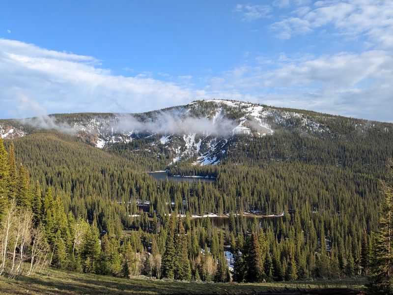
Battle Lake adds a historical stop to the drive with a monument connected to Thomas Edison.
A roadside turnout overlooking Battle Lake sits roughly two miles west of the Continental Divide. The lake sits below surrounding forest, a different setting from the exposed views near the summit.
The monument recalls a story tied to Edison’s 1878 visit to the area. In the account, a broken bamboo fishing pole placed in a fire drew his attention to the way the fibers glowed.
The story has long been linked to his later work on electric-light filaments, although the connection remains an anecdotal part of the site’s history rather than a settled account of the invention.
Read the marker, then give the lake a few minutes of its own. The turnout makes it easy to combine the history stop with a look across the water and surrounding timber.
If you packed lunch or a warm non-alcoholic drink, this is a convenient point to pause before continuing west. Keep food and trash with you when you leave, and use established areas rather than creating a new stopping spot.
Start Your Golden Journey From Encampment
Every road trip needs a starting point, and Encampment provides the eastern approach to Battle Pass Scenic Byway. From town, Wyoming Highway 70 heads west and begins climbing toward the Sierra Madre Mountains.
The transition happens gradually. Valley scenery gives way to thicker forest, higher slopes, and a series of roadside and mountain stops.
About 10 miles west of Encampment, the highway reaches the historic Battle townsite area. Battle is associated with the Sierra Madre mining era, and interpretive information at the Battle Townsite Overlook covers the history of the former settlement.
Before leaving town, handle the practical details. Fill the tank, bring water and snacks, and check the latest road conditions. The scenic drive is generally accessible from June through October, weather permitting, and seasonal conditions can close the pass when winter arrives.
An early start leaves more daylight for Aspen Alley, Battle Mountain, the Continental Divide, and Battle Lake without forcing every stop into a tight schedule.
Let the time of day decide how much you add. If the light is fading, stay with the paved route and save longer walks for another visit. If the afternoon is clear, slow down and give the high-country stops more room.
However you pace it, fall changes the route quickly. Golden aspens, orange-tinted slopes, high ridges, and a winding mountain road carry the fall scenery from one stop to the next.