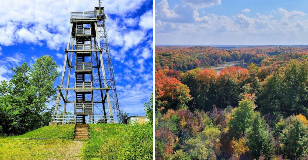
How high do you have to climb before Wisconsin begins to look completely different?
The answer waits in the Northwoods, where a forested path leads to the state’s highest natural point. The elevation reaches 1,951.5 feet, but the real test comes near the end. There, the observation tower adds 88 more steps between you and the view.
This is not a technical climb or an all-day wilderness mission. You simply keep moving.
On a clear day, you may see nearly 30 miles in every direction. So, follow the trail upward, and earn a perspective most travelers never see.
Wisconsin looks especially impressive when you are standing above almost all of it.
The Trail Leads Toward Wisconsin’s Highest Ground
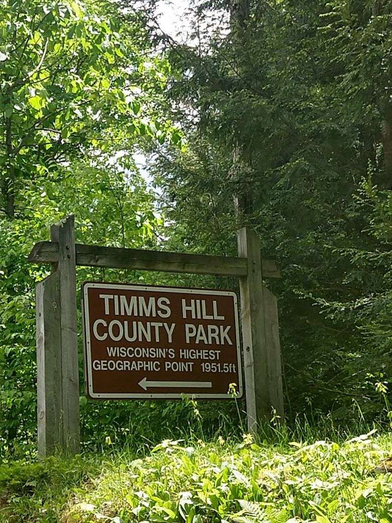
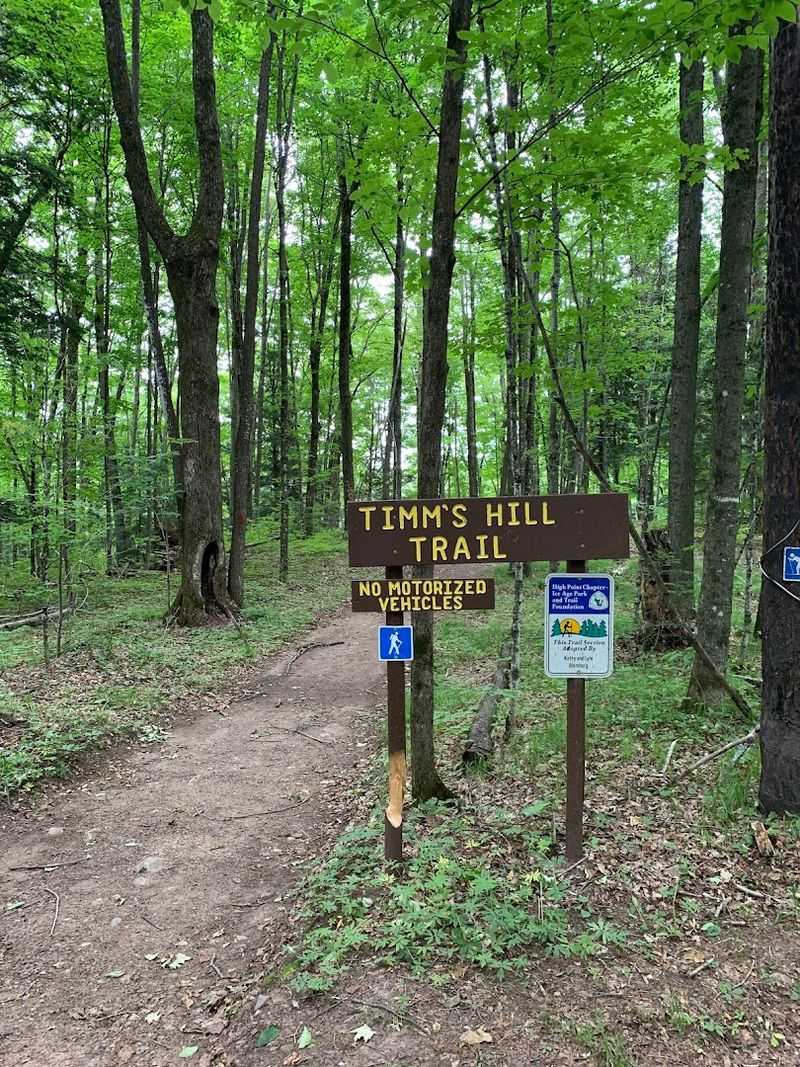
Your adventure begins below the summit, where the trail enters a forest dominated by northern hardwoods.
Timm’s Hill reaches 1,951.5 feet above sea level, making it the highest natural point in Wisconsin. The observation tower stands at the top, giving visitors additional height above the surrounding trees.
Travel Wisconsin describes the direct hike to the tower as a short but steep 0.4-mile route. It is not a long trek, but the incline keeps your legs working as you move toward the summit.
The forest controls the view during the early part of the walk. Tree trunks, leaves, and branches surround the trail, offering only brief hints of the wider landscape waiting above.
Comfortable footwear is a sensible choice because woodland surfaces can become uneven or damp. The climb may be short, but rushing would mean missing the quiet details along the way.
Then the tower appears through the trees, and the adventure changes from a forest walk into a test of how high you are willing to go.
The Park Sits Along A Wisconsin Rustic Road
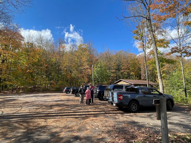
Timm’s Hill County Park is located at W3206 County Road RR, Ogema, Wisconsin.
County Road RR forms part of Rustic Road 62, a two-mile paved route that provides access to the park. The road carries you through the wooded landscape before reaching the entrance and parking area.
Price County keeps the park open throughout the year, though vehicle access changes with the seasons. The main gate generally operates from approximately May through October, opening at 7:30 a.m. and closing at 9:30 p.m.
During winter, parking is available near the intersection of Ring School Road and County Road RR. Reaching the hill during snowy months may therefore involve a longer journey on foot, skis, or snowshoes.
The park itself includes paved vehicle access and a parking area during the regular gate season. Once you leave the car, the summit must still be reached under your own power.
That final approach is part of the appeal. Wisconsin’s highest point is accessible, but it does not simply appear beside the parking lot.
Eighty-Eight Steps Separate You From The View
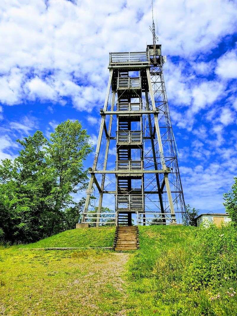
Reaching the summit is only the first half of the climb.
The observation tower rises roughly 55 to 60 feet above Timm’s Hill and places its viewing platform beyond the upper branches. Travel Wisconsin counts 88 steps between the ground and the top.
The metal staircase gives you several chances to look through the structure as you ascend. Each turn reveals more of the forest, while the ground slowly drops farther below.
Climbing at a steady pace lets you adjust to the height and enjoy the changing perspective. The tower is open to the surrounding air, so wind and weather become more noticeable as you move upward.
The final steps carry you above the canopy. Trees that towered over the trail now form a broad surface beneath the platform.
Do you look straight toward the horizon, or risk one quick glance through the stairs first?
Either choice confirms how much elevation you have gained since leaving the parking area.
The Northwoods Unfold Beneath The Platform
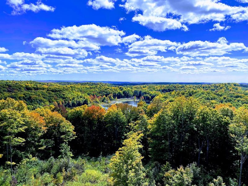
The upper platform provides a panoramic look across northern Wisconsin.
Forested glacial hills roll into the distance, broken by lakes, clearings, and small signs of development.
The landscape does not depend on one dramatic peak. Its scale comes from layer after layer of wooded terrain spreading outward from the hill.
Looking in every direction helps you understand why the tower matters. Timm’s Hill may be Wisconsin’s highest natural point, but the surrounding canopy would limit much of the view without the added height of the structure.
The tower lifts you above that green barrier and reveals the shape of the country below.
Pause long enough, and small details begin to emerge. A lake catches the light. A distant ridge forms a dark line against the sky.
Roads and buildings shrink into the wider forest.
The platform turns a number on an elevation marker into something you can see with your own eyes.
Bass Lake Appears Below The Hill
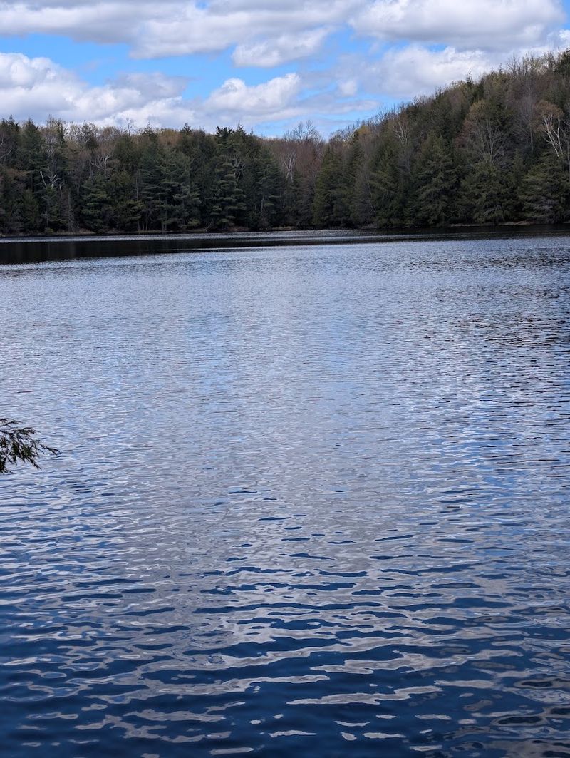
Bass Lake adds open water to the wooded panorama.
Price County states that the lake is completely surrounded by county park property. Travel Wisconsin places it about 160 feet below the high point, making it one of the most recognizable features near the tower.
Part of the shoreline of Timm’s Lake also borders the park. Together, the lakes break up the forest and give your eyes clear reference points as you study the view.
Back at ground level, Bass Lake offers more than scenery. Park amenities include a boat landing, fishing pier, and swimming beach.
You can therefore turn the tower climb into a longer outdoor day. Begin with the summit, return through the forest, and then head toward the water once your legs are back on level ground.
The lake also provides a useful reminder of how high you have climbed. From the shore, the forest rises around you. From the tower, the same water becomes one blue shape within a much larger landscape.
Autumn Covers The Horizon In Color
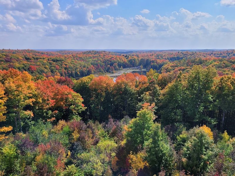
Fall brings the most dramatic transformation to Timm’s Hill.
The park’s northern hardwood forest shifts through shades of yellow, orange, and red, creating wide bands of color across the surrounding hills. From the tower, you can see those changes across a far greater area than you could from the trail.
Some trees turn earlier than others, so the view rarely becomes one uniform shade. Green sections may remain beside bright gold ridges, while darker evergreens hold their color among the hardwoods.
The timing of peak foliage changes with temperature and weather conditions each year. Checking Wisconsin’s current fall-color reporting before your trip provides a better guide than relying on one fixed weekend.
Busy fall days can bring more people to the summit and tower. A little patience gives everyone room to climb and enjoy the platform safely.
Even before full color arrives, the contrast across the hills can be striking. After the peak passes, remaining leaves and open branches reveal another version of the Northwoods.
The tower supplies the height. Autumn supplies the spectacle.
The Park Offers More Ways To Explore
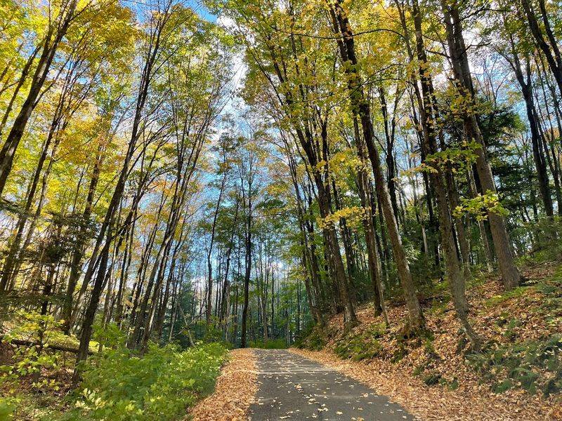
The tower may be the main objective, but it is not the park’s only adventure.
Timm’s Hill County Park includes hiking trails, picnic tables, grills, an open-air shelter, play equipment, a swimming beach, a fishing pier, and a boat landing. These facilities make it possible to stay well beyond the summit climb.
The trail network also connects with longer regional routes. The Timm’s Hill National Trail links the area with the Ice Age Trail, while nearby High Point Trails provide about nine miles of nonmotorized routes through hardwood and hemlock forest.
Seasonal recreation includes hiking, mountain biking, horseback riding, cross-country skiing, snowshoeing, and skijoring on designated trails.
Winter changes the character of the trip. Snow covers the access road and trails, the regular park gate closes, and the journey toward the summit becomes more demanding.
During the warmer gate season, the tower can serve as the opening challenge before a picnic, swim, or hike.
You can make the visit brief, but the surrounding trails and lakes give you plenty of reasons not to hurry home.
Timm’s Hill Rewards Every Step Upward
Timm’s Hill proves that a statewide high point can deliver adventure without requiring ropes, technical climbing, or days of preparation.
The forest trail carries you toward the summit, and the tower adds 88 final steps above the trees. At the top, the Northwoods stretches across roughly 30 miles on clear days.
The route asks for some effort, especially during the steeper sections and final staircase. In return, you get a view shaped by glacial hills, hardwood forest, and lakes far below the platform.
After descending, Bass Lake, picnic areas, trails, and other park facilities can keep the outing going.
You may arrive focused on reaching Wisconsin’s highest natural elevation. The real reward comes when you climb beyond it and discover how large the Northwoods looks from above.