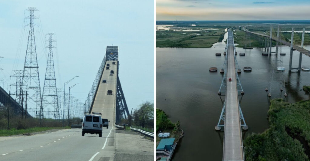
Texas has a bridge that apparently missed the memo about staying level.
The steel crossing climbs over the Neches River with a five-percent grade, and the flat coastal landscape makes that rise look even more dramatic.
Ships pass below while drivers get a front-row seat to one of the region’s most recognizable crossings.
The bridge has been doing this since 1938, when it opened under a different name. Nearly ninety years later, the historic cantilever span still knows how to make an entrance.
It also recently returned after a major maintenance project, reopening in April 2026.
Most bridges are content to get you from one side to the other. This one adds height, history, and enough drama to make the crossing feel like part of the road trip.
Five Percent Feels Much Bigger Against Flat Texas
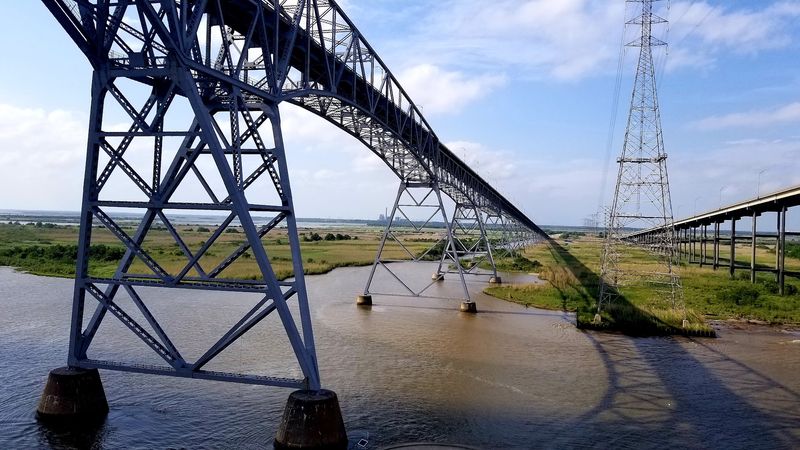
Southeast Texas does not spend much time practicing hills, which helps Rainbow Bridge make such an entrance.
The roadway climbs at a five-percent grade, meaning it rises about five feet for every 100 feet traveled. The surrounding coastal plain gives that incline extra visual impact because there are few nearby hills competing for attention.
From a distance, the steel truss seems to lift straight out of the landscape. Keep driving toward it and the road begins climbing toward the central span while the horizon opens around you.
Rainbow Bridge now carries westbound traffic from Orange County toward Jefferson County and Port Arthur. The parallel Veterans Memorial Bridge carries eastbound traffic in the opposite direction.
You do not need to turn the crossing into a test of courage. Keep your attention on the lane, follow posted speeds and current traffic conditions, and let passengers handle most of the sightseeing.
That is especially useful near the high central portion, where the river, marshes, and industrial landscape spread out around the steel framework.
Five percent may sound tame on paper. Put it on a bridge rising from flat coastal Texas and suddenly the calculator seems to be smirking.
Nearly A Mile And A Half Stretches Across River And Marsh
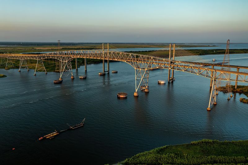
The climb is only part of the story. Rainbow Bridge is also very long.
The bridge and its approaches extend about 7,750 feet, which works out to nearly a mile and a half. The structure crosses the Neches River along with broad stretches of low, marshy terrain around the channel.
That distance is why the bridge begins rising well before the central navigation span. Long approach sections carry traffic upward until the steel truss dominates the crossing above the river.
The main span measures 680 feet between its primary supports. Cantilever spans, continuous truss spans, deck truss sections, girders, and approach structures make up the rest of the crossing.
If you are approaching from the Orange County side, the bridge can seem to keep growing as the high point comes into view. Once you are on it, the route settles into a two-lane highway crossing with an unusually broad view attached.
The bridge had to cross marshy ground as well as a busy shipping channel, so its length spreads the structure far beyond the river itself.
A mile and a half is nothing unusual during a Texas road trip. Put much of it above marshland and a major river, though, and the distance becomes much harder to ignore.
The River Gets About 176 Feet Of Headroom
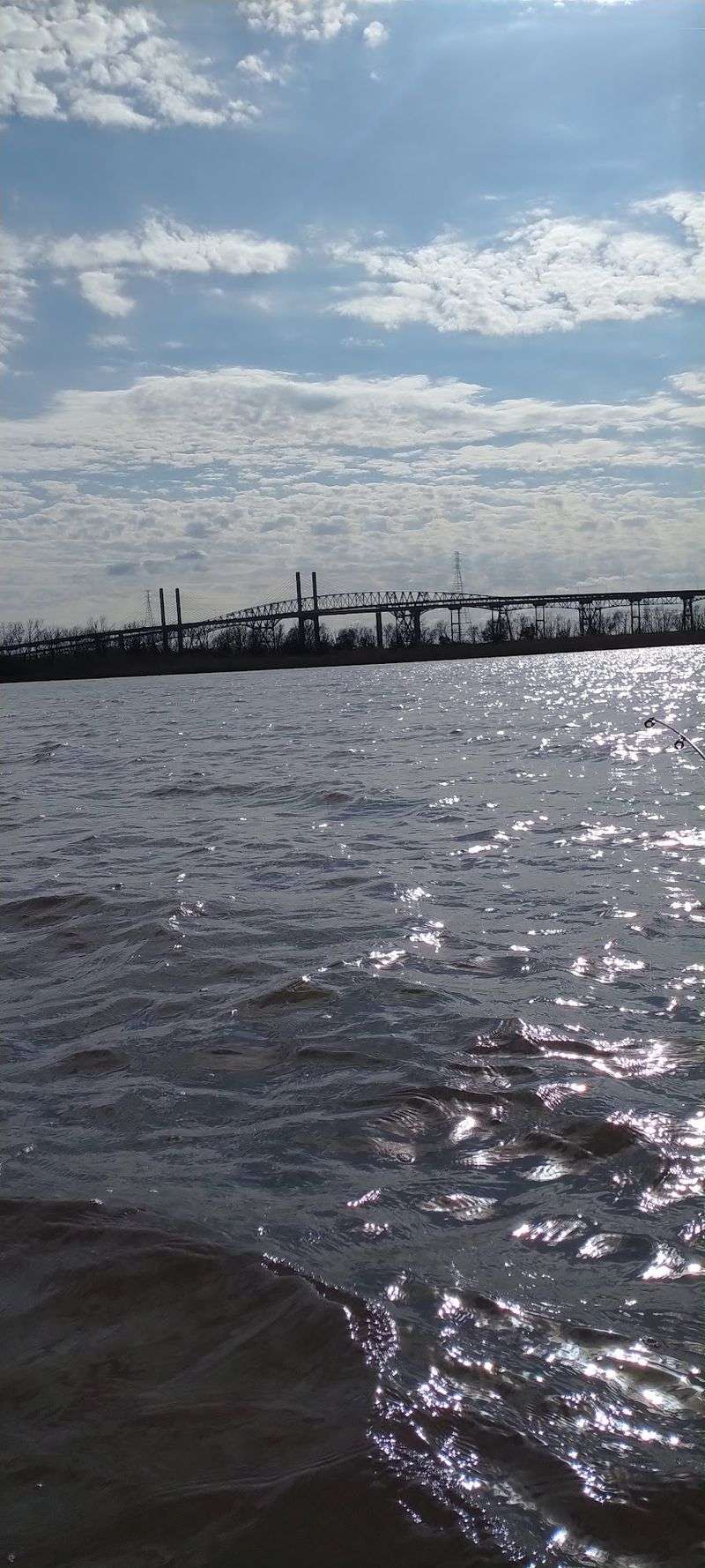
Rainbow Bridge climbs high because the Neches River below needed plenty of room of its own.
The navigation channel receives about 176 feet of vertical clearance beneath the bridge. When engineers planned the crossing in the 1930s, keeping the river open to oceangoing ships serving Beaumont was a central requirement.
One famous part of that story involves USS Patoka, a U.S. Navy ship that had served as a tender for large airships. The bridge clearance was designed to accommodate a vessel of that scale, although Patoka never traveled beneath the finished span.
The resulting clearance put the roadway higher over tidal water than any other highway bridge of its kind when the structure was completed.
The Neches remains an active shipping route linking the Beaumont area with the Gulf of Mexico. Cargo ships and tankers continue to use the waterway beneath the bridge.
From the driver’s seat, the reason for all that height can be easy to forget while the road is climbing. Look at the river traffic from a safe passenger-seat viewpoint and the design begins to make perfect sense.
Big ships needed room, and engineers gave them an upstairs neighbor.
A 680-Foot Cantilever Span Creates The Signature Shape
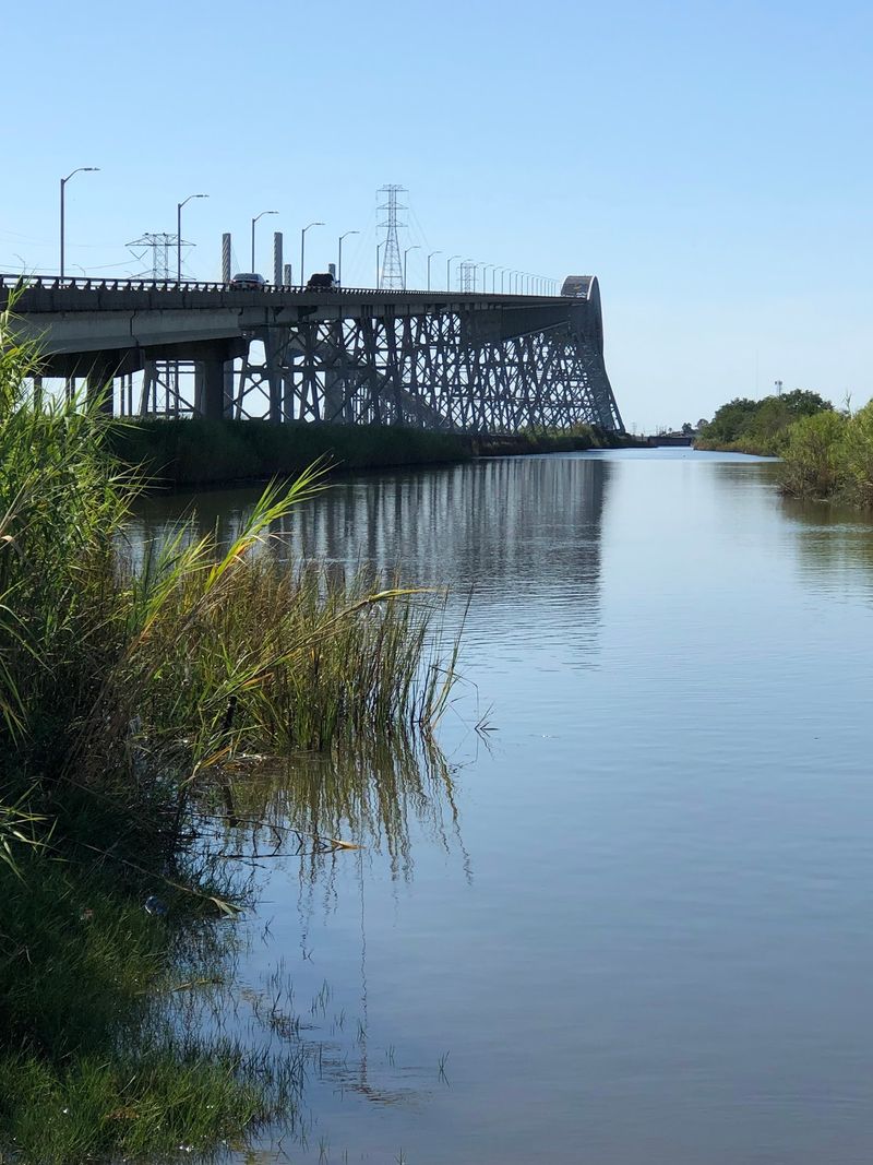
The center of Rainbow Bridge is where the steelwork takes over the skyline.
Its 680-foot main span uses a cantilever through-truss design, with large steel members forming the high central portion above the navigation channel. Additional truss and girder sections stretch toward the long approaches on either side.
That arrangement gives the bridge the rising profile that later made the Rainbow name fit so naturally.
Construction began in May 1936 under the Texas Highway Department. Building across marshy ground and the Neches River required deep foundations and extensive steelwork before traffic could ever make the climb.
By the time the bridge opened in 1938, it was the largest bridge the Texas Highway Department had built.
You can still see that scale before reaching the approach. The central truss rises above the coastal landscape while the long roadway reaches outward toward much lower ground.
Inside the span, steel members form a dense geometric frame around the roadway. The engineering may look complicated from the car, but your part remains refreshingly simple.
Stay in your lane, keep moving, and let the bridge handle the heavy lifting. I’d say It’s a fair division of workload.
Drivers Have Been Making This Climb Since 1938
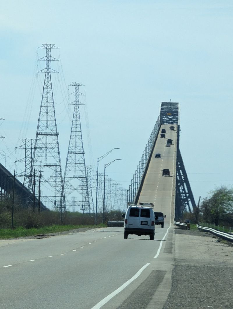
Rainbow Bridge entered service when automobiles looked very different and the Interstate Highway System was still years away.
Construction began in 1936, and the Port Arthur-Orange Bridge was dedicated on September 8, 1938. The new crossing replaced the Dryden Ferry, which had served travelers across the Neches River as local traffic and industry continued to grow.
The finished bridge created a permanent highway connection while leaving enough clearance for ships to continue traveling upstream.
A second major crossing arrived decades later. Veterans Memorial Bridge was dedicated in 1990 beside Rainbow Bridge, eventually taking eastbound traffic while the older bridge carried westbound vehicles.
Rainbow Bridge underwent a major rehabilitation during the 1990s before returning to service in that one-way configuration.
The Port Arthur-Orange Bridge was added to the National Register of Historic Places on October 10, 1996. Its listing recognizes the crossing for its importance in transportation and engineering.
That means your modern drive uses a structure built before the interstate system and preserved as a nationally recognized historic bridge.
Some highways give you mileage markers. This one gives you a 1938 landmark beneath the tires.
The Rainbow Name Did Not Arrive Until 1957
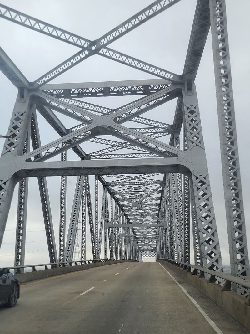
For its first nineteen years, the bridge answered to a very practical name.
It opened as the Port Arthur-Orange Bridge, identifying the areas linked by the crossing without spending much time on poetry.
That changed in 1957, when the North Port Arthur Lions Club sponsored a naming contest. Rainbow Bridge was the winning choice, giving the structure the name it still carries today.
The new name suited the shape. From a distance, the long approaches rise toward the high central steel span and descend toward the opposite side, creating a broad arc above the river and marshes.
It also gave Southeast Texas a landmark name that is easier to remember than a collection of highway numbers.
A Texas Historical Commission marker near the bridge tells part of the story, including the construction era, its height and length, the 1938 dedication, and the 1957 naming contest.
Today, Rainbow Bridge remains both a working transportation route and one of the most recognizable structures along this stretch of the Neches River.
Port Arthur-Orange Bridge told drivers where the crossing went. Rainbow Bridge gave the trip a better nickname.
Fresh Repairs Put The Historic Crossing Back In Service
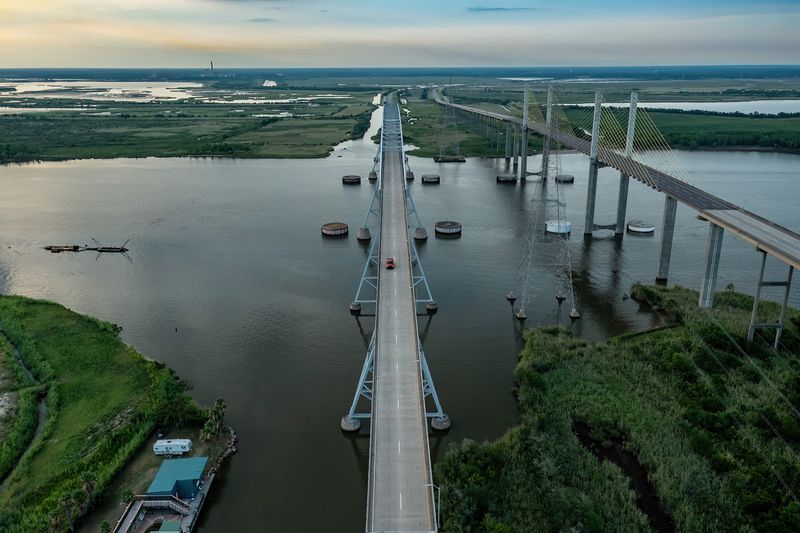
Rainbow Bridge recently spent more than a year away from traffic, but the pause ended in spring 2026.
The Texas Department of Transportation closed the bridge in March 2025 for major maintenance. Work included full-depth concrete deck restoration, steel railing repairs, structural repairs, and replacement of 1,200 rivets and four steel member pins.
During the closure, westbound traffic was shifted to the neighboring Veterans Memorial Bridge, which temporarily carried vehicles in both directions.
The main maintenance work was completed in March 2026. Detailed inspections followed before Rainbow Bridge reopened to traffic on April 11, 2026.
Westbound drivers can once again use the historic crossing between Orange and Jefferson counties while eastbound traffic uses Veterans Memorial Bridge.
For your first trip after the reopening, there is no need to make the drive a dare. Check current road conditions, keep your attention ahead, and leave the panoramic sightseeing to passengers.
The climb occupies only a small piece of a longer journey, but it gives Southeast Texas one of its most recognizable stretches of highway.
Nearly ninety years after the first dedication, steel, river traffic, and westbound cars are sharing the same crossing again.
Now that Rainbow Bridge is back in service, would you take the high road and make the crossing?