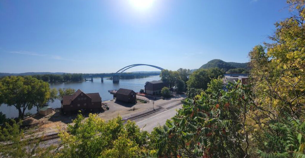
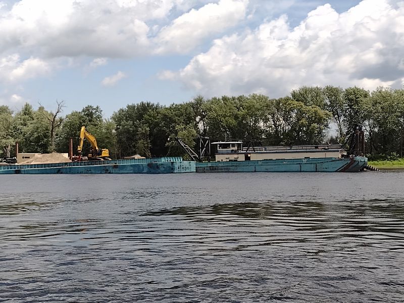
Fewer than 450 people live in this river town, and I counted more barges than traffic lights during my first afternoon there.
Northeast Iowa hides a stretch of the Mississippi where limestone bluffs rise straight out of the water and eagles perch close enough that you stop reaching for your phone camera.
I came for one night and stayed longer, mostly because the view from the levee kept changing every twenty minutes as the light shifted.
Here is the honest version of what this Iowa town offers: a working railroad line, a bridge to Wisconsin, bluff-top trails, and a pace so slow that ordering breakfast feels like a social event.
If you like your river towns without crowds, gift shop mazes, or parking meters, keep reading. I will tell you exactly where it is, when to go, and what surprised me most.
A River Town Of 429 People With A Big Front Yard
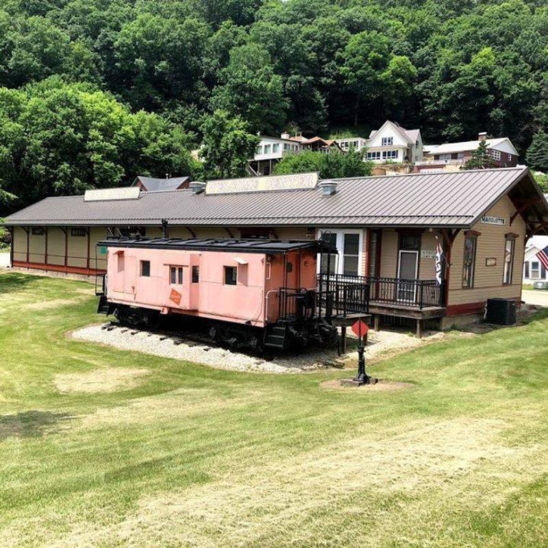
The population sign does not lie. Marquette, Iowa sits in Clayton County with 429 residents counted in the 2020 census, up slightly from 421 in 2000.
What that number cannot show is the scale of the water in front of it. The Mississippi widens here, splitting into channels and backwaters, and the town presses itself against the bluff line because that is all the flat ground available.
Main Street runs a few blocks. You can walk the entire business district in ten minutes and still have time to watch a barge push upstream.
Railroad tracks slice between the town and the river, and freight trains roll through often enough that I learned to pause mid-sentence and wait.
The mailing address is simply Marquette, Iowa 52158, which tells you plenty about how compact the place is.
Locals I spoke with were friendly but protective. Nobody wants a tour bus lane on a street where kids ride bikes down the middle.
That combination of tiny footprint and enormous view is exactly why the town keeps showing up in conversations among river people who would rather not advertise it.
How The Town Got Its Name And Its Railroad Bones
Father Jacques Marquette passed through this stretch of the upper Mississippi in 1673 with Louis Jolliet, and the town carries his name.
Before that name stuck, the settlement went by North McGregor, a nod to its larger neighbor just downstream.
Railroads made the place matter. Trains arrived, freight moved, and for years railcars crossed the river here on a pontoon bridge, one of the more unusual crossings on the entire Mississippi.
I learned that detail from a plaque near the waterfront and then spent an embarrassing amount of time trying to picture how a floating rail bridge actually worked.
The pontoon system is gone, but the tracks remain active, and the Canadian Pacific line still hauls freight along the levee.
Old brick and clapboard buildings survive downtown, some restored, some patiently waiting.
What I appreciated is that nobody has turned the history into a theme. No costumed guides, no gift shop replicas of steamboats.
The story sits on signs and in the bones of the buildings, and you piece it together at your own pace with a coffee in hand.
Crossing The Bridge Into Wisconsin
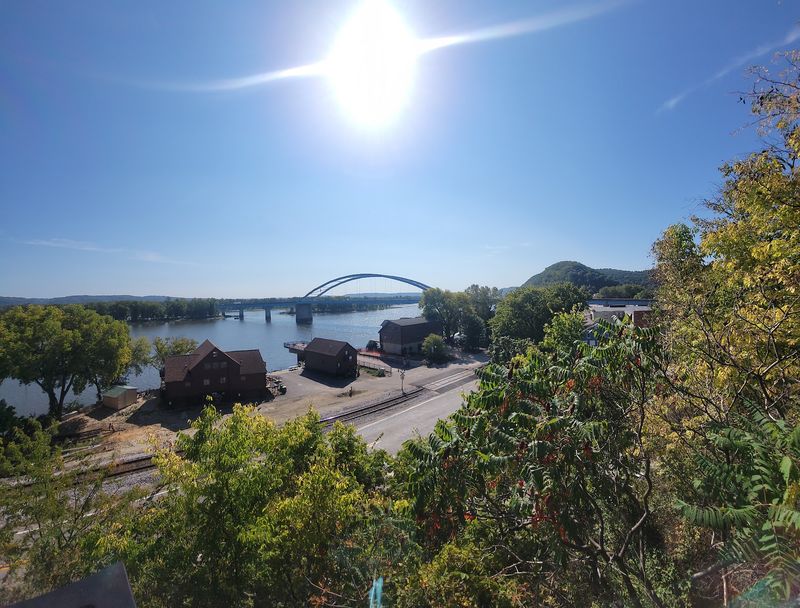
Standing at the Iowa end of the Marquette-Joliet Bridge, I watched a pickup truck cross into Wisconsin in under two minutes. The state line runs right through the middle of the river.
Highway 18 carries you over to Prairie du Chien, a considerably larger town with groceries, restaurants, and a hospital.
That closeness matters practically. You can base yourself in a quiet Iowa river town and still reach full services in about five minutes of driving.
The bridge also gives you the best free overview of the valley. Sightlines open up across islands, sandbars, and the wooded ridges on both banks.
Do not stop on the bridge itself. Instead, park in town near the waterfront and look upriver, or pull off on the Wisconsin side where there are designated spots.
Truck traffic uses this route, so bikes and pedestrians should be cautious about the shoulder width.
Coming back into Iowa at sunset, with the bluffs turning gold and the water going flat and silver, I understood why people who live here take the long way home on purpose.
Effigy Mounds Sits Practically Next Door
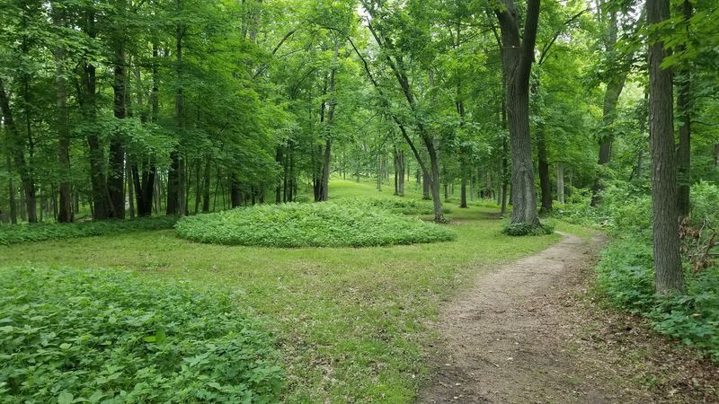
Three miles north of town, Effigy Mounds National Monument protects more than 200 prehistoric mounds, including animal-shaped ones built by Native peoples over a thousand years ago.
The Great Bear Mound stretches roughly 137 feet long, and standing beside it I could barely make out the shape from ground level. Aerial diagrams at the visitor center help.
Trails climb from the parking area up to Fire Point, where the overlook drops away toward the river with almost no railing between you and a very long view.
Bring water and decent shoes. The paths are packed gravel and dirt with steady uphill sections, and the first half mile does most of the climbing.
The grounds are sacred to many tribal nations, so staying on the trail is not a suggestion. Walking on a mound damages it.
Admission has historically been free, though hours vary by season, so check before driving up.
I went early on a weekday and shared the trail with two other people and a very committed pileated woodpecker.
Few places let you stand on ground shaped by human hands this old with this little company.
Pikes Peak And The Bluff Top View
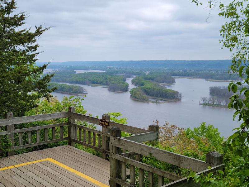
Iowa has a Pikes Peak, and it is nothing like the Colorado one. This bluff rises about 500 feet above the Mississippi and it holds one of the best river overlooks in the Midwest.
Pikes Peak State Park sits just south of Marquette near McGregor, a short drive along the river road.
The main overlook deck looks out over the spot where the Wisconsin River joins the Mississippi, and you can trace the color difference where the two currents meet.
A boardwalk trail leads to Bridal Veil Falls, which trickles over a rock shelf into a shaded pocket of the woods.
Autumn brings the crowds, relatively speaking. Mid-October weekends fill the parking lot, so arrive before ten if you want the deck to yourself.
Winter has its own appeal. Ice forms along the falls, and the bare trees open up sightlines you cannot get in July.
Restrooms, picnic shelters, and a campground make it easy to turn a quick stop into a full afternoon.
My advice is simple. Pack lunch in town, eat it on the bluff, and let the barges provide the entertainment.
Boats Docks And Backwater Fishing
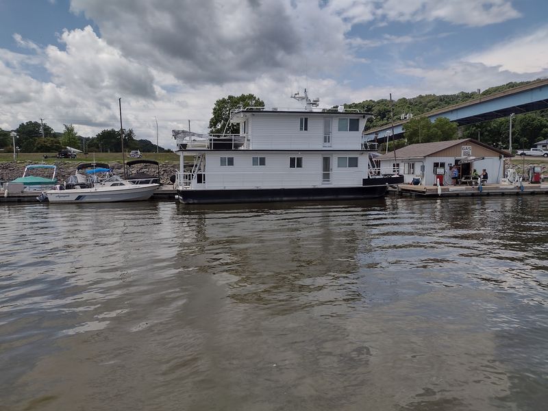
Fishing here is not a hobby, it is basically a local dialect. The backwaters around town hold walleye, bluegill, crappie, catfish, and northern pike, and the sloughs give small boats plenty of protected water.
Public boat access sits right in town, which means you can launch, run five minutes, and be surrounded by islands with nobody in sight.
Guides operate out of the area for people who do not own a boat or a tackle box the size of a suitcase.
Spring brings the walleye run below the wing dams, and summer evenings are all about panfish in the shallows.
Winter changes everything. Ice shacks appear on the frozen backwaters, and locals watch conditions closely because current makes river ice unpredictable.
Fishing on this stretch follows Mississippi River boundary-water rules. A valid Iowa or Wisconsin fishing license can provide privileges within the defined boundary waters under the states’ reciprocity agreement, but anglers still need to follow the applicable regulations.
I watched a man clean bluegill at the dock while explaining the difference between a good spot and a very good spot, which apparently comes down to about forty feet.
Bring bug spray from June through August. The mosquitoes do not negotiate.
Eagles Herons And The Flyway Overhead
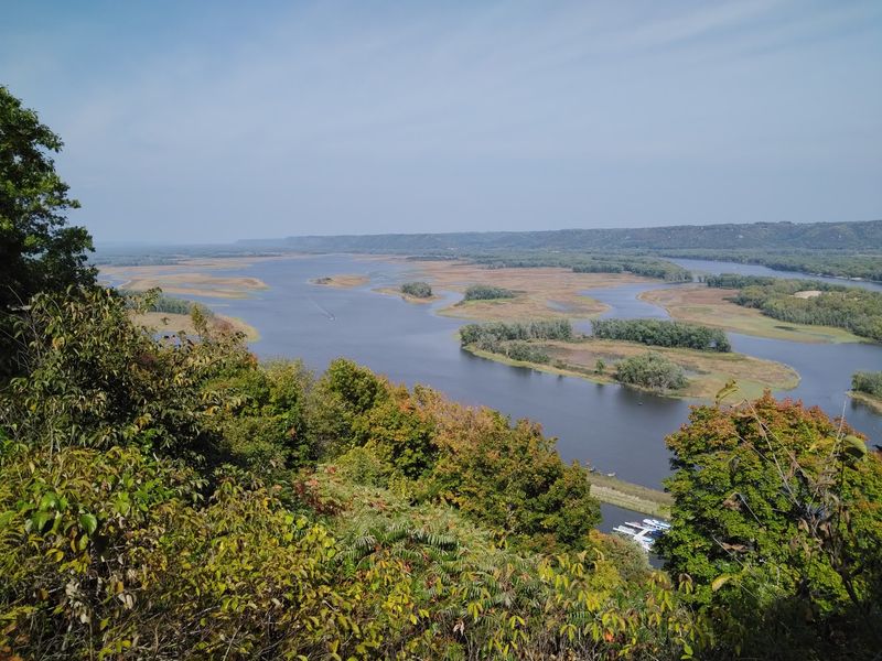
Counting bald eagles became my accidental hobby. In one January morning I spotted eleven, mostly sitting in cottonwoods above open water where the current keeps ice from forming.
The Mississippi Flyway funnels enormous numbers of migrating birds through this corridor twice a year.
Spring and fall bring pelicans, tundra swans, and huge rafts of ducks onto the backwaters. Great blue herons stalk the shallows all summer long.
You do not need special equipment, though binoculars turn a distant dot into an actual bird.
Best viewing happens from the levee area, the bridge approach, and anywhere along the river road where you can safely pull off.
Early morning wins. Birds are active, the water is calm, and the light comes over the Wisconsin bluffs at a low angle that makes everything look sharper.
Local birders keep informal notes on where the eagles are nesting, and asking politely at a shop or cafe usually gets you a helpful answer.
What struck me most was the sound. Standing on frozen ground, you hear wings before you see anything, which is a fair trade for cold fingers.
Where To Eat When The Town Has Four Blocks
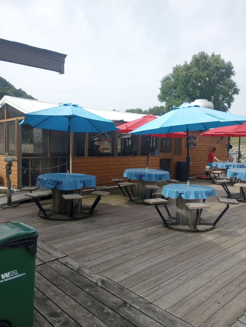
Breakfast options are limited, and honestly that simplifies your morning considerably.
The longtime Marquette Bar & Cafe closed in December 2025, leaving Casey’s General Store and the Sucker Shack as the city’s current dining listings, with more choices a short drive across the bridge in Prairie du Chien.
What you get depends on where and when you stop. Casey’s handles quick convenience-store food, while the Sucker Shack serves casual marina fare.
Hours shift with the seasons. Several spots run shorter schedules from November through March, so calling ahead saves you a disappointing walk.
The dockside spots see boat traffic in summer, which means lunch service can slow down when a group ties up all at once.
My best meal came from sitting at a counter and listening to two people debate river levels for twenty minutes while I ate a pork sandwich.
Groceries are minimal in town. Stock up in Prairie du Chien or McGregor if you are staying in a rental or camping nearby.
Cash is not always required, but small businesses appreciate it, and rural card readers occasionally have opinions about connectivity.
Come hungry, come flexible, and skip any expectation of a late dinner. Kitchens here close when the cook decides they are done.
Sleeping Close Enough To Hear The Trains
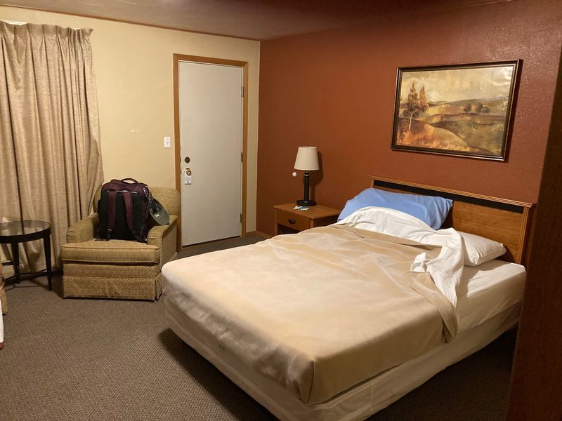
Lodging comes in small doses. A few motels and riverside rentals operate in and around town, plus campgrounds at nearby state parks for people who prefer canvas over carpet.
Book early for October. Fall color weekends fill rooms across the entire Clayton County stretch of Iowa, and last-minute searches get expensive fast.
Trains run at night. I mention this because the tracks sit close to the water and close to most lodging, and the horn does not care about your sleep schedule.
Personally I stopped minding after the second night. Others pack earplugs, which is the smarter move.
Campers should know that Pikes Peak State Park has electric sites and modern restrooms, while more primitive options exist in the surrounding area.
River-facing rooms are worth asking for specifically. Watching a tow push barges past your window at dawn beats hotel cable by a wide margin.
Cell service holds up in town but gets patchy on the bluff roads, so download maps before you wander.
Pack layers regardless of season. River air runs cooler than the forecast suggests, especially after sundown.
The Great River Road And Nearby Detours
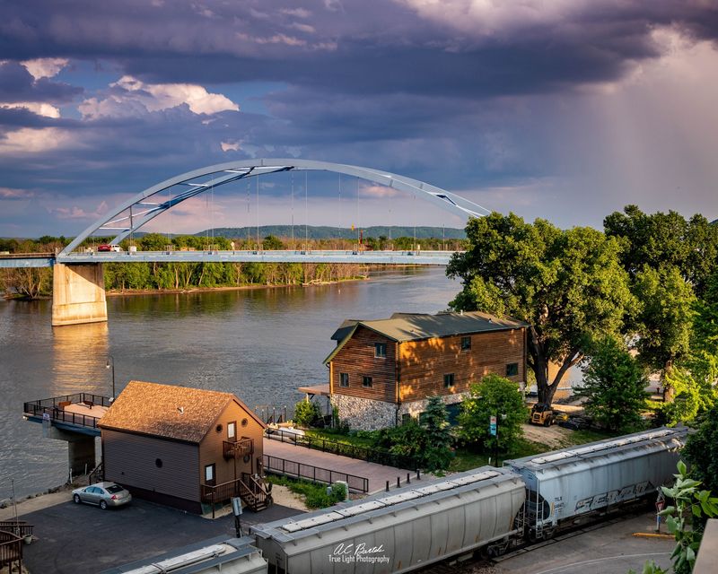
Highway 76 and the Great River Road turn driving into the main event around here. The route hugs the bluffs, dips into hollows, and delivers new river views every few miles.
McGregor sits just downstream with a longer Main Street, antique shops, and more places to eat.
Head north and you reach Lansing and the Driftless Area, where glaciers never flattened the land and the hills stayed stubbornly steep.
Spook Cave and the Yellow River State Forest are within reasonable reach for a day trip.
Fuel up before long drives. Stations are spread out, and the twisty roads burn more gas than the mileage suggests.
Motorcyclists love these curves in summer, so expect company on weekends with good weather.
Watch for deer at dawn and dusk. The wooded edges come right up to the pavement in places, and animals cross without checking traffic.
My favorite stretch runs south from town toward McGregor, where the road bends and the bluffs suddenly frame the water like a doorway.
Give yourself twice the time your map app estimates. Stopping constantly is the entire point of this road.
Picking The Right Season To Show Up
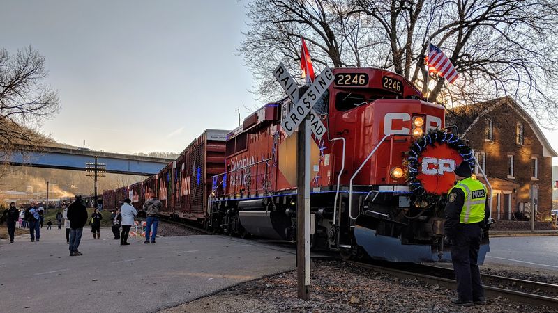
Timing changes this town more than most. October delivers the color everyone photographs, with maples and oaks turning the bluffs orange while the river stays deep green.
Summer means boat traffic, warm evenings, and full restaurant hours, plus humidity that makes the shade under the bluffs feel earned.
Spring is underrated. Wildflowers appear on the bluff trails, migrating birds pack the backwaters, and you can walk Effigy Mounds without breaking a sweat.
Winter empties the streets. Eagles arrive, snow outlines the limestone ledges, and some businesses cut hours or close entirely.
Flooding is a real consideration in late spring. High water can close boat ramps and low-lying roads along this part of Iowa, so check conditions before committing.
Weekdays in any season give you the quiet that locals actually value. I met three people on a Tuesday and had entire overlooks to myself.
My honest pick would be late September. Color starts, crowds have not arrived, and the mosquitoes have mostly given up.
Whatever month you choose, plan around daylight. Sunsets over the water are the closest thing this town has to nightlife.