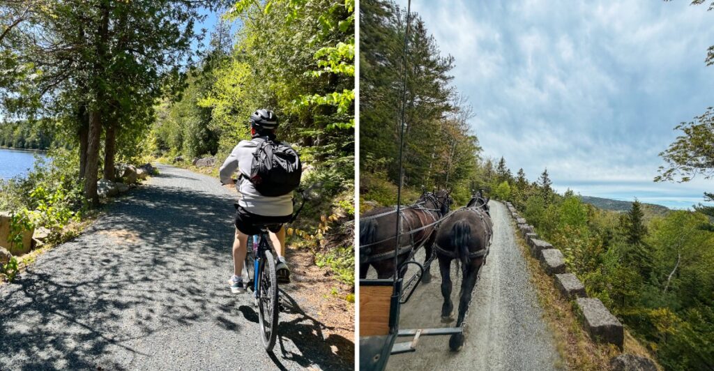
Forty-five miles of road and not a traffic jam in sight.
That already sounds like a vacation upgrade.
These historic carriage roads were built for horses, not horns.
Today, they give walkers, cyclists, and horse-drawn carriages plenty of room to roam without ordinary vehicle traffic joining the party.
The network dates back to the early 1900s, and Maine has kept its old stone bridges and winding routes very much in use.
I would resist the urge to treat all 45 miles like a challenge.
A few miles can turn into plenty once the hills start having opinions.
Pick a loop, keep a map nearby, and let the rest wait for another day.
The nicest part may be what you do not hear.
No engines. No impatient honking. Just the occasional reminder that a horse still has the right of way.
Rockefeller Built The Roads For Carriages Rather Than Cars
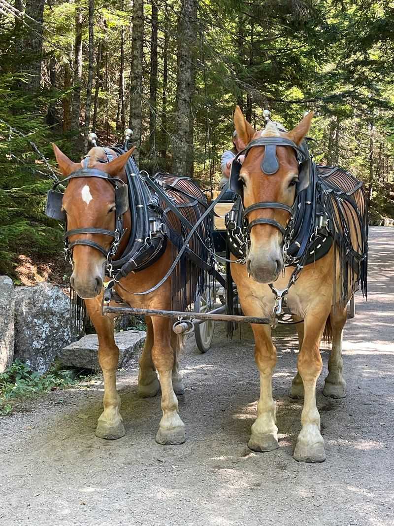
John D. Rockefeller Jr. wanted routes where horses and carriages could travel through the landscape without mixing with automobile traffic. Construction began in 1913 and continued through 1940, eventually producing the network visitors use today.
The roads were designed around the contours of Mount Desert Island rather than cutting straight across every hill. Curves follow the terrain, while grades were managed with horse-drawn travel in mind.
Broken stone formed the road surface, creating broad routes that are generally about 16 feet wide. Their width now gives walkers, cyclists, horses, and carriages room to share the system.
Regular visitor motor vehicles are prohibited on the carriage roads. That does not mean every part of Mount Desert Island is car-free. Park Loop Road, public roads, parking areas, and nearby communities all carry ordinary vehicle traffic.
Once you enter the carriage-road network, though, the pace changes. You hear bicycles, footsteps, and horses rather than a steady line of engines.
Keep an eye on intersections and signs rather than assuming every bend continues in the direction you expect. The network branches often enough that a casual ride can grow longer surprisingly quickly.
A map and a realistic turnaround point make the day much easier.
Forty-Five Miles Create Plenty Of Routes To Choose From
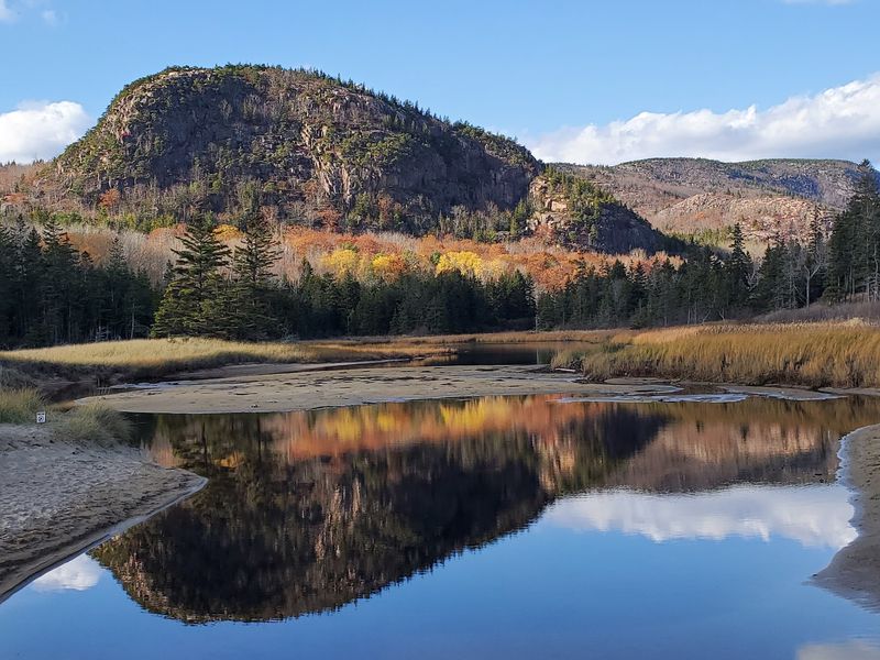
The carriage-road system stretches for 45 miles across Mount Desert Island, linking valleys, ponds, forests, and mountain slopes through a network of interconnected routes.
That mileage gives you options rather than requiring one giant ride. Shorter loops can fit into a morning, while stronger cyclists can connect multiple sections for a longer day.
Distances deserve attention before you begin. A route that looks short on a map can become more demanding once gradual climbs, stops, and side trips start adding up.
Numbered signposts mark intersections throughout the system, helping riders and walkers keep track of their location. Carrying a map is still useful, especially when cell reception becomes unreliable in wooded or lower areas.
The roads are surfaced with crushed stone rather than pavement. That surface suits the original carriage-road design and remains part of the historic character of the network.
Conditions can change after heavy rain or during seasonal transitions, so check current park alerts before committing to a specific loop.
Water and snacks deserve space in the bag even on shorter outings. Forty-five miles may be available, but there is no reason to prove anything to the entire network in one day.
Pick a loop that leaves enough energy to enjoy the way back.
Bicycles Share The Roads With Horses And Walkers
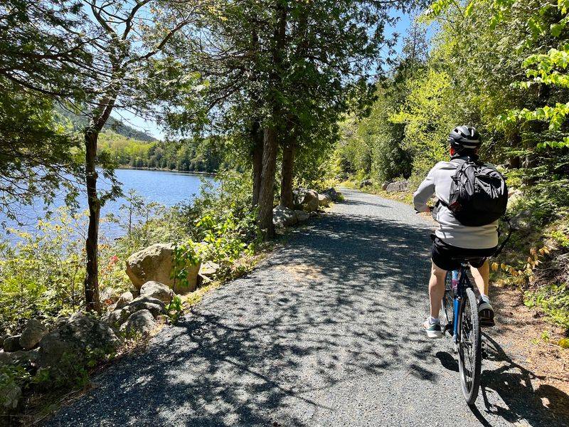
Cycling is allowed across much of Acadia’s carriage-road system, giving visitors a way to cover more ground without bringing a motor vehicle onto the historic routes.
The shared-road rules matter. Cyclists yield to horses and pedestrians, and everyone yields to horses. The speed limit for bicycles is 20 miles per hour.
Slow down well before approaching a horse from behind or meeting one in a narrow section. Give the rider or carriage driver time to guide the passing situation rather than slipping by quickly.
E-bike rules are also specific. Class 1 e-bikes are permitted where traditional bicycles are allowed, while Class 2 and Class 3 e-bikes are prohibited on the carriage roads.
If you are renting a bicycle nearby, confirm the class before leaving the shop rather than discovering the restriction at the trail entrance.
The crushed-stone surface also calls for attention on corners and descents. Keep enough control to stop comfortably when another user appears ahead.
You do not need to treat the roads like a race course. Choose a pace that leaves room to notice ponds, bridges, and changing terrain instead of spending the entire ride staring at the next climb.
The horses certainly are not in a hurry.
Seventeen Historic Bridges Break Up The Route
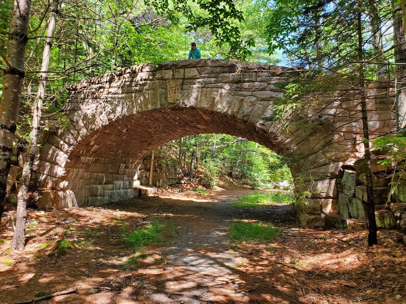
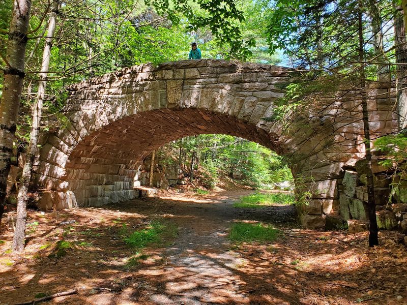
Stone bridges are some of the most recognizable features along the carriage roads. Seventeen historic bridges cross streams, ravines, motor roads, and other sections of uneven terrain.
Rockefeller financed 16 of the 17 bridges, and local stone was used to help the structures fit naturally into the surrounding landscape.
The bridges vary in design and setting rather than repeating one standard shape across the park. Some pass above motor roads, while others span water or wooded terrain.
That variety makes bridge spotting an easy way to break a longer ride into smaller pieces. Instead of thinking only about mileage, you can choose a route that links several bridges and use each one as a natural pause.
Wildwood Stables carriage tours also use portions of this road network, and some tour routes highlight the bridges and the history behind their construction.
If you stop for photos, leave room for other users to pass. These are working travel routes for bicycles, walkers, horses, and carriages, not just scenic overlooks.
The stonework is easiest to appreciate when you slow down anyway. Look at how the arches meet the terrain, then keep moving before your legs decide the bridge has become permanent seating.
Granite Coping Stones Became Rockefeller’s Teeth
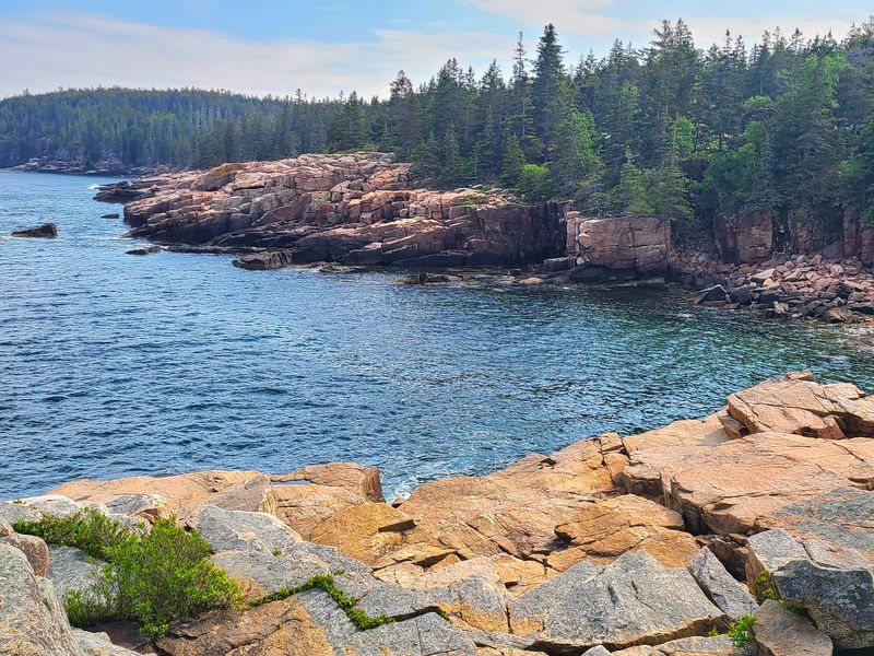
Large granite blocks line many carriage-road edges, especially where the road curves above slopes or other drops. These coping stones are commonly known as Rockefeller’s Teeth.
The nickname becomes obvious once you see a row of them. The individual blocks stand upright along the road like oversized stone teeth, providing a barrier without introducing modern metal guardrails into the historic landscape.
Their placement is practical, but it also became one of the network’s distinctive visual details.
You will notice them most easily on sections where the road bends along hillsides or passes above lower terrain. They can also serve as a useful reminder to keep your attention on the route when the surrounding view starts pulling it elsewhere.
The coping stones are part of the historic road design, so leave them exactly as they are. There is no need to climb, move, or rearrange anything for a photograph.
A water break beside the road is enough.
Once you have noticed the first row, you will start seeing the teeth in places you probably rolled past without thinking about them earlier.
That is one advantage of slowing down. Small pieces of the road begin to look less like decoration and more like part of the engineering.
Horse-Drawn Carriages Still Leave From Wildwood Stables
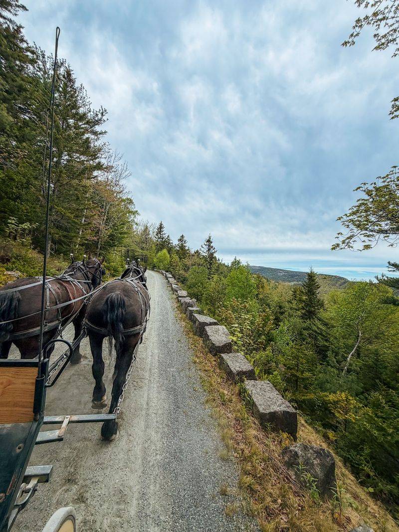
You do not have to pedal the carriage roads to experience them. Horse-drawn carriage tours continue to depart from Wildwood Stables during the operating season.
The current 2026 carriage season runs from May 23 through October 18, with different tour lengths and routes available during that period. Routes can vary, so choose the current option that fits your schedule rather than assuming every ride follows the same loop.
Carriage rides offer a slower look at the road system and leave the navigating to someone else. Depending on the tour, the route may include historic bridges, forest sections, and stories connected to the Rockefeller carriage-road network.
A wheelchair-accessible carriage introduced in 2022 also expanded access for visitors who use mobility devices.
For navigation, use 49 Dane Farm Rd., Mount Desert, ME 04660. The stables provide access to the eastern portion of the carriage-road network and serve as the departure point for current carriage tours.
Coastal conditions can change through the day, so layers are useful even when the morning begins comfortably.
If yesterday’s hike already claimed your legs, this is the easy decision. Take a seat, listen for the hoofbeats, and let somebody else handle the miles.
Check Current Conditions Before Choosing A Route
Seasonal conditions can affect the carriage roads, particularly during spring mud season or after storms. Sections may close temporarily to protect the road surface or allow maintenance work.
Check current Acadia National Park alerts before heading out rather than building the day around a route that is unavailable.
Parking also varies by access point, and not every carriage-road entrance is reached in the same way. The Island Explorer shuttle serves parts of Mount Desert Island seasonally and can help connect visitors with several park areas.
Once you are on the roads, remember the shared-use rules. Cyclists yield to pedestrians and horses, and all users give horses priority. Keep speeds below the 20-mile-per-hour bicycle limit and slow well before blind curves or busy intersections.
Bring water, snacks, sun protection, and a layer for changing conditions. A paper or downloaded map gives you a backup when cell service becomes unreliable.
Most importantly, do not confuse the carriage roads with the entire island. Cars remain part of everyday travel elsewhere on Mount Desert Island.
The quieter experience begins after you enter the historic road network.
From there, choose pedals, footsteps, or a carriage seat and let the route set a slower pace.