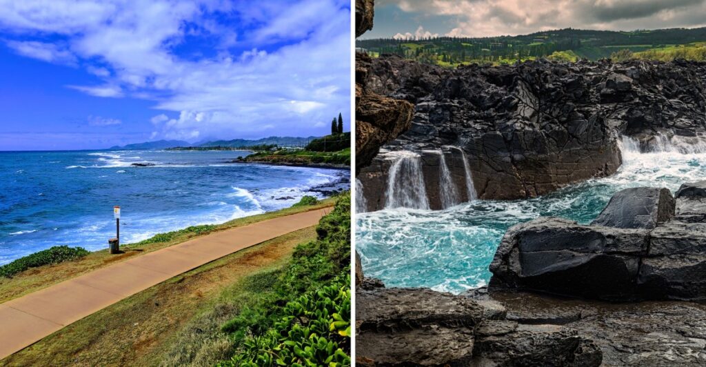
Do your walking shoes want an easy day or a little drama?
Hawaii can handle both.
One coastline gives you a smooth path and plenty of ocean beside you.
Another brings lava rock, wind, and waves crashing far below.
That is what makes these walks fun to compare.
You are not just changing trails. You are changing the whole mood.
A relaxed morning can stay relaxed. A more rugged route can ask for extra water and a bit more attention.
Either way, keep your distance from wildlife and give exposed edges the respect they deserve.
Then pick the stretch of coast that sounds right.
Because the ocean looks very different when you are seeing it one step at a time.
1. Makapuu Point Lighthouse Trail
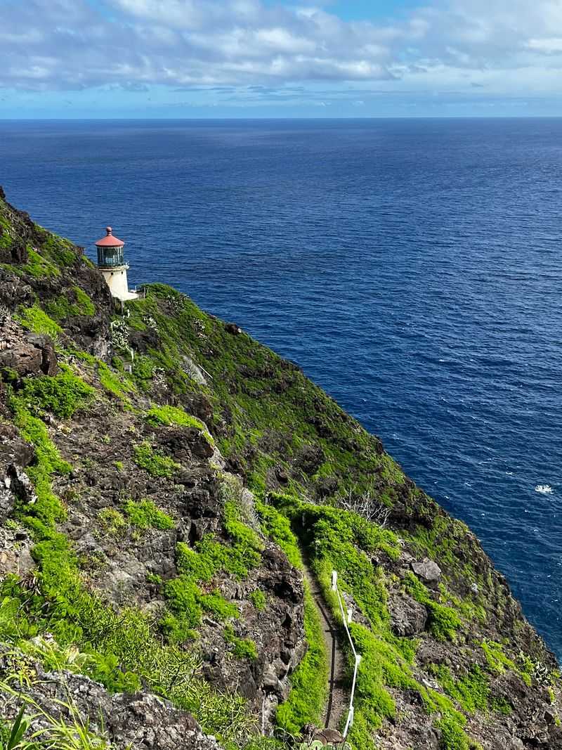
The paved road curves uphill through a dry, open landscape, with the blue Pacific appearing wider around nearly every bend. At Makapuʻu Point, the view feels far removed from Honolulu’s busy streets, even though this is one of Oʻahu’s more accessible scenic hikes.
The Makapuʻu Point Lighthouse Trail is roughly two miles round trip. It follows an old access road toward overlooks above the lighthouse, climbing steadily rather than remaining flat.
That makes it manageable for many walkers, but a stroller-friendly surface should not be confused with an effortless outing.
Expect sunshine, wind, and little shade.
Below the lookouts stands the white lighthouse with its bright red roof. Built in 1909, it still occupies a dramatic position overlooking the Kaʻiwi Channel.
The building itself is not open for casual tours, so plan to enjoy it from above rather than expecting to walk through the door.
Winter adds a possible bonus. Humpback whales migrate through Hawaiian waters, and the season generally runs from November into May, with the busiest viewing months in midwinter.
Bring binoculars and scan the water patiently; a distant spout is more likely than a conveniently timed leap beside the trail.
For an early start, carry water and take your time on the incline. The elevated viewpoints also look toward offshore islets and the eastern coastline. Keep to the paved route: the nearby tide-pool area is closed and unsafe to approach.
This walk delivers a memorable ocean panorama without requiring a scramble over the surrounding cliffs.
Location: Makapuʻu Point Lighthouse Trail, Kaiwi State Scenic Shoreline, Kalanianaʻole Hwy (HI-72), Waimānalo, HI 96795.
2. Kaena Point Trail
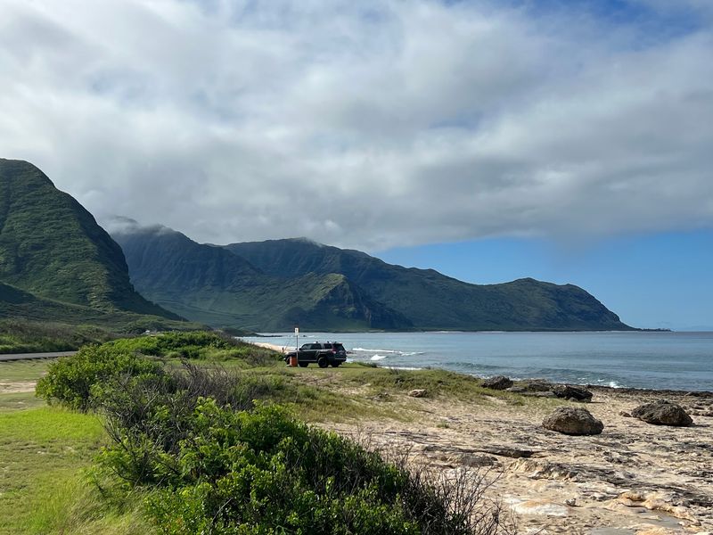
Here the road gives way to a long sweep of shoreline, broken rock, and open sky. Kaʻena Point sits at Oʻahu’s northwestern tip, where the coast feels wilder than the island’s resort promenades and the surf demands a respectful distance.
For this outing, use the Mokulēʻia-side walking approach.
The route follows a rough coastal track toward Kaʻena Point Natural Area Reserve, covering about five miles round trip from the usual walking starting area.
The ground is relatively level, but loose stones, sun exposure, and the distance make it a more demanding walk than the word “flat” might suggest.
The reserve protects seabirds, including nesting Laysan albatross, with a predator-resistant fence around sensitive habitat. Birdwatching can be rewarding, but keep to established paths and leave nesting areas undisturbed. Hawaiian monk seals may also rest along the shore.
They need space, not an audience gathering for photographs.
The timing of your trip matters. There is no reliable drinking water or shade along the trail, and strong sun can make the return feel longer than the outward walk. Pack enough water for the full outing, wear sturdy shoes, and avoid exposed rocky ledges when waves are high.
Access rules can change after storms. The Keawaʻula-side trail has been closed following storm damage, and vehicle access on the Mokulēʻia side is managed separately from pedestrian access.
Check the latest state park notice before driving out; do not assume a gate open to vehicles means every route is open.
For the right conditions, this is an expansive, quietly absorbing coastal walk.
Location: Kaʻena Point State Park, Mokulēʻia access, end of Farrington Hwy (HI-930), Waialua, HI 96791.
3. Wailea Beach Path
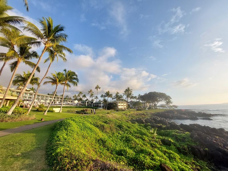
A morning along the Wailea waterfront offers a pleasant choice: keep walking to the next beach, or stop and watch the water for a while. The promenade follows Maui’s sunny south shore past landscaped resort grounds and a sequence of sandy coves.
The Wailea Beach Path extends roughly a mile and a half one way, depending on where you begin and finish.
Much of the route is paved or otherwise improved, although individual approaches to beaches may include slopes or steps. It is a relaxed walking option rather than a remote wilderness trail.
Start near one of the public beach access points and follow the coastline at your own pace. Wailea Beach and the neighboring coves make convenient landmarks.
Along the way, low walls, lawns, tropical planting, and the ocean alternate, so the scenery changes without any complicated navigation.
On clear days, look toward the offshore islands and Molokini’s crescent shape. During whale season, it is also worth pausing at an open viewpoint to scan the channel. Some days bring distant wildlife sightings, while other walks are all about the sea views.
The path works well for travelers who want to choose their own distance. Turn back after a short stretch, or build a longer walk by continuing between beach access points.
Carry water, even when the sea breeze makes the morning feel cool, and avoid assuming that every stretch has identical wheelchair or stroller access.
Public parking exists near several beaches, but spaces can fill. A walk early in the day leaves time to explore the shoreline without turning the outing into a hunt for a spot.
Location: Wailea Beach Path, public beach access along Wailea Alanui Dr, Wailea, HI 96753.
4. Kapalua Coastal Trail
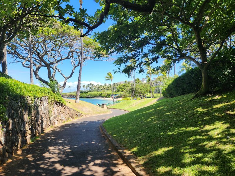
One moment you are beside a sheltered sandy bay; the next, the coastline opens onto darker lava and surf.
That contrast gives the Kapalua Coastal Trail its character.
Rather than presenting one continuous type of scenery, it changes texture as you move north along Maui’s western shore.
Walk from Kapalua Bay toward D. T. Fleming Beach for a route of roughly 1.75 miles one way, depending on your endpoints.
Sections pass beaches and landscaped areas, while others cross boardwalks and rougher natural ground. This is not a completely paved promenade, so closed-toe shoes are a sensible choice.
Near Oneloa Bay, the boardwalk helps protect delicate dunes. Stay on it instead of cutting across vegetation or creating a shortcut in the sand.
kFarther along, exposed rock adds visual drama but calls for attention to your footing, especially when wind or spray makes surfaces damp.
Your biggest decision may be how much of the route to tackle. A shorter out-and-back stroll still gives you ocean views, while the full walk allows more time to appreciate the changes between coves, headlands, and beach scenery.
Across the channel, Molokaʻi can be visible on clear days. In the cooler months, carry binoculars in case migrating humpbacks appear offshore.
Keep swimming plans separate from the hike itself: currents and surf vary dramatically among beaches, and an appealing bay from above is not a promise of safe water.
Check current path conditions before setting out, especially following heavy weather or coastal maintenance. Early daylight and a flexible turnaround point make for an enjoyable visit.
Location: Kapalua Coastal Trail, Kapalua Bay access, Lower Honoapiʻilani Rd, Kapalua, HI 96761.
5. Kaanapali Beachwalk
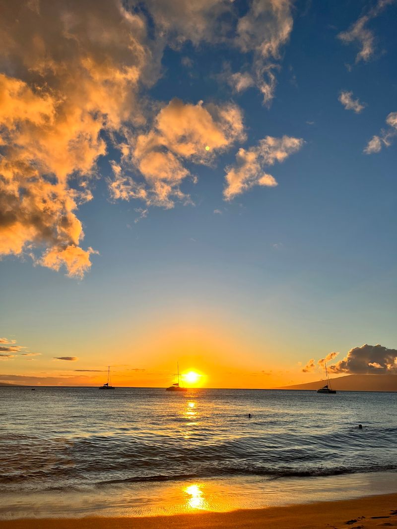
Not every coastal walk needs hiking boots. On Maui’s Kāʻanapali shore, a paved beachside promenade offers a lively mix of ocean, palms, hotels, and easy places to take a break. It is particularly appealing when you prefer an unhurried stroll over a trail with steep climbs.
Follow the public walkway beside Kāʻanapali Beach and choose a distance that suits your day.
The length varies depending on the start and turnaround points, so there is no need to treat a particular three-mile outing as the only route. You can simply walk for half an hour and retrace your steps.
A natural focal point is Puʻu Kekaʻa, widely known as Black Rock, at the northern end of the beach. The dark headland is a striking contrast to the sand and water. Traditional cliff-diving ceremonies are associated with the area, though schedules and presentations can change.
Enjoy the view without expecting a performance on demand.
The promenade also makes snacks easy. Shave ice, smoothies, and casual meals are available in the nearby shopping and resort district. One pleasant plan is to walk first, then pick a place to sit and watch the afternoon light on the water.
Although this is an improved path, it can be busy, particularly around beach access points. Give fellow walkers room and watch for sandy or wet patches.
Swimming and snorkeling near Black Rock are separate activities that require attention to posted warnings and sea conditions.
Parking arrangements differ between public-access spaces, shopping centers, and resorts. Decide where you will begin before setting off, then leave time for the return walk.
Location: Kāʻanapali Beachwalk, Kāʻanapali Pkwy public beach access, Lahaina, HI 96761.
6. Dragon’s Teeth Access Trail
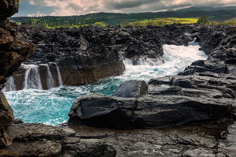
The rocks near Makaluapuna Point resemble a row of jagged teeth turned toward the sea. Wind and surf have helped shape the striking formations, turning a short coastal detour into a lesson in just how unusual volcanic landscapes can look.
This is a brief walk rather than a long hike. The Dragon’s Teeth access route begins near the Kapalua resort area and follows grass and rougher ground toward the rocky point. Depending on where you park, the round trip can be well under a mile.
There is no reason to hurry; the formations reward a slow approach.
Look at the contrast between pale, sharply edged rock and the darker surrounding shoreline. The scene changes as clouds move and the waves break beyond the headland. Closed-toe shoes are useful even on a short visit, since natural surfaces can be irregular and abrasive.
There is also an important cultural consideration. An area near the point is associated with Hawaiian burials and is protected. Respect posted boundaries and remain outside marked sensitive places.
This landscape is not simply an outdoor sculpture garden; it is part of a living cultural setting.
Choose a comfortable viewing position away from the exposed shoreline. Large waves can reach places that seem dry and safe, so avoid standing on low rock shelves to take photographs. Children should remain close on the uneven approach and near any drop-offs.
A visit pairs naturally with another Kapalua walk, but it can stand alone when time is short. Treat it as a quiet chance to observe the lava forms, the ocean, and the surrounding coast rather than an invitation to climb every ridge.
Location: Dragon’s Teeth (Makaluapuna Point) access, near Office Rd, Kapalua, HI 96761.
7. Ke Ala Hele Makalae Coastal Path
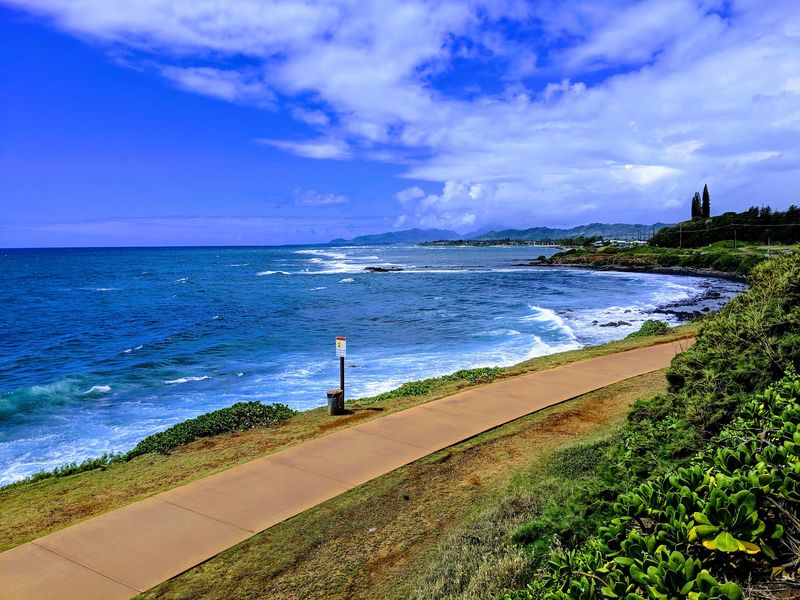
Walkers, runners, and cyclists share the open coastal views along Ke Ala Hele Makālae on Kauaʻi’s east side. Rather than a single short loop, this is a network of completed paved shoreline segments, making it easy to tailor an outing to the time and energy you have.
Its name means “the path that goes by the coast.” Sections around Kapaʻa and Keālia connect oceanfront stretches, parks, and beach views.
Mileage can differ as projects and connections evolve, so plan from a chosen access point rather than relying on one fixed total for the entire route.
Starting near Kapaʻa gives you options for a casual walk with shops not far away. Continue north toward Keālia and the scenery opens up, with rolling surf, coastal vegetation, and broad sky.
The paved surface makes walking straightforward, but the shared-use setting means keeping to your side and watching for bicycles.
Benches and rest places along portions of the path invite a pause. In winter, scanning offshore may reward patient whale watchers. You might also spot seabirds above the water; observe any resting wildlife from a respectful distance.
Morning tends to offer cooler walking conditions. Afternoon trade winds can be brisk, especially along exposed sections, so a hat that stays on and a filled water bottle are useful. Some stretches have limited services, even though parts of the route are close to town.
You do not need to cover every mile to enjoy it. Choose a comfortable turnaround point, take in the shoreline, and save another segment for a future visit.
Location: Ke Ala Hele Makālae, Kapaʻa coastal access near Kapaʻa Beach Park, Kūhiō Hwy, Kapaʻa, HI 96746.
8. Mahaulepu Heritage Trail
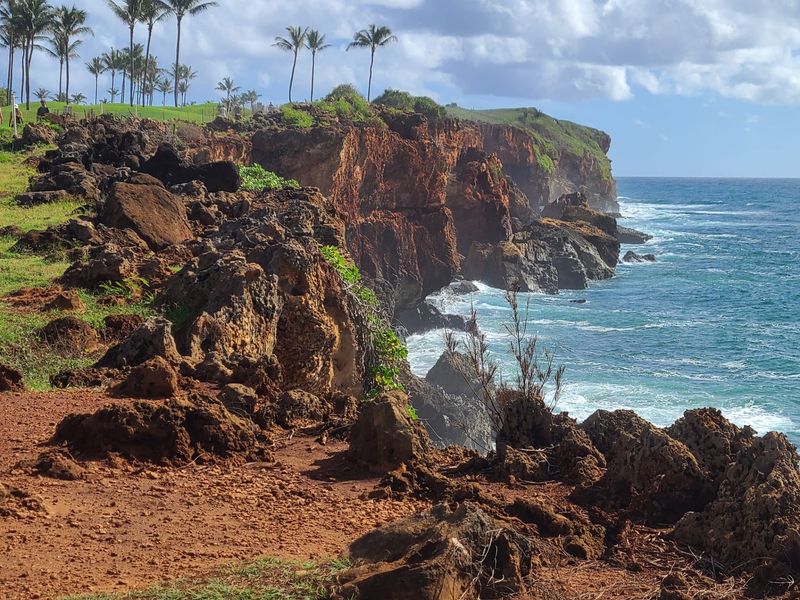
Hardened sand dunes, wind-shaped cliffs, and the open Pacific make the Māhāʻulepū Heritage Trail feel very different from Kauaʻi’s paved east-shore path.
Starting near Shipwreck Beach, the south-shore route invites a slower walk through a landscape with both geological and cultural significance.
A common outing runs roughly four miles round trip, although people choose different turnaround points. Expect uneven rock, sandy stretches, and areas exposed to sun and coastal wind.
Shoes with grip make a much better companion than beach sandals, especially where the ground slopes toward the cliffs.
The formations are a highlight. Layered sandstone and lithified dunes display folds, ridges, and changing colors as the light moves. Stop to admire them from the established route instead of approaching unstable edges for a photograph.
Cultural sites in this coastal area deserve the same care. Do not move stones, enter protected archaeological places, or treat old features as props.
Nearby Makauwahi Cave has its own visitor arrangements and conservation work; reaching the general area does not guarantee the cave itself is open for a tour.
The first part of the walk offers ocean views almost immediately, which makes a shorter excursion worthwhile.
For a longer outing, carry water and check the route back before continuing. There is little reliable shade, and the returning sun can feel stronger than expected.
Marine wildlife may appear in nearby coves. Watch from a distance rather than following animals along the beach. When the surf rises, the best view is often the one you enjoy from farther inland.
Location: Māhāʻulepū Heritage Trail, Shipwreck Beach (Keoneloa), Ainako St, Kōloa, HI 96756.
9. 1871 Trail
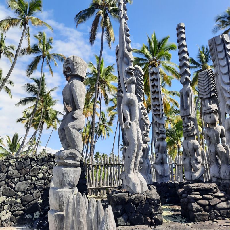
A trail can tell a story without a museum wall. On the Kona coast, the 1871 Trail crosses lava and sandy ground beside sites connected to Hawaiian communities that used this shoreline long before modern roads existed.
Within Puʻuhonua o Hōnaunau National Historical Park, a roughly two-mile round-trip walk leads toward the historic Kiʻilae village area. The route follows part of a much older coastal travel network. Improvements made in 1871 widened sections to accommodate horse travel, giving this particular stretch its modern name.
Start by understanding the landscape at the visitor center, then follow the marked route. Stone features, former village areas, and the Alahaka Ramp illuminate how people moved and lived along this coast.
The ramp is a steeper section, while other portions are uneven with loose lava and coarse sand.
The ocean remains close enough to shape the experience, but this is not a beach stroll in soft sand. Carry water, wear sturdy shoes, and protect yourself from the sun. The walk is largely exposed, so midmorning heat can become tiring even over a modest distance.
Respect matters here. Stay on designated trails, leave all cultural features untouched, and do not enter caves, lava tubes, or burial areas. The park’s preserved places are meaningful beyond their appearance in photographs.
You can extend your visit with the separate self-guided walk through the Royal Grounds and Puʻuhonua area. This makes an excellent pairing for travelers who enjoy learning how scenery and history meet, with time to appreciate both rather than racing to the finish.
Location: 1871 Trail, Puʻuhonua o Hōnaunau National Historical Park, 1871 Trailhead off Hwy 160, Hōnaunau, HI 96726.
10. Kaloko-Honokohau Coastal Trail
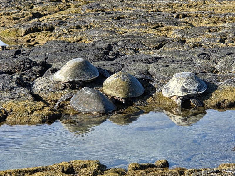
Along this stretch of Hawaiʻi Island, stone-walled fishponds and dark lava share the shoreline with beaches and coastal plants. It is a place to walk slowly, because much of what makes the setting remarkable lies in the details rather than a single dramatic viewpoint.
Kaloko-Honokōhau National Historical Park protects traditional aquaculture sites, including Kaloko and ʻAimakapā fishponds and the ʻAiʻōpio fishtrap.
Their stonework reflects generations of Hawaiian knowledge about tides, fish, and coastal resources. Trails connect different parts of the park, but not every feature lies beside one simple paved loop.
One straightforward approach is to begin at the Hale Hoʻokipa visitor center, where you can learn about the landscape and choose a route appropriate to the time available.
Other shoreline access points, including near Honokōhau Harbor, offer shorter approaches to specific sites.
Expect exposed sections and uneven lava underfoot. Comfortable walking shoes, water, and a hat matter more here than speed. Native birds may use the wetlands, and green sea turtles sometimes rest near the shore.
Leave ample room around wildlife and never block its route to the water.
The park does not charge admission. The visitor center has set hours, however, and its parking area closes earlier than some other access points. The Kaloko fishpond road is rough and unsuitable for most ordinary rental cars, so do not use it as a casual shortcut.
Give yourself time to understand the cultural setting, take in the changing coast, and choose a return route without rushing through the hottest part of the day.
Location: Kaloko-Honokōhau National Historical Park, Hale Hoʻokipa Visitor Center, 74-4968 Queen Kaʻahumanu Hwy, Kailua-Kona, HI 96740.