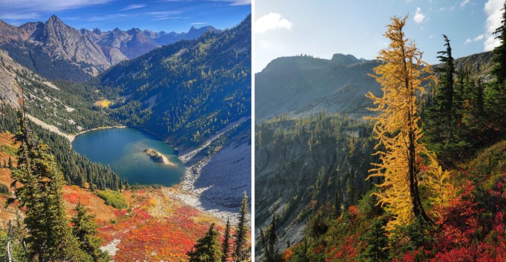
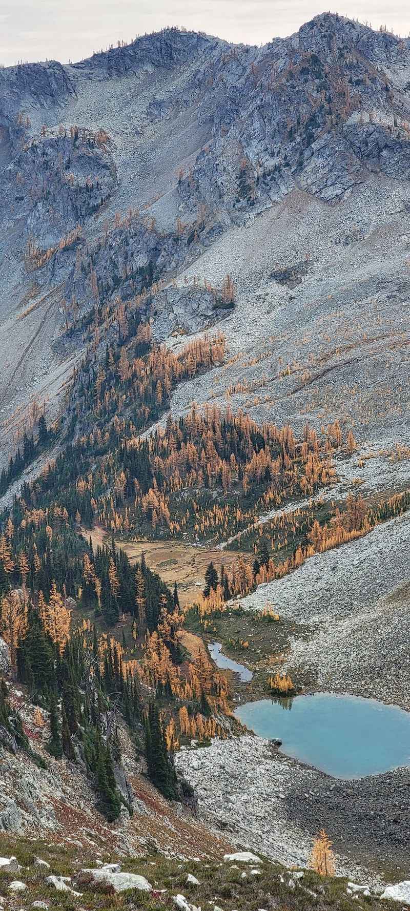
Every October, a whole mountainside of conifers drops the green act and turns bright gold.
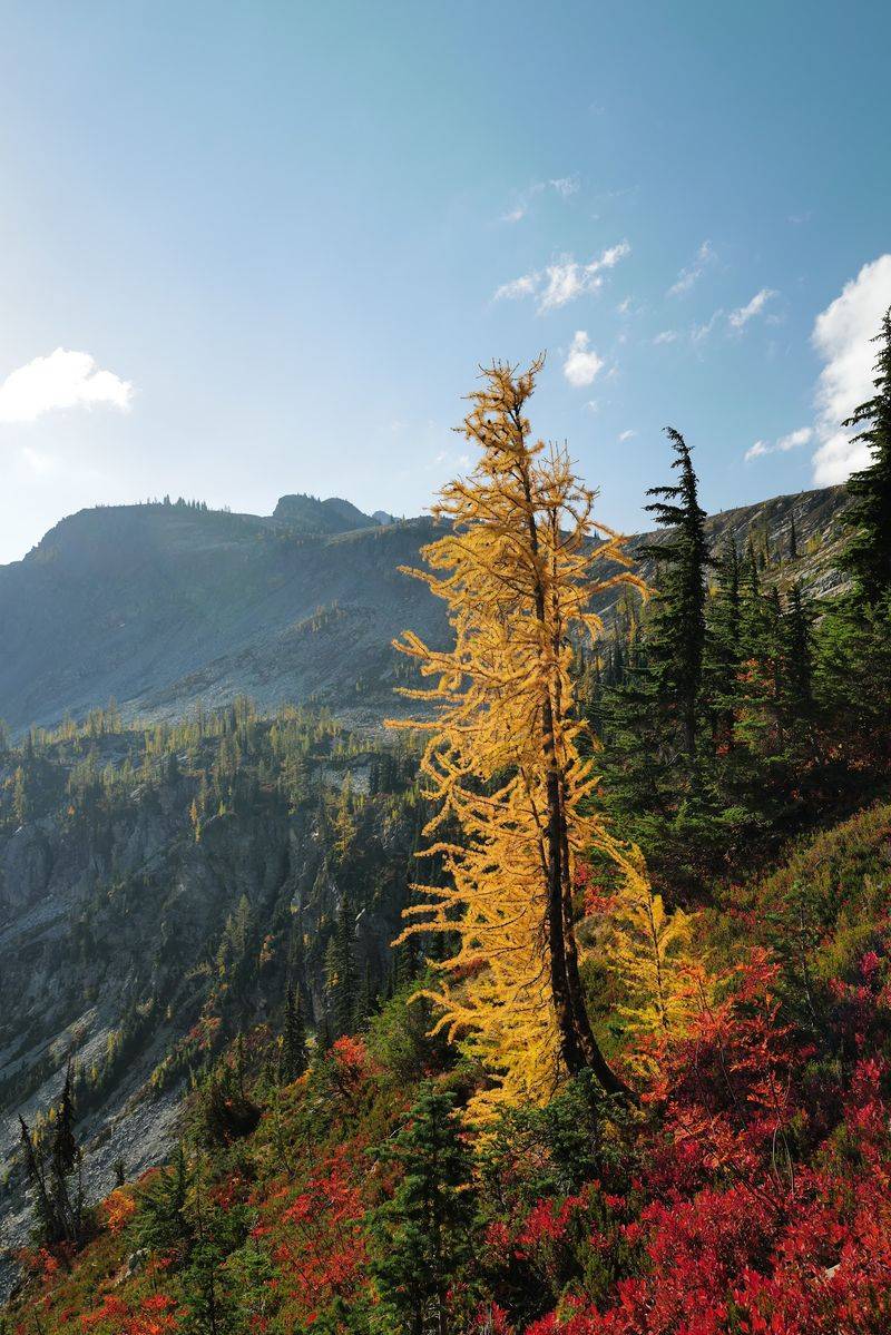
Yes, evergreen-looking trees that change color and lose their needles. They’re called larches, and they put on a show for only a week or two.
The parade happens along a 7-mile loop high in the Washington mountains. Hikers climb through forest, past an alpine lake, and onto a ridge with 360-degree views. On peak weekends, cars can line the highway for over a mile.
I like how nature picked such a short window for its best trick. It feels like a secret that everyone somehow knows about. I can’t imagine a better excuse to set an early alarm.
So what makes this one trail worth the crowds, the climb, and the sore knees? Let’s walk it together, one golden step at a time.
Meet The Trees That Break Every Evergreen Rule
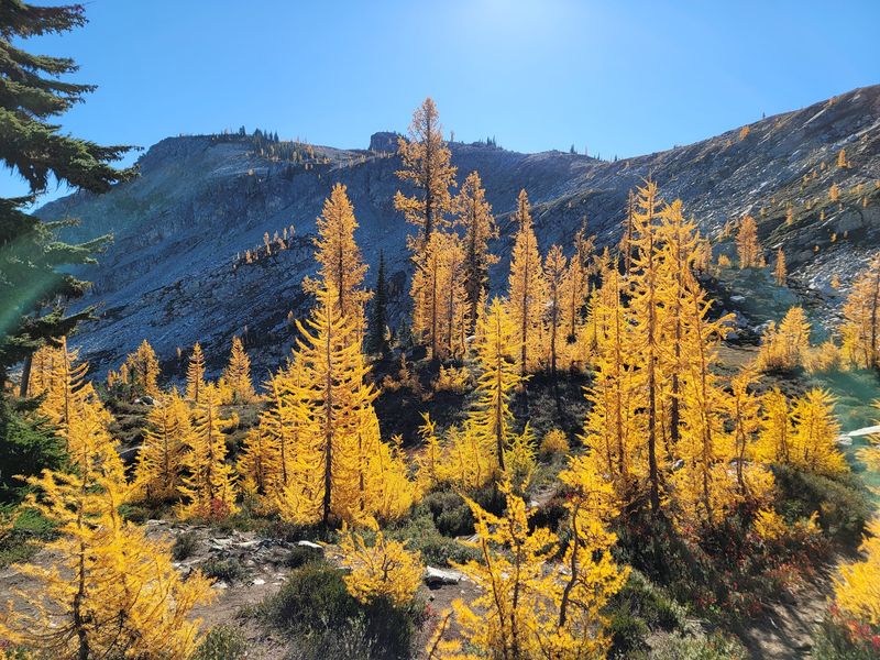
Most conifers stay green all year, but larches never got that memo. On the Heather–Maple Pass Loop, these rule breakers turn brilliant yellow and gold each fall. Then they drop their needles and wait out winter bare.
The color show usually starts in late September. Peak glow lasts only one to two weeks, often in early to mid-October. Hikers have a name for this rush to see them: larch madness.
That short window is exactly why timing matters so much. Show up too early, and the trees still look mostly green. Wait too long, and the needles may already be on the ground, or snow may be on the trail.
The smartest move is checking recent trip reports from the Washington Trails Association before you go. Hikers post updates on larch color, snow, and trail shape. It’s like a weather forecast, but for gold.
The larches mix with open meadows and rocky slopes near the high parts of the loop. Against dark peaks and blue sky, the yellow almost looks fake. Good luck taking just one photo.
Go Counterclockwise And Your Legs Will Thank You
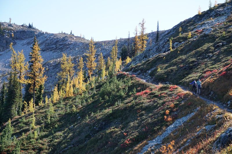
Direction matters more than you’d guess on this loop. You can hike it either way, but counterclockwise wins most of the votes. The climb feels steadier, and the views start earlier.
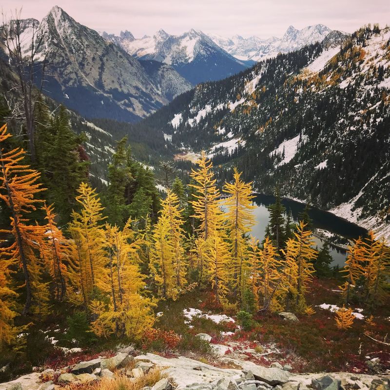
Going this way, the trail rises gradually while overlooking Lake Ann below. That lake stays in view for a long stretch. It’s a pretty great distraction from the burning in your thighs.
Clockwise is a different story. It starts with a steep, serious climb right away. Some hikers like getting the hard part done fast, but most prefer the gentler build.
The loop runs about 7.2 to 7.6 miles total. Elevation gain lands around 2,000 to 2,200 feet. That puts it in the moderate to difficult range, depending on your fitness and pace.
Counterclockwise does mean a steeper descent at the end. The final miles drop through switchbacks back into the trees. Trekking poles help a lot here, especially on rocky and rooty sections.
Give yourself plenty of time for the full loop. Photo stops will happen whether you plan them or not. Honestly, who could blame you?
A Short Detour To A Lake Worth Every Extra Step
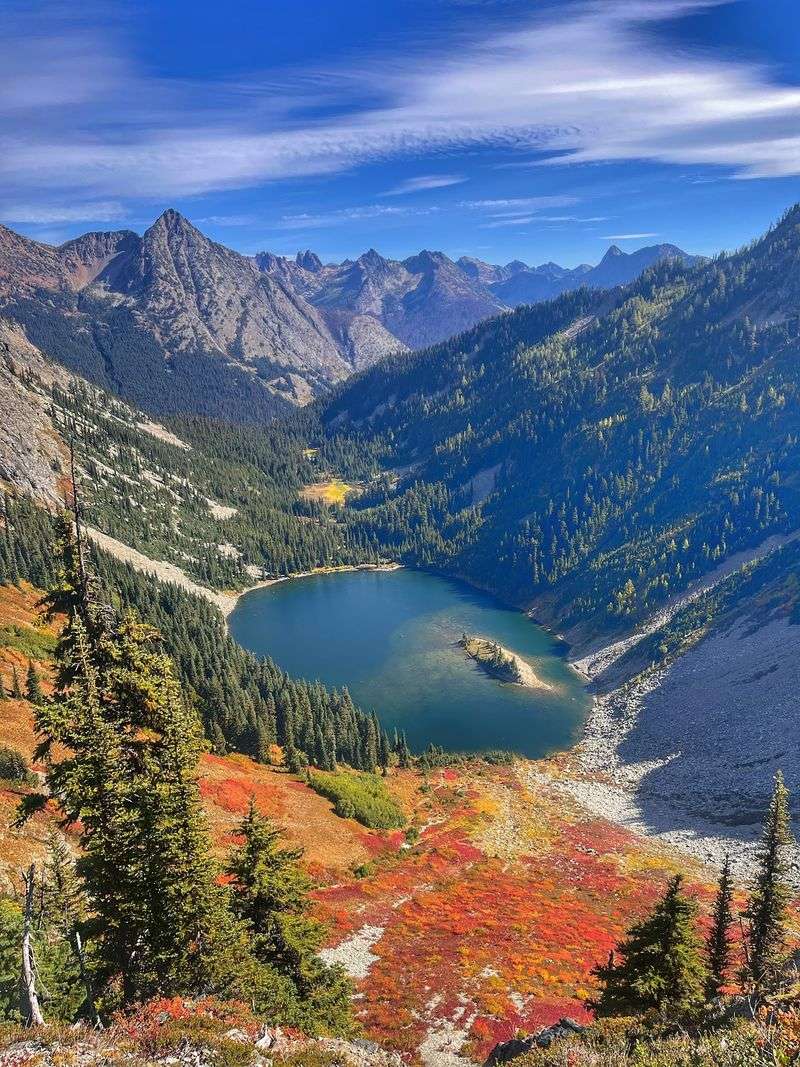
Lake Ann gets described as a jewel cradled in a talus bowl. That’s a fancy way of saying it sits in a ring of rocky slopes. The water glows below the trail like someone dropped a gemstone there.
An optional side trail leads down to the lake itself. It adds about 0.6 miles round trip to your day. For such a small effort, the payoff feels huge.
The spur comes up a little over a mile into the counterclockwise route. That’s early enough that your legs still feel fresh. Taking it now beats talking yourself out of it later.
Not up for the full loop? Plenty of hikers simply go to Lake Ann and back. It makes a shorter outing with a big scenic reward.
In summer, bring bug spray if you plan to linger near the water. Mosquitoes can be a real nuisance there. In fall, the bugs ease up, and golden slopes frame the lake instead.
Either way, pack a snack and take a breather. The steady climb toward Maple Pass starts soon after. You’ll want the fuel.
The Ridge Where Every Direction Looks Like A Postcard
Around 6,600 feet up, the trees step aside, and the whole world opens.
The ridgeline section offers full 360-degree mountain views. Peaks stack up in every direction like a giant stone crowd.
Big names show up here. Black Peak, Corteo Peak, and the Liberty Bell group all make appearances. Rainy Lake and Lake Ann sparkle far below.
Maple Pass marks the high point of the loop, reaching approximately 6,650 feet above sea level. That’s plenty of elevation to make you catch your breath, especially after the steady climb.
There’s plenty of room to sit and soak it in. Many hikers turn this spot into a lunch break with a view. Your sandwich has never had better scenery.
Watch the sky, though, because weather changes fast up here. Sun, wind, rain, and even snow can roll through on the same day. Pack layers and sun protection, since most of the high trail has no tree cover.
Keep an ear out for pikas in the rocky parts too. These tiny critters squeak before you spot them. Consider them the ridge’s welcome committee.
Set That Alarm Early Because Parking Vanishes Fast
On peak larch weekends, the lot can be full by 8 AM. After that, cars may stretch along the highway for over a mile. That’s a long warm-up walk before the real hike.
The trail starts at the Rainy Pass Trailhead in the Okanogan-Wenatchee National Forest.
Its location is Rainy Pass Trailhead, North Cascades Highway (WA-20), Winthrop, WA 98862. Park in the south lot on the left side of the highway.
From Winthrop, drive west on Highway 20 for about 35 miles. The trailhead sits around 4,900 feet in elevation. You’ll start high, which helps a little with the climb.
Overflow parking along the highway shoulder may be an option. Park carefully and responsibly, though. Bad parking can cause safety problems and even get you towed.
Weekdays are the best trick for dodging the crowds. If a weekend is your only choice, arrive before 8 AM. Earlier is even better during larch season.
On busy weekends, volunteers sometimes help manage the flow at the trailhead. Be kind to them. They’re out there so everyone gets a fair shot at the gold.
Grab Your Pass Before The Signal Disappears
Cell service fades fast on North Cascades Highway. So sort out your parking pass before you lose bars. Future you will be grateful.
Parking at Rainy Pass requires a valid Northwest Forest Pass or an America the Beautiful Interagency Pass. Don’t have an annual one? A day pass works too.
Don’t have an annual pass? A day pass is another option.
You can pay with cash at the trailhead’s self-service fee station using the provided envelope. Bring exact change and display your receipt on your dashboard. To avoid any last-minute hassle, consider purchasing a valid pass before arriving.
The trailhead doubles as the Rainy Pass Picnic Site. It has shaded picnic spots and vault toilets. That’s handy before and after a long day on the loop.
One thing it doesn’t have is drinking water. Bring all the water you’ll need from home. Sources are scarce on the ridge, so pack more than you think.
Heads up for 2026 visitors too. Paving and maintenance work planned for August 2026 could close the picnic area and trailhead temporarily. Check for updates before heading out.
Leave Fido Home For The Full Loop
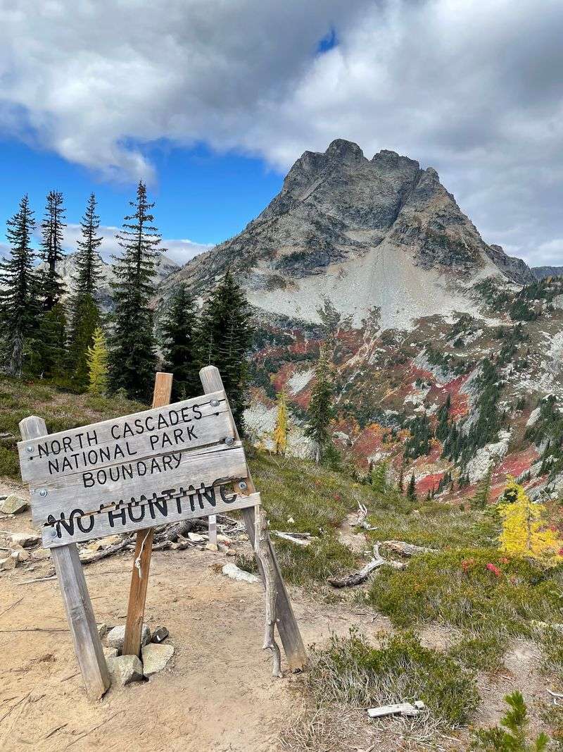
Dogs can join you on parts of this trail, with one big catch.
The high ridgeline crosses into North Cascades National Park. Pets aren’t allowed on that national park section.
Much of the loop lies in national forest land, where leashed dogs are fine.
But a chunk follows the park boundary closely. You can’t finish the full circle with a pup legally.
The easy answer is simple. If you want the whole Heather–Maple Pass Loop, plan a dog-free day. Your furry friend can nap at home and hear about it later.
Want company on four legs anyway? A shorter outing on the forest side may work better. Keep your dog leashed the entire time.
This rule also protects the fragile high country. Alpine plants and wildlife have a short season to grow and feed. Fewer disturbances help them bounce back each year.
Speaking of wildlife, hikers have spotted bears in this area. Keep food secure and give animals plenty of space. A little caution keeps everyone, furry or not, safe.
Watch The Calendar Because The Highway Won’t Wait
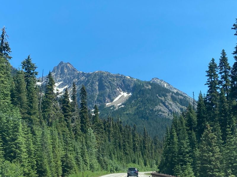
Your golden adventure depends on one road staying open.
North Cascades Highway, also called State Route 20, closes every winter. Snow and avalanche danger shut it down for months.
The closure usually happens in mid-November or early December.
The median date is November 24. But the earliest closure on record came on October 17, right in larch season.
That’s why checking the Washington State Department of Transportation is a must before driving out. Road updates can change quickly in fall. A quick look saves a long, disappointing detour.
The highway itself is a big part of the fun. It winds through some of the most dramatic scenery in Washington. The drive alone makes a pretty great warm-up act.
Spring reopening usually comes in April or early May. Summer brings wildflowers to the meadows along the Heather–Maple Pass Loop. So there’s beauty here beyond October, too.
Still, the gold season remains the headliner. Those few weeks of glowing larches are hard to beat. Mark your calendar now, and keep your fingers crossed for clear skies.