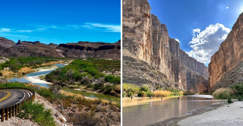
This Texas park has canyon walls that shoot up 1,500 feet right out of the river. Stand on one bank, and you’re in the U.S. Look across, and you’re staring at Mexico.
Pretty wild, right? That’s a lot of rock to stare at before lunch.
You also get desert, river canyons, and an actual mountain range packed into one park.
Come in November, and the highs sit in the 60s and 70s. That’s about as good as hiking weather gets. Mornings start cool, so tossing a light jacket in the car is a smart move.
After the summer rains, the desert can even turn green. For a desert, that’s quite the plot twist.
Then there’s a hot spring right by the river, also known as your tired feet’s favorite reward.
November Turns The Desert Into Perfect Hiking Weather
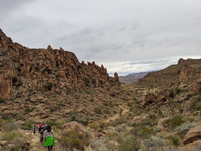
Timing matters a lot at Big Bend National Park, and November nails it.
Average November highs range from the mid-60s in the Chisos Mountains to the upper 70s near the Rio Grande.
Nights cool off fast, with average lows ranging from the mid-30s near the river to the mid-40s in the Chisos Mountains.
Pack a warm layer, because desert evenings don’t play around.
Rain stays low this month, so trail plans rarely get washed out. That makes November great for long hikes, scenic drives, and river trips.
The summer monsoon season ends just before fall arrives. Because of that, the desert can look unusually green, which surprises plenty of first-timers.
Crowds also tend to be lighter than the busy spring season. Late November into mid-December offers excellent stargazing, although Thanksgiving week can bring heavy crowds.
Spring visits can bring serious heat in the lower desert areas. Summer is even hotter, especially near the river, where shade is hard to find.
November generally brings milder hiking conditions, although lower desert elevations can still get quite warm.
Midday hikes can be more comfortable in November, but temperatures can still climb high enough to make exposed desert trails challenging.
One smart move is planning your low-elevation hikes for early mornings or late afternoons, when temperatures are generally cooler.
Save the higher trails for mornings, when the air is crisp and the light is soft.
Bring layers, a hat, and plenty of water anyway. The sun still shines strong out here.
Float The Rio Grande Between Two Countries
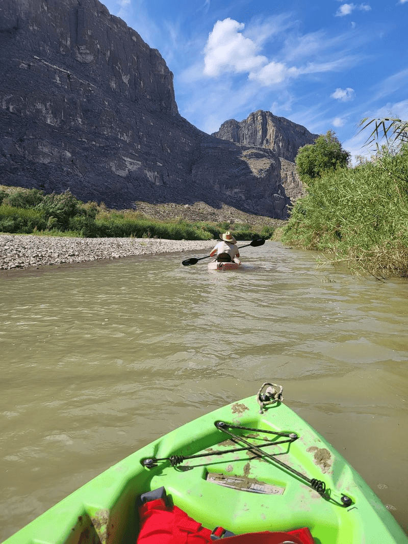
How many rivers let you paddle with one country on your left and another on your right? The Rio Grande does exactly that along 118 miles of the park’s border.
Trips range from half-day floats to adventures lasting several days. Rafting, canoeing, and kayaking are all popular ways to explore.
The big three canyons are Santa Elena, Mariscal, and Boquillas. Each one offers a different mix of towering rock and quiet water.
Families often like the half-day floats best. They give kids a taste of canyon life without wearing everybody out.
November is a strong month for river trips. The air is mild, and the sun won’t cook you in your life jacket.
Wildlife along the river can include beavers and turtles. Keep your eyes on the banks, because the quiet moments are often the best ones.
Water levels vary a lot, so plans should stay flexible. Local outfitters and park rangers can tell you what’s runnable.
Bring a dry bag for snacks, layers, and your camera. Wet sandwiches are nobody’s idea of a good time.
Santa Elena Canyon Will Make You Feel Tiny In The Best Way
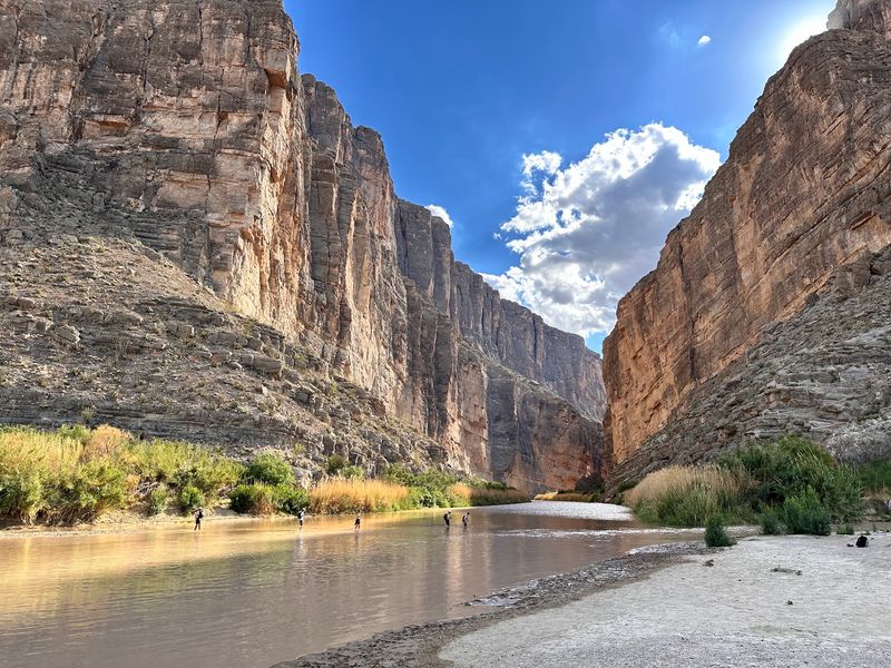
Fifteen hundred feet. That’s how tall the walls of Santa Elena Canyon can reach above the Rio Grande.
The canyon sits on the far west side of the park. One cliff belongs to Texas, and the opposite cliff belongs to Mexico.
A short trail leads hikers into the canyon mouth beside the river. It’s one of the most talked-about walks in the whole park, and the reason is obvious.
Getting there is half the fun. The Ross Maxwell Scenic Drive winds through the desert toward the canyon, with plenty of pullouts for photos.
Give yourself a few hours for that drive. Every curve seems to show off a new rock color or mountain shape.
River levels can change a lot from season to season. Some days the Rio Grande runs low, so check conditions at a visitor center first.
Road conditions can change too. Ask rangers before heading out, since weather can affect access in this area.
Afternoon light makes the canyon walls glow in warm tones. Sunscreen and good shoes help, because the trail climbs a bit before it drops toward the water.
Pick A Trail And Climb Toward The Clouds
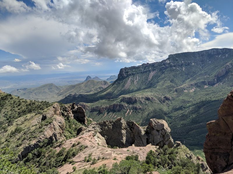
More than 150 miles of hiking trails twist through this park. They cover desert flats, mountain slopes, and riverbanks.
Lost Mine Trail ranks among the favorites, thanks to sweeping views of the Chisos Mountains. Start early, carry water, and watch your step for rattlesnakes.
Emory Peak tops out at 7,832 feet, the highest point in Big Bend National Park.
The South Rim Loop and Window Trail also draw serious attention.
Here’s the catch for this season. A planned two-year closure of the Chisos Basin beginning in May 2026 was canceled, and the area remains accessible to visitors.
Basin Road and nearby trails remain accessible following the cancellation of the planned closure. Check the park’s current status before you plan any Basin-area hike.
Plenty of great trails sit outside that zone. The Santa Elena Canyon Trail and the Hot Springs area are both strong choices.
The Chihuahuan Desert Nature Trail and paths near Rio Grande Village work well for easier outings. Kids often enjoy spotting roadrunners along the way.
Dogs aren’t allowed on park trails, except service animals. Leave the pup at home and pack extra snacks for yourself instead.
A Warm Soak Beside A Cool River Sounds Pretty Great
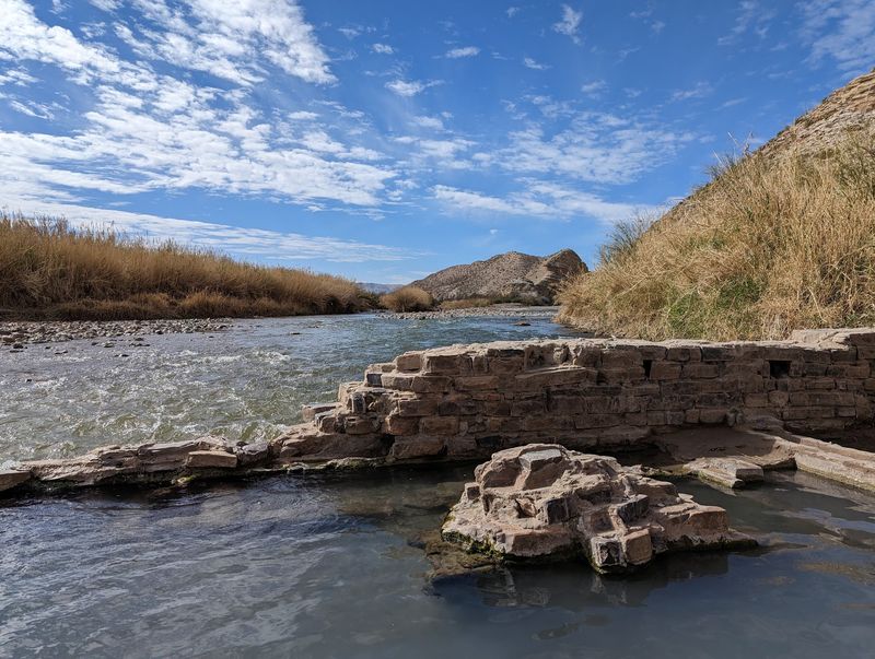
Sore legs, meet warm water. The Hot Springs Historic District lets you soak right along the Rio Grande.
The spring sits about a quarter mile from the parking area. It’s a short walk, which makes it a popular stop for all ages.
November is considered an ideal time for a dip. The cooler air makes that warm water feel even better.
The road out there gets a bit rough in spots. The road is narrow and rough, so check current conditions and vehicle suitability before driving to the trailhead.
History adds another layer to this stop. You can wander past old remnants and picture the area’s past while drying off.
Because the spring is easy to reach, it can feel busy at times. Morning or late afternoon visits may give you more elbow room.
Bring a towel, water shoes, and a dry change of clothes. Nobody wants a soggy drive back to camp.
Pair this stop with a visit to nearby Rio Grande Village. The area’s convenience store makes it easy to grab snacks and refill supplies afterward.
Cactus, Coyotes, And A Very Fancy Little Bird
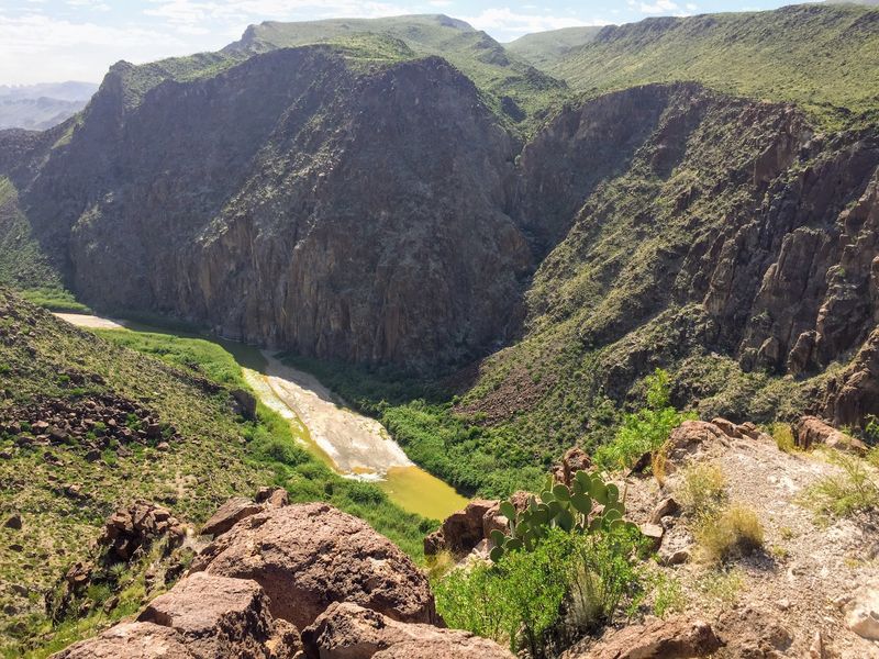
Big Bend protects the largest tracts of Chihuahuan Desert landscape and ecology in the United States. That’s a lot of prickly real estate.
About 1,200 plant species grow here, including an impressive variety of cacti. The park also counts around 450 bird species.
Birders get excited about the Colima Warbler, a special find in the Chisos Mountains. It’s the kind of name that makes casual hikers start carrying binoculars.
Mammals roam here too. Deer, coyotes, pumas, and black bears all call the park home.
Beavers and turtles live along the river, which surprises many desert visitors. Water changes everything out here.
Drivers should watch their speed, especially near dawn and dusk. Animals often cross roads when you least expect them.
Keep a respectful distance from all wildlife. Never feed animals, even the cute ones giving you hopeful looks.
The park was named an International Biosphere Reserve in 1976. It’s a fitting title for a place where a mile or two can feel like a different world.
Texas Handed This Park To Everyone, And It Shows
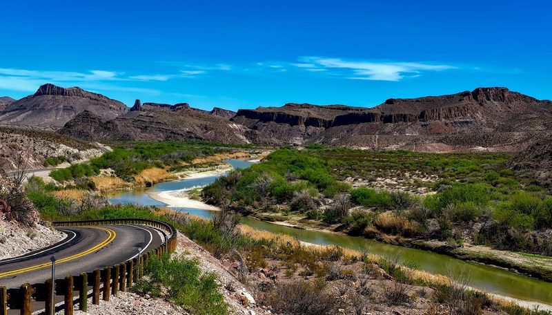
Back in 1933, this land was protected as Texas Canyons State Park. It was later renamed Big Bend State Park.
Congress authorized the establishment of Big Bend National Park on June 20, 1935.
Big Bend National Park officially opened on June 12, 1944.
People called it Texas’ Gift to the Nation. Pretty generous move, if you ask me.
The story stretches back much further. People lived in this region nearly 12,000 years ago, including Paleo-Indian and archaic groups.
Spanish explorers reached this area around 1535. Ranching and mining later shaped the region during the 1800s and early 1900s.
The Civilian Conservation Corps worked in the Chisos Mountains from 1934 to 1942. Crews built roads, trails, and facilities that visitors still rely on.
Today the park spans more than 800,000 acres. You’ll want several days to see even a good chunk of it.
More than 100 miles of paved roads and 150 miles of dirt roads crisscross the park. Visiting before 2026 ends gives you one more chance to catch it at its November best.