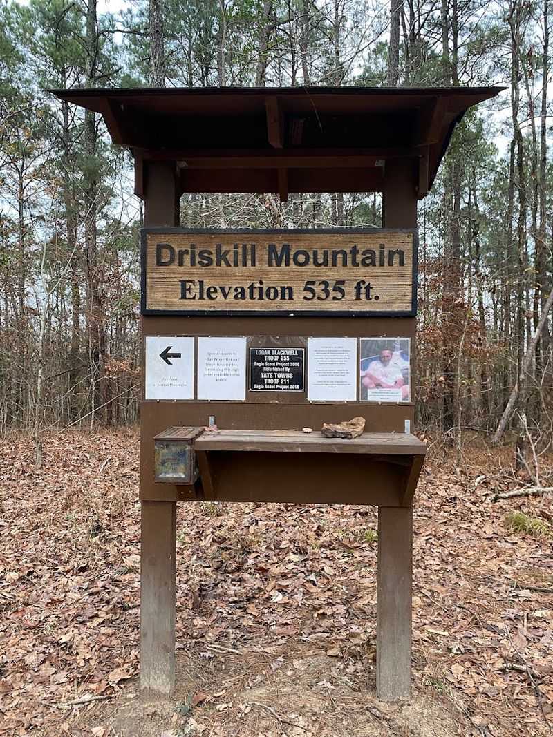
Louisiana is not known for its mountain scenery because it does not really have mountains but it does have Driskill Mountain which at 535 feet stands as the highest point in the state and offers a perspective on the surrounding pine forest that you simply cannot get from the flat lowlands where most of the population lives.
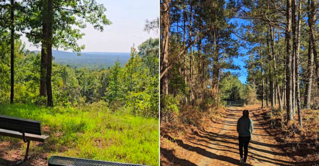
The trail to the top is barely a mile round trip and it climbs gently through a canopy of longleaf and loblolly pines that open up at the summit to reveal a view that stretches across Bienville Parish in every direction with treetops rolling like green waves toward the horizon.
And the kind of quiet that only comes when you are standing above the tree line in a place where almost nobody else is standing.
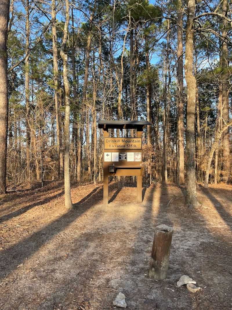
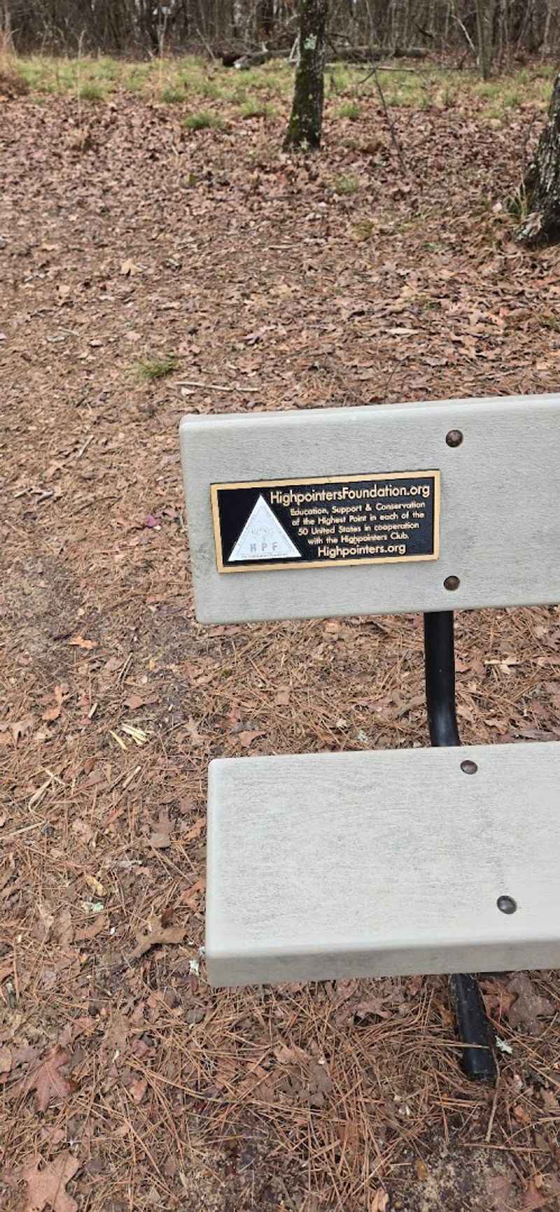
There is a small plaque at the top marking the elevation and a wooden bench where you can sit and eat whatever you brought in your backpack and stare out at a landscape that looks like it has looked for a hundred years because nobody has built anything taller than the pines between here and the next parish.
Hikers looking for treetop views in Louisiana will find that Driskill Mountain delivers a short forest climb, a statewide high point, and panoramic views that make every step of the ascent feel like a reward.
Vibe At The Trailhead
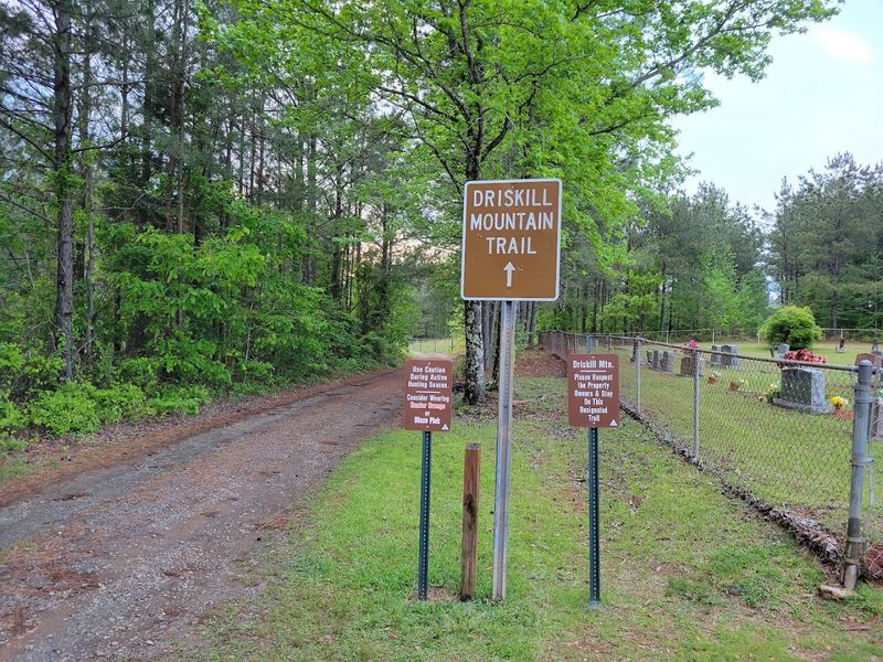
The first thing that hits you at the trailhead is how ordinary everything looks, a tiny church parking lot, a chained dirt road, and a small sign that quietly points the way. Yet the ordinary setting masks a low-key excitement: this is Louisiana’s highest natural point and people arrive with curious smiles and sensible shoes.
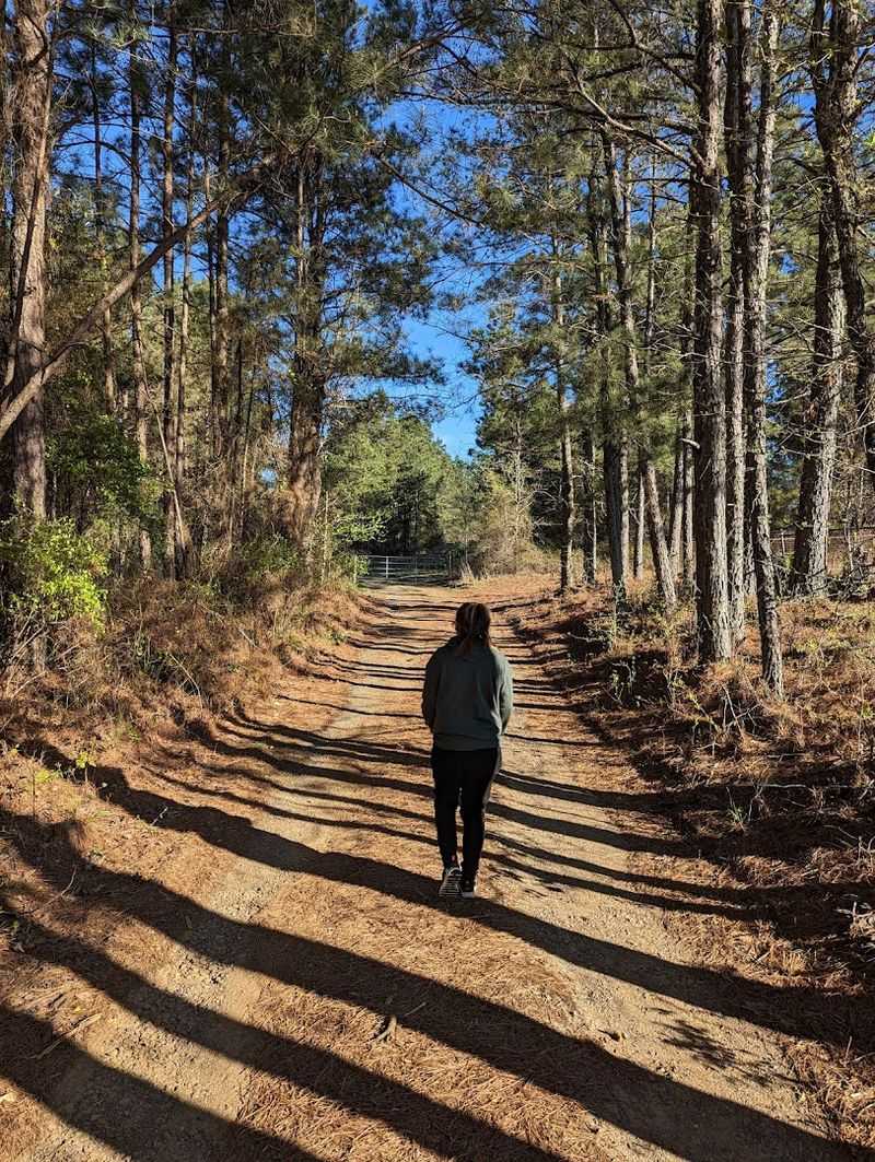
The path itself feels welcoming; a wide roadbed through mixed pines and hardwoods that invites conversation and slow walking. Benches and signage are spaced to encourage brief rests and reflection, and the air smells faintly of pine resin and warm earth.
Respect for private land is obvious in the materials and tone of the signs, and that courtesy sets a cooperative mood among hikers and locals alike.
Reaching Louisiana’s Highest Point
Driskill Mountain Trail is the kind of Louisiana outing that politely calls itself a mountain and then waits to see how seriously you take that. Head toward north Louisiana’s quieter pine country, where the roads get rural, the signs get more important, and the landscape starts acting like it has been keeping a small secret.
Aim for LA-507 near Bryceland, LA, with the understanding that this is more trailhead-and-church-parking territory than grand national-park entrance drama. The approach feels wonderfully low-key, which is exactly the charm: no huge gateway, no theatrical reveal, just a road, some trees, and the odd thrill of knowing you are about to climb the highest natural point in the state.
Once you get close, slow down and look for the trail access near Mount Zion Presbyterian Church instead of expecting a flashy welcome committee. Bring decent shoes, a little water, and the humility required for a “mountain” that may not impress your calves, but will absolutely improve your road-trip story.
First Impressions Along The Route
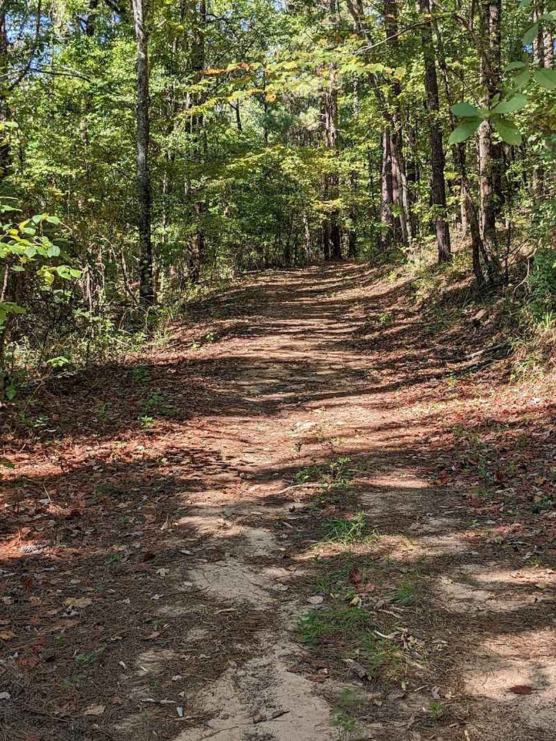
You start noticing small details a few minutes in: the soil has that distinctive reddish hue common to the region, tall pines punctuate the canopy, and the trail widens enough that you sometimes forget you are on a hiking path. The walk feels more like a gentle road climb than a rugged scramble, which makes it pleasantly accessible.
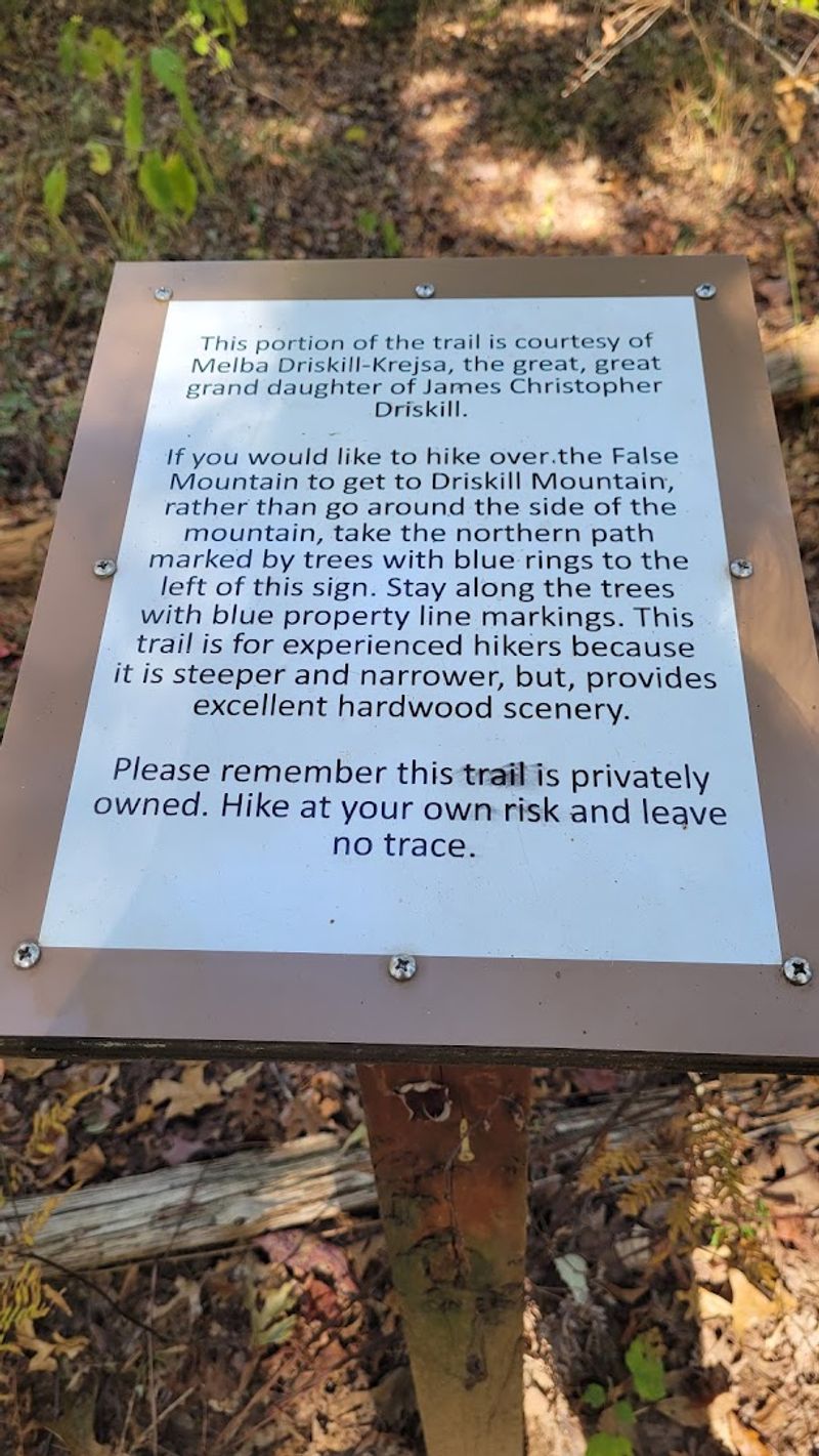
False summits appear subtly, marked and explained, creating little mini-celebrations as you crest them and realize you still have more height to gain. Those markers are useful morale boosts and help manage expectations for what the real summit will reveal.
Even on humid days the trail keeps a steady rhythm, and casual hikers, families, and dogs share the path with an easygoing, neighborly vibe.
Best Seasonal Timing
Spring and fall are the standout seasons to visit Driskill Mountain, offering mild temperatures and an attractive display of wildflowers or changing leaves. I found that March and April bring fresh green life and pleasant breezes, while October and November render the pines and hardwoods in warmer tones that photograph beautifully.
Avoid the height of summer when humidity and heat can make exercise feel punishing, and prepare for muddy conditions after heavy rains in any season. Early morning visits reduce insect encounters and provide crisper light for photos, while late afternoons can be golden but slightly warmer.
Plan visits around mild weather and you’ll enjoy cleaner views, better footing, and a generally more comfortable experience on the summit benches.
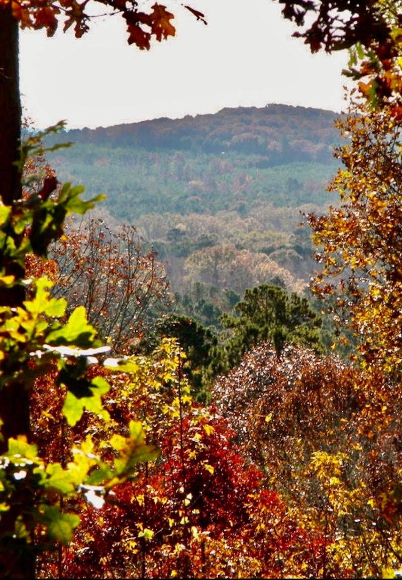
Summit Scenery
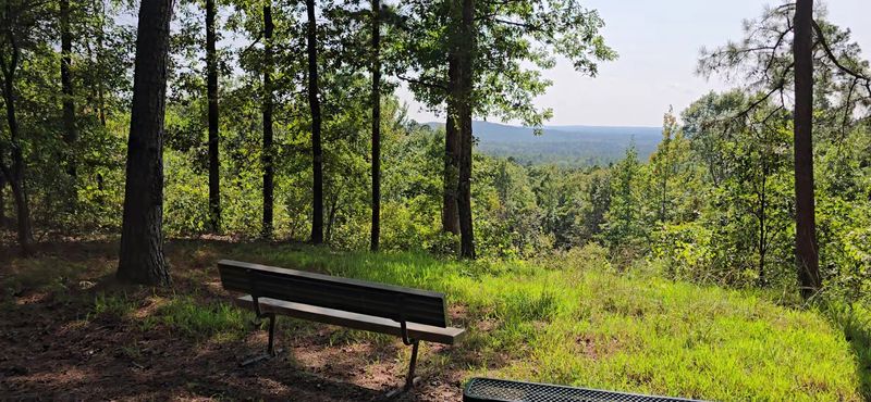
The summit rewards the short effort with a surprising treetop panorama that stretches over rolling forest and reveals Jordan Mountain in the distance. At just 535 feet the view isn’t alpine drama, but the angle above the tree line gives a true sense of elevation you didn’t expect in Louisiana.
Benches and a summit sign make it a tidy place to pause, sign the logbook, and take in the light across the pines. The vista is most effective in lower humidity when visibility sharpens and layers of tree crowns become visible.
This is a viewpoint for slow looking rather than grand gestures, a place where subtle shifts in weather and season change the character of what you see.
Trail Conditions And Surfaces
The main trail follows a broad, mostly well-drained roadbed composed of dirt and gravel, which makes sneakers or trail shoes perfectly adequate for most visits. After rain the lower sections can become muddy, so check recent conditions if storms moved through and consider waterproof footwear if needed.
Markers are frequent and clear, reducing the risk of accidental detours, though the narrower False Mountain Trail is steeper and requires more careful footing. That alternate route is better for hikers seeking a bit more challenge and a different texture to the walk.
Bring basic gear, water, a light jacket, and sensible shoes, and you’ll be set for the majority of conditions you might encounter on this short route.
Navigational Tips
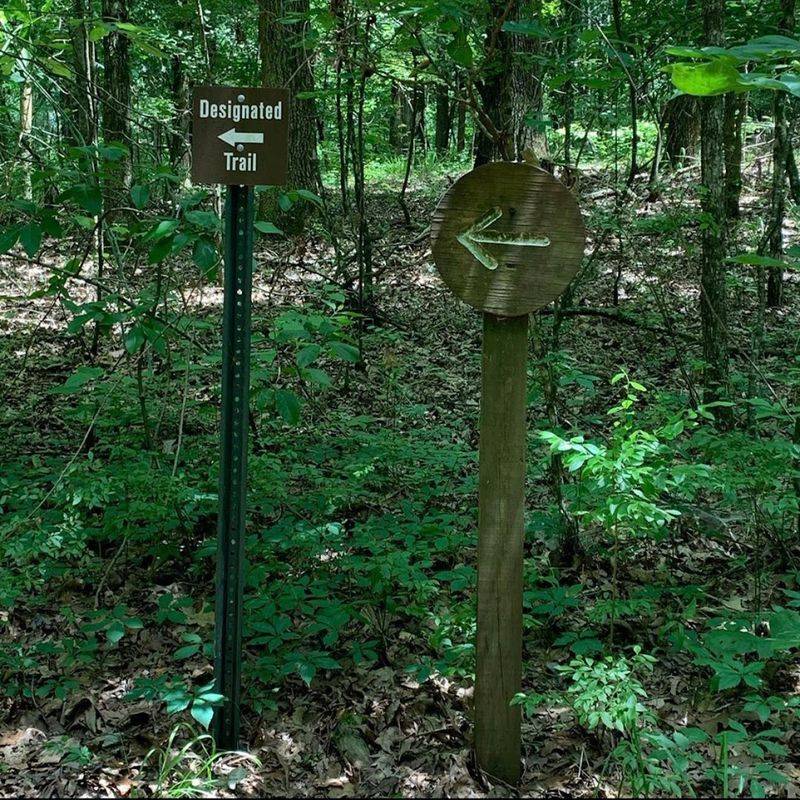
The trail is well marked but it’s wise to follow the main roadbed and the signs closely, since a few side tracks and the False Mountain path can confuse casual visitors. Stick to the painted blazes and interpretive panels, and you will avoid the maze of side trails and confused blue-marked routes mentioned by some hikers.
If you prefer certainty, download a basic map or carry a GPS track so you can confirm distances and path choices; most people complete the round trip in about an hour, though stopping to enjoy the summit can extend that time.
Keeping an eye on markers and respecting property boundaries ensures a frictionless visit and keeps access available for others in the future.
Visitor Etiquette And Access
Access to the summit crosses private land that owners graciously allow public use of, so basic etiquette matters: stay on the marked trail, carry out any trash, and treat the property as if it were your neighbor’s yard. Visitors signing the summit logbook and pausing on benches often leave brief notes of thanks, which feels appropriate for the goodwill this trail depends on.
There are no facilities on the mountain, so be prepared with water and plan restroom stops before arrival. Dogs are welcome but should be controlled and cleaned up after, and during hunting seasons bright clothing is advised for safety.
Small acts of respect matter here more than grand gestures; they keep the route open and friendly for all.
Nearby Logistics
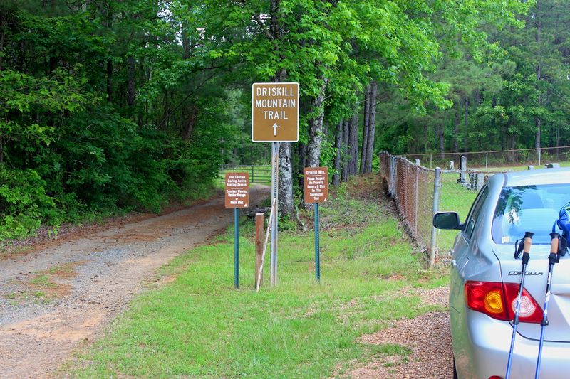
Park at the Mt. Zion Presbyterian Church lot on LA-507, where the trailhead begins a short walk past a cemetery and along a chained dirt road.
Parking is limited so arrive earlier on busy weekends or combine your visit with nearby small towns for a relaxed day trip experience.
The nearest services are in local towns rather than at the mountain itself, so fuel up and use restrooms before arriving if possible. Cell reception can be variable, so download directions or screenshot maps in advance to avoid any navigational hiccups.
Respect posted hours and local practices, the trail is open during daylight and free to use, and that simplicity is part of its charm.
Flora And Fauna Observations
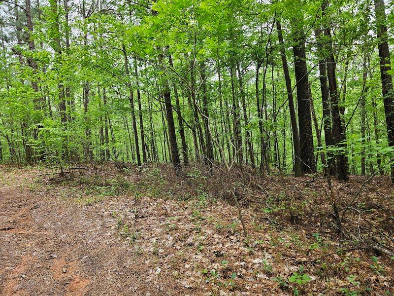
The walk through mixed pine and hardwood stands showcases regional ecology, tall pines, occasional hardwoods, and a carpet of leaf litter anchoring the reddish soil. In spring you’ll find small wildflowers and a buoyant chorus of birds; in warmer months insects are more noticeable, so insect repellent is a practical companion.
Small mammals and typical forest birds are part of the soundtrack rather than overt attractions; the trail’s modest elevation doesn’t create alpine species but offers a satisfying slice of local forest life. Observing closely rewards you with small discoveries like fungus, seed pods, and varied bark textures.
Walking slowly and listening closely enhances the encounter, the place unfolds in subtle, worthwhile ways.
Practical Safety Advice
Safety on this route is simple but essential: bring water, wear solid shoes, and be mindful of weather and insects that can make the walk less comfortable than it appears. During hunting season locals recommend high-visibility clothing like hunter orange or bright pink to reduce any risk and increase your visibility in the woods.
There are no restrooms or water sources on the mountain, so plan accordingly. Check recent trail reports or local posts if heavy rains occurred, as the lower trail can become muddy and slippery when wet.
With basic preparation and common-sense awareness, the hike is straightforward and safe for most ages and fitness levels.
Why It Feels Special
What makes Driskill Mountain feel special isn’t dramatic elevation but the quiet layering of local generosity, approachable terrain, and a summit that rewards attentive looking. Standing on the bench by the summit sign, you become part of a long line of visitors who respected the land and were offered a view in return.
The trail’s brevity and clarity mean it suits families, quick day-trippers, and highpointers alike, creating a diverse and friendly flow of visitors. That democratic quality is part of the charm, no prep is required for a meaningful visit, only curiosity and courtesy.
It’s a small, well-kept secret of the Piney Woods and one I recommend visiting with patience and gratitude for the access you are granted.