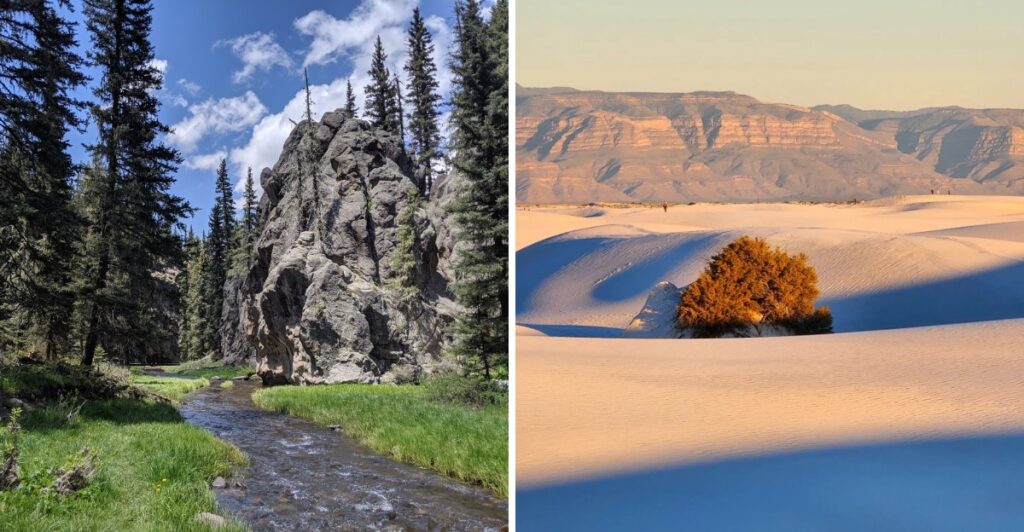
Sand dunes in New Mexico can creep up to 30 feet in a single year, which means a trail out there never looks quite the same twice. I find that wildly cool, like hiking on a map that keeps quietly redrawing itself overnight.
That restless sand is only one surprise. One mountain path climbs through four separate life zones, starting with prickly pear cactus and ending among aspen groves.
Another stop sends a 150-foot waterfall pouring into a desert pool.
I’m always drawn to places that break the rules of what a landscape should be. Honestly, this state does that constantly.
Alpine lakes sit above 11,000 feet, while old resort ruins hide below jagged desert peaks.
Dust off your hiking boots, pack plenty of water, and get ready for some unforgettable scenery. New Mexico has a few surprises waiting around the next bend, and some of these trails might just become your new favorites.
1. Travertine Falls
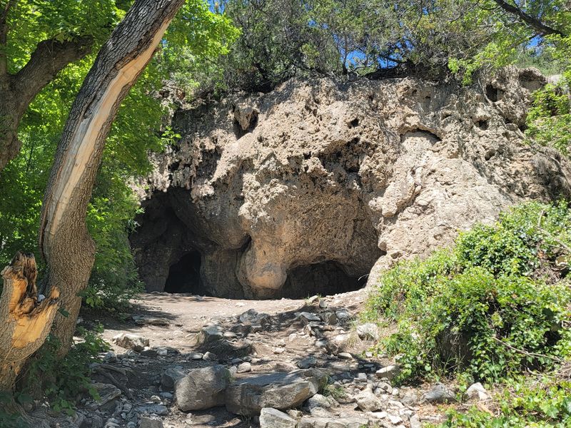
A waterfall that only shows up some of the time sounds like a flaky friend, but Travertine Falls makes it charming. The flow is seasonal, and the hike stays fun whether water is running or not.
The trail covers roughly 1.5 miles, so it fits nicely into a lazy morning. It’s an out-and-back route that kids can handle without turning into grumpy hikers.
Cave formations add a bonus round to the adventure. Young explorers tend to love anything that looks like a secret hideout, and this one delivers.
From the cave, you get a very pretty view down into the valley. That payoff feels big for such a short walk, so bring a camera.
Seasonal water means timing matters if you want to see the falls flowing. Even on a dry day, the rocky scenery and views keep things interesting.
Leashed dogs are allowed, so your pup can join the climb. A short trail like this suits dogs who prefer quick outings over marathons.
Picnic areas give you a spot to refuel before or after the hike. Pack a lunch and turn the outing into a relaxed half-day trip.
Hours run daily from 7:30 AM to 7:30 PM, and parking is free. Tuesday mornings tend to be quieter if you want the trail mostly to yourself.
Cedar Crest sits in the eastern foothills of the Sandia Mountains, a short drive from Albuquerque. That makes this an easy add-on to any New Mexico road trip.
Address: Crest Trail 130, Cedar Crest, NM 87008
2. La Luz Trailhead
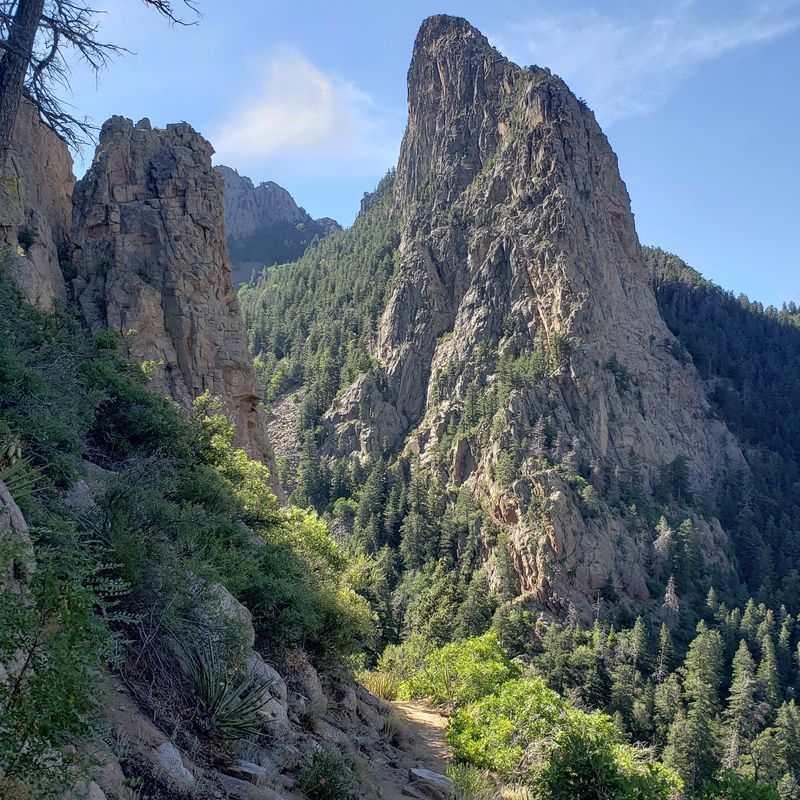
Few hikes let you start among prickly pear cactus and finish beside aspen groves on the same day. La Luz pulls that trick by climbing through four distinct life zones.
Fair warning, this one is a beast. The trail runs about 7.5 to 8 miles one way, with more than 3,000 feet of elevation gain.
Down low, juniper, piñon, and cactus line the rocky path. Higher up, ponderosa pines, blue spruce, and aspen take over as the forest turns cool.
The views keep getting bigger as you climb. You can spot Albuquerque, the Rio Grande, and the Mount Taylor volcanic field from the upper stretches.
The name means ‘The Light’ in Spanish. One story says early Albuquerque residents named it after a campfire glowing at an old mine below Sandia Crest.
Some hikers plan to ride the Sandia Peak Tramway down instead of hiking back. Check its status first, since construction and forest closures restrict access to portions of the upper mountain through 2027.
The trail remains accessible up to the tramway.
Sturdy hiking boots are a must on this rocky terrain. Snow can make upper sections impassable in winter, and summer fire danger sometimes brings temporary closures.
The trailhead opens daily from 6 AM to 8 PM. You’ll find vault toilets and picnic tables there, plus both free and paid parking options.
Start early, carry plenty of water, and respect your limits. This ranks among New Mexico’s most rewarding climbs, but it doesn’t hand out freebies.
Address: Forest Service 333 Rd, Albuquerque, NM 87122
3. Las Conchas Trailhead
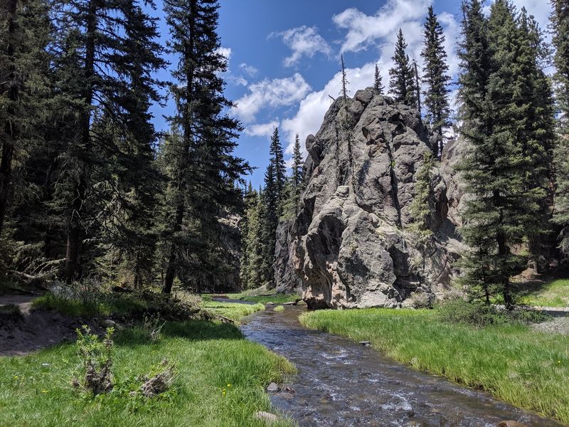
Few trails let you share the path with fish, butterflies, and the occasional wandering cow. Las Conchas pulls off that odd little trio along a creek in the Jemez Mountains area.
The path stays wide and mostly flat as it follows the stream. That makes it an easy out-and-back walk that works for little legs and grandparents alike.
Dense forest crowds in on both sides, so the setting feels peaceful from the first few steps. Rock formations rise along the way and give the scenery some real drama.
Climbers know this spot too, since the rocks here offer climbing opportunities. Even if you never touch a rope, those rocky walls make great backdrops for photos.
Speaking of snacks, this trail begs for a picnic. Pack sandwiches, find a shady spot near the water, and let the creek handle the background music.
Turn around whenever you feel like it. An out-and-back route means you choose the distance, which is handy with kids or a tired dog.
Dogs are welcome outside, so your four-legged buddy can tag along. Just keep an eye out for those cows, since your pup may have strong opinions about them.
Monday and Thursday afternoons tend to be calmer here. Saturday afternoons pull bigger crowds, so plan an early start if you want some quiet time by the water.
The trailhead is open daily from 8 AM to 8 PM. Parking is free in the lot and along the street, which leaves more room in the budget for post-hike treats in New Mexico.
Address: NM-4, Jemez Springs, NM 87025
4. Dale Ball Trails
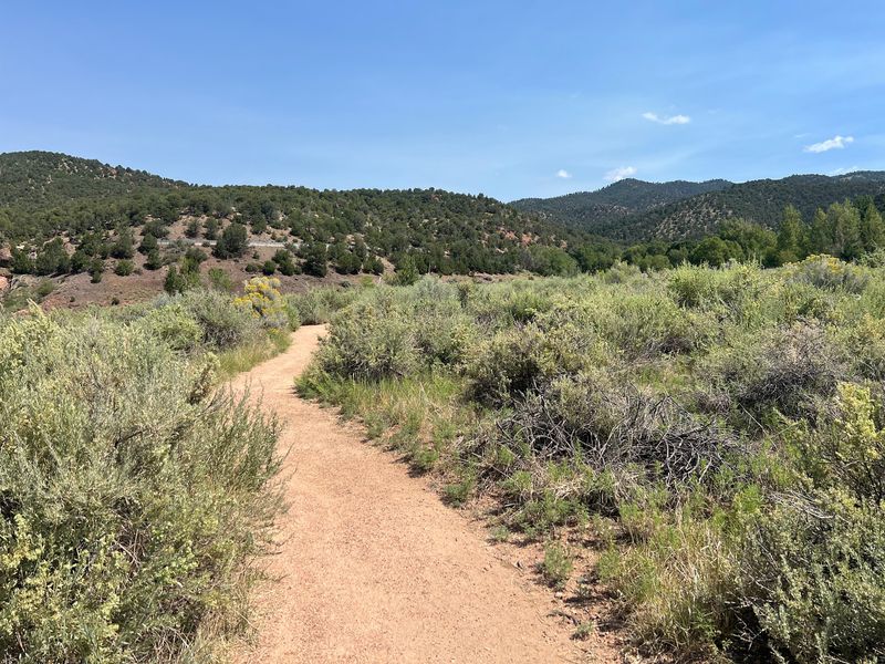
Twenty-two miles of trail sitting right on the edge of Santa Fe feels a little like cheating. The Dale Ball Trails give you a mountain workout without a long drive.
The network winds over varied terrain, so you can pick a mellow stroll or a sweaty climb. Hikers, runners, and mountain bikers share the routes.
Loads of rocks and diverse scenery keep things from feeling repetitive. Piñon-juniper woodland covers much of the area and gives the hills a classic high-desert look.
Craving a bigger challenge? The Atalaya Mountain Trail connects into this system and serves up views of Santa Fe, the Sandia and Manzano Mountains, and the Jemez Range.
Signage is easy to follow, which is a relief on a system this large. Still, snapping a photo of a trail map before you start never hurts.
Dog owners get a nice perk here. The trails are dog-friendly, with doggy bags and trash cans that help keep the paths clean.
Because many routes form loops, you can link segments and build a custom outing. That flexibility makes it easy to come back and try something new.
Parking is free in lots and along the street. Saturday evenings tend to be the quietest time to visit.
Summer mornings bring cooler temperatures, which helps on the climbs. Pack sunscreen too, since the high-elevation sun can sneak up on you.
Few cities in New Mexico offer this much trail so close to town. After your hike, Santa Fe’s galleries and plazas are a short drive away.
Address: Santa Fe, NM 87501
5. Williams Lake Trail
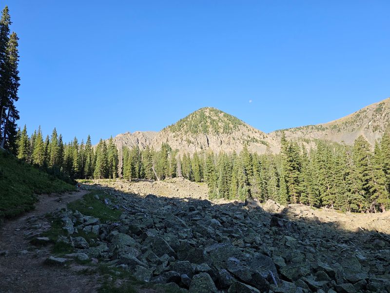
An alpine lake perched at roughly 11,000 feet doesn’t come easy, but this one asks surprisingly little. The trail climbs about 1,000 feet in under 2 miles to reach it.
You start near the base of Taos Ski Valley in the Sangre de Cristo Mountains. To reach the trailhead, drivers head up Twining Road past the ski valley parking lot.
Parking at Taos Ski Valley requires a daily fee, so plan for that before you go. Arrive early, because the best hiking hours start soon after sunrise.
The path climbs through the trees with beautiful scenery along the way. Thin air at this height makes the incline feel steeper than the numbers suggest.
Then the lake appears, tucked at the base of Wheeler Peak. At 13,161 feet, that peak is the highest point in New Mexico.
Strong hikers can continue on toward the summit from here. That longer push is strenuous, so only tackle it if you’re fit and well prepared.
Afternoon thunderstorms are common above treeline in summer. Rangers recommend getting back below the trees by 1 PM to stay safe.
Mark your calendar carefully, too. The area closes for about a week in mid to late August to respect Taos Pueblo cultural observances.
Snow can linger into early summer at these elevations. Late summer often brings the friendliest conditions, aside from that August closure.
Bring layers, water, and snacks, and watch for signs of altitude sickness. Slow and steady wins this climb every single time.
Address: New Mexico 87525
6. Dripping Springs Natural Area
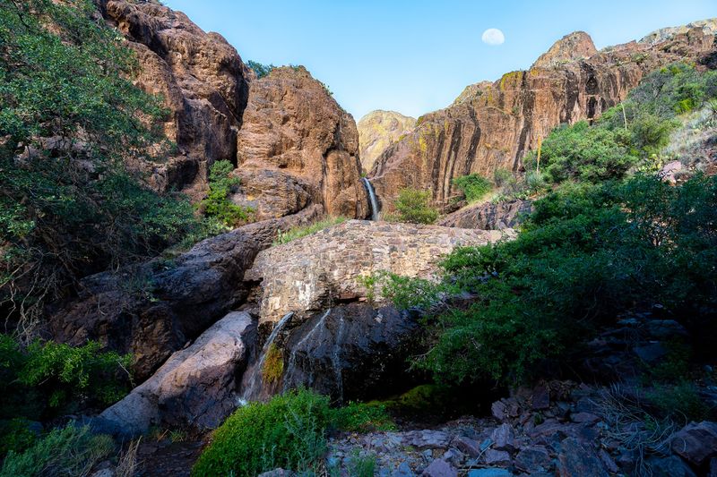
Old resort ruins and a spring that seeps right out of a granite wall make an unusual pair in the desert. Dripping Springs Natural Area serves up both below the jagged Organ Mountains.
The main hike runs about 1.5 miles uphill to the spring, making roughly 3 miles round trip. Wide gravel paths keep the footing simple for most hikers.
Along the way, rock spires and desert scrub give way to piñon-juniper and oak woodlands. The landscape shifts more than you might expect for such a short walk.
At the end, you’ll find the historic Van Patten Mountain Camp, a resort dating to the 1800s. A cave, a reservoir, and the dripping spring round out the scene.
Bring binoculars if you like wildlife. Red-tailed hawks, Gambel’s quail, golden eagles, desert mule deer, and coyotes live in this area.
Turn around on the way back for big views. The western face of the Organ Mountains and the Mesilla Valley spread out in front of you.
A visitor center offers interpretive displays about the mountains. The site also has accessible restrooms and 12 picnic sites for a post-hike lunch.
Hours open at 7 AM in summer and 8 AM in winter, closing at sunset. The area closes on Thanksgiving, Christmas, and New Year’s Day.
A day-use fee applies per vehicle. Weekdays tend to be calmer than weekend mornings, when this spot draws its biggest crowds.
Address: 15000 Dripping Springs Rd, Las Cruces, NM 88011
7. Baylor Pass West Trailhead
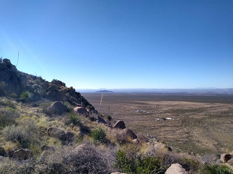
Here’s a trailhead that makes a great first impression, with plenty of parking and paths that are easy to follow. Baylor Pass West is a newer starting point with a big scenic payoff.
The hike to the pass covers about 3.5 miles with roughly 1,700 feet of gain. It’s rated moderate, thanks to a gradual incline instead of brutal switchbacks.
That steady climb lets you settle into a rhythm. You can actually enjoy the scenery instead of just staring at your shoes.
The real reward waits at the top. Views from the pass are spectacular, stretching across the rugged desert country around Las Cruces.
Rattlesnakes have been spotted along this route, so stay alert. Watch where you step and give any snake plenty of room.
Joggers use this trail too, which says something about its friendly grade. If you like trail running, this could become your new favorite workout.
Dogs are allowed outside, so your pup can come along. Carry extra water for them, since desert heat builds quickly.
The area also offers primitive dispersed camping. That’s a fun option if you want to catch the desert sky after dark.
Access is open 24 hours a day, and parking is free. Weekday mornings tend to be the quietest, while Saturday mornings get busier.
Southern New Mexico gets hot fast, especially in summer. Start early, wear sun protection, and bring more water than you think you’ll need.
Address: 4842 Baylor Canyon Rd #4726, Las Cruces, NM 88011
8. Catwalk Recreation Area
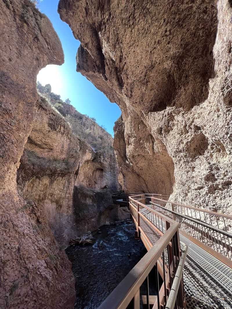
Walking on a metal catwalk bolted along a canyon wall feels like starring in your own adventure movie. Catwalk Recreation Area lets you do just that above a rushing stream.
The first portion of the trail is relatively easy and wheelchair accessible, with a walk that takes about an hour for many visitors. Beyond that accessible section, the route becomes more challenging, with uneven terrain and stream crossings.
Water steals the show here. A mini falls, swimming holes, and natural rock slides line the route, and many pools invite a splash on hot days.
The stream and trees create a soundtrack as you walk. It’s a peaceful place to slow down and actually listen to the outdoors.
Fall brings a special treat. The trees turn beautiful, and some leaves grow as big as your head, which kids find hilarious.
Picnic fans are covered too. You’ll find picnic tables, a barbecue grill, and public restrooms near the riverside area.
Dogs are allowed, so the family pup doesn’t have to stay home. The site is also considered good for kids, with easy hikes they can manage.
Hours run daily from 7 AM to 7 PM. Saturday afternoons bring the biggest crowds, while weekday mornings tend to stay calmer.
Glenwood sits in the Gila National Forest in southwestern New Mexico. Pair this stop with a scenic drive through the surrounding mountains.
Address: Catwalk Road, Glenwood, NM 88039
9. Sitting Bull Falls Recreation Area
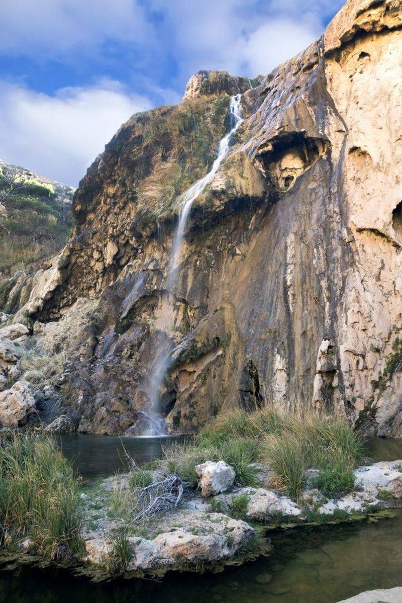
A 150-foot waterfall in the middle of the Chihuahuan Desert sounds like a mirage. Sitting Bull Falls is very real, and it plunges into a natural swimming area below.
Cold, clear water fills the pools at the base. On a hot day, that sight alone might convince you to make the drive.
Getting to the falls is easy, so you don’t need serious hiking skills. A short trail also leads to the top of the falls for a different view.
Want to stretch your legs more? Additional hiking trails wind through the area, and wildlife makes its home around this desert oasis.
An observation deck overlooks the pools at the bottom. It’s a great spot for photos, especially if you’d rather stay dry.
Picnic lovers hit the jackpot here. Stone shelters hold picnic tables and grills, so you can turn the visit into a full afternoon.
Friendly hosts help take good care of the grounds. That attention shows in how well the area is kept.
Hours are shorter than many parks, running daily from 8:30 AM to 4 PM. Plan your trip so you arrive with plenty of daylight.
Weekend afternoons get the busiest. Midweek mornings often feel more relaxed if you want space by the water.
Address: 742 Sitting Bull Falls Rd, Carlsbad, NM 88220
10. Alkali Flat Trailhead
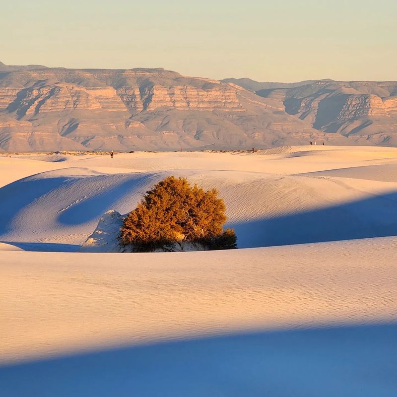
Hiking across the world’s largest gypsum dunefield feels less like a walk and more like visiting another planet. The Alkali Flat Trail is your ticket into that strange white world.
The gypsum dunefield at White Sands covers approximately 275 square miles, with a substantial portion protected by the national park. Those dunes can shift up to 30 feet a year, so the landscape keeps changing.
The route is a strenuous 5-mile out-and-back hike through the heart of the sand. Posts with red diamond trail markers guide you, and following them closely matters out here.
Walking on loose sand takes more effort than solid ground. Pace yourself, because 5 miles in dunes feels longer than 5 miles on a forest path.
Shade is basically missing in this terrain. Bring sun protection, plenty of water, and a hat you don’t mind getting dusty.
Timing your hike near evening has a big perk. The trail is known for surreal pinkish skies and dramatic sunsets over the dunes.
Fun fact: the gypsum comes from an ephemeral lake in the western part of the park. Wind carries the grains and builds the dunes you’re crossing.
Dogs are allowed on leash, so your pup can join the sandy adventure. Free parking sits right at the trailhead.
Hot summer days can get intense on open sand. Check park hours before you go and plan a cooler time of day.
Address: New Mexico 88352
11. Devisadero Loop Trail #108
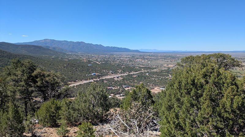
Looking for a lookout with a name to match? Devisadero roughly points to a place where you can see far, and this loop lives up to it.
The trail climbs to a peak with sweeping views of the Taos Valley. You can also take in the Sangre de Cristo Range and the country beyond.
Expect a solid workout. The 5.6-mile loop gains about 1,300 feet to the peak, while a 6-mile version has about 1,500 feet of total elevation change.
That’s rated moderately difficult, so it isn’t a stroll. Still, it’s very doable for hikers with decent fitness and good shoes.
The loop shape keeps things fresh. You won’t retrace your steps, which means new scenery on the way down.
A convenient parking area sits at the trailhead. Primitive facilities are available, so don’t expect fancy restrooms.
Dogs are allowed outside, making this a fun outing with a trail-loving pup. Pack water for both of you on the climb.
The trail is open 24 hours a day. Mornings are a smart choice, especially in summer when afternoons heat up and storms can roll in.
The trailhead sits in Carson National Forest, close to the town of Taos. Pair your hike with a stroll around town afterward.
Few northern New Mexico hikes deliver this much view for the effort. Save some phone battery for the top, because you’ll want photos.
Address: Carson National Forest, Taos, NM 87571