See those hills?
Look again.
People built them.
That one fact changes the whole walk.
Centuries ago, a major Indigenous city stood here, and the earthworks still shape this part of Illinois today. What looks peaceful now once belonged to a place full of people and purpose.
So do not just glance from the car.
Walk between the mounds. Climb one when access allows. Then look back across the flat land and let the scale sink in.
The biggest mound may grab your attention first, but it is not the whole story.
That is what makes this place so good at messing with your first impression.
You arrive thinking you are looking at hills.
You leave knowing you were standing inside the remains of a city.
Cahokia Mounds Preserves The Remains Of North America’s Largest Ancient City North Of Mexico
Long before the surrounding highways and suburbs appeared, a large settlement of earth and timber stood in what is now southern Illinois.
Cahokia became a major center of Mississippian culture, with monumental mounds, broad plazas, residential districts, and connections to other communities across the region.
Indigenous people developed this landscape over centuries. Cahokia flourished especially from about 1050 to 1350 CE, although the area’s wider Mississippian history begins earlier.
Archaeological evidence reveals a carefully organized settlement rather than a random collection of grassy hills.
Many of the buildings were made from materials that have not survived above ground. The mounds, their arrangement, and the traces uncovered by archaeologists help map where homes, public buildings, and activity areas once stood.
Follow the paths between the preserved earthworks and notice how their placement changes your view of the site.
Cahokia joined the UNESCO World Heritage List in 1982. The protected landscape includes part of a much larger ancient urban area, and the surviving mounds still mark its broad layout.
For an introduction before walking, look over the site map near the parking areas. You can begin with the open plaza or head toward Monks Mound, where the scale of Cahokia becomes easier to see.
Thousands Of Indigenous People Once Lived In This Massive Illinois Settlement
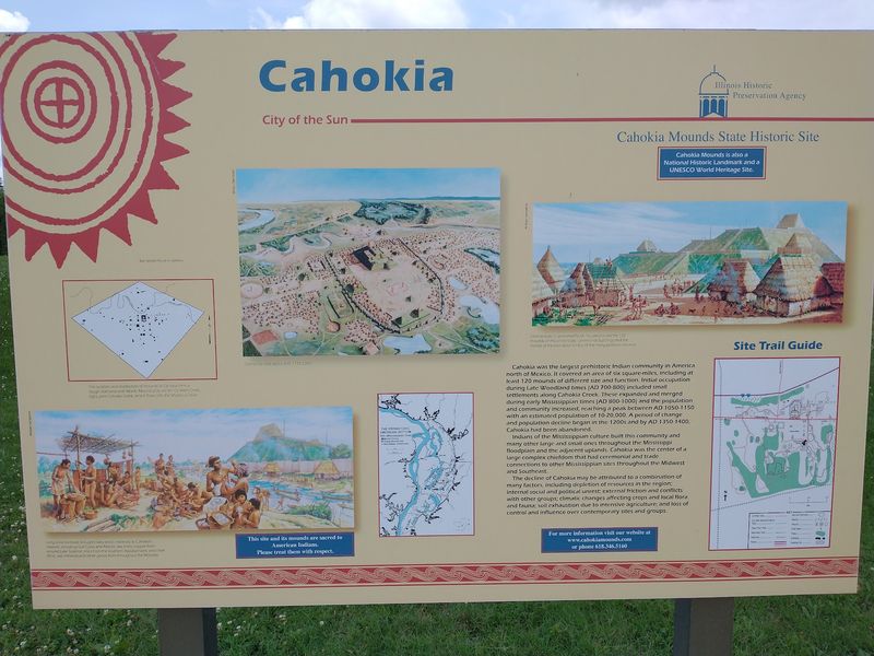
Around the year 1100, Cahokia was home to a population estimated at 10,000 to 20,000 people. Its peak is generally placed between 1050 and 1150 CE, when the settlement covered roughly 4,000 acres.
Exact population counts are estimates, but the surviving landscape shows the size of the community.
The city included neighborhoods, shared spaces, and large earthen constructions. Evidence of houses, workshops, and food production has helped archaeologists understand how different parts of the settlement were used.
Agriculture supported daily life, while the surrounding river valleys connected Cahokia with a wider regional network.
The Grand Plaza lies south of Monks Mound. This large open space formed a central part of the planned landscape, with important mounds arranged around it.
When you walk beside the plaza, look back toward Monks Mound to see how strongly it anchors the surrounding space.
A modern lawn cannot show every street, building, or activity that once occupied the area. Trail maps and interpretive displays offer more detail about the ancient layout.
If you’re visiting with children, compare the shapes and heights of the mounds, then look for the open ground separating them.
Allow time to stop and read rather than crossing the entire site at a brisk pace. The landscape stretches well beyond one parking area, and even a short route offers several different views.
Monks Mound Towers Above The Landscape As An Ancient Engineering Marvel
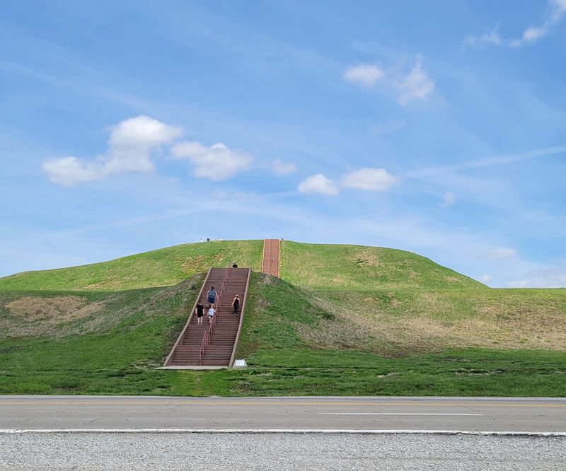
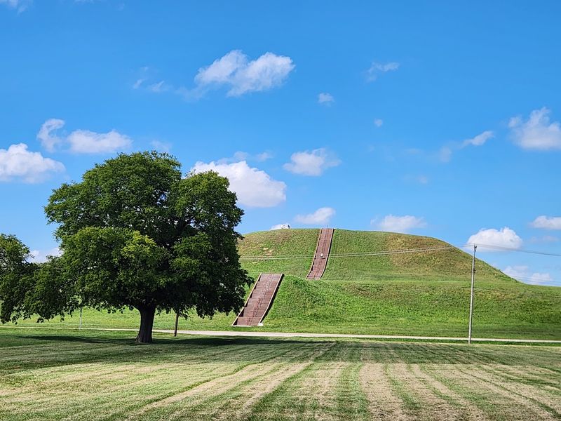
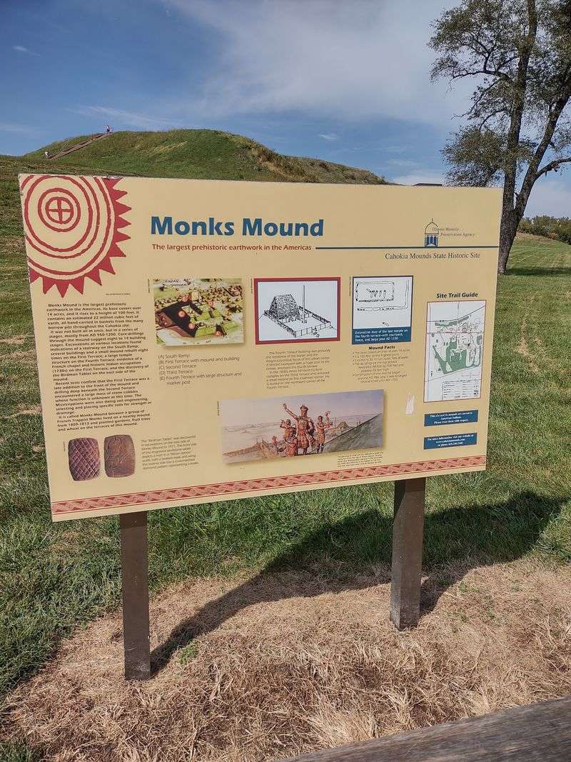
Monks Mound rises approximately 100 feet above the surrounding terrain. Built from layers of earth, it is the largest prehistoric earthen structure in the Americas. Its broad base and terraced shape take up far more space than the top appears to from a distance.
The mound was constructed in stages, with earth transported and placed by hand. Archaeological work has identified distinct building episodes over time. Look at its long sides before approaching the steps, and notice the terraces that break up the slope.
A staircase provides the designated route toward the summit when access is available. The climb includes many steps and little shade. Wear shoes with secure soles, carry water, and take breaks if you need them.
Check posted access notices before starting because maintenance or weather can affect the route.
From the upper terrace, clear conditions can reveal the St. Louis skyline and Gateway Arch across the Mississippi River. Closer to the mound, the Grand Plaza and other earthworks appear as parts of a larger arrangement.
Stay on authorized paths and stairways, and leave the grassy slopes undisturbed. Cahokia is an archaeological landscape, including areas where features remain below the surface.
If you would rather skip the climb, the base of Monks Mound still offers a close view of its immense footprint.
More Than 100 Earthen Mounds Once Formed The Heart Of Cahokia
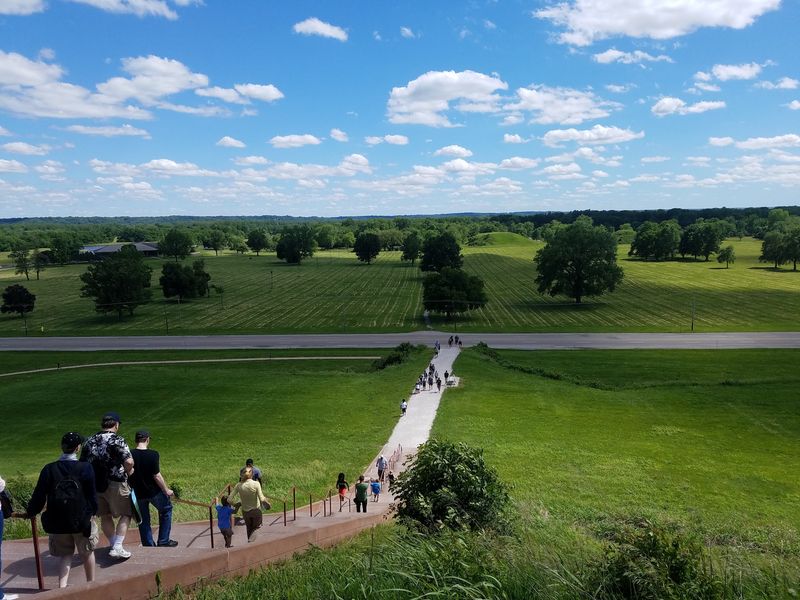
Cahokia originally contained about 120 earthen mounds across its wider urban area. Only some remain today. The State of Illinois protects much of the central site, including dozens of surviving mounds, while others lie outside the protected grounds.
Not every mound has the same shape. Flat-topped platform mounds provided raised settings for buildings and important activities. Other types include rounded and ridge-shaped forms.
Archaeological work has identified different uses, so the mounds should not be treated as interchangeable hills.
Some earthworks stand beside broad stretches of open ground; others are easier to recognize after you study a site map.
Walk from one area to another and notice how the relative heights change. A smaller mound can appear almost level from one side and much more distinct from another.
The mounds are meaningful cultural places with continuing importance for Native peoples. Use designated routes, respect closed areas, and leave all objects and soil where they are. The preserved ground is part of the archaeological record.
A walk beyond Monks Mound brings a different sense of scale to the visit. If you have extra time, follow a marked trail toward other surviving earthworks rather than viewing them only from the road. Check trail conditions after rain, when grassy sections can become muddy.
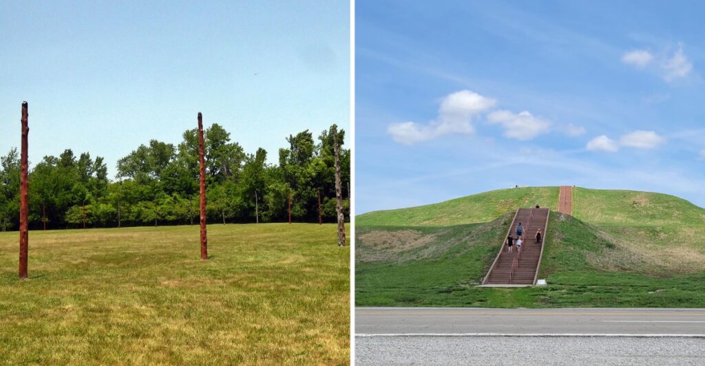
Woodhenge Reveals How Cahokia’s Residents Tracked The Sun And Seasons
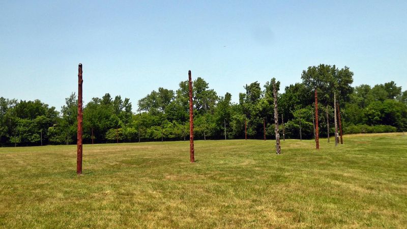
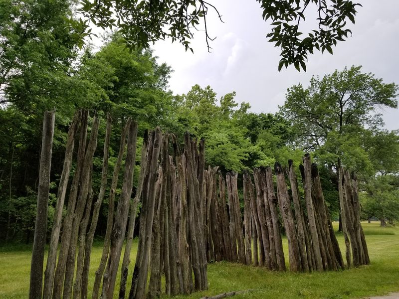
Woodhenge gives you a look at another part of Cahokia’s carefully arranged landscape. Archaeologists discovered patterns of postholes left by large circular arrangements of timber posts west of Monks Mound. A reconstruction marks one of these circles today.
The positions of some posts align with sunrise points at important times of year, including the solstices and equinoxes.
Researchers have interpreted the circles as places where residents observed seasonal solar changes. Their exact range of functions remains an area of study.
At the reconstruction, stand back far enough to see the spacing of the posts around the circle.
The open sky and long sight lines help you examine the arrangement without needing specialized equipment.
The present wooden posts are modern replacements, not timbers that survived from the original structures.
The central post area is reached over uneven, unpaved grass. Visitors using wheelchairs or strollers should consider the ground conditions before crossing toward the center. After rain, the approach may be softer underfoot.
Cahokia also hosts occasional sunrise programs connected with the equinoxes and solstices. These are scheduled events rather than daily demonstrations, so check the calendar if you want to attend one.
Otherwise, you can explore the reconstruction as part of a regular visit during posted grounds hours.
The Rise And Decline Of One Of America’s Most Remarkable Ancient Civilizations
Cahokia’s growth unfolded over centuries in the Mississippi River valley. Mississippian communities developed extensive agricultural practices, built monumental earthworks, and created gathering areas that connected people across the region.
The settlement reached its greatest size during the eleventh and twelfth centuries. Monks Mound, the Grand Plaza, and surrounding neighborhoods reflect a period of substantial construction and organization.
Cahokia was also connected to other settlements through networks of exchange and shared cultural traditions.
Over time, the population decreased. By the fourteenth century, the large urban center no longer had the same concentration of residents.
Researchers continue to investigate the changes, examining evidence related to environmental conditions, resources, settlement patterns, and social developments.
There is no single established explanation for every stage of Cahokia’s population shift. Archaeology continues to refine the timeline, and new findings can change how particular areas are understood.
As you walk, compare the large open plaza with the mounds around it. Their surviving forms offer a direct way to consider the city’s organization without trying to reconstruct unrecorded conversations or individual experiences.
Cahokia remains an important part of Indigenous history in North America. Its cultural landscape deserves thoughtful attention while you explore.
Exploring The Ancient Mounds And Archaeological Treasures Near St. Louis
Got an open afternoon near St. Louis? Cahokia Mounds is in Collinsville, Illinois, across the Mississippi River from the city. The outdoor grounds are open daily from dawn until dusk, with no admission charge for walking the site.
The Interpretive Center has been undergoing renovations. Its lobby currently offers limited access Wednesday through Sunday, generally from 9 a.m. to 3 p.m., including restrooms, a gift shop, and selected displays.
Check current arrangements before traveling, especially if indoor exhibits are a major part of your plans.
You can still explore the outdoor landscape on your own. Maps and brochures are available near the Monks Mound parking lot and outside the Interpretive Center. A vault toilet and water fountain are provided near the Monks Mound parking area.
For a longer visit, consider the optional Cahokia AR Tour app, which uses a phone or tablet to show digital reconstructions at selected outdoor stops. It is a paid app, and device compatibility varies. Download it and check how it works before heading along the trail.
Wear comfortable walking shoes, carry drinking water, and prepare for exposed stretches in sunny weather. Keep dogs leashed and use marked paths around the earthworks.
If climbing Monks Mound is on your schedule, allow additional time for the steps and for a look over the central plaza.
Set your destination to Cahokia Mounds State Historic Site, 30 Ramey Street, Collinsville, IL 62234. A site map and flexible route will help you explore several sections without trying to cover the entire ancient settlement in one afternoon.