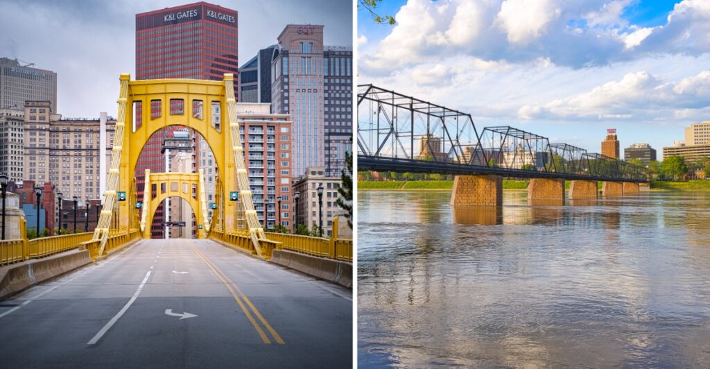
Bridges are supposed to help you get somewhere.
These may ruin that idea by making you stop halfway.
A crossing can frame a skyline, carry you over a wide river, or leave you staring down into a valley much longer than expected.
That is where Pennsylvania gets interesting.
Some bridges still carry the look and weight of the state’s industrial past. Others have become places to walk, linger, and watch the water move below.
And then there are the ones that seem determined to test how comfortable you are with heights.
One crossing might feel completely urban. The next could feel miles away from everything.
Apparently, getting from one side to the other was only part of the assignment.
1. Kinzua Bridge Skywalk
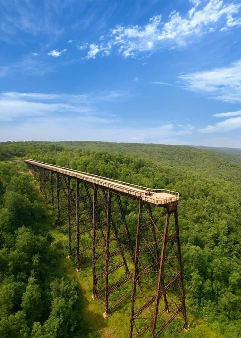
The first step onto a railway viaduct high above a wooded valley is enough to change your perspective. This is not a bridge you cross to reach another town. Instead, a surviving stretch of steel takes you out into open space, with a broad view of the Kinzua Creek Valley below.
The original Kinzua Viaduct opened in 1882 and later underwent reconstruction. A tornado brought down much of the structure in 2003, leaving twisted towers on the valley floor.
Its surviving end was reinvented as a pedestrian skywalk, with a partial glass viewing area near the end of the roughly 600-foot walk.
The viewpoint has an unusual combination of scenery and industrial history. Look across the forest canopy, then turn back to see the remaining bridge supports rising from the hillside.
From above, the fallen sections explain the scale of the old rail crossing more clearly than a photograph could.
Autumn brings the greatest color contrast, when yellow and red leaves spread through the gorge. Cooler air and a breeze at elevation make an extra layer useful, even on a sunny afternoon. The visitor center offers exhibits about the bridge, its construction, and the storm.
Plan this stop around its seasonal rehabilitation schedule: the skywalk is open for the fall viewing period through October 31, 2026, then closes again for construction.
The Kinzua Creek Trail also has controlled access, and crossing the stream to the far side is prohibited. Enjoy the permitted overlooks and stay clear of the fallen steel below.
Address: Kinzua Bridge State Park, 296 Viaduct Rd, Kane, PA 16735.
2. Roberto Clemente Bridge
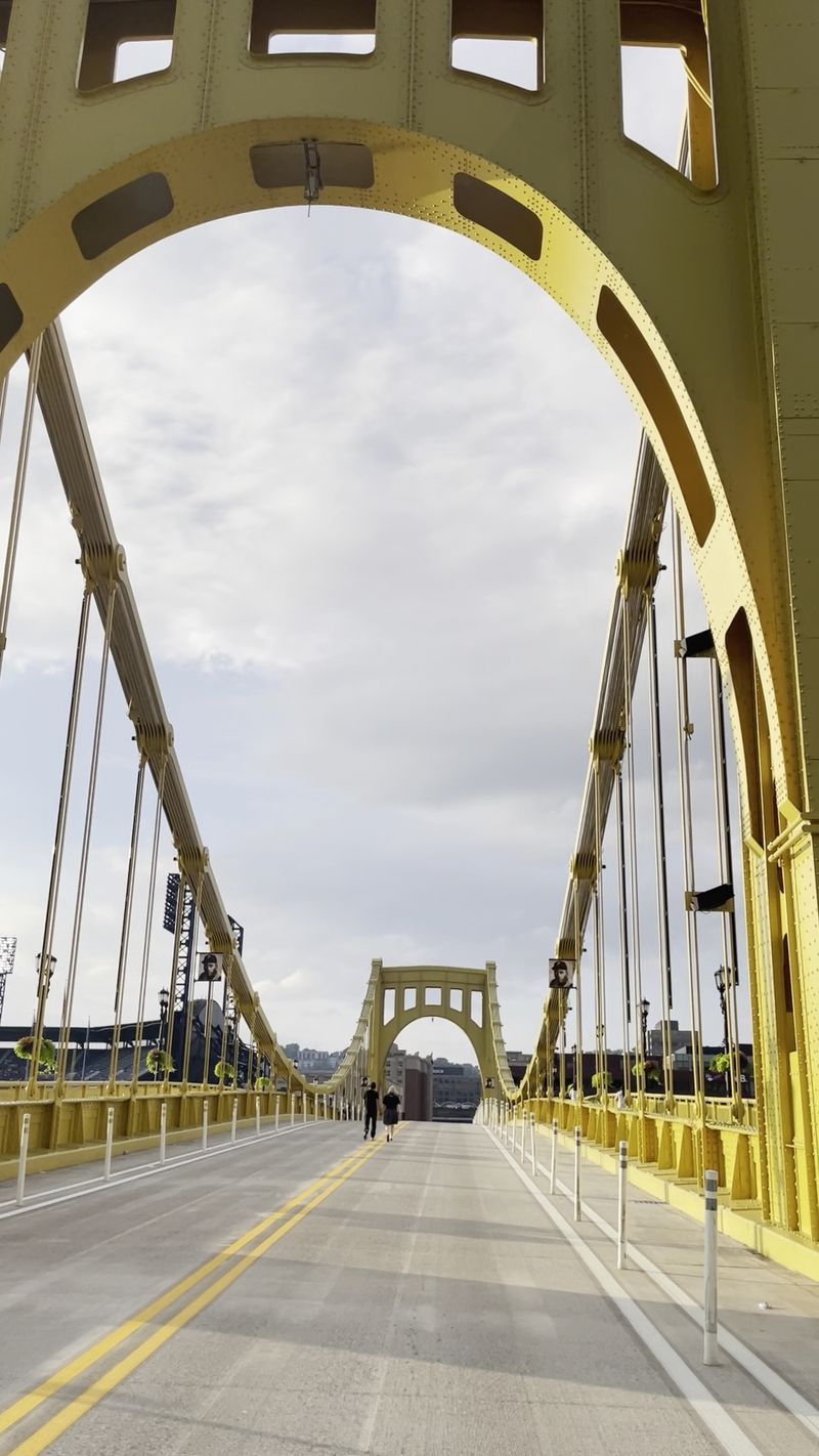
Pittsburgh’s yellow suspension bridges give the city skyline a distinctly recognizable outline. A walk across the Allegheny River here places downtown towers behind you and the North Shore ahead, with enough space to stop and watch boats moving below.
The Roberto Clemente Bridge carries Sixth Street across the river and connects the Cultural District with the area around PNC Park.
It is one of the Three Sisters bridges, a coordinated group of self-anchored suspension spans built in the 1920s.
Its namesake was the Pittsburgh Pirates baseball player remembered for his athletic career and humanitarian work.
On selected baseball game days, vehicle restrictions turn the crossing into an especially pedestrian-focused route.
At other times, stick to the sidewalks and allow room for people traveling in both directions.
The bridge offers a quick introduction to the city’s relationship with its rivers without committing to a long hike.
Pause around the middle to compare the riverbanks. On one side, the downtown streets rise closely behind the yellow bridge framework. Across the water, ballpark structures and riverside paths create a different skyline.
It is also an easy place to notice how close the other sister bridges stand.
Try walking toward the North Shore first, then return along the riverfront if you have time. That simple loop gives you several different angles on the span and lets you decide whether to continue toward a museum or find a spot for lunch.
Address: Sixth St at Fort Duquesne Blvd, Pittsburgh, PA 15222.
3. Benjamin Franklin Bridge
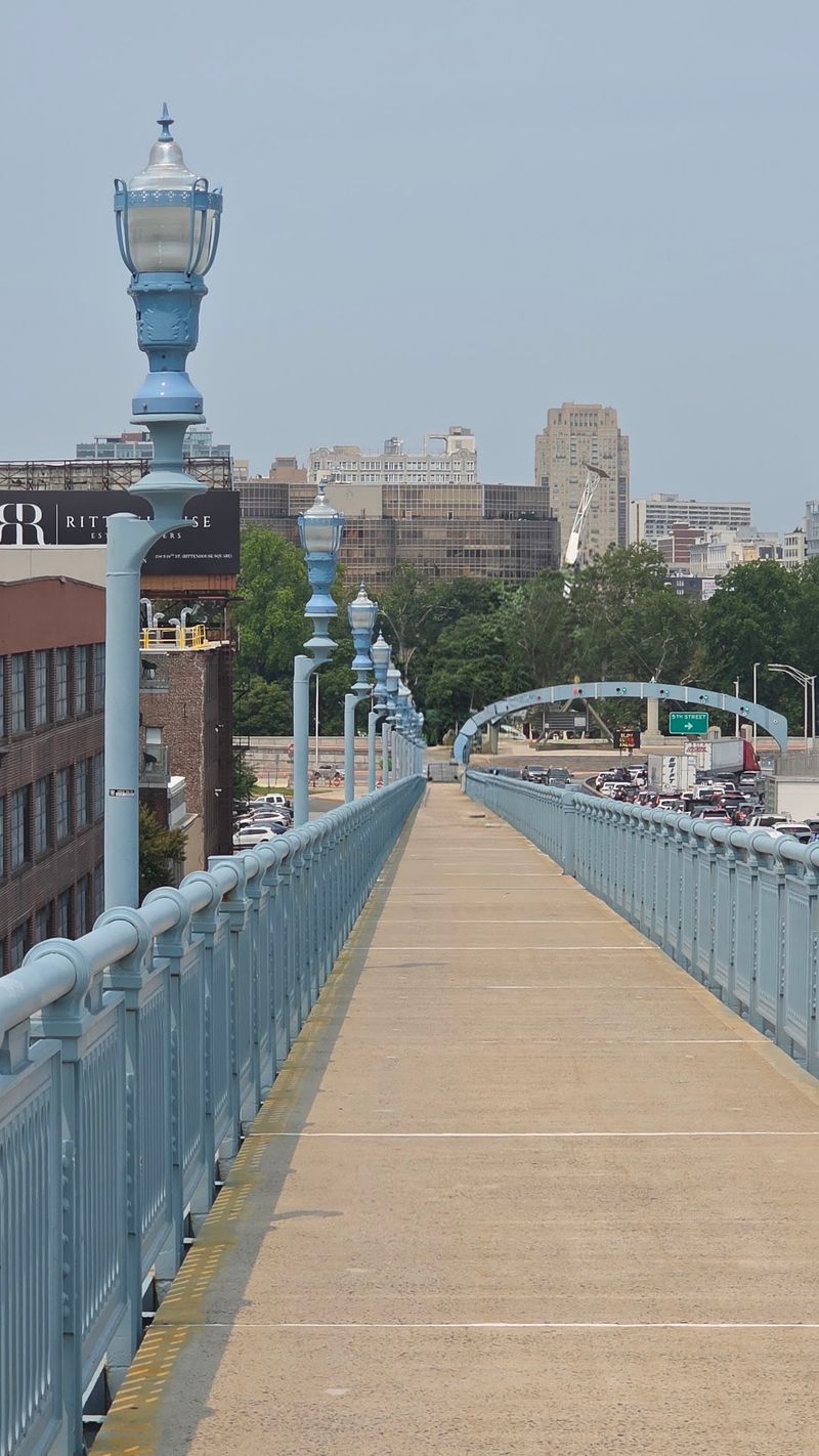
A walk from Pennsylvania into New Jersey can begin right in central Philadelphia. This long suspension bridge has a dedicated pedestrian route above the Delaware River, giving walkers a view that changes steadily as the city recedes.
Opened in 1926, the Benjamin Franklin Bridge connects Philadelphia with Camden. The bridge’s high towers and broad river crossing are impressive from street level, but the pedestrian path makes their scale easier to appreciate.
From the walkway, rooftops, waterfront buildings, and commercial vessels become part of one sweeping scene.
The climb from the Philadelphia entrance is gradual but noticeable.
Give yourself extra time if you want to pause for photographs, and carry water on warm days because the elevated path offers little shelter from the sun.
Cyclists also use the crossing, so keep to one side and remain alert at narrow sections.
The crossing has scheduled operating hours rather than unlimited overnight access. During the cooler months, opening hours are shorter than in summer. The south pedestrian walkway is currently the open route, while the north side is closed.
Follow posted signs because construction can change that arrangement.
One easy plan is to cross far enough for a river view and turn around rather than walking all the way to Camden. For a full crossing, the New Jersey entrance is at Fourth and Pearl streets.
Either choice offers an unusual look at Philadelphia’s waterfront and a satisfying sense of distance covered on foot.
Address: Pedestrian entrance, N 5th St and Race St, Philadelphia, PA 19106.
4. Smithfield Street Bridge
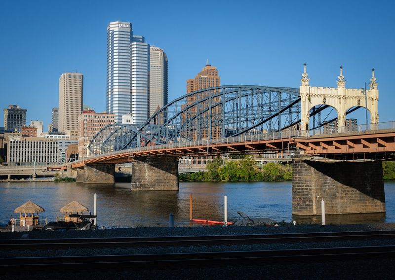
Curving steelwork makes this crossing a little different from Pittsburgh’s other downtown bridges. Instead of simple straight trusses, its metal members create a series of lens-like forms above the Monongahela River.
The Smithfield Street Bridge opened in 1883 and became a landmark of nineteenth-century engineering. Its distinctive lenticular trusses were designed by Gustav Lindenthal, and the bridge is recognized as a National Historic Landmark.
You can appreciate the geometry best while walking, when each curved panel passes slowly overhead.
One end meets the downtown street grid; the other brings you to Station Square. That makes the bridge convenient for combining river views with an easy urban outing. Look downstream for additional crossings, then turn toward the hills above the south bank.
The walkway is an active city connection rather than a secluded promenade. Keep moving when the sidewalk is busy, but take a moment where space permits to look back toward the towers and waterfront buildings.
The steel structure creates interesting changing patterns as the light shifts through it.
After crossing, you can continue toward the Monongahela Incline for a different view from Mount Washington. Or keep the excursion simple with a stroll around Station Square before returning to downtown.
Either way, the bridge provides a closer look at Pittsburgh’s long history of building across rivers.
Address: Smithfield St at Fort Pitt Blvd, Pittsburgh, PA 15222.
5. Walnut Street Bridge
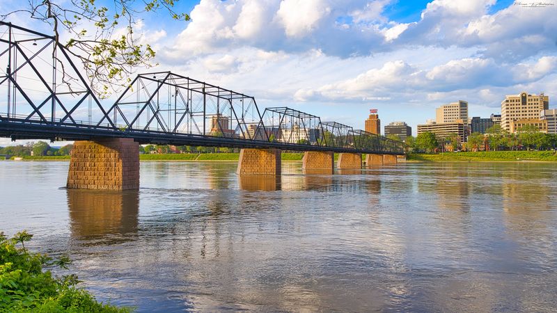
In Harrisburg, the Susquehanna River widens around City Island, creating a setting where a short bridge walk feels pleasantly removed from downtown traffic. The historic pedestrian crossing reaches the island from the eastern bank and frames views of the city behind you.
The Walnut Street Bridge opened in 1890 and later became a route for people walking or cycling rather than driving. Its western portion was badly damaged by flooding and ice in 1996.
The surviving eastern span provides the familiar connection between the Harrisburg riverfront and City Island.
The structure is sometimes called Old Shaky, a nickname that hints at its long local history. From the deck, the river stretches out on both sides, and the city’s buildings rise beyond the water.
Take a few moments to look upstream and downstream before continuing toward the island.
City Island adds options for a longer visit, with open spaces, seasonal recreation, and views toward the Capitol dome across the river. The crossing itself is relatively short, so it works for walkers who want scenery without a strenuous route.
Conditions and maintenance activity can affect pedestrian access, and the western end is not a through-route across the full river.
Approach it as a Harrisburg-to-City-Island stroll, not a way to reach the opposite shore. For a different angle on the water, the nearby Market Street Bridge also has sidewalks.
Address: Walnut St at Front St, Harrisburg, PA 17101.
6. Hot Metal Bridge
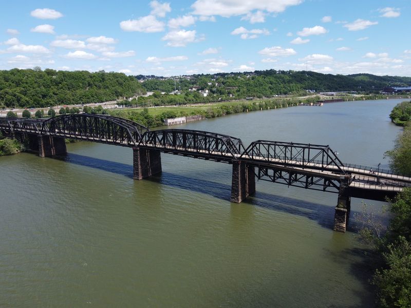
Before it became a practical walking and cycling connection, this river crossing helped move materials through Pittsburgh’s steel industry. Its name is a reminder of the days when rail traffic carried hot metal between industrial works on opposite banks.
Today the Hot Metal Bridge offers a route over the Monongahela River between the South Side and the Oakland side of the water.
One portion is used by vehicles, while a converted railroad span accommodates people walking and cycling.
The result is a place where industrial history remains visible without interrupting a modern trail outing.
Walk out far enough to look along the river rather than directly across it. The old steel framework, riverfront paths, and wooded slopes create layers of scenery that differ from the downtown skyline.
Depending on the time of day, you may also see rowers and other river traffic below.
The path is part of a broader network, so plenty of cyclists pass through. Staying to the right and keeping groups together makes the crossing more comfortable for everyone. A short walk can easily stretch into a longer excursion using the South Side riverfront trail.
For a relaxed afternoon, cross toward South Side Works, explore the shops and public spaces, then walk back over the bridge. It is an easy way to connect two neighborhoods while noticing the industrial engineering that once shaped this part of the city.
Address: Hot Metal St at Water St, Pittsburgh, PA 15203.
7. New Hope Lambertville Bridge
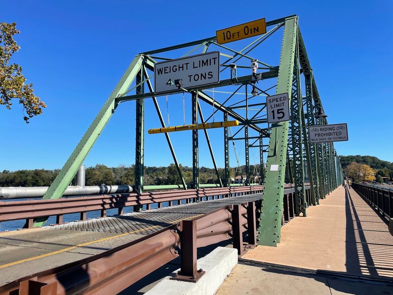
Crossing a state line feels surprisingly effortless when two walkable river towns sit on opposite ends of the same bridge. Start among the shops of New Hope, take a short stroll over the Delaware, and you arrive in Lambertville, New Jersey.
The New Hope–Lambertville Bridge is a steel truss crossing used by both vehicles and pedestrians. Its sidewalk gives you a view of the river and the buildings along both banks.
Unlike a bridge on a major expressway, this one feels closely connected to the streets and small businesses at either end.
As you cross, look downstream toward the wooded shores and upstream toward the changing river bends. The view is especially inviting when trees along the banks turn color in autumn. In warmer weather, you may also see paddlers moving through the water below.
The pleasure here comes from having two places to explore rather than a single destination. Spend time browsing in New Hope, cross for coffee or a snack in Lambertville, then wander back at your own pace.
You can shorten or lengthen the walk depending on how much of each town you want to see.
The bridge has undergone rehabilitation work, so follow any current pedestrian signs and temporary barriers. Parking around New Hope can be limited on weekends; arriving earlier in the day leaves more time for the streets and waterfront without rushing.
Address: Bridge St at Main St, New Hope, PA 18938.
8. Veterans Memorial Bridge
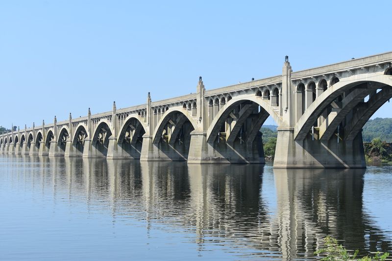
A procession of concrete arches reaches across the wide Susquehanna River between Columbia and Wrightsville.
Seen from shore, the repeated arches form a striking pattern; walking along the bridge reveals the scale of the river and the small islands scattered across it.
Also known as the Columbia–Wrightsville Bridge, the Veterans Memorial Bridge opened in 1930. It extends more than a mile and was an ambitious achievement in concrete-arch design.
The river crossing also carries a deeper local history: an earlier bridge in this area was burned during the Civil War to prevent Confederate forces from advancing eastward.
The sidewalk gives walkers a broad view of the river and surrounding communities. Depending on weather and season, you may see waterbirds along the islands and boaters passing below.
The long, exposed crossing can feel windier than the streets on either side, so a jacket is useful on cooler days.
Plan for the distance rather than treating it as a quick crossing. A complete out-and-back walk is several miles, and there is little shade over the water. You can also choose to go partway, enjoy the view, and return to the same riverbank.
The bridge currently accommodates pedestrians and cyclists, though a major rehabilitation is planned for future years. Follow any posted work-zone instructions. Columbia and Wrightsville both have riverfront places to explore before or after the walk.
Address: PA Route 462 at the Susquehanna River, Columbia, PA 17512.
9. Andy Warhol Bridge
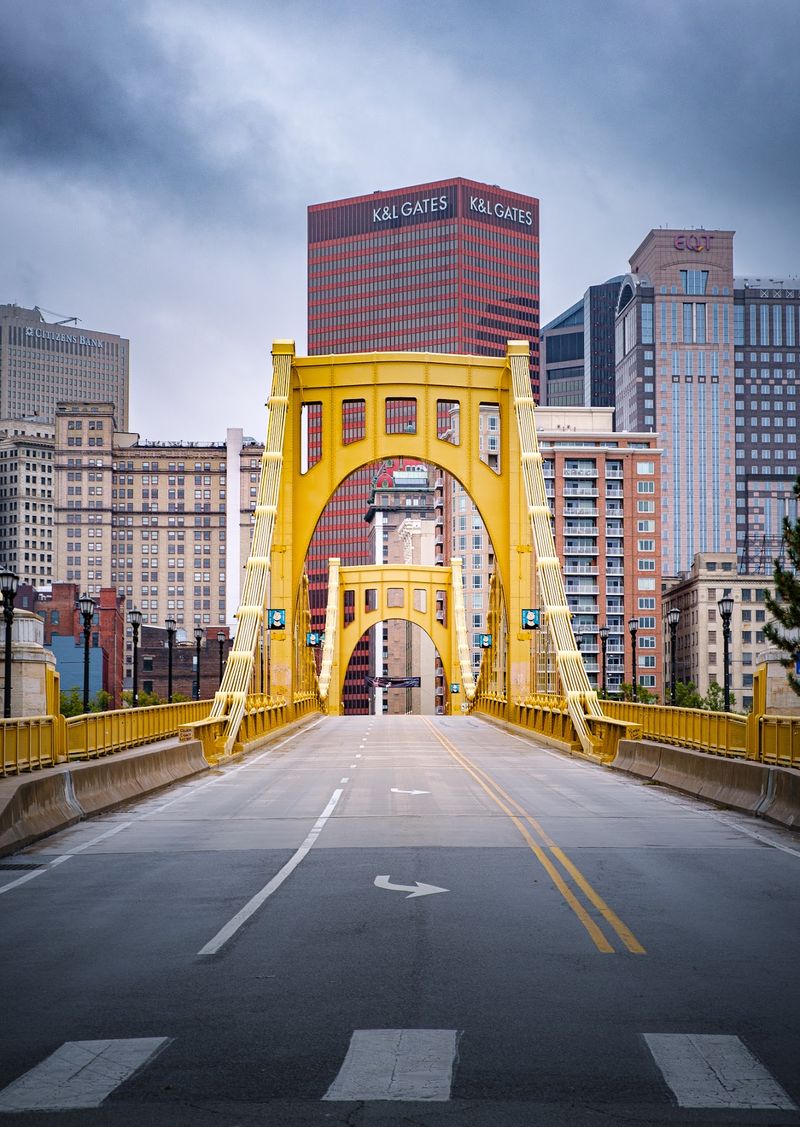
The yellow steel of Pittsburgh’s Seventh Street crossing offers a different introduction to the North Shore: instead of heading toward the ballpark, the route places you near a museum devoted to a famous Pittsburgh-born artist.
The Andy Warhol Bridge is another member of the Three Sisters group over the Allegheny River.
Like its neighboring bridges, it uses a self-anchored suspension design and carries walkers between downtown and the North Shore.
Stand back near the end of the span to notice how closely the three bridges resemble one another.
The name honors Andy Warhol, whose work transformed familiar images into boldly colored art. In 2013, the bridge itself became part of a temporary public artwork when volunteers covered portions of it with knitted panels.
The installation is gone, but the story fits a crossing named for an artist with a playful approach to ordinary objects.
On foot, the best details may be the changing river views rather than the bridge’s color alone. Downtown office towers fill one side of the scene, while the North Shore opens onto cultural attractions and riverfront spaces.
It is a manageable walk even if you are making a quick stop between other activities.
One easy route is to visit the Andy Warhol Museum, then cross the bridge toward downtown for a different view of the structure. Or reverse the plan and make the museum the reward at the end of your river crossing.
Address: Seventh St at Fort Duquesne Blvd, Pittsburgh, PA 15222.
10. Lumberville Raven Rock Bridge
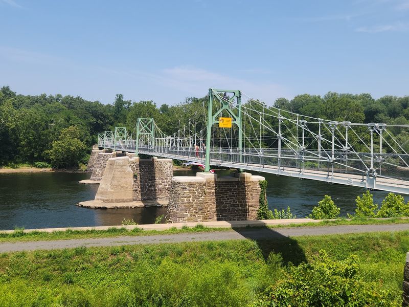
For a quieter Delaware River crossing, head to the small village of Lumberville in Bucks County. Here, a pedestrian-only bridge replaces the sound of passing cars with river breezes, footsteps, and the occasional bicycle rolling nearby.
The bridge reaches from the Pennsylvania shore toward Bulls Island in New Jersey. Its present structure dates to the twentieth century, while the crossing itself has older roots in the region’s network of river bridges.
The narrow deck and steel framework make the crossing feel more intimate than the broad highway bridges farther south.
Take your time along the middle stretch. Trees and riverbanks frame the water, and the view changes with each season: green foliage in summer, bright leaves in autumn, and more open views through bare winter branches.
The Pennsylvania end connects naturally with the Delaware Canal towpath, a route popular with walkers and cyclists.
Across the river, additional paths and recreation areas allow you to add distance without retracing every step. A short bridge visit can therefore become a longer afternoon outdoors.
The structure is maintained as a walking connection, although lighting and security improvements may bring temporary work activity. Follow signs and keep the narrow walkway clear for others.
Parking is limited around the village, so consider a quieter time of day and avoid blocking local access roads.
Address: River Rd (PA 32), Lumberville, PA 18933.