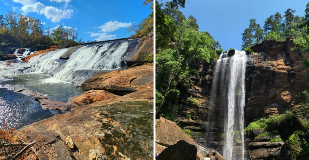
Here is the trouble with chasing waterfalls in Georgia: one is rarely enough.
You hear the first one before you see it, follow the trail a little farther, and suddenly the car keys can wait.
Some falls are easy wins. A short walk gets you there with plenty of energy left.
Others make you earn the view.
There are stairs. Gravel roads. Woodland trails that feel very friendly on the way down and slightly less friendly on the climb back.
That variety is what makes the day interesting.
Pick the stop that matches your shoes and your mood, bring water, and give wet rocks the respect they deserve.
Then listen for the next rush of water.
Good luck stopping at one.
1. Anna Ruby Falls
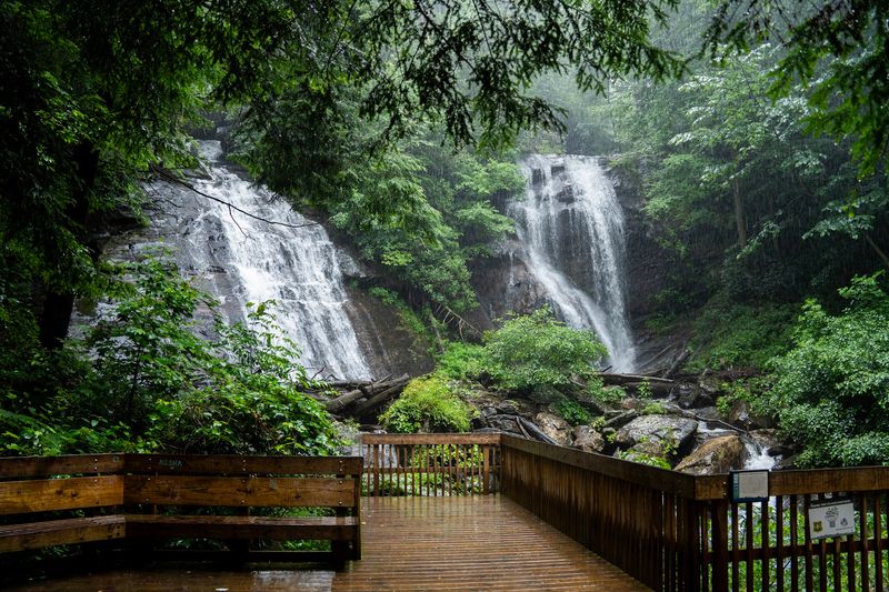
At Anna Ruby Falls, two neighboring streams tumble down the mountainside near Helen, meeting below a pair of cascades.
Curtis Creek makes the taller plunge, while York Creek follows its own rocky course. Together, they create an appealing view from the platforms at the end of a wooded approach.
The paved walk to the observation area is roughly 0.4 miles each way.
The surface makes navigation straightforward, but the uphill grade means that pushing a stroller can be difficult, especially on the descent.
Plan for the return journey too, even though that portion heads downhill.
Wheelchairs and other mobility devices are not permitted on the steep main trail; the shorter Lion’s Eye Trail near the visitor center is the more accessible alternative, though it does not reach the falls.
Another pleasant detail is how the main route follows the creek. You don’t have to wait until the final viewpoint for running water; it accompanies much of the walk.
Look around at the forest rather than keeping your eyes fixed on the end of the path.
The visitor center and gift shop offer a convenient place to begin, and picnic areas provide space for a snack afterward.
Admission is charged for visitors ages sixteen and older, while younger children enter free. This is a managed recreation area rather than an open-access roadside pullout.
It’s an especially useful stop when you’re already exploring the Helen and Unicoi area. Pair the waterfall with an unhurried woodland morning, rather than treating the paved trail as something you need to rush through.
Address: 3455 Anna Ruby Falls Rd, Helen, GA 30545.
2. Amicalola Falls
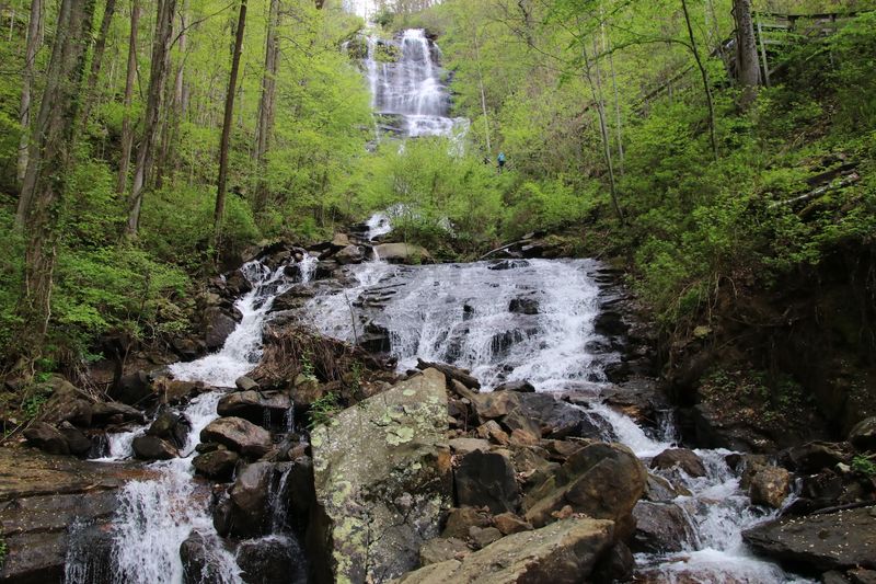
A cascade dropping 729 feet is difficult to take in from just one angle. The water descends a long, steep rock face, and the state park offers several ways to see different sections without everyone having to tackle the same climb.
The staircase route brings you nearer to the falls and turns the visit into a vigorous workout. If a long set of steps isn’t your idea of fun, choose a shorter paved approach to an overlook instead. Choose the route that fits your energy level.
The name Amicalola Falls comes from a Cherokee word commonly translated as ‘tumbling waters.’ Stand at a viewing area, and it’s easy to see how that description fits the white ribbons moving over the rock.
Hikers with bigger plans may recognize the park as the beginning of the Appalachian Trail Approach Trail, which heads toward Springer Mountain.
You can enjoy the waterfall without committing to that longer route, however. The park’s shorter paths give a completely different kind of outing.
Bring water, shoes with traction, and a little patience for the stairs if you take them. The park also has a lodge, visitor facilities, and picnic opportunities, allowing you to stretch a short viewpoint visit into a longer day outdoors.
A good plan is to choose your preferred overlook first and save any optional climbing for afterward. You’ll have the main view covered before deciding whether your legs are ready for more.
Address: 280 Amicalola Falls State Park Rd, Dawsonville, GA 30534.
3. Toccoa Falls
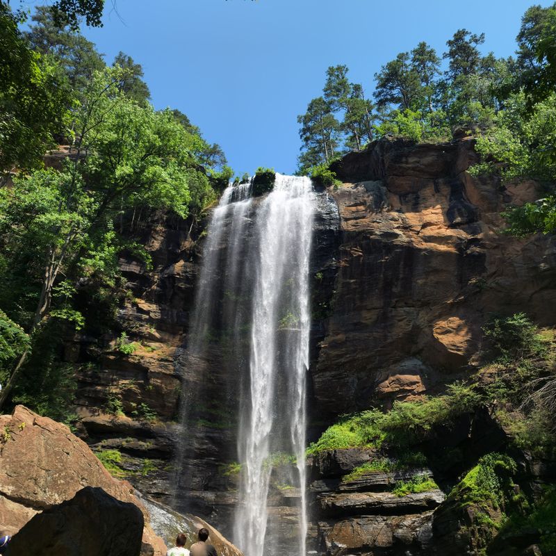
A tall waterfall on a college campus isn’t the usual image of a mountain hike. Here, a short path leads from a gift shop toward an open view of water plunging down a nearly vertical cliff. It’s a striking change from the forested trails elsewhere in northern Georgia.
The waterfall measures about 186 feet, while the approach is only around 100 yards. That makes this a choice for travelers who want an impressive natural sight without setting aside hours for hiking.
The path is accessible, though individual visitors should judge the surface according to their mobility needs.
Access runs through the Gate Cottage gift shop at the university, with a modest admission charge. Because the waterfall is on an active campus, visiting times can change for special events or holidays.
Plan your visit within the posted visitor hours rather than assuming the grounds are always open.
Once you’ve reached the viewing area, give yourself a few moments to notice the cliff walls and the narrow column of falling water. It’s a very different sight from the stepped cascades you’ll find around Lake Rabun.
Toccoa Falls pairs well with a day around Toccoa and the surrounding northeast Georgia foothills. Its short approach also makes it practical when your travel companions have different levels of hiking experience.
Address: 107 Kincaid Dr, Toccoa Falls, GA 30598.
4. DeSoto Falls
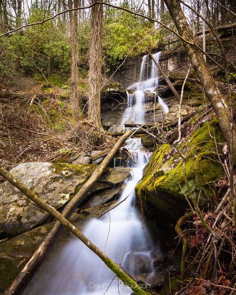
Frogtown Creek threads through a shaded forest where two commonly visited falls lie along separate short walks. Instead of a single dramatic overlook, this stop invites you to choose how far you want to wander among pine trees, rhododendron, and rocky streambanks.
At DeSoto Falls, the lower waterfall is about a quarter-mile from the trailhead. Continue toward the upper viewing area for a walk of about three-quarters of a mile from the starting point.
This area works well when you want the option of a shorter visit without giving up the chance to explore farther.
The upper and lower waterfalls offer two different views of Frogtown Creek, with rock ledges and woodland framing each cascade. The surrounding rock and woodland give each view its own character.
You may find yourself paying as much attention to the creek along the way as to the water at the overlook.
The recreation area includes camping and picnicking facilities, so an early hike can be followed by lunch beside the forest.
Day-use or camping fees may apply. Trails and campground services can have different seasonal arrangements, making a quick access check useful before a longer drive.
Choose sturdy footwear, even though these walks aren’t especially long. Damp leaves, roots, and gravel can make an otherwise gentle route feel trickier after rain. Stay at the designated viewing areas instead of approaching wet rocks.
Address: 18365 Highway 19, Dahlonega, GA 30533.
5. Dukes Creek Falls
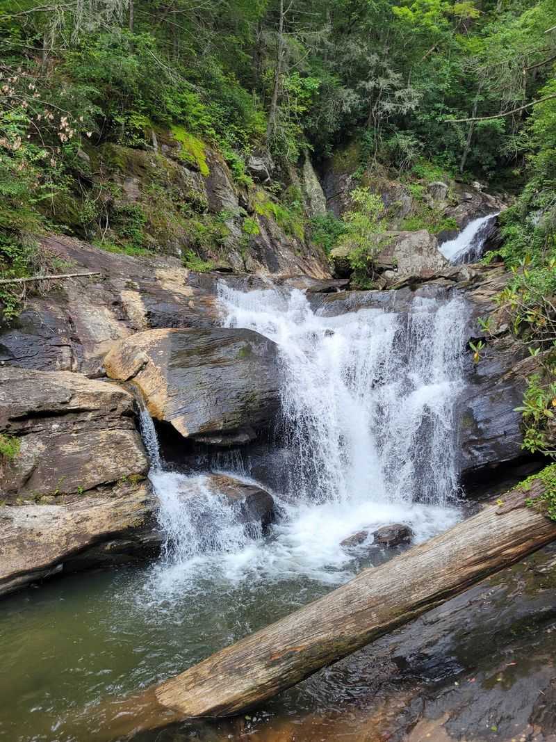
The easy part comes first on this hike: a downhill trail winding through a wooded gorge. Save some energy for the return. The uphill walk back to the parking area is where you may be especially grateful for a bottle of water and a comfortable pace.
The trail is accessed from the Russell-Brasstown National Scenic Highway near Helen. The walking route is approximately a mile each way, with overlooks along the descent and a viewing area near the gorge bottom.
The sight combines the surrounding creek valley with a notable cascade on Davis Creek.
Water tumbles down the rock face toward the confluence below, giving the gorge a layered appearance. Stop at a platform rather than scrambling toward the stream. Viewing from the built trail also lets you appreciate the scale of the wooded slopes around the waterfall.
Dukes Creek Falls Recreation Area is a daytime destination, open from sunrise to sunset, and a vehicle day-use fee applies. It’s convenient to combine with a scenic drive, although you’ll want to leave enough daylight for the uphill finish.
The best practical tip is to budget effort, not just distance. A two-mile round trip sounds modest on paper, but the elevation change makes it more substantial than a level park stroll. Take breaks when you need them and enjoy the change in perspective along the trail.
Address: Dukes Creek Falls Recreation Area, Russell-Brasstown Scenic Hwy, Helen, GA 30545.
6. Minnehaha Falls
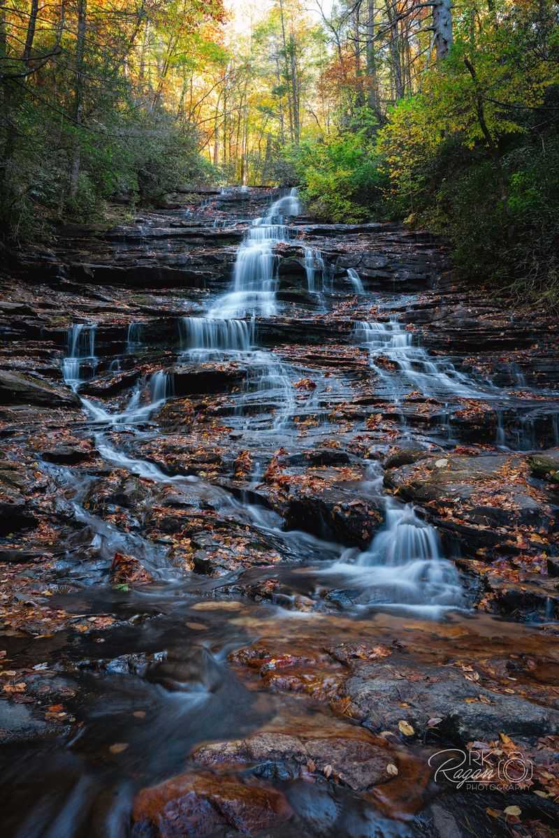
A broad staircase of water slipping down a series of rock shelves makes this cascade especially pleasing to watch. Instead of one vertical drop, the stream fans over multiple ledges, creating a layered pattern against the green woods.
A short trail near Lake Rabun leads toward the waterfall, roughly a quarter-mile from the trailhead. The approach is brief, but expect a natural path rather than a paved promenade. Roots and uneven ground still call for sensible shoes.
For Minnehaha Falls, the route begins along Bear Gap Road, a narrow road where parking is limited. Drive slowly, look for the designated trail access, and avoid blocking the roadway. Getting there takes a little more attention than the short walking distance might suggest.
Once at the waterfall, the most satisfying thing to do may be the simplest: stop and watch the water spread from one ledge to the next. The scene changes with rainfall, so the same rocks can show a finer trickle in dry weather and fuller ribbons after a wet spell.
Make the visit part of a Lake Rabun outing if you have time, but keep the waterfall itself as a viewing stop. The rocks can be slick, and the pleasant appearance of shallow flowing water is no reason to step into the cascade.
Your walk may be short, yet the winding approach road and woodland setting make it feel like a small mountain discovery.
Address: Minnehaha Falls Trailhead, Bear Gap Rd, Lakemont, GA 30552.
7. Helton Creek Falls
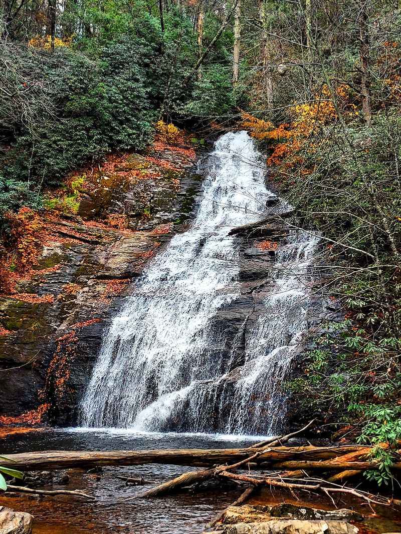
Two cascades appear along a short woodland path in the forest near Blairsville. The lower one comes first, offering an early view before the trail continues toward the taller upper cascade.
It’s a rewarding format when you enjoy seeing more than one waterfall on a single walk.
The falls are reached by a short trail off Helton Creek Road, where access includes a winding gravel stretch. Take the drive slowly and be considerate of oncoming vehicles. Limited roadside parking can also mean adjusting your plans when spaces are full.
At the upper falls, water slides over a slanted rock face into the basin below. A viewing platform offers a place to pause without wandering over slick stones. Resist the urge to treat the basin as a swimming stop; moving water and slippery rock call for caution.
At Helton Creek Falls, the walk is comparatively brief, but it still contains natural steps and uneven patches.
Families may enjoy the modest distance, provided everyone has footwear that can handle the surface. Younger children will need the usual close supervision on forest paths.
Nearby Vogel State Park gives you another option if you’re making a day of exploring this part of the mountains. You might pair a morning waterfall visit with a picnic elsewhere rather than crowding a narrow trailhead.
A little extra driving care pays off here. The path may be short, but the setting feels tucked away among the creeks and hardwood forest.
Address: Helton Creek Falls Trailhead, Helton Creek Rd, Blairsville, GA 30512.
8. Becky Branch Falls
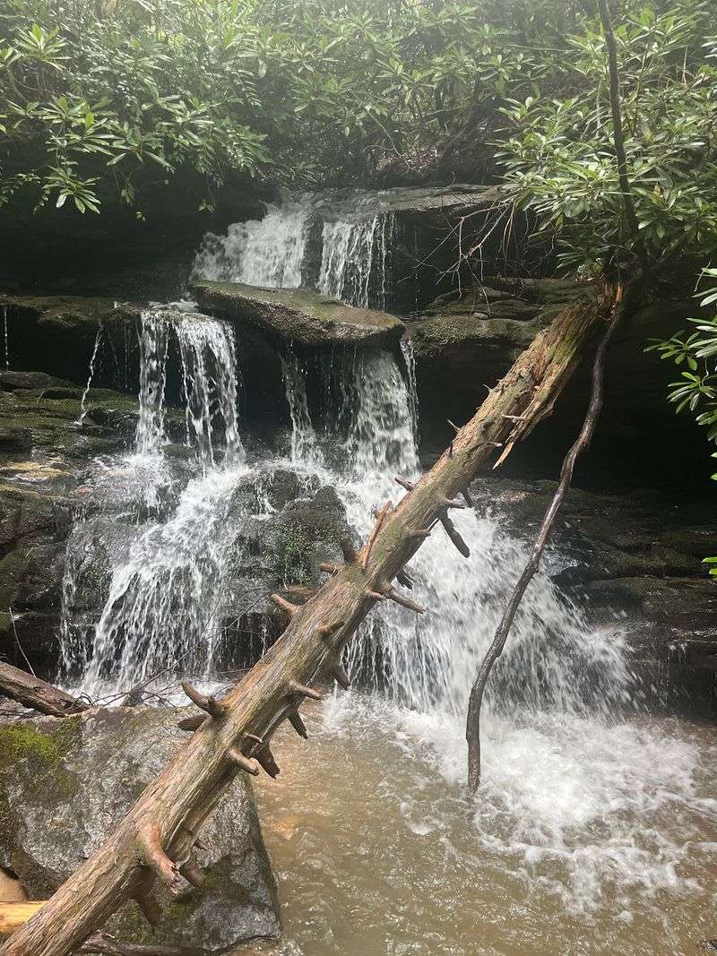
A wooden footbridge brings you face to face with a modest waterfall near Clayton. The view feels intimate rather than towering: water spills over a mossy, roughly 20-foot drop, surrounded by the green slopes of Warwoman Dell.
The waterfall sits along the Bartram Trail, with a short loop option from the recreation area. This can be a good choice when you want a woodland walk that doesn’t take up the entire morning. Still, parts of the route climb and can be slippery, especially after rain.
The trail’s connection to the larger Bartram route adds a touch of history. The long-distance trail honors naturalist William Bartram, who traveled through the Southeast in the eighteenth century.
You can enjoy this short portion without attempting any of the longer backcountry mileage.
Warwoman Dell itself has picnic facilities and remnants of work completed by the Civilian Conservation Corps. That gives you another reason to explore the area beyond the bridge and cascade. Take time to notice the stonework and quiet forest setting.
To visit Becky Branch Falls from downtown Clayton, the recreation area is reached by heading east along Warwoman Road. Look carefully for the entrance and trail signs, and use the parking area rather than improvising a roadside stop.
A bridge-side view and a picnic make an easy combination. Just keep the natural surfaces in mind and let the waterfall be something you observe rather than climb.
Address: Warwoman Dell Recreation Area, Warwoman Rd, Clayton, GA 30525.
9. High Falls State Park
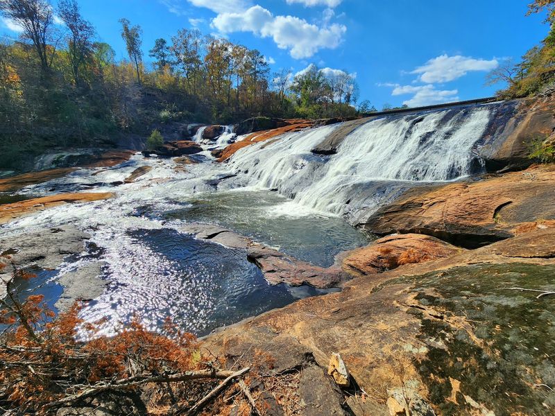
Here, the landscape shifts away from the mountain gorges of northern Georgia. The Towaliga River spreads across broad rocky shoals, creating powerful cascades in a state park between Atlanta and Macon.
It’s a different kind of waterfall outing, with an old industrial story close at hand.
The park’s namesake falls can be seen from designated trails and overlooks. High Falls State Park offers both a half-mile Historic Trail and a longer Falls View Trail, which is about a mile and a half.
The paths vary in terrain, so match the route to your comfort level and available time.
In the nineteenth century, a settlement here included businesses and mills that used the river’s setting. The community declined after a major railroad route passed it by. Remains of earlier industry add historical texture to a walk around the falls.
Beyond hiking, the park has a lake with fishing and boating opportunities, as well as campgrounds and picnic facilities. That makes it suitable for a fuller day rather than a single quick photo stop.
The river is not a place to wade or climb on exposed rocks. Park rules direct visitors to stay out of the water and off the rocky riverbed, which can be hazardous even when it looks inviting. Enjoy the cascade from the marked trail instead.
A vehicle ParkPass is required. Bring walking shoes, a water bottle, and enough time to explore the historic surroundings before returning to the road.
Address: 76 High Falls Park Dr, Jackson, GA 30233.
10. Horse Trough Falls
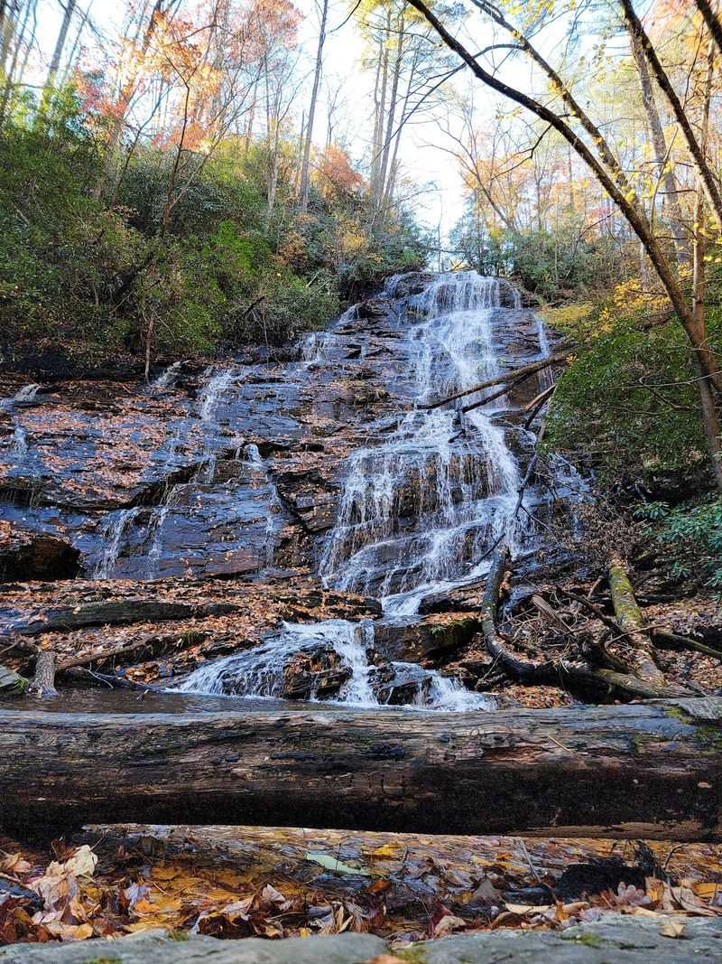
The headwaters region of the Chattahoochee River feels far from the busy roads downstream. Tall forest, a campground, and a quiet creek create the setting for a short walk toward a cascading waterfall tucked among the hills.
Getting here is part of the outing. The Upper Chattahoochee River Campground lies along a Forest Service road, and the approach can involve gravel and slow driving. The falls are reached on foot from the campground area, so allow time for the road as well as the trail.
The woodland path is relatively gentle, although its exact starting point and walking distance can depend on where you park.
A viewing area gives you a place to enjoy the cascade without scrambling down the bank. It’s a pleasant stop for anyone who prefers a forest setting to a crowded roadside attraction.
Horse Trough Falls spreads over rock in a series of narrow ribbons. After rainfall, those lines can look fuller; in drier conditions, more of the underlying stone is visible. Either way, the surrounding green vegetation provides much of the scene’s character.
Campground access and forest roads can change seasonally, particularly in colder months. Check the route before driving in, download directions for areas with limited signal, and take supplies that suit a more remote stop.
If you enjoy quieter walks, consider this a chance to listen to the creek and slow the pace. Bring your camera, but let the sound of the water have a moment too.
Address: Upper Chattahoochee River Campground, 48 Forest Service Rd 44, Helen, GA 30545