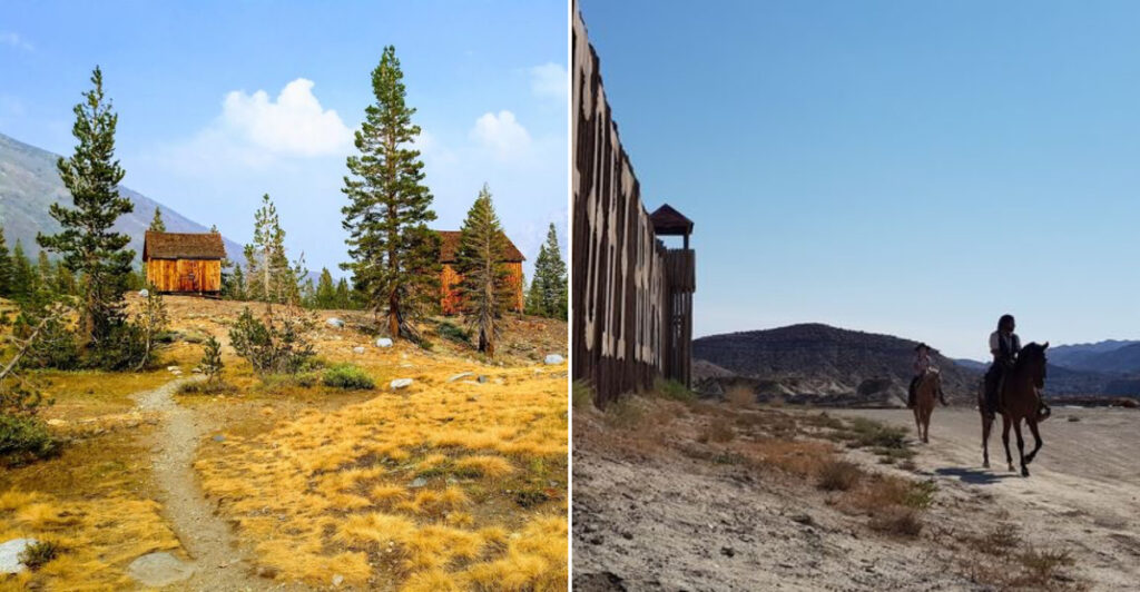
“What we remember, what we forget, what we bury, and what we leave behind,” as Louise Erdrich put it.
The heart and history of the States often lie in the middle of nowhere. In California, that history survives far beyond the polished routes most travelers know.
These towns once drew people who believed they had found a future. Work ended, families moved on, and the streets emptied, but enough remains to make the past feel close.
You reach one with buildings still standing or get to a place where only fragments mark what once existed. Either way, the quiet changes how you look at the landscape.
Take your time and prepare carefully, because several of these places sit far from easy roads.
What makes these towns unforgettable is not fear. It’s the strange beauty of seeing ambition reduced to wood, stone, dust, and a name fading beside a lonely empty road.
1. Bodie Ghost Town
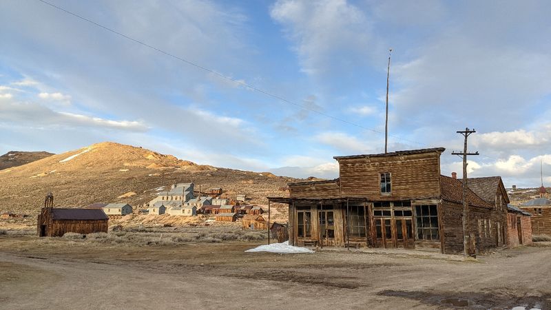
Bodie did not fade politely. Gold built it quickly, and the departure of its residents left an entire town standing in the Eastern Sierra.
Today, Bodie ranks among the best-preserved ghost towns in the United States. Its high elevation adds crisp mountain air and wide views to the experience.
California maintains the site in a condition known as “arrested decay.” Buildings are stabilized rather than fully restored, leaving peeling paint, leaning walls, and weathered interiors intact.
More than 100 structures remain from a town that once held thousands of residents during its late-1870s peak. Through the windows, you can spot old stoves, bottles, furniture, and other objects left behind.
Those small details give Bodie more personality than any polished recreation could manage.
Winter snow often makes the final road difficult to access, so late spring through early fall is generally more practical. Even the drive through sagebrush and volcanic country helps introduce the town’s remote character.
Bodie does more than preserve old buildings. It shows how quickly a thriving community can become part of the landscape.
Location: Bodie Hills, Mono County, Eastern Sierra Nevada.
2. Ballarat
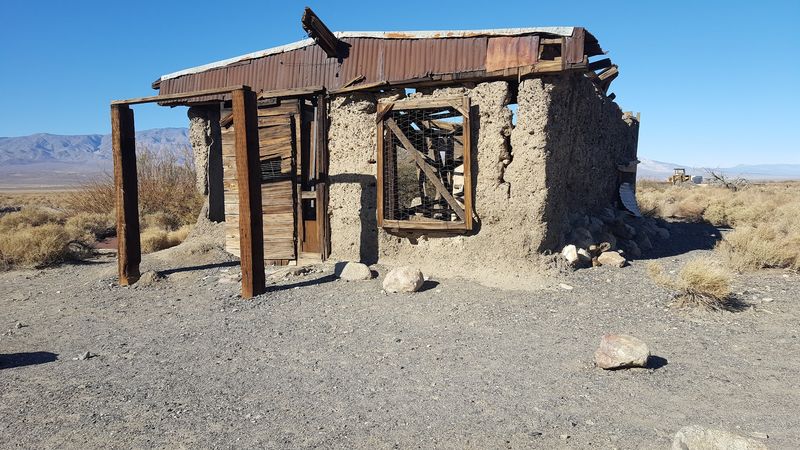
Ballarat’s crumbling adobe ruins stand beneath the Panamint Range in one of California’s most cinematic desert settings.
Established in the late 1800s, Ballarat supplied miners working throughout the Panamint Mountains. Its busiest years were brief, but enough remains to hint at its former role.
Adobe walls and scattered structures now stand beneath the strong desert sun. Their rough condition suits a place shaped by mining, isolation, and difficult travel.
The surrounding scenery provides much of Ballarat’s appeal. Mountain ranges rise sharply on both sides of the valley, while the open terrain makes every distant feature appear close enough to touch.
Spring can bring patches of wildflowers to the otherwise muted landscape.
Access involves an unpaved road, and conditions can change after storms. A high-clearance vehicle, ample water, and careful planning make the journey far more manageable.
Ballarat rewards travelers who appreciate places without gift-shop gloss or elaborate interpretation. Here, California’s mining history is presented with dust on its boots.
Location: Panamint Valley, San Bernardino County.
3. Bennettville At Mine Creek
Silver never delivered the fortune Bennettville people had hoped for.
Don’t despair though, because the abandoned settlement received a remarkable consolation prize. Its location near the beautiful Tioga Pass provides alpine scenery.
Founded during the 1880s, Bennettville grew around hopes for a profitable silver strike. The mine closed before those hopes produced lasting success.
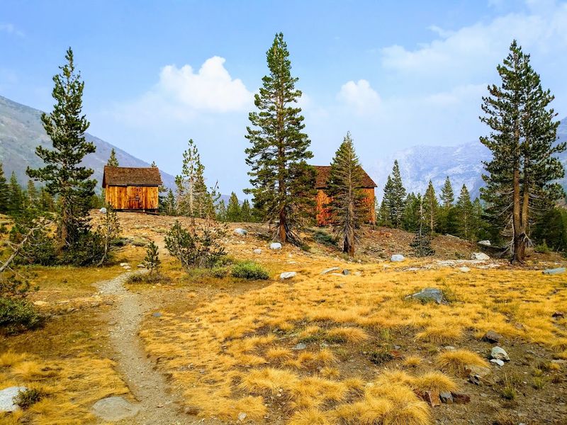
Workers eventually left, but two original wooden structures remain. An assay office and bunkhouse stand among granite slopes, open meadows, and seasonal wildflowers.
The contrast is simple and striking. Human ambition may have created Bennettville, but the surrounding Sierra Nevada now commands most of the attention.
A short trail begins near Tioga Lake and follows Mine Creek toward the former settlement. The route is relatively gentle, although the high elevation may slow anyone unaccustomed to thinner air.
Snow can remain near Tioga Pass well into the warmer months. July and August usually provide the clearest opportunity to see the buildings and surrounding landscape without winter conditions complicating the trip.
Few ghost towns combine such an approachable hike, preserved structures, and impressive mountain scenery in one compact stop.
Location: Tioga Pass, Tuolumne County, Sierra Nevada.
4. Mentryville
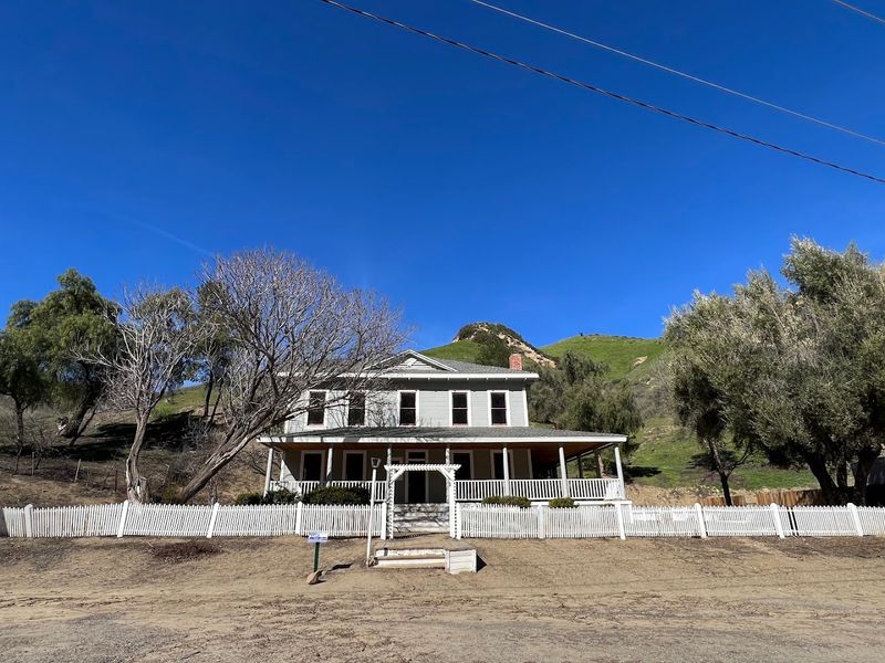
Mentryville is the rare California ghost town built on oil, not gold.
The settlement developed in Pico Canyon during the 1870s around one of the state’s earliest successful commercial oil operations. Workers and their families built a small community beside the industrial site.
Charles Mentry helped establish the operation, and Pico No. 4 became its best-known well. It produced oil for an unusually long period, making the canyon important to the development of California’s early petroleum industry.
A Victorian-era house, a one-room schoolhouse, and several outbuildings remain on the property. Their domestic scale helps balance the machinery and industrial history surrounding them.
Los Angeles County manages Mentryville as a historic park. Scheduled programs occasionally provide closer access to buildings that may otherwise be viewed only from outside.
Trails continue into Pico Canyon through open chaparral, with spring greenery softening the old industrial landscape.
Mentryville is also easier to reach than many California ghost towns. Its location near Santa Clarita makes it a practical outing for travelers who are not equipped for rugged desert roads or overnight hikes.
Mentryville may be quiet now, but its influence reached well beyond this canyon. California’s oil story gained important momentum here.
Location: Pico Canyon, Santa Clarita, Los Angeles County.
5. Panamint City
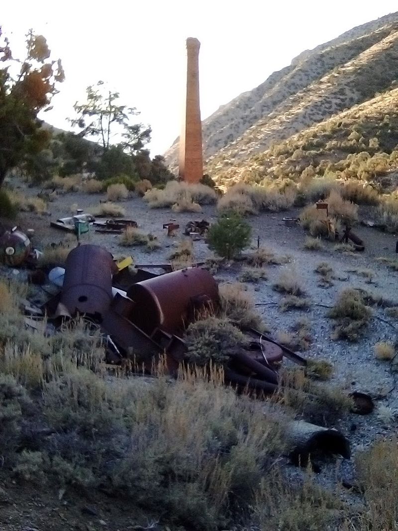
The route to Panamint City makes visitors earn the introduction. This former silver settlement sits deep in Surprise Canyon, far beyond an ordinary roadside stop.
Mining brought a sizable population into the Panamint Mountains during the 1870s. The town expanded rapidly before flooding, difficult conditions, and weakening mining prospects brought its boom to an end.
Stone walls, scattered machinery, and a tall smokestack remain in the canyon. Their isolated location has protected Panamint City from the steady traffic that reaches more accessible historic sites.
Surprise Canyon provides more greenery than its desert surroundings suggest. Flowing water supports cottonwoods and willows, creating shaded stretches along a route framed by rugged slopes.
The journey follows rough terrain and includes substantial distance and elevation gain. Most visitors approach it as an overnight backpacking trip rather than trying to hurry in and out before sunset.
Wildlife may appear along the trail, while the changing canyon keeps the hike visually interesting. Still, the beauty should not distract from practical needs such as water, navigation, and suitable footwear.
Panamint City asks more of you than most entries on this list. In return, it offers solitude, layered history, and one of California’s most unusual desert canyons.
Location: Panamint Mountains, Inyo County, Death Valley area.
6. Randsburg
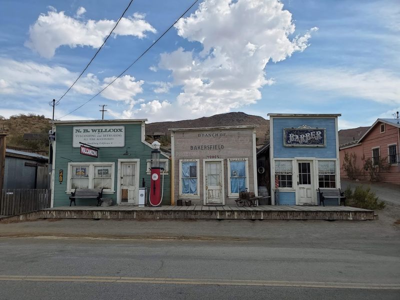
Randsburg never fully agreed to become a ghost town, and that stubborn streak remains its best feature.
The Mojave Desert community still has residents and operating businesses, placing it somewhere between a historic mining settlement and a living small town. You are not simply looking at ruins here.
Gold was discovered in the Rand Mountains in 1895, producing a boom that transformed the area quickly. Later mining activity involving silver and tungsten helped Randsburg survive longer than many settlements built around a single mineral.
Original storefronts continue to line the main street. A general store, soda fountain, antique shops, and a small museum give visitors several reasons to slow down and look beyond the building facades.
The street retains its Western appearance without resembling a newly constructed film set. Age supplied the weathered details naturally.
Beyond town, Joshua trees and creosote bushes spread through the high Mojave landscape. Former mining sites mark the nearby hills, although old shafts should be viewed only from established roads and trails.
Randsburg sits near US Highway 395, making it easy to include on a longer California road trip. Spring and fall generally bring the most comfortable temperatures for exploring the town at an unhurried pace.
Plenty of boomtowns disappeared when mining slowed. Randsburg simply adjusted, stayed put, and kept a few lights on.
Location: Rand Mountains, Kern County, Mojave Desert.
7. Tumco
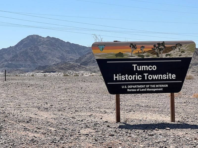
Even Tumco’s name contains a piece of its working past. It comes from The United Mines Company, one of the operations connected to this remote mining settlement.
Gold activity in the area dates to the 1880s. Over time, the camp developed housing, stores, and a school for the hundreds of workers living in the lower Colorado Desert.
That community required considerable effort to maintain in such an unforgiving climate. The remaining foundations make its former size easier to appreciate.
Stone walls, partial structures, and mining debris now cover a broad area. Visitors follow the settlement’s shape through what remains.
An interpretive trail helps explain how the camp operated. Information panels describe the mining process and provide context for the ordinary routines that developed around it.
The surrounding desert contributes its own details. Ocotillo, cholla cactus, and creosote grow between the ruins, while the low sun adds warmer tones to the nearby hills.
November through March usually brings the most manageable temperatures. Even during cooler months, ample water and sun protection remain important because shade is limited.
Complete buildings are not required to understand this place. The foundations alone reveal how much work and daily life once filled an apparently empty section of desert.
Location: Imperial County, Colorado Desert.
8. Skidoo
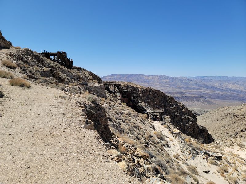
At a place named Skidoo, the most impressive story involves serious engineering rather than a playful nickname.
Gold was discovered here in 1906, bringing miners into a remote section of the Panamint Range. The settlement expanded quickly, but its location created one immediate problem: dependable water was many miles away.
The solution was an ambitious pipeline running more than 20 miles from the Telescope Peak area. Moving water that distance through rugged terrain was a notable achievement for the early 20th century.
The pipeline illustrates how much engineering was required before a desert mining camp could support daily life.
Cabin ruins, old equipment, and remnants of a stamp mill remain at the site. Crowds are uncommon, so visitors often have time to examine the area without competing with tour groups.
Skidoo lies within Death Valley National Park and is reached by an unpaved road. High clearance is generally recommended because road conditions can become rough or uneven.
The drive through the Panamint Range provides broad views over the surrounding desert. Early and late light reveals layers in the rocky slopes.
Spring and fall usually offer more manageable temperatures than summer. Food, water, and basic backcountry supplies matter because services are a considerable distance from the site.
Skidoo’s name may earn the first smile, but the pipeline earns the lasting attention. Mining ended, while the ingenuity behind the town remains surprisingly easy to appreciate.
Location: Panamint Range, Death Valley National Park, Inyo County.
9. Leadfield Ghost Town
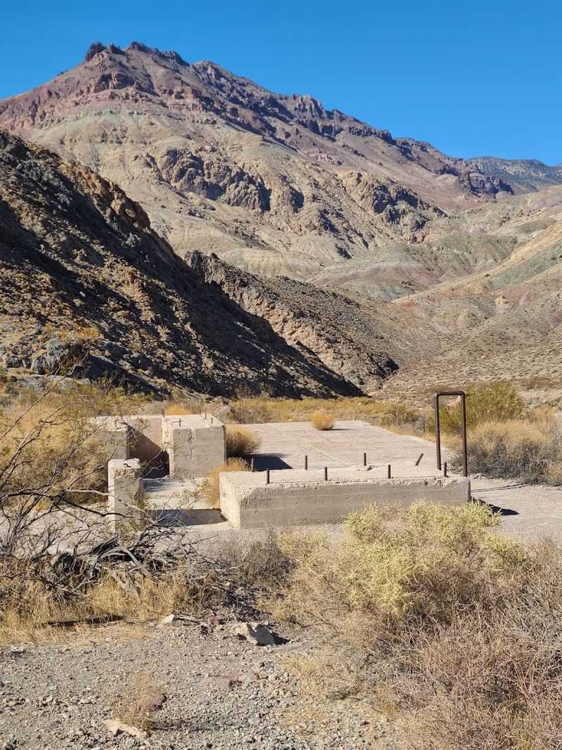
A town that lasted barely a year should be easy to overlook. Leadfield avoids that fate by occupying one of the most impressive settings in Death Valley National Park.
The settlement developed inside Titus Canyon during the mid-1920s. Heavy promotion drew investors and new arrivals to a lead-mining operation whose prospects never matched the enthusiastic claims surrounding it.
Leadfield declined almost as quickly as it appeared. Its brief life left behind stone walls, wooden remnants, and enough foundations to outline part of the former camp.
The ruins are modest, but the canyon is not. Towering rock walls surround the site, placing every human structure beneath layers of colorful geology.
Titus Canyon Road is a one-way dirt route that winds through narrow passages and broad desert viewpoints. A high-clearance vehicle is typically recommended, and storm damage can lead to closures.
Petroglyphs and unusual rock formations add interest along the drive. Leadfield becomes one part of a larger journey.
Cooler months between October and April generally provide the most comfortable conditions. Late-day light draws red, purple, and gold tones out of the canyon walls.
Its mining plans did not last, but the location continues doing excellent work. Few abandoned towns receive such a strong backdrop.
Location: Titus Canyon, Death Valley National Park, Inyo County.
10. Lundy
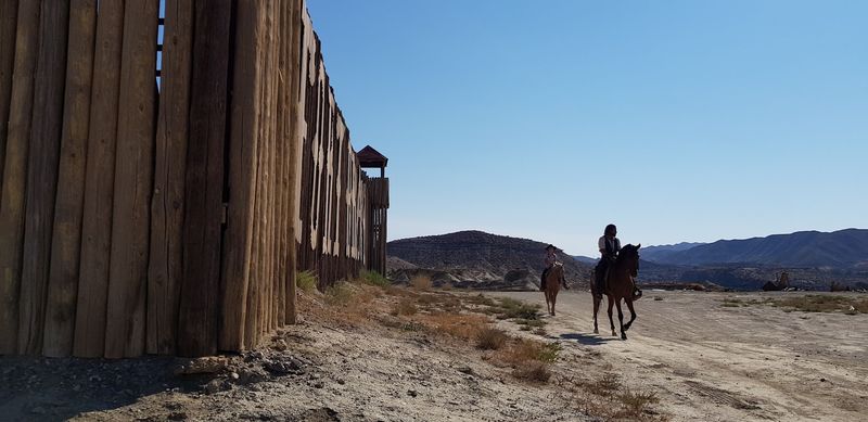
Lundy gives abandoned mining history one of the most spectacular backdrops in the Eastern Sierra.
The former mining settlement lies north of Mono Lake among steep slopes, clear water, and thick stands of aspen. Its location gives Lundy a gentler appearance than many ghost towns surrounded by open desert.
Silver and gold brought miners into the canyon during the late 1870s. A mill rose near the lake, and a small community developed around the mining operations.
Reliable water made Lundy more practical than many Eastern Sierra mining camps. That advantage supported the settlement for a time, although it could not guarantee a lasting boom.
Remnants of mining activity remain near Lundy Lake and deeper in the canyon. They share attention with a landscape that has become the main reason many visitors make the drive.
On calm mornings, the lake reflects the surrounding peaks with remarkable clarity. Trails continue toward old foundations and higher sections of the canyon.
Autumn gives Lundy its most recognizable look. Aspen trees turn gold along the slopes, drawing photographers and hikers during the fall color season.
The road into Lundy Canyon is generally manageable for standard vehicles during warmer months. Seasonal camping and hiking options are available nearby.
Lundy’s mining history gives the canyon depth, but nature has written the longer chapter. The combination makes this one of California’s most memorable former settlements.
Location: Lundy Canyon, Mono County, Eastern Sierra Nevada.
11. Cerro Gordo
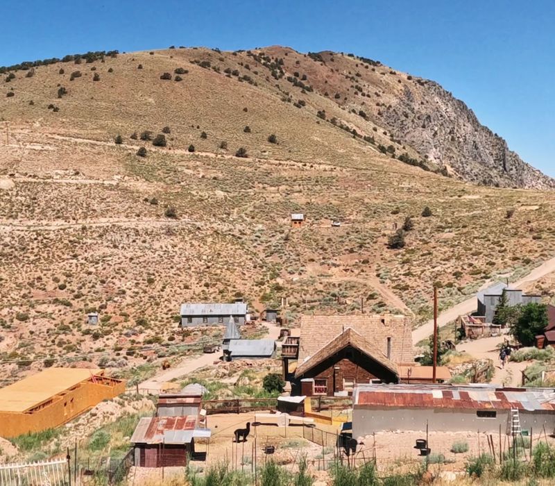
Cerro Gordo did not choose a modest address. The former mining town occupies a steep perch high above Owens Valley in the Inyo Mountains.
Silver was discovered here in 1865, followed by lead and zinc. Mining soon turned the remote mountainside into one of California’s most productive mineral settlements.
Thousands of miners passed through during the town’s busiest period. Beneath the surface, workers created roughly 30 miles of tunnels while buildings spread across the rugged slope.
Production eventually slowed, and Cerro Gordo was abandoned by the 1940s. Numerous wooden cabins, workshops, mining structures, and pieces of old equipment still mark the former townsite.
The setting supplies much of its visual impact. Weathered buildings overlook Owens Lake, Owens Valley, and distant mountain ranges that appear especially sharp in clear desert light.
Preservation work is now helping protect what survived. Visitors may explore the town during posted daytime access, although some structures and mining areas remain restricted.
Reaching Cerro Gordo requires an eight-mile climb along a steep dirt road. The property recommends a four-wheel-drive vehicle, particularly when weather or loose road surfaces complicate the ascent.
The difficult approach makes the first view especially rewarding. Cerro Gordo’s mining plans faded, but its mountaintop setting never learned how to be ordinary.
Location: Inyo Mountains near Keeler, Inyo County.