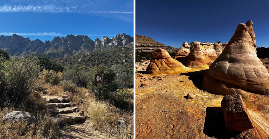
A cave in New Mexico holds a large population of Mexican free-tailed bats, and you can reach it on an easy, well-marked trail. I love that.
Most travelers zoom right past spots like this on their way to bigger names.
I’d say the quiet is the real prize here. One route reaches a hot spring after a couple of river crossings.
Another sits on private land and asks you to register before you show up. A third wanders past white rock towers and narrow slot canyons.
I like how each trail asks for a little extra effort. You might drive a bumpy dirt road or check a gate schedule first.
The payoff is space, silence, and views you won’t share with a tour bus. Which of these hikes deserves the first spot on your 2027 bucket list?
1. Ah-Shi-Sle-Pah Wilderness Trailhead
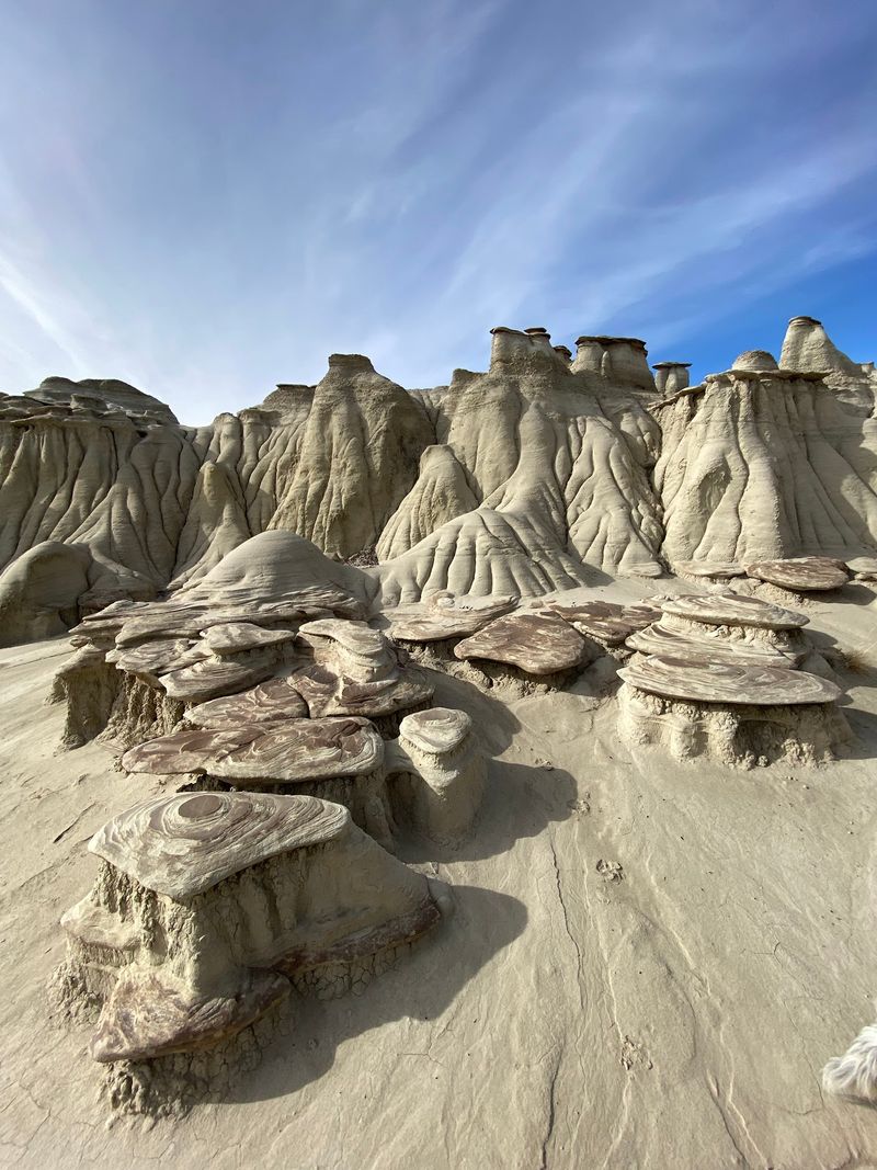
Few places in the Four Corners region feel this far from the noise. The badlands here look like a giant scooped out the earth and left the leftovers to dry.
Ah-Shi-Sle-Pah is a wilderness area managed by the Bureau of Land Management. That means no paved paths, no snack bar, and very few fellow hikers.
You’ll see eroded hills, odd rock shapes, and soft colors that shift with the light. Bits of petrified wood show up in this rugged country too.
Look closely, snap a photo, and leave them where they lie.
Kids tend to love this spot. The open ground lets them wander, climb small mounds, and invent their own adventure stories.
Since the trails are informal, bring a map or a GPS app. Landmarks can start looking the same after a while.
Shade is basically a rumor out here. Pack plenty of water, a wide hat, and sunscreen, especially in summer.
Timing matters too. Early mornings and late afternoons bring softer light, cooler air, and better photos of the badland shapes.
The trailhead sits along NM-57 south of Bloomfield. Plan your drive with care, since roads in remote areas can change after storms.
Want a place where your footsteps are the loudest sound around? This is a strong candidate.
Address: NM-57, Bloomfield, NM 87413
2. El Calderon Trailhead
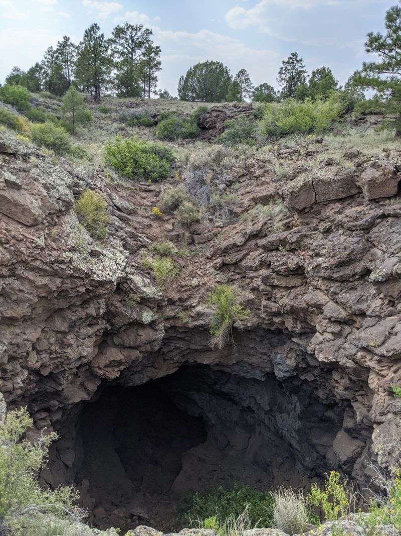
Bats, lava tubes, and a loop trail walk into a national monument. That sounds like a joke, but it’s simply a Tuesday at El Calderon.
The trail sits inside El Malpais National Monument near Grants. It’s an easy-to-moderate loop, so you can enjoy the scenery while watching your footing on uneven terrain.
Caves are the main event here. Lava tubes formed when flowing lava cooled on top while molten rock kept moving underneath.
One cave hosts a large population of Mexican free-tailed bats. Visitors can watch them emerge on warm summer evenings when the viewing area is accessible, but Bat Cave itself is closed to entry.
Above ground, the views stretch across meadows, sandstone cliffs, and mountains. It’s a lot of variety for such a friendly hike.
Birdwatchers should bring binoculars. The open landscape gives you plenty of chances to spot feathered locals.
The trail and parking area are closed for construction through November 2026. Check the National Park Service website for confirmed reopening information before planning a 2027 visit.
Wear sturdy shoes, since lava rock can be sharp and uneven. Cave access is restricted, and visitors should never enter closed caves.
Crowds stay thin, which is a nice bonus. You may have long stretches of trail all to yourself.
It’s a great pick for families or anyone easing into New Mexico hiking once the trail reopens.
Address: NM-53, Grants, NM 87020
3. Middle Fork Trail (#157) Trailhead
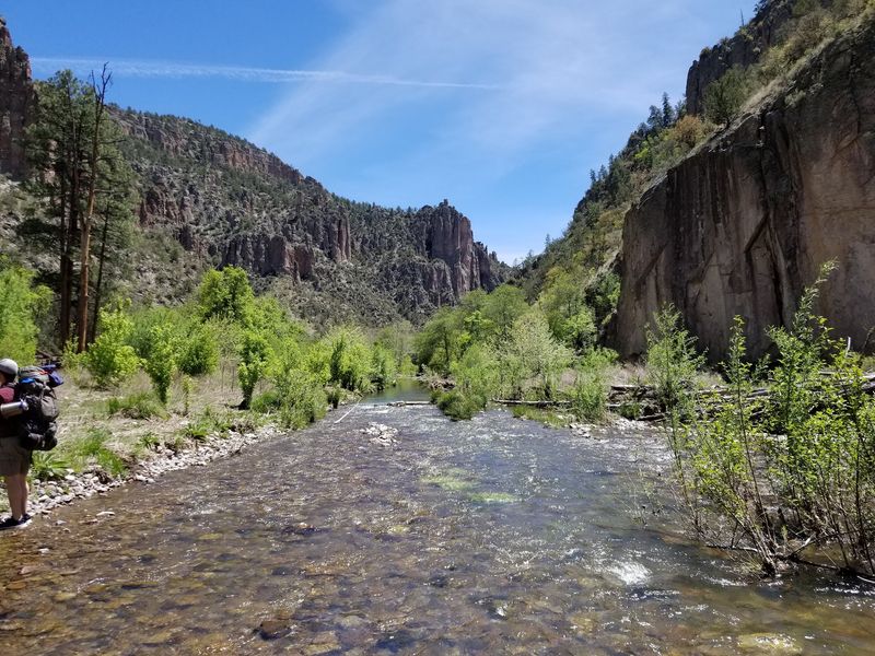
Dry socks are optional on this one. The Middle Fork Trail treats river crossings like a regular part of the plan.
Set in the Gila country near the Gila Cliff Dwellings National Monument, the path follows a river through deep canyons. You’ll splash across the water again and again as the walls rise around you.
Here’s the reward that gets people moving. Lightfeather Hot Spring sits about three-quarters of a mile from the trailhead, with river crossings along the way.
That short distance makes it a fun day hike. The spring’s source water is dangerously hot, so test the temperature carefully and avoid entering water near the source.
Wildlife sightings are common along the route. Keep your eyes on the riverbanks and canyon ledges for movement.
Water shoes or quick-drying sneakers are smart choices. Trekking poles also help when the current or rocks feel slippery.
Check the weather before you go. Rain upstream can raise the river fast, and canyon crossings are no place to gamble.
The trail can be explored as an out-and-back, so you pick your own turnaround point. Some hikers stop near the spring, and others keep exploring.
Foot traffic stays light compared to busier spots. The quiet makes the sound of moving water feel even louder.
Pack a towel. You’ll thank yourself later.
Address: Middle Fork Trailhead, Gila Cliff Dwellings Visitor Center, NM-15, Gila Hot Springs, NM 88061
4. San Lorenzo Canyon
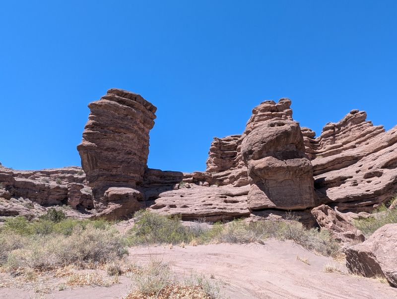
Sandstone walls do the talking in San Lorenzo Canyon. They twist, fold, and glow in shades that make your camera work overtime.
Located near Polvadera, north of Socorro, this canyon sits on Bureau of Land Management land. It stays refreshingly quiet compared to the state’s famous parks.
The hike is a moderate out-and-back walk. You choose how far to go, which makes it easy to fit into a road trip day.
Expect a sandy wash underfoot and rugged rock on both sides. Some sections narrow down, giving you that classic slot canyon feel.
Curious explorers will find plenty of nooks to poke around. Small alcoves and odd shapes appear around many bends.
Flash floods are a real concern in canyons like this. Skip the hike if storms are forecast, even if the sky above you looks clear.
Bring more water than you think you need. The sun bounces off the rock, and the canyon can heat up fast.
A high-clearance vehicle is a good idea for the dirt approach. Sand can get soft, especially after wet weather.
Photographers should aim for early morning or late afternoon. Low light makes the sandstone colors pop.
Leave the rocks unmarked, and pack out your trash. Places this pretty deserve gentle visitors.
Address: 63FH+54, Polvadera, NM 87828
5. Cerro Grande Trailhead
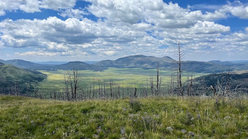
About 1,200 feet of climbing stands between you and one of the best caldera views in the Jemez Mountains. Your legs will notice, but your eyes will win.
Cerro Grande is part of Bandelier National Monument. The route runs roughly 2.3 miles each way through forests and grassy meadows.
The climb starts in shady woods. Then the trees open up, and the meadows give you room to breathe and look around.
Up top, the payoff is huge. You’ll see the Valles Caldera spread out below, along with the Pajarito Plateau.
The Valles Caldera formed from a massive volcanic eruption long ago. Standing above it helps you grasp just how big that blast was.
Rated strenuous by the National Park Service, this out-and-back is best tackled by hikers in good physical condition. Take breaks, sip water, and enjoy the scenery on the way up.
Elevation is no joke in these mountains. If you’re coming from lower ground, give yourself time to adjust before the hike.
Afternoon storms often roll through in summer. Start early so you’re off the open summit before thunder shows up.
Check current park conditions before visiting. Snow, ice, and thunderstorms can affect the route, particularly at higher elevations.
A light jacket is smart, even on warm days. Summits like to keep things breezy.
Address: Jemez Springs, NM 87025
6. Switchback Trail
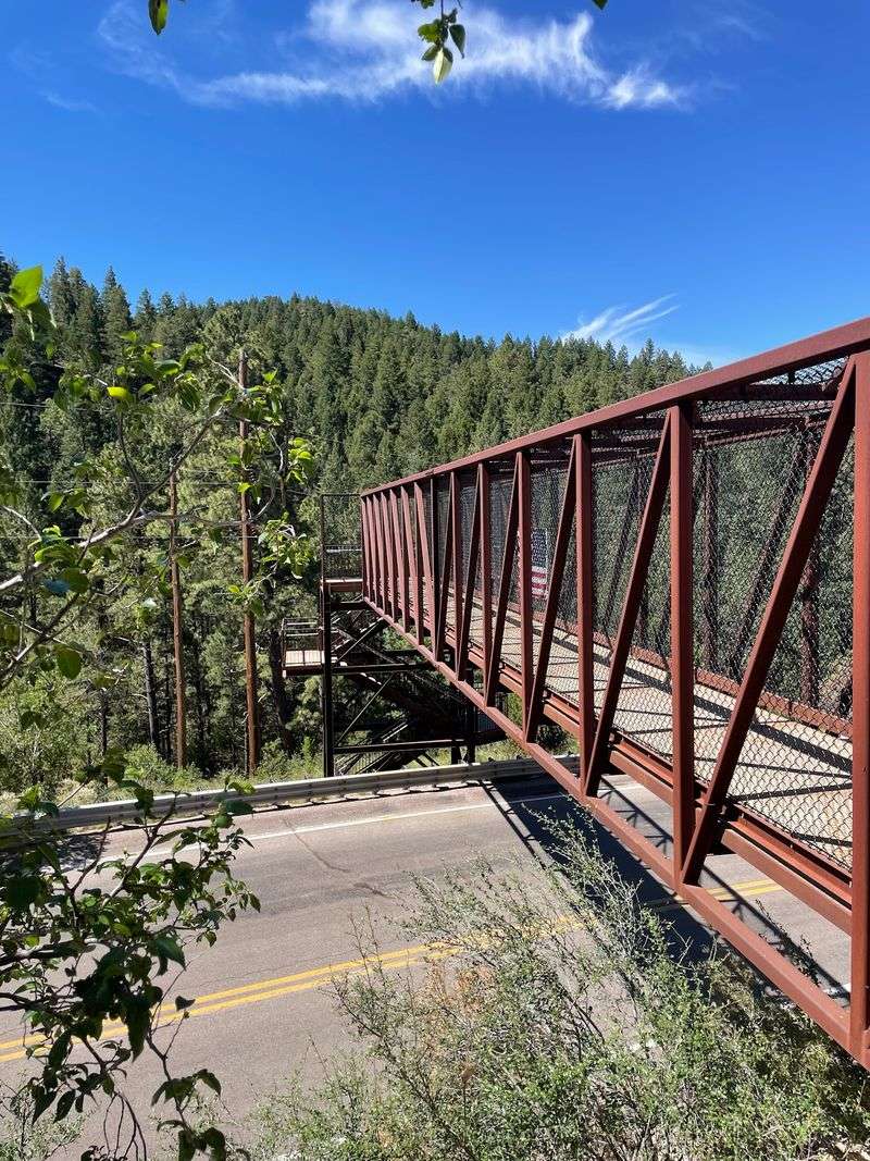
A bridge and a tunnel on one scenic trail? Cloudcroft clearly knows how to keep a mountain walk interesting.
The Switchback Trail sits in the Sacramento Mountains, where cooler temperatures offer a break from desert heat. It’s a moderately difficult loop with wooded sections and open views.
Informative signs line the route. They add small history and nature lessons without slowing you down too much.
The pedestrian bridge and tunnel are the stars for many hikers. Kids especially seem to treat them like bonus levels in a video game.
Views open up along the way too. You get mountain scenery along a route that follows portions of a historic railroad corridor.
The trail includes some steep sections, so sturdy walking shoes are recommended. One particularly steep stretch calls for extra care.
Cloudcroft sits high in the mountains, so the air feels thinner. Take it slow if you just drove up from the valley below.
Bring a light layer, since shaded forest can feel chilly. That’s a fun surprise in southern New Mexico.
Weekdays can be a good choice for visitors hoping to avoid busier weekend periods. Check trail conditions before setting out.
Pair this hike with a stroll through the village afterward. It makes for a relaxed mountain day.
Address: Bailey Canyon Road (FR 206), Cloudcroft, NM 88317
7. Pine Tree Loop Trail Head
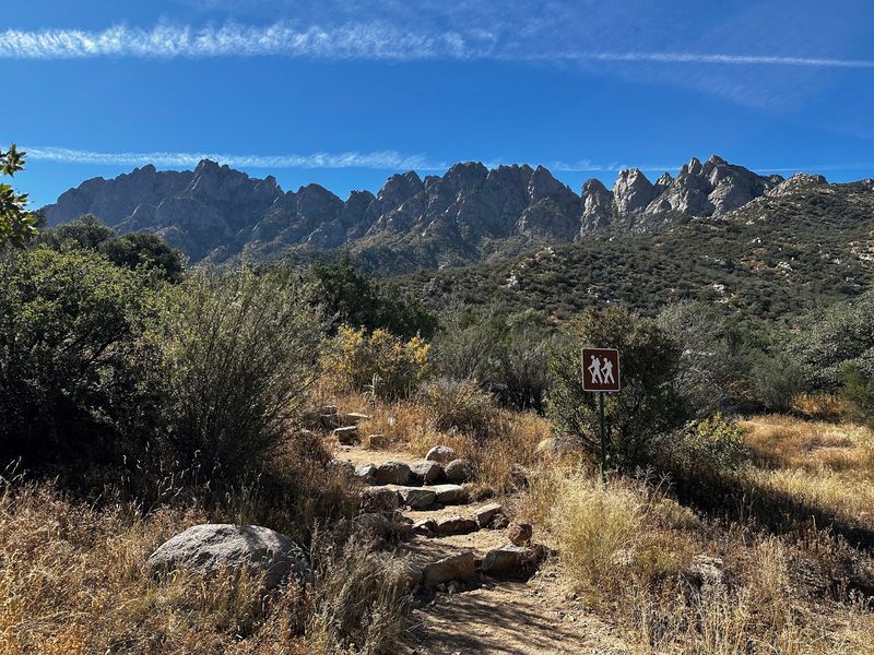
The Organ Mountains get their name from jagged peaks that resemble organ pipes. On this loop, those spires stay in view for much of the hike.
Pine Tree Loop runs about four miles on the eastern side of the range near Las Cruces. It’s a moderate trail with a steady mix of climbing and cruising.
Lower sections feel like classic desert country. Higher up, pine trees take over and bring welcome patches of shade.
Depending on recent weather, you may encounter seasonal water in the surrounding canyons. That’s a fun twist for a mountain range known for its dry slopes.
Big views reward your effort. Look for the Organ Needles above and the White Sands Missile Range stretching out below.
Dogs are welcome outside, so your four-legged hiking buddy can come along. Bring extra water for them, since sun and rock heat up quickly.
The trail is well maintained and easy to follow. Still, the loop has rocky spots that call for good shoes, and visitors should plan for the recreation area’s day-use fee.
Start early in warmer months. Midday sun in southern New Mexico can turn a pleasant hike into a slog.
Crowds stay smaller here than at nearby day-use areas. Weekday mornings are especially peaceful.
Snap a photo at the high point. Those peaks look unreal in morning light.
Address: Las Cruces, NM 88011
8. Plaza Blanca
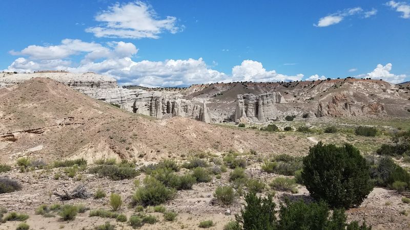
White rock towers rise like a frozen castle in the hills near Abiquiu. Photographers call it a paradise, and it’s easy to see why.
Plaza Blanca sits on private land owned by Dar al Islam. You’ll need to register in advance before visiting, so plan ahead.
Once you’re in, the hiking is mild and short. Out-and-back trails lead you right up to the formations.
Natural amphitheaters and slot canyons add to the fun. You can wander between pale walls that seem to glow under the sun.
The hiking trails are free to use. That’s a sweet deal for scenery this dramatic.
Hours run from 9 a.m. to 5 p.m. daily. Arrive early enough to explore without rushing back to your car.
The white rock reflects sunlight strongly. Sunglasses and sunscreen are must-haves, even on cooler days.
Respect the land, since visitors are guests here. Stay on paths, pack out trash, and follow posted rules.
The pace feels slow and quiet compared to busier parks nearby. That calm makes the formations feel even more striking.
Bring a camera with extra battery power. You’ll likely take far more photos than planned.
Address: 342 Co Rd 155, Abiquiu, NM 87510
9. Devisadero Loop Trail 108 Trailhead
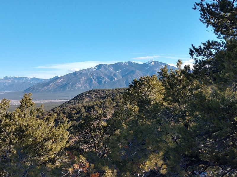
Devisadero roughly means lookout point in Spanish. The name fits, because the views over the Taos Valley are the whole reason to sweat.
Located in Carson National Forest just outside Taos, this loop runs about five miles. Expect roughly 1,125 feet of elevation gain.
That makes it a moderately difficult hike. You’ll feel the climb, but it never turns into a brutal grind.
Sweeping valley views open up as you gain height. On clear days, the scenery seems to stretch forever.
Many hikers pick this loop for its mountain scenery. It offers an accessible escape into the foothills near Taos.
The trailhead offers a parking area near Highway 64. Bring your own water, since you won’t find much else there.
Dogs are allowed outside, so your pup can tag along. Keep them close on narrow or rocky stretches.
Sunrise hikes are a great way to catch soft light over the valley. Check conditions and bring appropriate gear if you plan an early start.
Weather in the mountains can change quickly. Pack a layer and keep an eye on clouds in the afternoon.
Finish with a stroll through Taos. It’s a satisfying end to a big-view day.
Address: US-64, Carson National Forest, Taos, NM 87571
10. Ojito Wilderness – Arroyo Bernalillo
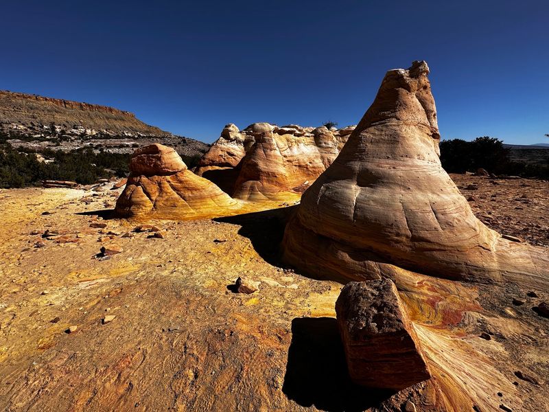
Hoodoos, mesas, and a bumpy dirt road set the scene. Ojito Wilderness feels wonderfully in the middle of nowhere, yet it’s an easy escape from Albuquerque.
This area sits on Bureau of Land Management wilderness land in Sandoval County. Arroyo Bernalillo offers opportunities to explore striking badlands on foot.
The hoodoos steal the show. These tall rock columns look like nature stacked them carefully and walked away.
Layered mesas add bold stripes of color across the horizon. It’s a great place for photos, especially when shadows stretch long.
Hiking is a popular activity here, but bicycles are prohibited within the designated wilderness. Explore on foot and enjoy the scenery at your own pace.
Dirt roads leading in can be rough. High-clearance four-wheel-drive vehicles are strongly recommended, and travel should be avoided after heavy rain.
Dogs are allowed on leash, so bring your pup along. Just pack extra water for both of you.
Shade is hard to find in this open country. Sun protection should be at the top of your packing list.
The area is open year-round. Many hikers prefer early hours, when the air stays cooler and calmer.
Bring snacks too, maybe a green chile burrito for a true New Mexico picnic. It makes a fine reward after exploring.
Address: Arroyo Bernalillo, Ojito Wilderness, Sandoval County, NM