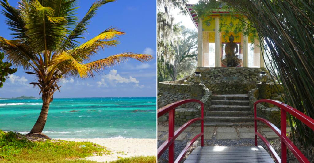
Louisiana’s islands feel like places where the road gradually gives up and the water takes over. That alone makes them irresistible.
Beyond the better-known cities and bayous, these scattered pieces of land hold beaches, fishing piers, bird colonies, old military ruins, and landscapes that seem to rearrange themselves after every storm.
Some islands are easy to reach; others ask a little more from you, which only adds to the sense of discovery.
Louisiana’s hidden islands combine Gulf Coast beaches, wildlife, historic sites, and remote scenery into some of the state’s most surprising escapes.
What I love is how different they feel from one another. One might be defined by seabirds and salt air, another by fishing camps, marshes, or traces of military history.
None feel especially polished, and that is part of the appeal. These are places shaped by weather, water, and stubborn human presence, where the landscape always seems slightly unfinished.
10. Grand Isle
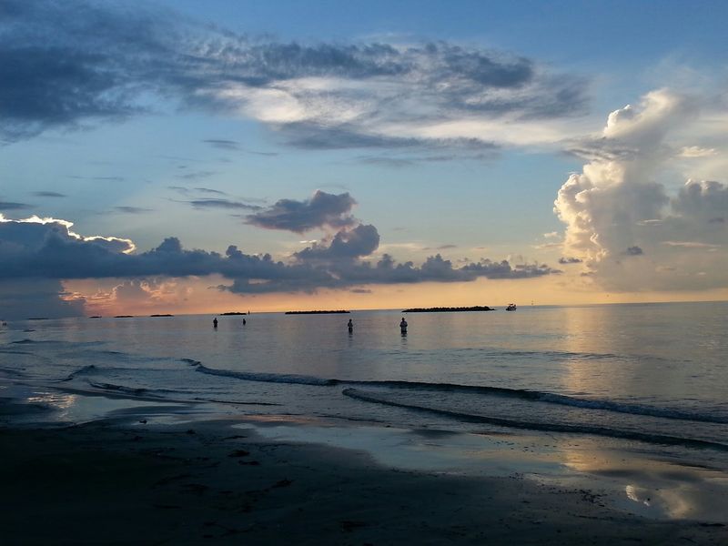
The drive becomes more interesting long before the beach appears. Highway 1 crosses miles of marsh and increasingly open water until Louisiana’s only inhabited barrier island finally stretches across the horizon, looking both vulnerable and stubbornly alive.
Fishing remains the great obsession here, but you do not need a tackle box to understand the appeal. Mornings are made for beach walks and birding, especially during migration, while evenings bring the sort of broad Gulf sunsets that make staying another hour seem entirely reasonable.
Grand Isle State Park occupies the eastern end of the island along Admiral Craik Drive, with beach access, camping, paddling, and fishing opportunities facing the Gulf. The island itself also has marinas, restaurants, rentals, and enough local infrastructure to make this the easiest destination on the list for a genuine overnight escape.
Weather deserves more respect here than a normal beach forecast. Check tropical conditions, wind, and park notices before driving south, particularly later in hurricane season.
I would leave at least one part of the day deliberately empty. Walk until the houses thin out, watch pelicans glide ridiculously close to the water.
9. Avery Island
Calling this place an island is geologically more interesting than geographically accurate. Instead of sitting offshore, the land rises above the surrounding south Louisiana wetlands on a massive salt dome, creating a green, elevated world that feels strangely separate from the flat country around it.
Its most famous resident needs little introduction.
The McIlhenny family has produced TABASCO pepper sauce here for generations, and the factory and museum turn that familiar red bottle into a surprisingly enjoyable excursion. Visitors can see how peppers, salt, aging barrels, and bottling fit together before crossing into a completely different experience next door.
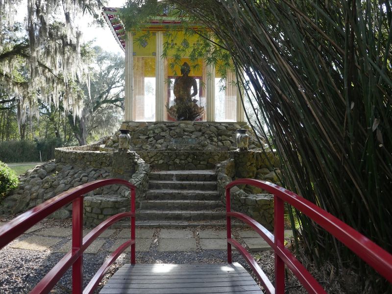
Jungle Gardens spreads through live oaks, bamboo, camellias, ponds, and subtropical vegetation, with Bird City attracting snowy egrets and other wildlife. Then, almost absurdly, a centuries-old Buddha statue appears among the greenery.
For navigation, use Highway 329, Avery Island, LA 70513; that is also the mailing location used by the McIlhenny Company.
Give yourself several hours rather than treating this as a quick factory stop. The sauce is the hook, but the salt-dome landscape is what makes the island linger in memory.
8. Jefferson Island
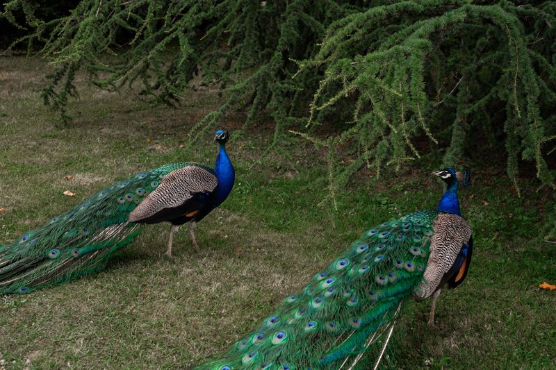
Peacocks have very little interest in allowing a historic mansion to remain the center of attention. They wander beneath the oaks, call loudly across the gardens, and generally behave as though the entire property was constructed for their personal use.
That theatricality suits the setting.
Like Avery, this is one of south Louisiana’s famous salt-dome “islands,” elevated above the surrounding lowlands rather than separated from them by open sea. Rip Van Winkle Gardens occupies the most celebrated part of the landscape, surrounding the 1870 Joseph Jefferson Mansion with enormous live oaks, subtropical plantings, ponds, and views toward Lake Peigneur.
The address is 5505 Rip Van Winkle Road in New Iberia, and the gardens currently welcome daytime visitors along with guests coming for the café and historic home.
The serenity becomes much stranger once you know what happened nearby in 1980. A drilling accident punctured the salt mine beneath Lake Peigneur, creating an enormous whirlpool and temporarily reversing the flow of the Delcambre Canal as water disappeared underground.
Today, things are considerably calmer.
7. Elmer’s Island
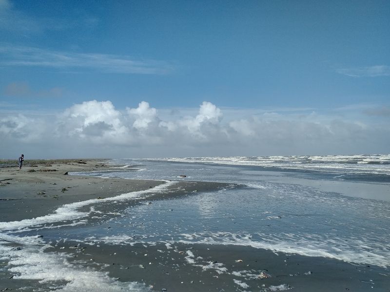
Bare feet and open beach would make this place seem carefree if the surrounding landscape did not constantly remind you how fragile Louisiana’s coast actually is.
Salt marsh, dunes, tidal flats, mangroves, and Gulf beach come together directly across Caminada Pass from Grand Isle, creating habitat for everything from red knots and piping plovers to frigatebirds and reddish egrets.
It feels wonderfully undeveloped because it is a wildlife refuge rather than a conventional beach park.
Access comes from Louisiana Highway 1 before Grand Isle, but visitors need a WMA Access Permit and must complete the required self-clearing process. Motorized vehicles are no longer permitted on the beach itself.
The refuge opens 30 minutes before sunrise and closes 30 minutes after sunset, with no overnight camping allowed. Seasonal beach shuttles help cover the distance during much of the year.
Those restrictions are not bureaucratic decoration. Shorebirds use these beaches to feed, rest, and nest, so marked closures deserve an extremely wide berth.
Bring more water than seems necessary, sunscreen, and binoculars.
Then walk.
Without vehicles roaring down the sand, ordinary details become the attraction: tiny tracks, shells, wind-bent plants, changing tide lines, and birds working the shoreline as if humans were merely temporary guests.
6. Marsh Island
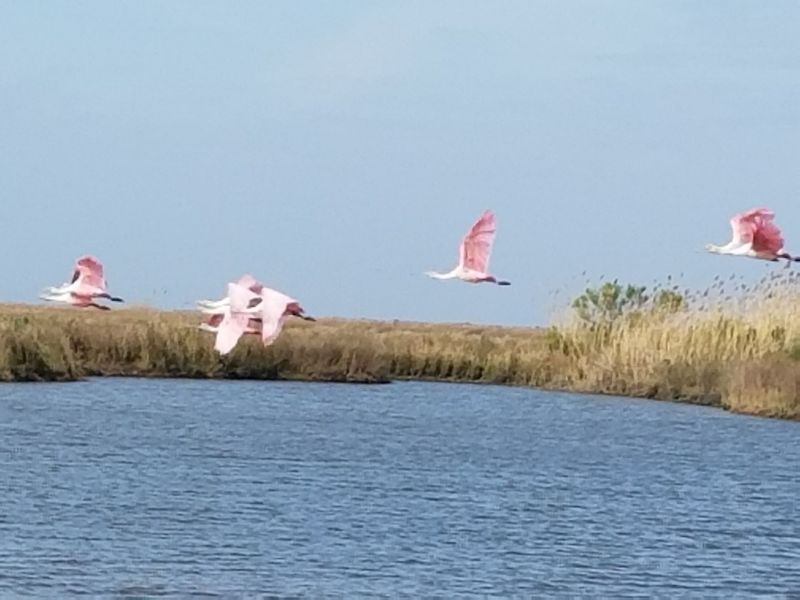
From a distance, this enormous refuge can look almost empty. There are few trees, no tourist streets, and none of the landmarks that usually reassure visitors they have reached a destination.
Look closer and the apparent emptiness starts moving.
Marsh Island stretches across roughly 71,000 acres between Vermilion Bay and the Gulf, providing brackish marsh habitat for waterfowl, shorebirds, birds of prey, alligators, fish, shrimp, and blue crabs. Its surrounding nursery habitat is important enough that coastal fisheries depend heavily on what happens in these quiet wetlands.
There is no road and no island street address. The refuge sits about six miles south of Cypremort Point and can only be reached by watercraft.
Visitors need a WMA Access Permit, public use is limited to sunrise through sunset, and overnight camping is prohibited.
That makes this a trip for experienced boaters rather than spontaneous sightseeing.
Check marine weather, tides, fuel, and navigation before leaving shore. Airboats and personal watercraft are prohibited, and access can be restricted when necessary to protect wildlife.
I would approach the island with very modest ambitions.
Fish. Watch birds.
Drift along the marsh edge.
5. Grand Terre Island
Ruined brick walls rising beside a Louisiana barrier beach create a slightly surreal first impression. Fort Livingston has been standing, crumbling, and weathering hurricanes on the western end of Grand Terre for well over a century, giving this otherwise windswept island an unusually visible layer of human history.
The fort was built during the nineteenth century to guard Barataria Pass and the approaches toward New Orleans. Before that, the surrounding waters were associated with Jean Lafitte and the Baratarians, which gives the island the rare distinction of fitting both military history and pirate mythology into the same stretch of coast.
There is no road to follow. Grand Terre sits directly across Barataria Pass from Grand Isle and is accessible only by boat, so local marinas and experienced captains provide the practical starting point.
Do not treat the old masonry like playground equipment. Coastal weather and erosion have been working on the structure for decades, and unstable walls, rocks, tides, and shifting sand demand sensible distance.
The best view may actually come from stepping back.
Old fortifications sit against open Gulf sky while waves continue reshaping the island beneath them.
4. Chandeleur Islands
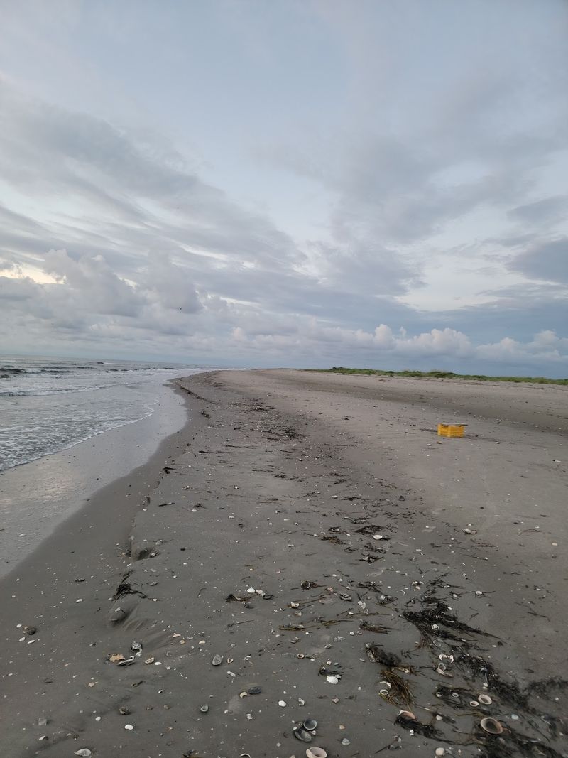
Distance changes expectations out here.
The Chandeleurs sweep through the Gulf east of the Mississippi River delta as a long chain of narrow beaches, shallow flats, marsh, and changing sandbars. Reaching them takes enough boat time that the mainland stops feeling like part of the day.
Most of the chain lies within Breton National Wildlife Refuge, one of the oldest wildlife refuges in the United States. Except for North Breton Island, refuge lands are also protected as federal wilderness, and their beaches provide essential habitat for seabirds, shorebirds, and other coastal wildlife.
Fishing is the main reason many visitors make the journey. Shallow water and broad flats create excellent opportunities, but this is not somewhere to improvise with an unfamiliar boat and a weather app you checked over breakfast.
Conditions change rapidly, shelter is limited, and hurricanes constantly rearrange the islands themselves. The U.S.
Fish and Wildlife Service specifically describes reaching the refuge as challenging because of its remoteness.
Go with an experienced captain, respect nesting areas, and carry everything the day might require.
3. Breton Island
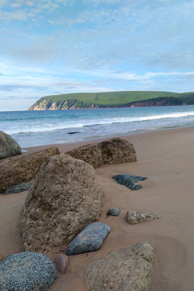
Thousands of birds can make a remote strip of sand feel more crowded than downtown New Orleans.
Humans simply are not the dominant species here.
Part of Breton National Wildlife Refuge, this isolated barrier island supports one of Louisiana’s major waterbird colonies. Brown pelicans, gulls, terns, shorebirds, and migratory species use the surrounding beaches and habitat, while federally threatened piping plovers depend on the wider refuge during winter.
The island has been changing for centuries. It formed within an older Mississippi River delta system and has continuously shifted under waves, storms, subsidence, and sediment movement.
A small settlement once stood here, but a devastating 1915 hurricane ended permanent habitation.
Modern restoration has added another chapter, rebuilding habitat to give nesting colonies more room and resilience.
There is no visitor center waiting on the island and no road address to type into the GPS. Access is by boat across open coastal water, and current refuge regulations should be checked before making the trip.
Wildlife observation works best from respectful distance anyway.
Bring binoculars or a long lens rather than approaching nesting birds.
This island does not need people to make it interesting.
2. Timbalier Island
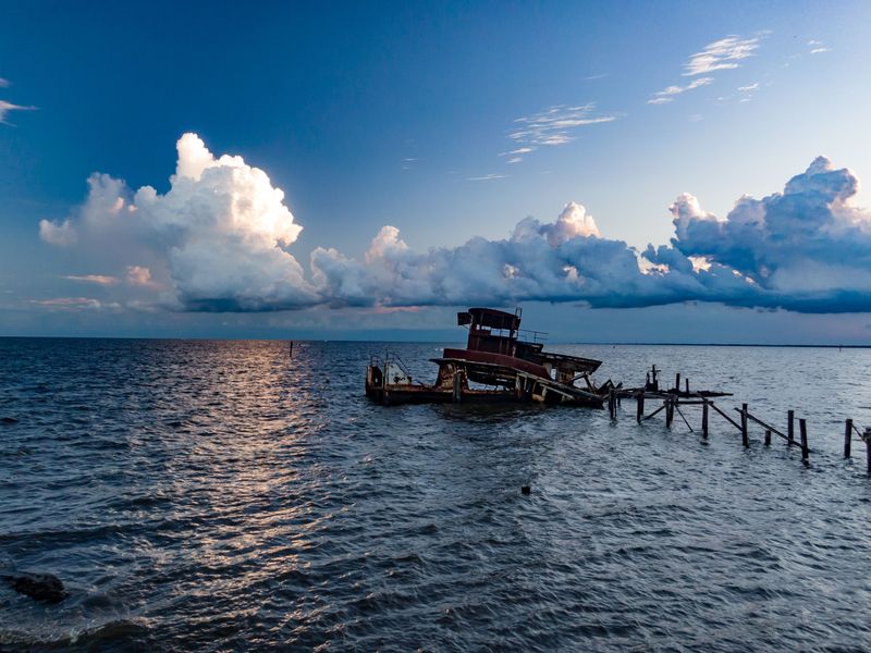
The first thing worth understanding is that the landscape you see today is partly natural and partly rebuilt.
Barrier islands along Louisiana’s Terrebonne coast absorb waves and storm energy before it reaches interior bays and marshes, but doing that job has also left them exceptionally vulnerable to erosion. Timbalier has lost and gained land repeatedly as hurricanes, currents, subsidence, and restoration projects reshape its shoreline.
Recent large-scale work added beach, dune, and marsh habitat here as part of the Terrebonne Basin Barrier Island and Beach Nourishment project, which restored habitat across Timbalier, Trinity-East Island, and West Belle Headland.
There is no road access or visitor infrastructure. Reaching the area requires a capable boat, good navigation, and local knowledge of Terrebonne’s coastal waters.
That remoteness is exactly what makes the view memorable.
Pelicans and shorebirds work the beaches, anglers target speckled trout and other coastal species nearby, and the flat horizon makes the island look almost impossibly thin against the Gulf.
I would treat any landing as conditional rather than guaranteed. Restoration zones, wildlife needs, water levels, and private or regulated areas can affect where visitors should go.
1. East Timbalier Island
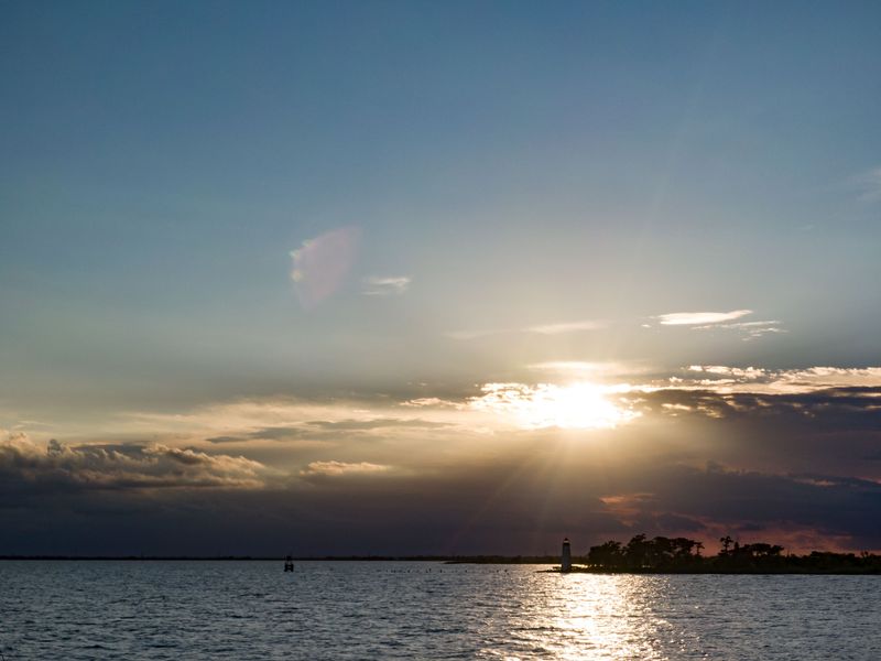
Few places on this list demonstrate Louisiana’s coastal crisis quite so starkly.
Older maps show a substantial barrier island west of Port Fourchon. Today, erosion and repeated storms have reduced East Timbalier dramatically, with contemporary reports describing little more than isolated sand remaining near portions of the former island footprint.
Louisiana is again studying a major restoration effort, and its FY2026 coastal plan includes design and engineering money for rebuilding the island.
That makes this less of a traditional beach destination and more of a place to understand from the water.
There are no facilities, roads, or dependable landing areas. Boat access from the Lafourche and Terrebonne coast requires local navigation knowledge, while offshore energy infrastructure, shallow water, shoals, and rapidly changing coastal features make current charts essential.
Earlier restoration work rebuilt portions of East Timbalier around 1999 and 2000, but the island continued to struggle against land loss afterward.
I would not arrive expecting a conventional island picnic.
Look instead at what remains, then look inland toward the marshes it once helped protect.