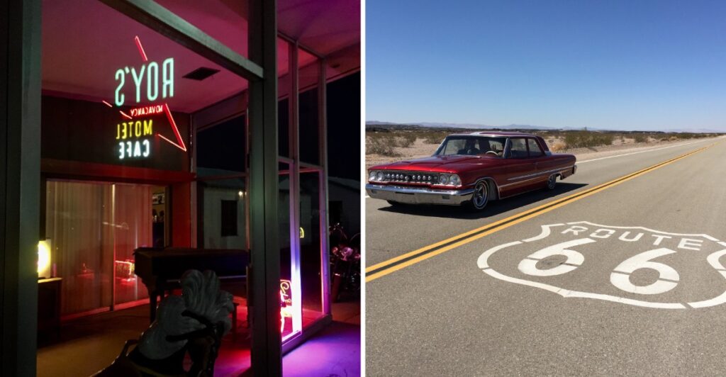
By sunset, one old neon sign starts acting like it owns Route 66.
During the day, this desert stop feels quiet enough to miss if you blink. Then dusk shows up, the sky dims, and the glow suddenly changes the whole scene.
That is when the place wakes up.
Out in California’s Mojave Desert, the highway still carries traces of a busier past, but you do not need a history lecture to feel it. A few old buildings and the empty road do plenty of talking on their own.
I would arrive before sunset, look around while there is still light, and then wait.
The desert gets quieter. The colors flatten. Then the neon flips on.
Honestly, that is the moment you came for.
Some roadside stops need a big attraction.
This one just needs the lights.
Amboy Crater Gives The Desert A Volcanic Backdrop
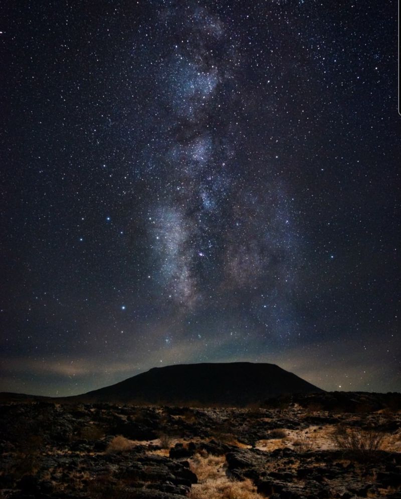
Amboy Crater sits just outside town and immediately explains why this part of the Mojave looks different from an ordinary sweep of sand. The cinder cone rises about 250 feet above the surrounding landscape and measures roughly 1,500 feet across.
Basaltic lava once spread from a breach in the crater across about 24 square miles. The crater earned National Natural Landmark status in 1973.
You can see plenty without committing to the full hike. The recreation area includes picnic tables, restrooms, shaded areas, and an accessible overlook with views toward the crater. A hiking trail leads toward the rim for anyone who wants a closer look.
The practical part matters here. There is no running water at the site, cell service can be weak, and temperatures rise quickly. Bring your own water and start earlier in the day if hiking is part of the plan.
That timing works nicely with an Amboy visit. Use the brighter hours for the crater, then move toward Route 66 as afternoon starts giving way to evening. The dark volcanic ground becomes more defined as the light begins to soften.
Route 66 Turned Amboy Into A Desert Stopover
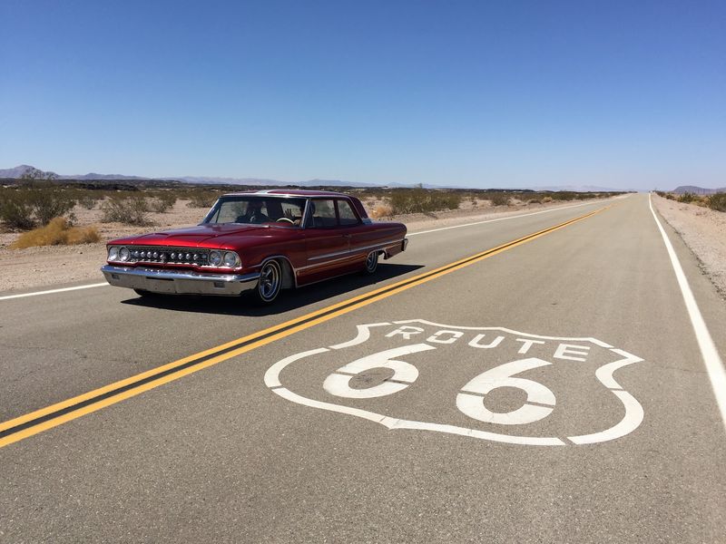
Amboy began as a railroad settlement in the late nineteenth century, but Route 66 changed its role. Once the highway began carrying motorists across the Mojave, the little community became a practical place to stop for fuel, food, repairs, and a bed.
By the late 1940s and early 1950s, the town supported several service stations, cafés, and a motor court. Railroad work and nearby industries also helped sustain a permanent community.
That scale is difficult to picture now. Interstate 40 bypassed the old highway in the early 1970s, and through traffic dropped sharply. Buildings remained, but the everyday rhythm changed as fewer travelers needed Route 66 for the trip between Needles and Barstow.
Today, the long empty approaches are part of the experience. Instead of arriving through suburban development or a line of highway exits, you watch a few structures take shape against an enormous horizon.
Keep your expectations tied to what Amboy actually is now. This is not a restored main street full of shops and restaurants. It is a small historic townsite where Route 66, railroad history, desert geology, and preservation efforts meet in one very quiet place.
Roy’s Started Serving Route 66 Travelers In 1938
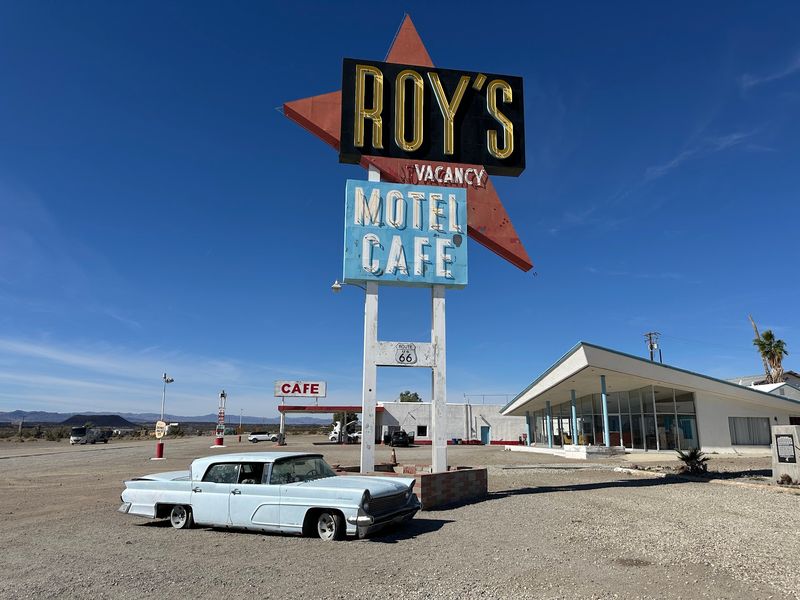
The building most people associate with Amboy began as a service station in 1938. Roy and his family expanded the operation as Route 66 traffic grew, with son-in-law Herman “Buster” Burris playing a major role.
That roadside complex became Roy’s Motel and Café. Its midcentury look came later, especially with the remodeling that brought Googie design to the property.
The towering sign arrived in 1959. At about 50 feet high, it used a bold arrow shape and roadside scale meant to catch the eye of drivers approaching across an open landscape.
Googie architecture loved movement, dramatic angles, glass, and space-age optimism. Those traits make particular sense here, where a sign had to compete with miles of sky rather than neighboring storefronts.
The motel and café do not currently operate in their old roles, so do not plan on booking a room or sitting down for a full café meal. The historic buildings remain part of the site while restoration continues.
Walk the property with that distinction in mind. Roy’s is active again as a roadside stop, but much of what you are looking at belongs to the preserved and slowly restored Route 66 complex.
The Neon Sign Comes Alive At Dusk
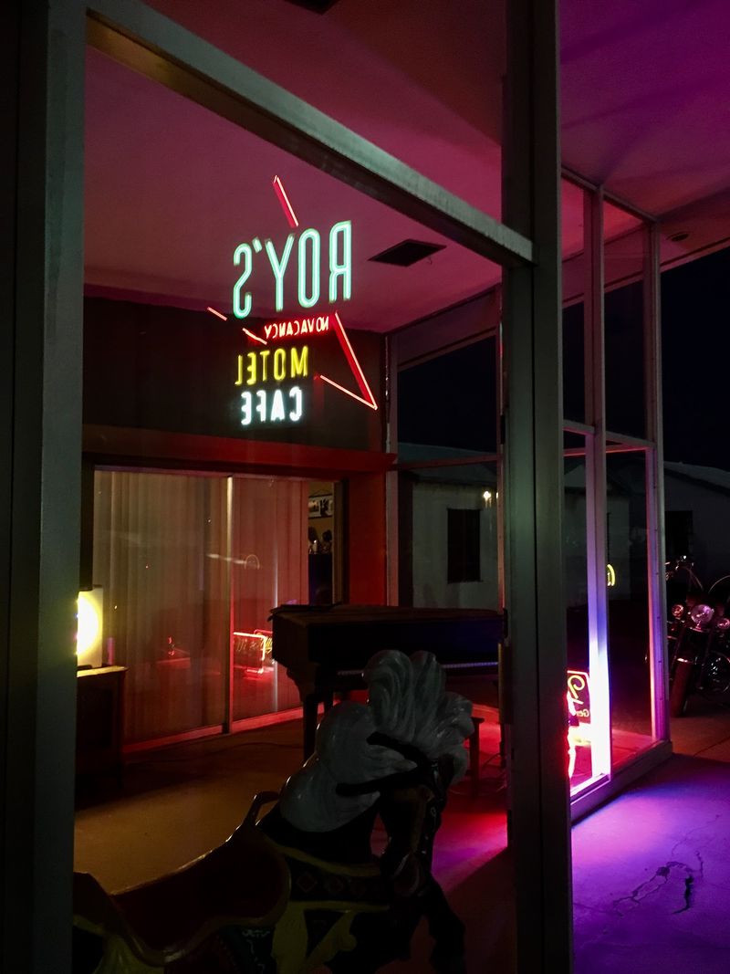
The sign is the reason sunset changes the mood so quickly. After decades without its full neon glow, Roy’s sign was officially relit on November 16, 2019.
The sign now glows nightly at dusk. That makes late afternoon the easiest window for seeing Amboy in two completely different moods without making two separate trips.
Arrive while the sun is still up and the sign reads like a giant piece of roadside sculpture. As the sky darkens, the red arrow and lettering begin to stand apart from the desert around them.
The open landscape helps. There are few competing lights in this stretch of the Mojave, so the neon does not have to fight a wall of storefronts, traffic signals, and parking-lot lamps.
Give yourself time rather than pulling in at the last possible minute. Watching daylight fade into neon is easier when you are not checking the clock.
One moment you are looking at faded pavement and pale buildings; a little later the sign is carrying most of the visual weight.
Night photography can be tempting, but you do not need elaborate gear to enjoy the scene. Stand somewhere safe, keep clear of traffic, and let the scale of the sign do the work.
Roy’s Still Provides A Practical Route 66 Stop
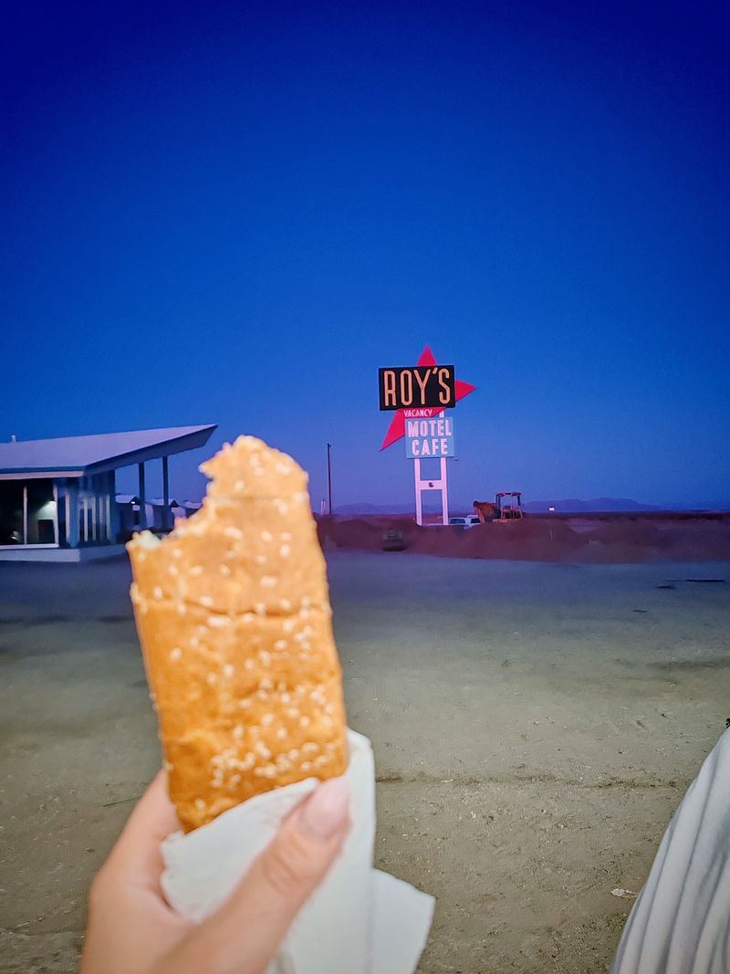
Roy’s is not simply an abandoned backdrop. The gas station is operating again, and visitors can stop for fuel, souvenirs, apparel, prepackaged food, and drinks.
The café and motel remain part of the restoration story rather than functioning as a full restaurant and overnight lodging operation.
That distinction is useful when planning the drive. Eat a proper meal before heading deep into this stretch of the Mojave, and treat Roy’s as a fuel, snack, and sightseeing stop rather than counting on full restaurant service.
For navigation, use 87520 National Trails Highway, Amboy, CA 92304. Once you reach the property, the sign, gas pumps, café building, motel units, and wide desert backdrop are all gathered into the same historic complex.
Roy’s current preservation work continues the effort begun by Albert Okura, who purchased Amboy in the 2000s with plans to restore the town. His son Kyle Okura has continued that work, including infrastructure improvements and efforts connected to the motel cottages.
There is no need to turn the stop into a checklist. Fuel up if necessary, look around the historic buildings, grab a cold drink, and save a little time for the sign after sunset.
The School And Church Hint At The Community Beyond The Highway
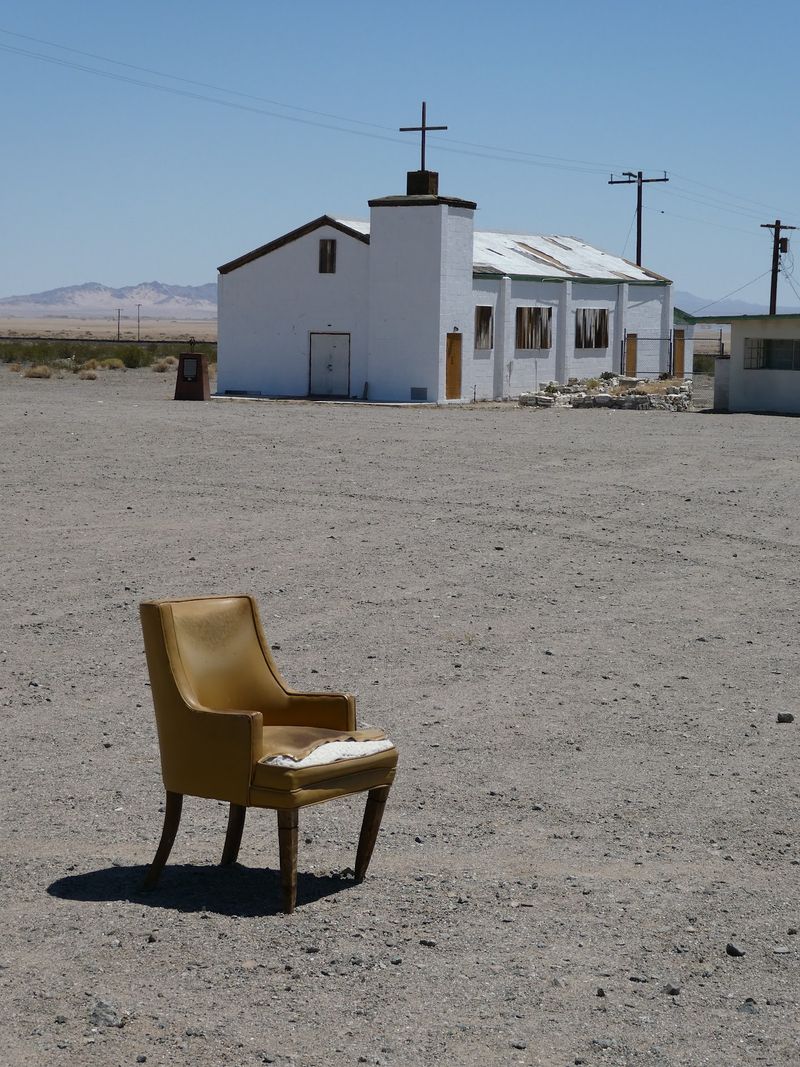
Roy’s can make Amboy seem like a one-business town, but the surviving school and church tell a broader story. Both still stand near the highway, reminders that people once built ordinary routines here as well as roadside businesses.
Families lived near the railroad, children went to school, and community life continued even when passing motorists were only stopping long enough for gas or food. That part of Amboy is easy to overlook when the neon sign gets most of the attention.
Treat the old buildings as historic remnants rather than attractions designed for entry. View them respectfully from public areas, and do not enter unless access is clearly permitted.
Their modest scale also puts the Route 66 years in perspective. Amboy supported a school, a church, workers, families, and businesses.
Spend a few minutes looking beyond Roy’s and the highway begins to feel less like a movie set. The remaining buildings are clues to a place where people lived their regular lives long before travelers began arriving mainly for photographs.
Bristol Dry Lake Completes The Desert Contrast
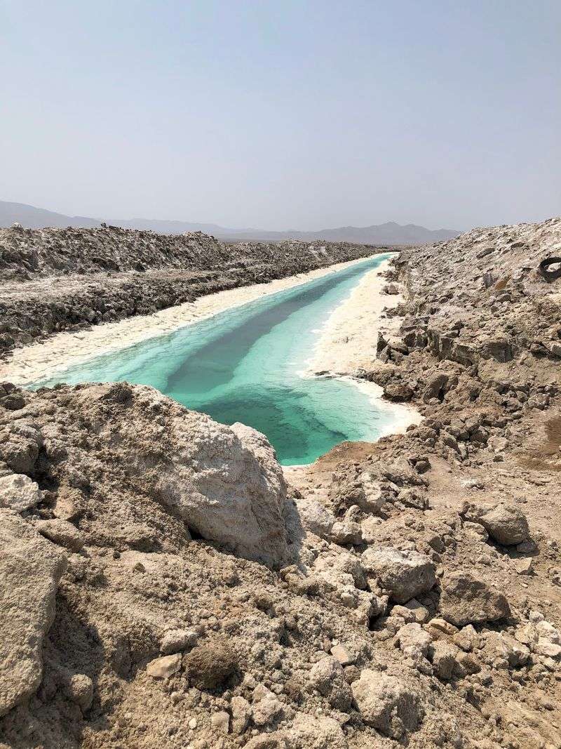
South and east of Amboy, Bristol Dry Lake adds another distinct surface to the landscape. The playa is known for salt deposits, and commercial mineral extraction has a long history here.
That pale ground creates a sharp contrast with the dark volcanic terrain around Amboy Crater. In one part of the drive, black lava dominates the view. In another, the dry lake can appear almost white under strong desert light.
Industrial areas around the playa are not sightseeing grounds, so stay on public routes and legal roadside viewpoints. There is no need to leave public access to understand the scale of the basin.
The contrast becomes especially noticeable late in the day. Lower light softens the glare, the crater and lava fields deepen in color, and the flat horizon starts preparing the stage for Roy’s neon.
That is the easiest rhythm for a first visit: geology before the hottest part of the day, town history in the afternoon, and the sign around dusk.
Keep water in the car, download directions before losing reliable cell service, and make sure the fuel gauge is comfortable before heading onto the quieter stretches of Route 66.
Once the neon is glowing behind you, the drive out feels different from the drive in. The buildings have not moved, and the desert has not changed, but the bright arrow now gives the dark highway a clear point of reference.