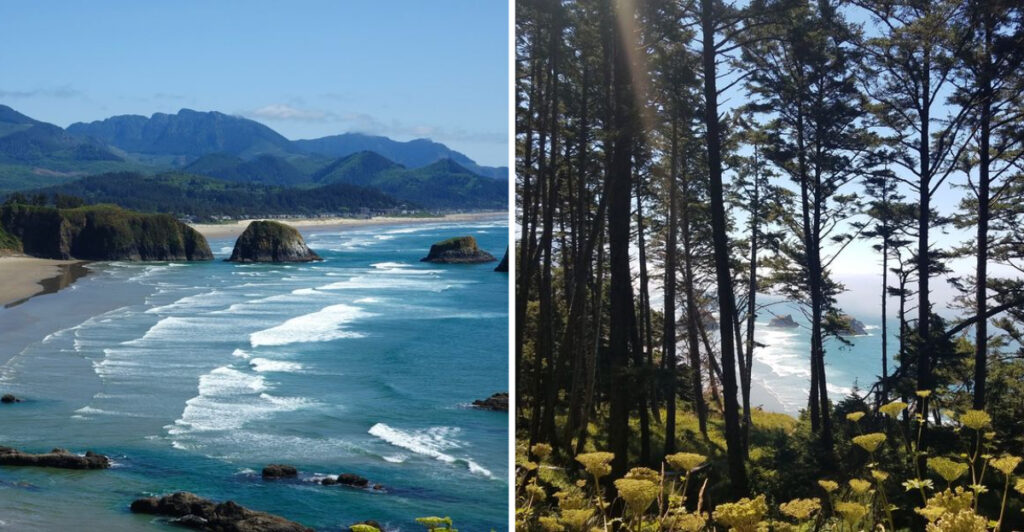
Simon says: follow the forest, find the beach.
This Oregon trail keeps the coastline hidden just long enough to make the reveal count. You start beneath the trees, leave the road behind, and let the sound of the surf do the teasing.
Then the forest finally gives up the secret.
The cove opens below with green headlands, sea stacks, and a stretch of sand that looks far more remote than its location suggests.
The walk is part of the fun. Each step strips away more traffic, more noise, and more of the ordinary beach-day routine.
No instant ocean view. No shortcut to the sand.
Just a forest trail playing Simon Says until the Pacific finally wins.
A Forest Trail Keeps This Beach Off The Easy-Access Route
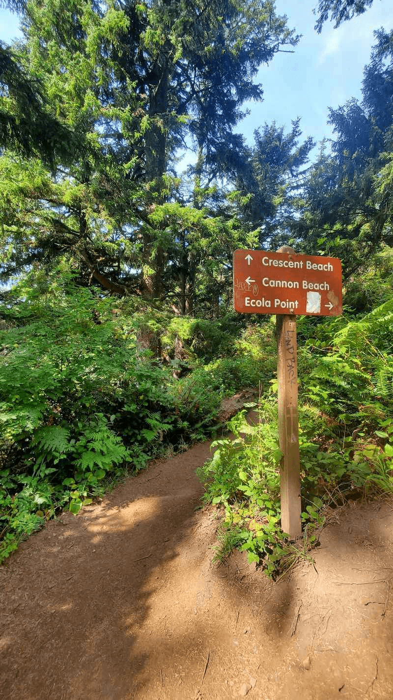
There is no parking lot waiting at the edge of the sand. To reach Crescent Beach, hikers start from the Ecola Point area and follow a forest route toward the cove.
The beach lies roughly 1.25 miles from the main parking area, with longer hiking possible if you continue toward Chapman Point. That distance sounds modest on paper, but the coastal terrain makes the outing more involved than a flat walk of the same length.
The trail moves through dense coastal forest where Sitka spruce, salal, wet roots, and uneven ground can make a short distance feel more involved than the mileage suggests. Rain changes the equation quickly.
Mud and slick sections are common features of coastal hiking, so shoes with solid grip belong on the list even when the forecast looks friendly.
The hike is part of what keeps the beach more secluded than the better-known shoreline around Cannon Beach. Crescent Beach is reached on foot rather than from an easy roadside pullout.
That means the first decision happens before you ever see the ocean. Are the shoes worth getting muddy?
Usually, that answer gets easier once the trees begin to open.
The First Clear View Of The Cove Changes The Whole Walk
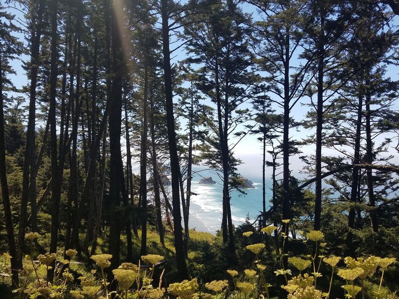
The trail does not reveal everything at once. For much of the approach, trees control the view, then gaps in the forest begin exposing pieces of coastline below.
A headland appears first, followed by sand, and then the Pacific spreads out behind it. Trees keep breaking the coastline into smaller glimpses until the entire cove finally comes into view.
Ecola State Park is known for this kind of scenery, with trails leading toward secluded coves, forested promontories, and cliffside viewpoints along roughly nine miles of coastline. Crescent Beach fits neatly into that landscape.
The changing elevation helps keep the reveal interesting. One opening may show mostly water, while another brings the curve of the beach and the forested cliffs into the same frame.
Take the viewpoint slowly instead of treating it as another checkpoint. The beach below looks different as clouds move, fog lifts, or late-day light catches the water.
On clearer days, the contrast can be surprisingly sharp, with pale sand below, dark evergreens above, and rock formations breaking the open Pacific into layers.
The trail still has work left after the view appears, but at least now you know what is waiting at the bottom.
Green Headlands Give The Beach Its Island-Like Look
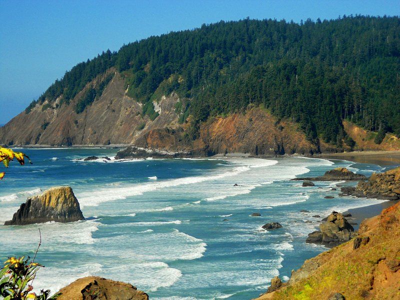
No palm trees are required for the comparison. What creates the almost Hawaiian impression is the way thick green forest drops toward blue-gray Pacific water while dark rock formations rise offshore.
Crescent Beach is surrounded by the same lush coastal vegetation that defines Ecola State Park. Sitka spruce forest covers the headlands and continues almost to the shoreline, giving the cove a much greener frame than many wide-open stretches of the Oregon Coast.
The steep slopes make that greenery especially noticeable from the sand. Instead of seeing development behind the beach, your view keeps climbing into forest.
Oregon keeps the cool air, dark evergreens, rougher water, and moody sky. The shape of the landscape does the rest. Even on a gray day, the green slopes can look almost unnaturally bright against the darker ocean.
If the title made you expect coconut trees, adjust the picture. The surprise here is seeing how close Oregon can get without borrowing any.
Sea Stacks Keep Rearranging The View From The Sand
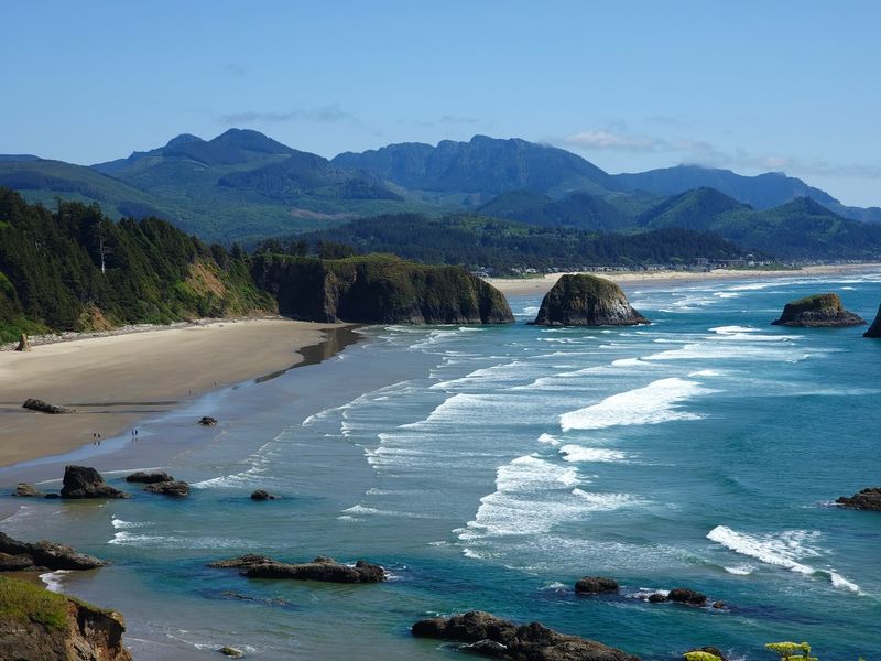
Once the trail reaches the beach, the horizon gets busier. Sea stacks and offshore rock formations interrupt the open water, giving the shoreline a series of natural focal points rather than one uninterrupted sweep of ocean.
They also make walking the beach more interesting because the view changes depending on where you stand.
Move closer to one end of the cove and a stack can overlap the headland behind it. Walk back the other direction and the same formation separates into open water again.
Ecola State Park is known for offshore sea stacks that punctuate this stretch of the Oregon shoreline and shape many of the park’s south-facing views.
The rocks become especially dramatic when waves wrap around their bases. From farther up the beach, they can look almost motionless while the entire ocean around them keeps changing.
Driftwood can add another layer along the sand, especially after rough weather. Treat those logs as scenery rather than guaranteed seating, since ocean conditions can change quickly.
Look inland occasionally too. From the shoreline, the forested walls around the cove can be just as striking as the rocks offshore.
The best beach plan here is simple: walk, look up, then walk a little farther and let the composition change again.
Low Tide Gives You More Shoreline To Work With
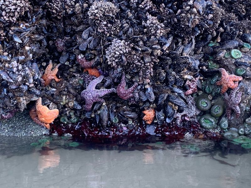
The ocean decides how much beach you get. Oregon State Parks publishes North Coast tide tables for Ecola State Park, so check the current tide before starting the hike.
Lower water can expose more sand and rocky shoreline, making it easier to explore the edges of the cove without crowding the surf line. It also gives you more room to study the smaller details around the rocks.
The difference can be obvious even during one visit. A stretch that looks broad on arrival can narrow noticeably as the tide begins pushing back toward the cliffs.
Tidepooling is one of the activities available around Ecola State Park, though conditions vary by beach and tide. If pools are exposed, look without moving animals, prying anything loose, or stepping through fragile habitat.
Higher water changes the personality of the same place. The cove becomes tighter, waves occupy more of the foreground, and some stretches of sand can shrink considerably.
That changing waterline also gives you a good reason not to leave bags or shoes too close to the surf. The Pacific has a habit of reclaiming space without much ceremony.
Check the North Coast tide table before starting the hike. You are not scheduling the ocean, only checking how much of the beach it plans to lend you.
Ecola State Park Adds Nine Miles Of Coast Around The Cove
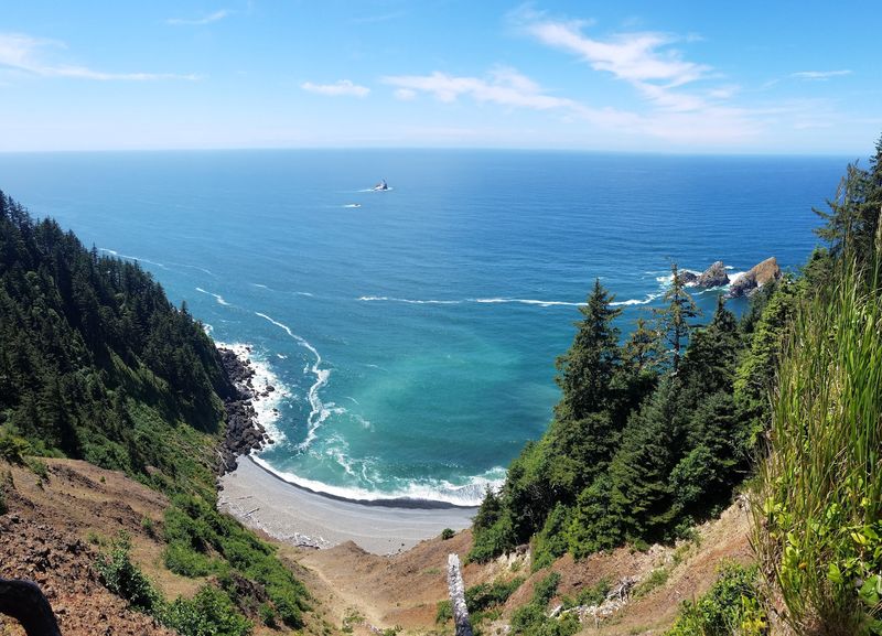
Crescent Beach does not sit alone. Ecola State Park wraps around Tillamook Head between Cannon Beach and Seaside, covering roughly nine miles of coastline with forest, cliffs, viewpoints, trails, picnic areas, and other beaches.
An eight-mile section of the Oregon Coast Trail passes through the park.
Indian Beach lies farther north and draws surfers and tidepoolers, while Ecola Point offers broad views south toward Cannon Beach and the offshore sea stacks.
That gives the park enough variety for more than a quick beach stop. You can spend one part of the day below the cliffs and another looking across the same coastline from above.
Wildlife watching can become part of the day too. Deer, elk, and eagles may be seen in the park, while migrating gray whales can sometimes appear offshore during winter and spring.
After the Crescent Beach hike, Ecola Point, Indian Beach, and other park trails can extend the day. Hike down, spend time on the sand, climb back up, then keep exploring.
Even the drive between park areas stays surrounded by thick coastal forest, so the transition back toward Cannon Beach does not happen all at once.
One current 2026 restriction matters: the west section of the Clatsop Loop Trail has been closed since April 17 because of an active landslide. The current Oregon State Parks alert specifically closes that section and does not list Crescent Beach Trail as closed.
The Coast Is Wild Enough To Keep The Plan Flexible
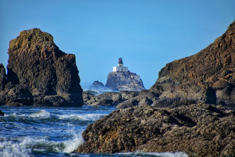
Ecola State Park sits on geologically active terrain, and landslides have affected roads, trails, and viewpoints over the years. That matters before heading toward Crescent Beach.
The park is currently open for day use, though erosion and landslides can still lead to temporary closures. The western section of the Clatsop Loop Trail remains closed in August 2026 because of an active landslide.
The park also requires a day-use parking permit, which can be purchased on site. Overnight parking is not allowed.
For Crescent Beach itself, check official park conditions and the tide table before leaving Cannon Beach, especially after heavy rain or rough weather.
A dry morning does not guarantee a dry trail either, since shaded forest sections can hold mud well after rain has stopped.
Also make sure to save enough energy for the return climb. The descent that made the beach seem wonderfully removed from everything becomes the uphill portion of the trip once it is time to leave.
The beach may look like an island hideaway from the right angle. Getting there reminds you exactly where you are.