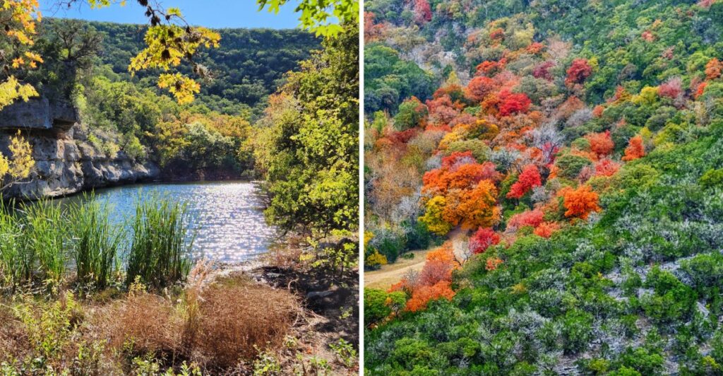
Texas in fall?
Yes, we are talking about actual red leaves.
Deep in the Hill Country, bigtooth maples can turn bright red, orange, and gold once autumn settles in. Against all that limestone and green, the color looks almost like it wandered in from a completely different state.
That contrast is what makes the season here so good.
Texas may not be the first place you think of for leaf peeping, but these maples clearly missed that memo.
Trails carry you through the changing landscape, with enough variety to make a quick look feel a little stingy.
The timing can shift from year to year, so the leaves get the final say on when the show really starts.
And when Texas decides to do fall color?
Apparently, subtle was never part of the plan.
Where Is This Natural Area In Texas?
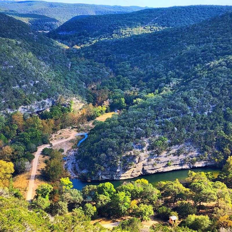
A drive through the southwestern Texas Hill Country brings you toward Vanderpool, where hills and creek valleys surround the roads. Lost Maples State Natural Area lies about five miles north of that small community in Bandera County.
The Sabinal River and its tributaries run through the natural area, passing wooded canyon bottoms and steep limestone slopes.
You’ll find a different landscape here from the broad, open plains often associated with Texas, with shaded creek crossings and rocky overlooks connected by hiking trails.
If you’re arriving from San Antonio, allow roughly two hours for the drive, plus extra time for stops or slow-moving traffic during the fall season. Ranch Road 187 leads to the entrance. Watch your navigation carefully as you get closer, since rural turns can be easy to miss.
Cell phone service is unavailable inside the natural area. Download driving directions and the trail map while you still have a signal. A paper copy can help when you’re deciding between trail junctions, too.
Start at park headquarters to check in, confirm trail conditions, and find out whether weather has affected access. Trails can close when conditions are unsafe, so don’t assume your planned route is open just because the sky looks clear at the entrance.
A Rare Splash Of Autumn Color In The Heart Of Texas
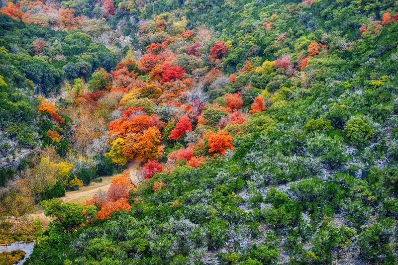
Fiery red leaves in Texas? Lost Maples offers a particularly colorful example when temperatures and rainfall cooperate. Its Uvalde bigtooth maples grow in sheltered canyons alongside other trees that change color as the season advances.
On some autumn days, red and orange maple leaves stand against pale limestone and darker evergreen vegetation. The display is never identical from year to year.
The park’s protected valleys contain springs, shaded slopes, and waterways. Bigtooth maples occur in these canyon habitats, where their roots can reach moisture in an otherwise rugged landscape.
You’ll see other trees too, including sycamores and bald cypress along portions of the river corridor.
On a creekside walk, look for shifts in the vegetation as the trail moves between exposed limestone and shaded watercourses. The maples are not the only trees with changing leaves, so check branches above you as well as the canyon floor.
For photographs, look toward the edge of a creek, the slopes beyond a trail, or individual leaves illuminated against the rock. Staying on the path protects the shallow roots of the maples and the soil around them.
Meet The Bigtooth Maples Behind The Magic
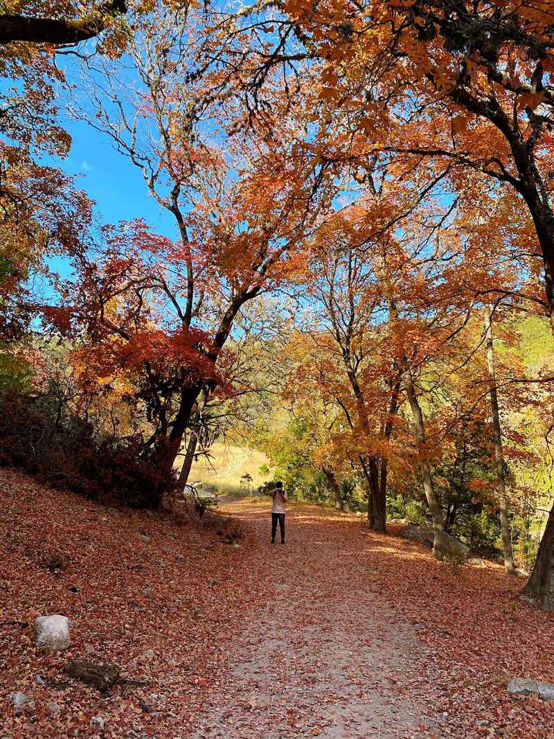
The distinctive trees at Lost Maples are Uvalde bigtooth maples, a type of bigtooth maple found in this part of Texas. The natural area protects a large, isolated stand that grows among steep canyon walls and wooded slopes.
These maples are associated with cooler, moister habitats, and their presence in sheltered Hill Country canyons reflects the area’s environmental history.
Their leaves have several broad lobes with noticeable teeth along the edges, giving you a useful feature to look for on the trail.
Take a close look at fallen leaves without picking anything from the trees. The leaf shape can help distinguish a maple from the narrow leaves of other streamside species. In autumn, look for differences in color even among trees growing relatively close together.
By fall, changing daylight and weather contribute to the colors that draw attention to these trees.
You don’t have to memorize plant names to enjoy the setting. Pause beside a designated path and compare the lobed maple leaves with the shapes of leaves from neighboring trees. Remain on marked trails.
Off-trail walking and climbing on hillsides are not allowed, and the maples’ shallow root systems can be damaged by foot traffic.
Timing Your Trip For Peak Leaf Season
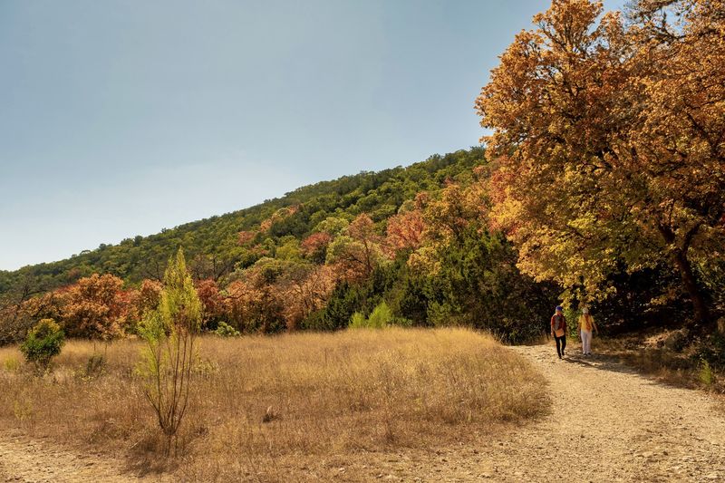
Show up early in the season and you may find mostly green maples. Visit after the main color change and some leaves may already be on the ground. Picking a date requires a little flexibility.
At Lost Maples, fall color commonly develops from the last two weeks of October into the first two weeks of November, depending on weather. Heat, rainfall, and cold spells influence the timing and intensity of the display. There isn’t one date that works every year.
Check the park’s fall foliage updates starting in mid-October. These seasonal reports can help you choose a week, especially if you’re traveling a long distance and have only one chance to visit.
October and November are busy months. The natural area has limited vehicle capacity, and entry may be unavailable once parking is full. Make a day-use reservation in advance, including for a weekday visit during the foliage season.
Fall temperatures can change through the day. Wear layers that are easy to remove, but keep water in your pack even if the air feels cool at the trailhead.
Trails That Lead Straight Into The Color
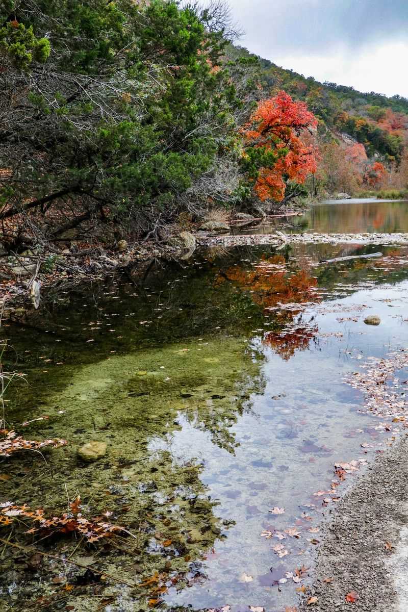
The trail system includes short walks and demanding climbs, so choose your route according to the time and energy you have available. Some sections are rocky, steep, or interrupted by creek crossings.
The Maple Trail is a 0.4-mile easy walk through a notable stand of bigtooth maples. Choose it to see the trees without committing to a lengthy uphill hike. Keep in mind that even shorter routes can include uneven footing.
For more distance, the East Trail covers 3.1 miles and includes challenging slopes above the Sabinal River. You can make a longer loop by connecting with the East-West Trail and the path back toward the day-use area. Allow additional time for those connecting sections.
Along the eastern trails, watch for Monkey Rock, a naturally shaped rock formation, and the Grotto, a sheltered rock feature near the route. Stay on the designated trail to see them rather than scrambling over slopes or climbing rock faces.
The West Trail is 3.6 miles and passes through rugged terrain, including the shaded Mystic Canyon area. Springs and elevated viewpoints are part of this route, but so are strenuous climbs and rocky steps.
Carry about a quart of water per person for each hour of hiking. Wear sturdy shoes, take care at crossings, and use the park map to estimate the full route, not just one named trail segment.
Bicycles are permitted only on the first mile of trails from trailheads. Beyond that point, continue on foot, and stay on the established route throughout your hike.
Smart Tips Before You Pack The Car
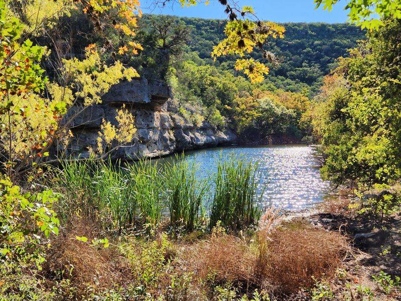
First, handle your entry reservation. Day passes and camping reservations are available through the Texas State Parks system, and peak foliage dates may sell out. Check current park alerts before leaving because weather or trail conditions can change your plans.
For navigation, head to 37221 FM 187, Vanderpool, TX 78885. Fill your tank and pick up groceries or hiking supplies before reaching the rural roads around the park. Bring everything you’ll need for the day’s hike rather than depending on a nearby store.
If you’d like to stay overnight, the park has 30 developed campsites with water and electricity, plus restrooms and showers nearby. Primitive sites have no potable water, and fires are prohibited in those backcountry camping areas.
Leashed pets can accompany you on trails, but remember to carry water for them and pick up their waste. Dogs cannot enter Texas State Park buildings. You can fish in the Sabinal River or Can Creek, and the Pond Day Use Area provides another place to spend time outdoors.
Pack a picnic for a designated area and carry out all rubbish when you leave. The Pond Day Use Area also offers a place to pause without committing to a longer hike. Before you set out for another trail, check the time and the amount of daylight remaining.
Leave plenty of time to return to your vehicle safely.
For an evening outdoors, camping also opens the possibility of stargazing when skies are clear. Bring a flashlight for your campsite, but don’t plan to navigate difficult hiking trails after dark.
Exploring The Canyon Beyond The Fall Color
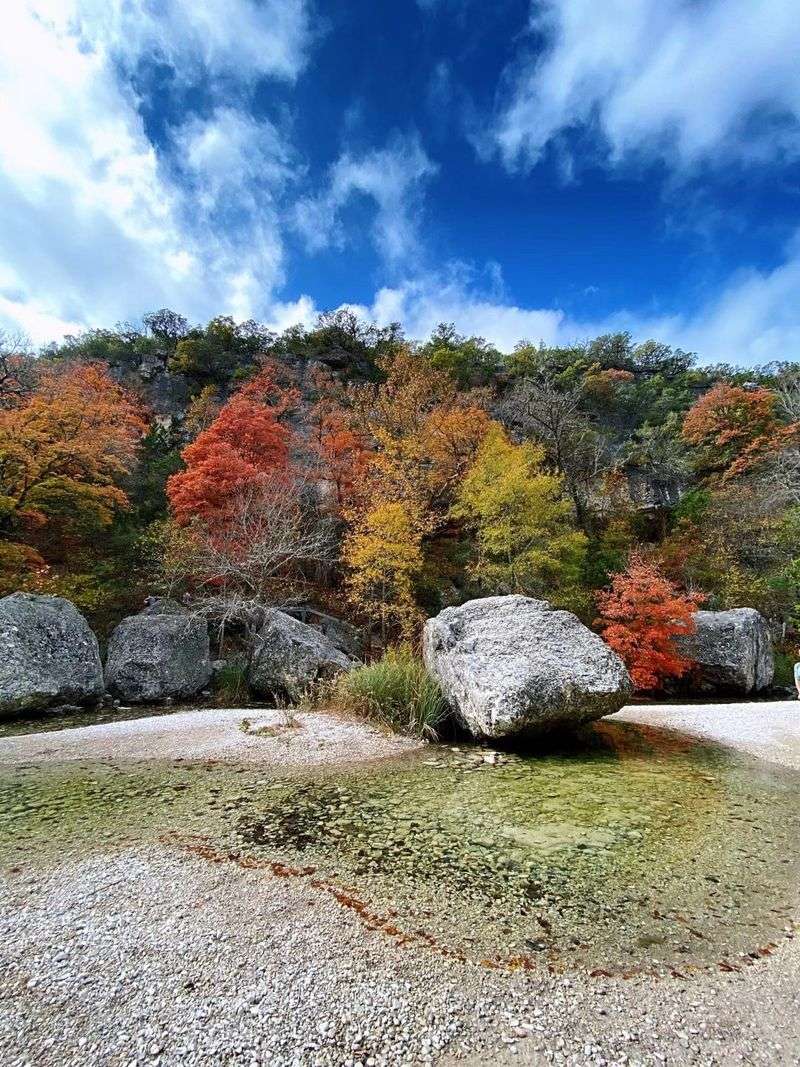
Autumn brings a different set of colors to the same limestone slopes, streams, and wooded paths you can explore throughout the year. A route that starts beside green trees in October may pass beneath yellow or red leaves on a later visit.
Start with the maple groves if foliage is your main interest, then choose whether you have time for an overlook or a longer creekside walk. The changing terrain gives you several ways to spend a day without making every stop a strenuous climb.
Wildlife is another part of the natural area. White-tailed deer, armadillos, gray foxes, and numerous birds live in the surrounding habitats. Look and listen from the trails, keep your distance, and never offer food to wild animals.
Carry your water, give people room on narrow sections, and take your time on loose stones.
Before heading back to Vanderpool, check that you have your belongings and all your rubbish. The maples, creek corridors, and canyon trails will be here for the next change of season.