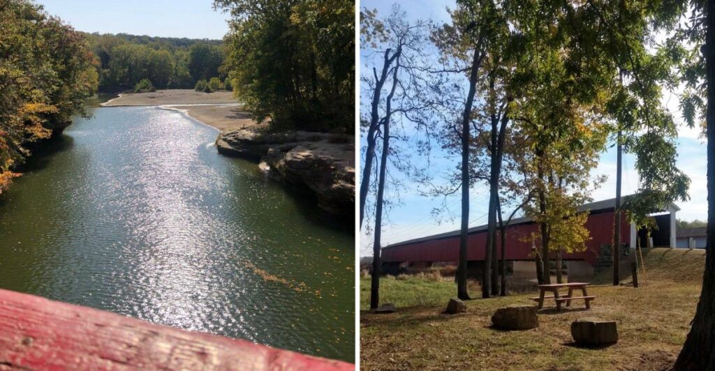
You know that road-trip rule about taking the scenic route? October in southern Indiana takes it personally.
The back roads start doing all the work. Fall color settles into the hills, and old covered bridges keep popping up just often enough to ruin any hope of sticking to a strict schedule.
Nine bridges shape the loop, but the day does not need to feel like a checklist. Some still carry cars. Others are better for slowing down and getting out for a closer look.
The route stretches across several counties, so the scenery keeps shifting as the miles add up.
I’d plan for the full loop and still expect to fall behind. Covered bridges are not exactly friends with punctuality.
Start The Drive At Indiana’s Oldest Covered Bridge
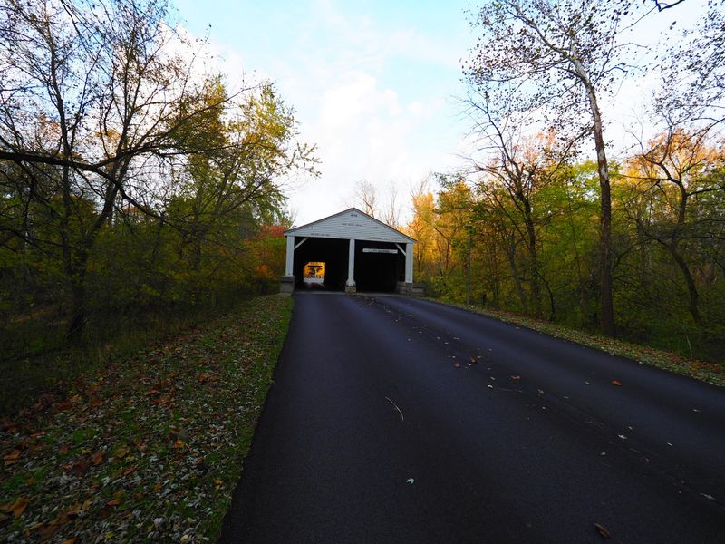
Ramp Creek Covered Bridge brings you face-to-face with one of Indiana’s oldest surviving pieces of road history. Built in 1838, it is the oldest surviving covered wooden bridge in the state and the only two-lane covered bridge in Indiana.
The bridge originally stood in Putnam County. It was moved to Brown County in 1932 and now carries traffic over Salt Creek at the north entrance to Brown County State Park.
Its double-barrel design creates two separate passages beneath the same roof, a sight that immediately looks different from the narrow single-lane bridges that appear later in the trip.
The structure uses a Burr arch truss configuration, with timber arches and trusses helping carry the roadway. Red siding and white trim make the bridge easy to recognize, especially when October color fills the trees around the park entrance.
Drivers should pay close attention to the posted limits. The north entrance has a 9-foot height clearance and a 3-ton weight limit, so RVs and vehicles towing trailers must use the park’s west entrance instead.
Passing through Ramp Creek is a simple way to begin. You are driving through a structure first built nearly two centuries ago, yet it still forms part of a working road today.
Bean Blossom Keeps The Brown County Miles Scenic
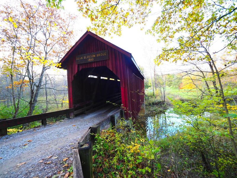
Bean Blossom Covered Bridge sits north of Nashville and dates to 1880. It crosses Bean Blossom Creek and uses a modified Howe truss design, giving the Brown County portion of the loop a second bridge with a different shape and scale.
The bridge is much shorter than several later stops, but its rural setting suits a fall drive. Brown County includes it in scenic driving material, and the approach along local roads gives you a reason to ease off the accelerator and pay attention to the landscape.
Bean Blossom remains open to traffic, so drivers can still pass through the single-lane structure. Take your time and follow any posted restrictions rather than assuming an old wooden bridge handles vehicles like a modern concrete crossing.
This part of the route also keeps the first two stops relatively close together. You can move from Ramp Creek to Bean Blossom without spending a large part of the morning on faster roads.
October is especially useful here because the surrounding hills carry so much hardwood forest. Even when peak color shifts from year to year, the combination of narrow roads, timber framing, and wooded hills gives this section a strong fall-road-trip character.
Medora Brings Serious Scale To The Route
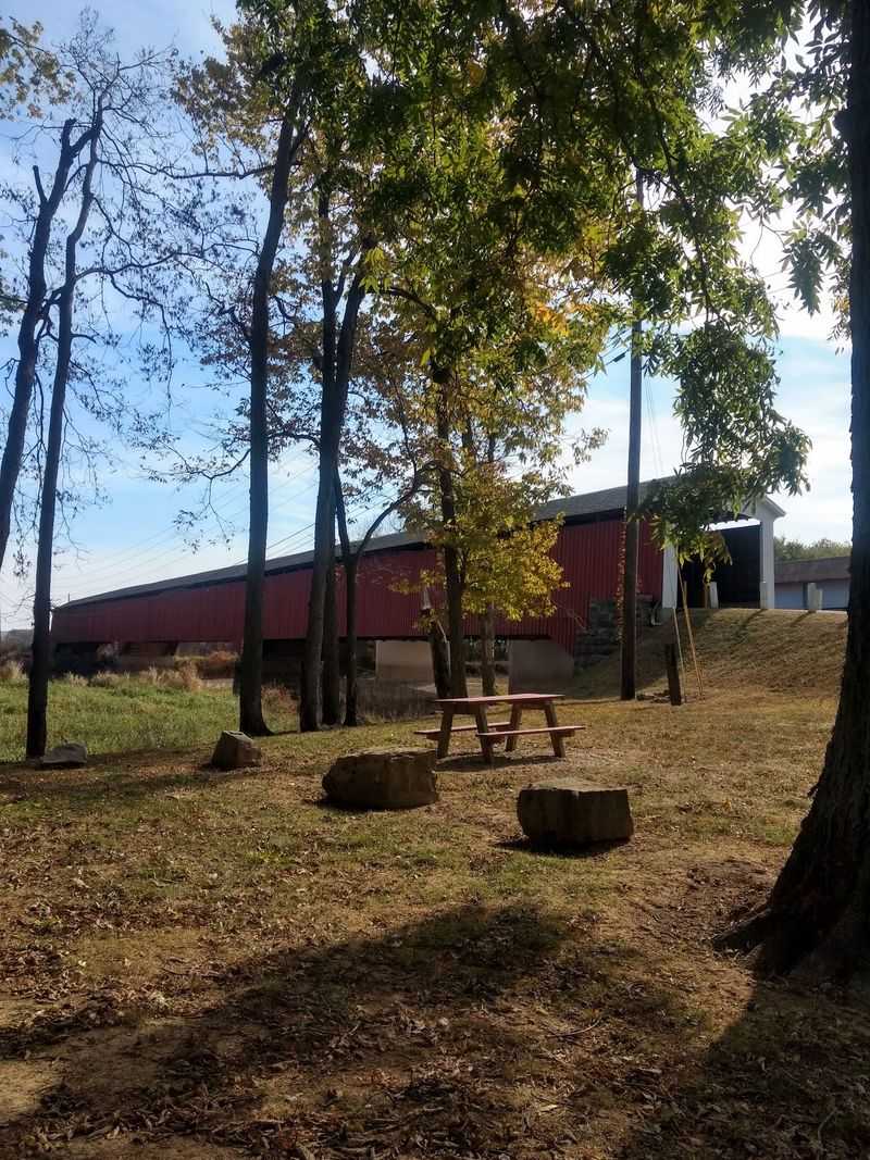
Medora Covered Bridge changes the mood as soon as you see its length. Built in 1875 by bridge builder Joseph J. Daniels, it crosses the East Fork of the White River east of Medora and is recognized as the longest historic covered bridge in the United States.
The bridge uses a Burr arch design and stretches across the river in multiple spans. Instead of driving through, you explore Medora on foot. It is open to pedestrians and bicycles, making this a good place to step out of the car after a long stretch of backroad driving.
Walking inside lets you see how the timber members repeat from one end to the other. The enclosed space also makes the bridge’s size easier to understand than a roadside glance ever could.
This is one stop where extra time pays off. The crossing is long enough that the walk itself becomes part of the visit, and the river setting gives you room to see the bridge from outside as well.
By October, the trees along the river corridor can add another layer of color, but the bridge does not depend on foliage for its appeal. Its length, engineering, and nineteenth-century construction already give you plenty to examine.
Shieldstown And Williams Add Two Walkable Crossings
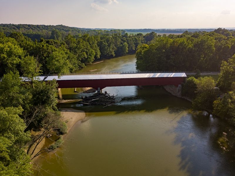
The southern part of the loop includes two more bridges across the East Fork of the White River. Shieldstown Covered Bridge in Jackson County was built in 1876, only a year after Medora. Williams Covered Bridge in Lawrence County followed in 1884.
Shieldstown is a Burr arch bridge built by Joseph J. Daniels. It once carried vehicles, but today it is a pedestrian crossing.
A major restoration was completed before the bridge reopened to visitors, allowing people to walk through a structure that spent generations serving local transportation.
Williams is another pedestrian-only stop on the current loop. It uses a Howe truss design and ranks among Indiana’s longest surviving covered bridges.
The change from driving to walking is welcome on a route this long because it gives you a chance to stretch your legs and look more closely at the craftsmanship.
If you need a reliable reference point for the northern end of the trip, Ramp Creek Covered Bridge is at 1801 State Road 46 E, Nashville, IN 47448. That is the Brown County State Park north-gate address, and it is the entrance with the 9-foot clearance and 3-ton limit.
With Medora, Shieldstown, and Williams all experienced on foot, this middle stretch naturally slows down. That suits October, when rushing past the landscape would defeat much of the purpose.
Scipio And James Put Cars Back On The Timber
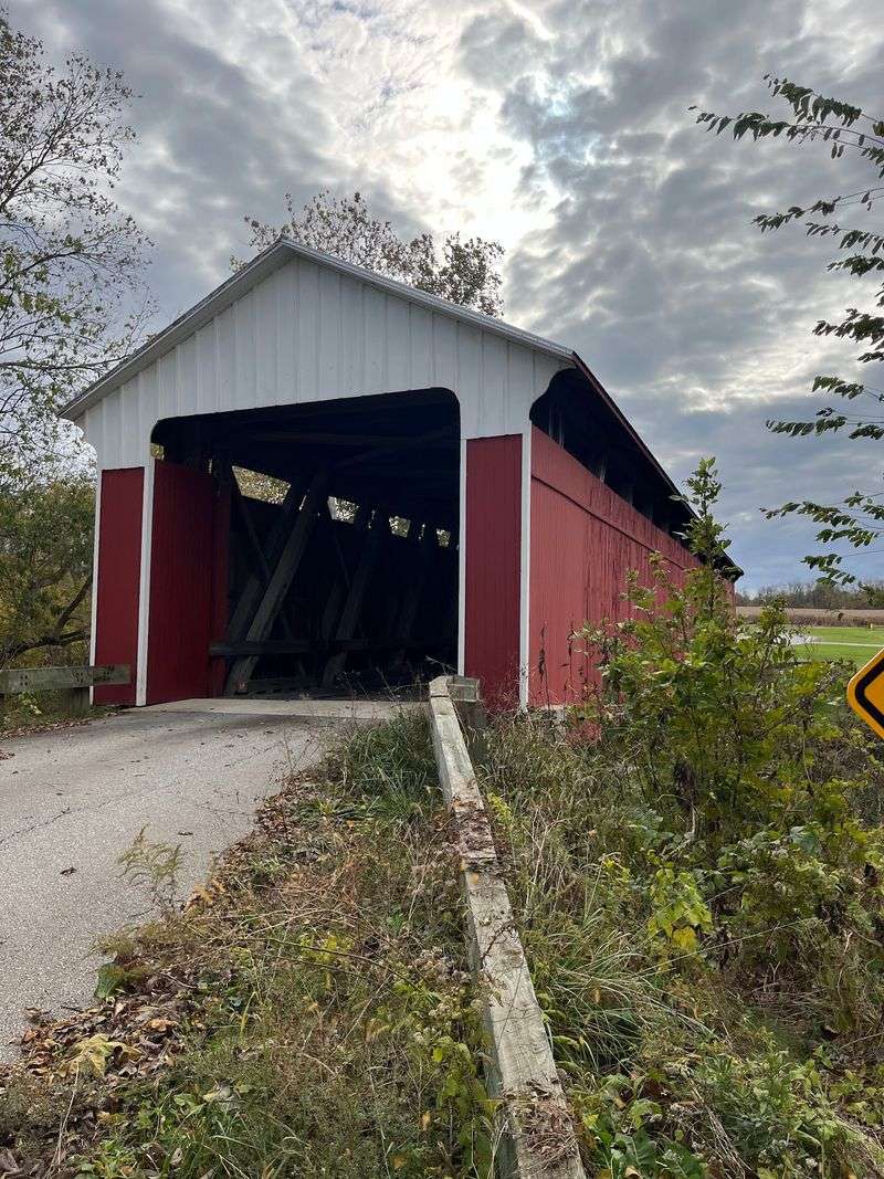
Jennings County brings two late-nineteenth-century bridges into the drive. Scipio Covered Bridge was built in 1886 over Sand Creek, while James Covered Bridge followed in 1887 over Graham Creek.
Both use Howe truss designs, and both remain open to traffic. That means the experience changes again after the pedestrian bridges farther south.
Instead of parking and walking through, you can pass beneath the wooden roof in your vehicle and continue along the county roads.
Scipio once formed part of an important transportation route connecting the village with North Vernon and other points across southeastern Indiana.
James also served local transportation needs, including access toward rail connections that helped farmers move goods to market.
Those histories are easy to understand when you see where the bridges sit. They were practical structures first, built to get people and goods across waterways.
Today, their survival gives the loop a pair of working nineteenth-century crossings close together in age. The roads around them also keep you away from the interstate rhythm that defines so many modern trips.
Download your route before setting out and watch for posted limits at every bridge. Rural roads can change quickly, and navigation is easier when you are not relying entirely on a signal.
Westport And New Brownsville Round Out The Nine
Westport Covered Bridge in Decatur County dates to 1880 and crosses Sand Creek. The Burr arch bridge spent decades carrying regular traffic, was later bypassed, and today allows limited vehicle travel under a posted weight restriction.
New Brownsville Covered Bridge brings the loop into Columbus. Built in 1840, it originally crossed the East Fork of the Whitewater River near Brownsville before being relocated. It now stands in Mill Race Park, where the bridge crosses part of the park’s water system.
Westport and New Brownsville could hardly look more different. Westport still sits in a rural setting connected to the road network that shaped its history, while New Brownsville now stands inside a carefully designed city park.
By the time you reach them, you have moved across bridges built from 1838 through 1887. You have also seen Burr arch and Howe truss designs, vehicle crossings, pedestrian bridges, river spans, creek crossings, and a bridge preserved inside a public park.
Nine stops may sound manageable on paper, but stopping, walking, photographing, and navigating local roads adds time quickly. Give the loop room to breathe instead of turning it into a race.
Make October About The Drive, Not The Finish Line
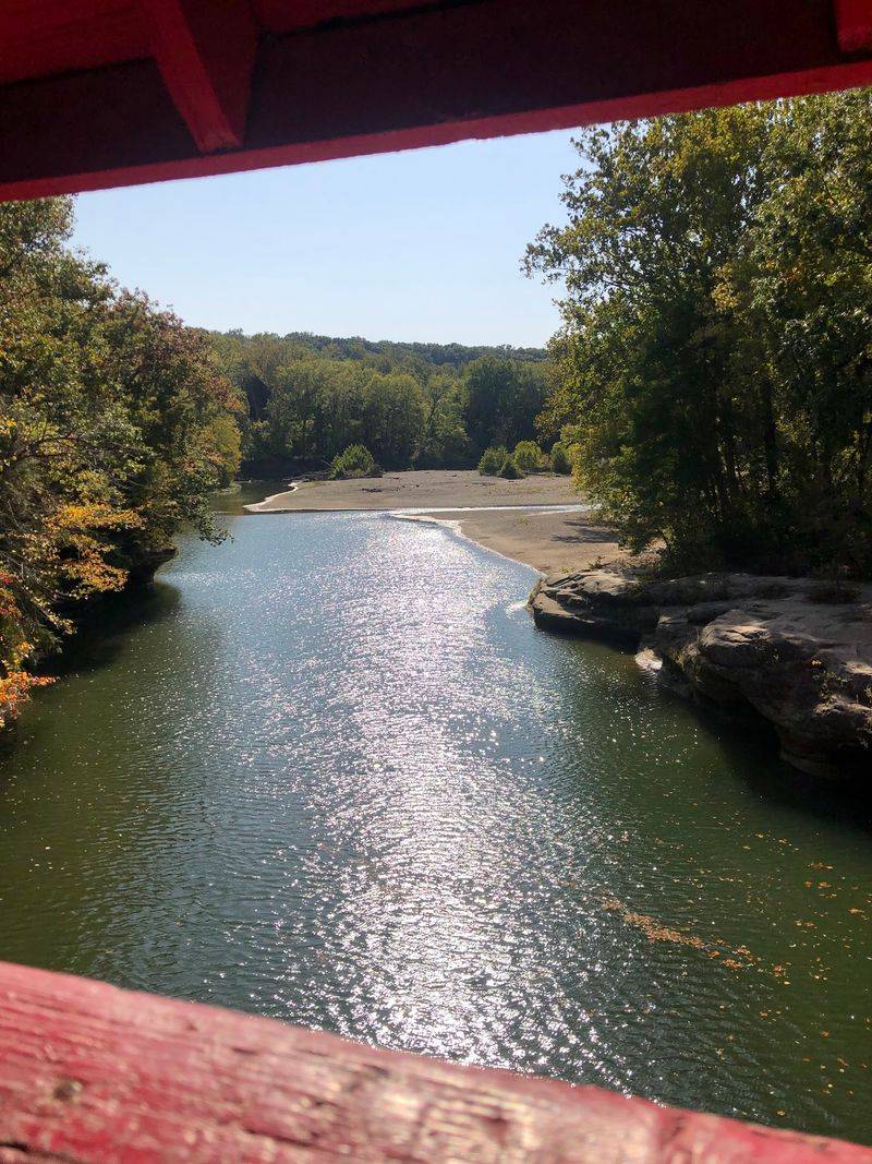
The Indiana Covered Bridge Loop covers roughly 216 miles and links nine historic bridges across six southern Indiana counties. That distance is enough to make the road between stops matter almost as much as the crossings themselves.
A one-day trip is possible for travelers who start early and keep stops short. A weekend makes more sense if you want to walk the pedestrian bridges, spend time in Brown County State Park, and take the rural sections at an easy pace.
October adds the seasonal backdrop people hope for, but peak color never follows an exact calendar. Weather, elevation, and temperature can shift the timing, so it is smarter to treat foliage as a bonus rather than build the entire drive around one predicted weekend.
The bridges are the dependable part. Ramp Creek reaches back to 1838. New Brownsville followed in 1840.
Medora, Shieldstown, Bean Blossom, Westport, Williams, Scipio, and James carry the timeline through the rest of the nineteenth century.
By the end, the route has given you two very different ways to experience Indiana history. Sometimes you are walking slowly through timber framing with a river below. Sometimes you are driving through a narrow wooden passage on a county road.
Add October leaves, and the whole trip becomes the sort of fall outing that is easy to repeat the next year.