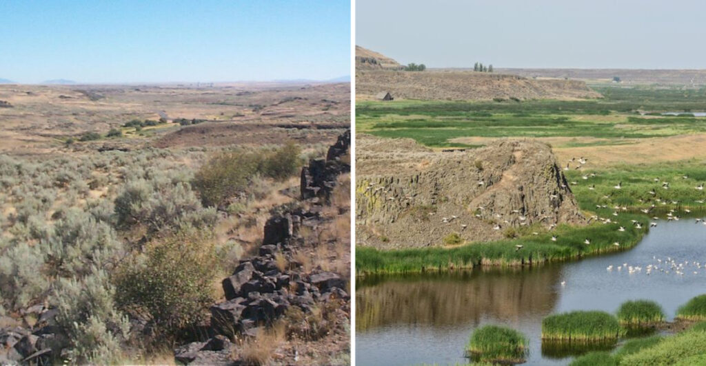
Someone owes that creek an apology. It has been accused of building a canyon clearly above its pay grade.
In eastern Washington, the evidence does not add up. The water below looks modest. The walls around it suggest something that once arrived with absolutely no respect for scale.
That contradiction is your invitation.
You follow a short trail expecting an easy leg stretch, then the ground starts presenting geological evidence like a lawyer with excellent timing.
Ancient lava enters the record. Ice Age floods take the stand. Your camera becomes an unreliable witness because every angle looks slightly fictional.
Washington keeps the entire case far from crowds, ticket booths, and polished viewpoints. You bring water, sensible shoes, and enough curiosity to question the map.
The hike ends quickly. The argument does not.
By the time you return to the car, that tiny creek has been acquitted. The floods clearly did it.
The Creek Has An Alibi
Wilson Creek looks entirely innocent beside the canyon carrying its name.
The waterway is small enough to make the surrounding scale seem almost suspicious. Steep slopes and basalt cliffs rise around a drainage that could never have excavated such a broad corridor on its own.
That mismatch is the first clue. Govan Recreation Site sits within the Telford-Crab Creek Scabland Tract, a flood-carved zone that the National Park Service describes as roughly forty miles wide.
During the Ice Age, enormous volumes of water moved through this part of the Columbia Plateau after glacial lakes overflowed and ice dams repeatedly failed.
Wilson Creek arrived later as the quiet tenant, not the original demolition crew.
The Bureau of Land Management now manages the site as a small, year-round recreation area for hiking, wildlife viewing, photography, nature study, and horseback riding. No entrance fee stands between you and the geological evidence.
Because the trail follows the present drainage, the size difference stays visible from beginning to end. Each bend repeats the same question with increasing sarcasm: how did that little creek get such an enormous office?
Walk through the gate and give the creek a fair hearing. It did not build this courtroom, but it has been maintaining the address ever since.
Ice Age Floods Left The Bigger Signature
The landscape makes more sense once you stop imagining an ordinary flood.
Near the end of the last Ice Age, Glacial Lake Missoula repeatedly formed behind an ice dam in what is now Montana. When that barrier failed, immense torrents swept across Idaho and eastern Washington before continuing toward the Pacific.
The National Park Service estimates that the dam broke dozens of times between roughly fifteen thousand and thirteen thousand years ago.
Each release lasted only days, but the water carried enough force to strip soil, redirect drainage, and cut channels into the Columbia Plateau.
At Govan, floodwater also moved through the Telford-Crab Creek tract after spilling from Glacial Lake Columbia. The broad canyon around Wilson Creek belongs to that regional story rather than to the modest stream now occupying its floor.
Those floods did not produce one neat river valley. They spread through braided routes, overtopped divides, and carved a network of coulees and channels across eastern Washington. Govan occupies one quieter piece of that enormous puzzle.
You do not need a geology degree to recognize the imbalance. The corridor is too wide, the walls are too abrupt, and the present water is clearly underqualified for the résumé.
Basalt Built The Walls Before Water Edited Them
The canyon had strong material long before the floods found it.
Much of eastern Washington rests on the Columbia River Basalt Group, a deep sequence of lava flows erupted between about seventeen and six million years ago.
Those flows spread across enormous areas, cooled into dark rock, and accumulated in layers across the Columbia Basin.
Wind later deposited loess over parts of the plateau. Then Ice Age floodwater arrived and removed much of that softer cover, exposing and cutting into the basalt below.
Wilson Creek Canyon presents the result without requiring a textbook. Dark cliff bands reveal stacked volcanic rock, while broken slopes show where erosion took advantage of joints and weaknesses.
The geology is dramatic because two very different forces worked the same site on completely different schedules.
Lava supplied the building material. Floodwater performed the aggressive renovation.
Look for vertical fractures, ledges, and changes in texture as sunlight shifts across the walls. The rock may appear uniform from a distance, but the closer view quickly ruins that assumption.
Photographers get better definition when the sun hits from an angle rather than directly overhead. Shadows reveal the cliff structure, while flat midday light can make several million years of geology look disappointingly tidy.
This canyon did not choose between fire and water. It kept receipts from both.
A Short Trail Delivers A Full Geological Argument
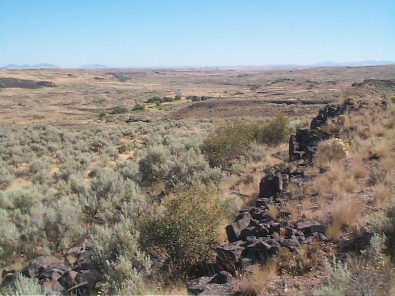
Mileage barely gets a chance to brag here.
Washington Trails Association lists the route at 0.8 miles round trip with only 37 feet of elevation gain.
The Bureau of Land Management describes the maintained portion as a nearly half-mile interpretive nature trail, which matches the walk from the parking area to its official endpoint.
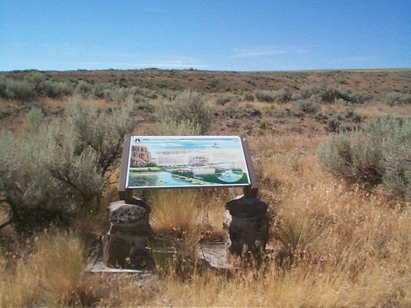
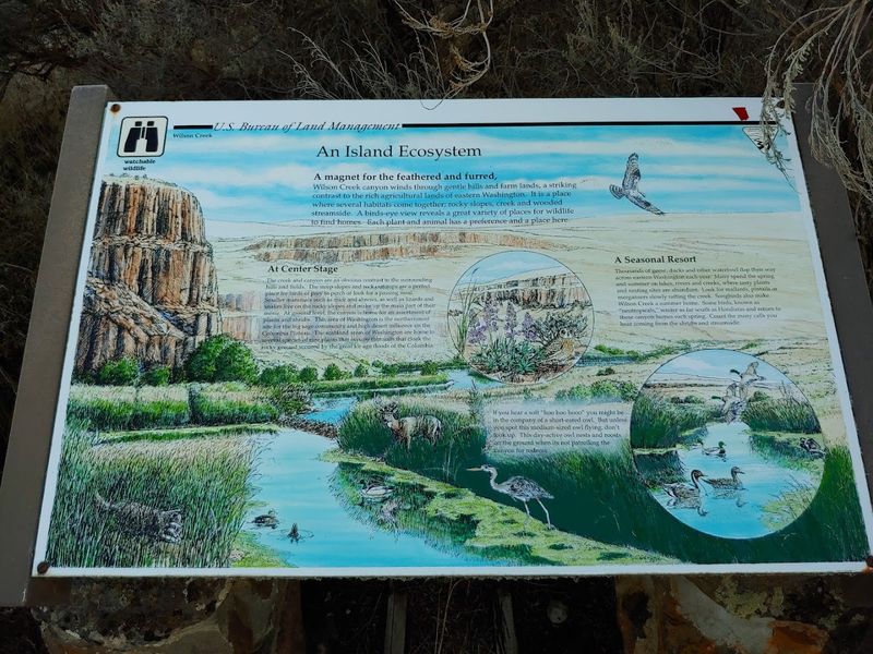
The crushed-gravel path begins beyond a gate and crosses mature shrub-steppe terrain. At about 0.4 mile, a signboard explains the local habitat and marks the end of the maintained trail.
That modest distance makes the outing approachable for families, casual walkers, and anyone who wants strong scenery without turning the day into an endurance contest.
BLM also identifies an accessible activity at the site, although outdoor surfaces can change with weather and maintenance.
The route remains exposed, so easy mileage does not mean automatic comfort. Heat, wind, loose gravel, and seasonal mud can influence the walk more than the elevation profile suggests.
You can continue roughly another quarter mile beyond the sign, but the route becomes less defined and eventually too steep for safe travel. Turning around is not surrender. It is simply an excellent way to avoid becoming part of the interpretive program.
Shrub-Steppe Life Refuses To Match The Color Palette
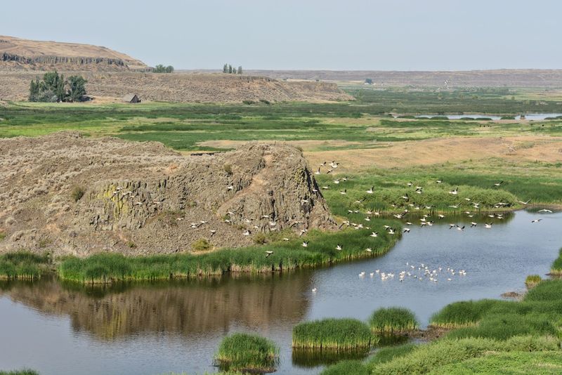
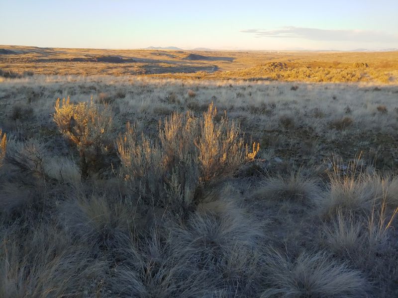
At first glance, the vegetation appears to have agreed on beige. Stay longer and that agreement falls apart.
Mature sagebrush lines the trail, joined by grasses and seasonal wildflowers that bring stronger color during spring.
Washington Trails Association also notes an abundance of birds, while the canyon supports mammals and reptiles adapted to dry Columbia Plateau conditions.
Spring can be especially rewarding, but it comes with one practical reminder. Rattlesnakes may be active, so watch where you step, keep children close, and give any snake plenty of room.
Dogs are allowed on leash, which also protects pets from wildlife and keeps them from disturbing nesting birds.
The exposed landscape offers little reliable shade. Bring more water than the trail distance seems to justify, because the site provides none. A hat and sun protection can earn their place quickly once the morning warms.
Binoculars add more value than their weight suggests. Birds can move between cliff ledges and sagebrush faster than your phone can focus, and keeping your distance is better for every animal involved.
Move slowly and scan the ground, cliff edges, and shrubs. The canyon does not advertise every resident at eye level.
The rocks dominate the first impression. The wildlife wins the second look.
The Trailhead Runs On Preparation Instead Of Amenities
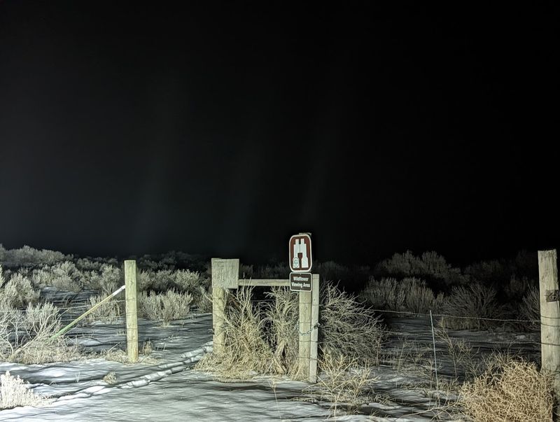
Govan Recreation Site has mastered the art of providing exactly one parking lot and no backup plan.
The gravel area holds only four or five cars, according to Washington Trails Association. It has no space for trailers or large recreational vehicles, and there is no toilet, potable water, trash collection, or visitor kiosk.
BLM keeps the site open year-round and charges no fee. That freedom comes with a simple exchange: everything you need arrives with you, and everything you bring leaves with you.
The official coordinates are 47.67722, -118.84985. Save them before leaving reliable service, because rural data connections can be inconsistent and app directions may wander creatively.
From Wilbur, the signed route leaves U.S. Highway 2 for Govan Road, then follows Lewis Bridge Road and Union Valley Road to the trailhead. The final roads are gravel but are generally described as wide and maintained.
Carry a basic roadside kit and start with enough fuel. The destination has no store, ranger desk, charging station, or convenient place to discover that your water bottle stayed on the kitchen counter.
Check weather and wildfire information before setting out. Rain, snow, smoke, or seasonal road work can change a simple outing quickly.
The Gravel Road Is Part Of The Admission Price
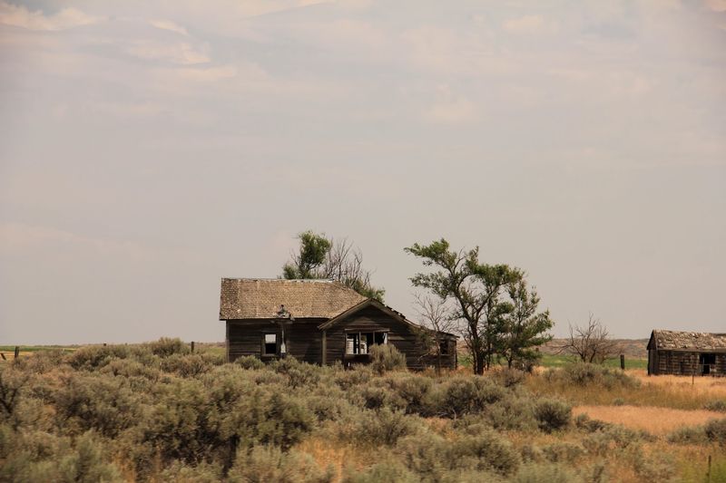
The destination starts testing your attention before the trail begins.
From U.S. Highway 2, the route passes through open farm country and onto gravel roads near the small community of Govan. The turns are straightforward when you follow the official directions, but the isolation makes guessing a poor navigation strategy.
BLM estimates the drive at roughly one and a half to two hours from Spokane. That distance helps explain why the site stays quieter than better-known scabland overlooks closer to major highways.
Once parked, the contrast becomes almost comic. You invested real road time for a walk shorter than many grocery-store aisles, yet the scale surrounding that walk makes the equation work.
The site also belongs to the Ice Age Floods National Geologic Trail, a network connecting landscapes shaped by the same extraordinary events across Montana, Idaho, Washington, and Oregon.
Govan provides one compact chapter without the crowds or infrastructure of a major landmark.
Treat the return trip as part of the outing rather than dead time. The gravel road requires steady speed, attention at bends, and enough daylight to make rural navigation less inventive.
Leave time for the drive back and avoid rushing the gravel. Dust, wildlife, and blind bends have no interest in your dinner reservation.
You came looking for another planet, but the road simply removed the gift shop.