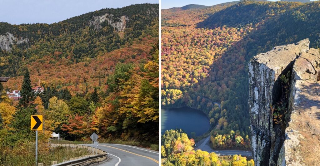
Route 26 briefly forgets that roads are supposed to have breathing room.
The cliffs move in. The pavement keeps going anyway.
That little squeeze through New Hampshire’s Great North Woods is only the opening scene.
Pull over and the landscape starts offering side quests. A waterfall can be almost ridiculously close to the road. Higher trails trade convenience for bigger views over the notch.
You do not have to turn the stop into an all-day hike either.
Take the quick look. Stretch it into a walk. Or climb until the road below starts looking suspiciously tiny.
Just do yourself one favor.
Save the serious staring for the pull-off.
The cliffs will still be there when you find somewhere safe to stare.
Route 26 Threads Straight Through The Notch
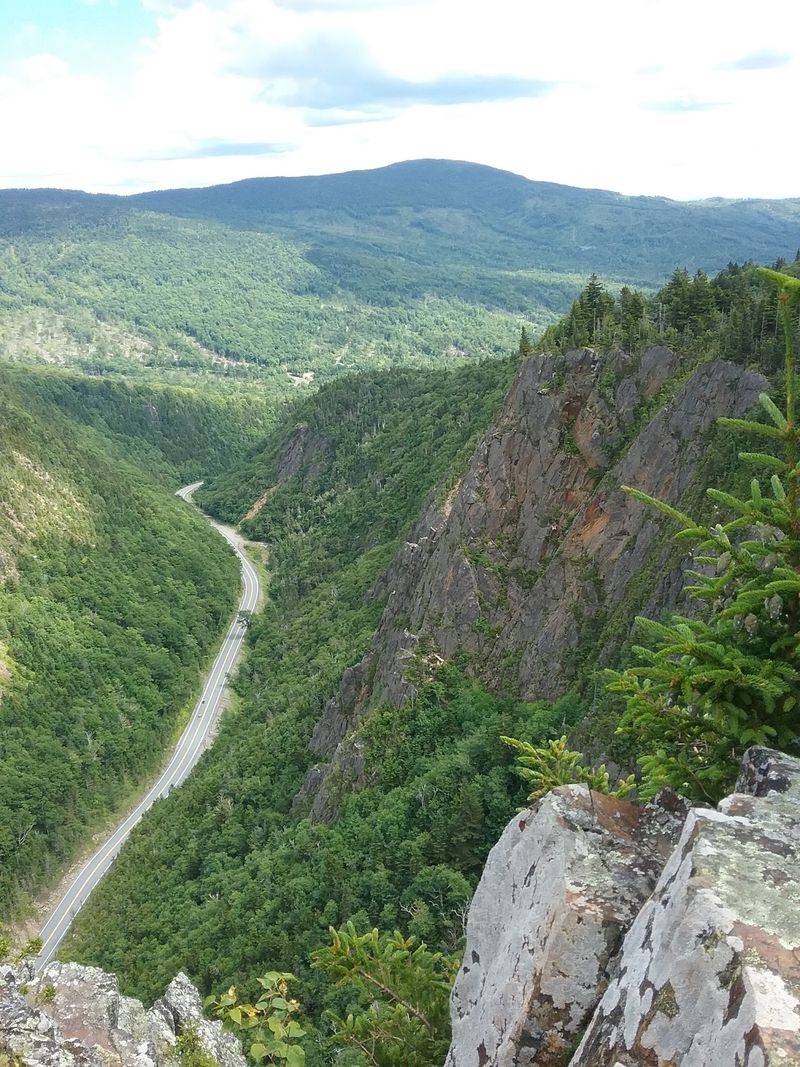
New Hampshire Route 26 runs directly through Dixville Notch, placing drivers inside the landscape instead of simply giving them a distant view.
The road curves through a compact mountain pass with cliffs rising close to the pavement and forest filling the slopes above them. In autumn, bright foliage wraps around exposed rock, while spring and summer trade the reds and oranges for layers of green.
The drive itself is short, so it is easy to pass through without realizing how much is tucked beside the road. Slow down, watch the curves, and use designated parking areas if you want time to look around.
This stretch of Route 26 is part of a larger scenic drive through New Hampshire’s Great North Woods. State tourism routes often pair Dixville Notch with Colebrook, Pittsburg, and other northern stops, making the pass an easy addition to a longer day on the road.
The scenery changes quickly as you enter and leave the gorge. One moment the road feels enclosed by rock and trees. A few bends later, the view opens toward Lake Gloriette and the surrounding mountains.
You get the tight mountain pass first, then broader views soon after. It is a quick change in scenery over a relatively short distance.
The Park Fits A Lot Into 127 Acres
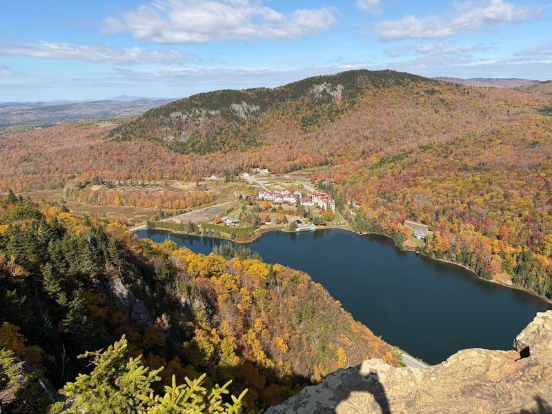
Dixville Notch State Park is small by acreage, but the terrain gives you several different ways to explore it.
New Hampshire State Parks puts the park at 127 acres and highlights the scenic gorge, waterfalls on two mountain brooks, and hiking routes toward Table Rock and nearby mountains.
You can keep the visit simple and stop for a roadside waterfall, or turn it into a half-day hike.
The trails range from moderate to more difficult. Roots, rocks, steep grades, and exposed ledges all show up depending on the route, so this is not the place to assume a short trail automatically means an easy one.
Pets are permitted in the park, subject to New Hampshire State Parks rules. Carry-in, carry-out practices also apply, so anything you bring should leave with you.
Off-season visits require more self-reliance. The park is typically unstaffed then, and comfort stations are not available. If snow, ice, or mud is possible, bring the footwear and traction that match the conditions.
You can decide how much effort you want once you arrive. The roadside stops take little time, while the steeper trails demand more daylight and stronger footing.
Table Rock Looks Down Over The Entire Notch
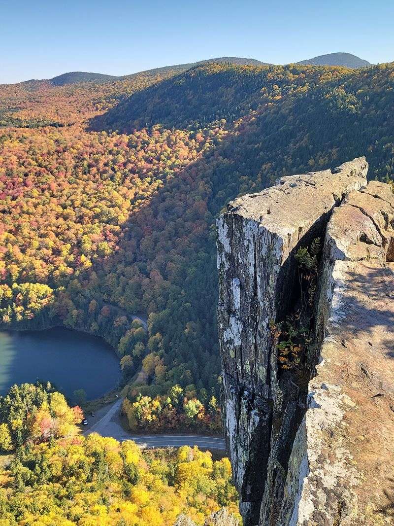
Table Rock is the hike that puts Route 26 into perspective.
The trail climbs to an exposed overlook above Dixville Notch, with views toward Lake Gloriette, the surrounding cliffs, and the road far below. From up high, the highway looks much smaller than it does behind the windshield.
New Hampshire State Parks estimates about 75 minutes for the Table Rock hike and describes the route as steep but manageable at a moderate pace with proper footwear.
The climb may be relatively short, but the elevation gain comes quickly. Mud, loose footing, and wet rock can make the ascent and descent more demanding after rain.
The top deserves even more attention. Table Rock has exposed edges, so keep a comfortable distance from drop-offs and save any photo experiments for stable ground.
If you want a harder outing, Sanguinary Ledge Trail takes roughly 2.5 hours and passes five overlooks along the way.
Choose based on time, weather, and how your legs feel that day. There is no prize for turning a scenic stop into a rushed climb.
Give yourself enough daylight to climb and descend without hurrying. Steep terrain gets less forgiving when tired legs and fading light arrive together.
Baby Flume Is Less Than A Tenth Of A Mile From Parking
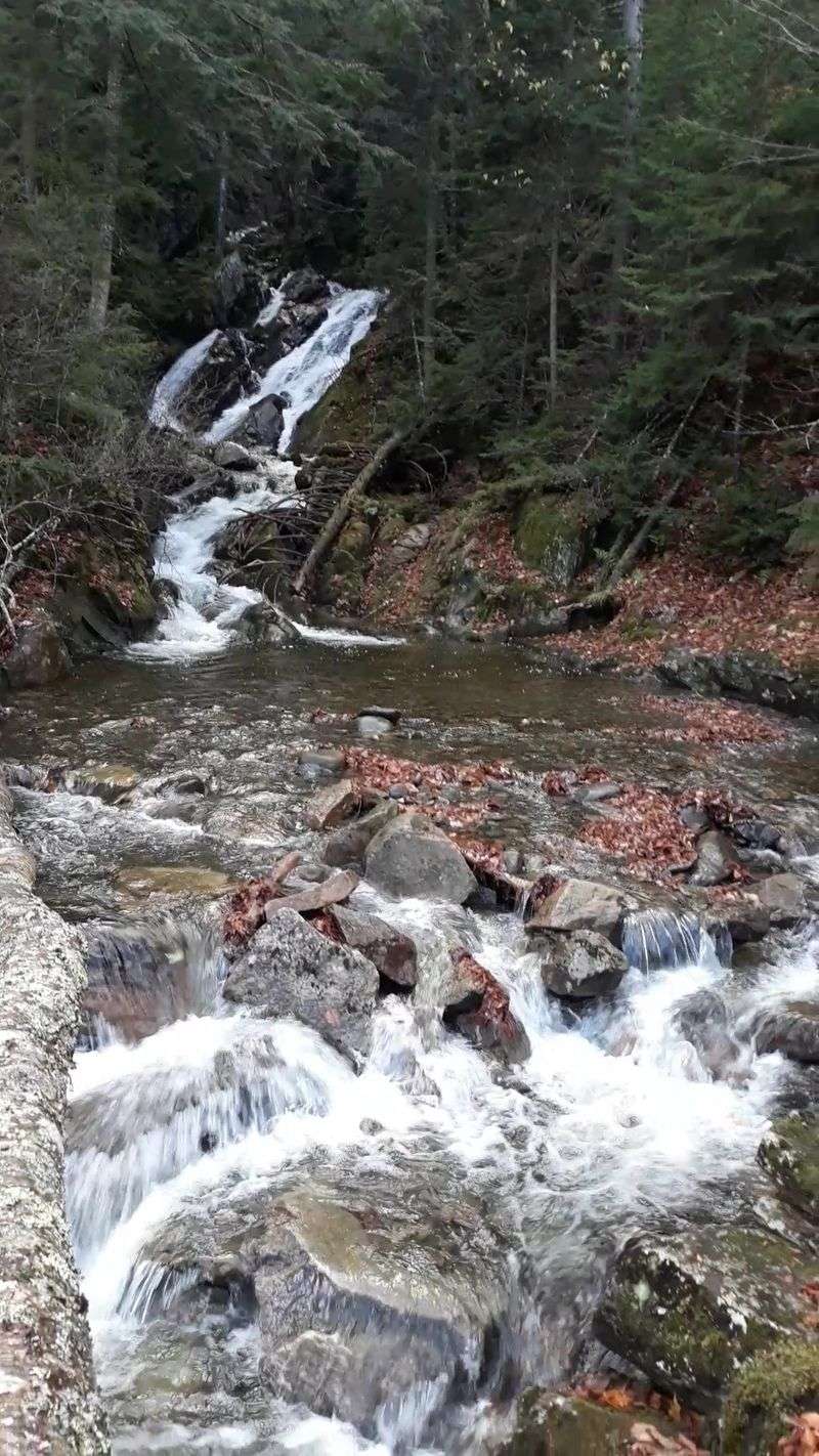
Not every waterfall here requires a steep hike.
Baby Flume, also called Dixville Flume or Flume Brook Cascade, sits less than a tenth of a mile from roadside parking. That makes it one of the easiest ways to leave the car and see a little more of the park.
The gorge was carved by Flume Brook, and the waterfall drops about 18 feet across three separate drops. Smaller cascades and a pool continue downstream.
Because the walk is so short, Baby Flume is a practical choice if you are passing through with limited time or if the bigger climbs are not part of the plan.
Spring runoff can give the brook more energy, while later-season water levels vary with recent conditions. Either way, wet rock deserves respect. Stay on stable footing and avoid treating the streambed like a shortcut.
Another waterfall option is Huntington Cascades. A short walk reaches the lower falls, and continuing farther brings you to the upper falls.
That gives you an easy way to add moving water to the visit without turning the stop into a full hike.
The Harder Trails Demand Better Footing And More Time
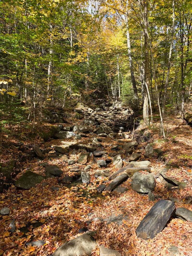
The cliffs that make Dixville Notch dramatic also create the park’s steeper hiking terrain.
New Hampshire State Parks classifies hikes here from moderate to more difficult. That range matters because a route can become much harder when roots are wet, rocks are slick, or leaves hide uneven ground.
Sturdy hiking shoes are the easiest upgrade you can make. They help on climbs, descents, muddy sections, and the rocky footing around overlooks and waterfalls.
A downloaded trail map is useful too. Cell service can be unreliable in remote parts of northern New Hampshire, so do not build the whole plan around having a strong signal.
Weather can shift quickly in the mountains. Fog may erase a view, rain can change footing within minutes, and colder months can bring ice well before lower elevations look wintry.
Start longer hikes with more daylight than you think you need. Sanguinary Ledge takes considerably more time than a quick Table Rock climb, and both deserve enough margin for slow footing.
If the group includes younger children or anyone uncomfortable with steep edges, the short waterfall walks may be the better choice.
The Park Address Sits Right On Route 26
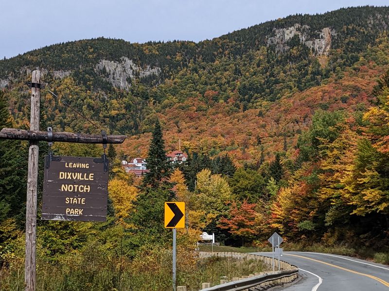
Dixville Notch State Park is at 1212 West Route 26, Dixville, NH 03576.
The location makes the park easy to fold into a drive across northern New Hampshire because Route 26 passes directly through the notch.
The park is always open for recreation unless closed or restricted by posting. During the off-season it is generally unstaffed, and comfort stations are not available, so plan as though you will need to handle the basics yourself.
Bring water, snacks, extra layers, and anything you need for the trail you choose. Carry your trash out with you.
Parking is available near trail and waterfall access points, but spaces can fill during popular foliage periods. If a lot is full, continue safely rather than creating a roadside parking problem.
Pets are allowed, though park rules still apply. Drone use is restricted across New Hampshire State Parks, and operators cannot take off or land within park boundaries.
A little preparation keeps the day simple: fuel up before heading deep into the Great North Woods, download directions, and arrive with enough daylight for whatever hike you picked.
Fall Color Arrives Early In Northern New Hampshire
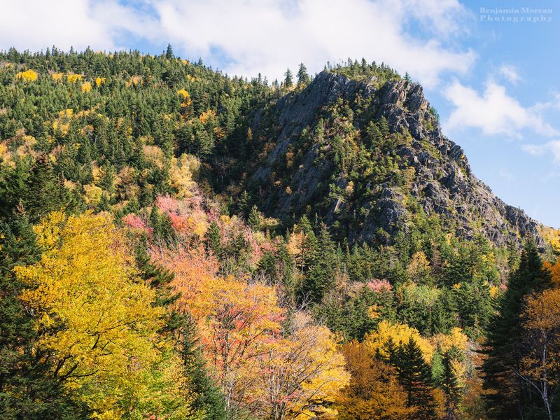
Northern New Hampshire typically enters the foliage cycle earlier than southern parts of the state, though exact timing changes every year with weather and growing conditions.
That makes late September and early October especially interesting for road trips through the Great North Woods.
Route 26 can deliver plenty of scenery without a hike. The road passes through the gorge, then opens toward broader mountain and lake views as you continue through the region.
If you do stop, autumn adds another layer to Table Rock, Baby Flume, and the surrounding cliffs. Bright hardwoods break up the gray rock, while evergreens keep patches of deep green in the mix.
Earlier in the day can be useful when foliage season brings more traffic. It also gives you more daylight if a quick photo stop turns into a trail.
Do not count on a specific peak-color date months in advance. Check current foliage reports and weather before the drive, then keep the route flexible.
That approach leaves you several options. You can drive through, stop for a waterfall, climb to an overlook, or combine all three.
Route 26 may be the reason you notice Dixville Notch in the first place. The cliffs, trails, and moving water give you several reasons to turn the engine off for a while.