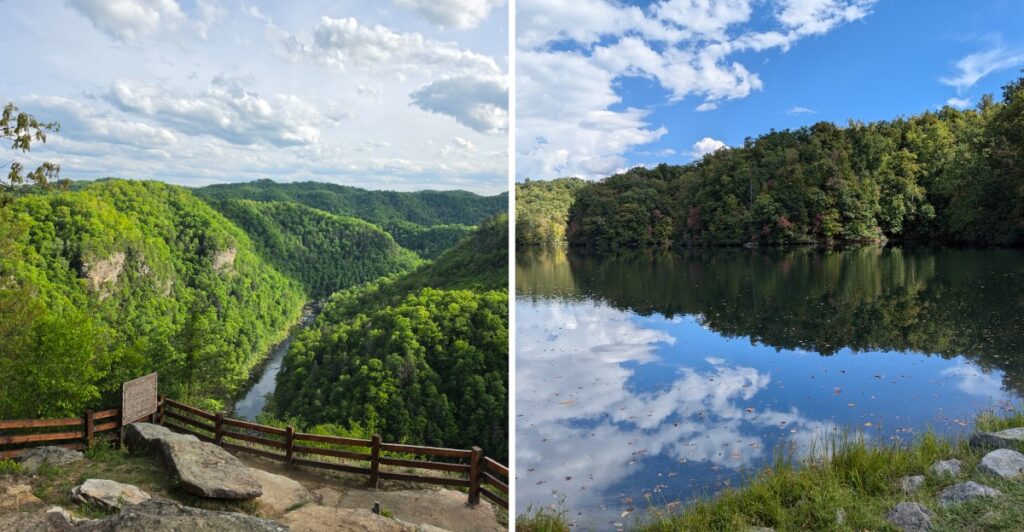
Think canyons need red rock and desert heat?
Try dropping 1,600 feet into Appalachian green instead.
A river cuts through Pine Mountain for more than five miles, leaving a gorge roughly 1,600 feet deep. Sandstone cliffs rise through the trees, and overlooks put you high enough above the water to understand the scale very quickly.
Then comes another twist.
The park sits right on the Virginia-Kentucky line, with both states sharing the job of managing it.
You can keep the visit easy with overlooks and shorter walks, or give the landscape more of your day.
The gates stay open year-round unless weather forces a closure, so every season gets its own version of the gorge.
Turns out, a canyon can skip the desert entirely and still make you stare.
The Gorge Stretches More Than Five Miles Through Pine Mountain
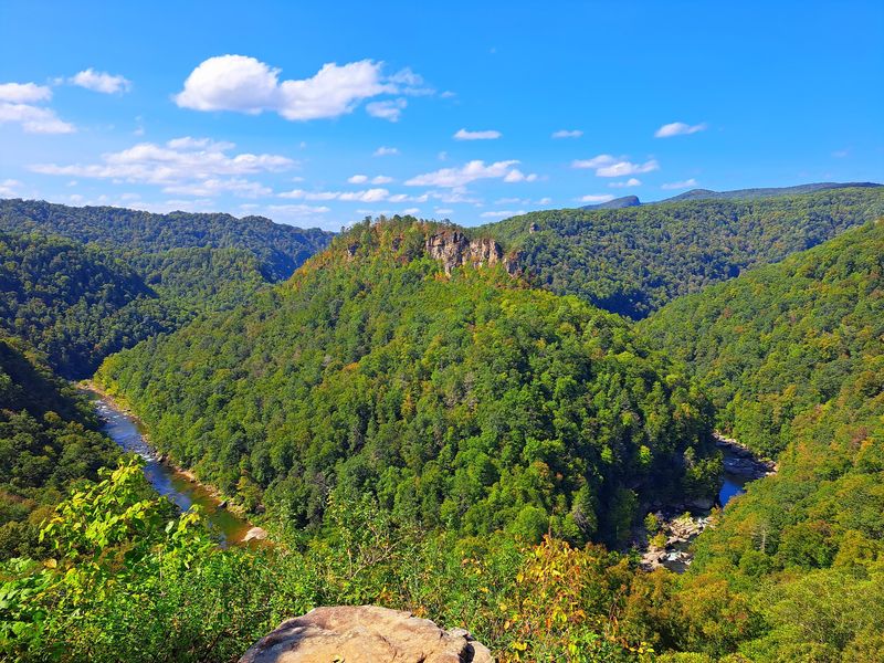
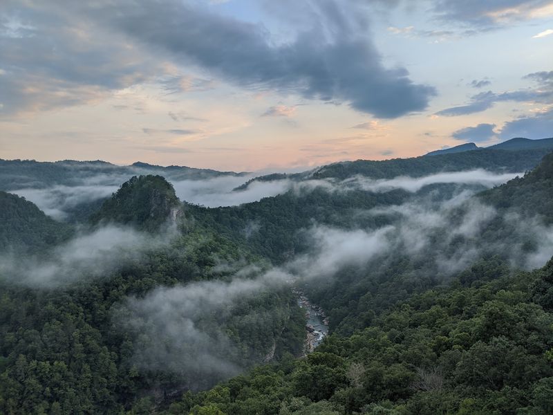
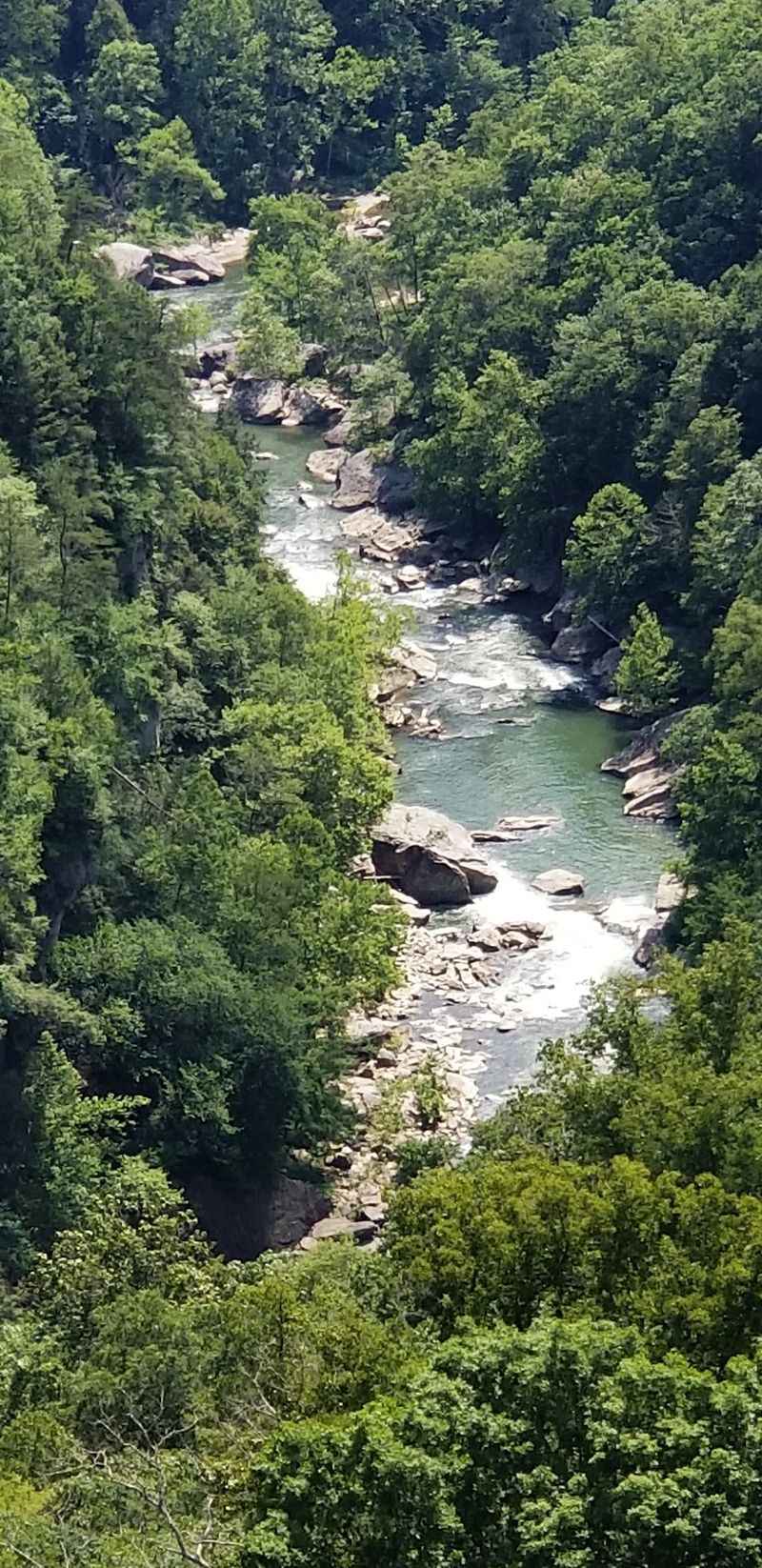
The Russell Fork created the feature that defines the park. As the river cut through Pine Mountain, it formed a gorge that stretches more than five miles and reaches about 1,600 feet at its deepest point.
That depth changes the way the landscape reads from above. The river can look narrow from the rim, while opposite slopes rise in layers of forest and exposed rock.
Instead of one single viewpoint showing the entire canyon, different overlooks reveal separate bends, cliffs, and formations.
The name Breaks comes from the break in Pine Mountain created by the river. That makes the landscape itself part of the park’s identity rather than simply scenery around a recreation area.
For a first visit, resist the urge to stop at one overlook and call the canyon seen. A short drive or walk to another viewpoint can completely change the angle. One stop may emphasize the river, while another puts the rock formations or depth of the gorge in front of you.
Morning fog can also change the view. If the canyon is partly hidden when you arrive, give the weather a little time before moving on. The scene can look very different once the clouds begin lifting.
Virginia And Kentucky Have Managed The Park Together Since 1954
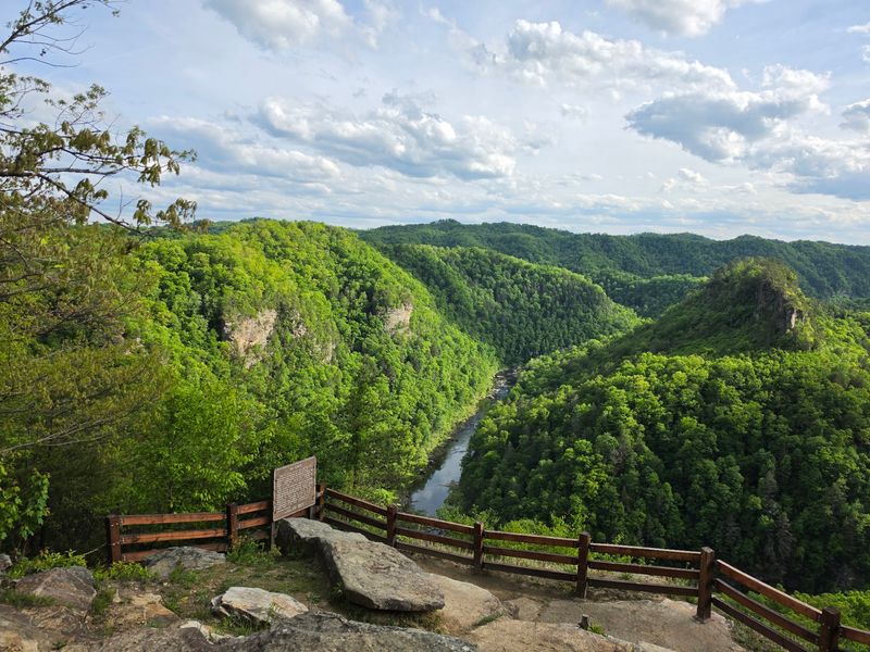
Breaks is unusual for another reason. It is one of only two interstate parks in the United States, with Virginia and Kentucky sharing responsibility for the land.
The Breaks Interstate Park Commission was formed in 1954 after the legislatures of both states approved the Breaks Interstate Park Compact. The commission includes representatives from Virginia and Kentucky and continues to oversee the park.
That cross-border arrangement makes the park feel a little different from a standard state park. You can move through a single recreation area while the landscape, trails, roads, and river sit along a state boundary.
The park covers roughly 4,500 acres of Appalachian terrain. Hiking paths, lodging, camping, fishing areas, picnic spots, overlooks, and visitor facilities are spread across that larger setting, so it helps to decide what kind of day you want before trying to cover everything.
If views are the priority, build around the rim and overlook areas. If hiking matters more, choose a trail first and let the overlooks become part of the route.
Staying overnight gives you even more flexibility, especially when morning fog or changing weather alters the canyon view.
Overlook Trail Connects Two Scenic Viewpoints
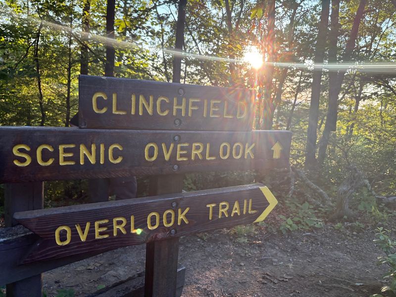
The Overlook Trail gives you one of the simplest ways to combine hiking with canyon views. The trail runs 0.75 mile between the Clinchfield and Stateline overlooks, making it 1.5 miles out and back.
It is rated easy, but the setting still deserves attention. Parts of the route follow the rim near cliffs, and not every section has protective railing. Good shoes and a little patience matter more than speed.
The trail works well when you want more than a quick roadside stop without committing to a long hike. Starting at one overlook, walking the trail, and returning gives you several changing perspectives without using most of the day.
Light can make the same view look different within a few hours. Earlier in the morning, fog may still sit low in the gorge. Later, shadows can sharpen the edges of the slopes and rock formations.
If the group has mixed energy levels, one person can enjoy the overlook while others add the walk. That makes this part of the park easier to fit into a family day than a route that requires everyone to tackle the same distance.
Take your time near exposed edges and stay focused on footing. The canyon does not need a risky photo angle to look impressive.
The Main Park Address Sits On The Virginia Side
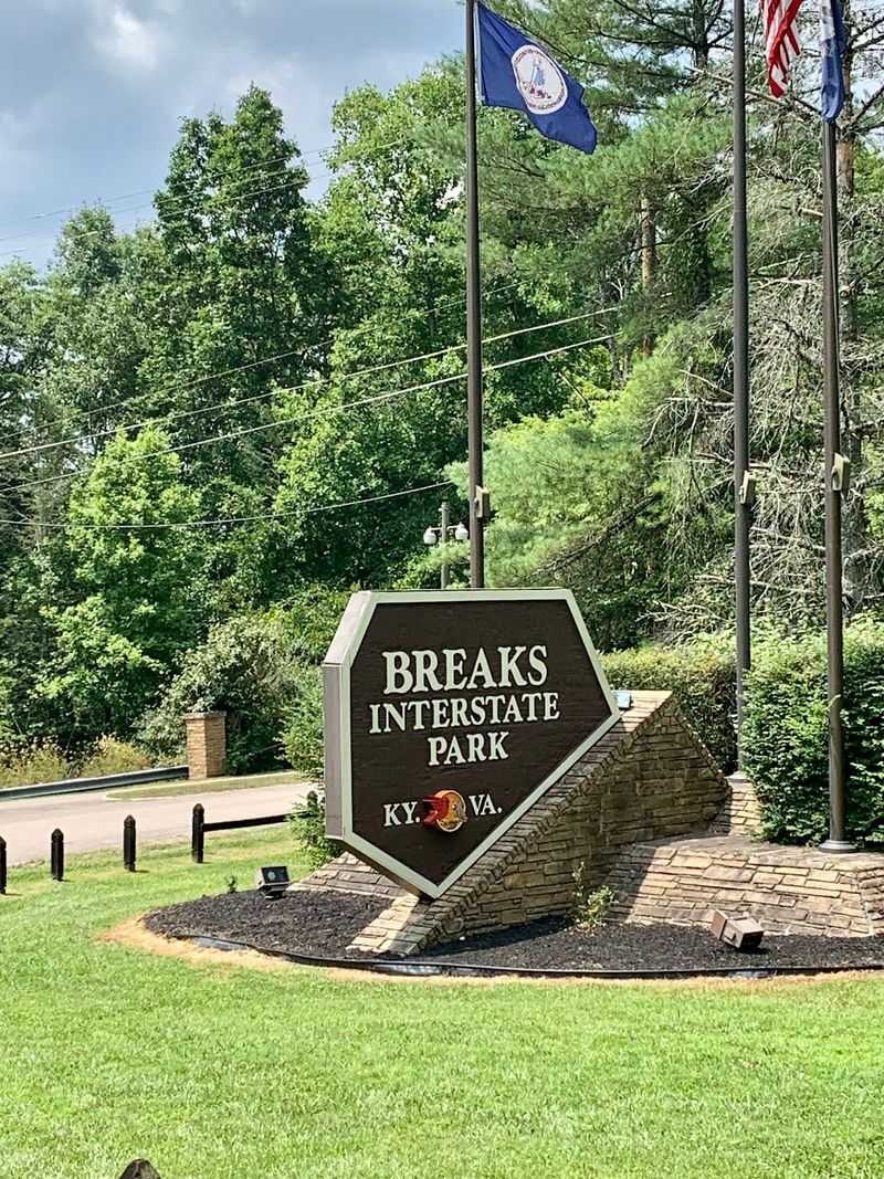
Breaks Interstate Park is in a mountainous and relatively remote part of Southwest Virginia, so the drive deserves a little planning. Roads approaching the park can be narrow, curving, and steep in places.
The main park address is 627 Commission Circle, Breaks, VA 24607. Arriving before dark is especially useful if it is your first trip, since mountain roads are easier to navigate when you can clearly see the turns and surrounding terrain.
Once inside, a map can help separate the overlook areas, hiking routes, lodging, campgrounds, lake, and river access points. The park is large enough that wandering without a plan can eat into the time you meant to spend outside the car.
The visitor center is useful for trail and overlook information and also includes historical and cultural exhibits. Its schedule changes during the year, so it should not be treated as a year-round, all-day facility even though the park itself remains open through the seasons.
The park gates are open all year except during certain inclement weather events. That distinction matters in winter, when a year-round park can still face temporary weather-related closures.
Check conditions, choose a first stop, and let the rest of the route follow from there.
Short Walks And Longer Trails Reach Very Different Terrain
The trail system covers more than scenic rim walks. Routes move through hardwood forest, rhododendron, creek valleys, sandstone formations, and down toward the Russell Fork.
Laurel Branch Trail is an easier option. It runs 0.75 mile from Laurel Lake toward the Prospector Trail, or 1.5 miles out and back, following a mountain stream through rhododendron and hemlock.
Along the way, it reaches a small rock feature called the Notches.
Camp Branch Historical Trail goes in a very different direction. The full route is about 3.5 miles and ranges from moderate to difficult, with sections that descend toward the Russell Fork and pass remnants tied to the area’s logging history.
Those differences make choosing by distance alone a mistake. A short rim walk and a longer descent toward the river can demand very different levels of comfort with steep terrain.
Start with the trail description, not just the mileage. If your group wants an easy walk with scenery, choose accordingly. If a tougher climb back from the river sounds appealing, save enough time and energy for the return.
Water, sturdy shoes, and a park map are simple additions that make the hiking day easier.
Laurel Lake Offers A Calmer Water Option
The Russell Fork is the force that shaped the gorge, but it is not the place for a casual float. Within the park, sections of the river include highly technical whitewater, and the gorge section is intended only for experienced whitewater paddlers.
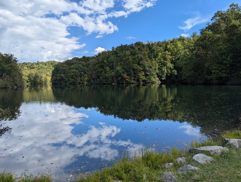
Laurel Lake provides a much calmer alternative. The small lake sits inside the main park and supports boating and fishing without the same whitewater demands.
That contrast is useful when a group wants time on the water without making the river itself the adventure. A lake stop can follow a morning at the overlooks or give tired legs a break after a trail.
Fishing is also part of the park experience, though the Russell Fork requires more planning because state licensing rules differ depending on which side of the canyon you use. Laurel Lake keeps that part simpler for visitors staying within the main park.
If the river interests you, enjoy it from established overlooks or access areas unless you already have the skill and preparation required for technical whitewater. The gorge looks calm from far above, but the water below can be powerful and complex.
Sometimes the better choice is letting the river provide the scenery while the lake handles the slower afternoon.
Year-Round Access Makes The Canyon A Four-Season Trip
The park gates stay open throughout the year, although severe weather can cause temporary closures. That gives the gorge a different character depending on when you visit.
Summer fills the slopes with dense green. Fall brings changing foliage across the canyon walls. Winter opens more views through bare trees, while spring gradually brings color back to the forest.
Overnight options also extend beyond the warmest months. Motel rooms, cottages, and cabins are available year-round. Most campground areas operate seasonally, while Campground D and the yurt remain available during the off-season.
That makes a return trip easy to justify without pretending every season offers the same experience. A fall visit may be about color and cool hiking weather. Winter can put more emphasis on rock formations and lodge stays.
Summer leaves more daylight for trails, lake time, and longer outdoor days.
The visitor center, restaurant, campground store, and other facilities follow their own seasonal schedules, so check those pieces separately from the park gates.
Breaks work best when you choose one or two priorities instead of trying to collect every overlook, trail, and activity in a single visit. Start with the gorge, leave room for the weather to change the plan, and let the rest of the park fill in the day.