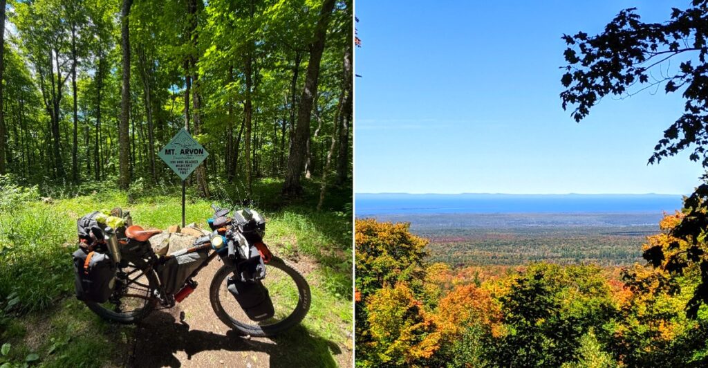
A 1982 government survey crowned this peak the winner by about 11 inches. That tiny margin still sparks friendly arguments today.
The summit sits deep in timber country in Michigan’s Upper Peninsula. A blue mailbox waits at the top with a logbook inside. Blue diamond signs guide drivers along rugged logging roads to reach it.
The journey feels like a scavenger hunt with a prize at the end. GPS often gives up out there, so the signs become your best friend. You won’t find a gift shop, a snack bar, or even a restroom.
I believe that’s exactly the charm. A newer survey has even reopened the debate over which nearby hill truly stands tallest. How does a peak stay famous when its crown keeps wobbling?
Follow The Blue Diamonds Like A Trail Of Breadcrumbs
Forget trusting your phone on this one. Out past L’Anse, GPS and Google Maps often send drivers down roads that barely exist.
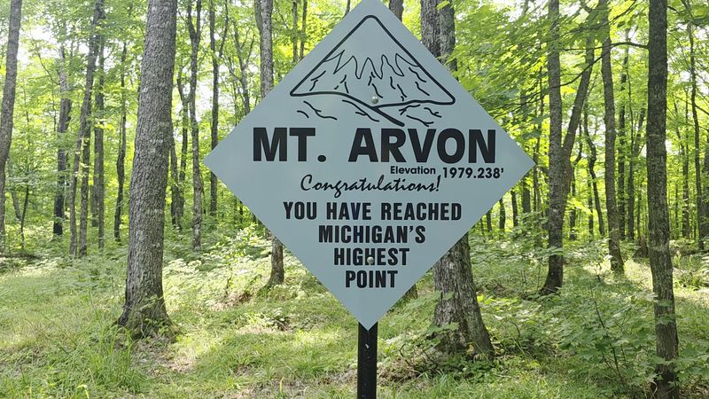
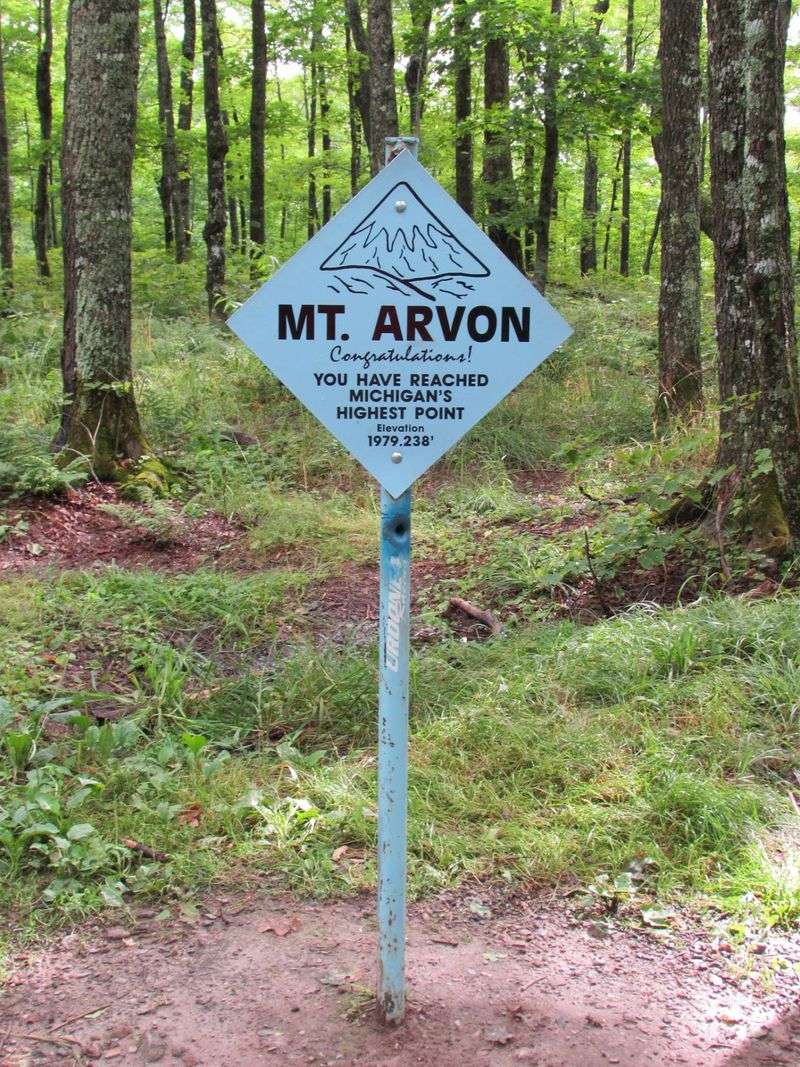
Luckily, blue diamond-shaped signs mark the way to Mount Arvon roughly every mile. They lead you along the logging roads all the way to the summit area. Think of them as friendly little guides nailed to the trees.
Most people start in the village of L’Anse. Main Street turns into Skanee Road, and from there you head onto Roland Lake Road. That road connects toward Ravine River Road and the marked forest routes beyond.
The summit sits about 26 to 27 driving miles east of L’Anse. That might not sound far. On narrow gravel, though, it takes patience.
Download offline maps before you leave town, since cell service fades fast in the woods. The Baraga County Convention and Visitors Bureau in L’Anse can also share detailed directions. It’s located at 755 East Broad Street, L’Anse, MI 49946.
One more tip worth tucking away. Pay attention on the way in, because the return trip can feel different heading the other direction.
Follow The Blue Signs Into The Huron Mountains
Mount Arvon lies in the Huron Mountains of Michigan’s Upper Peninsula, approximately 27 driving miles from L’Anse. Begin with the Baraga County tourism authority’s detailed route from L’Anse.
Turn onto Roland Road and follow the blue Mount Arvon signs through the network of forest roads. These remote roads are the key to reaching the summit area.
Use the designated parking area below the summit and continue along the marked approach. Check road conditions before attempting the drive, especially in winter.
Your Car Will Want A Pep Talk Before This Drive
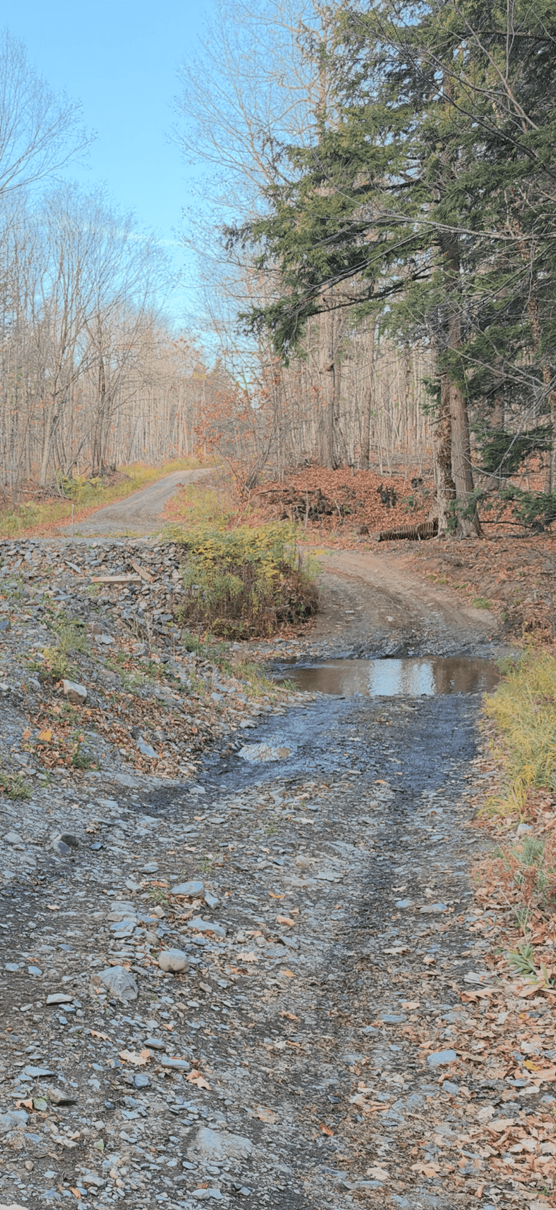
Rough roads are part of the deal here. The route to Mount Arvon follows remote, unpaved logging roads that can turn steep and bumpy.
A high-clearance or four-wheel-drive vehicle is strongly recommended. That’s especially true after rain, when mud can make things tricky for regular cars. Some stretches include small stream crossings, so a low sedan may struggle.
Roads have improved a lot over the years. Crews have done better grading, and a parking lot near the top was added in 2012. Still, conditions change with weather and seasons.
Remember that these are working timberlands. Logging operations can be active, so yield to timber trucks whenever you meet one. They were here first, after all.
Take it slow and give yourself plenty of time. Rushing on gravel is never a winning plan.
It also helps to pack a basic emergency kit. A spare tire, water, snacks, and a paper map can make a big difference in a remote area. Being prepared turns a bumpy ride into a fun adventure instead of a stressful one. Your vehicle will thank you later.
Sign Your Name In The Mailbox Everyone Talks About
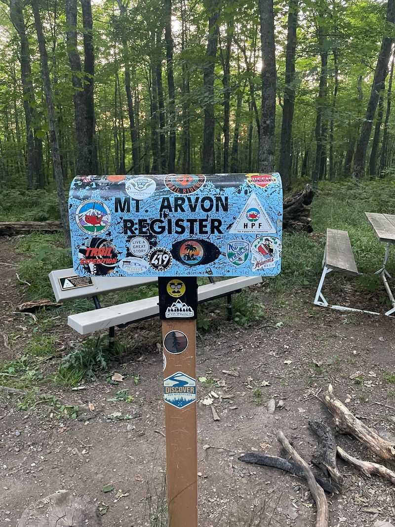
Who knew a mailbox could feel this exciting? At the summit of Mount Arvon, a blue mailbox holds a logbook where visitors sign their names.
It’s a small thing, but it feels like joining a club. You add your name to a long list of folks who made the same trip. Bring a pen just in case, because nobody wants to miss this moment.
Nearby, you’ll spot a sign confirming this is Michigan’s highest point. There’s also a USGS survey benchmark set into the ground. Those markers make perfect photo backdrops for proving you made it.
Here’s a fun detail. An archive of past logbooks is kept at the Baraga County Convention and Visitors Bureau in L’Anse. So your scribble could become part of local records one day.
High-pointers, people who try to reach the top of every state, treat this stop as a must. Even if you aren’t chasing all fifty, signing in still feels great.
I can’t imagine skipping it. Write something clever, add the date, and snap a picture with the sign before heading off.
The Overlook Steals The Show From The Actual Summit
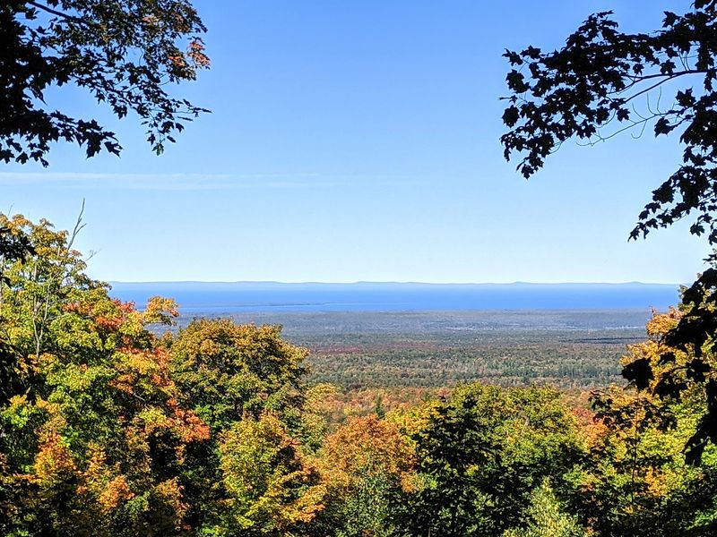
The true top of Mount Arvon is wooded. Trees block most of the view right at the peak, which surprises some first-timers.
Don’t worry, though. An overlook created in 2008 sits a short walk from the summit. From there, the scenery opens up in a big way.
On a clear day, you can see Lake Superior stretching toward the horizon. The Huron Islands, Point Abbaye, and Keweenaw Bay also come into view. That’s a lot of blue and green packed into one spot.
Haze can soften the view, so timing matters. A bright, clear day gives you the best shot at seeing far across the water.
The overlook is close enough that skipping it would be a real shame. Plan a few extra minutes to soak it all in. Bring binoculars if you own a pair.
I like that the reward comes in two parts. First you tag the highest point, then you get the big view as a bonus. It’s like finishing a test and finding out recess runs long. Not a bad trade for a little extra walking.
Pick Your Hike: Quick Stroll Or Longer Trek
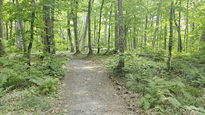
Good news for tired legs. From the main parking area, the walk to the summit of Mount Arvon is short and fairly level.
Distances vary depending on where you park, but it’s usually just a few hundred feet. Most visitors can handle it without much trouble. That makes it one of the easier state high points to reach on foot.
Craving more of a workout? The optional Mount Arvon Trail offers a longer hike. It runs about 1.75 to 2 miles one way, or roughly 3.6 miles round-trip.
The longer trail has rugged sections and small stream crossings. Rocks or logs often help you step across. Wear sturdy shoes that can handle a little mud and water.
Pets and kids may find some parts steep, so plan accordingly. Taking breaks is never a bad idea out here.
Either way, you’ll be surrounded by thick Upper Peninsula forest. The trail gives you time to notice the trees, the quiet, and the fresh air. Choose the short walk for an easy win, or the long one for bragging rights. Both lead to the same proud finish.
Pack A Lunch Because The Summit Has A Picnic Spot
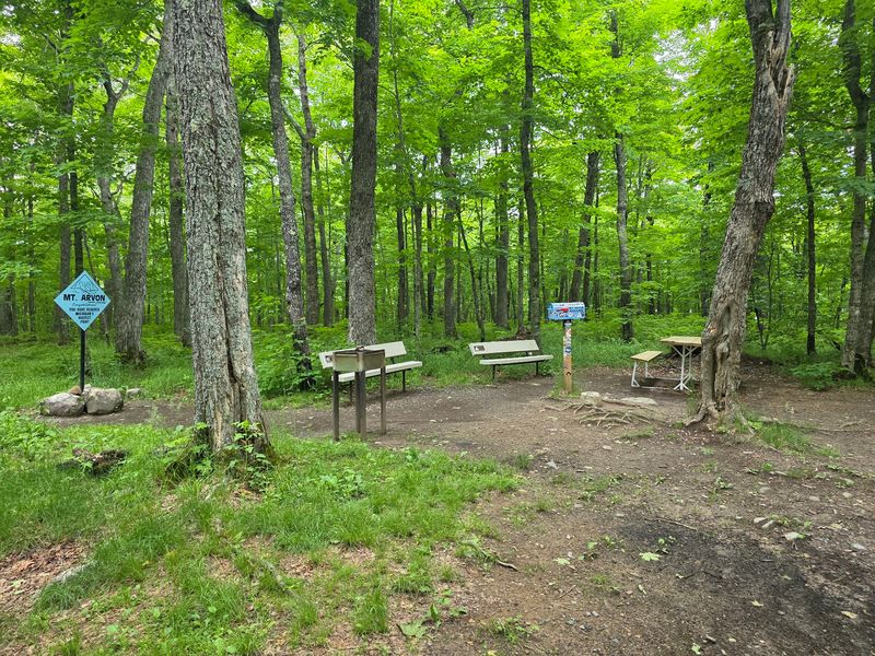
Lunch with a record-breaking address sounds pretty fun. The Mount Arvon summit area includes a picnic table and benches for day visitors.
There’s also a fire pit and grill for daytime use. Bring hot dogs, sandwiches, or whatever travels well in a cooler. Eating at the top of Michigan gives any snack an upgrade.
Now for the important part. There are no restrooms, no water, and no other services at the summit. The long dirt roads leading in don’t have any either.
So plan ahead in L’Anse before you leave pavement behind. Fill water bottles, grab food, and use restrooms in town. Future you will be grateful.
Camping is not allowed at Mount Arvon, so this is strictly a day trip. If you want to sleep outdoors, Baraga State Park is a nearby option. Other Upper Peninsula campgrounds work too.
Pack out everything you bring in. The land is privately owned, and keeping it clean helps keep it open. A tidy picnic is the best way to say thanks for the generous access.
A Timber Company Owns It, And Everyone Is Welcome
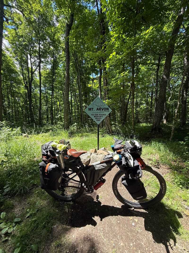
Here’s a twist many folks don’t expect. Mount Arvon sits on private land owned by Weyerhaeuser, a timber company.
Even so, the public can visit year-round. Access to the peak and its roads is free, and no permits are required. That’s a pretty generous setup for a working forest.
Earlier owners included Plum Creek and MeadWestvaco. Through those changes, the mountain stayed open for curious travelers. It’s become a shared treasure for Michigan.
Then came big news in 2026. A conservation easement now protects 73,000 acres of timberland in the Michigamme Highlands, including Mount Arvon. It promises public access and careful forest management going forward.
The long-term goal is for the area to grow into old-growth forest. Picture towering trees taking shape over many decades. Future visitors may see a very different summit than we do today.
I believe that’s one of the coolest parts of the story. A high point that keeps changing, both in height debates and in the forest around it. Respecting the land helps make sure that open-door policy sticks around for good.
Timing Your Visit Makes All The Difference
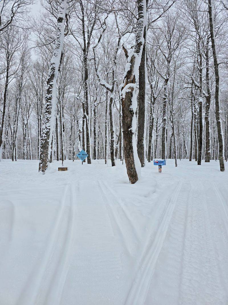
Snow changes everything up here. In winter, the roads to Mount Arvon are not plowed.
That means cold-season access happens only by snowmobile or snowshoes. Unless you’re well equipped for winter travel, it’s best to wait for warmer months.
The sweet spot runs from late spring to early fall, roughly May through October. Weather is milder, and roads are usually free of snow and ice. That’s when most cars have their best chance.
Still, check conditions before heading out from L’Anse. Rain can leave roads muddy, and spring thaw can make things messy. The visitors bureau in town is a smart first stop.
Fall brings a special bonus. Hardwoods across the Upper Peninsula turn bright colors, making the drive feel like a moving postcard. Summer offers long days and plenty of daylight for exploring.
Start early so you aren’t driving gravel roads after dark. Give yourself extra time for slow stretches and photo stops. Michigan’s highest point isn’t going anywhere, even if its title keeps people guessing. Pick your season wisely, and the trip will feel like a true Upper Peninsula win.