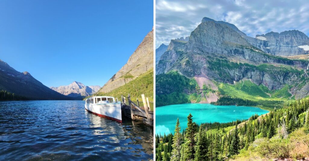
I am not going to pretend this is an easy stroll.
Your legs will notice.
But the trail keeps giving you little reasons to keep going. A lake drops farther below.
A waterfall shows up at exactly the right moment. Then the mountains open wider, and you start forgetting how much climbing you have already done.
Somewhere ahead, the ice is still holding on.
That matters here in Montana, where the glacier has been retreating for years, and the landscape keeps telling that story in real time.
You can shorten part of the route with a boat ride, but either way, this is the kind of day that deserves an early start and plenty of water.
Carry bear spray too.
Then keep moving.
If I am going to complain about sore legs, I at least want a view worth bragging about afterward.
Grinnell Glacier Has Been Retreating For Generations
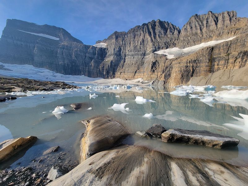
Glacier retreat in this part of Montana began around the end of the Little Ice Age in the mid-nineteenth century. Since then, Grinnell Glacier has become smaller and thinner as the balance between snowfall and melting has changed.
A glacier forms when snow survives from year to year, compresses into denser material, and eventually becomes moving ice. When melting removes more ice than new snowfall replaces, the glacier loses mass and its margins retreat.
Grinnell makes that process unusually easy to picture because the surrounding landscape preserves signs of where the ice once extended.
Today, water fills part of the basin below the glacier, while exposed rock marks areas that were once covered by ice. Salamander Glacier remains higher on the mountain wall above.
Do not treat the ice itself as a destination to walk onto or approach closely. The maintained trail leads to the viewpoint and surrounding basin, where steep terrain, loose rock, cold water, and changing ice conditions deserve plenty of respect.
Take time at the viewpoint instead. Look from the lake to the glacier and then up toward Salamander, and the scale of the landscape becomes much easier to understand.
Grinnell Lost Nearly Half Its Area In Several Decades
Between 1966 and 2015, Grinnell Glacier lost about 45 percent of its area.
That change was part of a park-wide pattern. Every named glacier measured in Glacier National Park became smaller during the same period, though the amount of loss varied from one glacier to another.
By 2015, 26 named glaciers still met the commonly used size threshold for active glaciers. Historical estimates indicate that the park contained many more glaciers around the end of the Little Ice Age.
The exact future of any individual glacier is harder to predict than a simple deadline suggests. Earlier projections sometimes attached specific disappearance dates to Glacier National Park’s ice, but those dates should not be treated as certainty.
For a hiker, the numbers work best as context rather than a reason to hurry recklessly up the trail.
Historical photographs and modern views make the change easier to see than statistics alone. If you pause at one of the broader overlooks, notice the exposed rock, the lake below, and the smaller bodies of ice separated across the basin.
The landscape is changing, but it is still a place to visit carefully rather than a countdown clock.
The Trail Climbs Through The Many Glacier Valley
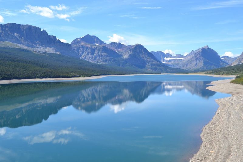
The route to Grinnell Glacier begins gently enough, following the Many Glacier valley past Swiftcurrent Lake and Lake Josephine before the major climbing begins.
Those first miles give you time to settle into the day. Forest, lakeshore, and mountain views alternate before the trail starts gaining elevation above Grinnell Lake.
Once the route climbs, shade becomes limited. The exposed sections open wide views across the valley, but they also leave hikers more exposed to sun, wind, and fast-changing mountain weather.
Carry layers even if the morning begins warm.
Wildlife is another reason to stay alert. Bears live throughout Glacier National Park, including the Many Glacier area. Carry bear spray where you can reach it quickly, make noise in places with limited visibility, and never approach wildlife for a photograph.
Mountain goats, bighorn sheep, deer, and other animals may also appear along or above the trail.
Give them space and let them choose where to move. A narrow trail is not the place to test which animal will step aside first.
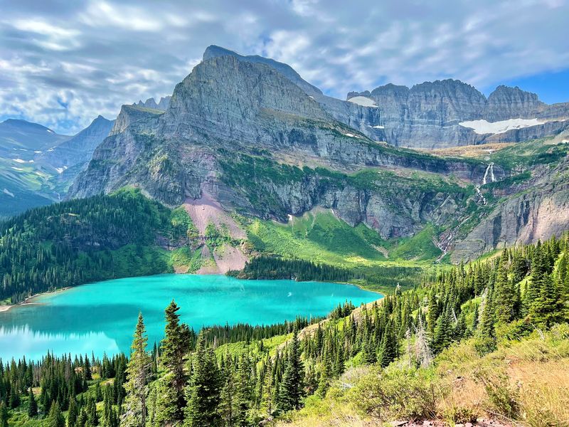
The higher you climb, the broader the valley becomes below you. Stop at safe spots for the view rather than trying to take photographs while walking near exposed edges.
About Five Miles Lead To The Grinnell Glacier Viewpoint
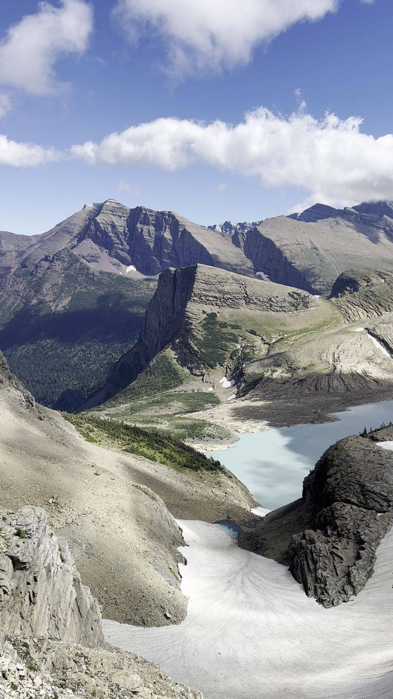
From the Grinnell Glacier Trailhead, the viewpoint is about five miles away one way.
The hike is considered challenging.
Expect roughly 1,600 feet of net elevation gain, with additional ups and downs adding to the work along the full route. That means the trail can feel harder than a single elevation number suggests.
The later miles bring most of the sustained climbing. Rocky trail, exposed sections, and elevation can slow the pace even for hikers who move quickly on flatter ground.
Build breaks into the day before you need them. Drink water regularly rather than waiting until the final climb, and keep enough food for the return trip.
The viewpoint sits near the glacier basin, with Grinnell Glacier, meltwater, cliffs, and Salamander Glacier all within the wider scene.
Stay on the established route and respect closures or posted warnings near the destination. Ice, rockfall, cold water, and unstable terrain can create hazards beyond the maintained trail.
Remember that reaching the viewpoint is only half the hike. Save enough energy and daylight for the return to Many Glacier.
Boat Rides Can Cut Several Miles From The Hike
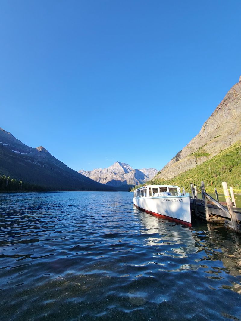
You do not have to walk every lakeside mile to reach the upper trail.
Seasonal concessioner boat tours leave from Many Glacier Hotel and cross Swiftcurrent Lake. After a short walk between the lakes, a second boat crosses Lake Josephine before hikers continue toward Grinnell Glacier.
Using the boats reduces the remaining hike to about 3.6 to 3.7 miles one way, depending on the route measurement used.
The shortcut saves distance, not difficulty.
Most of the serious elevation gain comes after the boat drop-off, so the steep mountain section still waits ahead. Treat the boat as a way to remove flatter approach miles rather than a way to make the upper trail easy.
Reservations are useful because summer departures can fill, and return boats operate on set schedules. Return seating may also be handled on a first-come basis, so know the day’s final departure before heading uphill.
One-way options can work if you want to walk the lakeshore in one direction and use the boat in the other.
Whichever version you choose, leave extra time. Mountain weather, wildlife, trail conditions, and your own pace can all change the schedule.
Salamander Glacier Sits Above Grinnell Glacier
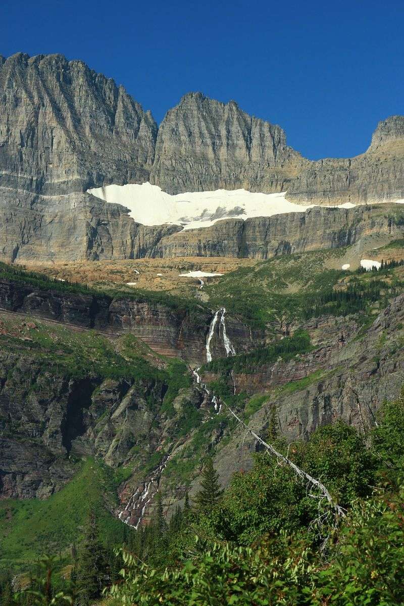
Look above Grinnell Glacier and another ribbon of ice appears along the mountain wall. That is Salamander Glacier.
The two were once connected as parts of a larger ice mass. As the glacier retreated, the connecting ice disappeared, separating Grinnell below from Salamander above.
The separation occurred during the twentieth century as retreat accelerated. What is now called Salamander was once the upper portion of the larger Grinnell system.
Seeing both from the basin helps make the history easier to picture.
Start with the lower glacier, then trace your eyes upward toward the ledge holding Salamander. Rock now fills the space where ice once connected the two.
You do not need to leave the trail to understand the change. The viewpoint already provides enough distance to compare ice, exposed cliff, and meltwater across the basin.
Bring binoculars if you want a closer visual look at the upper ice without trying to approach it.
This is also a good place to slow the pace after the climb. Eat a snack, add a layer if the wind has picked up, and give your legs a break before beginning the descent.
The return follows familiar ground, but tired legs make careful footing just as important on the way down.
What To Know Before Hiking To Grinnell Glacier
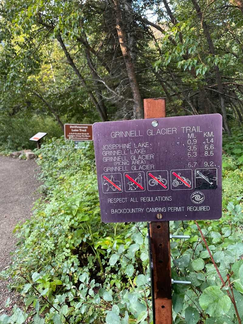
Grinnell Glacier is a strenuous mountain hike, and conditions can change significantly during the season. Snow may linger on higher sections into summer, while weather, wildlife activity, flooding, or trail damage can trigger temporary closures.
Check current trail and road conditions before driving into Many Glacier.
Start early enough to leave a generous daylight margin. Bring water, substantial snacks, sun protection, layers, sturdy footwear, and bear spray carried where it can be reached quickly.
Do not count on cell service for navigation or emergency information. Download maps and essential trip details before entering areas with limited coverage.
The Many Glacier area is reached from the east side of Glacier National Park near Babb. Route specifically to Many Glacier and the Grinnell Glacier Trailhead rather than relying on Glacier National Park’s administrative offices for navigation.
If you plan to use the boat shortcut, check the operating season and departure schedule separately before arriving.
Once you are on the trail, let pace rather than mileage control the day. Take breaks before fatigue builds, step carefully near exposed sections, and turn around if weather or trail conditions stop feeling safe.
The glacier viewpoint is worth reaching only when the return trip is still well within your time, energy, and daylight.