That tiny gap on the map?
Do not trust it.
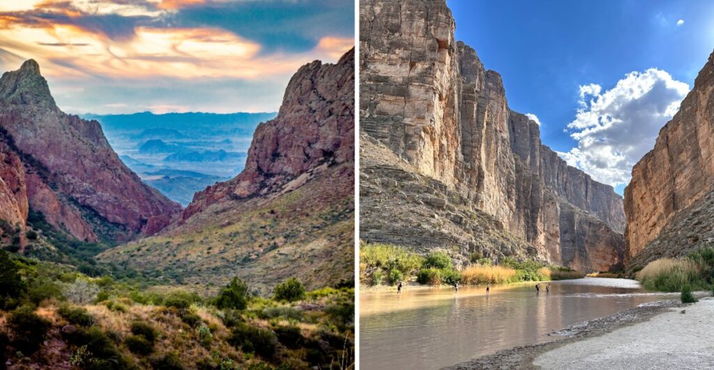
In West Texas, the next stop can be much farther away than it looks. The road stretches, the desert keeps going, and the mountains sit there pretending they are close.
They are not.
The river cuts through deep canyon country, while higher elevations bring cooler air and a completely different side of the landscape.
Trying to cram everything into one day gets ambitious fast.
The heat matters. So does the mileage.
I’d pick one direction and let the day belong to it.
Because when the distances are this big, even a quick detour can turn into a road trip of its own.
The Enormous Rio Grande Bend That Gave This Texas National Park Its Name
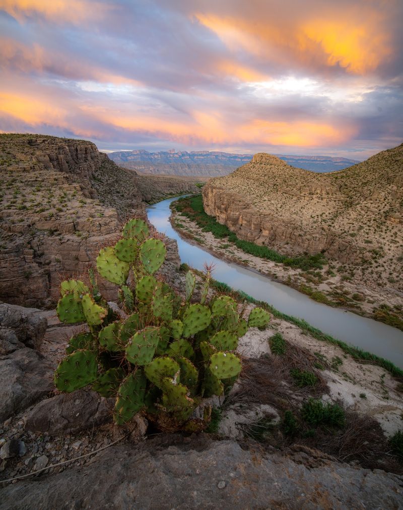
Pull out a map of Texas and look toward the state’s southwestern edge. The Rio Grande traces a broad bend around the region, forming the boundary between the United States and Mexico as it travels past the park.
Big Bend occupies a broad stretch of that curve in Brewster County.
The park was established in 1944 and now covers 801,163 acres. Its varied terrain includes the Chihuahuan Desert, the Chisos Mountains, and river corridors lined with vegetation. There is no single viewpoint where you can take in the entire bend at once.
Instead, the scale becomes clearer through a series of drives, overlooks, and hikes.
Choose a starting point before driving deep into the park. Panther Junction Visitor Center, near the central road junction, provides maps, information, and exhibits. It operates daily from 8:30 a.m. to 5 p.m., while the park entrances remain open around the clock.
Cell coverage is limited, and a route that looks short on a small map can involve a long drive. Download offline maps, top up the fuel tank, and carry drinking water before leaving the major approach roads.
For a first visit, concentrating on one part of the park can leave more time outside the vehicle.
Santa Elena Canyon’s 1,500-Foot Limestone Walls Tower Above The River
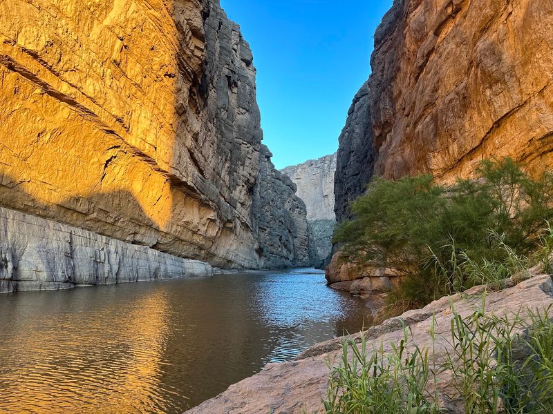
Tilt your head back at Santa Elena Canyon, where limestone walls reach roughly 1,500 feet above the Rio Grande.
One side of the canyon lies in Texas and the other in Mexico, with the river passing between them. From a distance, the entrance appears as a narrow opening in a high wall of stone.
The canyon is in the western portion of the park, beyond the Castolon area. Ross Maxwell Scenic Drive is the usual paved approach, but storm damage and roadwork can interrupt access.
In October 2026, the paved road between Cottonwood Campground and Santa Elena Canyon remains listed as closed.
Check road conditions before building the day around this stop, and do not drive past closure barriers.
When access is available, the canyon entrance and surrounding river landscape provide close views of the sheer cliffs. Sunlight reaches different sections of the rock as the day progresses, changing the contrast between bright walls and shaded water.
The river corridor is lower and often warmer than the mountain areas. Plan an early outing during hot weather, take more water than you expect to need, and keep a backup destination in mind if road or trail conditions prevent a visit.
A Winding International Border Through Texas’ Wild Desert Landscape
How often does a national park visit put an international boundary directly beside your walking route?
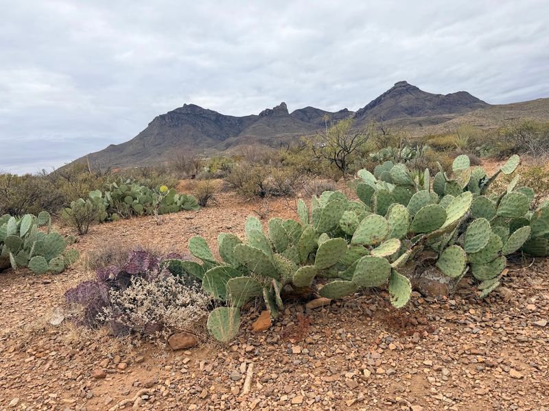
Along the park’s southern edge, the Rio Grande separates Texas from the Mexican states of Chihuahua and Coahuila.
The surrounding mountains continue across the border, while the river winds between gravel bars, vegetation, and occasional cliffs.
Near Rio Grande Village, the Boquillas Crossing Port of Entry provides a designated route to the Mexican community of Boquillas del Carmen.
The crossing currently operates Friday through Monday, 9 a.m. to 4 p.m., and requires appropriate passport documentation. Crossing anywhere else is not an alternative to the official entry process.
After clearance at the port, travelers may use a small rowboat to cross the river for a fee, depending on conditions. The village is farther inland, reached on foot or through locally offered transportation.
Anyone considering the trip should allow time for the return crossing and border procedures rather than treating it like an informal riverside walk.
Not every riverbank is suitable for entry or recreation. Currents, unstable banks, and changing water levels deserve care, even where the surface looks calm.
Enjoy the border scenery from established overlooks and trails, carry plenty of water, and leave cultural and natural objects where you find them.
Three River Canyons Reveal Millions Of Years Of Geological History
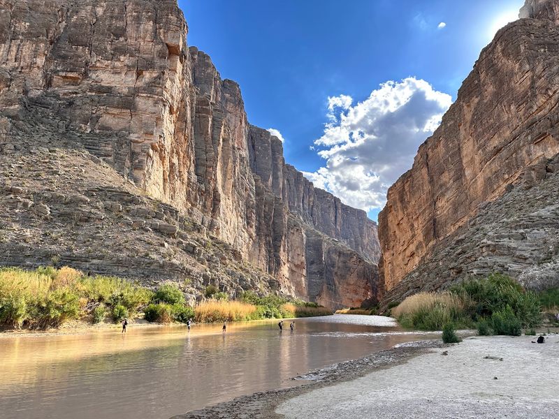
Rock has a long story here. Santa Elena, Mariscal, and Boquillas are the park’s three major Rio Grande canyons, each exposing a different section of the region’s layered geology.
Their scale becomes easier to appreciate when you compare them on the park map rather than trying to see everything in a single afternoon.
Santa Elena is known for tall limestone walls and an entrance reached from the western scenic-drive corridor when roads are open.
On the eastern side, Boquillas Canyon has a trail toward the mouth of another long gorge, with views of the river and sandy shoreline along the way.
Mariscal Canyon is much less convenient for an ordinary driving itinerary. Reaching its vicinity over primitive roads requires careful vehicle preparation, and a river trip calls for a separate plan.
Park alerts currently list several unpaved roads closed, while other primitive routes require a high-clearance, true four-wheel-drive vehicle.
A standard rental car is not suitable for those conditions.
A practical choice is to pair one accessible canyon with another short hike or scenic overlook. If a road is closed, use the park’s current conditions information to choose an alternative. Stay on established routes, especially near steep drop-offs and loose rock.
Ross Maxwell Scenic Drive Leads Through Volcanic Peaks And Desert Overlooks
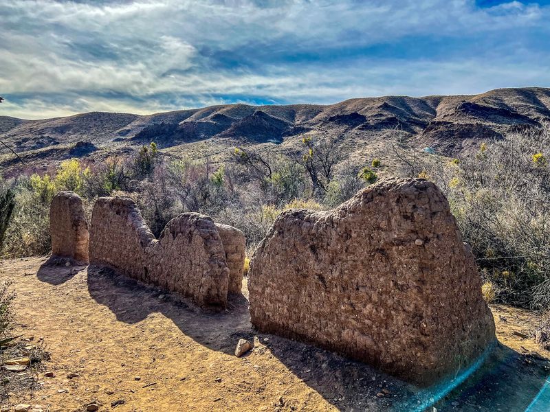
Set aside time for Ross Maxwell Scenic Drive rather than treating it as a shortcut. The approximately 30-mile road travels through the park’s western desert and, when the approach is open, leads toward Castolon and Santa Elena Canyon.
Its pullouts bring volcanic hills, desert washes, and historic ranch landscapes into view.
Start with the shorter stops that interest you. The Sam Nail Ranch area preserves traces of an earlier homestead, including an old windmill and vegetation supported by water in the desert.
Blue Creek Ranch Overlook looks toward the Homer Wilson Ranch site below, where ranching history sits beneath rugged cliffs.
Carry your lunch and enough water for everyone traveling with you. Supplies and food service are scattered across a large park, and some facilities have limited hours.
Panther Junction and Rio Grande Village have stores and fuel service, but the trip between stops still merits preparation.
Weather can affect both paved and unpaved roads. A wash that is dry during one visit may be impassable after heavy rain. Use a current park map, obey closures, and treat the drive as a series of possible stops rather than a guarantee that every endpoint will be available.
Hiking Along The Rio Grande Where Texas And Mexico Meet
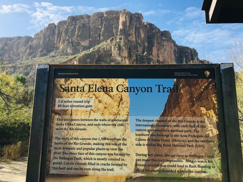
Lace up sturdy shoes for a canyon walk, but choose the route after checking current access. The Santa Elena Canyon Trail is a short round-trip hike of roughly a mile and a half.
From the trailhead, hikers cross the bed of Terlingua Creek and climb a short, steep bank before continuing along the Rio Grande into the canyon.
That creek crossing is the deciding point. It can be dry sand, thick mud, or flowing water, depending on recent rain. High water may make the route impassable, and the road leading toward the trail can also be closed.
Never attempt to force a crossing when conditions are unsafe.
River travel requires different preparation. Canoeing, kayaking, and rafting are possible on designated stretches when water and access conditions permit, but a permit and careful planning may be needed.
Check river levels and regulations before making arrangements with an outfitter.
Pets are not allowed on park hiking trails. Bring water, sun protection, and shoes with dependable traction, and keep a safe distance from wildlife.
Even modest mileage can feel demanding in the desert sun, so let the season and your own hiking ability determine the route.
From The Chisos Mountains To The River Valley, Big Bend’s Changing Desert Scenery
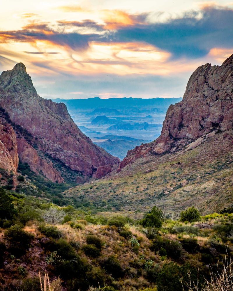
Drive from the river corridor toward the Chisos Mountains, and the surroundings change noticeably. The mountains rise above the Chihuahuan Desert, with Emory Peak reaching 7,832 feet.
At higher elevations, pines, oaks, and junipers appear among rocky slopes where temperatures can be cooler than on the desert floor.
The Chisos Basin area provides access to well-known hikes such as the Window Trail and Lost Mine Trail. Previously planned major construction closures in the Basin were cancelled, and the area has remained accessible, although individual facilities or routes may still have restrictions.
Check the current conditions before leaving for a trailhead.
For trip planning, use the park headquarters address at 1 Panther Junction, Big Bend National Park, TX 79834. The visitor center there is a useful stop for maps and advice about road or trail conditions before you commit to a longer drive.
The park entrances are open day and night, but daytime facilities do not follow that schedule. After sunset, choose a safe, established area away from traffic and allow your eyes to adjust to darkness.
Under clear skies and away from bright lights, the Milky Way and numerous stars may be visible.
Bring a layer for cooler mountain air and keep your headlights on whenever you are driving.