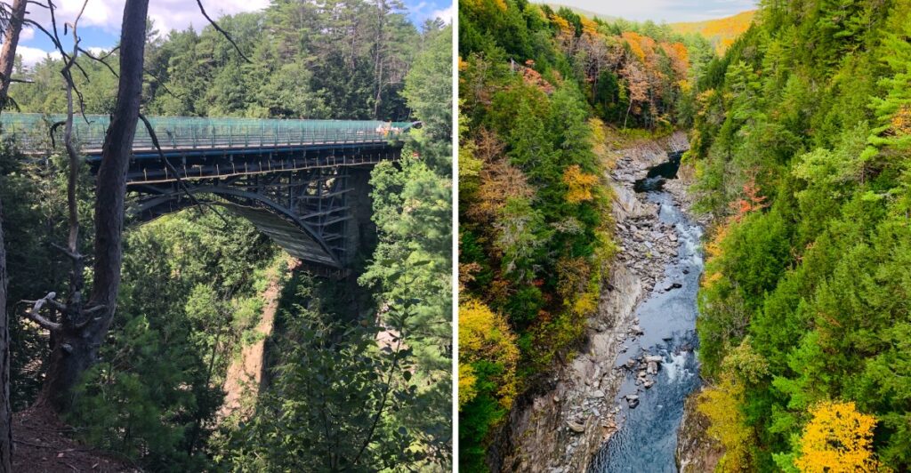
Pull over. Seriously.
This is not the kind of view you glance at through the windshield and keep moving.
The river sits far below, carving through a gorge deep enough to make the railing suddenly feel very important. Then the old bridge adds another layer, carrying traffic across a crossing that has been here since the early 1900s.
Vermont saves the better surprise for after the first look.
A trail lets you trade the overhead view for one closer to the water, while the nearby park can easily stretch the stop beyond whatever five-minute break you imagined.
I would not rush this one.
The bridge gives you the gasp, but the trail makes you earn the second one.
Vermont’s Deepest Gorge Drops To The Ottauquechee River
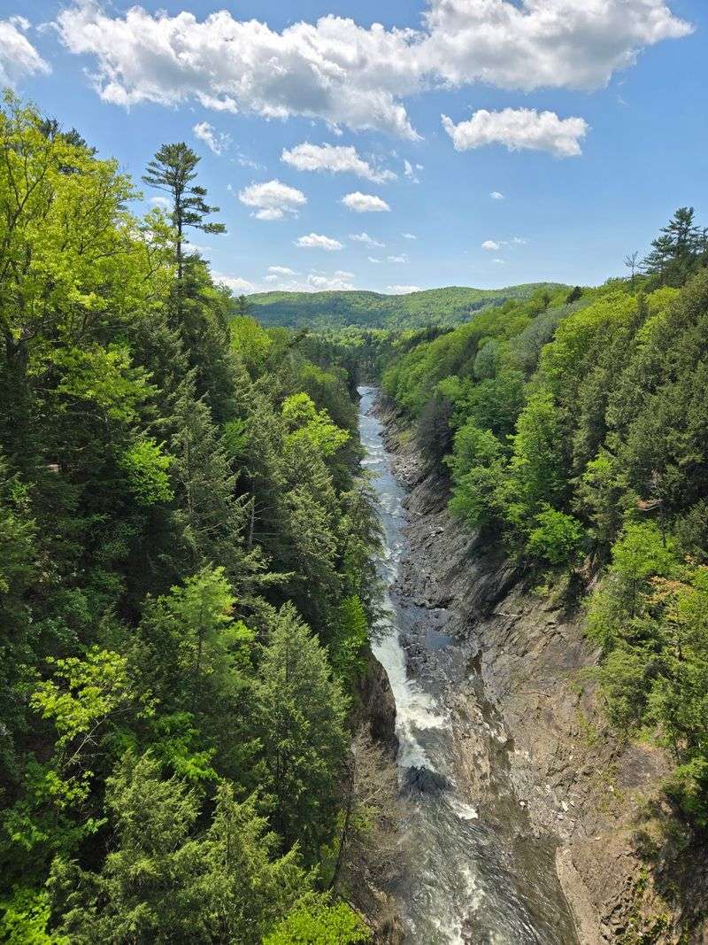
Quechee Gorge is Vermont’s deepest gorge, with the Ottauquechee River flowing about 165 feet below the viewing points along Route 4.
The gorge stretches for roughly a mile through the landscape, so the bridge view shows only part of the full formation. Trees cover much of the upper rim, while exposed rock appears along the steeper walls and closer to the river.
Season changes the scene quickly. Spring can bring stronger water flow and fresh foliage, summer fills the gorge with dense green, and autumn brings the bright color that draws travelers to this part of Vermont.
Water levels shift with weather, so the river may look broad and lively after wet periods or calmer during drier stretches.
If you stop at the bridge first, give yourself time to look in both directions rather than treating the overlook as a single photograph. The upstream and downstream views reveal different bends in the gorge.
The gorge is often nicknamed Vermont’s “Little Grand Canyon,” a fitting shorthand for its steep wooded walls and river far below.
Glacial Activity Shaped The Gorge Thousands Of Years Ago
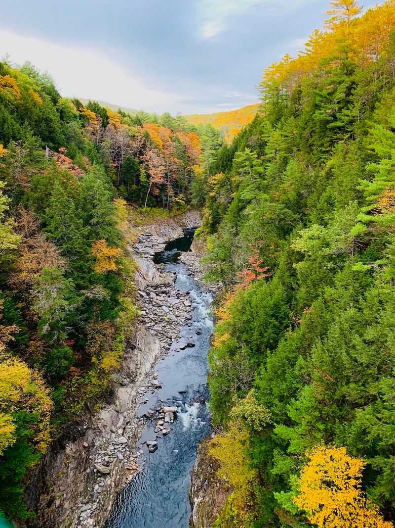
The gorge began taking its present form through glacial activity roughly 13,000 years ago.
As the last ice sheets retreated from the region, meltwater and changing drainage patterns helped cut through the rock beneath what is now Quechee.
The Ottauquechee River kept shaping the channel after the glaciers were gone. Water moving through the gorge continues to act on the rock, especially during periods of stronger flow.
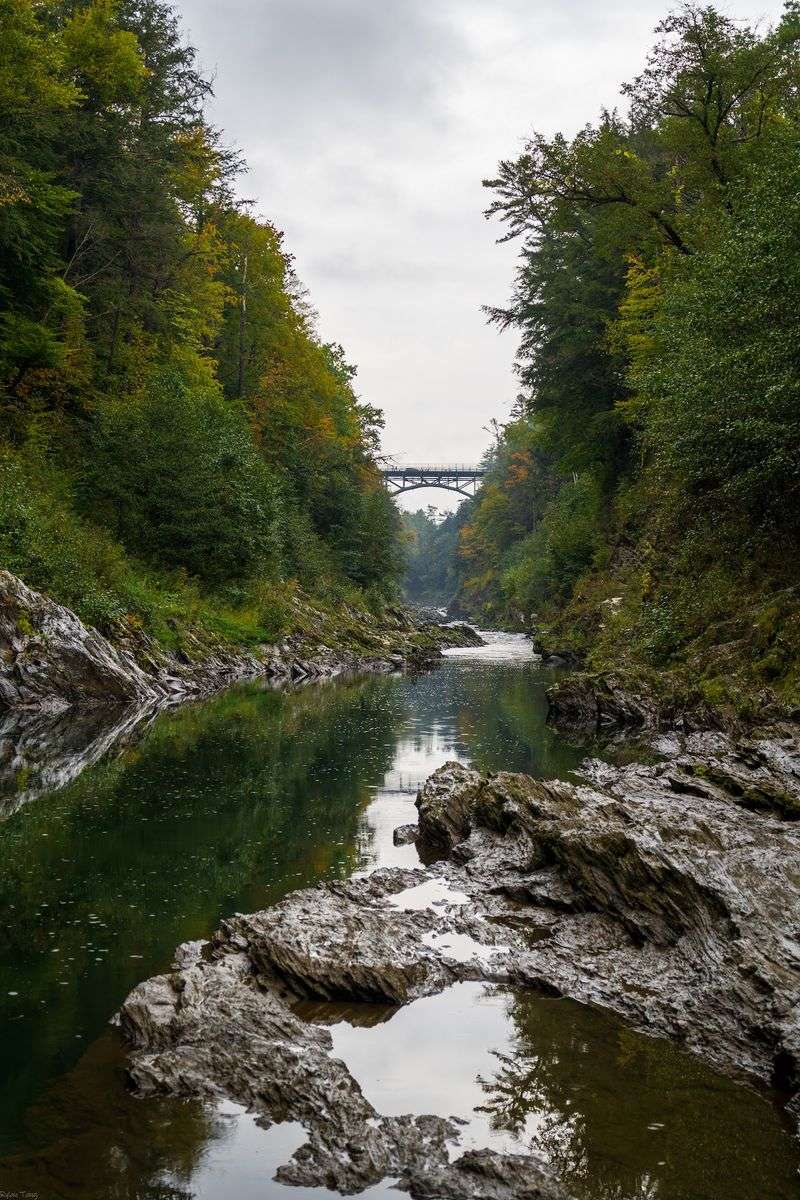
You can see pieces of that long geologic story from several levels. From the bridge, the gorge reads as one large cut through the landscape. Along the trail, the rock surfaces, river channel, and steep walls become much easier to examine at close range.
At road level, trees and distance soften the edges. Closer to the river, individual rock surfaces, pools, and the shape of the channel become more obvious.
For children, it is an easy place to connect a landscape with the forces that formed it without turning the stop into a classroom lecture.
A trail walk after the bridge overlook gives the geology a second chapter, and sturdy footwear helps on sections where roots, rocks, or damp ground make the surface uneven.
The Historic Bridge Rises High Above The Gorge
The Quechee Gorge Bridge carries U.S. Route 4 about 165 feet above the Ottauquechee River.
The steel structure is approximately 285 feet long and 41 feet wide, making it a relatively short crossing with a dramatic amount of open space beneath it.
Pedestrians can cross the bridge and look into the gorge from the sidewalk. As of late September 2026, there are no pedestrian restrictions tied to the rehabilitation project, and the upstream sidewalk is open.
The bridge has been undergoing a major rehabilitation that includes work on the deck, railings, sidewalks, steel arch, joints, and other structural elements.
Vermont has designated it a “Forever Bridge,” reflecting the state’s intention to preserve the historic structure and keep it in service rather than replace it outright.
On foot, you can stop at the railing, follow the river through the gorge, and notice the steel structure beneath the roadway.
Keep children close and stay within the pedestrian areas, especially when traffic is moving nearby.
If construction activity is taking place during your visit, follow the posted pedestrian route. Access can shift temporarily even when the bridge itself remains open.
The Bridge Began As A Railroad Crossing
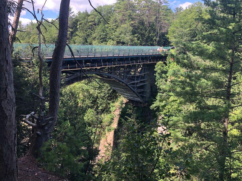
The bridge crossing Quechee Gorge was built in 1911 as a railroad bridge.
Its three-hinge steel deck arch design carried rail traffic over terrain that would have made a lower crossing difficult. Decades later, the structure was converted for highway use in the 1930s.
The surrounding area also has ties to Vermont’s industrial past. Land that became Quechee State Park was once associated with the A. G.
Dewey Company, a major wool processor that operated in the area.
The mill used water from the falls and mill pond above the gorge for power. At its height, the company employed hundreds of people, and some remnants of the former mill and dam can still be seen near the head of the gorge.
The mill closed in 1952, and much of the surrounding industrial complex disappeared in the following years.
A few years later, the landscape began moving toward a recreational future. Campground and picnic development started in the early 1960s, and Vermont began managing the park in 1965.
Today, a walk around the gorge connects those layers without needing a long history lesson: railroad bridge above, mill remains near the water, and parkland occupying ground once tied to industry.
The Gorge Trail Changes The View Completely
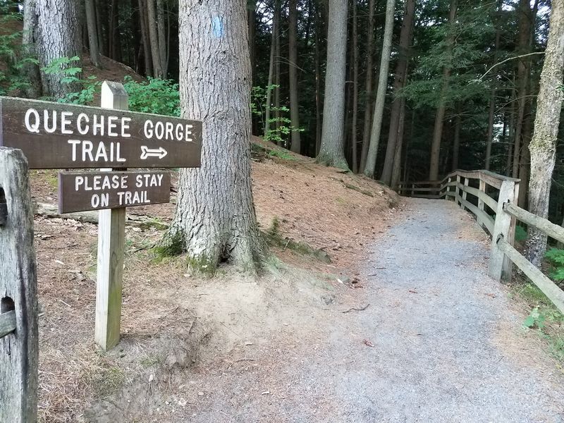
The Quechee Gorge Trail lets you leave the bridge viewpoint and see the landscape from much closer to river level.
The route to the bottom is rated moderate, with about a mile of round-trip walking from the bridge.
Starting from the visitor center adds distance, bringing the round trip to the bottom to about a mile and a half.
The trail can also be followed toward Dewey’s Pond, with longer round-trip options depending on where you begin.
As of late September 2026, the trail beneath the bridge is open again after construction-related closures.
Wear shoes that handle roots, rocks, and damp surfaces well. The river and gorge walls may tempt you closer to the water, but changing conditions can make rocks slick and currents stronger than they appear.
Stay within open areas and follow posted warnings near the water and any remaining construction zones.
From above, the gorge feels deep and narrow. From lower on the trail, the bridge becomes part of the skyline and the rock walls take over the scene.
Allow enough time for the climb back. Even a short trail feels different when the return trip points uphill.
Quechee State Park Gives You More Time Outside
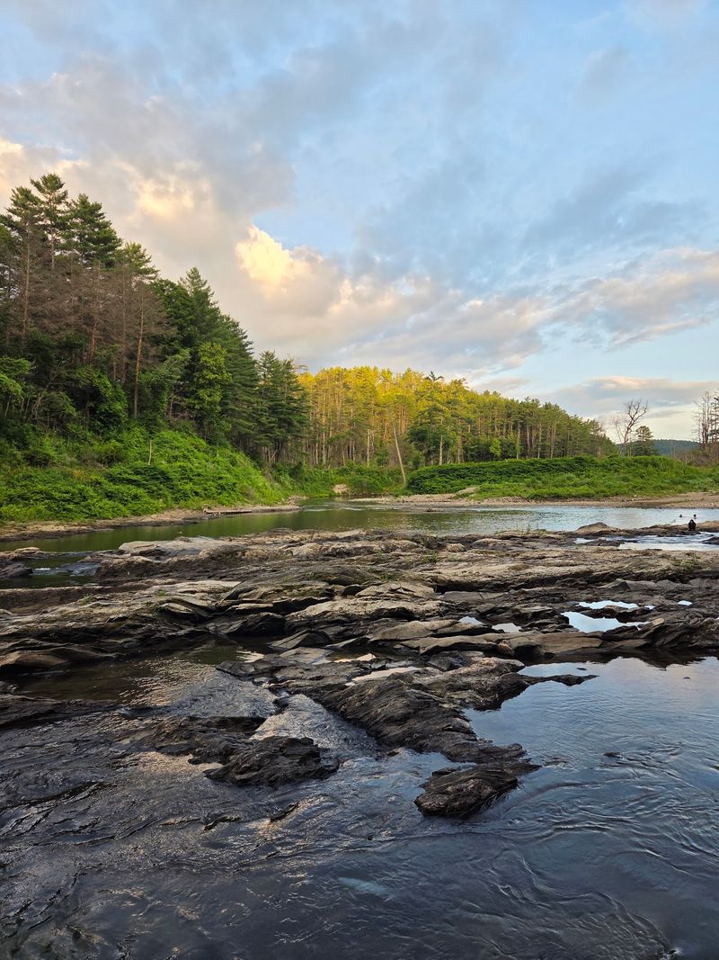
Quechee State Park sits beside the gorge and adds camping, cabins, fishing, picnicking, and open space to the visit.
The park currently has six cabins, tent and RV campsites, and lean-to sites, giving you several ways to stay overnight during the operating season.
Fishing is available along the Ottauquechee River, where brook, rainbow, and brown trout are found. Picnic areas offer an easier option if you only want to turn the gorge stop into a slower lunch break.
The park’s operating season generally runs from Memorial Day weekend through the second Monday in October, while day-use hours run from morning until official sunset during the season.
Quechee State Park is at 5800 Woodstock Road, Hartford, VT 05047.
If you are visiting during autumn foliage, planning ahead makes sense because the park’s seasonal closing date falls during one of the busiest travel periods in the region.
Campers should also check current reservation availability before building a trip around an overnight stay.
For a shorter visit, combine the bridge with the gorge trail and a picnic. If you have more time, the cabins, campsites, fishing access, and interpretive programs give you reasons to stay beyond the overlook.
Current Access Makes The Bridge And Trail Easy To Pair
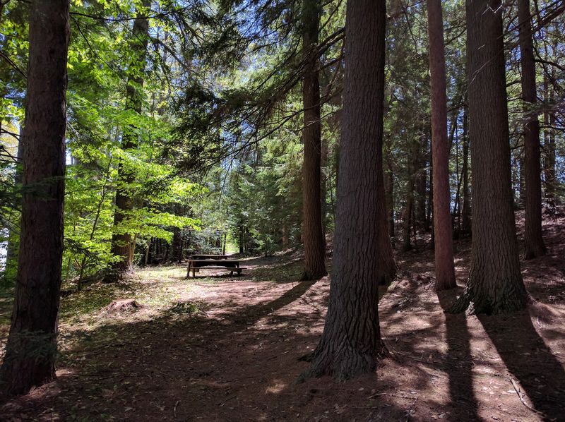
Pedestrian access is currently open across the bridge area, including the trail beneath the bridge and the upstream sidewalk.
The southwest parking lot is also available.
One additional short lane closure is expected as bridge work wraps up, with flaggers directing traffic when that work occurs.
For the simplest visit, start near the bridge, take in the gorge from above, then decide how much walking you want. The one-mile round trip to the bottom gives you the river-level perspective without taking over the entire day.
If the weather is wet, save extra time for the trail and watch your footing. A light layer can also help when the temperature drops near the shaded river corridor. If foliage season has brought heavier traffic, allow more time for parking and crossing between access points.
The gorge works well as a quick scenic stop, but it becomes much more interesting once you move beyond the railing.
Look down from the historic bridge, follow the trail toward the river, then glance back up at the structure from below. Three viewpoints can turn one Vermont roadside landmark into a surprisingly full afternoon.